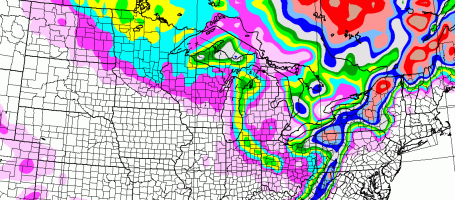
* Heaviest snows arrive tonight, 3-6" likely by morning, a few towns south/west of MSP may wind up with closer to 8" or more.
* Winter storm warning posted for metro - even the freeways/interstates will become snow covered after dark. Travel tonight will be very treacherous.
* Snow slowly tapers tomorrow (maybe another 1" or so Saturday). Light winds will limit blowing and drifting.
* Arctic sunshine Sunday, highs in the mid teens, coldest since Feb. 1, 2010.
On Track For A Cool Half Foot? Yes, it still looks "plowable", at least 3-6" for much of the metro area, but I'm feeling even more confident that we'll see enough snow to shovel and plow. I'm also a bit more confident that the southern and western suburbs may pick up as much as 8" of snow.
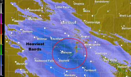
Doppler Radar: 3 pm. The heaviest snow bands are setting up over the western and southern suburbs - which stand the greatest chance of picking up 6-8" by Saturday afternoon. Snow will continue to pick up in intensity through the afternoon/evening hours, falling at the rate of 1" every 2 or 3 hours by tonight.
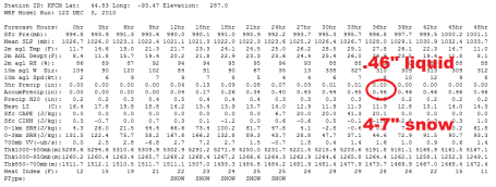
Feeling More Confident about 6". The latest WRF model prints out .46", with a 15/1 ratio that should equal about 6" (or more) of snow by Saturday afternoon. Winds will be light Saturday, meaning minimal blowing and drifting. But highways will be very slippery, especially AM hours.
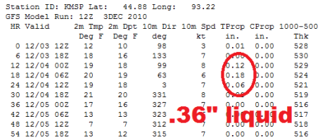
More Numbers. The latest GFS model prints out .36", which equates to 5 or 6". Everything is leading us to believe that this will be a 4-7" snowfall, less north/east, more south/west.
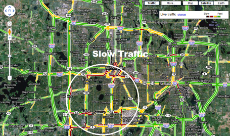
Traffic Getting Tougher. The biggest jams are showing up over the southwestern metro (where snow is heaviest). I expect problems throughout the entire metro area by 5 pm - many wet/slusy freeways becoming snow covered after dark. To see the latest traffic map click here.
No comments:
Post a Comment