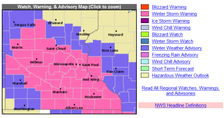
* Winter Storm Warning in effect for today, tonight and Saturday morning - includes the metro area.
* Snow spreading across the metro area, getting heavier and steadier as the afternoon goes on, around an inch on the ground for the PM commute. Even freeways and interstates will be snow-covered and very icy.
* Most of the accumulating snow arrives this evening and tonight, when snow may accumulate at the rate of 1" every 2 hours or so. With air temperatures near 20 all the freeways and interstates will be snow-covered, icy and slippery.
* Another inch possible Saturday (best chance morning hours) - travel conditions should slowly improve as the day goes on.
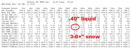
* Still thinking 3-6" for most of the metro, but a band of 5-8" may brush the western and southern suburbs (Prior Lake, Chanhassen, Chaska and Waconia).
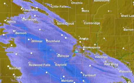
Doppler Radar Update: 1:40 pm. Radar shows snow streaking across the metro area. Snow will become heavier and steadier as the afternoon goes on. A friendly word of advice: if you can leave a little early for the drive home you'll thank yourself. I don't think it's going to be horrible at 6 pm, but conditions at 3 pm will be better. I expect travel conditions to go quickly downhill during the evening and nighttime hours.
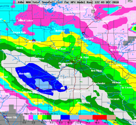
How Much? I think this snowfall prediction is on the right track, an average of 3-6" across the immediate metro (enough to shovel and plow), with some 8" amounts south/west of Chaska and Prior Lake, maybe 10" piling up on Mankato and Marshall.
No comments:
Post a Comment