11th snowiest winter so far (since 1891).
14.1" snowfall so far in February (13.4" of that fell Sunday and Monday).
26.5" snowiest February on record (1962).
14" snow on the ground as of Monday evening.
8 Snow Emergencies in the Twin Cities so far this winter.
300+ accidents reported Sunday and Monday morning, just in the metro area.
2nd snowiest winter (to date) since 1891 in the Twin Cities.
From Pete Boulay at the MN State Climatology Office. I asked him the last time we saw two (1-foot-plus) snowfalls in one winter?
"In the 1980's it was fairly common. The last time we had two 12 inch snowfalls in one winter was 1991-92. We also had two 12 plus snowfalls in the winter 1981-82, 1982-83 and in 1984-85. There are probably others before the 1980's. but that's all I can recall right now.
The top 10 season snowfalls for the Twin Cities can be seen at the bottom of this list. We have a pretty good chance making this list by the end of the day."
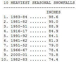
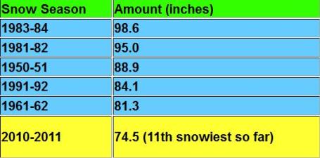
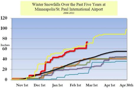
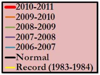
Echoes Of 1983-1984. Snowfall for our current winter is the red line, tracking amazingly close to 1983-1984, the winter we wound up with an astounding 98.6" snow burying the Twin Cities. Not sure we'll see quite that much, but we are probably destined for 85" before the winter is through with us (sometime in April?) The local NWS office has more details here.
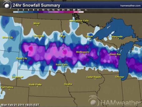
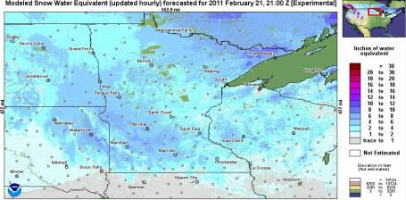
Carpet Of White. Snowfall from midday Sunday through midday Monday showed an almost straight east-west axis to the heaviest snow band, from South Dakota due east to Madison and the Twin Cities. Map courtesy of Ham Weather, a division of WeatherNation.
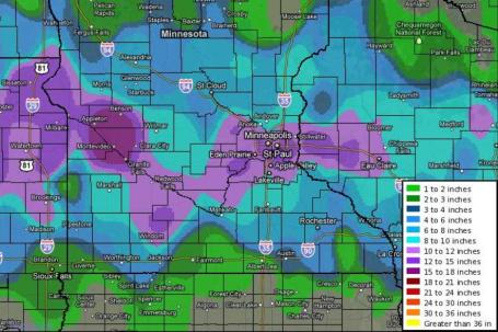
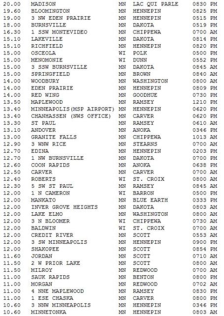
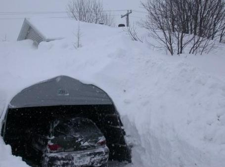
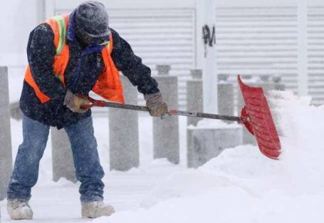
Fairbanks, North Pole Dig Out From Record Snow. An update from Alaska's Daily-Miner "FAIRBANKS - As much as 18 inches fell in parts of the Fairbanks area Sunday and today, with the heaviest snow reported in North Pole, according to the National Weather Service in Fairbanks. Approximately 12 inches of snow fell at Fairbanks International Airport. “It really varied widely how much snow each area got,” said weather service meteorologist Scott Berg. “The heaviest bands were just south of Fairbanks, across North Pole and Eielson (Air Force Base).” Snowfall is expected to slow down this afternoon, but difficult driving conditions should persist this afternoon as winds blow several inches of recently fallen snow around the Fairbanks area. An additional 1 to 2 inches are expected today before the storm system leaves the area, Berg said."
Forensic Meteorology Solves The Mystery Of Record Snows. NOAA's ClimateWatch division has a story about meteorologists tracking the recent string of record snowfalls on the east coast to try to determine why the intensity and frequency of these major coastal storms has spiked upward: "Shortly after the third of three major snowstorms brought record-setting snowfall to the U.S. mid-Atlantic region, NOAA’s Climate Scene Investigators (CSI) assembled to analyze why the snowstorms happened. The CSI is a team of “attribution” experts in NOAA whose job is to determine the causes for climate conditions. By distinguishing natural variability from human-induced climate change, they aim to improve decision-making and inform adaptation strategies. The CSI team was formed in 2007, following chaotic media coverage of the record U.S. warmth in 2006 (see CSI: NOAA Climate Scene Investigators). Here they have been called to the scene again, but now to explain cold, snowy conditions, and to reconcile those with a warming planet. After a series of record-setting snowstorms hit the mid-Atlantic region this winter, some people asked NOAA if humans could somehow be to blame. Specifically, they wanted to know if human-induced global warming could have caused the snowstorms due to the fact that a warmer atmosphere holds more water vapor."
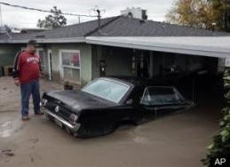
Extreme Weather Batters The Insurance Industry. A story from Huffington Post and Reuters: "What no one disputes is that the storms the industry expects aren't happening and the ones they don't expect are hitting them hard. The implications are profound for consumers as well as insurers. If hundred-year storms are now at risk of happening every 40 years or every three, it is difficult to know how much property insurance should cost. The last couple of months underscore just how much climate seems to be changing. Queensland state in Australia has suffered a virtual apocalypse -- flooding in December, flooding in January and tropical cyclones in February that inundated at least 30,000 homes and crippled the local coal industry. Meanwhile in the United States, snow fell on Christmas Day in a number of southern cities for the first time since at least the 1880s. Los Angeles got six months' worth of rain in three weeks, causing some of the worst flooding in the state's history. The New York metropolitan area had an unprecedented blizzard the day after Christmas and a month later got almost the same, breaking historical records."
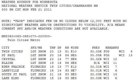
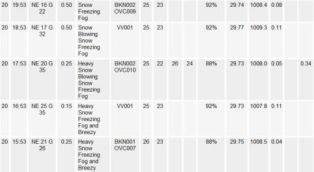


Paul's Conservation Minnesota Outlook for the Twin Cities and all of Minnesota:
TODAY: Partly sunny, better travel. Winds: SE 10-15. High: 25
TUESDAY NIGHT: Partly cloudy and chilly. Low: 18
WEDNESDAY: Milder with light snow and flurries, coating to 1/2" possible. High: 34
THURSDAY: Windy and cooler with more clouds than sun. High: 24
FRIDAY: Chance of light snow, maybe 1-2". Low: 4. High: 14
SATURDAY: Lingering flurries, a cold wind. Low: 2. High: 16
SUNDAY: Sun returns, slight warming trend. Low: 6. High: 25
MONDAY: Sunny start, PM flurries. High: near 30
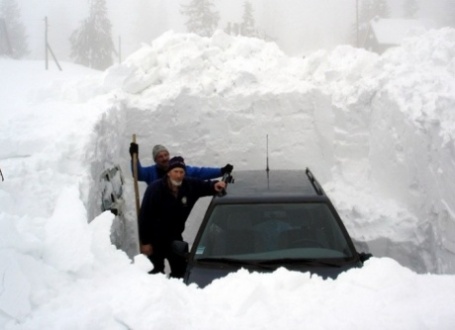
Snow Rage
I like the snow. It's a fresh start, it makes my yard look better (covers up my dog's indiscretions); it's excuse to pull out my inner 20-year-old & fire up the snowmobile. But for livid commuters camped out on area freeways (on a good day) the snow just rubs salt in our vehicular wounds, turning the drive home into Mission Impossible. I get it. The solution: heat the roads; snow and ice melts on contact. There's a business there.
What we have here is an accumulation of coincidences. 2010 was Minnesota's wettest year (34" avg). The most tornadoes on record (104). And now two (1-2 FOOT mega-snowstorms in one winter? That hasn't happened since the Winter of 1991-92, according to Pete Boulay at the MN State Climate Office. I'm all for serendipity, but do you think the 4-5% increase in water vapor (the most abundant greenhouse gas) might be loading the dice in favor of more extremes? Time will tell.
Welcome to the second snowiest winter, to date, since 1891. Only 1982 had more snow as of Feb. 22 (76.9"). The sun returns today, a brief thaw (and slushy coating) tomorrow. No more commute-trashing storms in sight, just a cool-down by the end of this week, maybe a few subzero nights the latter half of next week. We paid a steep price for that 52 F. last Wednesday. Think warm thoughts.
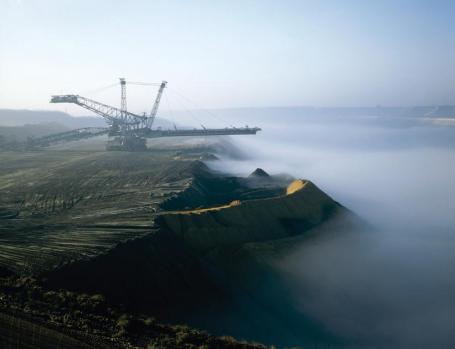
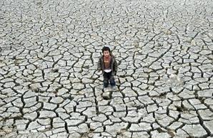
Global Food Wars. From a blog at forbes.com: "Global warming is a threat to international stability says Christiana Figueres. In remarks delivered last week in Madrid, the U.N.’s chief climate official warned of “climate chaos.” In 2008, according to U.N. academics, there were 20 million temporary refugees fleeing sudden changes in climate. Even gradual ones could be disruptive, and they may cause anywhere between 200 million to a billion people to migrate in the next four decades. Figueres’s warning echoed a series of increasingly dire assessments issued in recent years. For instance, Lord Nicholas Stern in 2009 predicted that, unless humankind did something decisive about the climate, there could be mass migrations leading to conflict, or “extended world war” as he put it."
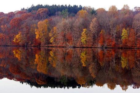
Global Warming Means Longer Allergy Season: Study. AFB has an article that made me do a double-take. Did you know our allergy season here in the Twin Cities is 16 days longer than it used to be? I didn't either. An excerpt from the article: "WASHINGTON — Ragweed allergy season in North America has grown two to four weeks longer in recent years because of warmer temperatures and later fall frosts, researchers said. Northern parts of the United States and Canada have seen the most dramatic rise in allergy season length between 1995 and 2009, said the study to be published in Tuesday's edition of the Proceedings of the National Academy of Sciences. The city of Saskatoon in Saskatchewan, Canada saw the longest pollen season, adding 27 more days in 2009 compared to 1995. Winnipeg, Manitoba saw a 25-day increase during the same period. Fargo, North Dakota and Minneapolis, Minnesota each saw allergy seasons extend 16 days. But looking further south, Rogers, Arkansas and Georgetown, Texas saw decreases of several says in their pollen seasons. The study said the starker changes in the northern latitudes were consistent with the United Nations' Intergovernmental Panel on Climate Change projections of more intense warming in areas closer to the Arctic. "Latitudinal effects on increasing season length were associated primarily with a delay in first frost of the fall season and lengthening of the frost-free period," the study said."
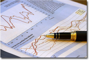
Global Warming And Asset Allocation. Are you an investor? If you think that climate change is real (as most peer-reviewed climate scientists and every major scientific organization believes) than your stock portfolio should probably reflect that belief. An article from istockanalyst.com: "If you think climate change is a real and present danger, your asset allocation should reflect that outlook, according to a new study from Mercer, the consulting firm. That's sure to be a controversial recommendation in some quarters. Anything related to climate change tends to stir debate of one kind or another, and so reviewing the topic as it relates to investing promises no less. Ready or not, it's time to take a hard look at the implications of climate change for designing and managing portfolios, Mercer explains in "Climate Change Scenarios—Implications For Strategic Asset Allocation" The paper argues that climate change increases investment risk and so asset allocation strategies should adjust accordingly. The uncertainty surrounding policy regulations and the economic impact of climate change inspire "new approaches" for building portfolios. The analysis is a joint effort by Mercer and more than a dozen institutions, including the California Public Employees' Retirement System (CalPERS) and the International Finance Corporation."
No comments:
Post a Comment