
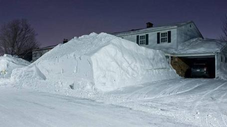
Could Be Worse. O.K. It won't be THIS bad. We're not predicting 6 feet of snow, just a foot (to maybe a foot and a half in some locations). Not quite as much as December 10-11, when 17.1" fell, but close. If we pick up 10" from this storm (pretty likely) we'll have the unique distinction of living through the second snowiest winter (to date) since 1891. Only 1982 had more snow as of now (76"). Take a bow - this is turning into a truly historic winter for snow.
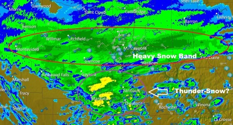
Heaviest Snow. It's here - the moderate to heavy snow capable of falling at the rate of 1-2"/hour, possibly even accompanied by thunder/lightning (thunder-snow!) That's how rapidly the air is rising overhead. That air is rising, cooling, water vapor condensing out into supercooled water droplets and ice crystals. Those crystals stick together, gravity pulls them to the ground when they get large enough - the result is what you see out your window right now. Doppler radar image as of 4:45 pm.
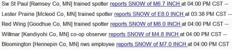
Snow Reports. Much of the metro already has roughly a half foot, that will be close to 10" by 9 or 10 pm tonight. The latest reports are here.

How Much? The latest NAM model prints out well over a foot for much of central Minnesota, including the Twin Cities, as much as 15" in some locations as an east-west band of snow temporarily stalls out from Alexandria and St. Cloud and Willmar to the Twin Cities and Eau Claire much of Sunday night.
* About 1-3" should fall during the day Monday (mainly morning hours), bring the totals into the 12-15" range by Monday afternoon. Definitely plowable.
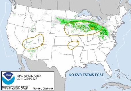
Thunder-Snow? You know it's really coming down hard when snow is accompanied by thunder and lightning. If the air is rising violently enough, you can wind up with crackling thunder (and on occasion: snow falling at the rate of 2-4"/hour!) Map courtesy of SPC, the Storm Prediction Center. Nothing severe, but there is a chance of thunderstorms across the southern quarter of Minnesota into the early nighttime hours.
No comments:
Post a Comment