* Potential for 1"+ hail and frequent lightning.
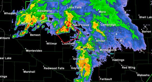
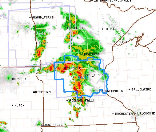
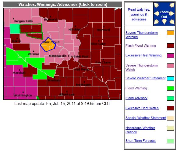
* Flash Flood Warnings: Alexandria area (1-4" rain has fallen, another 1-2" possible).
* Excessive Heat Watch in effect Saturday through next Wednesday for the Twin Cities.
* Excessive Heat Warning already posted for southwestern Minnesota.
* Dew point may reach 80 by Saturday afternoon.
* Heat Index: 105-115 this weekend, heatwave lingers into most of next week.
BULLETIN - EAS ACTIVATION REQUESTED
FLASH FLOOD WARNING
NATIONAL WEATHER SERVICE TWIN CITIES/CHANHASSEN MN
814 AM CDT FRI JUL 15 2011
THE NATIONAL WEATHER SERVICE IN THE TWIN CITIES HAS ISSUED A
* FLASH FLOOD WARNING FOR...
DOUGLAS COUNTY IN WEST CENTRAL MINNESOTA...
SOUTHERN TODD COUNTY IN CENTRAL MINNESOTA...
* UNTIL 1100 AM CDT
* AT 812 AM CDT...NATIONAL WEATHER SERVICE DOPPLER RADAR INDICATED
THUNDERSTORMS WITH VERY HEAVY RAINFALL ACROSS THE WARNED AREA.
BETWEEN 1 AND 4 INCHES OF RAIN HAS FALLEN SINCE 4 AM CDT... AND ANOTHER
1 TO 2 INCHES OF RAIN IS EXPECTED THROUGH 930 AM CDT.
* RUNOFF FROM THIS EXCESSIVE RAINFALL WILL CAUSE FLASH FLOODING TO
OCCUR. SOME LOCATIONS THAT WILL EXPERIENCE FLOODING INCLUDE...
ALEXANDRIA...LONG PRAIRIE...BRANDON...CARLOS...CLOTHO...
EVANSVILLE...FORADA...GARFIELD...GREY EAGLE...KENSINGTON...LITTLE
SAUK...MILTONA...NORTH SHORE...OSAKIS AND PLEASANT BEACH.
OBSERVERS IN SOUTHWEST TODD COUNTY REPORTED RAINFALL TOTALS OF NEAR
4 INCHES WITH THESE STORMS.
Severe Storm Watch Until 1 pm. SPC has issued a storm watch for central MN (including the Twin Cities) through midday. The arrival of super-heated air will leave our atmosphere ripe for severe storms much of the day.
No comments:
Post a Comment