66 F. average high for September 28 in the Twin Cities.
82 F. high at International Falls, Minnesota Wednesday, breaking the old record of 80 in 1922.
88 F. at Madison, Minnesota Wednesday.
89 F. at Canby, Minnesota.

Wind Advisory. An advisory has been issued by the NWS for much of central and eastern Minnesota - and all of Wisconsin. More details:
URGENT - WEATHER MESSAGE
NATIONAL WEATHER SERVICE TWIN CITIES/CHANHASSEN MN
252 PM CDT WED SEP 28 2011

...WINDY CONDITIONS ARRIVING IN THE WAKE OF A COLD FRONT...

.A COLD FRONT WILL MOVE THROUGH THE AREA EARLY THURSDAY MORNING...
WITH COOLER TEMPERATURES AND GUSTY WINDS ARRIVING IN ITS WAKE.
NORTHWEST WINDS OF 15 TO 25 MPH WILL QUICKLY DEVELOP IN THE
MORNING... THEN PICKUP TO BETWEEN 20 AND 30 MPH BY AFTERNOON.
WINDS WILL GUST TO AROUND 40 MPH AT TIMES FROM LATE MORNING
THROUGH THE AFTERNOON... WITH A FEW GUSTS IN EXCESS OF 45 MPH
POSSIBLE. WINDS WILL BEGIN TO QUIET DOWN DURING THE EVENING HOURS.
12.80" rain in Baltimore in September at BWI Marshall Airport. Previous September record: 12.41" in 1934
9.64" rain in Philadelphia in September: Record for September precip is 6.63 inches.
100 days above 100 F. at San Angelo, Texas.
Hot Tweets:
@JustinNOAAJustin Kenney —— #Heat: Average temp in Houston so far this September is 82.8, 3rd warmest on record1.usa.gov/q8RXzT
JustinNOAA Justin Kenney —— Houston #heat this year: 3rd warmest April, 8th May, 1st June, 3rd July, 1st August, 3rd Sept 1.usa.gov/q8RXzT
A Mixed Up Weather Map - Mid Afternoon Wednesday:
Minnesota:
Hallock- 82
Detroit Lakes- 81
Moorhead- 82
Temperatures in Florida:
Miami, Florida- 80
Birmingham, Alabama- 81
Mobile, Alabama- 72
Montgomery- 73
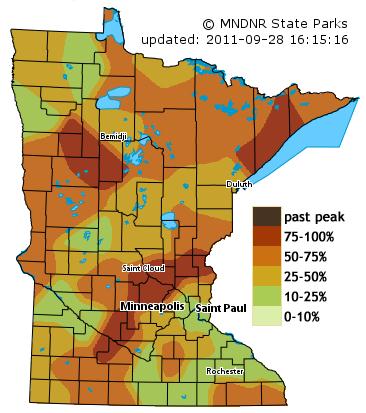
Ripening Colors. My semi-educated hunch: this upcoming weekend may be the best time to head out in search of peaking color. According to the Minnesota DNR 75-100% of the leaves have riped up just north and west of the Twin Cities, and along Lake Superior's North Shore. Up north colors may be past-peak by the second week of October. That, and there's a good chance of rain the weekend of October 8-9.
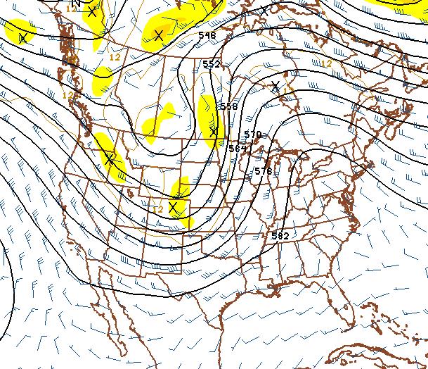
Change In The Pattern? 500 mb winds next Thursday show a strong trough of low pressure over the Northern Rockies, a broad south/southwest flow pumping warm (moist) air into Minnesota. The chance of rain increases the end of next week, with cooler weather returning by the second weekend of October. Significantly cooler weather is likely by mid October - make the most of next week's 70s.
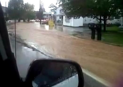
Flash Flood. Here's a YouTube clip showing the result of flash flooding near Gettysburg, Pennsylvania - reports of 2-3" rains in less than 2 hours - falling on saturated, waterlogged ground.
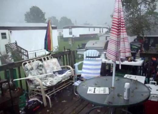
Freak Hailstorm. This YouTube clip captures some of the craziness during a sudden hailstorm in Windsor, Virginia - reports of tennis ball size hail nearby.
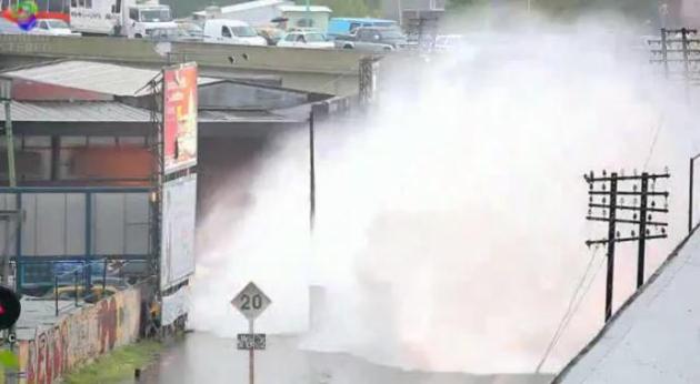
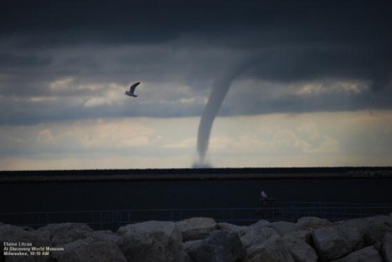
Listen To The Train Whistle. This is some of the most incredible YouTube video I've ever seen - you hear the train coming, the whistle is blaring, and then a wall of water comes toward the camera. This was taken in Belgium, during the aftermath of flooding.

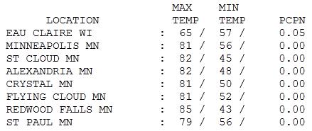
Outbreak of Indian Summer. What a Wednesday. Most of the state saw highs in the low 80s, 81 in the Twin Cities, 82 at St. Cloud and 85 at Redwood Falls, nearly 15 degrees above average.
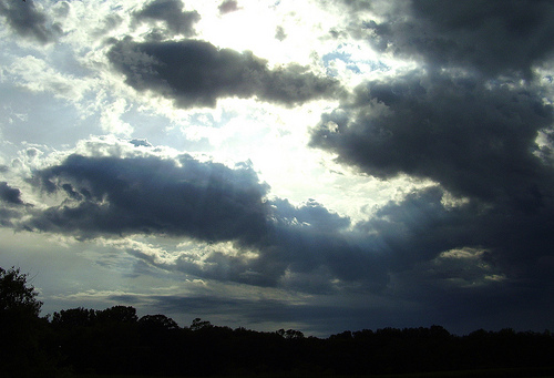
cloud photo credit.
Paul's Conservation Minnesota Outlook for the Twin Cities and all of Minnesota:
TODAY: Very windy, patchy clouds with a passing PM shower. Winds: NW 25-40. High: 65
THURSDAY NIGHT: Lingering clouds, still windy. Low: 46
FRIDAY: Bright sun, less wind. NW 10-15. High: near 60
SATURDAY: Blue sky, very pleasant. SE 10. Low: 43. High: 64
SUNDAY: Sunny, more Indian Summer. Low: 50. High: 72
MONDAY: Plenty of sun, even milder. Low: 56. High: 76
TUESDAY: Mostly sunny and quiet. Low: 58. High: 75
WEDNESDAY: More clouds and wind. Low: 55. High: near 70
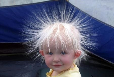
A Very Bad Hair Day
O.K. Forget about bad hair days - I've had a bad hair GENERATION, but that's another story. An Alberta Clipper arrives today with 25-45 mph wind gusts, showers north/east of the metro. Yesterday's 80-degree warmth seems like a weather-mirage.
Winds ease up tomorrow with a weekend warming trend (a string of 70-degree days likely much of next week). Keep light jackets handy, but it's still very premature retiring the shorts and T-shirts.
Speaking of warm weather gear, America just endured the hottest summer since 1936, the height of the Dust Bowl - second hottest on record for the lower 48 states.
A massive storm on the sun Monday may increase the odds of spotting the Northern Lights in the coming days. No guarantees, but it's worth a shot. No big storms are brewing, the next chance of widespread rain the first weekend of October.
I was in a rejuvenated (impressive) Duluth Wednesday for a speech on climate change and reinventing America's energy future. Someone in the audience had a profound observation. "Paul, it seems like we're relying on our smartphones more and people less." Sad but true.
BTW, the drive down I-35 was stunning, an explosion of color just north of MSP.
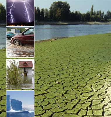
"Clear Proof" That Climate Change Causes Extreme Weather. Proving cause and effect with weather is tricky - but is there enough evidence to connect a warmer (wetter) atmosphere with an increase in extreme weather events? The story from the U.K. Guardian: "Al Gore has warned that there is now clear proof that climate change is directly responsible for the extreme and devastating floods, storms and droughts that displaced millions of people this year. Speaking to an audience of business leaders, political leaders including Scotland's first minister Alex Salmond and green energy entrepreneurs in Edinburgh, Gore said the world was at a "fork in the road". The former US vice-president and climate campaigner also argued that America has suffered a "breakdown in democratic governance", because members of Congress are obsessed with appeasing special interests in return for campaign funding, rather than confronting climate change. The former vice president and climate campaigner said that US democracy had been undermined. "In the language of computer culture, our democracy has been hacked," he said. In a near hour-long speech to the Scottish low-carbon investment conference, Gore said the evidence from the floods in Pakistan, China, South Korea and Columbia was so compelling that the case for urgent action by world leaders to combat carbon emissions was now overwhelming, Gore said."
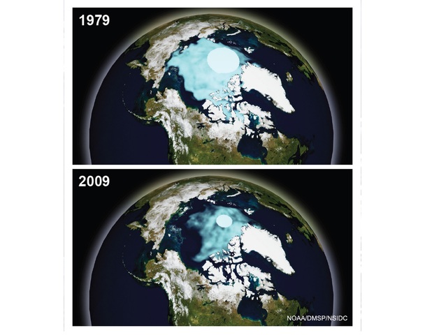
Look North America. Here's an Op-Ed from the New York Times: "As American lawmakers struggle to fix the economy, they are missing the elephant in the room — or, more aptly, the polar bear. America has a vast pool of untapped resources in its backyard. The North American basin, the Alaskan Arctic, holds an estimated 30 billion barrels of oil and more than 220 trillion cubic feet of natural gas, as well as rare earth minerals and massive renewable wind, tidal and geothermal energy. The economic potential is in the trillions of dollars, as with the Siberian and Eurasian Arctic basins. The difference is that other nations, like China and Russia, have responded by building polar icebreakers and ice-strengthened ships, and by investing in resource exploration. The United States has not. The Arctic is the newest emerging region, and yet the United States has no action plan. Both the Bush and Obama administrations have proclaimed it to be in America’s strategic interest, but Washington has done little to convert words to action. The Pentagon, Coast Guard, National Science Foundation, academics and nonprofit organizations have compiled study after study. It’s time for policymakers to act.
No comments:
Post a Comment