60s possible today south/east of MSP.
Paul's Conservation Minnesota Outlook for the Twin Cities and all of Minnesota:
TODAY: More clouds than sun, mild. A passing shower is possible. Winds: S 7-12. High: 57 (a few 60s possible south/east of the Twin Cities).
TUESDAY NIGHT: Clouds, a few showers or sprinkles (best chance southeastern MN). Low: 37
WEDNESDAY: Colder. Clouds and another shower giving way to slow clearing. High: 49
THURSDAY: Sun returns, brisk. Low: 30. High: 47
FRIDAY: Fading sun, breezy and seasonably cool. Low; 29. High: 49
SATURDAY: Gusty showers (wet snow may fall on far northwest MN). Low: 40. High: 55
SUNDAY: Early sprinkles or flurry? Slow clearing during the day. Low: 38. High: 49
MONDAY: More sun, less wind. Low: 29. High: 45
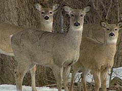
2011 Firearm Deer Hunting Opener Outlook: windy with (rain) showers, highs in the 50s; winds gusting to 30 mph. Wet snow possible over far northwestern MN, Red River Valley into eastern North Dakota, where several inches of snow may accumulate. Click here for more information from the Minnesota DNR.

"Oh wow. Oh wow. Oh wow." Steve Jobs' last words before his death, as reported by his sister, Mona Simpson, in a deeply moving eulogy in the New York Times.
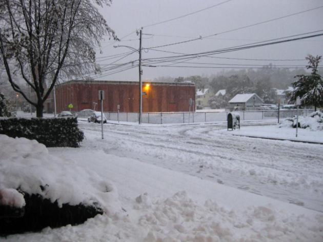
Snowy Wonderland. Thanks to Nicholas Isaac from Bristol, Connecticut for passing on this photo (he just got power back and was able to send in some photos)
Historic "Snowtober" in the Northeast:
* Earliest snow.
* Most snow.
* Earliest snow days at area schools from Maine to Virginia.
* Record state power outages.
(source: CNN)
"Widely referred to by its social media moniker, “Snowtober,” the storm smashed records that had stood since the beginning of the reliable instrument record in the late 1800s (and in some cases, even longer than that), and upended assumptions about what a fall nor’easter can do." - Capital Weather Gang story about the record October snowfall below.
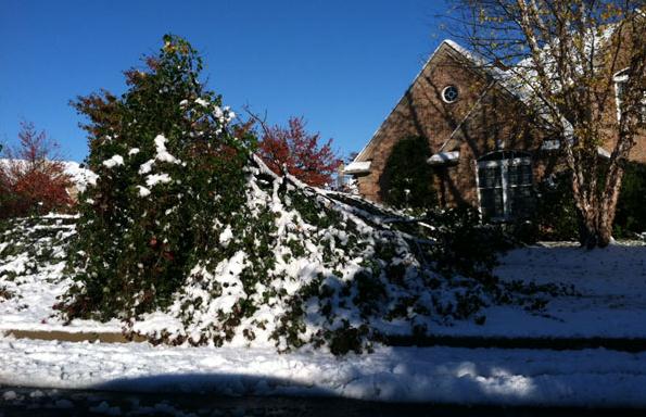
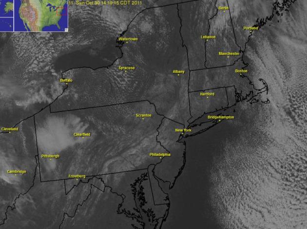
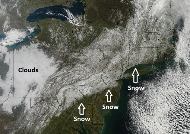
86% of northeastern USA had 4" or more of snow on Halloween. Photo above courtesy of The Morning Call).
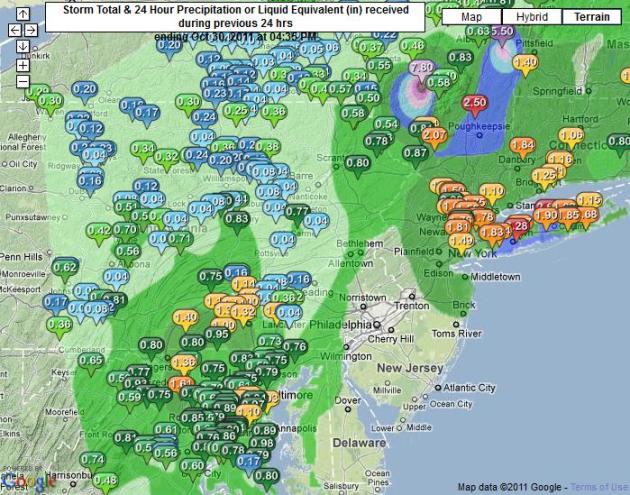
31.4" snow: Golden Snow Shovel Award goes to the town of Jaffrey, Massachusetts, where over 2 1/2 feet of snow piled up.
22.5" snow at Concord, New Hampshire: second greatest 24 hour snowfall (in any month). Source: Capital Weather Gang.
2.9" Central Park, New York City: only time in New York City history where an inch or more has been reported in October.
Nearly 1,000 trees may be lost in Central Park due to Saturday's heavy wet snow (New York Times).
"The most extraordinary October snowstorm in over two centuries in the Northeast U.S. has finally come to an end this Sunday afternoon. Not since the infamous snow hurricane of 1804 have such prodigious amounts of snow been recorded in New England and, to a lesser extent, in the mid-Atlantic states. In fact, the snowfall, in most cases, has exceeded that of even the great October snow of 1804." - Christopher Burt, weather historian, courtesy of Dr. Jeff Master's WunderBlog.
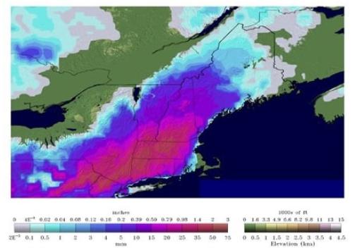
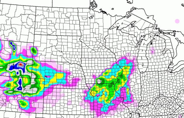

Getting Closer. A Winter Storm Watch is posted for the Denver area for 4-8" of snow from tonight into Wednesday. A wave of low pressure rippling northeast along an advancing cold front may squeeze out a few inches of snow from near Kansas City to Des Moines the Quad Cities to Rockford and Madison.
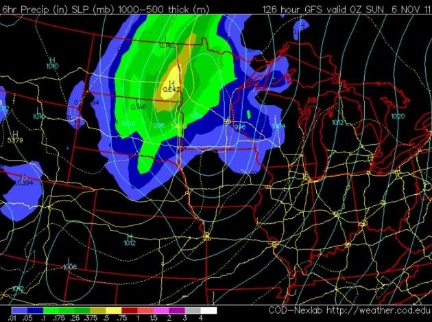
Saturday: Warm Enough For Rain. Models spin up an impressive storm for the weekend, but a storm track well west of the Twin Cities will place most of Minnesota on the warm side of the storm, highs in the 50s with rain showers likely. Wet snow is possible north/west of Detroit Lakes and Thief River Falls, from Fargo/Moorhead north to Crookston, and as much as 3-6" snow may accumulate over the central and eastern Dakotas. The farther north/west you go, the better the odds of enough snow for tracking.
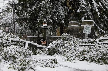
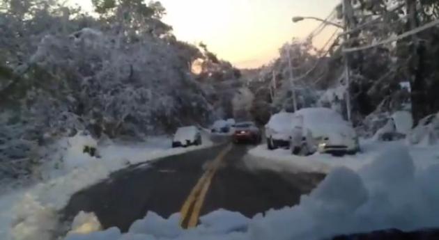
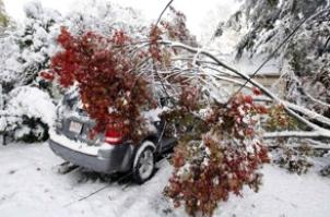
Widespread Damage. Millions without power, some people may be in the dark through the end of the week. Tens of thousands of trees may have been damaged or destroyed by the freak, early-season snowfall. Heavy and wet it accumulated on leaves (that had yet to fall from trees), making a bad situation even worse. Check out this YouTube footage of damage in upstate New York. Unbelievable.
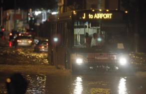
Flash Flood Warnings Issued For Miami-Dade. South Florida has seen soaking rains and considerable flash flooding in recent days. The Miami Herald has more details: "The respite from rain won’t last long. Though floodwaters slowly began receding Monday morning, more storms were expected to sweep across South Florida in the afternoon — some of them torrential enough to quickly turn streets and already saturated suburban yards into lakes once again. Most of South Florida was under a flood watch and just before noon the National Weather Service issued a flash flood warning for East Central Miami-Dade County as a band of intense cells approached from the south. “It’s been dry this morning but we do have some additional rain moving into the area this afternoon, some of it heavy,’’ said Robert Molleda, warning coordination meteorologist for the service’s Miami office. Some areas could see another one to two inches, maybe much more, to go on top of a weekend that produced double-digit rainfall amounts from Coral Gables to Fort Lauderdale. The rain could extend into the early evening, making for a soggy Halloween outing."

Weather: Cloudy With A Chance Of Stalking. Yes, some of these apps know EXACTLY where you are at any given time. Great for serving up a relevant ad, but it turns out that many people aren't fond of digital stalking. Paidcontent.org has the story: "It’s like being followed by the weatherman. A new class action suit against HTC makes some unsettling allegations about how the phone maker has been using a built-in weather app. In a suit filed in Seattle federal court, two plaintiffs claim that their phone’s AccuWeather app is transmitting precise data about their location at regular intervals and whenever they tap to check the weather. They say the app, which is built into the phone, can’t be disabled and that phone maker HTC is sharing the location data with advertisers that want to target users with customized ads. The plaintiffs also say HTC is failing to encrypt the data that transmits their location. According to the complaint, the AccuWeather app, which is also available for the iPad, collects location information that is more precise than necessary to provide weather information. Rather than simply collecting “coarse information” to learn that a person is in a certain part of the city, the app obtains the precise corner at which he or she is standing at a given time. The complaint says this information is useful to AccuWeather because the company is in the business of selling user profiles gleaned from smartphone data."

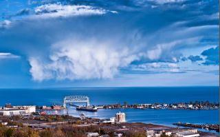
Photo Of The Day: Cumulus Congestus. It's unusual to have these vertically-stretched instability cumulus clouds in October, but a pool of unusually cold air in the upper atmosphere left skies over Duluth unusually unstable. That's snow falling out of those clouds. Photo courtesy of Shawn Thompson Photography.


Not Bad (For Halloween). Considering over 8" snow fell 20 years ago, on October 31, 1991, I was just fine with 50 and blue sky yesterday. Morning fog and stratus gave way to a midday clearing trend, temperatures close to average across the state; highs ranging from 43 at International Falls to 50 in the Twin Cities and St. Cloud, 52 at Rochester and 59 at Redwood Falls.


The Big Lag
Life is full of delicious irony. Like the fact that I had to fly to Washington D.C. to see my first snow of the winter season. A few poor souls running the Marine Corp Marathon Saturday slipped on icy bridges, a surreal sight for D.C. in October.
With a few exceptions winter is coming later to Minnesota; farmers confirm the growing season is 2-3 weeks longer than it was a generation ago. This year is a classic example. The first 32 F. temperature in the Twin Cities came October 21, two weeks later than normal. The average date of the first snow flurries at MSP is October 16. There's a risk of flurries Saturday night, but I still don't see any measurable snow for the metro area through the second week of November.
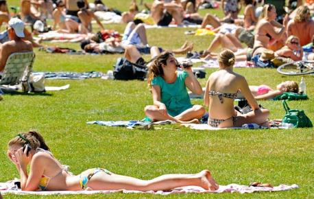
A big storm will push rain into town for the Deer Hunting Opener Saturday, mixed with snow over the Red River Valley of northwestern Minnesota, where a few inches of slush may pile up. 50s are likely today, again Saturday; jacket weather the rest of the week. A whopping 9.8 inches of snow fell November 2010. On average 10 inches of snow falls this month; white-knuckle commutes far more likely closer to Thanksgiving.
While the east coast digs out we've won the Fall Lotto!


Special Investigation: Who's Behind The "Information Attacks" On Climate Scientists? The Institute for Southern Studies has more: "This week, in a courtroom in Prince William County, Virginia, a hearing will take place that could have implications for the privacy rights of scientists at colleges and universities across the country. It's part of a lawsuit brought by the American Tradition Institute, a free-market think tank that wants the public to believe human-caused global warming is a scientific fraud. Filed against the University of Virginia, the suit seeks emails and other documents related to former professor Michael Mann, an award-winning climate scientist who has become a focus of the climate-denial movement because of his research documenting the recent spike in earth's temperature. By suing the university, the American Tradition Institute wants to make public Mann’s correspondence in an effort to find out whether he manipulated data to receive government grants, a violation of the state’s Fraud Against Taxpayers Act. But a Facing South investigation has found that the Colorado-based American Tradition Institute is part of a broader network of groups with close ties to energy interests that have long fought greenhouse gas regulation. Our investigation also finds that ATI has connections with the Koch brothers, Art Pope and other conservative donors seeking to expand their political influence."
No comments:
Post a Comment