55 F. high in the Twin Cities Tuesday.
0": no rain (or snow) predicted for the next 84 hours at MSP.
50-degree warmth forecast to linger (off and on) into the 3rd week of November. I
still don't see any arctic air for Minnesota looking out 15 days.
Paul's Conservation Minnesota Outlook for the Twin Cities and all of Minnesota:
TODAY: Clouds, early sprinkles and a shower or two. Gradual clearing during the afternoon. Winds: NW 10-15. High: 47
WEDNESDAY: Clear to partly cloudy and chilly. Low: 30
THURSDAY: Bright sun, less wind - seasonably cool. High: 48
FRIDAY: Sun fades late in the day as clouds increase. Dry. Low: 31. High: near 50
SATURDAY: Wet and windy, showers likely. Low: 38. High: 54
SATURDAY NIGHT: Rain tapers, changing to wet snow over far northern Minnesota. (Set your clock back one hour as we head back to standard time). Low: 37
SUNDAY: Mostly cloudy, windy and colder. Snow showers north, some accumulation north of Leech Lake. High: 46
MONDAY: Plenty of cool sun. Low: 29. High: 48
TUESDAY: Sunny start, clouds increase. Low: 37. High: 47
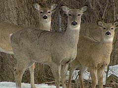 Deer Hunting Opener.
 Latest guidance suggests rain showers may hold off until Saturday night and early Sunday, possibly ending as a little wet snow over far northern Minnesota Sunday. Right now I don't see any significant snow accumulation in Minnesota through early next week. Saturday: peeks of sun, windy and mild. Highs:
mid 50s (60 not out of the question over central/southern MN).
 Back To Standard Time
. We come off daylight saving time this weekend. Don't forget to "fall back" one hour before turning in Saturday night. An extra hour of sleep! Newstaar Media has more on why we even mess with daylight saving time and standard time
here.
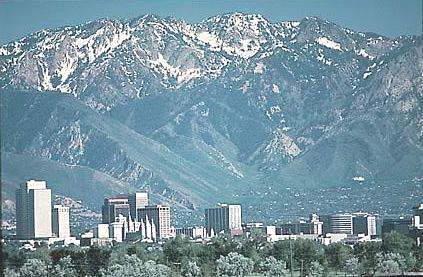 November
 is Denver's second snowiest month, on average, with 8.7" snow (1981-2010).
The forecast for this storm is roughly 4 to 10 inches, which is the entire month’s average snowfall. In addition, just another tid bit of trivia…the biggest snowstorm in Denver was Nov. 2-4, 1946 (today marks the 65th anniversary) where 30.4 inches fell. More on November weather from the Denver NWS office here.
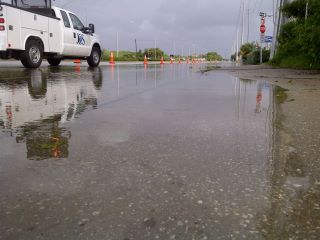 22" rain
 fell on Vero Beach, Florida in October, second greatest monthly amount on record (second only to 2004, when Hurricane Frances and Jeanne hit in the month of October).
"
Weather Underground meteorology director Jeff Masters....said in the United States from June to August this year, blistering heat set 2,703 daily high temperature records, compared with only 300 cold records during that period, making it the hottest summer in the U.S. since the Dust Bowl of 1936." - AP article below on apparent global increase in extreme weather events.
Northeast Reels From Third Weather Disaster In 3 Months. From
USA Today: "
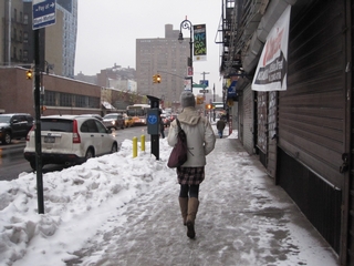
While people from West Virginia to Maine huddled in the cold Monday, state officials and utility workers were struggling with the third strike of disasters in three months. A rare October snowstorm this weekend slammed areas that were hit hard by flooding after Hurricane Irene in August and Tropical Storm Lee in September. The snowstorm, coming on the heels of those two storms and an earthquake, topped "a challenging year, because Mother Nature threw a lot of things our way," said Dennis Buterbaugh, a spokesman for the Pennsylvania Department of Transportation. "It's certainly a lot of work and a lot of extra expenditure." At least 21 deaths were blamed on the storm, including eight in Pennsylvania and one in Canada. Most were from falling trees and traffic accidents. More than 3 million customers lost power in the Northeast, and by Monday night, that number was down to 2.2 million."
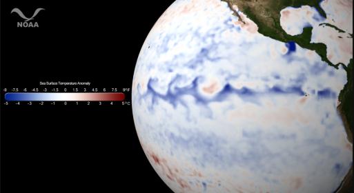 La Nina Is Back
. We've been talking about this for a couple months now. A cooling trend in the equatorial Pacific (although not as strong as last winter)
may still favor colder, drier weather for the Upper Midwest, dry weather for the southern USA and a bias toward big storms tracking up the east coast of the USA. The story from
NOAA: “
A sea surface anomaly, or departure from the average temperature, is calculated by subtracting the temperatures from a time period of interest from the 30-year average (1981-2010) for the same time period. The resulting data shows areas that are hotter or colder than normal. Sea surface temperature anomaly data allow scientists to quickly identify features of interest, especially for El Niño/La Niña, coastal upwelling, and hurricane intensification. The strengthening La Niña in the Pacific Ocean brings with it a host of possible trends as outlined by the NOAA Climate Prediction Center’s Seasonal Outlook released October 20, 2011. These trends include lower than normal precipitation for the southwest and southern Great Plains and Mississippi Valley. Below normal temperatures are favored for southern sections of the Florida peninsula, northern Great Plains and northern Rockies. Trends favor modest warmer than normal conditions for much of the east."
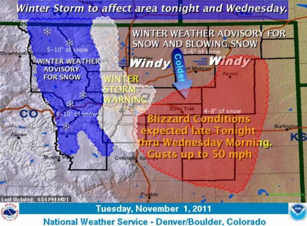 Wednesday White-Out?
 Winter Storm Warnings are posted for Denver, with Blizzard Warnings in effect just south/east of the Mile High City for near-zero visibility. Hundreds of flights into KDIA may be delayed or cancelled today, with 5-10" snow for downtown Denver, more east of the I-25 corridor. Click
here for storm updates from the Denver NWS.
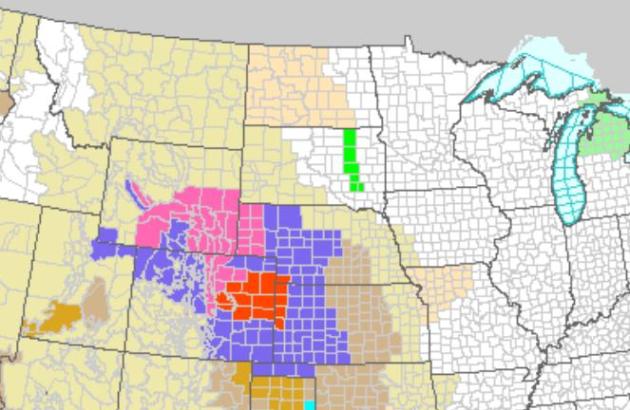
 Blizzard Warnings
. NOAA has issued blizzard warnings from the southern/eastern suburbs of Denver into northwest Kansas for white-out conditions - winter storm watches as close as central Nebraska. Click
here for the latest watches and warnings.
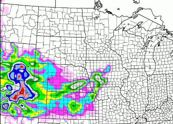
 Predicted Snowfall.
 The NAM model is hinting at over a foot near Denver, with some 3-6"+
amounts into Nebraska and southwestern Iowa.
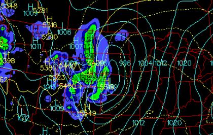 Weekend: Western Storm Track.
 The weather map late Saturday shows an intense storm over Nebraska, tracking almost due north - keeping us on the warm, eastern side of the storm track. That should mean 50s Saturday, even an outside shot at 60 degrees, followed by a cooler wind on Sunday - rain ending as snow showers/flurries over far northern Minnesota. This may be one of the warmer Deer Hunting Firearm Openers in recent memory.
In Flooded Bangkok, Shades Of Hurricane Katrina. One factor that contributed to extreme flooding in New Orleans (and Bangkok): overdevelopment. Paving over swamps and suburbs with parking lots and corporate office parks meant rainwater had less of a chance to drain properly and naturally - the potential for historic flooding increases when water is forced to run off into streets, sewars and rivers.
Globalpost.com has the story: "
BANGKOK, Thailand — Sacrificial neighborhoods, overtaxed infrastructure and political infighting. Though far less chaotic and fatal than Hurricane Katrina, Bangkok’s flooding woes share similarities with the 2005 disaster that nearly destroyed New Orleans. Bangkok and New Orleans, both founded in the 18th century, are low-lying port cities built in natural floodplains. As they developed, both cities lost protective marshlands and forests to concrete sprawl and deforestation, leaving residents more vulnerable to floodwaters. Greater Bangkok’s crisis and Hurricane Katrina are not equal in scope: the Thai floods’ rising death tool is at 380 and Katrina killed more than 1,800. A sudden and ferocious hurricane wrought New Orleans’ flooding; Thailand has suffered the agonizing build-up of waters brought by a 25 percent increase in average seasonal rainfall."
Thailand Flood Defenses Divide Bangkok. The
Christian Science Monitor has the details: "
An uneasy calm prevailed today along the Sam Wa canal in northern Bangkok after Thailand's government acquiesced to angry locals who wanted to hack a 1-yard-wide opening in a sluice gate along the canal. The hole will allow their flooded suburbs to drain – but threaten flooding in the heart of the city. For more than two months Thailand has been inundated with the worst flooding the country has seen in decades, in some places deeper than five feet. Almost 400 people have been killed and hundreds of thousands of others displaced. Bangkok, the economic hub of the country, has been relatively spared from massive flooding, protected by a system of barricades and canals. However, partly because of the barricades, the water inundating the suburbs surrounding the city hasn't been able to properly drain, frustrating residents and forcing a debate on the ethics of protecting the canal-lined heart of Bangkok at the expense of the suburbs."
Will A New Weather Satellite Change The Way Weather Is Predicted? Here's a fascinating article from the
Alaska Dispatch: "
A prototype for a new generation of weather satellites successfully launched from Vandenberg Air Force Base in California in the predawn hours Friday morning. The $1.5 billion, SUV-sized craft carries five instruments that will monitor 30 features in the atmosphere, on land, and in the ocean that affect daily and seasonal weather patterns, as well as long-term climate behavior. Known by its acronym NPP, the 2.3-ton craft is designed to orbit Earth around its poles 14 times a day to provide its measurements in virtually unprecedented detail. Four of the five instrument packages aboard the craft are traveling to space for the first time, although prior craft have carried hardware that has measured similar climate parameters. The craft is unique in that it is the first satellite designed to satisfy the needs of weather forecasters and climate researchers simultaneously, project officials say. "NPP will help improve weather forecasts, enable unique scientific insights, and allow more-accurate environmental predictions," says Michael Freilich, who heads the Earth Science Division at the National Aeronautics and Space Administration."
A Storm Out Of Season. Here's an Op-Ed on last Saturday's historic snowstorm across the northeast from the
New York Times: "
It sounds like the pitch for a Tim Burton movie: White Halloween. But Saturday night and Sunday morning were more frightful than amusing. The astonishing snowstorm that swept across the region left millions without power. Everywhere from West Virginia to New Hampshire, the landscape was a chaos of downed limbs, felled trees and snapped utility lines. Monday began in many places without school and electricity; in some, it looked as though even Halloween might be put on hold until the cleanup was further along. At higher elevations farther north, where the snowfall was deep but relatively dry, the damage was not severe. And there was a peacefulness in the sudden, temporary halt to autumn’s bustle. Farther south, there was less snow, but it was wetter, heavier and far more destructive, especially because it fell on trees that were not yet bare. Where the damage was worst, it looked as though autumnal trees had shed their branches instead of their leaves."
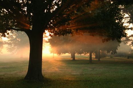
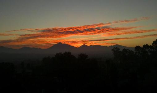 Sunrise
. “Picturesque sunrise this morning thanks to some altocumulus clouds about 15,000 ft above the desert. Photo taken from NWS San Diego in Rancho Bernardo.”

 Not Bad For November 1
. Sunshine gave way to increasing clouds ahead of a cool front. Tuesday highs ranged from 49 at Hibbing to 64 at Rochester, 57 at St. Cloud and 55 in the Twin Cities.
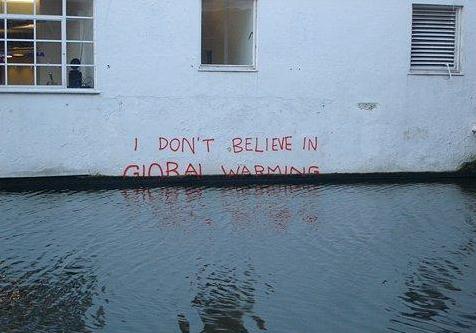
Outlook: More Extremes
Shell-shocked residents of the Northeast must be wondering what's next? Hurricane Irene in August, Tropical Storm Lee in September, an earthquake, and now the historic "Snowtober" storm. We can't find a comparable October snowfall going back to 1804.
This slushy misery comes on the heels of the most extreme year in U.S. history: a record 10 separate billion dollar events in 2011. Dr. Jeff Masters at Weather Underground reports the U.S. just experienced the hottest summer since the Dust Bowl of 1936; 2,703 daily high temperature records, compared to only 300 low temperature records. One summer doesn't prove anything, but a warmer atmosphere can hold more water vapor, loading the dice in favor of more floods (and record winter season snows).
Blizzard warnings are posted near Denver, some 6-12" amounts likely, with wet snow as close as Iowa tomorrow.
Cool sun returns Thursday and Friday, temperatures close to average. Heading out for the Deer Hunting Firearm Opener? A big storm tracking west of town will mean showery rains, highs in the 50s, ending as 1-2" snow up north Sunday.
Still no flakes for MSP. Since 2004 the latest we've seen our first snow is November 5 (2007). Average date for the first flurries is October 16. I have a hunch our first snowflakes this year may be 3-4 weeks later than average (which does NOT mean an easier-than-normal winter is inevitable, btw). Doesn't work like that, I'm afraid. But considering we could be knee-deep in snow right now, every day like this (without warnings, advisories or wind chill) is a gift.
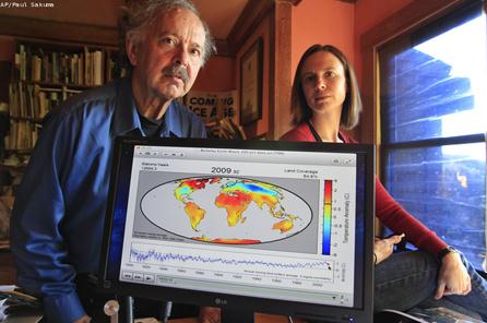 Muller: Why You Should Not Be A Global Warming Skeptic
. By now you're heard the story, a climate change skeptic who employed a team to try and do a better job analyzing global data (filtering out warming from cities). The result: he confirmed what IPCC, NOAA and NASA scientists (and every other major scientific association on Earth) has been saying for 20 years: the atmosphere is warming, and we are probably largely responsible for this spike. More from
Technorati: "
On October 21, Dr. Richard Muller published an article in the Wall Street Journal (WSJ) presenting the results of a two-year exhaustive study of the world temperature records using multiple methods to verify the data. The verdict, global warming is real and the skeptics are wrong. This was news because Dr. Muller, a physics professor at the University of California, Berkeley, has been one of the 'legitimate scientists' that skeptics have relied on to support their position that global warming is a myth. This startling announcement was largely ignored by the news media until Jon Stewart had a field day with the announcement on his October 26 episode of The Daily Show with Jon Stewart. Since airing, several other news media outlets have picked up the story, including MSNBC and The Huffington Post."
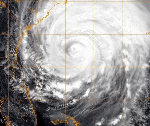 Wild Weather Will Get Wilder, Says Global Warming Panel
. Here's a good recap from the
New York Daily News. New York saw the snowiest January on record (3 huge storms) and the wettest August ever recorded. Here's an excerpt from the article: "
The report, obtained by the Associated Press and AFP, says weather costs will rise and some locations may become “increasingly marginal as places to live.” The scientists said they were a 99% certain that temperature extremes will keep increasing and called it “likely” that peak temperatures will rise 5.4 degrees F by 2050, and 9 degrees F by 2100. Three years in the making, the report comes in a year of unprecedented weather extremes and a record-breaking 10 multi-billion-dollar weather disasters, from February’s mega-blizzard to Hurricane Irene to the record-smashing tornado swarms in Midwest and Southeast. “It think that this year's weather extremes are a sign that climate change is starting to effect our weather,” said Weather Underground meteorologist Jeff Masters. “When you get a naturally extreme year combined with climate change putting more energy into the atmosphere, you're going to get an incredible year like this one.”
Thailand Flood Misery Continues As Scientists Say Climate Change Is Causing More Weather Extremes. This entry from
MSNBC.com: "
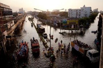
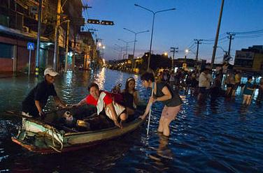
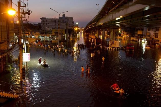
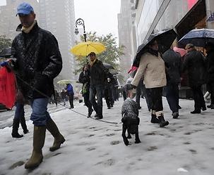
Residents walk along a major flooded intersection in the Thonburi area of Bangkok, Thailand, on October 31. Thousands of flood victims have been forced to take shelter at crowded evacuation centers around the capital. Thailand is experiencing the worst flooding in over 50 years which has affected more than nine million people.
The AP reports:
The Intergovernmental Panel on Climate Change says that extreme weather disasters like the recent record floods in Thailand are striking more often, according to a draft summary of a report obtained by The Associated Press. It says there is at least a 2-in-3 probability that climate extremes have already worsened because of man-made greenhouse gases. Read the full story."
Photo credit above: Paula Bronstein / Getty Images
Panel Says Wild Weather Worsens. Here's a timely article from the
Associated Press: "
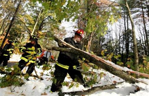
WASHINGTON (AP) — Freakish weather disasters — from the sudden October snowstorm in the Northeast U.S. to the record floods in Thailand — are striking more often. And global warming is likely to spawn more similar weather extremes at a huge cost, says a draft summary of an international climate report obtained by The Associated Press. The final draft of the report from a panel of the world's top climate scientists paints a wild future for a world already weary of weather catastrophes costing billions of dollars. The report says costs will rise and perhaps some locations will become "increasingly marginal as places to live." The report from the Nobel Prize-winning Intergovernmental Panel on Climate Change will be issued in a few weeks, after a meeting in Uganda. It says there is at least a 2-in-3 probability that climate extremes have already worsened because of man-made greenhouse gases. This marks a change in climate science from focusing on subtle changes in daily average temperatures to concentrating on the harder-to-analyze freak events that grab headlines, cause economic damage and kill people. The most recent bizarre weather extreme, the pre-Halloween snowstorm, is typical of the damage climate scientists warn will occur — but it's not typical of the events they tie to global warming. "The extremes are a really noticeable aspect of climate change," said Jerry Meehl, senior scientist at the National Center for Atmospheric Research. "I think people realize that the extremes are where we are going to see a lot of the impacts of climate change." (photo above courtesy of sacbee.com).
Climate Change Linked To Wild Weather. Another perspective on the soon-to-be-released study from the IPCC, this time from the
Sydney Morning Herald: "
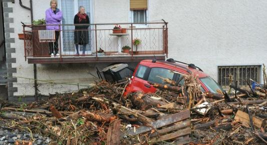
A draft UN report three years in the making concludes that man-made climate change has boosted the frequency or intensity of heat waves, wildfires, floods and cyclones and that such disasters are likely to increase in the future. The document being discussed by the world's Nobel-winning panel of climate scientists says the severity of the impacts vary, and some regions are more vulnerable than others. Hundreds of scientists working under the Intergovernmental Panel for Climate Change (IPCC) will vet the phonebook-sized draft at a meeting in Kampala of the 194-nation body later this month. "This is the largest effort that has even been made to assess how extremes are changing," said Neville Nicholls, a professor at Monash University in Melbourne, Australia, and a coordinating lead author of one of the review's key chapters."
Trees Not Adapting Well To Climate Change. The story from
UPI: "
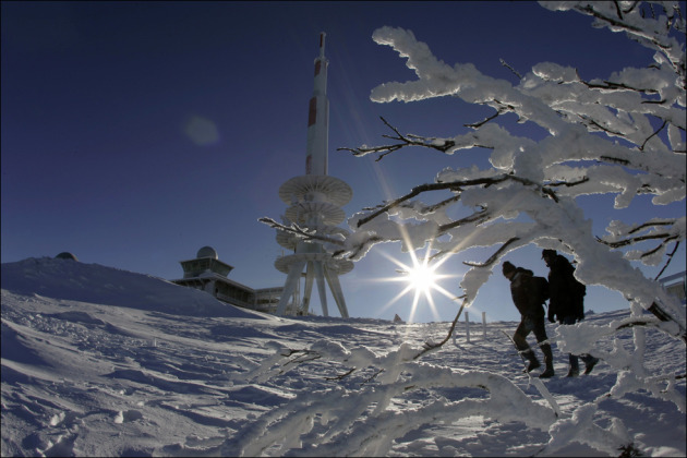
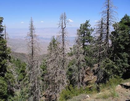
DURHAM, N.C., Oct. 31 (UPI) -- More than half of tree species in eastern U.S. forests aren't adapting to climate change as quickly or consistently as predicted, researchers said. Nearly 59 percent of the species examined in a study by Duke University researchers showed signs that their geographic ranges are contracting from both the north and south, a Duke release said Monday. "Many models have suggested that trees will migrate rapidly to higher latitudes and elevations in response to warming temperatures, but evidence for a consistent, climate-driven northward migration is essentially absent in this large analysis," James S. Clark, a professor of environment, said. Fewer species -- only about 21 percent -- appeared to be shifting northward than predicted, the researchers said. "Warm zones have shifted northward by up to 100 kilometers (62 miles) in some parts of the eastern United States, but our results do not inspire confidence that tree populations are tracking those changes," Clark said." (Photo above courtesy of treehugger.com).
Forests Not Adapting To Climate Change. Another look at the Duke study from
zeenews.com: "
Washington: More than half of eastern US tree species aren’t adapting to climate change as quickly or consistently as predicted, according to a new Duke University-led study. “Many models have suggested that trees will migrate rapidly to highelatitudes and elevations in response to warming temperatures, but evidence for a consistent, climate-driven northward migration is essentially absent in this large analysis,” said James S. Clark, H.L. Blomquist Professor of Environment at Duke’s Nicholas School of the Environment. Nearly 59 percent of the species examined by Clark and his colleagues showed signs that their geographic ranges are contracting from both the north and south. Fewer species - only about 21 percent - appeared to be shifting northward as predicted." (photo courtesy of sciencedaily.com).
Ignorant And Proud. A story from
Media Matters: "
By any reasonable measure, last week was not a good one for conservative media figures that believe climate scientists are somehow fabricating the theory of climate change. Richard Muller, a physicist at University of California, Berkeley, announced the results of new research from the Berkeley Earth Surface Temperature Project affirming that the planet is getting warmer and confirming the accuracy of several other existing global temperature records. As the Associated Press explains, while the findings are "no different from what mainstream climate scientists have been saying for decades," what's especially notable about Muller's findings is "who is behind the study": One-quarter of the $600,000 to do the research came from the Charles Koch Foundation, whose founder is a major funder of skeptic groups and the tea party. The Koch brothers, Charles and David, run a large privately held company involved in oil and other industries, producing sizable greenhouse gas emissions. A study funded in part by oil industry interests finds that the planet is getting warmer and that climate scientists have "truly been very careful in their work, despite their inability to convince some skeptics of that" -- this seems like the kind of thing that should give pause to people that refuse to accept data from supposedly biased sources like NASA."
Wingnut Watch: October Snow Ends Climate Change Debate. More on the "heavy October snow means climate change is bunk" line of thought, from Media Matters and
The Rolling Stone:
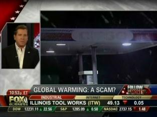
Via Media Matters: "It's snowing in October – so, sorry, that pretty much sews up the case against climate change. How could the planet be warming if it's getting colder? Thus, the logic of Fox News Eric Bolling, who tweeted as follows on Saturday, as snowflakes blanketed the Northeast: "Hey, Al Gore ... earliest snowfall in NYC since the Civil War ... where's your global warming now, see?" Bolling followed this up with a segment on his Fox Business show gleefully citing the snowstorm as evidence that climate change is bogus. There's a lot to be said about this, but let me just quote Andrew Freedman over at the Washington Post, who writes: "Snowtober” occurred during a year in which the U.S. has already suffered a record number of billion dollar weather disasters, including Irene; spring flooding along the Mississippi River, and the ongoing Texas drought. Scientific evidence continues to mount that certain types of extreme weather events, including heavy precipitation events (both heavy rain and snow) are becoming more common and severe due to global warming."







No comments:
Post a Comment