**SATURDAY EVENING UPDATE** 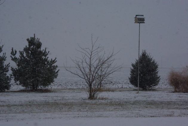
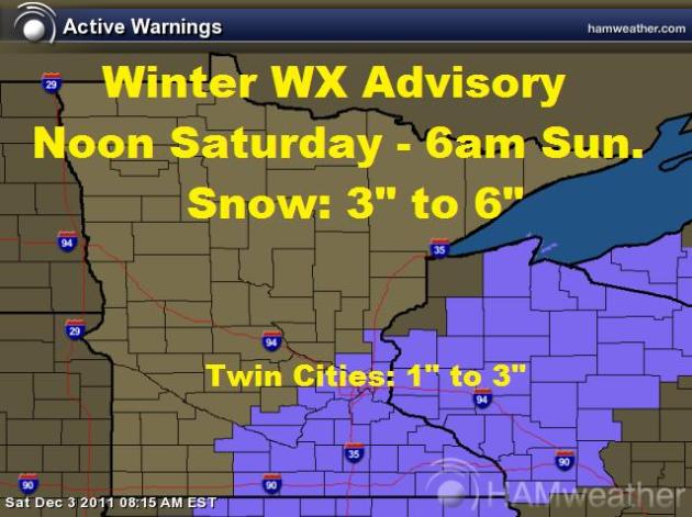
**WINTER WEATHER ADVISORY NOW CONTINUES UNTIL 6AM SUNDAY**
SNOW: Within the advisory area, 3" to 6" of snow is possible - HOWEVER, the Twin Cities is likely to see 1" to 3" with the higher amounts on the southeast side of town and lighter amounts on the northwest side of town. Anywhere from 3" to 6" (some isolated +6") can be expected from Mason City, IA to Albert Lea, MN to Rochester, MN to Winona, MN to Eau Claire, WI
**READER UPDATES & PICTURES**
Thanks to Terri Prigge from near New Richland, MN for the picture below...
"Here's a picture from southern Waseca County (near New Richland, MN) taken about 2:30pm. It started snowing around 1/1:30pm here."
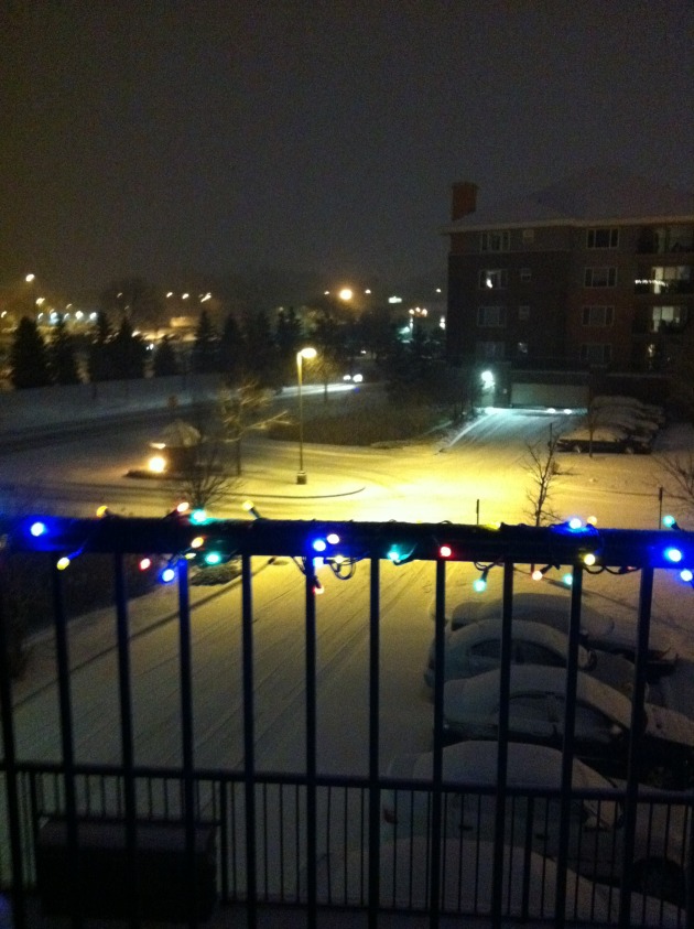
Thanks to Gavin & Laura Tugana from St. Louis Park, MN for the picture below:
Thanks for keeping your blog updated today - We love keeping up to date with the weather. Have a great rest of your night and keep up the good work!
Gavin & Laura"
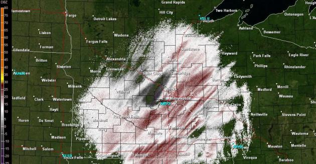
Radar As of 6:30pm Saturday
Snow continues at light to moderate levels through the southern half of the state, the heaviest is still expected across the southeastern tip, though some across the southeast Metro may get some appreciative numbers too!
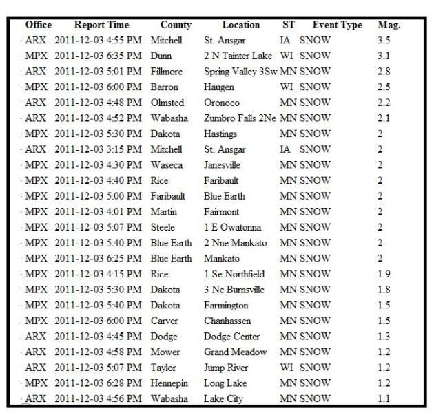
Snow Reports So Far
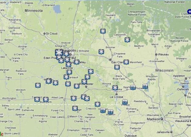
Here Are Some of the Latest Numbers
SATURDAY NIGHT: Heaviest snow potential continues through the evening hours of Saturday. Total accumulations across the Twin Cities: 1" to 3" (heavier amounts on the southeast side of the metro and the lighter amounts on the northwest side of the metro). Low: 23. Winds: NNW 5-15mph
SUNDAY: Lingering flurries possible very early, otherwise a sunnier start with a cloudier afternoon/evening as another clipper drops south of the International border. Could see some light snow/flurries late. High: 31 Winds: WNW 5-10mph
MONDAY: Breezy, feels like December! Few scattered light snow showers possible early. Low: 16. High: 22 Winds: N 10-20mph
TUESDAY: Cold sunshine, brisk wind chill. Low: 8. High: 19. Winds: SW 10-20mph
WEDNESDAY: Still cold, increasing PM clouds. Low: 12. High: 25
THURSDAY: Cold with some sun. Low: 13. High:19
FRIDAY: Still cold with a few passing clouds. Low: 8. High: 18
DON'T FORGET TO SEND SNOW REPORTS & PICTURES TO ME, I'LL USE THEM IN THE BLOGS LATER TODAY/TOMORROW:
tnelson@weathernation.net
More updates to come,
Todd Nelson
No comments:
Post a Comment