NEW YEAR'S DAY: WIND ADVISORY continues through midnight Sunday Night. Windy and much colder with more clouds than sun. Passing flakes in the afternoon. High: 24 (wind chill in the teens and single digits). Winds: NW 15-30mph gusts to 45mph.
SUNDAY NIGHT: WIND ADVISORY Continues through Midnight Sunday Night. Still breezy and much colder. Cloudy with a few passing flurries. Low:
MONDAY: Coldest day in sight. Bright sun, less wind - a rare colder-than-average day. Low: 8. High: 18. Winds: Northwest 15-25mph
TUESDAY: Cold start. Fading sun, light snow up north. Low: 4. High: 25
WEDNESDAY: Partly sunny, a bit milder. Low: 18. High: near 32
THURSDAY: Mild sun. Feels like March again. Low: 20. High: 40
FRIDAY: More sun and still very mild. Low: 25. High:40.
SATURDAY: Mix of clouds and sun, turning colder. Low: 20. High: 25

Happy New Year! I guess Mother Nature wanted to join in the part too. After a relatively quiet and benign weather pattern, this is the most significant weather we've had in a long time. Wind whipped snowflakes will continue today as the storm continues to plow eastward through the Great Lakes. Any snow that piled up in your front yard overnight, will likely end up in your neighbors yard several blocks away with winds still gusting close to 50mph through the early New Year.
Enjoy the little bit of snow while you can because what you see now, probably won't be around by the end of the week. A mild Pacific flow will have temperatures soaring close to 40 degrees by the end of the week. With that said, our somewhat lame winter will continue into the first full week of 2012.
December temperatures ended up being warm enough to claim a name in the top 10 warmest Decembers in recorded history. In fact, 4 out of the last 6 months made it into the top 10 warmest months in recorded history locally.
Not sure when the switch will flip or if we'll even have a legitimate winter, but time may be running out. The 2nd week of January is typically our coldest period.
Half-Dollar Size Flakes
I took this picture last night from the NW Burbs... not sure I've ever seen snowflakes that big before!
More Half Dollar Size Flakes
Thanks to Bill Doms from Buffalo, MN for this shot. With a long exposure, he was able to capture these streaking snowflakes. You can see Bill's website @:

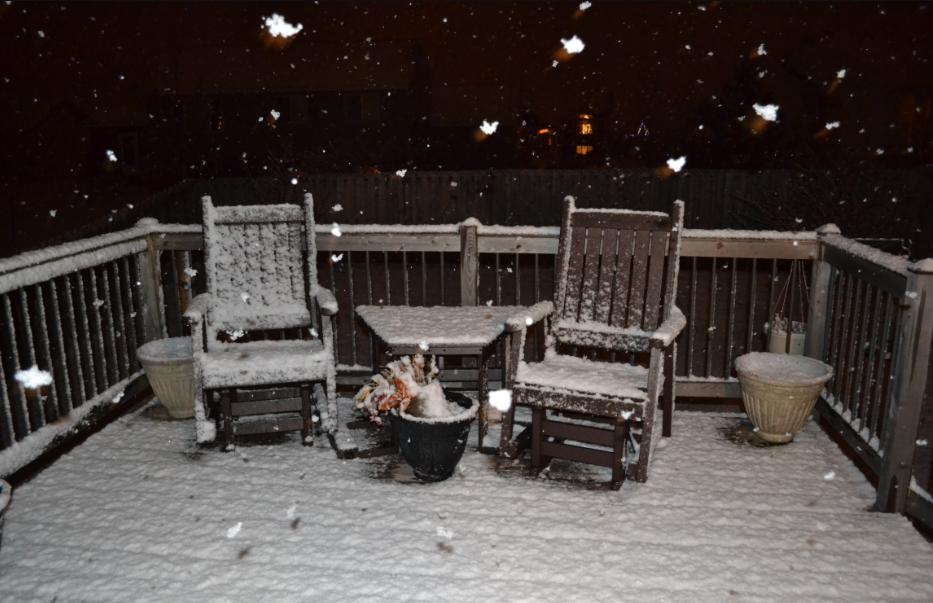
Another Snow Picture
Thanks to Katie Ferrier for this shot on New Years Eve

Twitter Report From New Years Eve
There had been reports of thundersnow and thundersleet across parts of the state, here was one Twitter report from:
@koryhartman Kory Hartman


There has been thundersnow and thunderSLEET going on for about 45 minutes in southwest Minnesota, near Windom. #mnwx
New Years Storm Downgraded
The National Weather Service downgraded the storm from it's threat level from a warning to just an advisory through 6am Sunday. The wet, sloppy, slushy consistency of the snow didn't make it nearly as dangerous as it would have been if was a cold and fluffy snow.

Snow Reports
It's an early look and I'll have more, but here are just a few snow reports to chew on for now...

Radar Picture @ 10pm Saturday
This was about the time the heaviest was moving through the Metro. There were several reports of HUGE snowflakes across the city.

What's Next? Big Winds For the New Year
Strong winds will buffet the area through the day Sunday. The good news is that because the snow was so wet, the strong winds won't be blowing the snow around too much. However, the strong NW winds will usher in some of the chilliest air in weeks.
WIND ADVISORY FROM 3AM SUNDAY THRU MIDNIGHT SUNDAY NIGHT
Wind Gusts: Up to 50mph possible

Cold Start to 2012
This is the temperature map a few thousand feet above the ground, which shows a much air mass in place to start off the new year. This will likely have our daytime highs in the teens on Monday and overnight lows in the single digits.

The 40s Return?
Can you believe that as we near the coldest time period, which on average is the 2nd week of January, we're talking about high temperatures in the 40s? Believe it! The image below shows the upper level temperature map by Thursday, which could beacon the 40s on temperature maps near you!

Thanks for checking in, have a great New Year!
Meteorologist Todd Nelson
No comments:
Post a Comment