32 F. high temperature on Monday in the Twin Cities.
23 F. average high for January 16.
15 F. high temperature a year ago, January 16, 2011.
First subzero low of winter in the Twin Cities:
Thursday morning.
March 2: last time the mercury dipped below zero at KMSP
(-3 F.)
1"+ powdery snow today, up to 2" in some spots. With temperatures near 10 F. much of the day traffic may compress that light snow into black ice. Roads will be slippery.
2-5" new snow on the ground in the Twin Cities by Saturday?
3 separate systems come sailing through town this week, the best chance of a few inches Saturday. It may actually look like January out there within 96 hours.
January 24-25:
significant storm forecast to track south/east of Minnesota. A plowable snowfall is possible early next week, especially south/east of MSP. Too early for any more specifics, but the pattern is definitely looking a bit more interesting for snow-lovers.
6-10" snow predicted for the Seattle area by Thursday. 3-5" may fall tomorrow, another 3-6" late Wednesday into Thursday. If this forecast verifies, it will be the most snow for the Sea-Tac area since November of 1985.
0: number of subzero nights so far this winter.
5: number of subzero nights last winter in the Twin Cities as of January 17.
17: average number of subzero nights at KMSP as of mid January.
January 18: latest (first) subzero in the Twin Cities (2002). This year we'll come very close to breaking this record.
Subzero lows expected here at MSP Thursday and Friday of this week, the only negative numbers in sight.
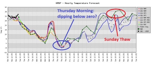
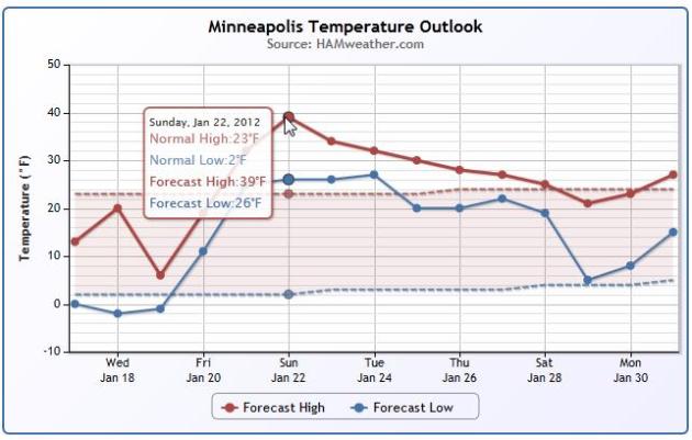 Temperature Trend.
 The Ham Weather temperature graph for Minneapolis - St. Paul shows temperature blipping well above average over the weekend, followed by another dip (into the normal range) by the end of next week. Click
here to plug in your zip and get your own personalized temperature trend.
26 minutes of additional daylight in the cities since the Winter Solstice on December 21.
January Snowfall So Far:
.9" Twin Cities (MSP International).
1.8" Louisville, Kentucky.
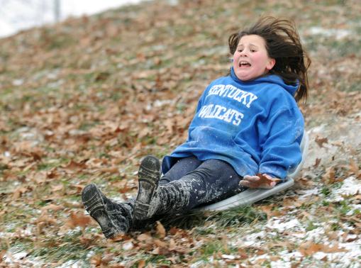
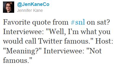
Rough Sledding. "
In this photo taken Friday, Jan. 13, 2012, Isabella Crowe, 10, flies down a barely snow-covered hillside at Chautauqua Park in Owensboro, Ky. (AP Photo/The Messenger-Inquirer, Gary Emord-Netzley)."
"
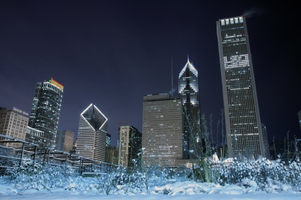
What a winter! Despite the weekend chill & first week's snow, this winter's 10.2-deg milder than last to date & has seen only 31% as much snow!" - meteorologist Tom Skilling, WGN-TV in Chicago. Photo:
sheimagazine.com.
-48 F. at Fairbanks, Alaska - coldest temperature reported in 4 years.
-56 F. at the North Pole weather station. More details from the NWS
here.
"
2016 is looming as the year during which a gap in weather satellites could leave the nation without some of the severe storm data that’s vital to early warnings. " - from a story below on budget issues impacting new weather satellites.
"
Youth is a wonderful thing. What a crime to waste it on children." - George Bernard Shaw
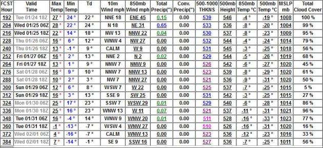
Flirting With Zero. No, this won't be your grandfather's arctic front: possibly 1 night below zero (Thursday). If temperatures stay above zero on Wednesday we may set a record for the latest subzero on record in the metro area. The old record for latest subzero: January 18, 2002. All the models show a nice temperature recovery over the weekend, highs may climb above freezing by Sunday. Grilling weather.
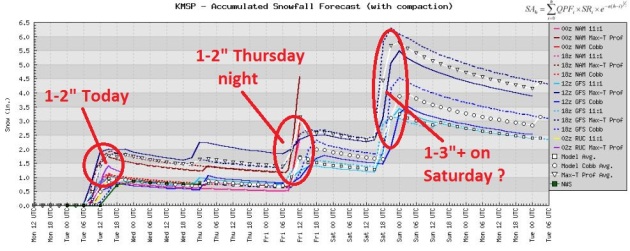 Looking Better For "S-N-O-W".
 I
don't want to get your hopes up - or mine for that matter, but the arrival of much colder air will create a more favorable environment for snow. The arrival of colder air sets off an inch or two today, another 1-2" Thursday night, maybe a few more inches on Saturday. By the weekend we may have 2-4" of snow on the ground. I know - I'll believe it when I see it.
 Accumulating Snow?
 6-8" by midday Saturday? That may be a stretch, but a series of (minor) clippers may drop a "plowable" amount of snow by the weekend - the heaviest amounts south/west of the Twin Cities. Finally - some good news for snow lovers (and anyone with a plow or snow blower).
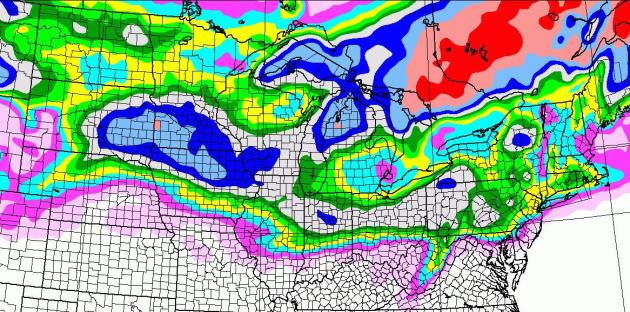
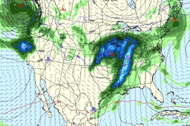
Brushed By A Major Storm Early Next Week? The latest GFS
model run takes the storm track farther south/east. That's good and bad (for snow lovers). The heaviest snow bands may pass just south/east of MSP, but with a track across southeastern Iowa and southern Wisconsin precipitation would probably fall as all-snow. An earlier run on Monday tried to bring a cold rain into much of Minnesota early next week. The GFS still prints out about .84" liquid, with 850 mb temperatures ranging from -4 to -8C, definitely cold enough for snow. It's still (way) early to panic...or celebrate, but at least there's a chance...
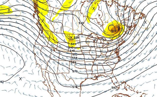 February 1: Seasonably Cold (More Frequent Snows?)
 The 500mb forecast valid Feb 1 (GFS) shows a modified zonal flow with a continuation of unusually strong jet stream winds aloft, meaning frequent weather changes, a parade of clipper-like systems - probably no major storms late January and early February. Temperatures should trend close to average:
highs in the 20s, even some 30s from time to time.
 Extended Outlook: Closer To Average
. After a close-encounter with a significant storm early next week we dry out again from January 26 - February 1, highs ranging from upper teens to near 30 at times, another arctic swipe possible by Ground Hog Day (Feb. 2).
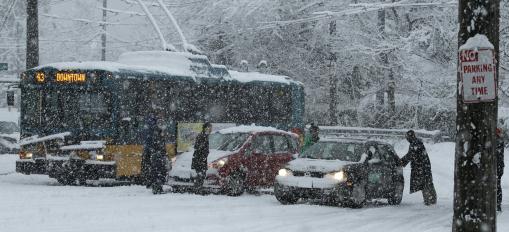
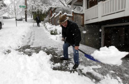
Ski Seattle. Good grief - first Alaska, now the Pacific Northwest is getting hammered with near-record snowfall amounts. It's getting closer...one of these days. More details: "
Ken Cunningham shovels his sidewalk during a snowstorm in Seattle, Sunday, Jan. 15, 2012. Several inches of snow fell quickly Sunday morning, snarling traffic and clogging roadways. Cunningham said he moved to the area from Chicago, so he knows how to deal with snow, but he added that snow plows are out almost immediately in that city when the snow flies. (AP Photo/Ted S. Warren)."
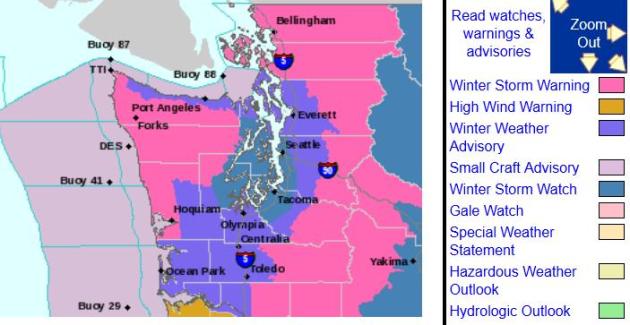
Arctic Front Could Now Make For A Snowy 1-2 Punch In Seattle.
KOMOnews.com has the latest: "....
The grand finale, at least as far as snow is concerned, comes Tuesday night into Wednesday as a powerful storm rolls into Western Washington. Forecasting models still differ a bit on exactly how this will play out, but are at least coming closer together. The general theme is for heavy snow to begin late Tuesday night or early Wednesday morning as the storm approaches, then at some point, change to rain, but not before several inches of snow have fallen. A Winter Storm Watch is now in effect for all of Western Washington for Wednesday to indicate potential for a widespread snow event.
Forecast models are still very inconsistent on the path and behavior of this storm, which will make a great difference in when the changeover occurs. It's possible several inches of snow will fall before the changeover, and amounts will vary depending on the storm's track."
Latest Watches & Warnings. Here are more details on the impending Snowpocalypse for Seattle from the local KSEA
National Weather Service office.
Holy Snow Blower! The latest NAM model prints out 6-8" for downtown Seattle and Tacoma, with some 16"+ amounts over the Cascade Range and Olympic Peninsula - a potentially crippling snowfall for much of the Pacific Northwest.
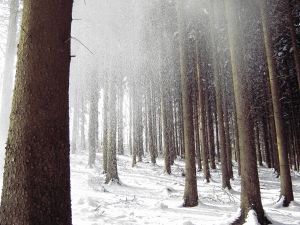
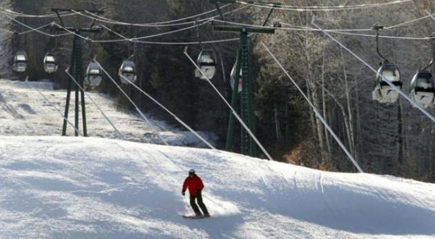
Ski Resorts Blow Fake Snow For A Brown Winter. NPR has the story: "
Across the Midwest and northeast this weekend, ski resort towns are celebrating the arrival of winter for the first time this season. Terry Hill has been renting out cabins near Baxter State Park in Maine in 30 years, where she says they only received about four to five inches of snow on Saturday. She usually rents her cabins to those who like to snowmobile, but those cabins are empty right now. She says Maine needs a couple more big storms to make up lost ground for what's been a brown winter..... "First 10 days of January, warmest, driest in U.S. history," Douglas says. "Ninety-five percent of the country [is] experiencing below-average snow conditions." Douglas says Minneapolis is finally getting "typical January weather," at 11 degrees and wind-chill dipping below zero, but earlier this week, it was 52 degrees. "What's weird is that 15 to 20 cities set all-time rainfall records last year, seven states had the wettest year on record," Douglas says. "We've had crazy extremes, Texas in the midst of a historic drought while it's incredibly wet east of the Mississippi." Photo: Jim Cole/AP.
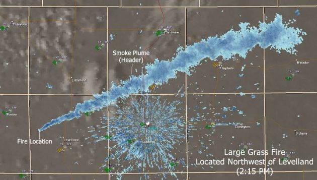
Tracking Smoke On Doppler? Here's a Facebook post from the Lubbock office of the National Weather Service: "
Fire crews are working to contain a large grass fire about 35 miles west of Lubbock. The fire is located just northwest of Levelland and very close to Highway 114. The smoke from the fire is visible from the Lubbock NEXRAD. No current reports on the fire’s size, but tank batteries are threatened."
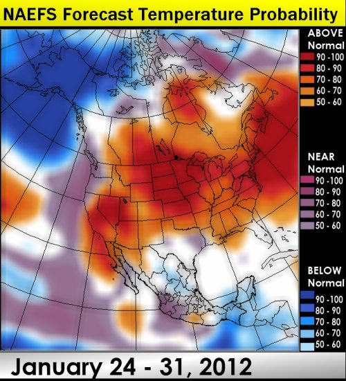
March-like Last Week of January? The NAEFS computer ensemble is hinting at a resumption of a relatively mild, Pacific flow by late January, meaning more 30s, even a few 40s can't be ruled out. Meteorologist Larry Cosgrove at WxAmerica has more details: "
While both the GFS and ECMWF model packages are colder over parts of the central and southern U.S. after January 24, I call attention to the very warm appearance of the NAEFS super-ensemble. I see no important pattern change through February 1, since the coldest anomalies remain over Alaska and the Yukon Territory. There will be two moderate snow/ice events in the Midwest over the next six days before the much waterm wari takes over for the 6-10 day period. Keep in mind that a ferocious storm is predicted to move from the Texas Panhandle to Lake Superior (Panhandle Hooker A Type) which will likely bring widespread severe weather/flooding rains across the lower Great Lakes, Mississippi Valley as well as Ohio and Tennesse River watersheds between January 23-26. A huge blizzard is likely in the Front Range and High Plains in association with this storm."
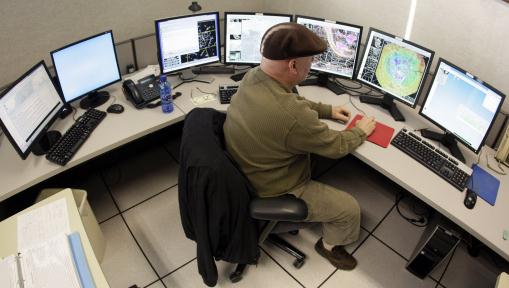
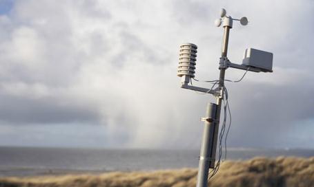
Fine-Tuning The Doppler. "
In this Jan. 13, 2012 photo, National Weather Service meteorologist Bobby Boyd works at the NWS facility in Old Hickory, Tenn. New technology in the facility's Doppler radar allows meteorologists the ability to see things more clearly, including rain, snow, and even debris from a tornado. (AP Photo/Mark Humphrey)."
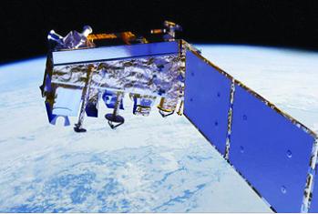
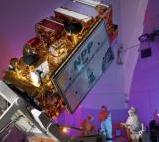
Delay In Satellites Could Jeopardize Severe Weather Forecasts. Emergency Management has the story (which is of significant concern to meteorologists at NOAA and in the private sector as well: "
2016 is looming as the year during which a gap in weather satellites could leave the nation without some of the severe storm data that’s vital to early warnings. After 2011’s record-breaking severe weather — with 12 disasters that cost more than $1 billion — it seems counterintuitive that budget reductions may create a period of 12 to 18 months during which severe warnings days in advance of a storm likely won’t be available, according to National Oceanic and Atmospheric Administration (NOAA) predictions."
Home Insurance To Cost More. The
Columbus Dispatch has the details: "
Last year’s catastrophic tornadoes, floods and hurricanes probably mean that the cost of insuring your home will continue to climb. The cost of homeowner policies had been rising even before a rash of deadly storms in 2011 led to insured losses that were about double the already-high level of 2010, according to industry figures. Although insurers are prohibited from increasing rates to recoup losses from past storms, the losses they suffered in the past several years can be factored into projections of expected future losses that are used to set rates. How much rates could go up this year is hard to predict, but any rate increase would figure to ad no more than a few dollars a month to the cost of a typical policy."
4 Things You Can Do To Prolong Your Life. Wear better shoes? OK - keeping an open mind. I thought this was vaguely interesting; check out the
YouTube clip: "
Dr. David Agus talks Connie Chung on four things you can do to prolong your life -- take baby aspirin, a statin (like Lipitor), get your flu shot and wear better shoes. 92YU unites the best minds from universities and organizations all over the world and welcomes them to 92Y! Lecturers from the Ivy League and beyond take on the most extraordinary ideas, people and creations of our time."
"
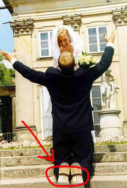
Like a good wine, marriage gets better with age - once you learn to keep a cork in it." - Gene Perret
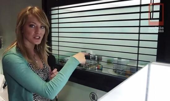
Samsung "Smart Window" Is Like A Giant Transparent iPad.
Geekosystem.com has the story: "
Whenever you’re cruising through CES announcements and demos, you’re always looking for that one thing that ignites that spark of excitement in your chest, lights up your eyes, and makes you realize that we’re living in the future. Well, the Samsung Smart Window will deliver. The Samsung Smart Window is a window, but it’s a display. It’s a giant transparent touchscreen you can use as a window. It’s a see-through, window iPad. It’s amazing. It only takes a few features to drive home how crazy this technology is. For instance, it comes with a blinds app. If you activate it, you can slowly open and close the digital blinds and affect the amount of actual light that comes in. It’s also a one-way mirror, meaning that you don’t have to be afraid of passersby seeing you or what’s on your screen; they’ll only see themselves."
"Unruly Fliers": Delta Flight Diverts On Champagne Request. Say what? AP and
USA Today have the story: "
A Delta Air Lines flight from Atlanta to Costa Rica diverted to Tampa last night because of an unruly German couple, The Associated Press reports. The incident came on Delta Flight 413, which departed Atlanta at 6 p.m. ET before making the unscheduled stop in Tampa around 7:34 p.m. ET. Delta spokeswoman Chris Kelly Singley tells AP that the "unruly" husband and wife were removed from the Delta 757 at that time. AP says the couple apparently was upset at meal service on the flight, writing: Tampa International Airport spokeswoman Janet Zink identified the passengers as Peter and Gabriele Strohmaier of Dusseldorf, Germany. She said they were seated in first class and demanding food and champagne and refused to sit down."
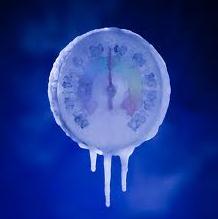
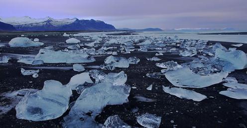
The Icy Beach Of Iceland. Neatorama has the photo and explanation. Image courtesy of Ivan Meljac. "
Where else but Iceland would you expect to find big chunks of ice on the beach, instead of sand? Behold the (brr!) beautiful beach of Jökulsárlón as photographed by French photographer Ivan Meljac, and featured in Quiet Moments in Iceland's Landscapes by Fotopedia."
"
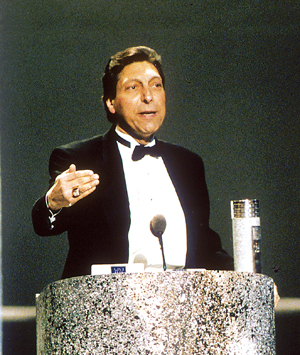
Take time every day to laugh, to think, to cry." - the late, great North Carolina State basketball coach Jimmy Valvano. He died of inoperable cancer in 1993; his remarkable
goodbye speech during the 1993 ESPY Award show always brings tears to my eyes. It's definitely worth a look.
Photo courtesy of the AP.
Paul's Conservation Minnesota Outlook for the Twin Cities and all of Minnesota:
TODAY: Light snow and flurries. 1-2" snow (more south of MSP metro). Icy roads. Wind chill: -5. Winds: NW 10-15. High near 10
TUESDAY NIGHT: Mostly cloudy and cold. Low: 2
WEDNESDAY: Another clipper. More light snow and flurries. High: 15
THURSDAY: More sun. First subzero temperatures of winter? Low: -6. High: 7
FRIDAY: Light snow and flurries - not as numbing. Low: 0. High: 21
SATURDAY: Windy, turning milder. Period of wet snow possible. Low: 18. High: 25
SUNDAY: Sunnier and drier day of the weekend. Low: 22. High: 34
MONDAY: Clouds increase, rain/snow mix at night? Low: 21. High: 33
* A significant storm possible by Tuesday of next week, the greatest potential for accumulating snow January 24=25. The heaviest snow bands may set up south/east of MSP - too early to say with any level of confidence.
Coldest Week of Winter
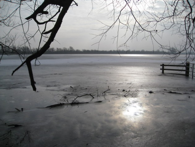
Yes, I'm going out on a limb. But long-range guidance shows a relatively mild, Pacific-influenced wind flow returning the last week of January into early February. This may be, in fact, the coldest week of winter, a winter that's been downright easy. And it won't get that cold; maybe 1 or 2 nights below zero (first of the year for the metro area). The approach of bitter air will set off a period of light snow today; a quick inch or two greasing up highways. When it's this cold traffic can compress powdery snow into an icy film - black ice will be a real concern into Friday morning. Be careful out there.
The Great Snow Drought of '12 limps on. Less snow could mean a lower risk of spring flooding, but if we don't get a few big, beefy storms by late March soil moisture may be inadequate for spring planting. Lake water levels may fall - we could be in real trouble by summer if the pattern doesn't shift gears fairly soon.
It's too early to panic (or celebrate), but long range guidance is hinting at a real storm early next week, around January 24-25. An early computer run Monday brought enough warm air north for mostly rain, the evening run takes the storm farther south/east, implying all snow - but the heaviest snow bands may set up over southeastern MN and Wisconsin. The truth: it's too early to say, but the maps are definitely starting to look a bit more "interesting".
“ To be without some of the things you want is an indispensable part of happiness." - Bertrand Russell
Climate Stories....
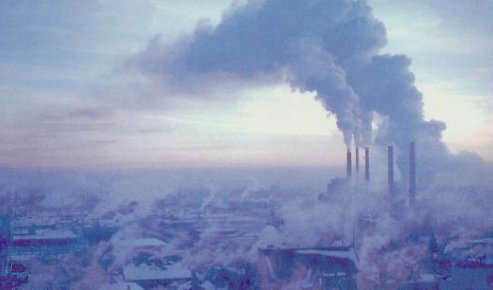
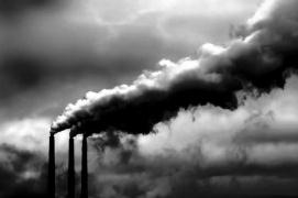 Finding The Polluters: A Step Toward Accountability On Global Warming.
 From
NRDC, the National Resources Defense Council: "
A new EPA web tool documents global warming pollution from about 6,700 facilities across the United States, filling a critical gap in the public's right to know about pollution. Polluters have been required to report on toxic chemical emissions for years, but in 2010, for the first time, big industrial polluters were asked to provide information on emissions of carbon dioxide and other heat-trapping pollutants. Why is this important? For those of us who track this issue every day, the data is unsurprising. Power plants are far and away the biggest emitters of global warming pollution, responsible for nearly 75 percent of the pie. But making the information specific, local, and easily accessible for the public brings the issue of global warming out of the clouds, so to speak, and down to earth. Knowing who the polluters are, and where they're located, is the first step toward holding them accountable."
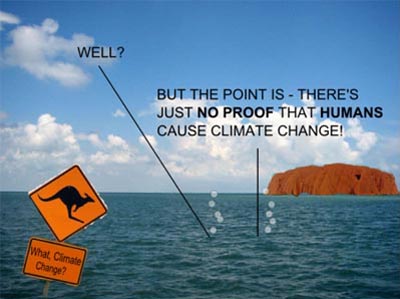
Climate Change, Disbelief, And The Collision Between Human And Geological Time.
Forbes.com has the story: "
Geologic time scales are long – too long for the human mind to really comprehend. Over millions, and tens of millions, and hundreds of millions of years, the Earth has changed from something unrecognizable to the planet we see on maps, plastic globes, and photos from space. The Atlantic Ocean didn’t exist eons ago and it will literally disappear in the future as the continental plates continue to move inch by inch. A visitor from outer space millions of years ago would have looked down upon land masses and land forms unrecognizable today. As John McPhee notes in his book, Assembling California, “For an extremely large percentage of the history of the world, there was no California.” Or North America, China, Australia, Hawai’i, Mt. Everest, Grand Canyon, or any of the other landforms and natural symbols we think of as immutable." Photo above courtesy of
safecom.org.au.
Climate Change Skepticism Seeps Into Science Classrooms. The story from the
L.A. Times: "
A flash point has emerged in American science education that echoes the battle over evolution, as scientists and educators report mounting resistance to the study of man-made climate change in middle and high schools. Although scientific evidence increasingly shows that fossil fuel consumption has caused the climate to change rapidly, the issue has grown so politicized that skepticism of the broad scientific consensus has seeped into classrooms."
Climate Deniers Hit New Low With Vicious Attacks On Scientists.
Huffington Post has the story: "
The climate deniers are kicking puppies now. That was my reaction when I heard that Katharine Hayhoe was being deluged with hate mail after stories surfaced that she had written a chapter on climate change for Newt Gingrich's upcoming book, a chapter quickly dropped when conservative commentators began making a big fuss about it. Similar attacks have been leveled against MIT scientist Kerry Emanuel following his speech at a forum for Republicans concerned about climate change. The "frenzy of hate" he's received include threats to his wife." Photo above: byronkennard.com.
CATO's Patrick Michaels: Serial Deleter Of Inconvenient Data.
ThinkProgress has the story: "
Patrick Michaels is a research fellow at the Cato Institute think tank, the chief editor of the website World Climate Report, has been given a climate blog at the business magazine Forbes, and his articles are frequently re-posted at climate “skeptic” blogs like Watts Up With That (WUWT). Despite his clear conflict of interest (Michaels has estimated that 40% of his work is funded by the petroleum industry), many people continue to rely on him as a reliable source of climate information. This is an unwise choice, because Michaels also has a long history of badly distorting climate scientists’ work. In fact, not only does Michaels misrepresent climate research on a regular basis, but on several occasions he has gone as far as to manipulate other scientists’ figures by deleting parts he doesn’t like. Patrick Michaels is a serial deleter of inconvenient data."


No comments:
Post a Comment