Todd's Conservation MN Outlook for the Twin Cities and all of Minnesota:
SUNDAY: More sun, a bit milder. Winds; S 10. High: 38.
SUNDAY NIGHT: Clouds thicken, winds increase. Winds: SE 10-15. Low: 26
Presidents' Day (Washington's Birthday): Rain/snow mix develops. Winds: SE turning SW 5-15.High: 36
TUESDAY: Breezy. Partial clearing, flurries and light snow lingers up north. Winds: WNW 10-15. High: 36
WEDNESDAY: Scattered flurries, not as breezy. Low: 20. High: 34
THURSDAY: Next clipper. Coating of snow? Low: 22. High: 36
FRIDAY: Cloudy with flurries. Chilly. Feels like February again. Low: 20. High: 28
SATURDAY: Colder. Mostly sunny, stronger southerly wind. Low: 16. High: 27.

SUNDAY: More sun, a bit milder. Winds; S 10. High: 38.
SUNDAY NIGHT: Clouds thicken, winds increase. Winds: SE 10-15. Low: 26
Presidents' Day (Washington's Birthday): Rain/snow mix develops. Winds: SE turning SW 5-15.High: 36
MONDAY NIGHT: Rain/snow mix changing to all snow, light accumulations possible. Low: 28
WEDNESDAY: Scattered flurries, not as breezy. Low: 20. High: 34
THURSDAY: Next clipper. Coating of snow? Low: 22. High: 36
FRIDAY: Cloudy with flurries. Chilly. Feels like February again. Low: 20. High: 28
SATURDAY: Colder. Mostly sunny, stronger southerly wind. Low: 16. High: 27.
Signs of Spring
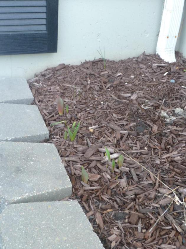
Thanks to my good friend, Matt Dux (from Kansas City, MO) for the picture below. He mentions that seeing his tulips coming up in mid-February is a bit strange. He typically doesn't have to mow the lawn until the end of March, but the way things are going this year, he might have to fire up the John Deere a bit earlier this year.
Another Sign of Spring... ??
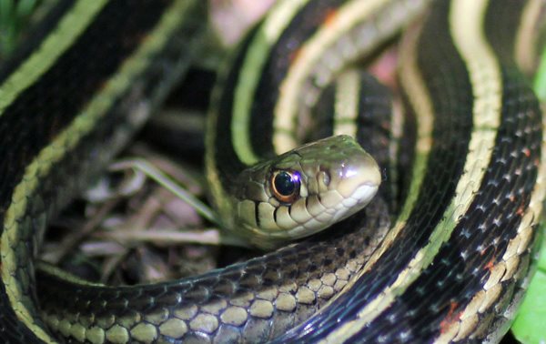
WeatherNation Meteorologist Katie Ferrier took her dog, Sydney, for a walk on Saturday, they found a couple of Gartner Snakes sunning themselves in the grass. Keep in mind, IT'S FEBRUARY!!! Normal hibernation for these little slithery creatures is through April or May. Even wildlife is goofed up this year by our weird winter.
Katie asked on the WeatherNation Facebook page whether or not people are seeing other signs of spring and this is what they had to say:
With That Said, Winter Threatens Presidents' Day
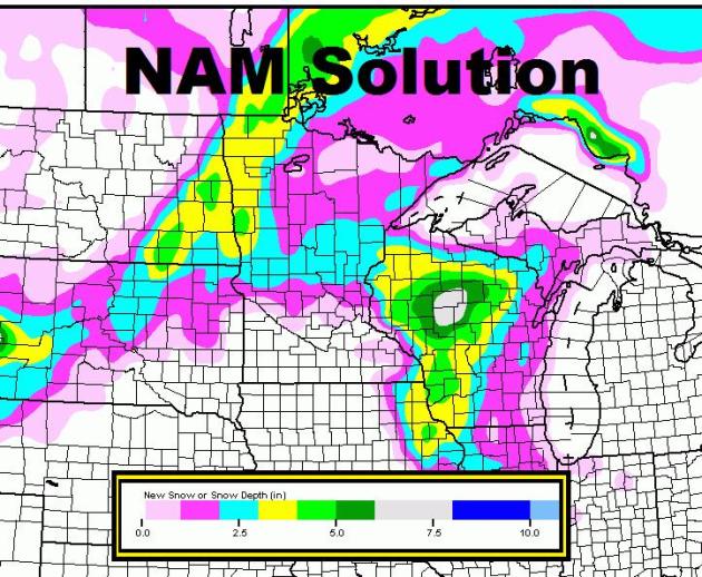
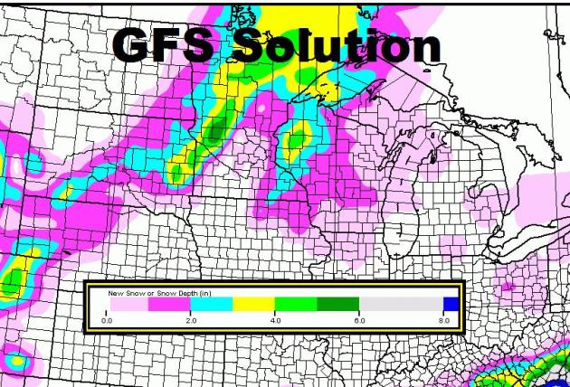
Rumors have been floating about a Presidents' Day storm, which doesn't look too menacing, but because it's the first real system that has lit up weather maps in some time, it's getting a few more eyeballs this weekend. I know there are several folks off of work and school, but a little rain/snow mix transitions to a little snow later Monday. I could see some light accumulations into Tuesday, mainly north of the Twin Cities. Below are two different model solutions for the Monday-Tuesday system, note how much less snow there is across southern Minnesota due to the rain mixing in with the snow.
The NAM Solution Bring Very Little Snow the the Twin Cities
The GFS Solutions Brings Light Amounts Too
But there is a 1" to 4" swath showing up closer to home. Depending on the track of the system, this could set up close(er) to home... stay tuned! More updates to come later Sunday!!
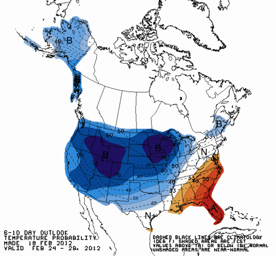
Looking Ahead Through February's End
The Climate Prediction Center shows a little change in our weather pattern as temperatures are expected to be below normal for a change. This may also bring in a chance for more active (snowy) weather.
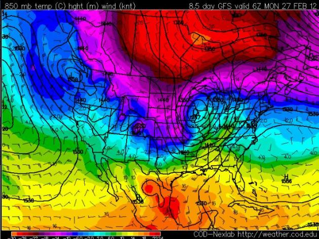
Stormy End to February?
The extended model runs try to develops a larger storm by February's end. Hard to tell at this point if this will actually pan out, but a storm of this magnitude would not only bring a better chance of snow, but it would also explain the cold snap at the end of the month... stay tuned!
Thanks for checking in and have a great rest of the weekend.
-Meteorologist Todd Nelson-
No comments:
Post a Comment