Todd's Conservation MN Outlook for the Twin Cities and all of Minnesota:
Presidents' Day (Washington's Birthday): Clouds thicken, light rain/sleet/snow mix develops late. Winds: SE 10-15.High: 39
TUESDAY: Lingering flurries and light snow showrs. Partial clearing. Winds: WNW 5-15. High: 38
WEDNESDAY: Another clipper arrives, scattered light snow showers. Coating possible. Low: 27. High: 37
THURSDAY: Mostly cloudy with more light snow late. Low: 25. High: 36
FRIDAY: Cloudy with flurries. Chilly. Feels like February again. Low: 21. High: 29
SATURDAY: Colder. A little more sun. Low: 13. High: 27.
SUNDAY: Clouds increase, chance of snow. Breezy. Low: 14. High: 27.


Presidents' Day (Washington's Birthday): Clouds thicken, light rain/sleet/snow mix develops late. Winds: SE 10-15.High: 39
MONDAY NIGHT: Rain/sleet/snow mix changing to all snow, light accumulations in east central MN and west central Wisconsin. (1" to 2" of slush possible). Winds: SE turning SW 5-10mph. Low: 29
WEDNESDAY: Another clipper arrives, scattered light snow showers. Coating possible. Low: 27. High: 37
THURSDAY: Mostly cloudy with more light snow late. Low: 25. High: 36
FRIDAY: Cloudy with flurries. Chilly. Feels like February again. Low: 21. High: 29
SATURDAY: Colder. A little more sun. Low: 13. High: 27.
SUNDAY: Clouds increase, chance of snow. Breezy. Low: 14. High: 27.
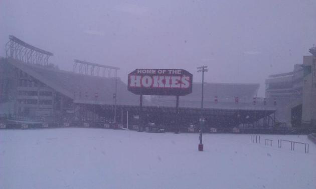
Home Of The Hokies
A water-logged storm system along the Gulf Coast States created quite a stir over the weekend. Strong to severe storms developed along the Gulf Coast, but it snowed across parts of the Ohio Valley and the Mid-Atlantic States. This was the scene yesterday at Virginia Tech, home of the Hokies.
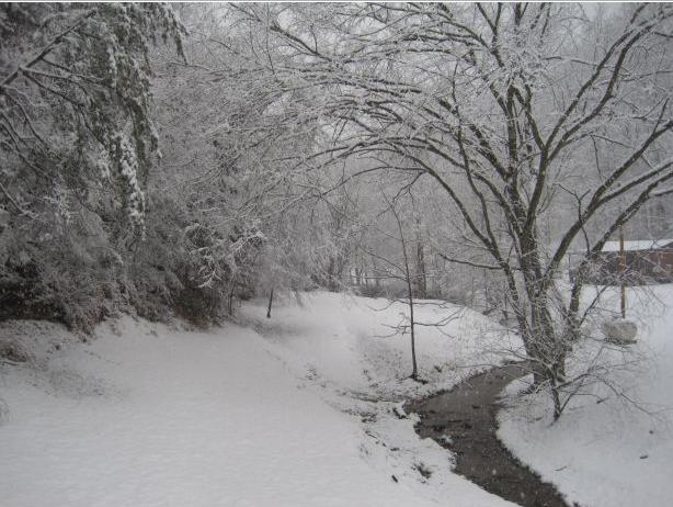
Kentucky Snow
Here's another picture of some snow out of Kentucky, from the National Weather Service's new experimental storm report website via Twitter HERE:
This picture is from just southeast of Lexington, KY thanks to @EderdsKY
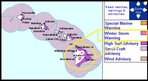
Winter Weather In Hawaii
Take a look at the watches and warnings map for Hawaii, note the pink colors across the high elevations of the Big Island... those are Winter Storm Warnings. The National Weather Service is expecting freezing rain and black ice, which has resulted in some road closures mainly above 8000ft.. It's not all that rare or significant, but it seems as though everywhere else but the Upper Midwest.
Now It's Our Turn...
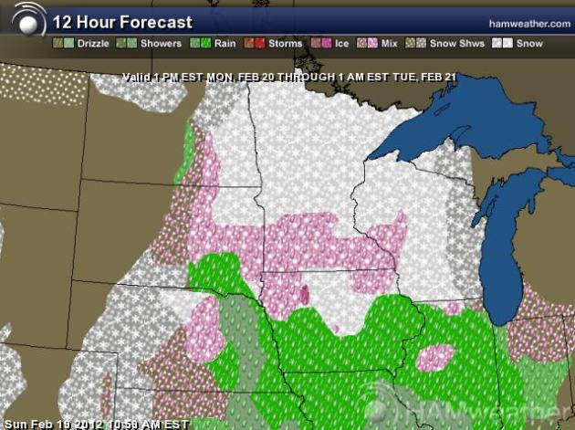
The weather maps look quite a bit more interesting over the course of the week as a stronger Pacific flow continues to hit the West Coast. Pieces of Pacific energy and moisture will run continuously through the Upper Midwest through next weekend, the first of which will be with us today and tomorrow.
1pm Monday - 1AM Tuesday
A mild southerly wind will keep some of the moisture in the form of rain, which will limit the snow accumulation potential across southern Minnesota.
1AM Tuesday - 1PM Tuesday
Colder air on the back side of the storm will begin to wrap around the western edge of the storm, so the wintry mix will begin to transition to all snow through early Tuesday. Light snow accumulations will be possible late Monday into early Tuesday.
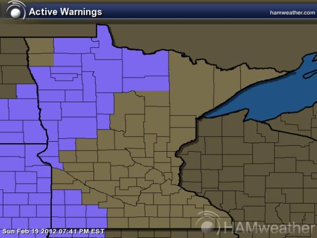
Winter Weather Advisory
The National Weather Service has parts of eastern North and South Dakota along with the far northwestern corner of Minnesota for the potential of 3" to 5" of snow through 6am Tuesday.
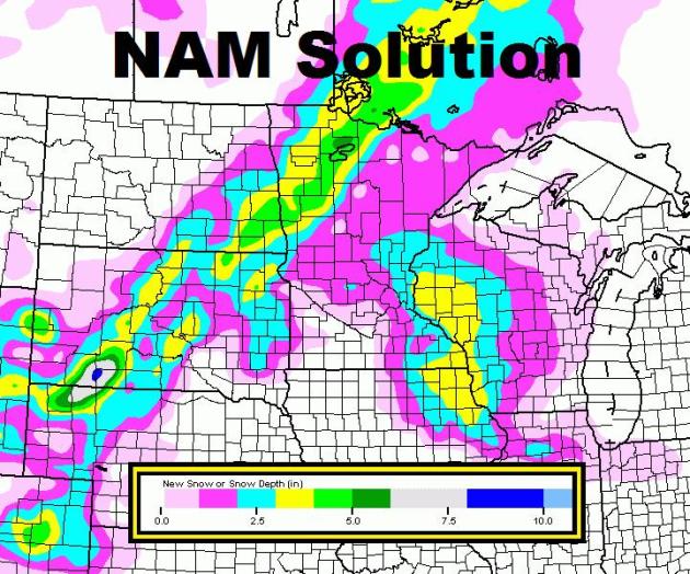
NAM Solution
The NAM solution keep most of the snow in the advisory area, but it also has a secondary snow swath of 1" to 3" across east central Minnesota and west central Wisconsin. This is likely to be a very sloppy, slushy accumulation
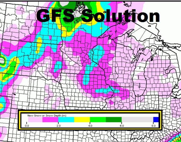
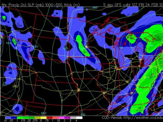
GFS Solution
The GFS solution shows a similar trend, with the heaviest through Tuesday across eastern ND & SD and parts of northwestern MN. There will be a secondary, smaller, swath (1" to 2') across east central MN and west central WI.
Wintry Week Ahead
It appears that this will be a fairly active week with several chances of light snow moving through the Upper Midwest this week. Another clipper system arrives later Wednesday with a light snow chance and yet another light snow chance swings through late Thursday into Friday.
Late Wednesday System
Late Thursday System
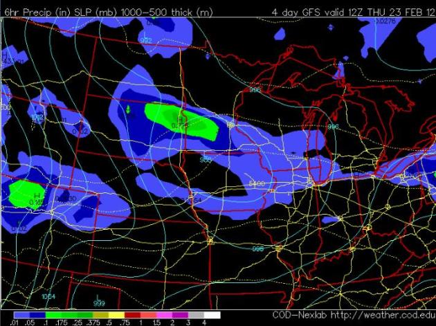
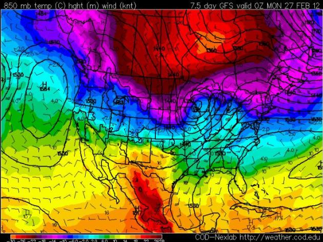
End of February Storm?
The GFS, an exteded weather model, is still hinting at a potential storm system next weekend. The result would be a chance for accumulating snow and colder temperatures through the end of the month... Stay tuned!
Thanks for checking in, have a great week ahead!
Don't forget to follow me on Twitter @TNelsonWNTV
-Meteorologist Todd Nelson-
No comments:
Post a Comment