By Todd Nelson
Welcome to Winter! After an extremely warm start to December, temperatures have finally settled into a below average position and will continue through the New Year. Even with the more recent cool spell, December temperatures are running nearly 4 degrees above average. Interestingly, the only month that will have finished with below average temperatures in 2012 is October.
A recent article released by MN state climatologist Pete Boulay said that 2012 will wind up in a tie for the warmest year on record in the Twin Cities along with 1931. 2012 across the nation will likely wind up being the warmest year on record!
Thanks to about 2.5" of fluff late last week, the Twin Cities will end up with 15" of snow for the month, which is nearly 4" above the December average. Season to date, the Twin Cities has only seen 15.8" of snow, which is nearly 5" below normal.
A blob of Arctic air will get hung up over the Hudson Bay into the new year. Several moisture starved clipper systems will sail in from the northwest, sending frequent bouts of that cold stuff our way through next week. Other than a few light flurries it looks like a shovel free forecast for a while. -Todd Nelson
___________________________________________________________________________________
Todd's Conservation MN Outlook for the Twin Cities and all of Minnesota:
SUNDAY: Mostly sunny. South wind develops, clipper arrives late. High: 25.
SUNDAY NIGHT: Moisture starved clipper system rolls through, a few flurries possible. Cold NW winds develop. Low: 6
NEW YEAR'S EVE: Cold! Closing the books on 2012. High: 7
NEW YEAR'S EVE NIGHT: Stay warm ringing in the New Year!. Low: -7
NEW YEAR'S DAY: Cold start to 2013! High: 13
WEDNESDAY: Fading PM sun, nothing rough. Low: 6. High: 14.
THURSDAY: Weather maps look quiet. Low: 0. High: 14.
FRIDAY: Sunny and a little warmer. Low: 5. High: 20.
_____________________________________________________________________________________
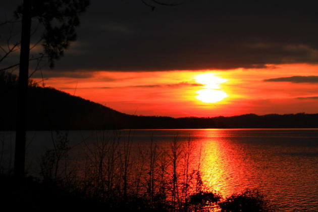
Guntersville, AL
Thanks to @MainStormTower for the picture below out of Gunterville, AL
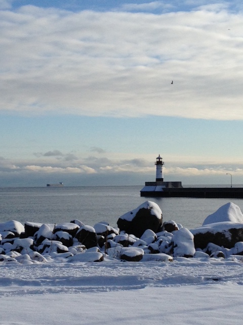
Duluth, MN
Thanks to my good friend Wanda Brandt for the picture below from Duluth, MN
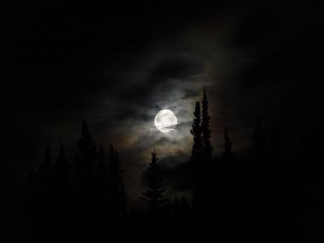
Denali National Park, AK
Thanks to the Denali National Park, AK Facebook page for the picture below of the last full moon of 2012.
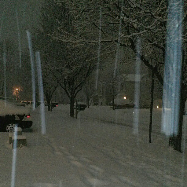
Noblesville, IN
Thanks to
@samlgookins for the picture below of heavy snow falling in Noblesville,
IN from this weekend's snow event across the Ohio Valley.
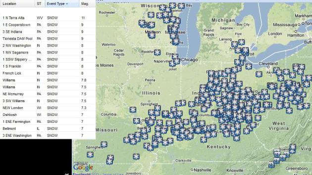
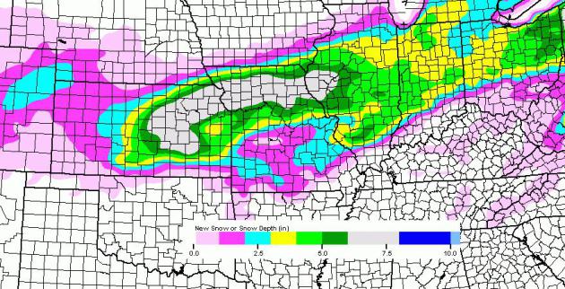
Ohio Valley Snow Totals
Here are some of the highest snow tallies I could find from across the Ohio Valley.
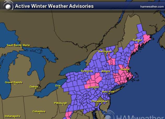
More Snow in the Northeast
The image below shows all the winter headlines through AM Sunday. Snow totals of up to 12" are possible in localized areas!
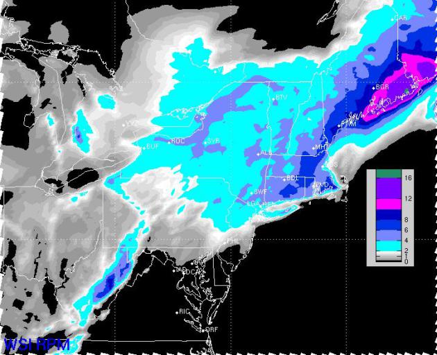
Northeast Snow Totals Thru Sunday
The RPM model
suggests shovelable snow amounts for many in the Northeast through
Sunday. The storm will deposit several inches of snow across parts of
Maine.
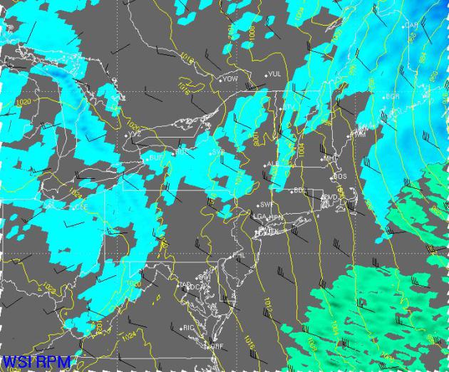
Lingering NE Snow on Sunday
Here's the weather map around
midday Sunday. Lingering snow showers/flurries along with breezy
northwesterly winds will allow for blowing and drifting snow through
much of the day Sunday. There may even be a few lingering flight delays
early Sunday.
More Snow on the Way
There another storm developing
across the mid-section of the nation will have more shovelable snow
potential for folks from Kansas to the Eastern Great Lakes by early next
week. The NAM forecast brings up to 6" possible around the Kansas City,
MO area around the New Year. This forecast CAN and WILL change... stay
tuned!
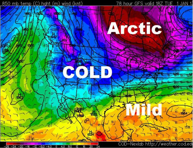
COLD New Year's Forecast
It definitely looks like winter
into the New Year. The extended forecast calls for a big Arctic blog to
set up over the Hudson Bay through next week. Waves of this modified
Arctic air will settle south of the international border by way of
moisture starved clipper systems.
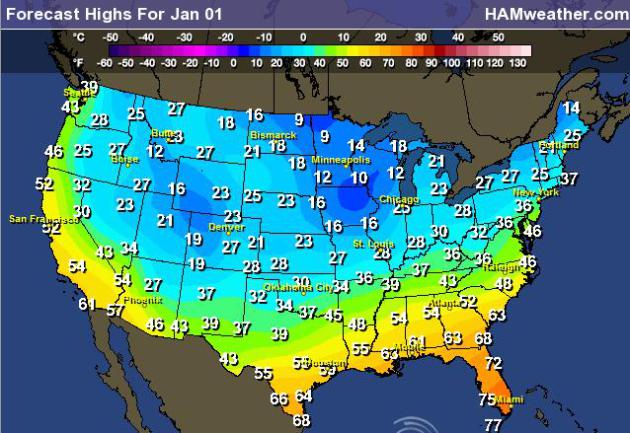
Highs on New Year's Day
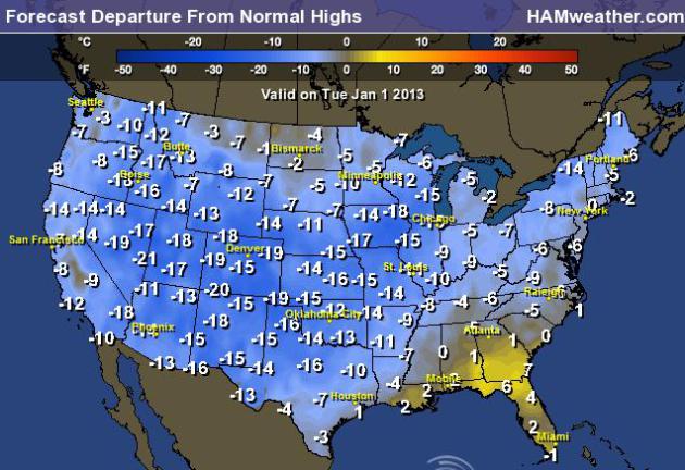
Highs From Normal on Tuesday
Take a look at how much colder than average high temperatures will be on Tuesday.
Thanks for checking in, have a great rest of you weekend!
Don't forget to follow me on Twitter @TNelsonWNTV

No comments:
Post a Comment