33 F. high yesterday in the Twin Cities.
24 F. average high on January 27.
36 F. high on January 27, 2012.
2" snow fell (officially) in the Twin Cities yesterday, at MSP International.
.38" precipitation fell yesterday, in the form of rain, freezing rain and snow.
6 nights below 0 F. so far this winter. Average for the entire winter at MSP: 22.5 nights.
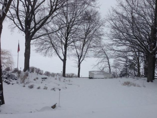
Sloppy Thaw
At a party Saturday evening people just couldn't
resist. "Paul, where's your global warming now! And why are we having
such a rough winter?" Uh boy... I was polite, so Minnesota-nice my teeth
hurt.
"Can you see the globe from your window?" I
asked. I think we're all hard-wired to look outside and assume the
weather's just like that - worldwide. Perspective is important, as well
as not mistaking weather for climate.
And a rough winter, really? Compared to last
winter, absolutely, but overall? Not so much. Typical winter: 22.5
subzero nights in the metro. So far this winter: 6 nights below 0 F.
In spite of the recent cold spell a 7 percent savings on home heating costs this winter, based on heating degree days.
Yesterday's fleeting burst of ice & slushy
snow gives way to a minor meltdown today; mid-30s feels good. Wear your
second-string shoes.
Another inch of slush is possible tonight;
tumbling temperatures Wednesday; highs near zero on Thursday. Not as
cold as last week, but cold enough. I see gradual warming in February as
a higher sun angle kicks in. Maybe we'll see a real storm. NOAA
predicts significant improvement in our drought by May.
I wish I was that optimistic.
367 crashes triggered by Sunday's ice and slushy snow, according to KARE-11.
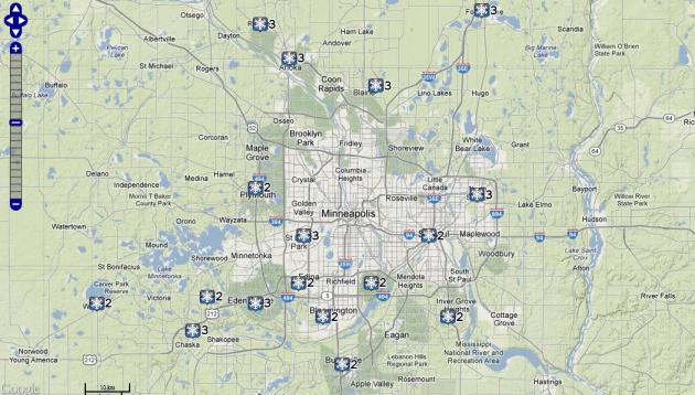
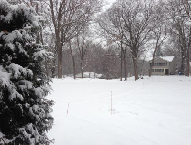
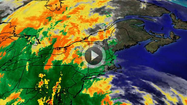
Sunday Snow Burst. It was a 1-2 punch, a few hours
of freezing rain and drizzle (glaze ice), and then, as predicted,
temperatures aloft cooled, allowing rain to change to a 2-4 hour period
of wet snow. I forecast 1-2"; most of the metro area picked up 2-3"
before the snow cut off around 4-5 pm. Map above: NOAA.
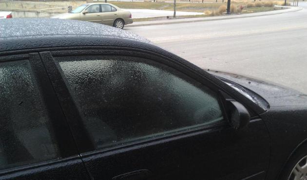
Insidious Ice. It was pretty bad out there around
midday and early afternoon Sunday, as rain froze on contact with cold
surfaces. With glaze ice front-wheel drive and even four-wheel drive
doesn't help much. It's usually the SUV's, driving too fast for
conditions, that are the first to wind up in the ditch. Photo above:
Steve Bridges and WeatherNation TV.
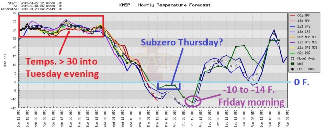
Sloppy Thaw - Then Another Cold Slap. Try to get the
slush off your driveway and sidewalk between now and Tuesday afternoon,
because another big tumble is on the way - air temperatures may hold
(just) below zero again Thursday, bottoming out around -10 to -15 F.
Friday morning before recovering next weekend. Graph: Iowa State.
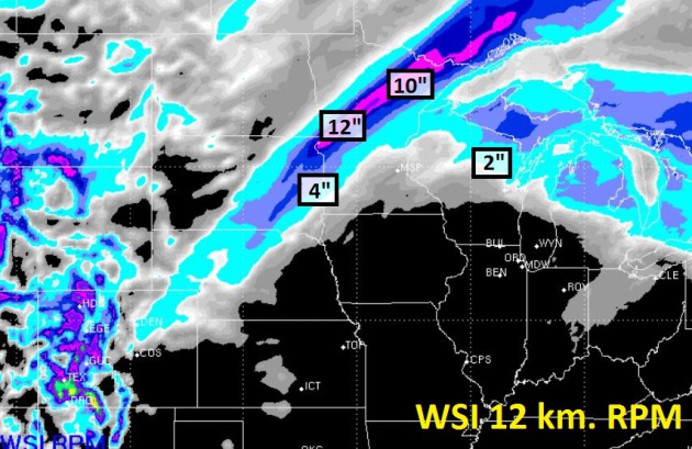
72 Hour Snowfall Prediction. The Twin Cities metro
area may pick up a slushy coating tonight and early Tuesday, but the
greatest potential for accumulation is from Breckenridge to Detroit
Lakes, Fergus Falls and the BWCA, where a narrow band of 6-10"+ snow may
fall as much colder air arrives Tuesday into early Wednesday. Keep that
in mind if you're driving into central, western or northern Minnesota
tomorrow. Model graphic: WSI.
Big Swings. After hovering just above 32 F. today
and part of Tuesday, temperatures drop off rapidly Wednesday, bottoming
out Thursday and Friday. Some moderation is likely next week, the ECMWF
European guidance suggesting 20s, even a few 30s next week.
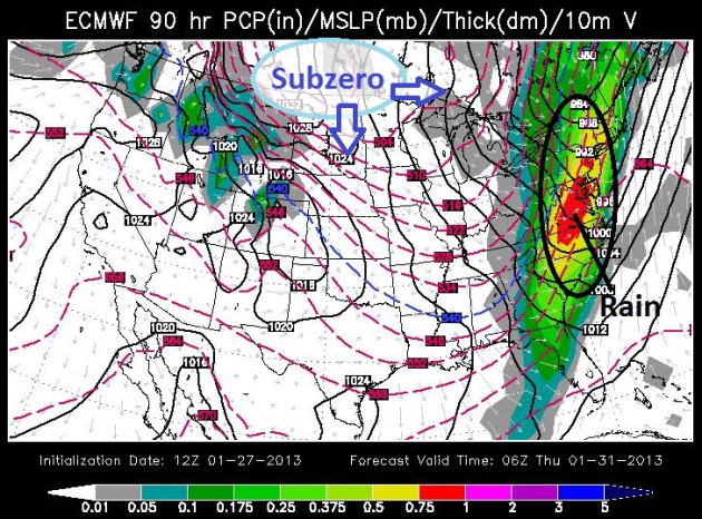
Wednesday Weather Map: Soaking Rains East Coast, Polar Plunge Upper Midwest.
The ECMWF forecast, valid midnight Wednesday night, shows a surge of
heavy rain and T-storms from Boston to D.C. to Atlanta, while the next
bitter airmass pushes south out of Canada. Map: WSI.
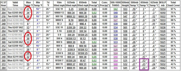
Looking Forward To February. I still don't see any
(major) snowfalls looking out 10-14 days, looking at NAM, ECMWF and GFS
guidance. But 30s will feel good, a few episodes of thawing temperatures
next week and the second week of February. Long-range GFS guidance
(above) hints at a subzero low or two around Feb. 12, but the odds of
subzero daytime highs will diminish rapidly as we sail into February,
with a rising sun angle and evidence of a more persistent Pacific flow.
Enjoying Snow, While We Still Can. Here's an excerpt of a
New York Times story (subscription may be required to read the full text): "...
Fortunately,
despite worries about a warming planet, no one is predicting the end
of snow anytime soon. Some cold places will see more snow, because
warmer air can carry more moisture. In the Northern Hemisphere, snow
coverage this past December was the greatest since records began in
1966, Rutgers University’s Global Snow Lab reported. But Dr. David Robinson,
a climatologist at Rutgers, warns that year-to-year fluctuations and
regional differences can deceive casual observers. In general, he says,
there has been an “overall decline in snowfall.” Other studies echo
that conclusion. The United States Global Change Research Program’s recently released draft National Climate Assessment
reports that “Overall snow cover has decreased in the Northern
Hemisphere, due in part to higher temperatures that shorten the time
snow spends on the ground.” The report also notes a decline in the
frequency of very snowy winters and in snow accumulations in the
American West, and said we can expect more rainstorms “in previously
snow-dominated settings....”
Favorite Photos from the weekend, courtesy of WeatherNation TV:
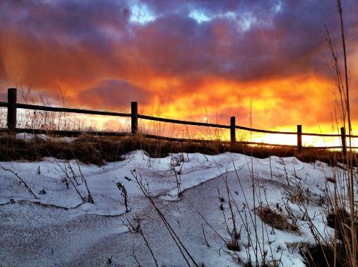
An Inflammed Sky. Thanks to MTsevereweather, who snapped this photo near Great Falls, Montana. Big Sky Country indeed.
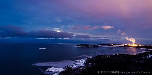
Winter Panorama. Greg Kretovic at
MichiganNaturePhotos.com took this photo, overlooking Marquette
Michigan. Note a lack of ice on Lake Superior.
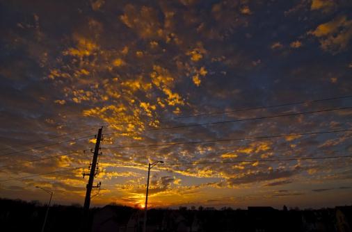
Sun-Dabbled. Some of the best photos come near
sunset and sunrise, with a low sun angle illuminating the underside of
cloud formations, resulting in colors and textures you just can't find
anywhere else. Thanks to Mike Schierholz, who snapped this photo near
Kansas City.
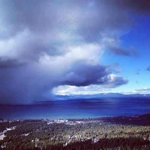
Definition Of A "Snow Shower". That's Lake Tahoe off in the distance, courtesy of Ski Heavenly. I'm there...
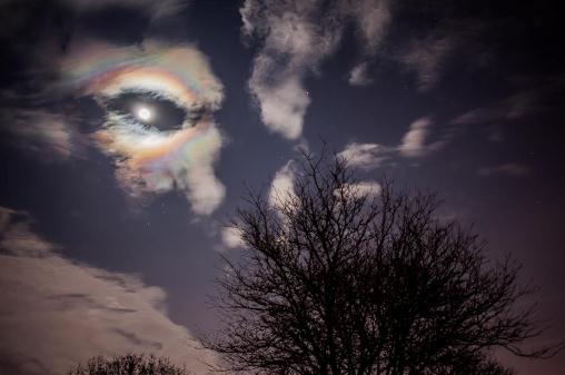
A Carona You Can't Drink. No, it's not a 22 degree halo, but a
corona, courtesy of Michael Haines, who snapped this photo in southeastern Michigan.
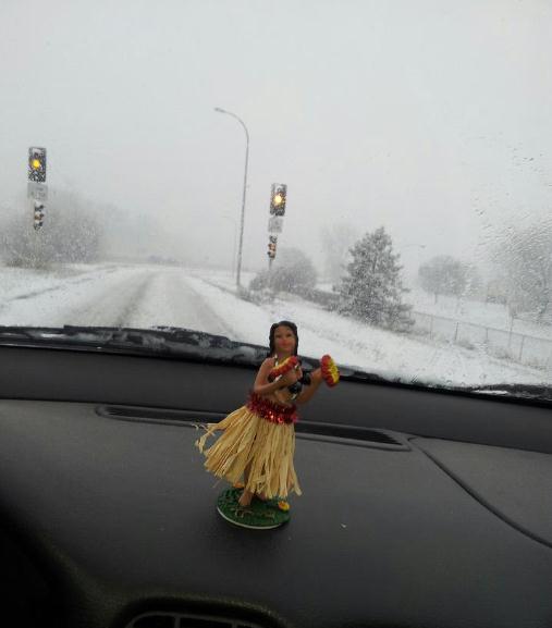
And The Winner:
Dreaming Of Hawaii. Klint Skelly was navigating the
snowy streets of St. Cloud yesterday, but he never lost sight of his
goal. Maui. Oahu would work. So would the Big Island. Heck, at this
point I'd settle for Dubuque.
Paul's ConservationMinnesota Outlook for the Twin Cities and all of Minnesota:
TODAY: Peeks of sun, welcome thaw! Winds: S 5-10. High: 36
MONDAY NIGHT: Cloudy with drizzle ending as a coating of slush. Low: 27
TUESDAY: Early slush, slow PM clearing, turning cooler. High: 32 (early), then falling
WEDNESDAY: Few flakes, gusty and colder. Wake-up: 14. High: 16
THURSDAY: Coldest day of the week. Windchill: -15. Wake-up: -3. High: -1
FRIDAY: Partly sunny, numbing breeze. Wake-up: -12. High: 12 (above)
SATURDAY: Next clipper, few flakes. Wake-up: 8. High: 19
SUNDAY: Intervals of sun, feeling better. Wake-up: 13. High: near 30
Climate Stories...
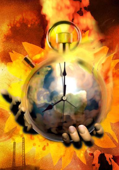
Climate Change: No More Denying It. I'm a naive
optimist, and even I still expect some to continue denying the data, the
trends, and the implications. Why? There are trillions of dollars at
stake. Here's an excerpt from
CBS This Morning: "...
First,
Kluger wanted to be clear on the distinction between weather and
climate. "Weather is the short term event: A day, a week, a month, even a
year," he said. "Climate is these large, thematic changes." Over the
last 40 years, record-setting temperature months around the world have
increased five-fold. Nine of the top ten warming years on record have
been in the 2000s. And Hurricane Katrina-type events are turning out to
be twice as likely in years with warming. Kluger said climatologists
have long been warning the public of the dangers of too much carbon in
the atmosphere, and now, all of the changes they had been predicting
have happened on schedule..."
Nicholas Stern: "I Got It Wrong On Climate Change - It's Far, Far Worse."
You may remember "The Stern Report". It turns out, in 20/20 hindsight,
he may have underestimated the risk. Here's an excerpt from the
U.K. Guardian: "...
In an interview at the World Economic Forum in Davos,
Stern, who is now a crossbench peer, said: "Looking back, I
underestimated the risks. The planet and the atmosphere seem to be
absorbing less carbon than we expected, and emissions are rising pretty
strongly. Some of the effects are coming through more quickly than we
thought then." The Stern review, published in 2006, pointed to a 75%
chance that global temperatures would rise by between two and three
degrees above the long-term average; he now believes we are "on track
for something like four ". Had he known the way the situation would
evolve, he says, "I think I would have been a bit more blunt. I would
have been much more strong about the risks of a four- or five-degree
rise."
Photo credit: "
Lord Stern now believes he should have been more ‘blunt’ about threat to economies from temperature rises." Photograph: Sarah Lee for the Guardian
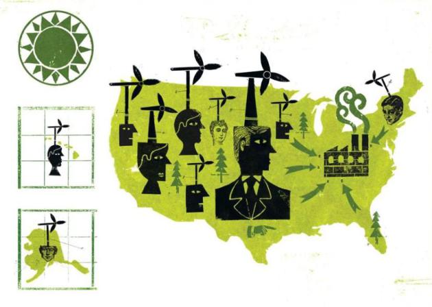
In The War Against Climate Change Look To The States. With
a politically polarized political minefield in Washington D.C. are
viable climate solutions more likely to succeed at a state and local
level? Here's a segment of an Op-Ed at
The Boston Globe: "...
Third,
innovation works better with decentralization. Compared with top-down
federal programs, innovation happens faster when there is competition
between technologies and business models, and ample opportunity for new
entrants to compete against incumbent firms. (This is especially
important in electricity, where not only startups but also big
companies like Apple and Google should be allowed to challenge
incumbent utilities with innovative new energy systems and
services.)....The federal government still has a crucial role in funding
basic energy research. But for downstream innovation investments it’s
time to bypass Washington. That’s how to unlock America’s enormous
entrepreneurial, managerial, and financial capabilities to meet one of
the 21st century’s greatest challenges."
United States Should Lead On Climate Change. Here's a snippet of an Op-Ed at
The Kansas City Star: "
President
Barack Obama called on Americans last week to renew the battle against
climate change. This line from his inaugural address garnered deserved
attention: “We will respond to the threat of climate change, knowing
that the failure to do so would betray our children and future
generations.” But pause the tape right there. First, Obama in his four
years as president already has taken several actions aimed at reducing
carbon emissions, primarily through increased fuel efficiency rules for
vehicles..."
I agree. It's been a weird... not tough winter. I personally think everyone's making use of their days they get to spend getting things done instead of cleaning up after the snow. However, one thing I did notice is that when it does snow even the slightest bit. Everyone freaks out. I made sure that Doylestown heating checked my furnace before the winter started so I am not one of those people who don't have heat when we need it.
ReplyDelete