By Paul Douglas
We're all accustomed to cold fronts. But the surge of polar air shaping up for late week may elicit calls, e-mails and tweets of concern from friends & loved ones. "Are you OK?" Uh, I can't feel various body-parts. But I'm OK.
I'm certain that Minnesota will experience two separate waves of numbing cold; potential record cold for parts of Minnesota by the weekend, another arctic dip Tuesday. There is moderate to high confidence of a plowable to crippling snowfall over northern Minnesota, where over a foot of snow may fall, with near-blizzard conditions by midweek.
The MSP metro should pick up at least a couple inches late Tuesday into Wednesday, with plowable amounts from the northern suburbs to St. Cloud, Brainerd and Alexandria.
Temperatures fall off a cliff Thursday, falling into single digits. Subzero lows are likely Friday, Saturday and Sunday morning. A Yukon-blue sky Saturday gives way to another chance of accumulating snow late Sunday into Monday as a reinforcing jab of bitter air approaches.
Character- building? Absolutely. But before you consider running south on I-35 with what you can carry, long-range guidance shows 30s returning mid-December. 30s above zero!
____________________________________________________________
MONDAY: Mostly cloudy. Slight chance of a wintry mix in the southern half of MN. Snow in northern MN, accumulations likely. High: 37. Winds: SE 5-15.
MONDAY NIGHT: Mostly cloudy with a light rain/snow mix possible. Heavier snow still in the northern third of Minnesota. Low: 31.
TUESDAY: Mostly cloudy. Rain/snow mix still possible, turning to all snow later. Heavier snows again in central and northern MN with significant accumulations possible. High: 37. Winds: ESE 5-15, turning WNW 10-20 later/overnight.
WEDNESDAY: Mostly cloudy with lingering light snow and flurries. Turning windy and much colder! Wake-up: 25. High: 28. Winds: NW 10-25
THURSDAY: Flurries possible early. Blustery, sharply colder. Wake-up: 8. High: 12
FRIDAY: A fresh Siberian breeze. Wake-up: -2. High: 7
SATURDAY: Numbing sunshine, feels like mid Winter. Wake-up: -4. High: 6.
SUNDAY: Still frigid. A tropical cruise sounds nice. Wake-up: -2. High: 12.
____________________________________________________________
This Day in Weather History
December 2nd
1985: Record low highs were set in north and east central Minnesota with temperatures ranging from the single digits below zero to the singles digits above. Alexandria was the cold spot with a high of 4 degrees Fahrenheit below zero. Other low high temperatures included Redwood Falls with 3 below, Long Prairie with zero, and Litchfield and Little Falls with 5 degrees above zero.
1982: Warm up over Southern Minnesota. Record high of 63 degrees at Twin Cities.
________________________________________________________
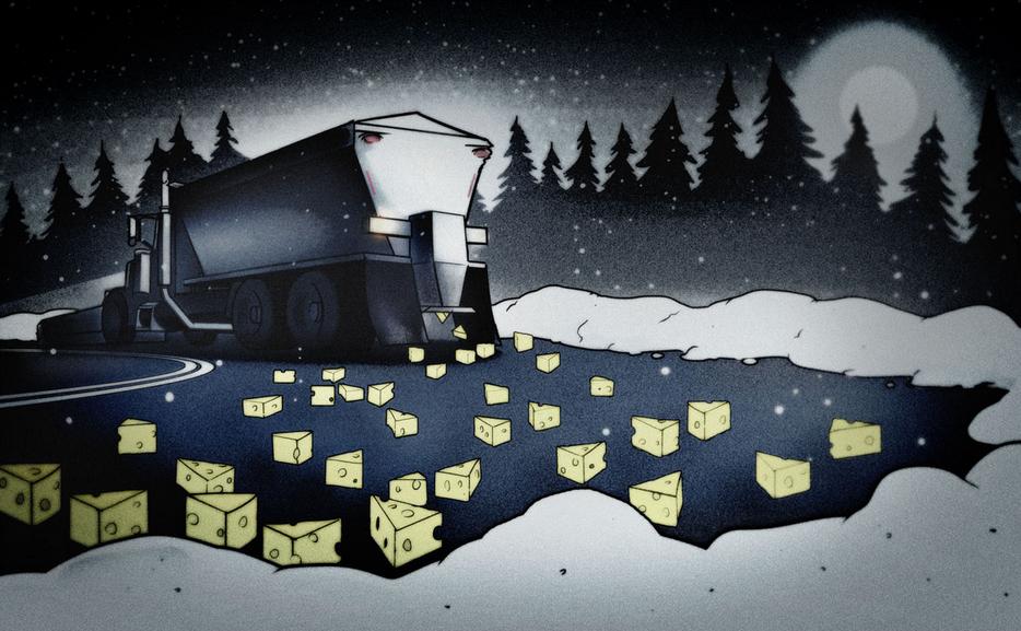
"Our Roads Smell Like Wisconsin"
Just when you think Wisconsin couldn't get anymore Wisconsin-like... they go and through cheese
brine on their roads, but for good reason! Check out this story from ModernFarmer.com
"From backwoods county highways to Milwaukee city streets, Wisconsin road crews will be using a new weapon in the war on winter accidents — cheese brine.
Brine is a liquid cheese-making byproduct; if you’ve bought fresh mozzarella, it often comes floating in the stuff. To cheese-makers, it’s a hassle — they spend many thousands of dollars to dispose of cheese brine each year, trucking it to wastewater treatment plants.
the first year alone, tiny Polk County saved $40,000 in rock salt costs. Conversely, F&A Dairy saved on brine disposal costs — to the tune of nearly $30,000.
The odor stems from organic matter, little bits of cheese flotsam left from the brining process. It’s these bits that make brine so effective as a road de-icer. Regular salt brine has a freezing point of 6 below zero, but cheese brine doesn’t freeze up until 21 below."
Read more HERE:
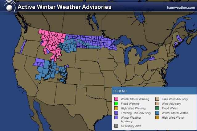
Winter Weather Headlines
A cheesy road advisory? With snow on the way to parts of wisconsin, I wouldn't be surprised if there some type of smell advisory that gets issued at some point! Take a look at the winter weather headlines that heve been posted for parts of the U.S.
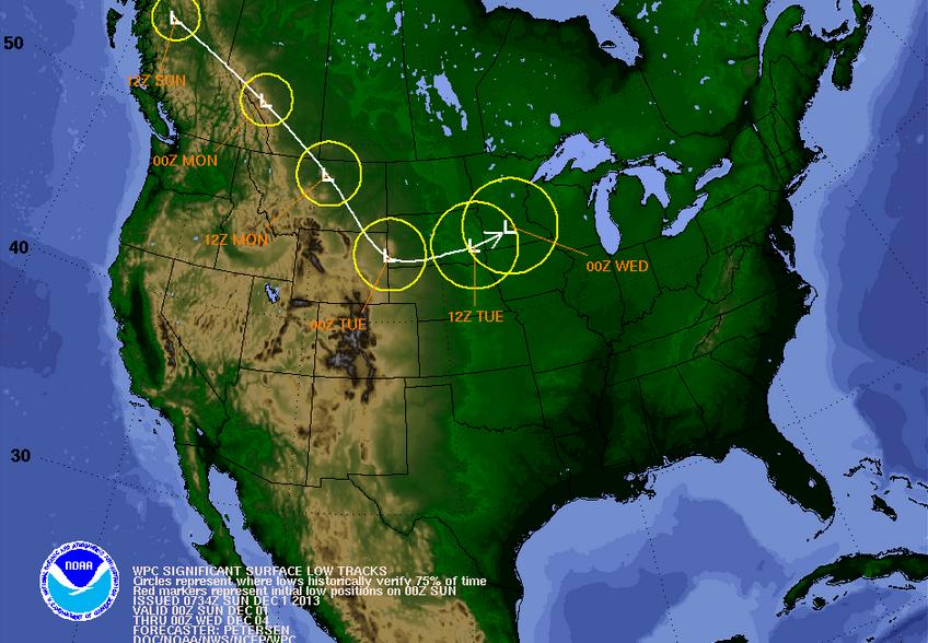
Tracking Our Next Winter Storm
Model runs have been fairly consistent on shovelable snow across much of the northern/central Rockies into parts of the Upper Midwest since last week. As we continue through the first half of the week, the track of the low pressure system will wobble with time. The track of this low will dictate where some of the the heaviest snow will be found through that time. According to NOAA, here's the track of the low pressure through PM Tuesday.
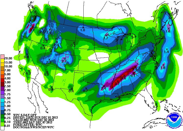
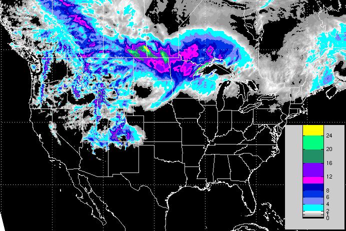
5 Day Precipitation Potential
According to NOAA, here' the 5 day precipitation potential across the nation. It appears that some decent accumulations of either rain or snow will be possible over the coming days as our next storm system moves through the central part of the country.
Snow Potential
Here's the latest snow potential through midweek, which shows a bunch immediately north of the international border. However, there will definitely be some plowable stuff in the Lower 48 through that time.
Plummeting Temps
Anytime temps plummet the way they look to do late this week, I am reminded of this guy. Do you know who he is?
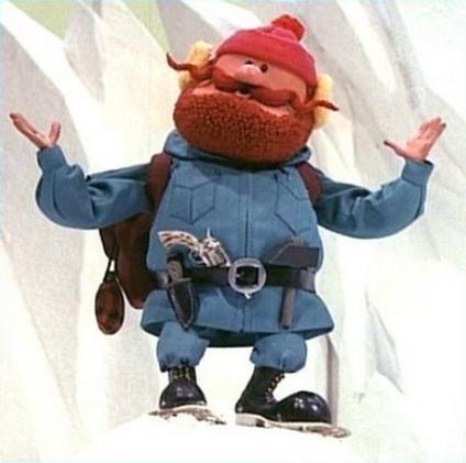
It's Yukon Cornelius!
He's the one who helped Rudolph the Red Nosed Reindeer. His name also resembles a cold place, the Yukon and thats exactly where our weather is coming from! Take a look at temps for late week.
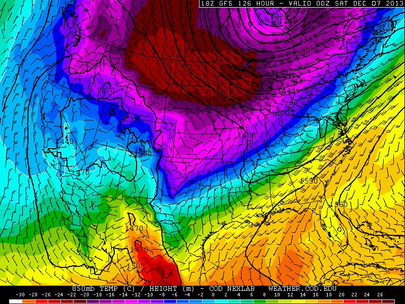
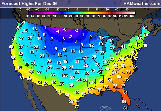
High Temps Friday
Here's a brief look at how cold actual daytime high temperatures could be by Friday.
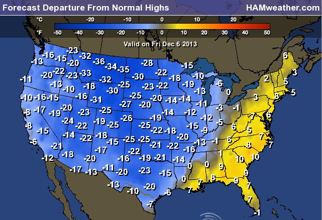
Highs From Normal Friday
Badger Lake
Have you ever heard of Badger Lake? No? If not, this would be a great stocking suffer for you or someone you know this holiday season! I just received my copy this weekend and have already cracked into the 1st chapter. It was written by my good friend and colleague, Aaron Shaffer. It seems very intriguing so far AND there's even an interest to weather enthusiasts as a tornado makes an appearance into the book!
"Murder and corruption. A small-town news team. Tropical birds. Sharp-clawed badgers. A tornado. What could possibly go wrong? Badger Lake is a fun and fun-ny mystery/adventure novel, combining the never-ending surprises of Carl Hiaasen and Tim Dorsey’s humorous writing with the easy-reading and fast-paced style of Spencer Quinn’s Dog On It series. After two strange murders in two days, small-town Badger Lake needs some heroes. A twisted, but strangely comical, storyline pits small-town television news against East Coast mob. Who are the heroes trying to find a pair of bumbling murderers? A motley crew, consisting of tropical bird-toting television reporter Walt Johnson, an intern who wants to be known as "Captain," and their TV station's peculiar management team — a cross-dressing general manager and a news director with a roughly ten-second attention span. While attempting to solve the murders, the group of news men forms an alliance with a pair of well-educated, scantily-clad college women, and a lazy, but emotional, sheriff. There are painful encounters with wild animals, strange water chases involving boats and animals, a tornado, and many other scenarios that could only take place in one place: Badger Lake, Wisconsin."

Thanks for checking in and have a great week ahead!
Don't forget to follow me on Twitter @TNelsonWNTV

No comments:
Post a Comment