By Paul Douglas
If you don't like Minnesota's weather don't fret, complain or panic. Just wait a few hours - because it'll change. So will the forecast for the next 7 days, a habit many readers find maddening.
Why? Predicting the weather is the scientific equivalent of hitting a moving target. With a slingshot. And one hand tied behind your back.
We rely on global data to "initialize" computer models; that's the fuel that goes into the supercomputer's engine. The closer you get to a specific event in time (a storm, for example) the higher resolution the data going into the NAM, GFS and ECMWF. There are 4 new model runs every day - a slight wobble in storm track or temperatures aloft can shift the forecast. Global data is a puzzle with big pieces missing, and model physics isn't perfect.
Ask anyone who predicts the future; computers only go so far.
No worries today, but a wintry mix slushes up a few roads Monday but freeways stay wet. This week's storm is tracking farther north, pulling enough warm air into Minnesota for midweek rain.
And then we swan-dive off a temperature cliff Thursday: single-digit highs Friday into Sunday. It may be one of the 2 or 3 coldest fronts of winter.
_____________________________________________________
SUNDAY: Clouds increase, still dry. Good travel weather. Winds: SE 5-10. High: 34
SUNDAY NIGHT: Cloudy. Light snow develops late. Light coating possible by daybreak. Winds: SE 5-10. Low:25.
MONDAY: Mostly cloudy. Slight chance of a light snow, mixing with a little light rain in the southern half of MN. Snow in northern MN, accumulations likely. High: 35. Winds: SE 5-10
TUESDAY: Mostly cloudy. Periods of light rain, mixing with snow in central MN. Heavy snow in northern MN with accumulations likely. Wake-up: 28. High: 36
WEDNESDAY: Lingering light snow and flurries. Turning windy and much colder! Wake-up: 25. High: 28
THURSDAY: Light snow possible. Blustery, sharply colder - falling temperatures. Wake-up: 11. High: 14
FRIDAY: A fresh Siberian breeze. Wind chill: -10. Wake-up: -1. High: 8
SATURDAY: Numbing sunshine, feels like mid Winter. Wake-up: -2. High: 7.
______________________________________________________
This Day in Weather History
DECEMBER 1st:
1998: The warmest December day ever in the Twin Cities with 68 degrees. St. Cloud rose to 61.
1985: Parts of central Minnesota received up to a foot of snow. Snowfall totals included 12 inches at Waseca and Milaca, 11.3 at Alexandria, and 11 inches at Fairmont and Long Prairie.
______________________________________________________
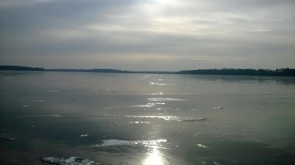
Ice Making Weather
Thanks to my good friend Matt Bydlon for this picture of a Minnesota lake that is turning hard! There's going to be some good ice making conditions across much of the Midwest as an Arctic air mass breaks loose and moves in by the 2nd half of the week...
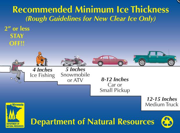
Ice Safety
There is no such thing as 100 percent safe ice.
"When is ice safe?
There really is no sure answer. You can't judge the strength of ice just by its appearance, age, thickness, temperature, or whether or not the ice is covered with snow. Strength is based on all these factors -- plus the depth of water under the ice, size of the water body, water chemistry and currents, the distribution of the load on the ice, and local climatic conditions."
Read more from the Minnesota DNR HERE:
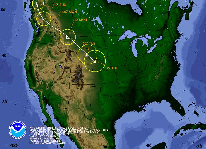
Tracking a Winter Storm
At this point, you may have heard of some big changes coming in the weather department. A strong storm system dropping in from Canada will track across the northern Rockies and slide out into the Plains by early week.
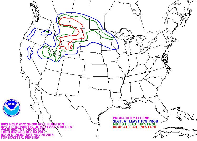
Snow Potential
Take a look at the snow potential thru AM Thursday. Note the heavier snow potential from the Rockies into the Upper Midwest. This developing storm will likely change as it moves into the Lower 48 early this week, so keep up to date with the latest forecast if you plan traveling.
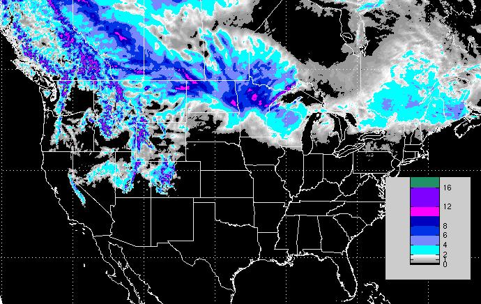
Snowfall Potential
According to NOAA, the probability of at least 4" of snow or more is fairly high from the Northern Rockies to the High Plains
Significant Cold
Although the amount of snow in specific locations is a bit uncertain at this point, the cold air is not! Another (even colder) blast of Arctic air will settle south of the international border by the 2nd half of the week. Here's the progression of the Arctic air mass through the week.
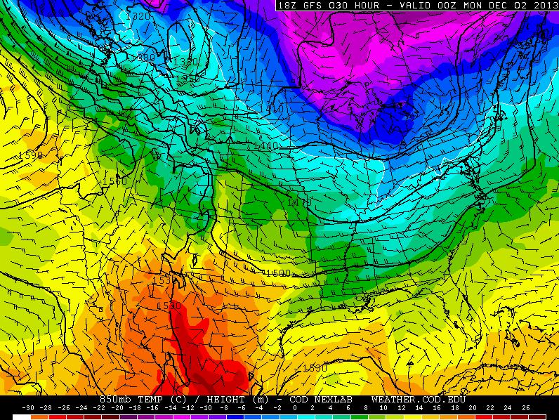
Sunday Temps
Other than a chunk of colder air still hanging out over the Great Lakes region, temperatures for Sunday don't look too terribly bad (yet) for much of the nation.
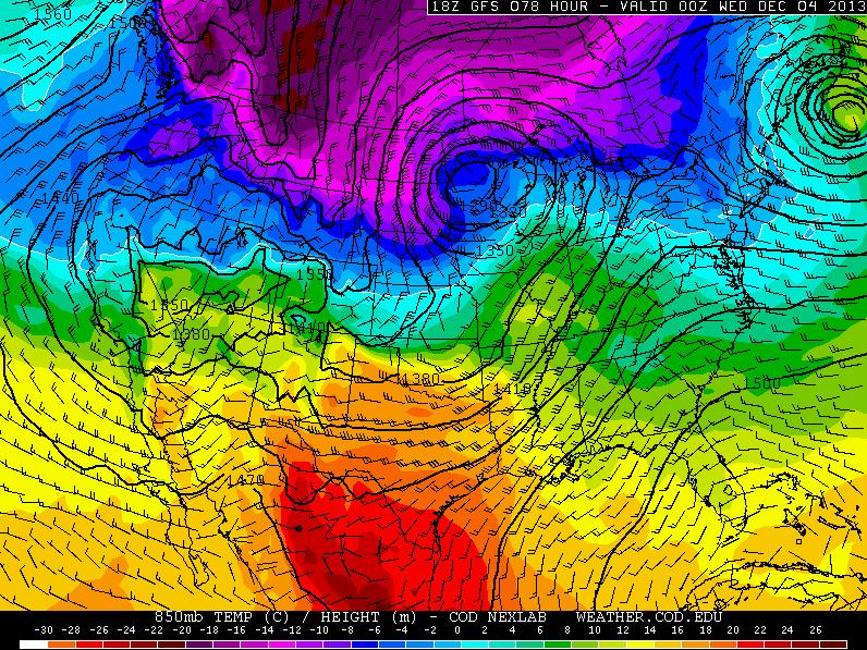
Tuesday Temps
By Tuesday, the center of the storm will over the Midwest. At this point, heavier snow looks to be piling up across the Upper Mississippi Valley near the international border. Note the much colder air mass that's building up on the north and western side of the storm
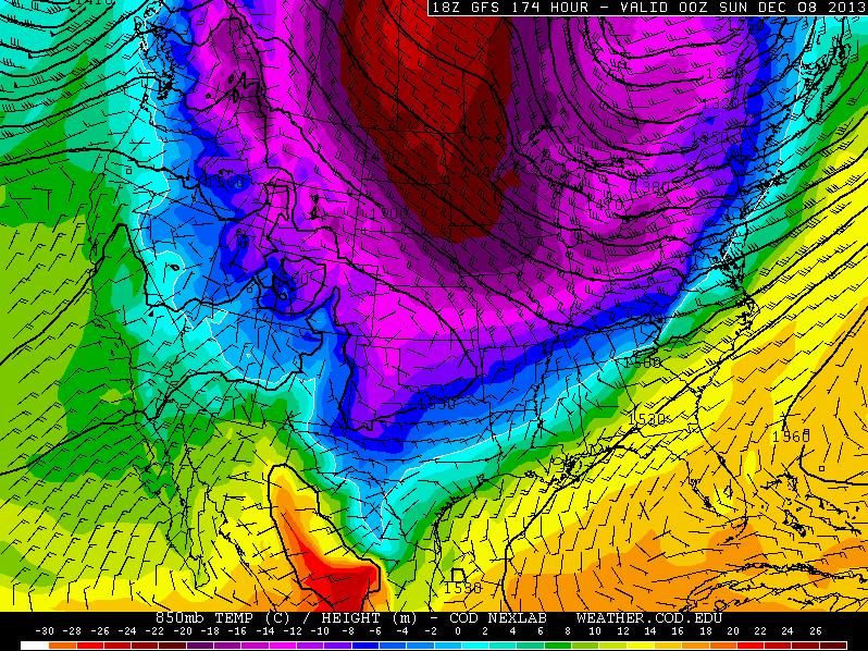
Saturday Temps
By Saturday, temperatures will have plummeted drastically across much of the Midwest. This will likely be some of the coldest air of the season for a majority the the Midwest/Plains region. The other thing to keep in mind is that there will be snow on the ground in some of these areas, so the cold air won't even moderate that much through the weekend. It'll still be quite bone chilling!
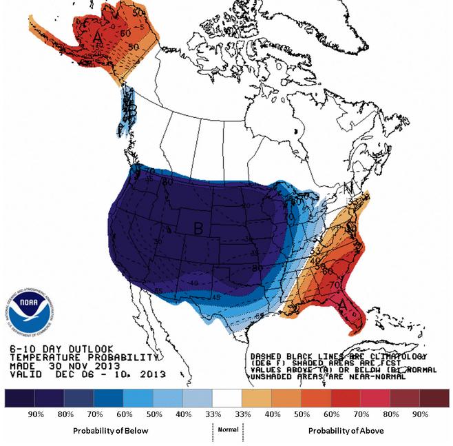
Extended Temperature Outlook
According to NOAA's Climate Prediction Center, the extended temperature forecast suggests well below average temperatures for the western two-thirds of the nation through the early/middle part of December.
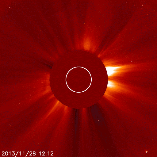
Comet ISON Lives?
Outer Space is incredible! It's amazing to think of how much unknown there is out there and how small we are as humans. Take a look at this video from NASA that shows Comet ISON making a close encounter with the sun on Thanksgiving. You can see that ISON actually survived!
However, the latest from NASA is that ISON is quickly dying...
Read more from Spaceweather.com HERE:
Thanks for checking in, have a great rest of your weekend!
Don't forget to check me out on Twitter @TNelsonWNTV

No comments:
Post a Comment