By Todd Nelson
Slowly, but surely I'm starting to get all feeling back in my extremities...
It was a rough go of things over the past few days as some of the coldest air in nearly 2 decades blew through the area. Get this; On Wednesday morning, it was colder in parts of Florida than it was in Alaska! However, it's not unusual to see warmer Alaskan temps when we are colder.
The driving force behind our large-scale warm ups and cool downs is directly related to the jet stream. As the strong upper level wind bubbles north and buckles south we warm up and cool down. The larger the bubble or buckle, the bigger the warm up or cool down tends to be.
The strong upper level wind becomes more "Zonal" by the end of the week; blowing straight from the Pacific rather than from the Arctic regions as it was earlier this week in the "High Amplitude" weather pattern.
The upcoming westerly flow will not only keep things quite active over the next several days, but it keeps us quite mild! There is a threat of highs actually reaching the freezing mark as earlier as Friday... Minnesota heat wave here we come!
We cool down a bit next week, but not as painfully polar as it was.
_____________________________________________________________________
WEDNESDAY NIGHT: Another double digit sub-zero night for most. Low: -11. Feels Like: -20F. Wind: SSE 5-10.
THURSDAY: Breezy south wind, not nearly as harsh. Clouds increase late. High: 16. Feels Like: -20 early. Wind: S 10-15.
THURSDAY NIGHT: More clouds. Not sub-zero! Low: 13.
FRIDAY: More clouds, snow develops in far SE MN late. High: 33
SATURDAY: Dripping icicles. Much better. Wake-up: 18. High: 28
SUNDAY: Light wintry mix possible early. Wake-up: 13. High: 32.
MONDAY: Another clipper. Light mix possible. Wake-up: 18. High: 28.
TUESDAY: More clouds, light snow possible. Wake-up: 19. High: 27.
WEDNESDAY: Sunny breaks. Wake-up: 12. High: 28.
_______________________________________________________________________
This Day in Weather History
January 9th
1982: Both January 9th and 10th saw some of the coldest windchills ever seen in Minnesota. Temperatures of -30 and winds of 40mph were reported in Northern Minnesota. This would translate to windchills of -71 with the new windchill formula, -100 with the old formula.
1934: Sleet and ice storm over southwest Minnesota. Hardest hit was Slayton, Tracy and Pipestone. The thickest ice was just east of Pipestone with ice measuring 6 to 8 inches in diameter. At Holland in Pipestone County three strands of #6 wire measured 4.5 inches in diameter and weighed 33 ounces per foot. The ice was described as: "Very peculiar information being practically round on three sides, the lower side being ragged projectiles like icicles: in other words pointed. The frost and ice were wet, not flaky like frost usually is. In handling this, it could be squeezed into a ball and did not crumble."
_____________________________________________________________________
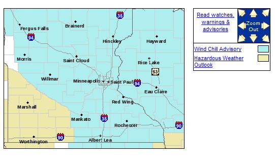
Wind Chill Advisory
...ONE MORE NIGHT OF DANGEROUSLY COLD WIND CHILLS EXPECTED TONIGHT...
AS HIGH PRESSURE SLIDES INTO WISCONSIN TONIGHT...SOUTHERLY WINDS WILL BEGIN INCREASE...FIRST THIS EVENING ACROSS WESTERN MINNESOTA AND AFTER MIDNIGHT FOR EASTERN MINNESOTA INTO WESTERN WISCONSIN. THESE WINDS...WHEN COMBINED WITH STILL UNSEASONABLY COLD TEMPERATURES WILL CREATE WIND CHILL VALUES OF BETWEEN 25 AND 35 DEGREES BELOW ZERO. WARMING TEMPERATURES OVERNIGHT WILL ALLOW WIND CHILL VALUES TO RISE ABOVE 20 BELOW ZERO WEST OF I-35 BY THURSDAY MORNING...WHILE COOLER TEMPERATURES EAST OF I-35 WILL ALLOW DANGEROUS WIND CHILL VALUES TO PERSIST INTO THURSDAY MORNING.
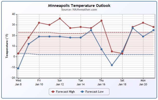
Minneapolis Temp Trend
It's a heat wave, Minnesota style. We make it into the double digits for high temperatures Thursday and back to near the freezing mark by Friday!
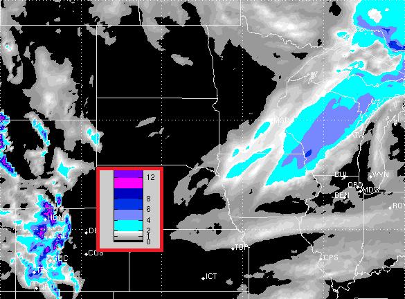
Friday Snow Potential
It looks like a little snow will be possible on Friday, but the best chance of accumulating snow is across far southeastern MN into central Wisconsin. Here's the snow potential through midday Saturday.
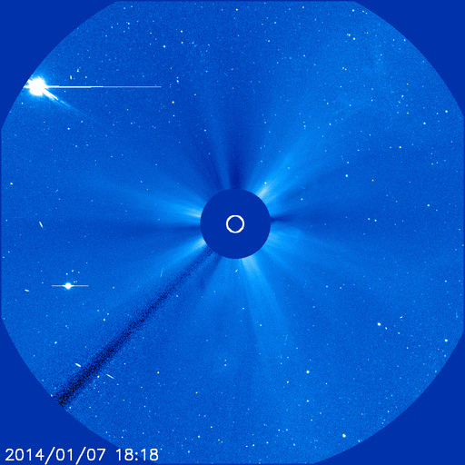
Northern Lights Potential
According to NASA, there was an explosion on the sun January 7th, which was Earth directed, which mean that northern lights will be possible for some northern dwellers depending on weather conditions.
Here's a video of the X1-Flare from NASA's SOHO
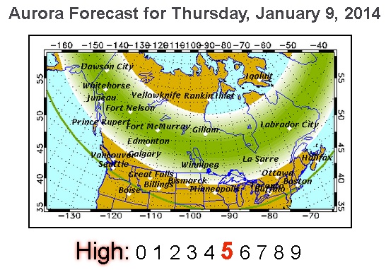
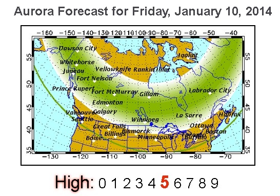
Northern Lights Forecast
The forecast here from the Geophysical Institute from the University of Alaska Fairbanks shows promise for quite a few folks near the international border both Thursday and Friday!
Forecast: Auroral activity will be high. Weather permitting, highly active auroral displays will be visible overhead from Inuvik, Yellowknife, Rankin and Igaluit to Juneau, Edmonton, Winnipeg, Thunder Bay and Sept-Iles, and visible low on the horizon from Seattle, Des Moines, Chicago, Cleveland, Boston, and Halifax.
Forecaster Comments: A large, Earth-facing solar event occurred on Jan 7, 2014. The effects of this event should reach Earth sometime on the 9th of January. Our short term forecast is not available, so you should watch the Current Aurora Activity panel at the Auroral Forecast website: http://www.gi.alaska.edu/AuroraForecast
See more HERE:
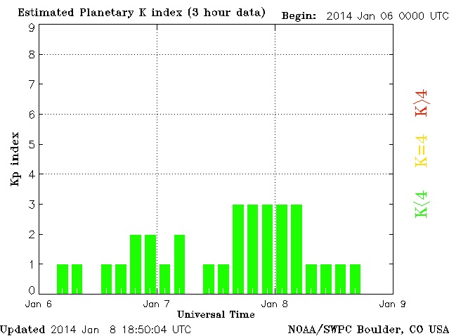
Planetary K-Index
If you're interested and in a potential view zone, keep an eye on this index as this is a pretty good indicator for when the northern lights may be visible. When the K-Index jumps into the yellow or red category, then you'll know that the solar storm has reached our atmosphere!
Here's your Planetary K-Index Link:
Cold Air Finally Fades
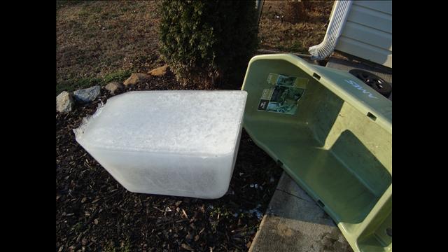
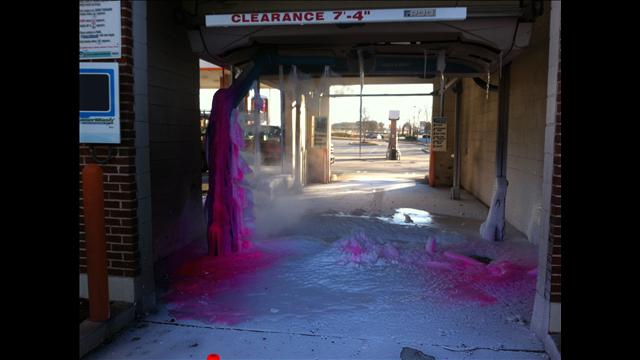
Thanks to WXIA-TV out of Atlanta, GA for these cold weather images from the recent cold snap. Keep in mind that temperatures AM Tuesday and AM Wednesday were colder than some spots in Alaska!
Ice cube for giants?
Someone forgot the memo to turn the car wash off during extreme cold weather events! Either that or the car wash got sick.
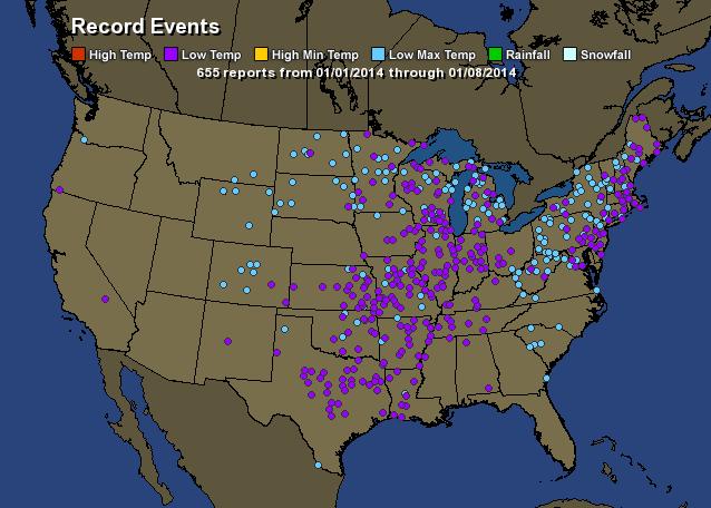
Record Cold - Past 7 Days
According to HamWeather.com there have been nearly 650 record low and record low max temperatures over the past week.
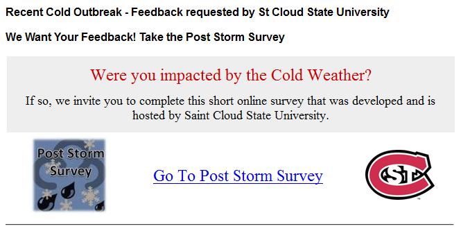
Where You Impacted By the Cold?
As a St. Cloud State University alum (Go Huskies!) - I wanted to pass this along since it has timely weather ties. If you were impacted the recent cold blast, students and professors invite you to take a short survey
"The objective of this Post Storm Survey (PSS) is to gain insight into decision-making related to hazardous winter weather. This information will be vital for the weather forecasting community in learning to better communicate the threat of hazardous weather. This research is one of the critical tools in bridging the gap between the weather community and users."
short 'post storm survey' HERE:
See more about the survey HERE:
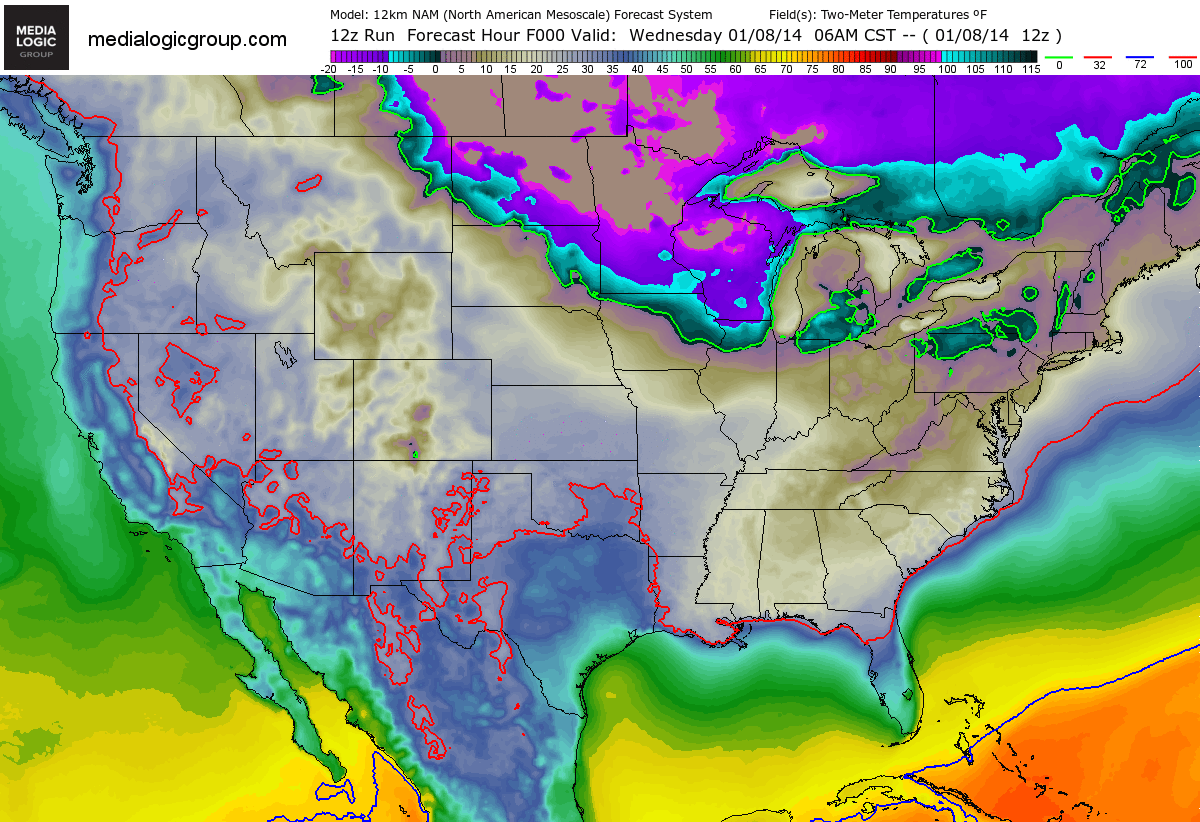
Warming Trend!
This is great news, right? After record cold, some of us will be back to average later this week, but warmer than normal temps return by the weekend!
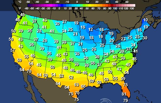
Thursday's Highs
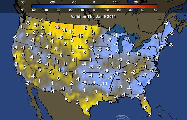
Thursday's High From Normal
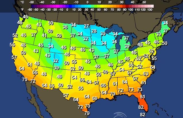
Saturday's High
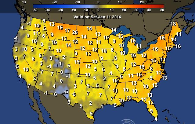
Saturday Highs From Normal
Massive Lake Effect Snows
Another massive lake effect snow event has unfolded over the eastern Great Lakes Region as this latest Arctic air mass moved through.
See a full list of webcams HERE:
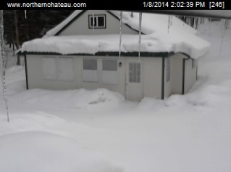
Here's a snowy scene from the Redfield, NY, which is located on the Tug Hill Plateau downwind of Lake Ontario.
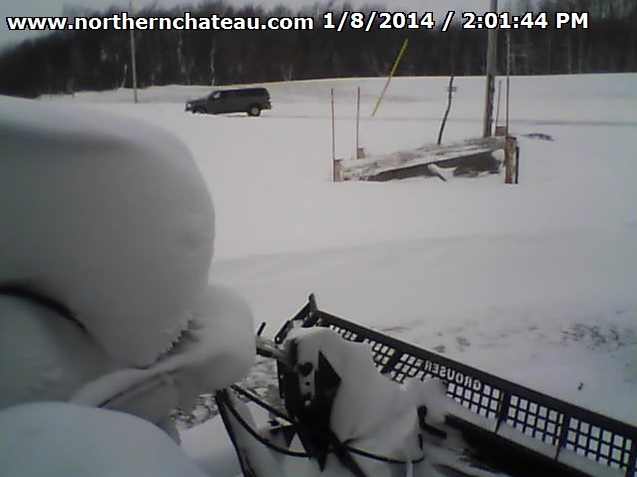
Here's another from Lowville, NY also downwind of Lake Ontario
Digging Out
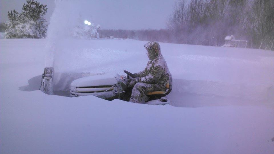
Hey thanks to Karen Miller-Rickard for this snowy picture out of Rodman, NY where they're attempting to dig out from some significant snow tallies!
Feet of Snow
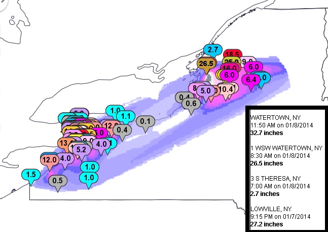
Here were some of the snow tallies from Wednesday prior to the snow machines shutting down! Note the near 3ft. report out of Watertown, NY!
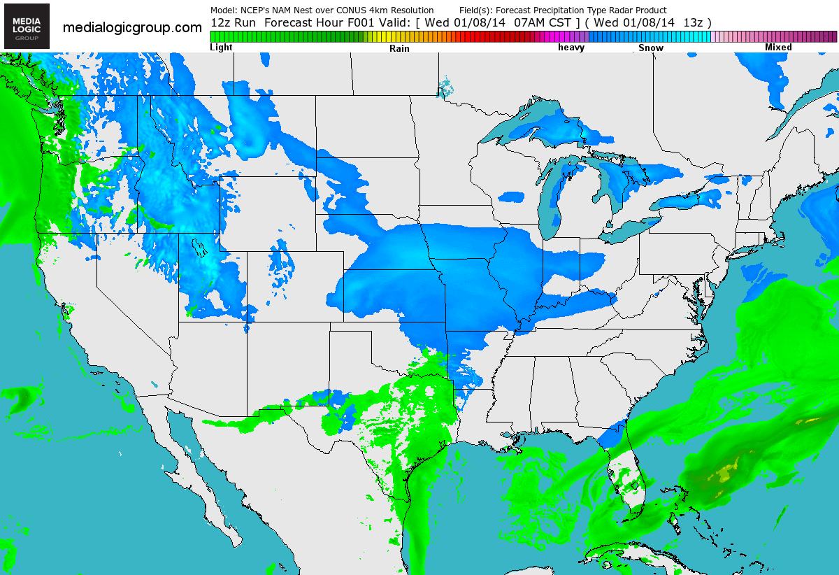
More Weather on the Way...
As we move through the end of the week, we'll have to keep an eye on a system that will slide through the middle part of the country.
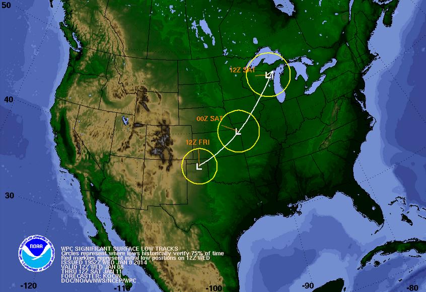
Watch towards the end of the loop as the low mentioned above comes together in the central part of the country... Note the snow potential on the northwest side of the system and the heavier rain that beings to develop through the central and lower Mississippi Valley.
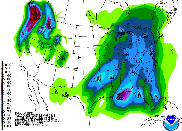
3 Day Precipitation Forecast
According to NOAA, the 3 day precipitation forecast brings copious amounts of heavy moisture across parts of the Pacific Northwest, especially in the higher elevations of the Cascades and Olympics. We'll also see some decent moisture return to parts of the south, where thunderstorm can't be ruled out later this week.
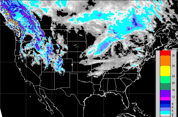
3 Day Snowfall Potential
There will be no shortage of snowfall in the western mountains. How about those snow amounts along the higher terrain in western British Columbia! Note also the snow potential over parts of the Midwest later this week. Some of this snow could be shovelable thru early Saturday morning.
Thanks for checking in, have a great rest of your week! Don't forget to follow me on Twitter @TNelsonWNTV

No comments:
Post a Comment