By Todd Nelson
If you're keeping track, the coldest day of this latest Arctic blast was Monday when the low temperature in Minneapolis dropped to -23F and the daytime high reached -12F. Interestingly, there were no records broken for the date Jan. 6! While this was some of the coldest air we've seen since 1996, we couldn't quite reach the record low temperature of -27 set in 1912 or the record cold high of -14 set in 1909.
The cold air mass dislodged by the "Polar Vortex" you may have heard about at the watercooler, is now beginning to retreat back to Canada. The Arctic air mass will drag it's heels through the region today, so it'll still be cold, but not quite as harsh as it was earlier this week.
Believe it or not, temperatures could reach the freezing mark within a few days! You might actually start seeing your neighbors emerge from their homes this weekend. Gas stations and car washes will likely be packed, so plan accordingly. As much as I love a good old fashioned Minnesota winter, this one is already starting to wear me out. December temperatures ended up being -7.5F below average, while January temperatures are already running nearly -20F below average!
_____________________________________________________________________
TUESDAY NIGHT: Still cold, but wind chill warning free! Low: -16. Feels Like: -25F. Winds: WNW 5.
WEDNESDAY: Icy sunshine. High: 2. Feels Like: -20F early. Winds: WNW 5.
THURSDAY: Breezy south wind, not nearly as harsh. Clouds increase late. Wake-up: -10. High: 14
FRIDAY: More clouds, wintry mix possible in far SE MN late. Wake-up: 13. High: 31
SATURDAY: Dripping icicles. Much better. Wake-up: 19. High: 32
SUNDAY: Light wintry mix possible early. Wake-up: 20. High: 34.
MONDAY: Another clipper. Light snow possible. Wake-up: 12. High: 22.
TUESDAY: Chilly, but not Arctic. Wake-up: 10. High: 20.
_____________________________________________________________________
This Day in Weather History
January 8th
1902: January thaw across Minnesota. Twin Cities warms to 46 degrees.
_____________________________________________________________________
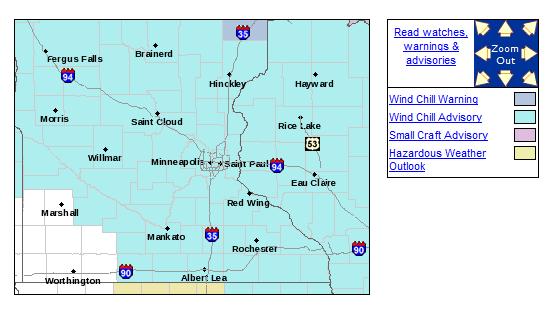
Wind Chill Advisory
...MORE DANGEROUSLY COLD TEMPERATURES AND WIND CHILLS EXPECTED TONIGHT...
.HIGH PRESSURE MOVING INTO MINNESOTA TONIGHT WILL BRING WITH IT CLEAR SKIES AND ANOTHER ROUND OF VERY COLD TEMPERATURES...WITH ACTUAL AIR TEMPERATURES EXPECTED TO DIP DOWN TO AROUND 15 BELOW IN SOUTHERN MINNESOTA...TO AROUND 30 BELOW ZERO OVER CENTRAL MINNESOTA. WHEN COMBINED WITH NORTHWEST WINDS OF 5 MPH...THIS WILL RESULT IN APPARENT TO TEMPERATURES DROPPING TO BETWEEN 25 AND 40 BELOW ZERO AT TIMES INTO WEDNESDAY MORNING.
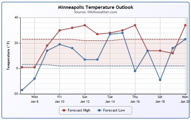
Minneapolis Meteogram
I'm glad to report that the coldest of the cold is behind us and it looks like a thaw may be in store for us by the weekend! That's going to feel warm after the latest Arctic slap.
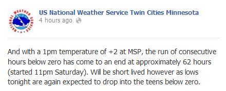
62 Hours of Sub-Zero Weather
Thanks to the National Weather Service for this info. As of Tuesday 1pm, the official temperature at the MSP Airport warmed to +2F meaning that the streak of sub-zero weather ended at 62 hours.
See more from the NWS Twin Cities on Facebook HERE:
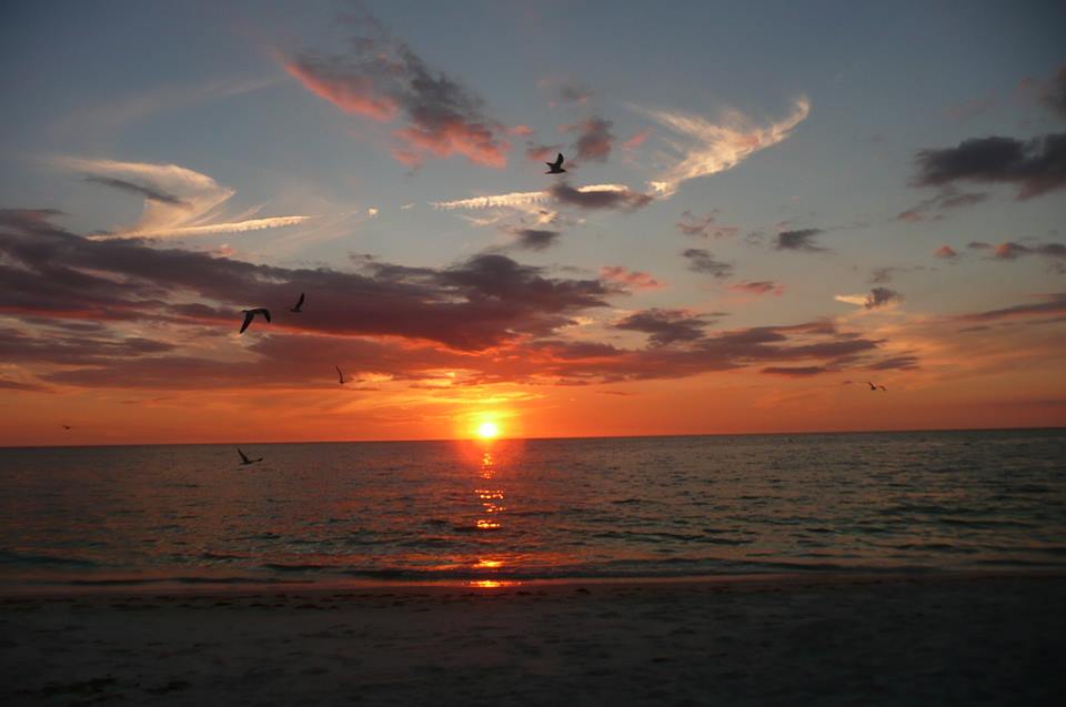
Cold Sinks South
Thanks to my good friends Bob and Mary Miller for this great shot from Bonita Springs, FL. The sunset last night looked stunning, however, I'm sure it was a little chilly!
It was another frigid morning for many in the eastern two-thirds of the country on Tuesday where temperatures dipped to record low values in some areas. Thanks to WPMI-TV out of Mobile/Pensacola for this picture, which was taken in Turnerville, AL early Tuesday... Now that's a site you don't see too often this far south!

Morning Lows Tuesday
Would you believe that it was colder this morning in Pensacola, FL than it was in Billings, MT. The coldest of the cold is still situated across the Great Lakes, where earlier today, temperatures dipped into the -10s and -20s. With the wind chills, some areas had -20s to -40s wind chill values! BTW, it was even cold enough in Atlanta, GA for schools to be cancelled!

Notable Cold Temps
Thanks to a number of different weather service office across the nation for posting their local low temperature records/notable low temperature numbers from Tuesday. How about that one from Key West, FL where the low temp of 55F was the coldest reading there since February 18th, 2013 when the mercury dipped to 53F.


Another Cold Night
The National Weather Service continues FREEZE WARNING headlines for the Gulf Coast region as temperatures are expected to dip into the 10s and 20s once again through AM Wednesday.

Here are the forecast lows through AM Wednesday across the Gulf Coast region...

Tracking A Warmup!
Take a look at the 850mb temps over the next few days and note how different it looks from the depths of the Arctic plunge on AM Tuesday to a much warmer PM Friday.
AM TUESDAY

PM FRIDAY

High Temperatures Friday
Ahh, now this is more like it!

Here are the highs from normal on Friday! Note that instead of the eastern two-thirds nation being nearly 20F to 30F below average, we'll be nearly 5F to 10F ABOVE average!

Cold in the United States
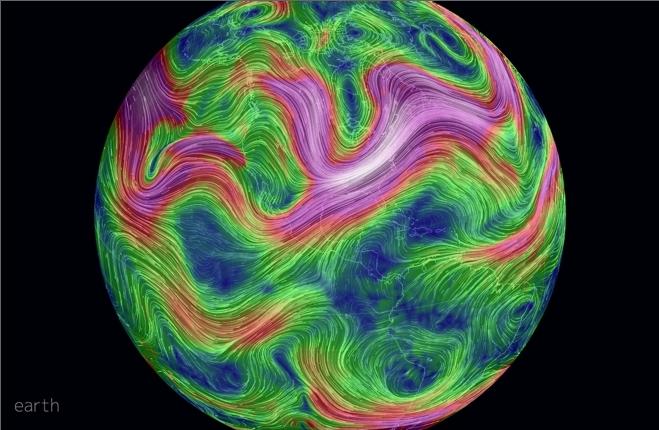
While it has been extremely cold across parts Canada, did you know that parts of the northern hemisphere has been warmer than average over the past 30 days? An article by Climate Central suggests that the our recent Arctic blast may be part of a bigger pictures that describes an alteration in heat balance from the North Pole to the Equator.
"The Arctic has had a mild winter so far, in part because of an area of high pressure in the North Pacific Ocean that has blocked the flow of weather systems like a stop sign at an intersection, forcing the jet stream northward over western Canada, and then back down to the southeast across the U.S. That favors episodic outbreaks of cold air in the East, Cohen said, but not extended cold."
Read more from Climate Central HERE:
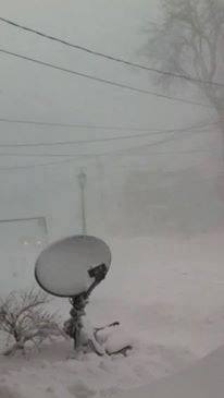
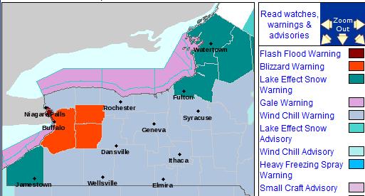
Heavy Lake Effect Snow
Thanks to Karen Miller-Rickard for this picture out of Watertown, NY where heavy lake effect snow has been piling up since earlier this week.
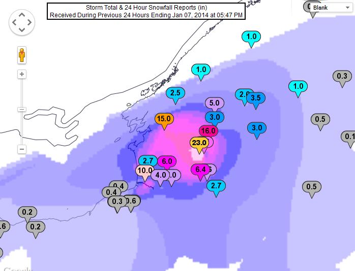
Here are some of the heavy snow totals from downwind of both Lake Erie and Ontario
Lake Erie
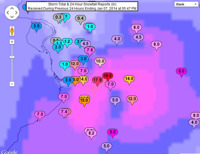
Lake Ontario
Lake Effect Snow Continues
The National Weather Service continues Lake Effect Snow and Blizzard Warnings in the eastern Great Lakes region until PM Wednesday. In the end, snow totals of 2ft. to 4ft. may be possible in spots!
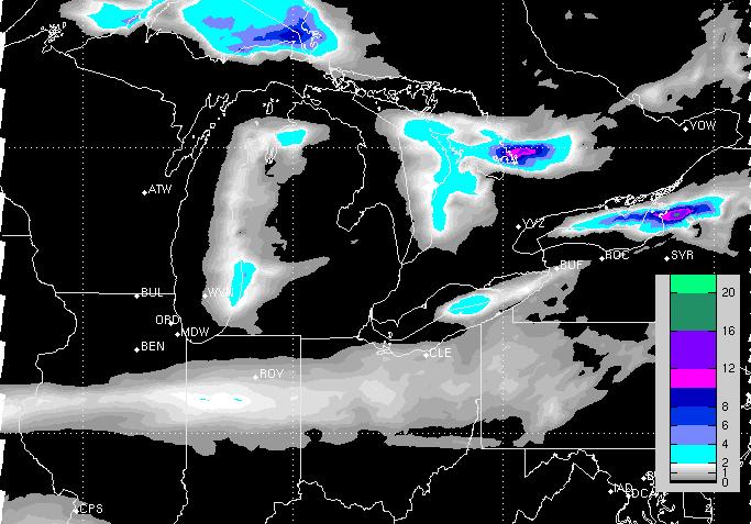
Snowfall Forecast
Here's the snowfall forecast through PM Wednesday, which shows the heaviest (additional) tallies east of Lake Ontario, where we've already had some of our highest tallies reported so far.
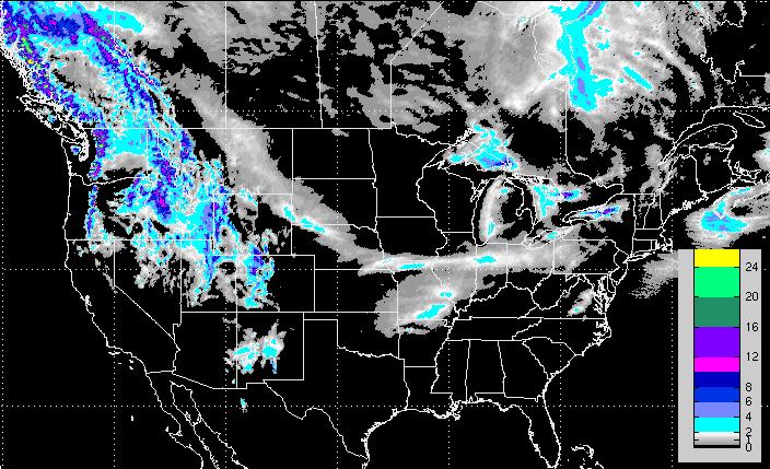
National Snow Forecast
Other than the heavier lake effect snow around the Great Lakes Region, there isn't much happening on the national snowfall forecast thru midday Friday, except for folks in the western mountains. Higher elevations in the Rocky Mountains through the end of the week could get quite a bit of snow!
Developing Systems
Several impulses of energy will continue whipping the West Coast through the end of the week and each one of these system will slide into the central part of the country with rain/snow and wintry mix chances.
5 Day Precipitation
Here's NOAA's 5 day precipitation forecast, which suggests several inches of precipitation in the higher elevations of the Olympics/Cascades in the Pacific Northwest, while lighter amounts will tally up in the central part of the country.

Thanks for checking in on this Tuesday, have a great rest of your week! Don't forget to follow me on Twitter @TNelsonWNTV

No comments:
Post a Comment