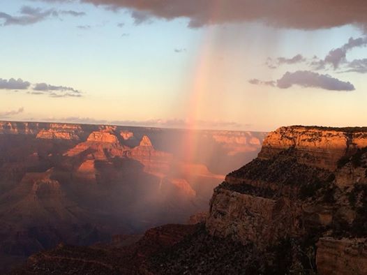
A Grand Rainbow !!
Thanks
to my good friend Linda HalbakkenBichrt for the picture below who sends
this in from the Grand Canyon. What a beautiful evening rainbow from
Saturday!!
Big Swings
By Paul Douglas
September: possibly the only month of the year where snow, tornadoes and heat waves can all occur in the same month. And forget the calendar. As far as the atmosphere is concerned "meteorological autumn" began on Labor Day.
The sun is now as high in the sky as it was in early April, but hot fronts can still sweep north. The record Twin Cities temperature range for September: 104 F (1931) to 26 F (1942). The earliest flakes in the metro in modern-day records. September 15, 1916. Horrifyingly amusing trivia to start the work week.
Nothing that extreme is brewing, but an early taste of October is still aimed in our general direction, courtesy of Canadian airmail. Highs hover in the 50s Thursday and Friday; suburbs wake up to 30s Saturday morning with a light frost possible from near St. Cloud to Brainerd.
Expect patchy clouds and 70s Monday, enough sun for 80F Tuesday and a few strong late-day T-storms. Rain tapers Wednesday morning, followed by a stiff wind that will leave you checking the calendar. No fear. Temperatures mellow next weekend, sunshine both days with 60s by Sunday.
We'll see more 70s, probably a few more 80s before the wicked winds of winter really kick in.
===========
SUNDAY NIGHT: Mostly clear and quiet. Low: 57.
MONDAY: More clouds, isolated T-shower possible late. High: 76. Winds: S 10-15
MONDAY NIGHT: still unsettled. Isolated shower/storm still possilbe. Low: 63
TUESDAY: Warm sun, late day storms possible. High: 81
WEDNESDAY: Rain tapers, turning cooler. Wake-up: 60. High: 62
THURSDAY: Mostly cloudy, feels like October. Wake-up: 48. High: 57
FRIDAY: Scrappy clouds, sweatshirt worth. Wake- up: 43. High: 56.
SATURDAY: Frost up north? Cool sunshine. Wake-up: 37. High: 60
SUNDAY: Sunny and warmer. Wake-up: 42. High: 68.
============
This Day in Weather History
September 8th
1985: An F1 tornado touched down in Faribault County causing $25,000 worth of damage and hail up to 1 3/4 inches in Freeborn and Waseca Counties.
1968: 1 3/4 inch hail fell in Goodhue County.
1931: A record was set in St. Cloud with a temperature of 102 degrees Fahrenheit.
============
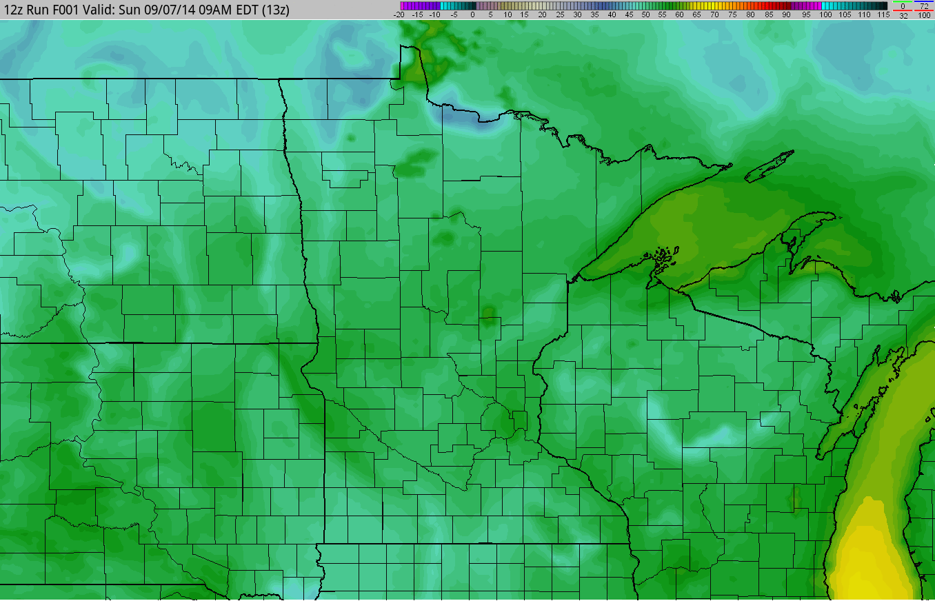
Cold Front Approaches
The temperature loop below from AM Sunday to PM Tuesday shows the early stages of the cold air mass descending into the region. The coldest days for us will be Thursday and Friday with highs only in the 50s!!
=====================
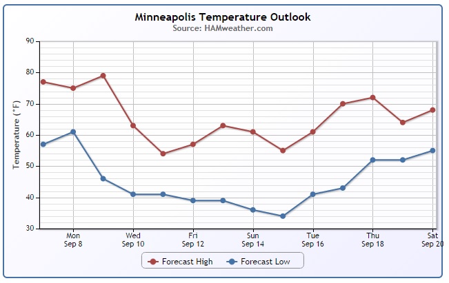
Minneapolis Temperature Trend
Good grief! Take a look a the temperature drop by midweek in Minneapolis! With highs nearing 80F to highs in the low to mid 50s by the end of the week... this next front means business! Keep in mind that these temperatures will likely be nearly 20F to 30F below average!
=============
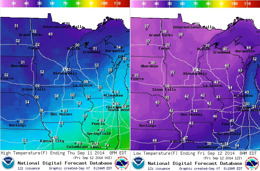
Thursday Chilly Weather Outlook
BRR!! The outlook for Thursday/Thursday night isn't all that appealing. Considering that these temperatures are more appropriate for late October... we're in for a real doozy!
According to my good friend and colleague, D.J. Kayser, these are the last times we had highs/lows below:
Last High Below 60F: May 16th (54F)
Last High Below 55F: May 16th (54F)
Last High Below 50F: May 15th (49F)
Last High Below 55F: May 16th (54F)
Last High Below 50F: May 15th (49F)
Last Low Below 45F: May 17th (41F)
Last Low Below 40F: May 14th (38F)
Last Low Below 35F: April 29th (34F)
Last Low Below 40F: May 14th (38F)
Last Low Below 35F: April 29th (34F)
==============
Average High/Low for Minneapolis
September 8th
Average High: 75F (Record 99 set in 1931)
Average Low: 56F (Record 36 set in 1883)
===============
Sunrise/Sunset for Minneapolis
September 8th
Sunrise: 6:43am
Sunset: 7:37pm
==============
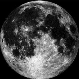
Moon Phase for September 8th at Midnight
0.2 Days After Full Harvest Moon
==============
Full Harvest Moon
Did you know that this month's Full Havest Moon will also be the last Super Moon of 2014? Here's a nice write-up from UniverseToday.com
"Time to dust off those ‘what is a perigee Full Moon’ explainer posts… the supermoon once again cometh this weekend to a sky near you.
Yes. One. More. Time.
We’ve written many, many times — as have many astronomy writers — about the meme that just won’t die. The supermoon really brings ‘em out, just like werewolves of yore… some will groan, some will bemoan the use of a modernized term inserted into the common astronomical vernacular that was wrought by an astrologer, while others will exclaim that this will indeed be the largest Full Moon EVER…"
Here's a guide of everything you need to know about this year's Harvest Moon from EarthSky.org
"Shine On Harvest Moon
By Nora Bayes and Jack Norworth (1903)
Shine on, shine on harvest moon
Up in the sky,
I ain’t had no lovin’
Since January, February, June or July
Snow time ain’t no time to stay
Outdoors and spoon,
So shine on, shine on harvest moon,
For me and my gal."
(Photo credit: Rich Koivisto)
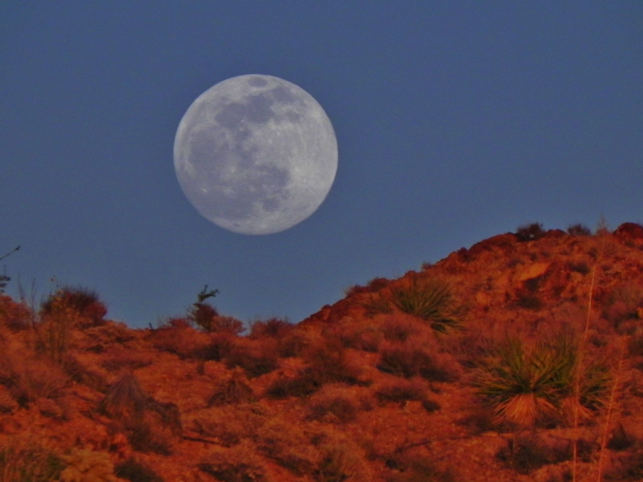
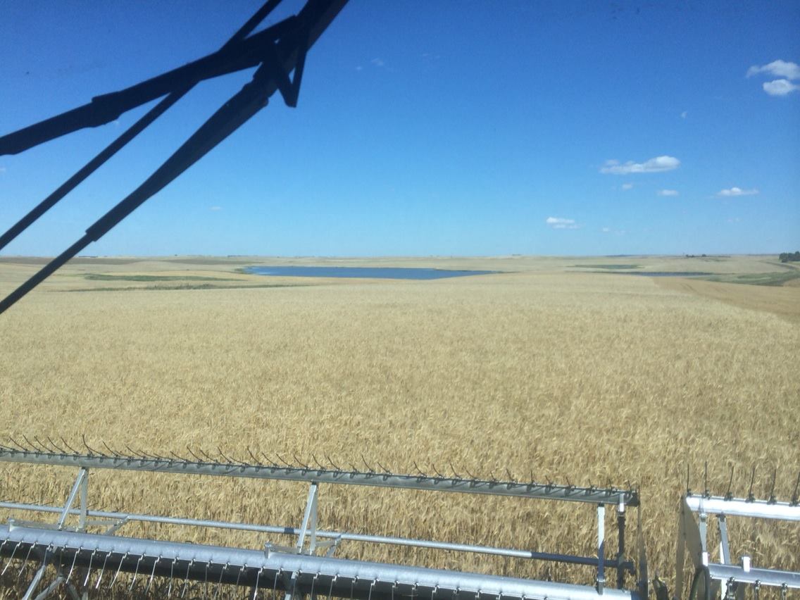
Making Most of the Harvest Moon
Thanks to my Aunt and Uncle in law Jan and Lynn Jacobson for the picture below out of Alamo, ND. They've been busy combining Durum. Hopefully they'll be making the most of the harvest moon!
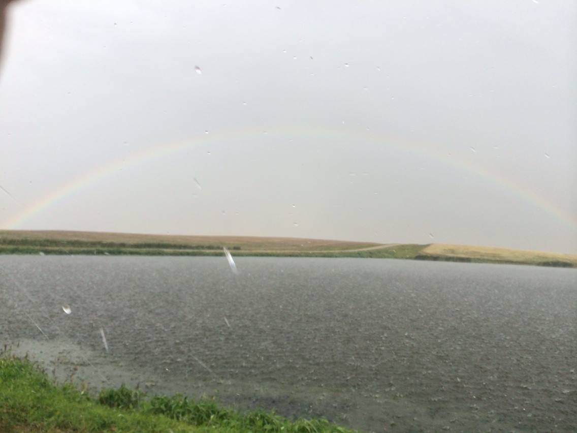
North Dakota Rainbow
Here's another picture from Jan Jacobson. As she was combining last week, a rainbow appeared!! It almost looks like snow is falling in this picture, but it's likely rain (possibly small hail). However, some areas of North Dakota could see some a light snow mix by midweek! UGH!! More on that in a bit.
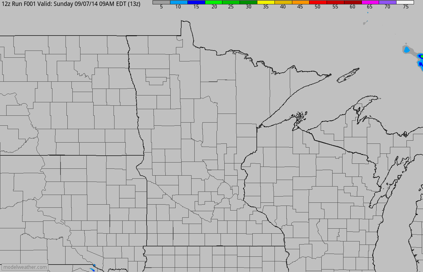
Simulated Radar
After a nearly perfect weekend, weather conditions will sour a bit into early next week. There will be an uptick in the rainfall potential Monday and especially Tuesday. Some of the storms on Tuesday could be a little on the strong side. In fact, the Storm Prediction Center has issued a SLIGHT RISK of severe weather for parts of the Upper Midwest Tuesday.
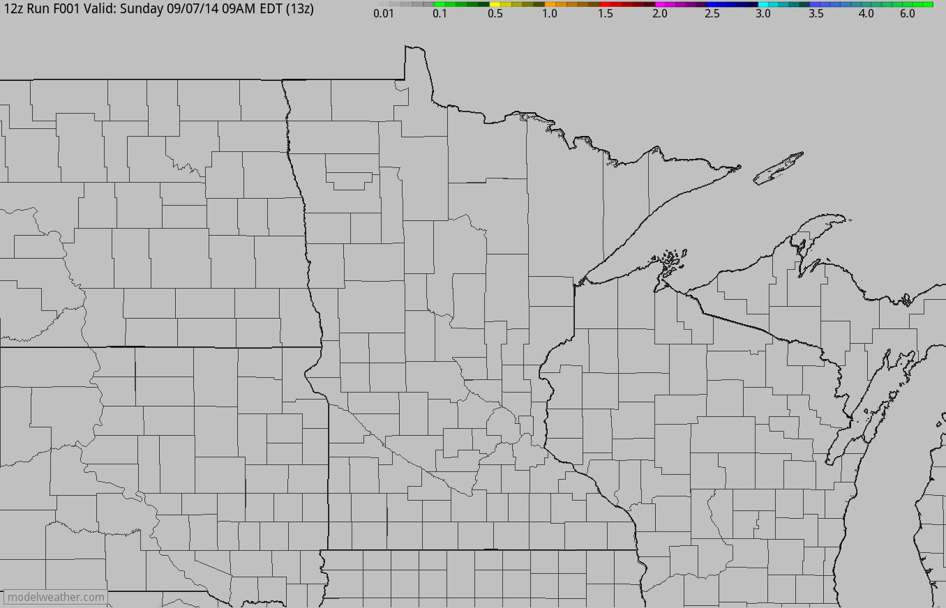
Simulated Rainfall
Our rainfall potential will definitely be on the rise into the early week time frame as our next storm system approaches. It appears that the heaviest will be across the southern part of the state with any strong storms that develop.
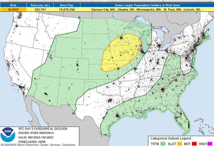
Severe Threat Tuesday
As our next storm system moves into the Midwest, a tight pressure gradient and a tightly wound area of low pressure could help to produce strong to severe storms across the area. Here's the latest from the Storm Prediction Center.
...MID MISSOURI VALLEY THROUGH UPPER MIDWEST... THE SYNOPTIC SETUP AS DESCRIBED ABOVE APPEARS TO SUGGEST AT LEAST SOME POTENTIAL EXISTS FOR A MORE SUBSTANTIVE SEVERE WEATHER EVENT THAN IS CURRENTLY DEPICTED IN THE CATEGORICAL AND PROBABILISTIC GRAPHICS. HOWEVER...CONSIDERABLE UNCERTAINTY REMAINS CONCERNING A NUMBER OF FACTORS WHICH COULD IMPACT THE EXTENT AND INTENSITY OF THE CONVECTIVE POTENTIAL. THIS INCLUDES THAT TIMING OF MORE RAPID SURFACE LOW DEEPENING...AND STRENGTHENING OF LOWER/MID TROPOSPHERIC FLOW WITHIN ITS WARM SECTOR LATE TUESDAY AFTERNOON AND EVENING. ADDITIONALLY...WHILE MID-LEVEL LAPSE RATES ABOVE THE MOISTENING BOUNDARY LAYER MAY STILL BE MODESTLY STEEP INITIALLY...SUPPORTIVE OF SIZABLE MIXED LAYER CAPE WITH INSOLATION...MODEL OUTPUT SUGGESTS THAT CONSIDERABLE HIGH-LEVEL CLOUD COVER COULD RESTRICT SURFACE HEATING. THE POTENTIAL FOR SUSTAINED DISCRETE SUPERCELL DEVELOPMENT ALSO REMAINS UNCLEAR. WITH SUFFICIENT DESTABILIZATION...LARGE-SCALE FORCING FOR UPWARD VERTICAL MOTION MAY SUPPORT THE RAPID EVOLUTION OF A PRE-FRONTAL SQUALL LINE. REGARDLESS...IT APPEARS THAT A REMNANT CONVECTIVE BOUNDARY...NEAR/EAST OF THE MID MISSOURI VALLEY THROUGH PARTS OF CENTRAL/SOUTHERN IOWA...COULD PROVIDE A FOCUS FOR ENHANCED TORNADIC POTENTIAL...OR THE EVOLUTION OF MORE SUBSTANTIVE DAMAGING WIND POTENTIAL...AS CONVECTION PROGRESSES NORTHEASTWARD/EASTWARD ACROSS AND ALONG IT...TOWARD THE UPPER MISSISSIPPI VALLEY TUESDAY NIGHT.
National Weather Outlook
Lingering showers/storms continue along the Mid-Atlantic region through the early week time frame, but some of the heaviest rain will be found in the Southwest through that time frame. A piece of energy begins to break loose on Tuesday and develops into a much larger/wrapped up storm by midweek across the Midwest.
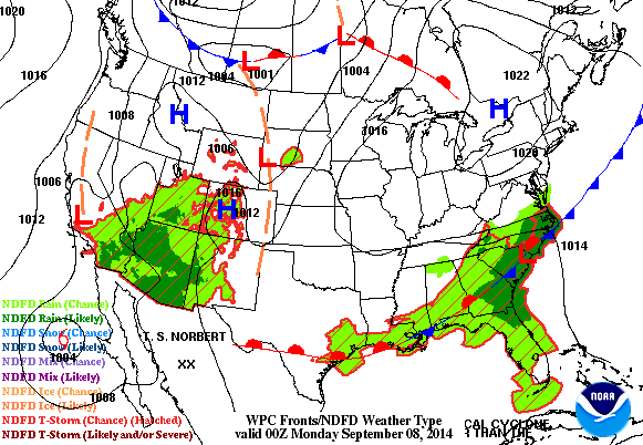
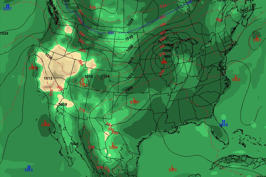
Storm System Wednesday
Here's the developing storm system by AM Wednesday. Note the tightly would are of low pressure over the Midwest; this will be responsible for a strong to severe storm potential through midweek. Note also the blue '540' line (freezing line) perched north of us in Canada. This freezing line is expected to continue to drop south through the end of the week.
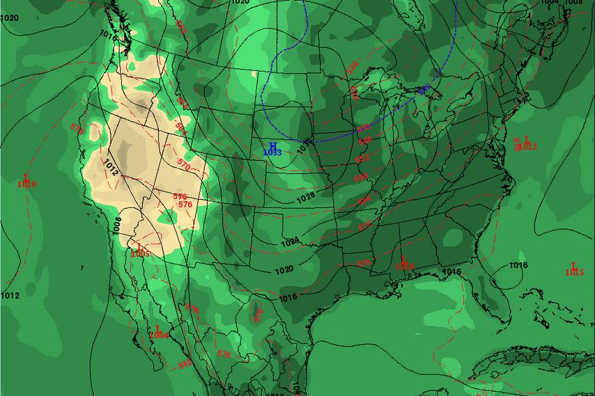
AM Friday
At this point, the storm system will be well north of us, however it will have pulled some significantly colder air south of the border. Take a look at where the blue line is sitting by AM Friday... this freezing line could be interesting for any lingering moisture that may hanging around in the Upper Midwest.
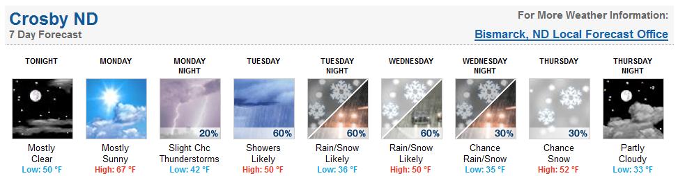
Crosby, ND Snowy Forecast??
YIKES!! Here's the forecast for Crosby, ND from the NWS Bismarck... UGH
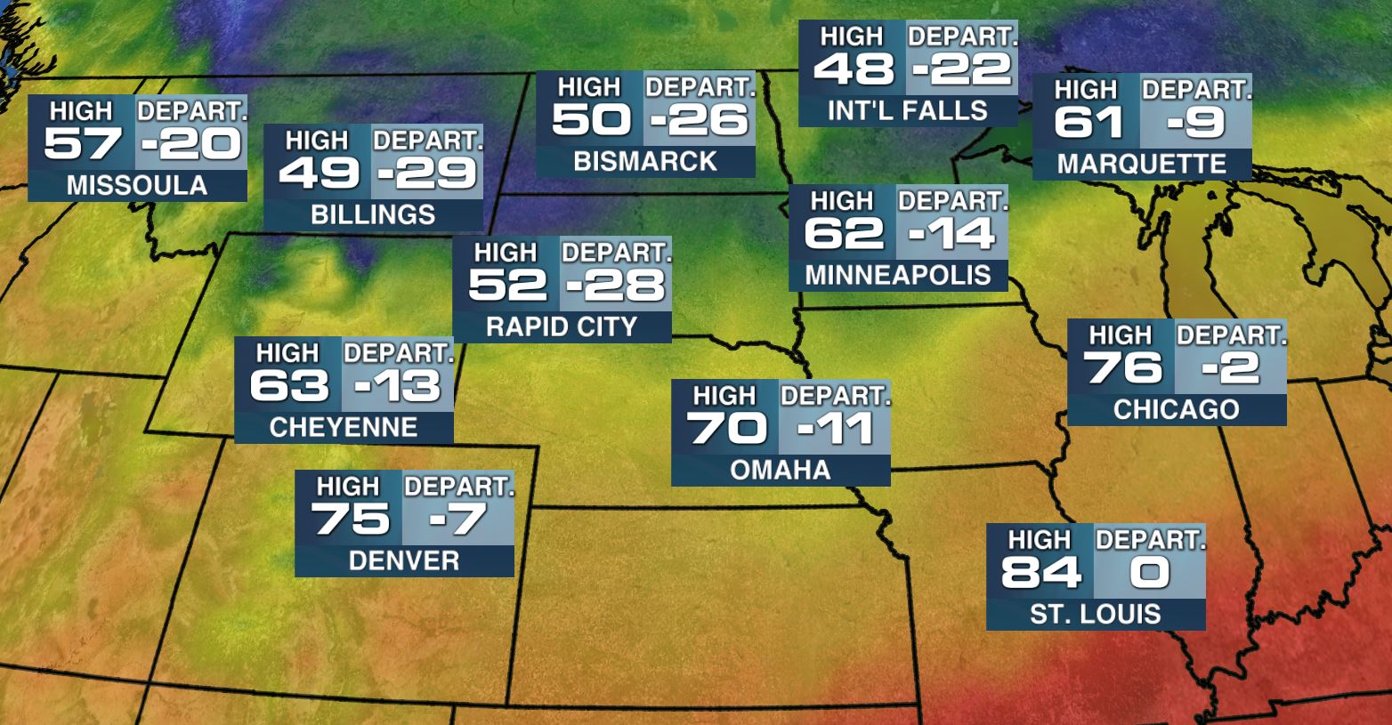
Late October-ish Weather Late Week
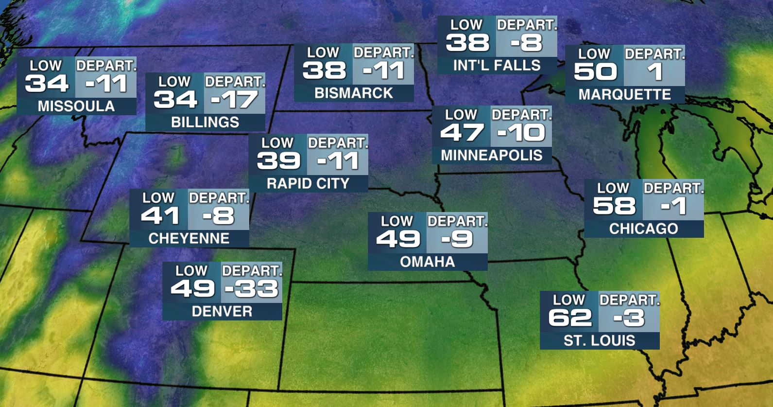
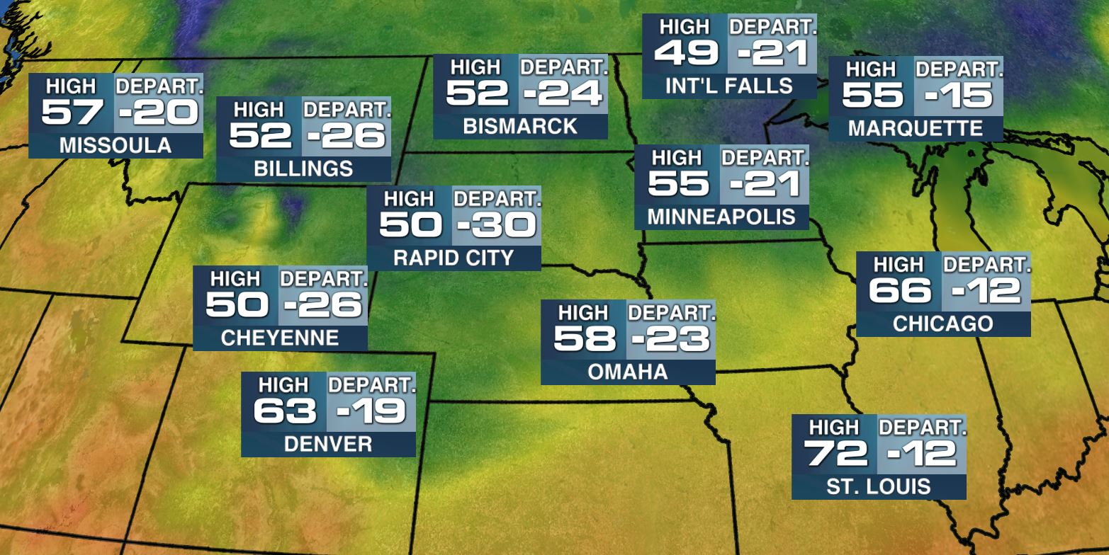
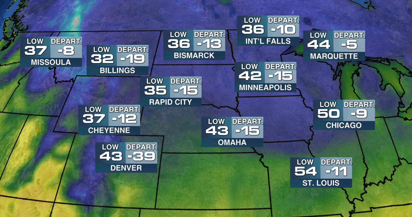
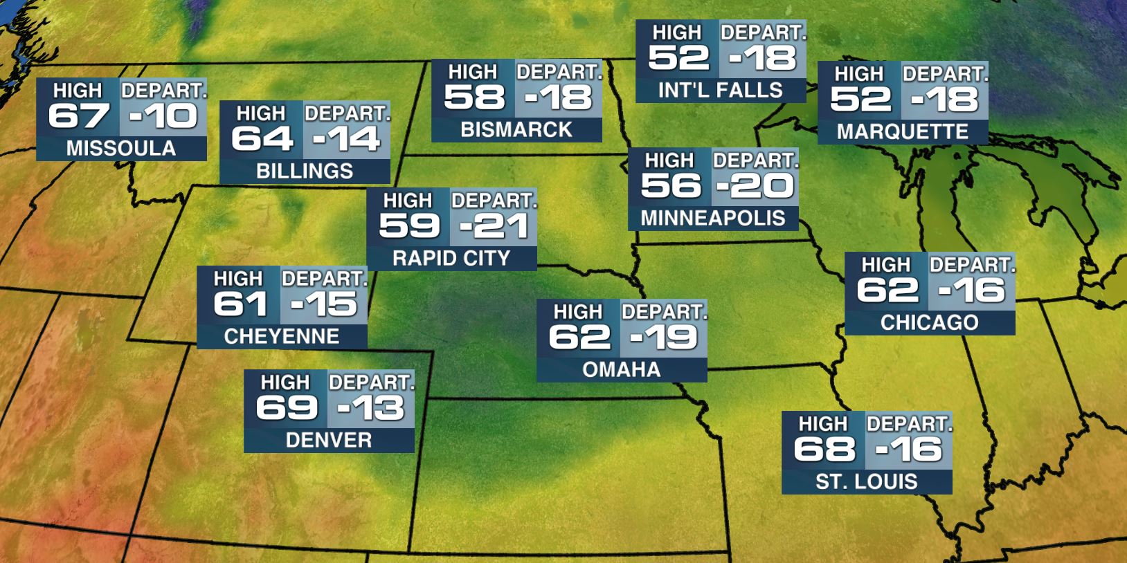
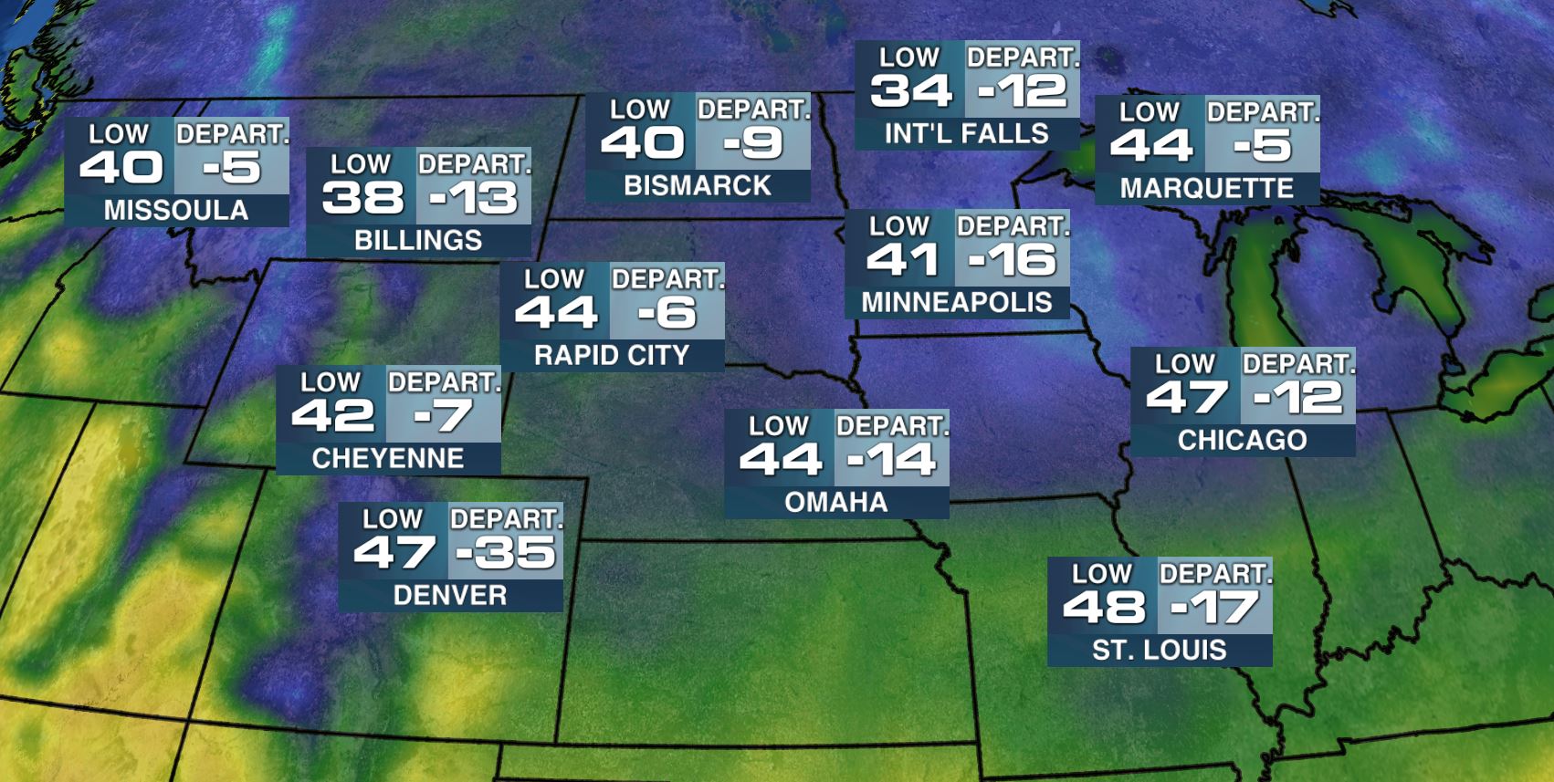
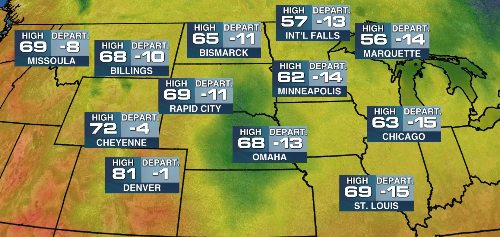
Thanks again to my good friend and colleague for the images below... Here's the progression of the cold air mass by late this week! Note how significantly cold it is during each time period from the highs and lows Wednesday to the highs and lows on Saturday.
Wednesday Highs
Lows AM Thursday
Highs Thursday
Lows AM Friday
Highs Friday
Lows AM Saturday
Highs Saturday
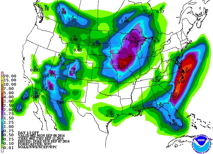
Rainfall Forecast
According to NOAA's HPC, the 3 day rainfall forecast suggests a pretty fair amount of moisture across parts of the Southwest, the Midwest and the Mid-Atlantic regions through early next week. Some of the rainfall could be heavy enough to produce flood concerns in the Southwest.
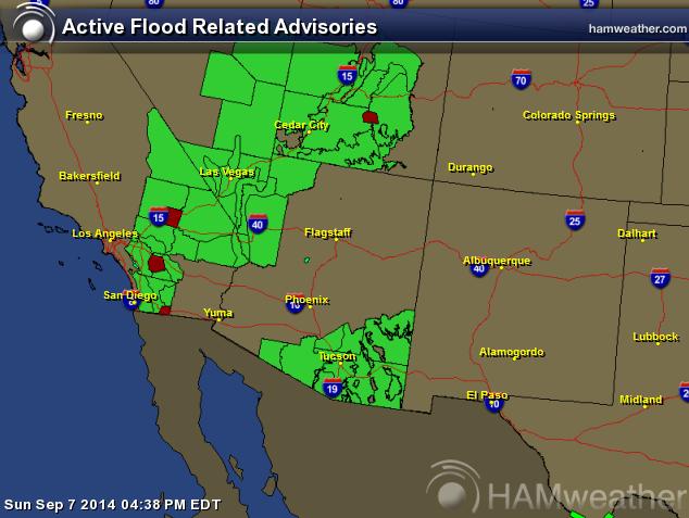
Flood Concerns
The National Weather Service continue Flash Flood watches across parts of the Southwest through Monday as moisture continues to stream north of the remnants of Norbert in the East Pacific.
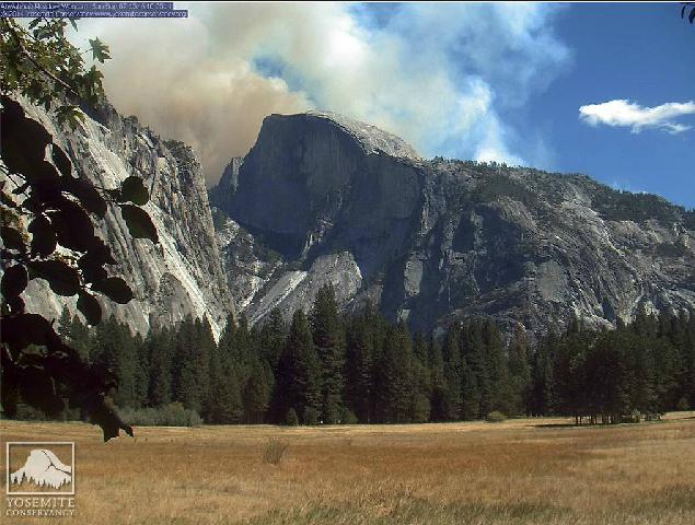
New Fire Near Half Dome
A new fire broke out near Yosemite National Park. Here's the latest from CNN.com:
"Firefighters near Yosemite National Park made gains Saturday afternoon on a wildfire that torched 300 acres, injured one person and forced the evacuation of some nearby homes.
More than 745 fire personnel contained 60% of the wildfire, which ignited Friday, the California Department of Forestry and Fire Protection said.
The Mariposa County Sheriff's Office evacuated an undisclosed number of residents in the Ponderosa Basin area, and authorities said 700 structures were threatened."
Read more from CNN.com HERE:
Thanks for checking in and have a great week ahead! Don't forget to follow me on Twitter @TNelsonWX

No comments:
Post a Comment