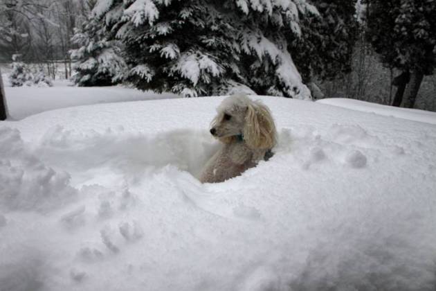
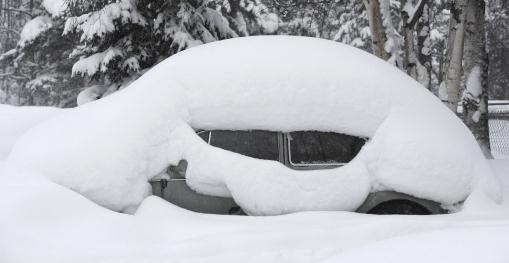
75 F. high Monday in the Twin Cities.
75 F. average high on September 8.
77 F. high on September 8, 2013.
Trace of rain fell yesterday at MSP International Airport.
September 9 in Minnesota Weather History:
1979: 1 3/4 inch hail fell in Douglas County.
1917: Very chilly air over region with 17 degrees at Roseau.
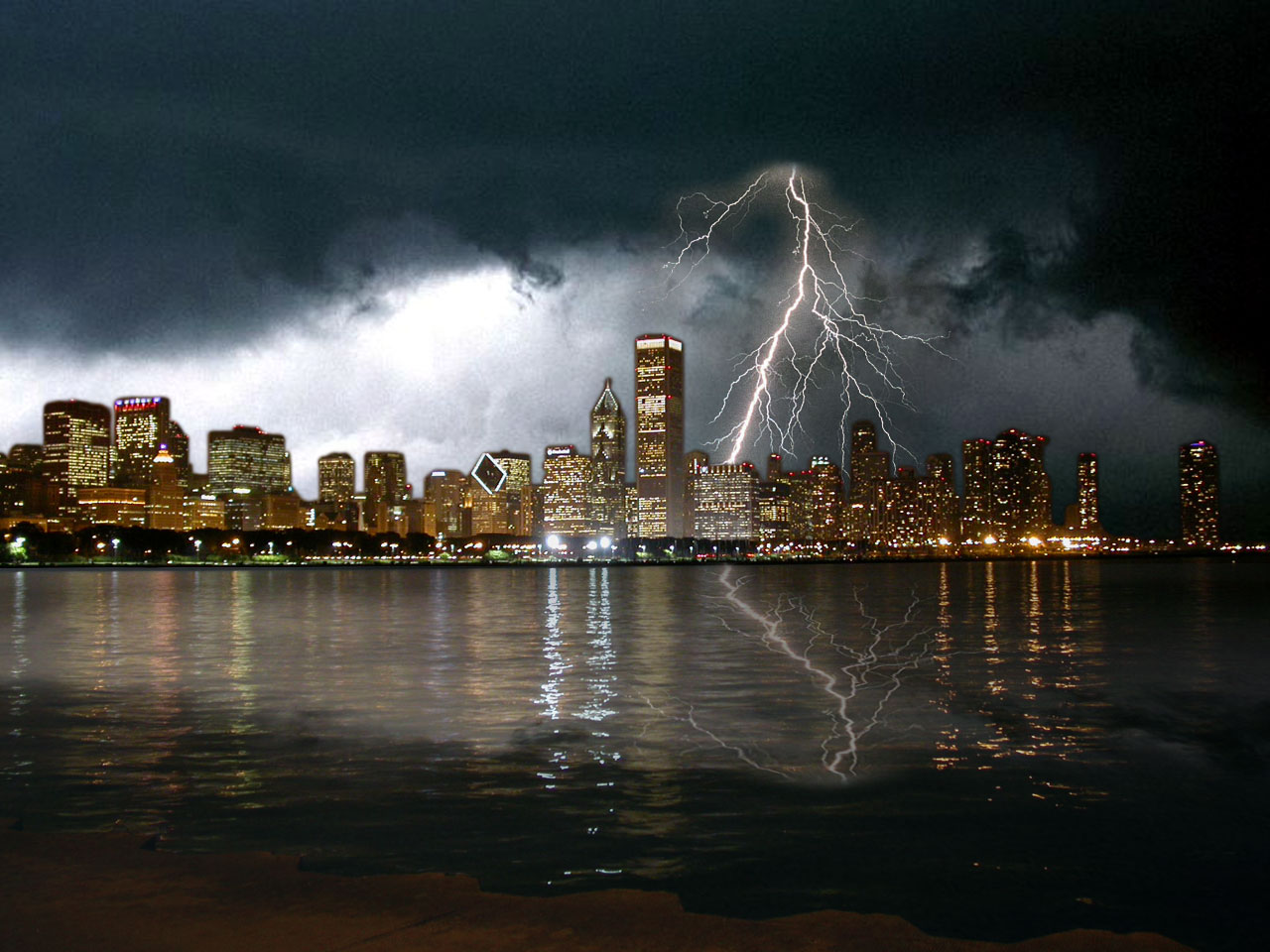
Climate CSI
As
my father likes to remind me: if you're not just a little bit paranoid
you're not paying attention. I would rank low-grade paranoia right up
there with humility, empathy and curiosity; essential attributes for
success in business and life.
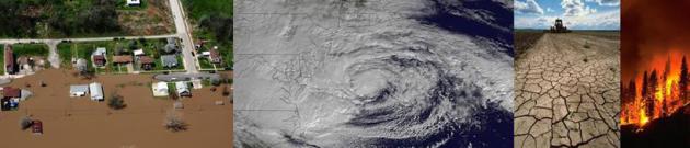
I just returned from San Diego, in a deepening and historic drought. Trees are withering; signs of water stress are everywhere.
Meanwhile
record flash floods hit Phoenix with 3-5 inch rains; a plume of
tropical moisture from ex-Hurricane Norbert fueling monsoon storms.
Along
with thinning arctic ice, shrinking glaciers, warmer, more acidic
oceans, and rising sea levels, heavier summer rains are another symptom
of a warming, increasingly volatile climate system.
Another puzzle piece.
An
October-like storm brushes Minnesota with heavy rain tonight. An inch
may soak the metro with 2-4 inch rains over southeastern Minnesota,
where flash flooding can't be ruled out. A few storms over the southern
third of Minnesota may turn severe later today and tonight. Behind the
storm temperatures tumble into the 50s Wednesday; late week weather
should feel like something out of the third week of October. We wake up
to 30s Saturday (the metro stays frost-free) with 60s returning by
Sunday.
No need to take the boat out yet. Give it a few weeks.
Please!
Severe Threat Later Today.
Lifted index and cape values lead me to believe that a few explosive
T-storms are possible this evening and tonight; a few may turn severe. I
would not be surprised to see severe storm, even rare September tornado
watches issued, especially south of MSP. Source: NOAA SPC.
Increasingly Soggy.
NOAA's 4 KM NAM model prints out some impressive rainfall amounts, as
much as 2-4" for parts of southeastern Minnesota by midday Wednesday.
Over 1" of rain is possible in the Twin Cities metro, followed by a
chilling north wind, gusting to 30 mph on Wednesday. Loop: HAMweather.
A Shot of October.
After mellowing to near 80F today temperatures tumble tomorrow, holding
in the 50s for highs Wednesday into Friday; typical for the third week
of October. We should wake up to 30s Saturday morning before
temperatures warm into the 60s and 70s early next week. The heaviest
rain comes tonight into Wednesday morning along the leading edge of this
autumnal smack. Graph: Weatherspark.
Tidewater Soaking - Monsoon Storms Southwest USA.
National accumulated rainfall predictions (4 KM NAM) show some extreme
rains near Norfolk, Virginia and Las Vegas, another smear of heavy rain
pushing across Iowa and southeastern Minnesota. 60-hour rainfall totals:
NOAA and HAMweather.
Near-Record Dew Points Last Week. Here's a clip from Dr. Mark Seeley's most recent
Weathertalk Newsletter that caught my eye: "...
September
3-4 brought very high dewpoints to many parts of the state, with
readings of 70 degrees F or higher. Montevideo reported a 73 degrees F
dewpoint on the 3rd and 77 degrees F on the 4th, while the University of
Minnesota-St Paul Campus reported a dewpont of 75 degrees F on the 3rd
and 79 degrees F on the 4th of September. These are near record values
for the date..."
El Nino Watch: 6 Months and Still Counting.
Worried about the polar vortex reappearing next winter? ENSO-neutral
winters (no La Nina or El Nino) tend to be unusually harsh. If the
Pacific Ocean does warm significantly into a moderate El Nino event the
odds of bitter, sustained cold diminish a bit. Here's a clip from
Climate Central: "...
The
latest update, issued Thursday, notes that some aspects of the tropical
Pacific’s behavior look more promising than they did at the time of the
last update in early August,
but keeps the likelihood of an El Niño developing at 60 to 65 percent.
“We still believe that the event will occur,” CPC forecaster Michelle
L’Heureux told Climate Central. When might this happen? Sometime in the
September to November time frame, the CPC forecast said. Once the El
Niño does form, it is expected to continue into the early part of 2015.
The event, though, is only expected to be a weak or moderate one,
L’Heureux said..."
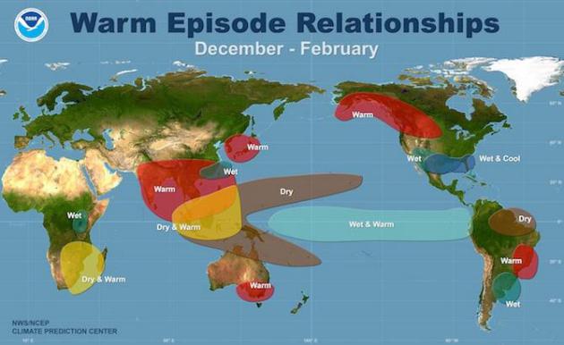
Image credit above: "
The climate impacts typically associated with an El Niño during the months of December, January, and February." Courtesy of NOAA.
Remembering The San Diego Hurricane of 1858. The Weather Channel
has a fascinating story about the rare hurricane that battered the
small town of San Diego in 1858. I don't want to imagine what would
happen if a similar storm struck today. Here's a clip: "The
year was 1858. Abraham Lincoln was running for a seat in the U.S.
Senate. The start of the Civil War was still three years away. A stage
coach trip from Missouri to the young state of California took nearly a
month. And in Southern California, the town of San Diego had grown to a
little more than four thousand people. In the final days of September,
1858, those four thousand people experienced a storm like no other
before it. A hurricane in the eastern Pacific moved northward from the
warm waters of the tropics toward the California coast. This one took a
different path from the usual. Instead of moving away from land, it
headed north-northeast toward the California coast..."
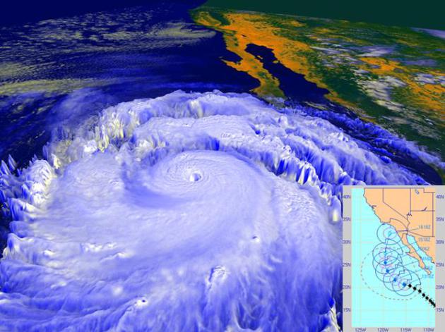
Image credit above: "
In
September 1997, powerful Hurricane Linda, shown in this NASA rendering
created with data from the NOAA GOES-9 satellite, was briefly forecast
to strike Southern California, most likely as a tropical storm, as shown
in the inset forecast track from the Naval Research Laboratory’s Marine
Meteorology Division. The storm eventually turned westward away from
land, but still brought rainfall to parts of Southern California and
high surf." Main image credit: NASA/NOAA Inset image credit: NRL/NCEP.
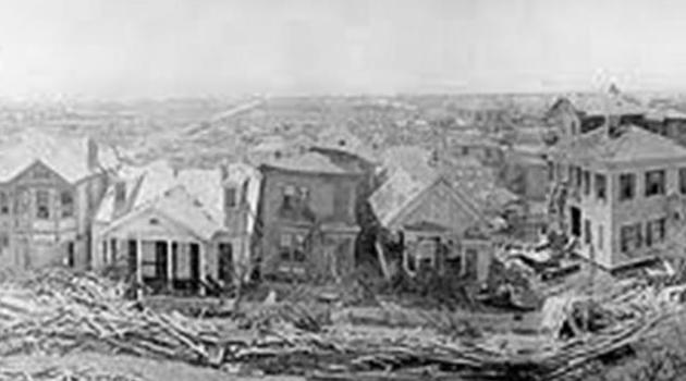
September 8, 1900: When a Hurricane Changed History. There still hasn't been anything as horrific as the Galveston Hurricane of 1900; here's an excerpt of a review at
click2houston.com: "...
On
September 8 - 114 years ago today - Galveston’s path through history
was radically changed. What is known as the 1900 Storm made landfall on
the island as a category 4 hurricane. Much like the Bolivar during Ike,
the storm surge eviscerated the city, which to some extent, is still
dealing with the ramifications today. An estimated 8000 people died,
mostly in Galveston. The 1900 Storm remains the record holder for the
largest loss of life from a natural disaster in the USA..."
Water's Edge.
Reuters
has a thorough, comprehensive and rather remarkable series focused on
rising sea levels. As water warms it expands, and that has implications
for homeowners and businesses along America's coastline. Here's an
excerpt of Part 1: "...
All along the ragged shore of Chesapeake Bay
and the Atlantic coast of the Delmarva Peninsula, north into New England
and south into Florida, along the Gulf Coast and parts of the West
Coast, people, businesses and governments are confronting rising seas
not as a future possibility. For them, the ocean’s rise is a troubling
everyday reality. This is the first in a series of articles examining
the phenomenon of rising seas, its effects on the United States, and the
country’s response to an increasingly watery world. Other stories will
show how other nations are coping..."
Dramatic Proof That California's Drought Is One Of The Worst Ever.
KHON2.com in Honolulu and CNN have the video and story details; here's an excerpt: "...
It’s
a common sight throughout the state — most of California’s major
reservoirs are less than half-full. More than 80 percent of the state is
either in the extreme or exceptional drought category, the highest
levels. It’s meant things like no showers or running water for several
communities, an increase in wildfires, brown and neglected public parks,
and farmers losing their crops. “It’s like mourning. It’s death. Our
product is dead,” said grape farmer Jesse Rodriguez..."
Fields of Green a Desert for Bees.
The Star Tribune
takes a look at whether a new class of insecticides applied on seeds to
reduce the impact of pests may be crippling bee populations in the
process; here's an excerpt: "...
Bayer CropScience, Monsanto and
others in agribusiness say there is no evidence that neonicotinoids are
to blame. Years of research went into their development, including
studies that concluded the low doses bees encounter as they forage for
pollen and nectar are insufficient to kill them, company officials say.
Yet beekeepers, environmentalists and many scientists are raising a
growing chorus of disagreement. Dozens of studies have now found that
low doses of neonicotinoids may not kill bees outright, but can cripple
their highly sophisticated navigational and communication skills, and
hamper a queen’s reproduction..."
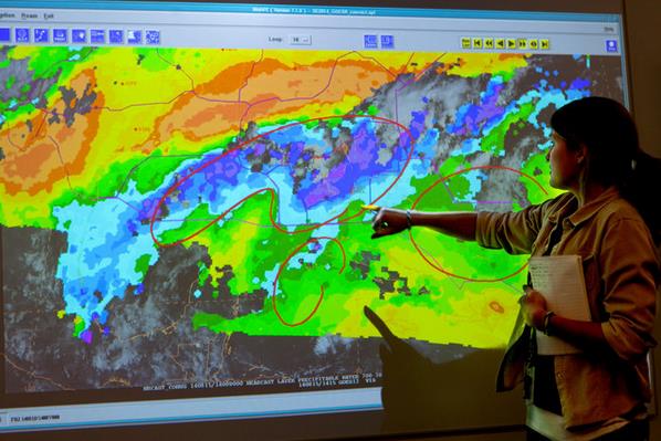
Eyetracking Research Could Improve Tornado Warning Coverage.
How do people process tornado warnings? What do they look at, in which
order (and emphasis) that gets them to take action to protect
themselves? Here's an excerpt of an interesting story at abc13.com in
Toledo, Ohio: "...
Severe weather coverage is busy, from action cams
to radar sweeps and damage pictures. Research with a special eyetracker
machine helps us hone in on what's important. "OK, we have all this
information coming in at the public: audio, sensory, video," Drost
said. "What are they picking up? What are they focusing on to take
into consideration to make the decision on whether they're going to heed
the warning." People respond to warnings based on weather knowledge,
history, emotions, and what's on your TV screen..."
Museum's Tornado Exhibit Injures 8 Children. This one was just too unbelievable not to include in my daily rundown of story links.
Artnet News has the story: "
Thirteen
children suffered acid burns in Reno, Nevada, on September 3 when a
“routine” experiment designed to foster understanding of how tornadoes work went awry. Emergency workers responded to a report of an explosion at the Terry Lee Wells Discovery Museum, the Associated Press reports,
where they determined that the incident was actually a “chemical
flash,” which one spokesman likened to throwing gasoline on a fire..."
Photo credit above: "
The Terry Lee Wells Nevada Discovery Museum in downtown Reno, Nevada."
Photo: Courtesy of nvdm.org.
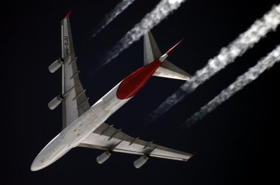
Airlines Take The Bump out of Turbulence. Here's an excerpt of an interesting article at
The New York Times: "...
Turbulence
poses a particular challenge because it cannot be seen by satellite or
radar. But meteorologists use complex weather models as well as reports
from pilots to predict areas of heavy turbulence. Sensors on some planes
operated by Alaska Airlines, American Airlines and Delta Air Lines can
automatically relay turbulence information to dispatchers to look for
alternative routing for later flights. An average of 36 people have been
injured as a result of turbulence each year since 2002, according to
the F.A.A., which records only the most severe cases..."
Photo credit above: "
Amanda Terborg, an Aviation Weather Center meteorologist in Kansas City, Mo." Credit Dan Gill for The New York Times.
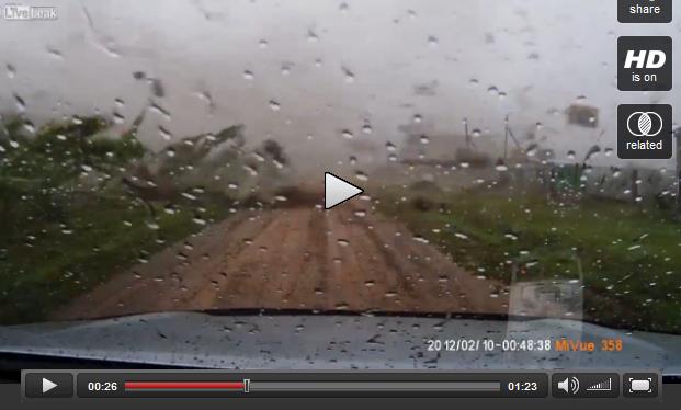
World's Shortest Tornado "Chase"?
You just can't make this stuff up. A weather enthusiast in Russia pulls
out of his garage with the dashcam going, gets onto the road and sees a
tornado coming, pulls back into his garage, which is no longer in one
piece. The video clip at
LiveLeak is worth a look: "
Russian
guy pulls out of his garage just as a tornado arrives. tries to go back
inside but alas, the garage is no more. Note, Dashcam date is
incorrect. This happened only a few days ago (29/08/2014 in Bashkiria,
Russia)..."
Credit: Рябоконь А.Н.
H2OME: Your House At The Bottom of the Ocean. Under the heading of wretched excess this scores an honorable mention; here's the intro to the story at
Gizmag: "
Living
on the bottom of the ocean is not a new concept. It's a theme that has
been visited in literature, cinema, games, and even a few hotels have
capitalized by offering underwater rooms.
However, US Submarine Structures is going one step further, offering
the super rich a commercially-available underwater home with the
luxuries of a 5-star hotel..."
43 1/2 Socks Removed From Dog's Stomach. And here I thought my dog was hungry, good grief.
USA TODAY has a video and story; here's an excerpt: "
Chomping down on 43 1/2 socks was enough to make one 3-year-old Great Dane
pretty sick. After vomiting and retching during the day, abdominal
radiographs revealed "a severely distended stomach and a large quality
of foreign material," according to Veterinary Practice News..."
Photo credit:
DoveLewis Emergency Animal Hospital.
My Past Comes Back to Haunt Me. My sister sent this to me and I must say I'm terribly
embarrassed. The truth: I was young and foolish when I made this movie
back in 1957. My skanky nightclub days are definitely behind me now.
TODAY: Fading sun, still warm. Winds: SE 10. High: near 80
TUESDAY NIGHT: Showers, possible heavy T-storms. Low: 55.
WEDNESDAY: Heavy rain tapers during the morning. Slow PM clearing with a cool wind. N 15-30. High: 57
THURSDAY: Scrappy clouds, jacket-worthy. Wake-up: 43. High: 56
FRIDAY: More clouds than sun. October-ish. Wake-up: 42. High: 58
SATURDAY: Chilly start. Bright sun. Better. Wake-up: 37. High: 61
SUNDAY: Sunny start, clouds increase. Wake-up: 46. High: 65
MONDAY: Another clipper-like shot. Wind-whipped showers. Wake-up: 47. High: 59
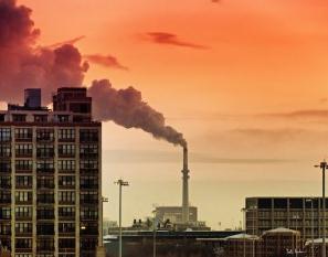
Climate Stories....
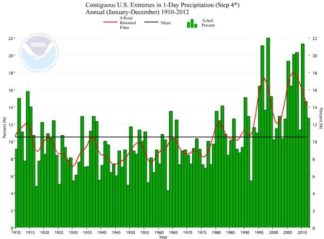
Extreme 24-Hour Precipitation Trends 1910 - 2012. I'm
no rocket scientist, as my wife reminds me daily, but I detect a trend.
Data above (NOAA NCDC) is for the Lower 48 states; trends over the
Southwest USA are flat; Monday's historic rains in the Phoenix area
(3-5+" of rain) were the heaviest one-day totals ever recorded, but some
of this moisture was leftover from Norbert, a fizzling hurricane off
the coast of Baja Mexico.
Extreme Snowfall Events Will Continue Even in Global Warming, Says Study. New research highlighted at
Capital Weather Gang caught eye; here's a clip: "...
Paul
O’Gorman, a professor at MIT’s Department of Earth, Atmospheric, and
Planetary Sciences, used model simulations to investigate the impact of
global warming on both average, day to day snowfall amounts as well as
the extreme snowfall events. He found that while average daily snowfalls
could decrease by 65 percent by the late 21st century, the extreme
snowfall events only decreased by eight percent in the model
simulations. In fact, in some high-latitude cases, the models suggested
that extreme snowstorms could deposit 10 percent more snow..."
Rising Temps. Won't Halt Blizzard Hazard.
At higher latitudes the frequency of blizzards may actually increase,
which I found interesting, which made me ponder whether that's better
than rising sea levels in Florida or perpetual drought in California and
Arizona.
The Daily Climate has more details on the new winter research referenced above: "...
The
study found that, under high warming scenarios, those low-lying regions
with average winter temperatures normally just below freezing would see
a 65 percent reduction in average winter snowfall. But in these places,
the heaviest snowstorms on average became only 8 percent less intense.
In the higher latitudes, extreme snowfall became more intense, with 10
percent more snow, even under scenarios of relatively high average
warming. There is a relatively narrow temperature range − just below
freezing point − at which the heaviest snowfalls seem to occur..."
Why A Tax on Carbon Can Help Climate Change - And The Economy.
We put a price on every pollutant and let the market sort out the rest,
why not carbon, methane and other greenhouse gases? Here's an Op-Ed
from
Forbes that caught my eye: "...
As
he says in the Harvard Magazine interview, “No solution to this massive
problem will make everyone happy, so the best outcome will involve
striking an optimal balance. A carbon tax may do that because it raises
revenue, and thus the additional possibility of redeploying those funds
in ways that stimulate economic growth.” Jorgenson describes what he
calls the “double dividend” (also the title of his book
on this topic). “So in order to achieve the double dividend – curbing
emissions while simultaneously achieving economic growth – you have to
collect the tax and recycle the revenue..."
 Cities Taking Action to Offset Effects of Global Warming, But They Can't Call It That.
 Yes, forget about science, it's all about semantics. Here's a snippet of an AP story at
cjonline.com: "...
Big
cities and small towns are shoring up dams and dikes, using roof
gardens to absorb rainwater or upgrading sewage treatment plans to
prevent overflows. Others are planting urban forests, providing more
shady relief from extreme heat. Extension agents are helping farmers
deal with an onslaught of newly arrived crop pests. But in many places,
especially strongholds of conservative politics, they’re planning for
the volatile weather linked to rising temperatures by speaking of
“sustainability” or “resilience,” while avoiding no-win arguments with
skeptics over whether the planet is warming or that human activity is
responsible..."
The Unbelievably Cheap $10 Billion Plan To Stop Climate Change With Airplanes.
First, I'm not sure you can entirely stop warming, perhaps mitigate and
slow the rate. Second, injecting chemicals into the upper atmosphere to
artificially cool the Earth's surface - what can possibly go wrong?
Here's a clip from a story at
The Motley Fool: "...
There
are some obvious flaws with geoengineering projects of any kind, which
Caldeira and others are quick to promote. For instance, there are
social, financial, and ethical costs and consequences that would have to
be evaluated or dealt with. If it's acceptable to dump carbon dioxide
into the Earth's atmosphere, then is it also acceptable for a single
nation or company to dump sunlight-blocking particles there? After all,
no one country owns the atmosphere -- how would complaints and legal
action be handled?..."
Image credit above: "
Is this all we need to stop climate change?" Source: Sergey Kustov/
Wikimedia Commons.
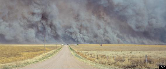
Guest Opinion: Global Warming Makes Firefighting More Dangerous.
The Billings Gazette has an Op-Ed that caught my eye; here's the intro: "
As
former Montana smokejumpers we are increasingly alarmed by the
severity, size, and expense of wildfires. The weather this year in
Montana might give false hope to those who think weather and climate are
the same. But climate is about trends and scientists say that those
trends are proving what our guts have told us for a long time: Climate
change is an increasing problem for firefighters who are facing
increasing risks as a result. Since the 1980s, Montana’s wildfire season
increased by two months while average global temperatures have steadily
trended upward. Climate researcher Steve Running has summarized the
data this way: “Since 1986, longer, warmer summers have resulted in a
fourfold increase of major wildfires and a sixfold increase in the area
of forest burned, compared to the period from 1970 to 1986...” (File photo above: AP).


No comments:
Post a Comment