By Paul Douglas
My oldest son, Walt, summed up an improbable year better than his old man ever could. "Worst winter in 30 years, lousy spring, June monsoons and a delayed summer. I didn't think we could salvage 2014. But this fall has made up for the pain."
On Friday highs topped 80F over parts of western Minnesota; Indian Summer spills into Monday with more 60s. Our lukewarm fall is consistent with recent trends: longer, milder autumns - delaying lake ice formation and persistent snow cover. There are exceptions to every rule, but since about 2000 winter kicks off a few weeks later than it did 50 years ago.
Our weather honeymoon goes off the rails later this week as temperatures tumble. Not exactly arctic but more typical of November.
The overall pattern favors chilly intrusions from Michigan to New England, spinning up a series of big east coast storms. A family of storms will soak the west coast; California seeing some desperately-needed rain in the coming weeks.
In spite of next week's temperature relapse I see a mild, Pacific bias here into November. No idea about March, but it would appear that we'll tip-toe into winter in the coming weeks. Better than a cold slap across the face.
==============
SATURDAY NIGHT: Mostly clear and cool. Low: 39
SUNDAY: Fading sun, still breezy. High: near 63. Winds: SE 10-15
SUNDAY NIGHT: Chance of showers/storms overnight. Low: 50
MONDAY: Peeks of sun. Stray shower early. High: 63
TUESDAY: Mostly cloudy and cooler, feels like October. Wake-up: 43. High: 49
WEDNESDAY: Partly sunny and brisk. Wake-up: 33. High: 47
THURSDAY: Mostly cloudy, feels like November. Wake-up: 35. High: 50
HALLOWEEN: Clear, cool and dry for Walking Dead Reunion. Wake-up: 30. High: 45
SATURDAY: Hard freeze. Bright sun and breezy. Wake-up: 26. High: 47
==============
This Day in Weather History
October 26th
1996: An unusual outbreak of severe occurred across north central Minnesota. Intense low pressure tracking into Minnesota produced blizzard conditions over portions of South Dakota, while further east in Minnesota, unseasonably mild temperatures developed. Temperatures climbed near 70 with dew points in the 50s. 1 to 1 3/4 inch hail and strong winds were reported in Lac Qui Parle, Yellow Medicine, Chippewa, and Swift Counties. These storms produced 12 tornadoes, the largest reported were F2s. Southwest of Alexandria in Douglas County, an F2 tornado with a 9 mile track destroyed several homes. One women sustained broken bones and internal injuries when a portion of her house, with her inside, was flung 200 feet onto the interstate. This tornado also pushed over a 500 pound fuel tank. Tornadoes also touched down in Swift, Kandiyohi, Pope, Stearns, and Isanti Counties.
1985: Indian Summer across Minnesota. Twin Cities hits 70.
================
Average High/Low for Minneapolis
October 26th
Average High: 53F (Record: 83F set in 1955)
Average Low: 36F (Record: 16 set in 1962)
================
Sunrise/Sunset Times for Minneapolis
October 26th
Sunrise: 7:43am
Sunset: 6:10pm
================
Moon Phase for October 26th at Midnight
3.4 Days Since New Moon
===================
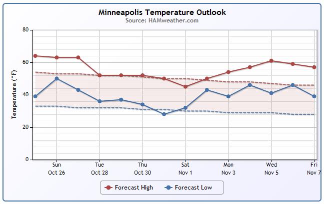
Minneapolis Temperature Trend
After several days of spectacular fall weather, temperatures will take a bit of a tumble at the end of the month/early November. It won't be terribly cold, just more like it should be at this time of the year. Fear not, extended model runs may be suggesting yet another mild stretch of weather close to the MN Deer Hunting Opener... Stay tuned.
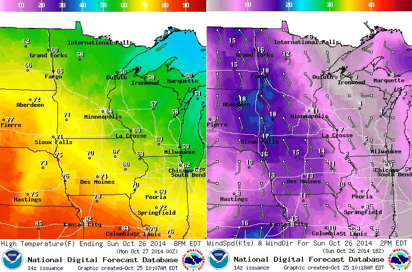
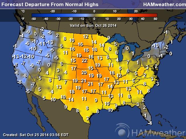
Sunday Weather Outlook
An approaching cold front will bring a few showers/storms to the region late Sunday night. Prior to the arrival of the front, winds will pick up out of the southeast and temperatures will warm to the lower 70s across southern MN. MSP will see highs in the mid 60s once again.
Sunday Night Weather Outlook
A cold front slides through the region on Sunday night and brings a slight chance of showers/storms through the overnight hours. Not much rain is expected... October 2014 has seen 1.75" of rain, most of which fell in the first 2 days of the month; October 1st: 0.68" and October 2nd: 0.78".
Minnesota Weather Outlook
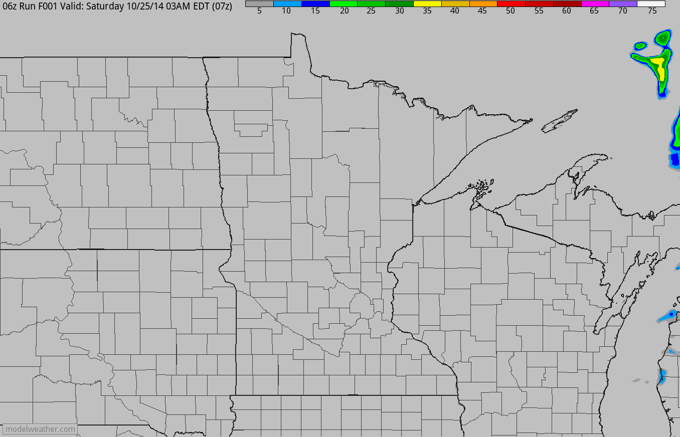
Sunday nights precipitation chance looks to blow through rather quickly with the heaviest precipitation staying across northern Minnesota and into northern Wisconsin. Don't be surprised if you hear a few rumbles of thunder as the front rolls through.
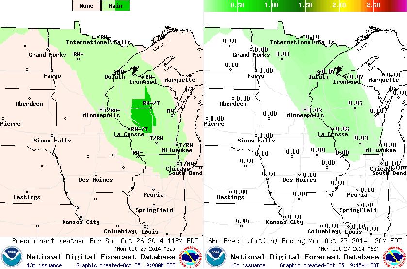
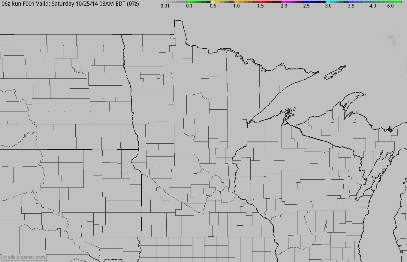
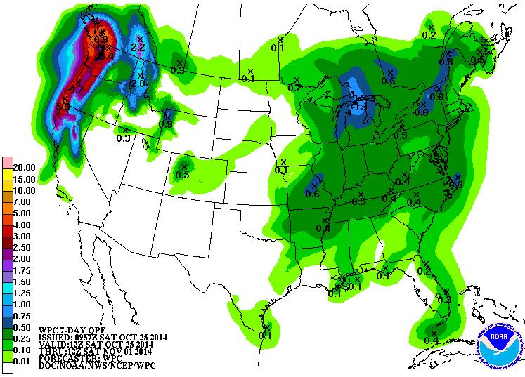
Precipitation Outlook
Here's another look at the precipitation potential as the front slides through the region late Sunday/early Monday. Again note how most of the accumulating rain stays across northern Minnesota and into Wisconsin.
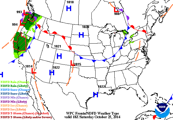
National Weather Outlook
Our rain/thunder chance that rolls through on Sunday night/early Monday is actually part of a much larger area of low pressure in the western U.S. that has been blasting that area with heavy wind and lots of precipitation. Post front, temperatures will drop enough of bring a wintry mix to the Mountains and even some accumulations at lower elevations.
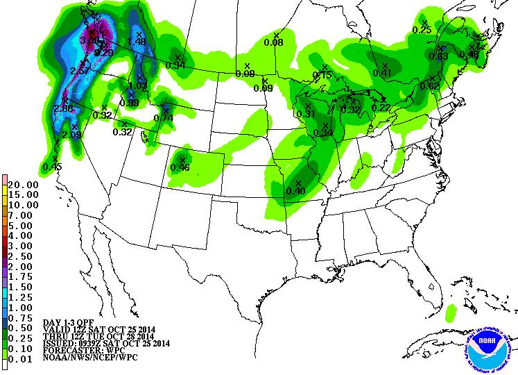
National Precipitation Outlook
Heavy precipitation will continue in the northwestern part of the nation, especially along the coast and the Cascades. Some of this moisture in the western U.S. will be in the form of snow!
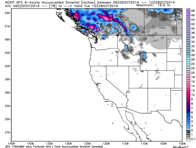
Western Snowfall Potential
Although the snow potential isn't much through early next week, it's just another sign of things to come. This is one of the first big western storms of the season and it's just a matter of time before a similar storm with cold enough air buries the mountains! I'm sure skiers and snowboarders are getting anxious.
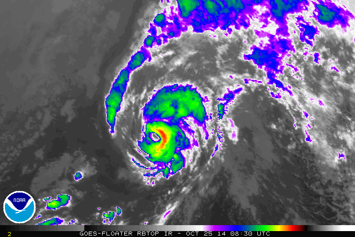
Ana Lives!!
As of early Saturday, Ana was a weak category 1 hurricane with sustained winds of 75mph! If you remember, Ana was the storm that impacted the Hawaiian Islands last weekend. It's not all that often that you see tropical systems in the Central Pacific this far north.
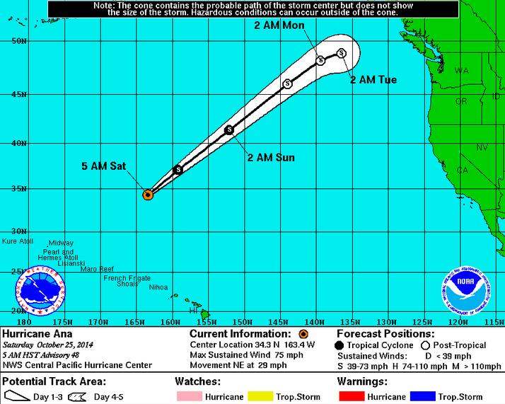
Tracking Ana
As of Saturday, the Central Pacific Hurricane Center had Ana becoming a Tropical Storm over the weekend, but it could potentially stay a Tropical Storm through early next week! Keep in mind that this storm will help to bring more heavy precipitation to the Pacific Northwest through the early part of next week.
Looking Ahead... Sunday
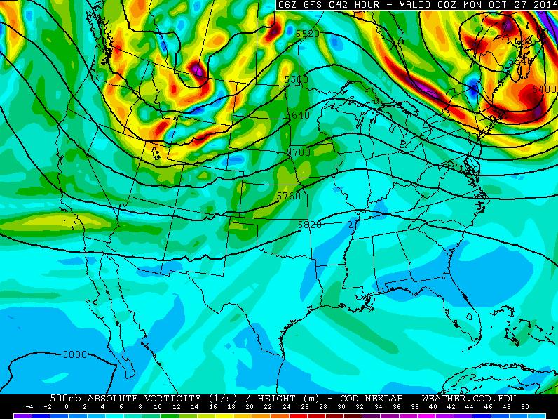
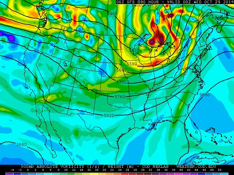
The image below shows the upper level 500mb vorticity (spin) by PM Sunday. Note the trough over the Northwest, this feature (bringing cooler, windy and wet weather to the Northwest now) is kicking our warm and dry weather east. Prior to the trough moving in, temperatures on Sunday will be quite warm over the central U.S..
Heavy Northwest Precipitation
According to NOAA's HPC, the 7 day precipitation outlook suggests several inches of precipitation possibly through the week ahead. Flood concerns could become an issued if this keeps up.
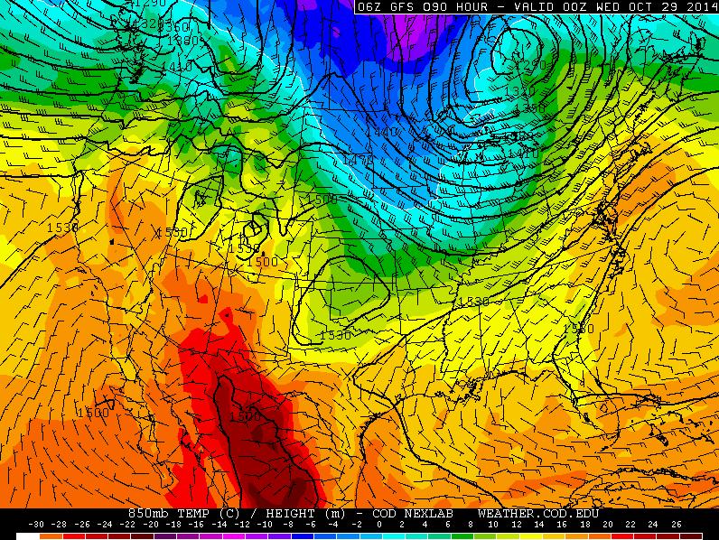
Here's the 850mb temperature outlook for Sunday and note the large bubble of warmth taking up residence in the central part of the country.
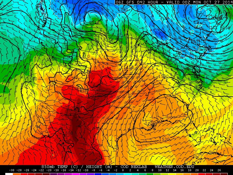
Temperatures on Sunday will still be well above normal prior to the trough of low pressure moving through.
Looking Ahead... Tuesday
The trough of low pressure by Tuesday will have moved into the Great Lakes Region with some much colder temperatures moving in as well.
The 850mb temperature profile by Tuesday shows the much colder air moving into the Midwest/Great Lakes by then. Temperatures could actually be cold enough near the international border for a little wintry by midweek!
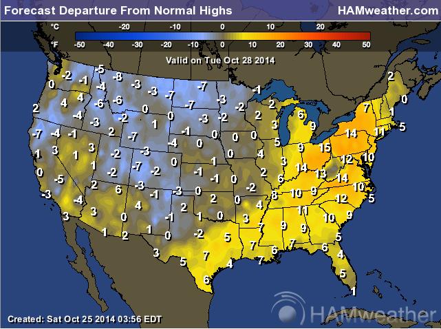
Tuesday's high temperatures will certainly be MUCH cooler than what we've been dealing with, but interestingly, that will be closer to where we should be at this time of the year!
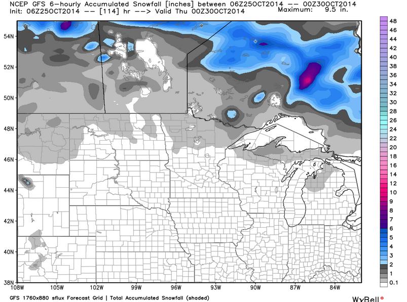
Midweek Snow Potential?
Some of the extended model runs are suggesting a slight chance of a little wintry mix/snow as the weather feature mentioned above moves through midweek. It appears that any non-accumulating snow potential looks to stay across northern Minnesota. Keep in mind that MSP averages 0.6" of snow in October and we've seen 0.0" this year!
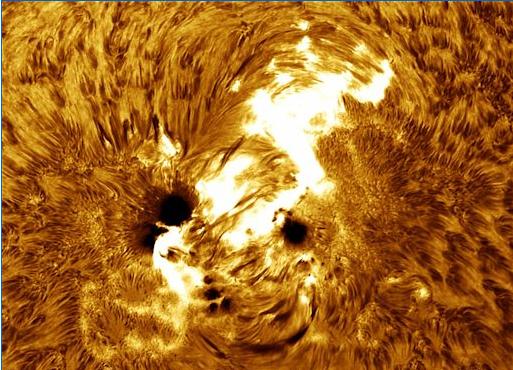
X-Flare Causes Radio Blackouts??
Here's an interesting story about a very large sunspot is creating minor radio blackouts here on Earth...
"A pulse of extreme UV radiation from the flare ionized the upper layers of Earth's atmosphere, causing a brief but strong blackout of HF radio communications over the dayside of Earth. Such blackouts may be noticed by amateur radio operators, aviators, and mariners.
Coronagraph data from the Solar and Heliospheric Observatory (SOHO) suggest that the explosion did not hurl a significant CME toward our planet. (Interestinngly, none of the X-flares from this active region has so far produced a major CME.) As a result, Earth-effects may be limited to the radio blackout."
Read more from www.Spaceweather.com HERE:
Thanks for checking in and have a great rest of your weekend! Don't forget to follow me on Twitter @TNelsonWX

No comments:
Post a Comment