23 F. high in the Twin Cities Wednesday.
31 F. average high on December 3.
36 F. high on December 3, 2013.
December 3, 1886: Minneapolis hits a record setting 15 degrees below zero
Wintry Intermission
Are
weather extremes becoming more extreme over time, or is all this talk
of increased volatility nothing but "alarmist hype"? Minnesota just went
from the warmest year on record in 2012 to the worst winter in 30
years. From nagging drought in 2013 to the wettest June, statewide, in
2014.
We've always had our ups and downs but the weather roller coaster ride seems to be wilder than ever.
Steeper and deeper, with more twists and turns than a Stephen King novel.
It's probably not your imagination.
There's
growing evidence that jet stream steering winds are becoming amplified
over time; more erratic and meandering than average, resulting in some
jaw-dropping cases of weather whiplash.
For example: November was
the 9th coldest on record. Now weather models show temperatures topping
50 by mid-December. Warm enough for rain days before the Winter
Solstice? It looks like it.
A shift in the pattern, possibly a
symptom of El Nino warming of the Pacific, pushes a parade of storms
into California, turning our winds aloft to the southwest next week.
That could mean 40F by late next week, maybe a few days above 50 in
mid-December.
No big storms are brewing but a cold twist aloft
sparks a wet snow Sunday/Monday. That may be our last best hope for a
white Christmas this year.
Hang on!
* File photo from Valleyfair courtesy of Carlos Gonzales at The Star Tribune.
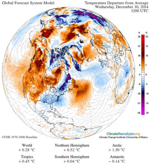
Temperature Anomalies Next Wednesday.
Climate Reanalyzer, valid 12z next Wednesday, December 10, shows a
surge of Pacific warmth pushing into the western half of Minnesota and
western Canada with temperatures 10-20 degrees above average. That
should translate into a 1-2 week thaw for much of the northern tier of
the USA.
Forecast temperature anomaly obtained using Climate Reanalyzer (http://cci-reanalyzer.org), Climate Change Institute, University of Maine, USA.
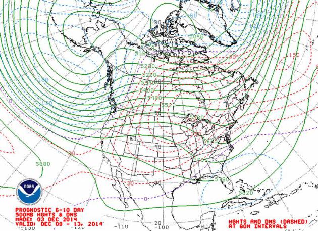
Shifting Gears.
Upper level steering winds are transitioning to a strong zonal flow
into the second and third week of December; a series of powerful storms
tracking across the Pacific into California, pushing an abnormally warm
bubble of high pressure into the Rockies and Plains, resulting in a
taste of March. 500 mb winds from December 9-13 courtesy of NOAA.
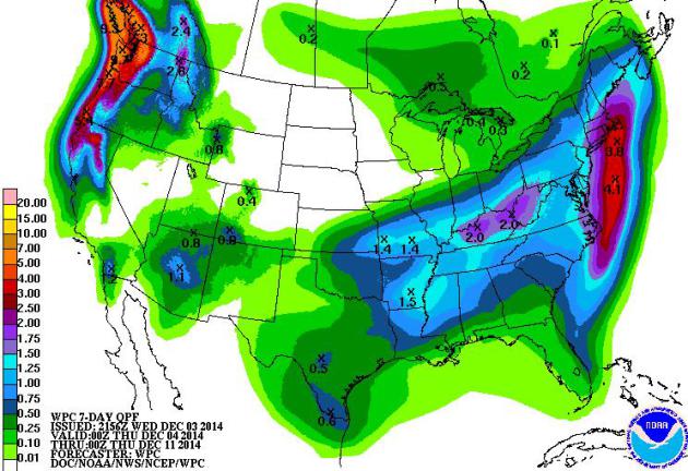
Stormy Book-Ends.
The pattern favors a series of coastal storms impacting New England in
the coming days, with more storms plowing into the west coast over the
next 1-2 weeks; relatively dry weather east of the Rockies. 60-hour
accumulated precipitation forecast: NOAA NAM and HAMweather.
Pacific Northwest Flood Potential.
The storm that pushed into California late Tuesday into Wednesday
sparked flash flooding, mudslides and huge traffic delays. Models show
the heaviest rain over the next week from northern California into the
Pacific Northwest, where some 6-8" rainfall amounts are predicted. 7-Day
QPF: NOAA.
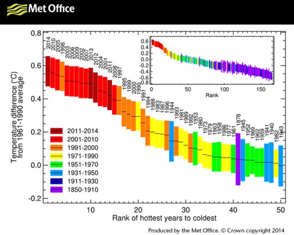
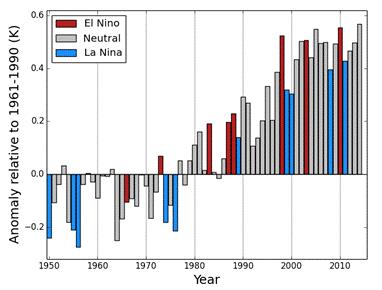
2014 Headed Toward Hottest Year on Record - Here's Why That's Remarkable. Joe Romm takes a look at 2014 temperature records, in spite of a lack of El Nino. Here's an excerpt from
Think Progress: "...
What
is remarkable, as the WMO explains, is that we’re headed toward record
high global temps “in the absence of a full El Niño-Southern Oscillation
(ENSO).” We get an El Niño “when warmer than average sea-surface
temperatures in the eastern tropical Pacific combine, in a
self-reinforcing loop, with atmospheric pressure systems,” which affects
weather patterns around the world. It’s usually the combination of the
long-term manmade warming trend and the regional El Niño warming pattern
that leads to new global temperature records. But not this year..."
* Graph above courtesy of
The U.K. Met Office.
2014: Hottest - Or One Of The Hottest On Record, Worldwide. Here's an excerpt of a post at
The World Meteorological Society (WMO) that caught my eye: "
The
year 2014 is on track to be one of the hottest, if not the hottest, on
record, according to preliminary estimates by the World Meteorological
Organization (WMO). This is largely due to record high global sea
surface temperatures, which will very likely remain above normal until
the end of the year. High sea temperatures, together with other factors,
contributed to exceptionally heavy rainfall and floods in many
countries and extreme drought in others..."
2014 On Track To Be England's Hottest Year In Over Three Centuries. I'll bet it's another coincidence.
The Guardian has the story - here's the introduction: "
2014
is set to be England’s hottest year in over 350 years, according to the
world’s longest continuous record, with climate change at least partly
to blame. The whole world has had a warm year and global data, released
later on Wednesday, is likely to indicate a new record. Higher
temperatures cause more evaporation and more rain, and 2014 began with
England’s wettest winter in over 250 years, leading to widespread flooding..."
File photo above: "
A
tourist photographs the view from Primrose Hill in north London as
others enjoy the unseasonable hot and sunny weather in London as they
look over the commercial centre of central London on Friday, Oct. 31,
2014. The capital is set for its hottest Halloween on record as
temperatures soar as high as 21C (69.8F) in the capital." (AP Photo/Rob Taggart)
*
The BBC
reports on a 75% probability that 2014 will go down in the record books
as the U.K's hottest year since records were first started in 1772.
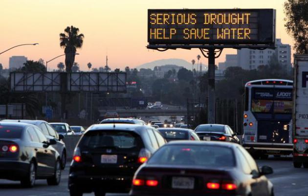
How Unusual Is The 2012-2014 Drought? According to a new research paper submitted to
The Wiley Online Library it may be the worst in 1200 years. Here's an excerpt of the paper's abstract: "...
We
demonstrate that while 3-year periods of persistent below-average soil
moisture are not uncommon, the current event is the most severe drought
in the last 1200 years, with single year (2014) and accumulated moisture
deficits worse than any previous continuous span of dry years..."
Photo credit: AP Photo/Richard Vogel, File.
TODAY: Clouds increase, not as cold. Winds: S 10-15. High: 29
THURSDAY NIGHT: Patchy clouds. Low: 23
FRIDAY: Mostly cloudy, thawing out. High: 34
SATURDAY: Sunny, slightly cooler. Wake-up: 15. High: 28
SUNDAY: Sloppy PM mix changes to wet snow. Wake-up: 19. High: 33
MONDAY: Snow tapers to flurries. Sloppy AM. Wake-up: 26. High: 29
TUESDAY: Blue sky, late-day thaw expected. Wake-up: 16. High: 32
WEDNESDAY: Breezy. Grilling weather. Wake-up: 22. High: 36
* Temperatures may rise into the 40s late next week.
Climate Stories...
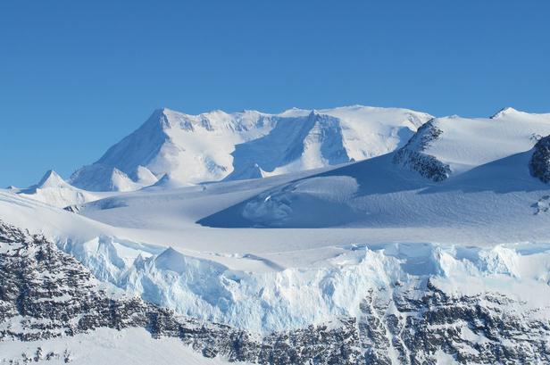
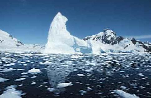
The Rate of Melting Ice in Antarctica's Most Vulnerable Region Has Tripled.
Slate has the story - including a clip that made me do a double-take: "...
In
fact, the melt rate in West Antarctica’s most vulnerable region, the
Amundsen Sea Embayment, has tripled over the last decade, according to new research
released on Tuesday. The total glacier loss averaged 91.5 billion tons
per year according to the study, which means that every two years for
the last two decades it lost a water weight equivalent to Mt. Everest.
The loss rate has only been getting worse, accelerating by an average of
6.7 billion tons per year since 1992..." (File photo: James Yungel, NASA).
The Last Time The Arctic Was Ice-Free In The Summer, Modern Humans Didn't Exist. Meteorologist Eric Holthaus at
Slate provides perspective at Slate; here's an excerpt: "...
1 year ago, atmospheric carbon dioxide reaches 400 parts per million for the first time in at least 800,000 years,
probably longer. It took 100,000 generations for human ancestors to
transition to something resembling us. For each of those 100,000
generations, the planet was crowned with ice. Now, that ice will
probably go away. That incredibly rapid rate of change—10 times faster than any change recorded over the past 65 million years—is extinction-worthy..."
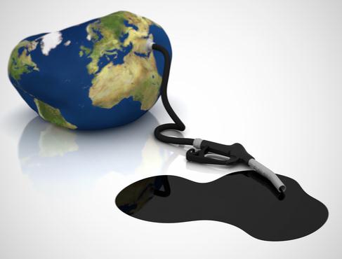
The "Carbon Bubble". Why Fossil Fuels Could Be A Far Riskier Investment Than You Think. Andrew Freedman at
Mashable has an interesting story - here's his introduction: "
There
are increasing signs that the financial sector is picking up on the
fact that, if we are going to have a decent shot at limiting manmade
global warming to the level that world leaders have already agreed to,
oil and gas companies are going to have to leave much of their proven
oil and gas reserves in the ground, rather than exploiting them for
profit. This, in turn, could mean that fossil fuel companies are a far
riskier investment option for individuals and institutions than most
people realize, effectively creating a "carbon bubble" that could
destabilize the world economy..." (Image credit: Clean Technica).
Evangelicals Add Support For EPA Plan To Cut Coal Pollution. Here's an excerpt from a story at
The Washington Post: "
Evangelicals
are teaming up with environmentalists to support the Obama
administration’s Clean Power Plan to substantially reduce carbon dioxide
emissions from coal-burning power plants. The Rev. Mitchell Hescox,
president and CEO of the Evangelical Environmental Network, submitted
comments from more than 100,000 “pro-life Christians” who he said are
concerned about children’s health problems that are linked to unclean
air and water..."
Weird Arctic Weather Causes Near-Disaster In Northernmost Town.
Inside Science has the details of some truly head-scratching weather in 2012; here's an excerpt: "...
The
snow and ice on the islands melted. It rained for days and the high
temperatures lasted for two weeks. Permafrost, the frozen soil that can
reach hundreds of feet deep, started to melt. Then it got cold again and
everything froze over. Snow collected in potentially deadly avalanches.
The remote islands were cut off from the European mainland. Wildlife
died. Although Norwegian scientists believe this was a once-in-500-year
event, climate change may bring more winters like the winter of 2012,
and it is happening elsewhere..."
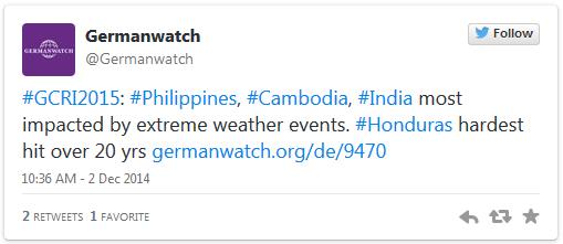
India, Cambodia, Philippines Top Climate Risk Index.
Deutsche Welle takes a look at countries most vulnerable to climate volatility and rising seas; here's an excerpt: "...
These
results show the particular vulnerability of poor countries regarding
climate risks, despite the fact that the absolute monetary damage in
rich countries is substantially higher," Germanwatch reported.
Germanwatch used data from reinsurance company Munich Re and the
International Monetary Fund, basing its index on death tolls from
extreme weather - droughts, floods, storms and more - deaths per 100,000
inhabitants, absolute economic losses and losses as a percentage of
gross domestic product. The group could not project its Climate Risk
Index into the future, although the text held plenty of warnings..."
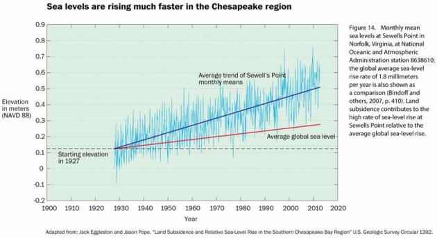
The Yoga-Mat Effect. Why The D.C. Region Is Literally Sinking Into The Sea.
Land subsidence is combining with thermal expansion of warming ocean
water to create more problems for coastal regions, especially at high
tide, full moons and major storms, hurricane or otherwise. Here's a clip
from
The Washington Post: "...
In
the Chesapeake region, it’s believed that land subsidence has
contributed to about half of the measured rise in sea levels in the last
century. Some of that comes from removing water from underground, and
some of that is glacial isostatic adjustment. Reducing fossil fuel
emissions will tame some of the sea level rise, but it won’t fix the
natural sinking of the land. Which means that in places like the
mid-Atlantic, communities will have to adapt to the increased flooding
and inundated backyards..."


No comments:
Post a Comment