The Right Stuff
By Paul Douglas
"What a severe yet master artist old Winter is..no longer the canvas and the pigments, but the marble and the chisel" wrote John Burroughs in 1866. That was well before gas-powered furnaces, heated car seats and 24-hour weather channels. Which confirms my theory that Minnesota was settled during the summer months; dazed pioneers hanging on for dear life during fierce winters. Ever optimistic for the future.
To be Minnesotan is to live in a perpetual state of atmospheric forgiveness. "A warm front is coming - better days ahead!" Amen.
Average temperatures blip upward during the third week of January, responding to a higher sun angle.
On this date in 1888 the metro woke up to -29F. A slow-motion worldwide warming hasn't eradicated cold fronts just yet but the Twin Cities aren't seeing -20s or -30s anymore.
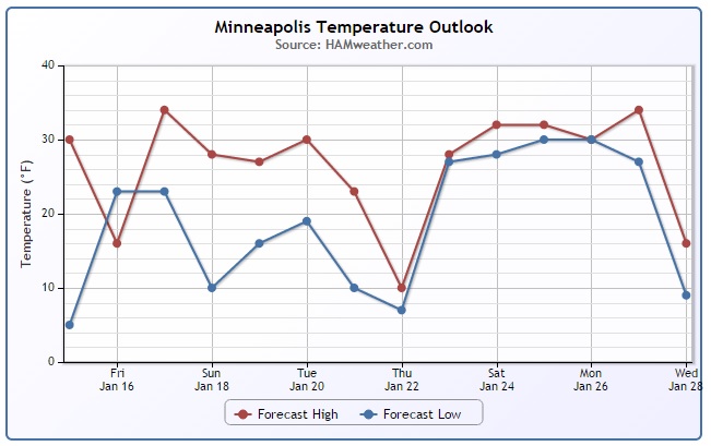
Computer models show another arctic swipe from late next week into the end of January; more single-digit highs and subzero lows, but probably not as cold as last week. In the meantime enjoy a few days above 30F into midweek.
No wind chill or crummy commutes, just a canopy of fog and crud. What's your preference: gray and 32F or bright sun and zero? We should sample both.
==========
THURSDAY NIGHT: Patchy clouds, chance of light snow late. Low: 17
FRIDAY: More clouds a few flurries early. High: 28
FRIDAY NIGHT: Mostly cloudy and quiet. Low: 24
SATURDAY: Mild start, flurries, cooling off late. High: 36
SUNDAY: Some sun, still above average. Wake-up: 24. High: 32
MONDAY: Gray with a coating of flurries possible. Wake-up: 18. High: 29
TUESDAY: Nuisance snow. Light coating? Wake-up: 20. High: 28
WEDNESDAY: More clouds than sun. Wake-up: 18. High: 26
THURSDAY: Cooler, chance of light snow. Wake-up: 10. High: 20.
===============
This Day in Weather History
January 16th
1921: Winds gusting up to 59 mph created a sand blizzard across southwest Minnesota and a snowstorm across the north.
===============
Average High/Low for Minneapolis
January 16th
Average High: 23° (Record 43° set in 1961)
Average Low: 7° (-32° set in 1977)
==============
Sunrise/Sunset Times for Minneapolis
January 16th
Sunrise: 7:47am
Sunset: 4:59pm
==============
Temperature Trend for Minneapolis
Thanks to a VERY frigid past couple of weeks, January temperatures are running nearly 9.5° below average so far this month. The good news is that readings will be quite a bit warmer over the next several days with nothing Arcitc in sight in the foreseeable future! Climatologically speaking, this is about the coldest time of the year, so to have readings nearly 10° above average - we're doing alright!
==============
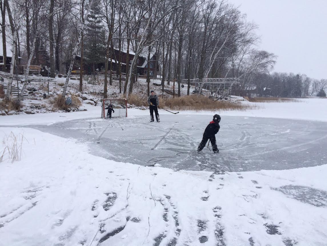
All Things Hockey??
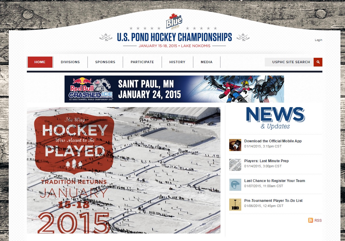
This weekend will hold a special place in my heart. Not only will the U.S. National Pond Hockey Championships be played at Lake Nokomis, but Saturday is Hockey Day in Minnesota, probably one of my favorite days out of the entire year!
Events for the U.S. Pond Hockey Championship can be found on their website HERE:
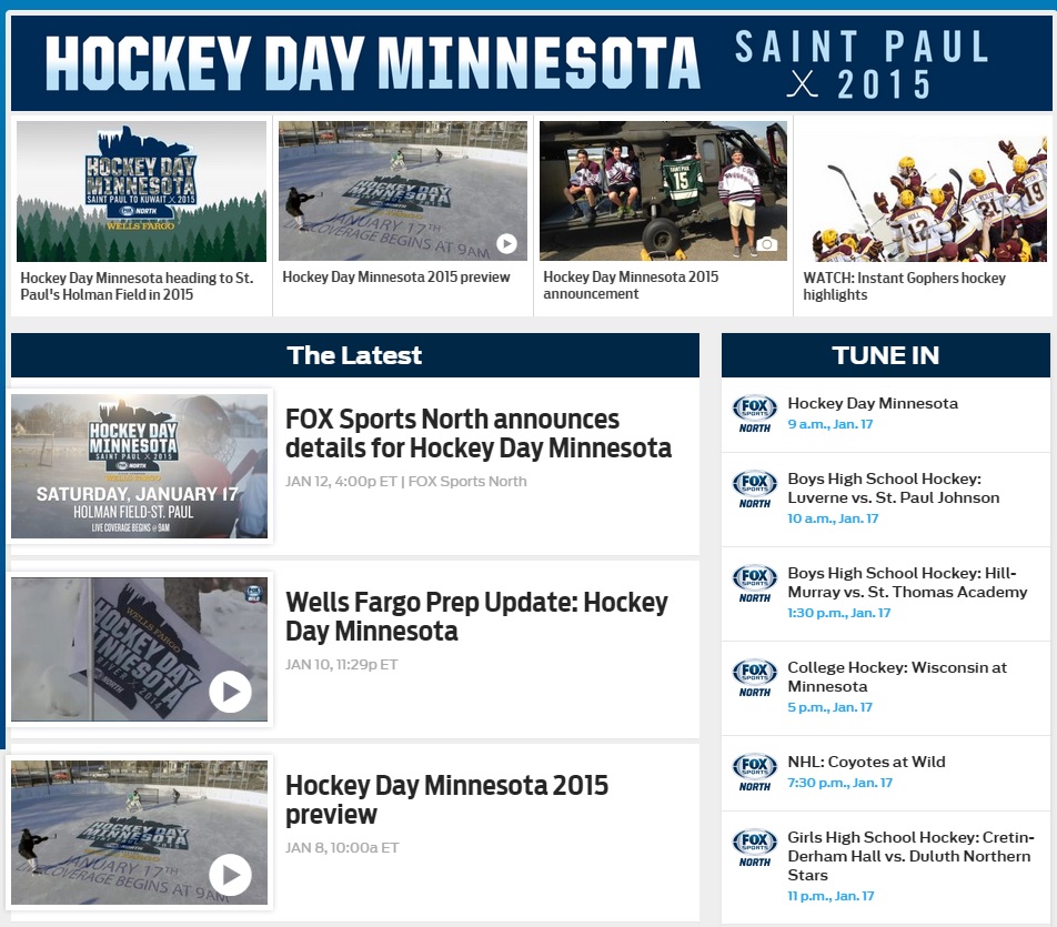
Hockey Day in Minnesota
Hockey Day in Minnesota is a pretty big deal for me. I tend to find myself on the couch watching hockey for several hours. This year, it falls on Saturday, January 17th with nearly a full day of hockey coverage on FSN. From MNB High School Hockey games to the MN Golden Gophers to the MN Wild, it'll be a great day! Take a look at the line-up on FSN HERE:
Mild Saturday Ahead
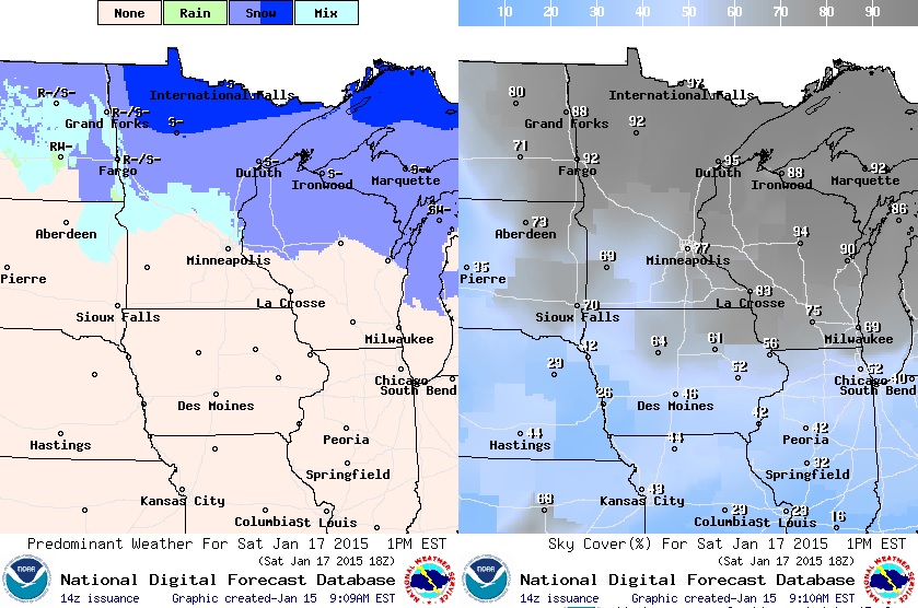
Weather conditions on Saturday will actually quite warm. In fact, we could sneak up into the mid/upper 30s, which will be the warmest since just before Christmas! This will be ahead of another fast moving clipper system that will stay mainly across the northern part of the state. Note that temperatures may even sneak up close to 40° in southwest Minnesota! A cold front will push through later in the day with winds becoming breezy late in the day. Temperatures Sunday look to cool down a bit, but it won't be anything like we've seen so far this month and certainly nothing Arctic!
Saturday Highs Temps & Winds
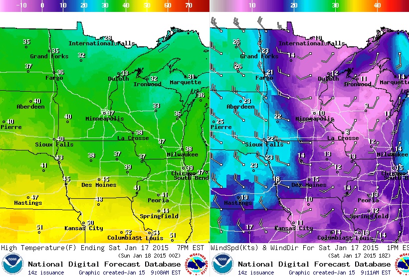
Saturday's Weather at 1pm
Partly to mostly cloudy skies will give way to a little wintry mix, mainly across the northern half of the state. There could be some light snow accumulations across the far north as well!
Minnesota Snowfall
The winter of 2014-2015 has actually been a fairly lack-luster winter so far. Other than being a little colder than normal, we are nearly 8" below average snowfall so far this season! Most climate locations around the state are reporting seasonal deficits as well:
St. Cloud: -0.7" Below Average
Rochester: -0.9" Below Average
Duluth: -14.9" Below Average
International Falls: -3.7" Below Average
Fargo: -18.5" Below Average
Sioux Falls" -0.4" Below Average
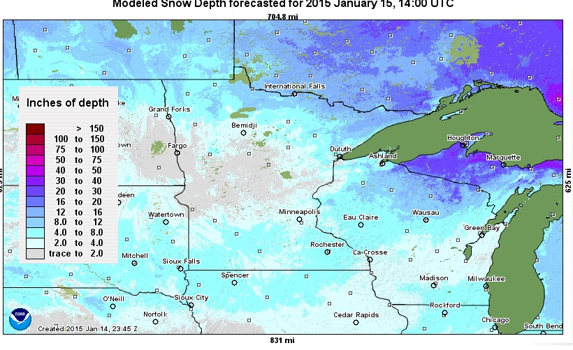
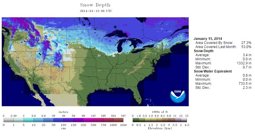
As of Thursday, January 15th, there was 4" of snow reported on the ground at the MSP Airport, 6" of snow on the ground in Duluth and 13" of snow on the ground in International Falls. Note the void of heavy snowpack over central Minnesota in the graphic below.
National Snow Coverage
According to NOAA's NOHRSC, nearly 50% of the nation was covered in snow on January 15th. Interestingly, so of that snowpack covered parts of the Texas Panhandle! That just goes to show you how cold it has been as of late.
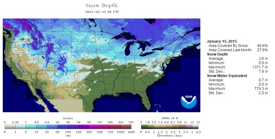
As of last year on January 15th, only 27% of the nation was covered in snow.
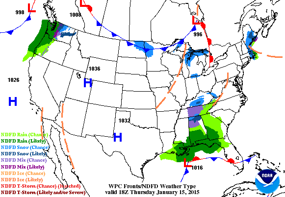
National Weather Outlook
Weather conditions across the nation look fairly quiet heading into the end of the week. There doesn't appear to be any major storm systems meandering into the middle part of the country, but heavy Pacific moisture will continue to inundate the Pacific Northwest through the weekend.
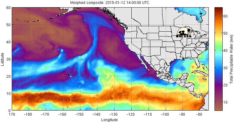
Heavy Precipitation Setup For Pacific Northwest
The Precipitable Water Vapor Loop below shows a pretty interesting setup, which will help to dial up significant amounts of precipitation for the Pacific Northwest. Note the plume of moisture that is gathering from just west of the Hawaiian Islands to near the Pacific Northwest. Often times, when this type of feature shows up, lots of moisture get deposited along the West Coast and that's exactly what we'll be seeing over the next several days.
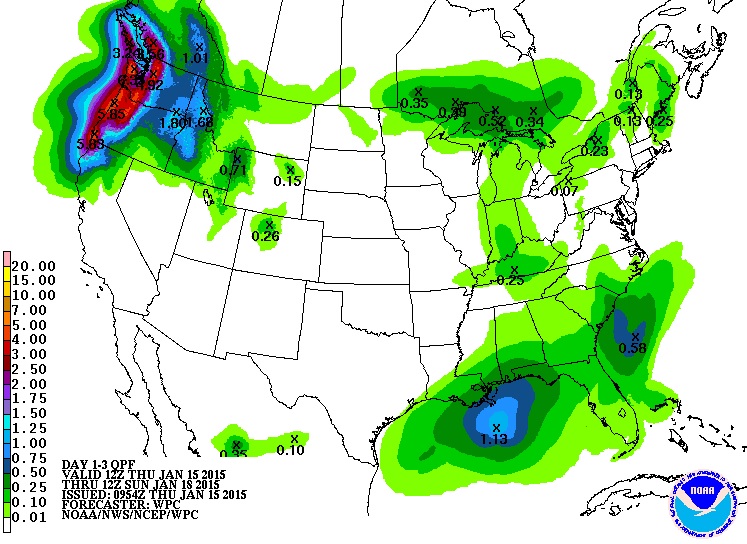
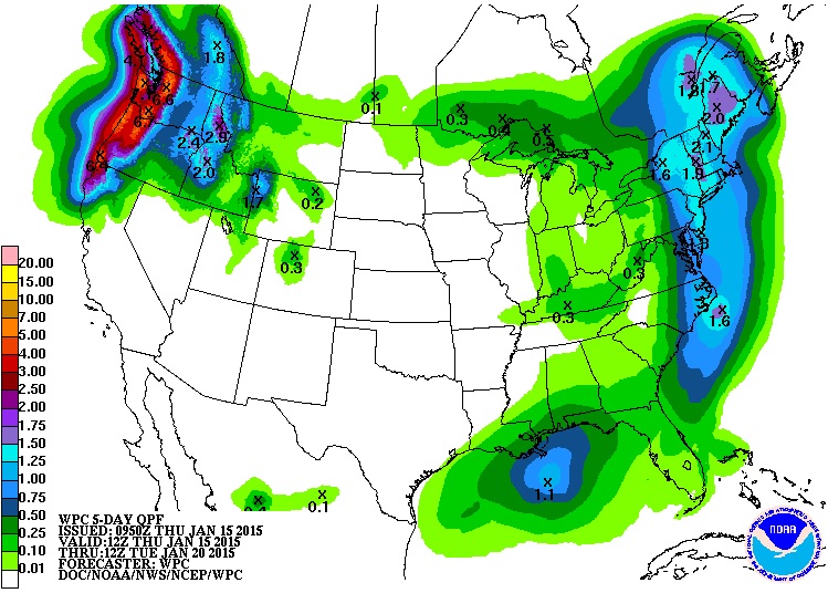
Precipitation Outlook Next 3 Days
According to NOAA's HPC, the 3 day precipitation outlook shows quite a bit of moisture in the Northwest corner of the nation. Nearly 3" to 6" of liquid can't be ruled out through AM Sunday! Keep in mind that coastal communities will see mostly rain, while higher elevations will see mostly snow!
Precipitation Outlook Next 5 Days
Here is the precipitation outlook over the next 5 days, which suggests even more liquid sloshing around in the Northwest through early next week. There also appears to be fairly decent surge of moisture lifting north along the East Coast into early next week. Temperatures also appear to be cold enough for a little snow, so we'll have to keep an eye on the snowfall potential then!
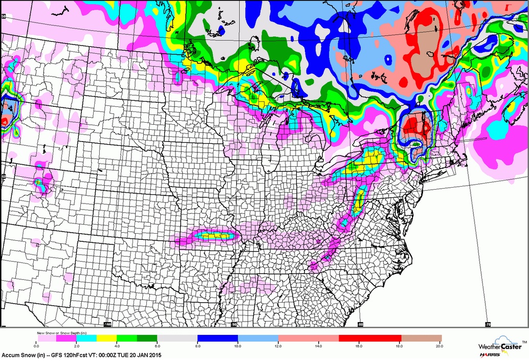
Snowfall Potential
Here's a quick glance at what we could be up against in the snow department through early next week. Note how much of the central U.S. looks to stay mostly snow free, however folks along the international border and in the Northern New England States could see some shovelable snow... stay tuned for more!
Milder Weather Ahead
It's funny how warm average temperatures feel after dealing with such cold readings for such a long period of time. Sure, it'll be warmer over the next few days, but a few cold air intrusions will make their way through the Northeastern part of the nation into next week.
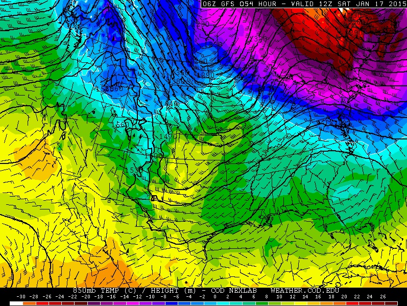
Temperature Outlook AM Saturday
Note the warmer temperatures surging into the Upper Midwest by early Saturday. This will be ahead of a clipper system sliding southeast out of Canada. Typically, with clipper systems rolling through, temperatures will go up and down quite frequently... we call this the temperature roller coaster. Ahead of a clipper Saturday, temperatures will be warm to above average levels!
Highs on Saturday
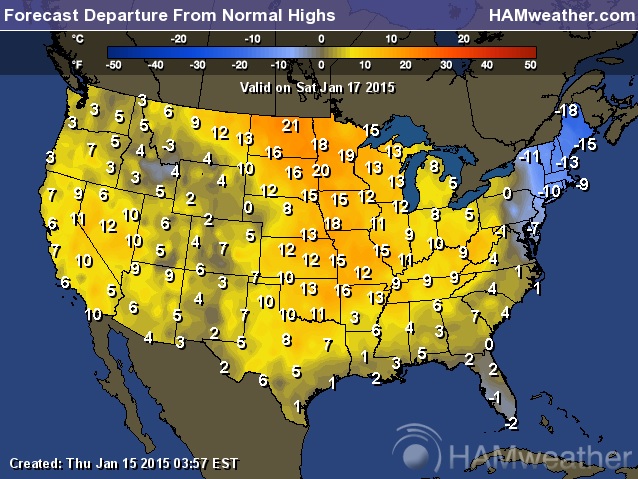
Highs on Saturday across the middle part of the country look quite a bit warmer than it has as of late! Note that the only real Arctic looking stuff has moved into the extreme northeastern part of the nation!
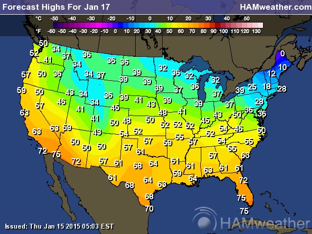
Highs on Saturday could be nearly 10° to 20° above average ahead of a fast moving clipper system that will impact those near the Great Lakes.
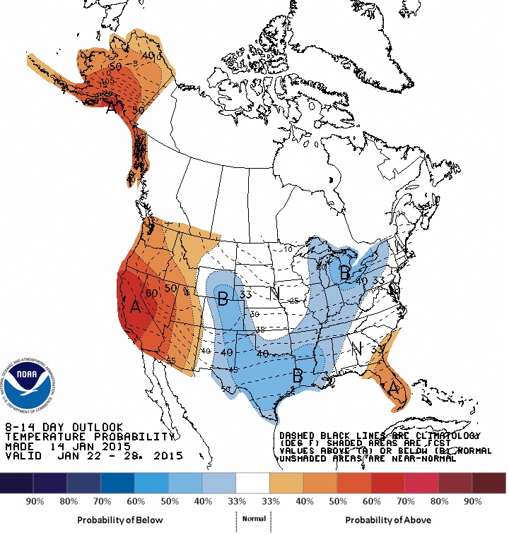
Will The Warmth Last?
According to NOAA's CPC, the 8 to 14 day temperature outlook shows the potential for cooler conditions once again across the eastern two-thirds of the nation by the end of the month. The good news here is that it doesn't appear to be anything too significantly Arctic!
My Favorite Weather Apps
Interested in weather? Here are a few apps that I use on a regular basis, maybe you'll find them handy too?
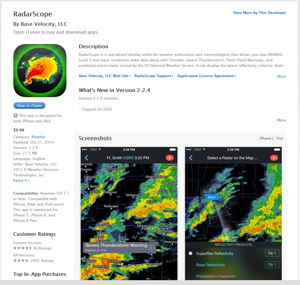
RadarScope - Cost $10
This is by far, one of the best radar apps out there! Very powerful and a great way to track storms close to home and across the nation, which also shows warning boxes.
IMAP Weather Radio - Cost $10
This is a great way to get watch/warning information for your specific location when significant weather moves in! There is no shortage of what type of weather you want to be warned/notified about!
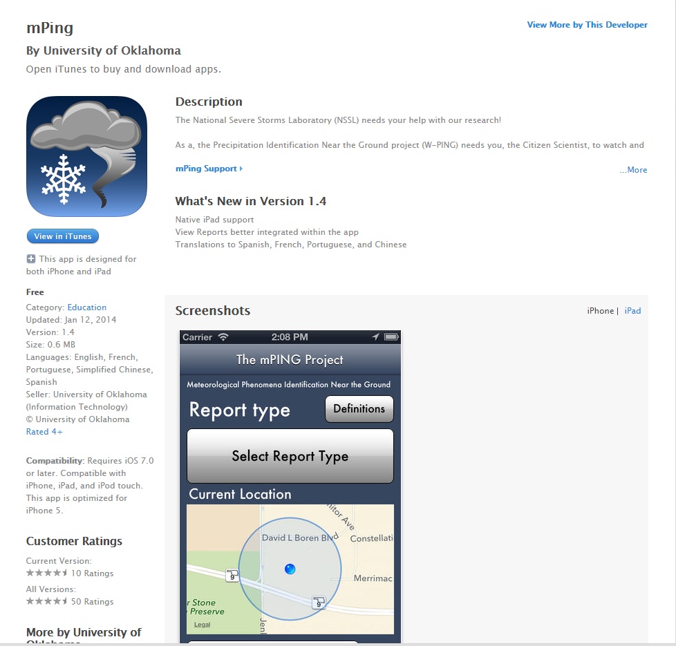
mPing - Cost FREE
Here's a neat little way of being a part of the weather community. This app allows people to report their precipitation type, which helps folks at the NSSL "collect radar data from NEXRAD radars in your area along with sounding data from our models during storm events, and use your data to develop and validate new and better algorithms."
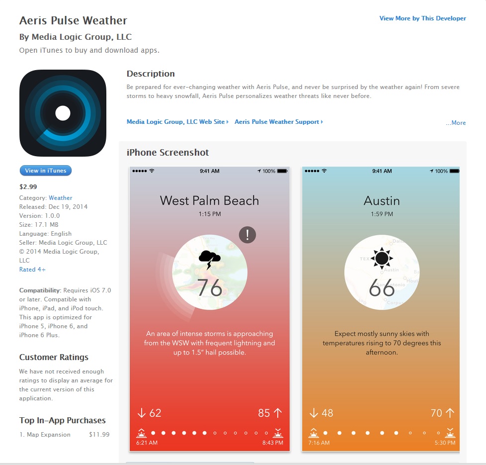
Aeris Pulse - Cost $2.99
This is a fairly new weather app, which helps identify storm threats close to you and lets you know what may be headed your way! The app is VERY clean and looks appealing
Thanks for checking in and have a great rest of your week/weekend ahead! Don't forget to check me out on Twitter @TNelsonWX

No comments:
Post a Comment