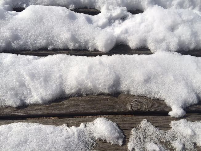
Snow Drought?
By Todd Nelson
It's been an interesting winter thus far... We started off with a bang; November finished nearly 8F below average with near average snowfall 9.4". December took a bit of a turn with temperatures finishing a little more than 5F warmer than average, but we were also a little more than 6" below average snowfall. January lived up to it's name over the first couple of weeks, but the Arctic air gave way to a warmer Pacific flow and we ended nearly 3.5F warmer than average with snowfall once again running almost 7" below average!
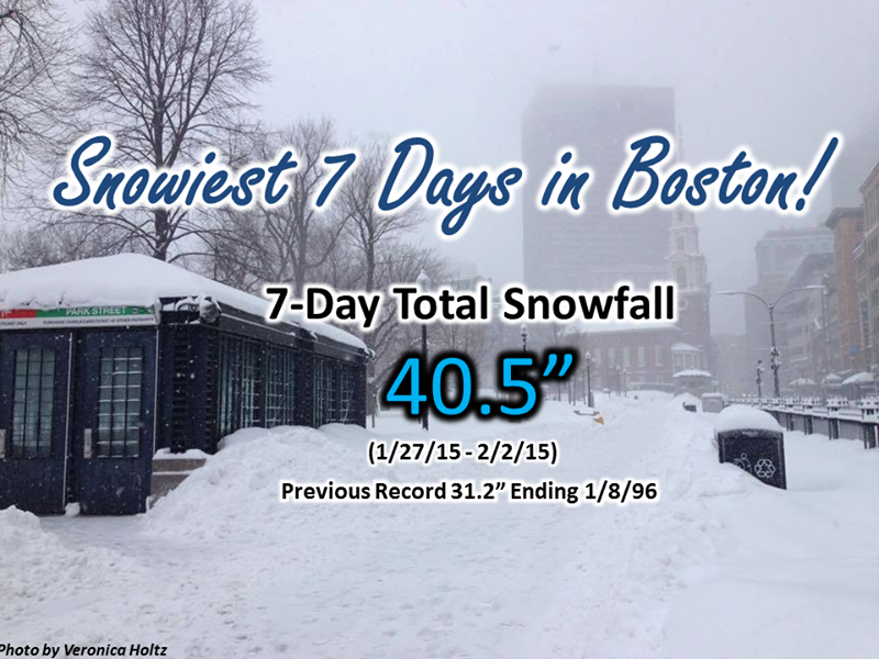
Season to date, the Minneapolis Airport has seen 22.4" snow, which is nearly 13". Boston on the other hand saw 22.4" of snow in one storm at the end of January, a week later they picked up another 16.2"! According to the NWS, they had their snowiest 7 days on record with 40.5" of snow. Interestingly, they've seen their entire seasonal average in about a weeks time!
Clipper systems will be remain in our future over the next several days with light snow chances through earlier next week. We may chip away at our current snow drought, but it'll be slow going. Knowing our weather, I wouldn't be surprised to see it all in March & April!
=================
WEDNESDAY NIGHT: Mostly clear and cold. Low: near 0. Winds: WNW 5-15. Wind Chill: -10F
THURSDAY: Face numbing start, bright sun early. High: 19. Winds: SW 10-15. Wind Chill: -10F to -15F early.
THURSDAY NIGHT: Becoming mostly cloudy, light snow possible northern MN. Low: 11
FRIDAY: Mostly cloudy, risk of a thaw. Light snow far northern MN. High: 30
SATURDAY: Light mix? More snow far northern MN. Wake-up: 18. High: 31
SUNDAY: Another clipper, chance of snow. Wake-up: 20. High: 29
MONDAY: More clouds than sun, quiet. Wake-up: 15. High: 26
TUESDAY: Nothing Arctic, few flakes. Wake-up: 16. High: 31
WEDNESDAY: Colder. Wind-whipped flakes. Wake-up: 17. High: 26.
==================
This Day in Weather History
February 5th
1834: Warm-up at Ft. Snelling with a high of 51
=================
Average High/Low for Minneapolis
February 5th
Average High: 26F (Record: 51F set in 2005)
Average Low: 9 (Record: -27 set in 1979)
=================
Sunrise/Sunset Time for Minneapolis
February 5th
Sunrise: 7:28am
Sunset: 5:27pm
=================
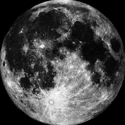
Moon Phase for February 5th at Midnight
2.3 Days After Full (Snow) Moon
===================
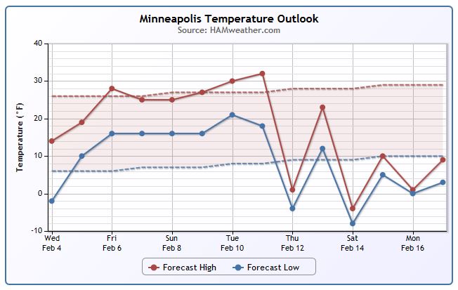
Minneapolis Temperature Trend
It's been a fairly cold start to February and it'll remain a little chilly through Thursday, but look at the mild stretch of weather that looks to push back in over the weekend/early next week! Temperatures appear to warm back to near/slightly above average levels. The slight warm up will also bring the storm track closer to home, so snow chances will also be building over the weekend!
Thursday Weather Outlook
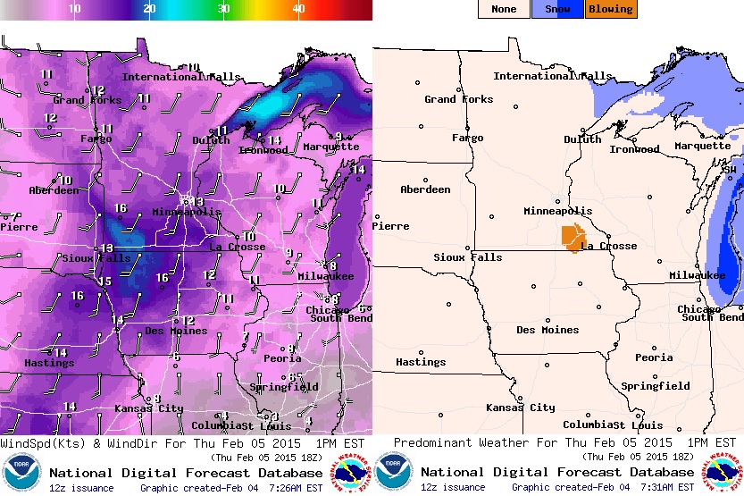
Although actual air temperatures will be warmer than they were on Wednesday, feels like temperatures will still be quite raw during the day Thursday! Look at the "Feels Like" temperature (right) by midday/early afternoon Thursday! Many locations will still feel like the sub-zero range... BRR!
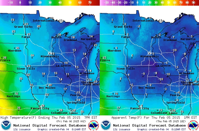
Thursday Weather Outlook
Winds on Thursday will be increasing midday with winds gusting close to 20mph out of the Southwest. Due to the light, fluffy snow we had earlier this week, blowing snow could still be an issue in some rural areas across southern MN.
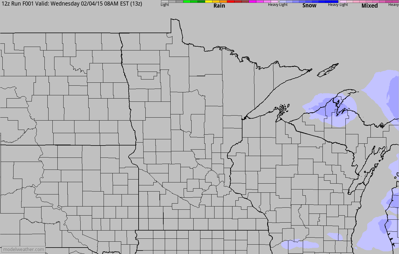
Clipper Systems
Take a look at the forecast below from AM Wednesday through PM Friday. Note the fast moving bouts of snow that looks to skid across the international border. These weak impulses of energy will be responsible for light snow accumulations as they pass.
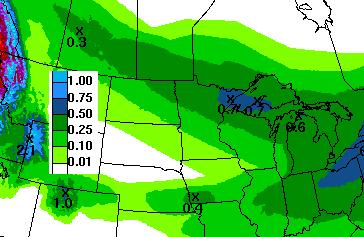
5 Day Precipitation Forecast
According to NOAA's 5 day precipitation forecast, the heaviest band of precipitation through early next week looks to be across the far northern reaches of Minnesota. Some spots in the Arrowhead could get close to 0.25" to 0.5" liquid, which could result in some shovelable snow potential there.
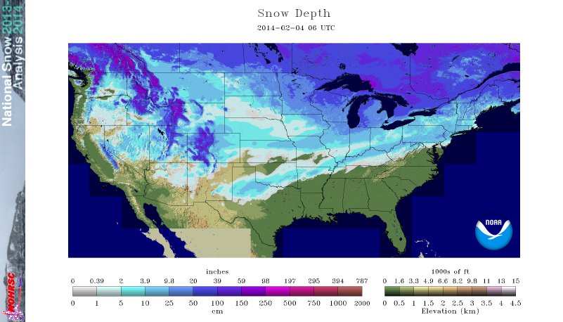
2015: National Snow Coverage
As of Wednesday, February 4th - NOAA suggested that nearly 37% of the nation was covered in snow.
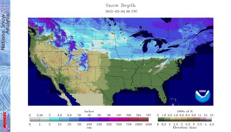
2014: National Snow Coverage
Last year at this time, the nation was nearly 61% covered in snow with snow as far south as Texas!
Crazy Boston Snow!
No doubt it has been snowy in the Northeast, but did you hear that Boston actually set a record for the snowiest 7 days in history?! From January, 27th to February 2nd, the city saw 40.5" - beating the previous 7 day record of 31.2" back in early January of 1996!
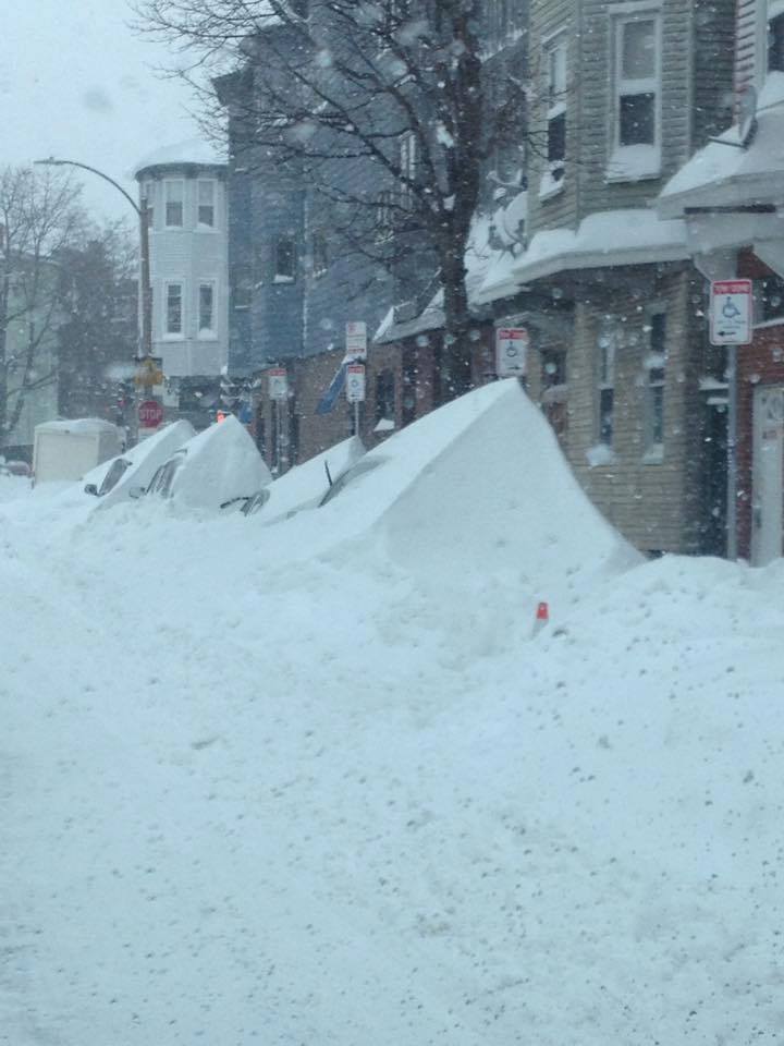
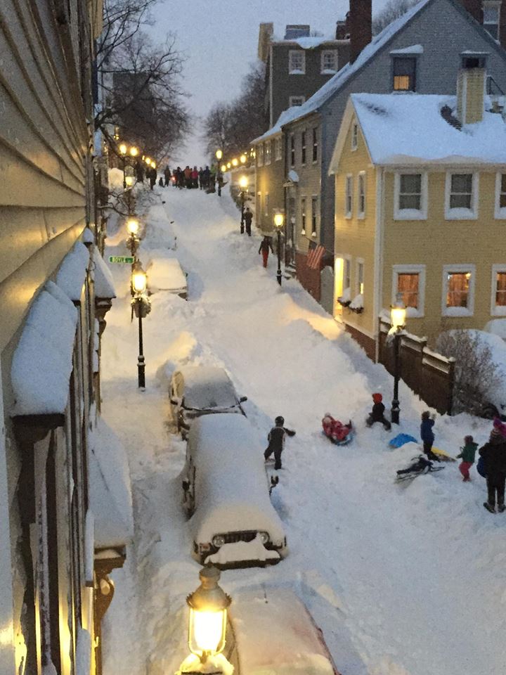
Crazy Boston Snow
Here are a couple of my favorite pictures from the massive amounts of snow that fell over the past week and a half in Boston...
(East Boston, Mass. photo courtesy NWS Boston via Jen Sayler)
(Pleasant Street, Charlestown, MA (photo courtesy NWS Boston via Christopher Lovell)
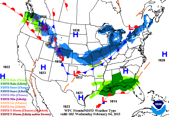
National Weather Outlook
Weather conditions look to remain fairly active across the northern tier of the nation over the next couple/few days. Note the blob of snow that heads into the Northeast during the 2nd half of the week, while a massive blob of rain moves into the Pacific Northwest. Pieces of energy are breaking off of the main Pacific flow, then translating into clipper systems that cross through the middle U.S. and eventually into the Northeast with more accumulating snow!
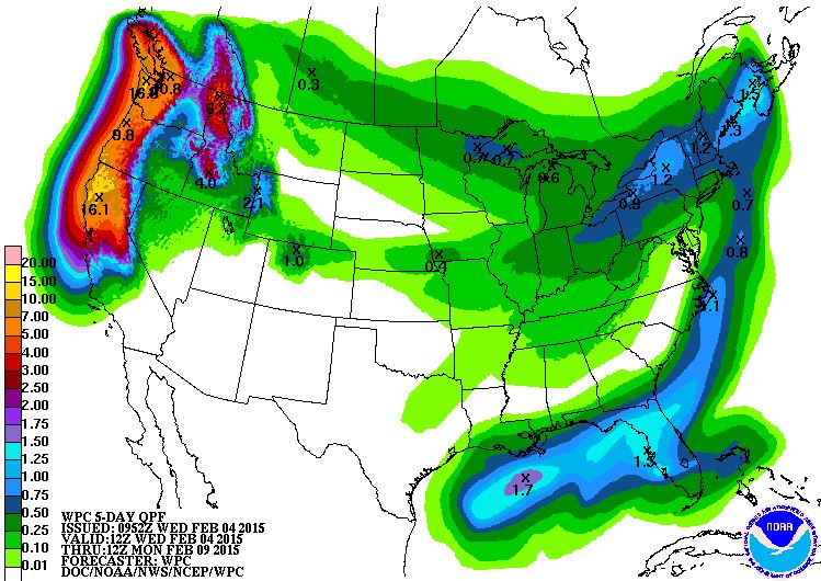
Extreme Western Moisture
Look at the incredible amount of moisture that could get wrung out on the West Coast through early next week. According to NOAA's HPC, some spots could see upwards of 16" liquid, which could cause significant flooding impacts and debris flows!
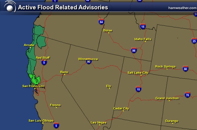
Flash Flood Concerns
Due to the significant rainfall that is forecast to fall over portions of the West Coast, the National Weather Service has issued a number of flood headlines through the weekend. I wouldn't be surprised to see more flood headlines issued as we approach the end of the week/weekend as the system starts unfolding!
* A VERY MOIST FLOW OFF THE PACIFIC WILL BRING WIDESPREAD RAINFALL TO THE NORTH BAY STARTING ON THURSDAY AND CONTINUING THROUGH THE WEEKEND. OCCASIONALLY HEAVY RAIN IS EXPECTED ON FRIDAY AND FRIDAY NIGHT WHICH WILL LIKELY LEAD TO SOME LOCAL FLOODING.
* BIGGEST CONCERN FOR FLOODING WILL BE SPOTS IN THE NORTH BAY WITH POOR DRAINAGE ALONG WITH ROADS AND HIGHWAYS PRONE TO DEBRIS FLOWS.
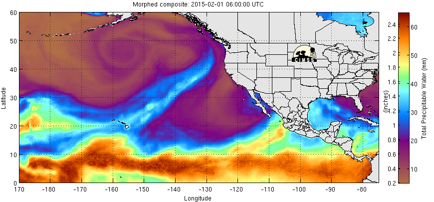
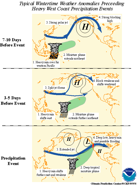
Why So Much Moisture? Atmospheric River
The precipitable water vapor loop below shows the culprit behind the significant rainfall expected over the next several days. Note the bright plume of moisture that extends from near the Hawaiian Islands to the Pacific Northwest. This tropical moisture flow can often times wring out copious amounts of moisture over a several day period, which can be a big flood contributor. This is also known as the Pineapple Express or an Atmospheric River!
Pineapple Express
"is a non-technical term for a meteorological phenomenon characterized by a strong and persistent flow of atmospheric moisture and associated with heavy precipitation from the waters adjacent to the Hawaiian Islands and extending to any location along the Pacific coast of North America. A Pineapple Express is an example of an atmospheric river, which is a more general term for such narrow corridors of enhanced water vapor transport at mid-latitudes around the world."
Read more HERE:
Atmospheric River
"An atmospheric river is a narrow corridor or filament of concentrated moisture in the atmosphere. Atmospheric rivers consist of narrow bands of enhanced water vapor transport, typically along the boundaries between large areas of divergent surface air flow, including some frontal zones in association with extratropical cyclones that form over the oceans. The term was originally coined by researchers Reginald Newell and Yong Zhu of the Massachusetts Institute of Technology in the early 1990s, to reflect the narrowness of the moisture plumes involved. Atmospheric rivers are typically several thousand kilometers long and only a few hundred kilometers wide, and a single one can carry a greater flux of water than the Earth's largest river, the Amazon River. There are typically 3–5 of these narrow plumes present within a hemisphere at any given time."
Read more HERE:
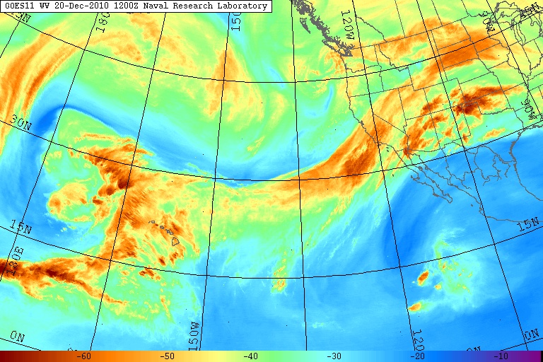
(Photo courtesty Naval Research Laboratory - Water vapor imagery of the eastern Pacific Ocean from the GOES 11 satellite, showing a large atmospheric river aimed across California in December 2010. This particularly intense storm system produced as much as 26 in (66 cm) of precipitation in California and up to 17 ft (520 cm) of snowfall in the Sierra Nevada from December 17–22, 2010.)
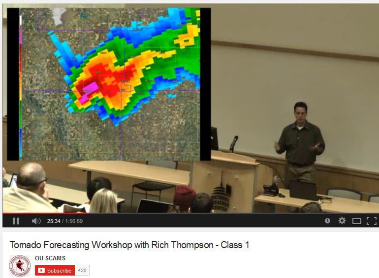
Tornado Forecasting Workshop with Rich Thompson
Are you interested in weather? Are you interested in tornadoes? Are you interested in tornado forecasting? Check out this Tornado Forecasting video from the University of Oklahoma's Student Chapter of the American Meteorological Society. Rich Thompson (Lead Forecaster Operations Branch from the Storm Prediction Center). There are some great nuggets here if you have time!!
See the video HERE:
Thanks for checking in and have a great rest of your week! Don't forget to follow me on Twitter @TNelsonWX

No comments:
Post a Comment