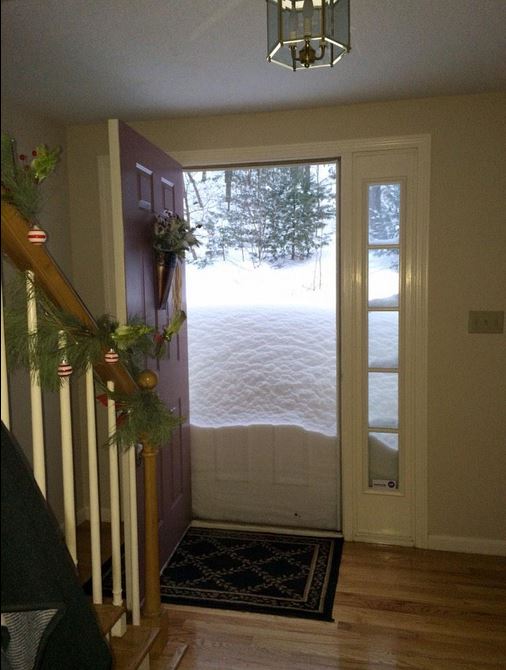
It really has been an incredible past couple/few weeks in the Northeast with round after round after round of heavy snowfalls. Here's a picture from earlier this week out of Hollinston, Mass.
(Thanks @elaine_hart for the picture out of Holliston, Mass.)
Super-Sized
By Paul Douglas
The next time you watch a network TV reporter out in the weather wait for a predictable tag line: "..and another storm is on the way!" In the curious case of Boston it's true.
The city saw 6 feet of snow in less than 3 weeks, 72 inches in the last 30 days, nearly 40 inches on the ground - the most in recorded history. This may have something to do with Gulf Stream water temperatures 11C above normal east of Cape Cod; the meteorological equivalent of throwing gasoline on a campfire.
From extreme 7 foot lake effect snows in Buffalo to 200 mph Super Typhoon Haiyan hitting the Philippines, warmer water, worldwide, is turbocharging some storms. The forecast calls for more records.
While we scrape out from under another anorexic clipper. Cold exhaust in its wake drops the mercury Wednesday. I see 3 separate slaps of numbing air; single digit highs over the weekend in spite of a pleading sun. Long range GFS guidance shows a thaw the last week of February. You'll be shocked to hear that no snowstorms are brewing, looking out 2 weeks.
Meanwhile Boston will be brushed by another blizzard on Sunday as subzero air mixes with unusually warm water offshore. Yes, another storm is on the way.
=================
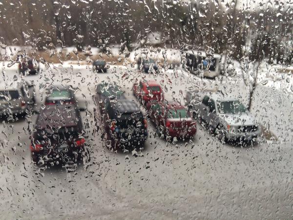
Messy Tuesday Weather
This was the view from my office on Tuesday morning after the round of freezing rain, snow, ice pellets came through... we had a little bit of everything and it made the rounds VERY slick.
=======================
TUESDAY NIGHT: Slick roads as snow tapers to flurries. Turning breezy late. Low: 20. Winds: Turning WNW 10-25mph.
WEDNESDAY: Windy, tumbling temps. 10F by 5pm. Wind chill: -5F to -15F by 5pm. Winds: NW 15-30+ High: 21, falling temps.
WEDNESDAY NIGHT: A few flakes? Much colder, biting wind. Low: -4. Wind Chill: -10F to -25F
THURSDAY: Blue sky, light winds and partially numb. High: 12.
FRIDAY: Lots of clouds, good travel. Wake-up: 8. High: 22
SATURDAY: Hello January! Wind chill: -20. Wake-up: -3. High: 6
SUNDAY: Next clipper. Light accumulation? Wake-up: -1. High: 13
MONDAY: Gray, snow may stay south. Wake-up: 4. High: 20.
TUESDAY: Last cold front (for this round). Wake-up: 2. High: 16.
==================
This Day in Weather History
February 11th
1932: Mizpah picks up 13 inches of snow in a storm.
==================
Average High/Low for Minneapolis
February 11th
Average High: 28F (Record: 57F in 1882)
Average Low: 11F (Record: -31F in 1899)
==================
Sunrise/Sunset Times for Minneapolis
February 11th
Sunrise: 7:19am
Sunset: 5:35pm
===================
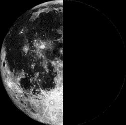
Moon Phase for February 11th
Last Quarter at 9:50pm
====================
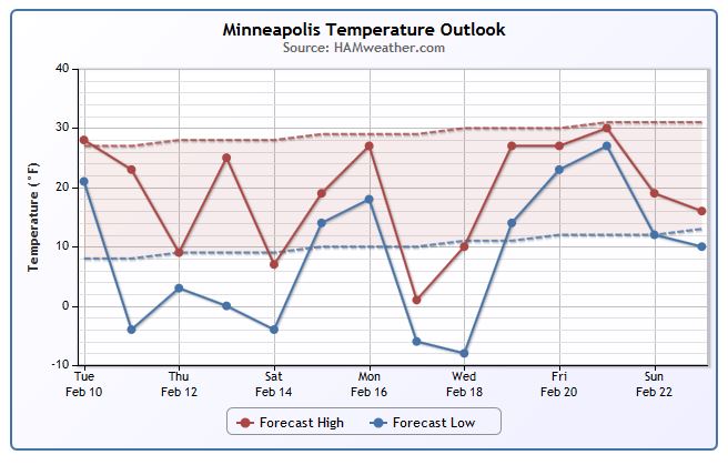
Minneapolis Temperature Trend
After a several days of relatively mild weather, temperature take a bit of a hit during the second half of the week. Our wintry weather spell on Tuesday will give way to strong winds and falling temperatures on Wednesday. It appears that wind chill values will go sub-zero at some point during the day Wednesday and stay sub-zero into Thursday. Actually air temperatures will likely dip below 0 Wednesday night/Thursday morning!
==================
Wednesday Weather Outlook
Weather conditions on Wednesday will be quite chilly considering how warm it was earlier this week. High temperatures should be able to top out around 20F in the Twin Cities, but a strong northwesterly wind will help to tug down much colder air through the day. Feels like temperatures (image on right) will feel more like the sub-zero range already by midday.
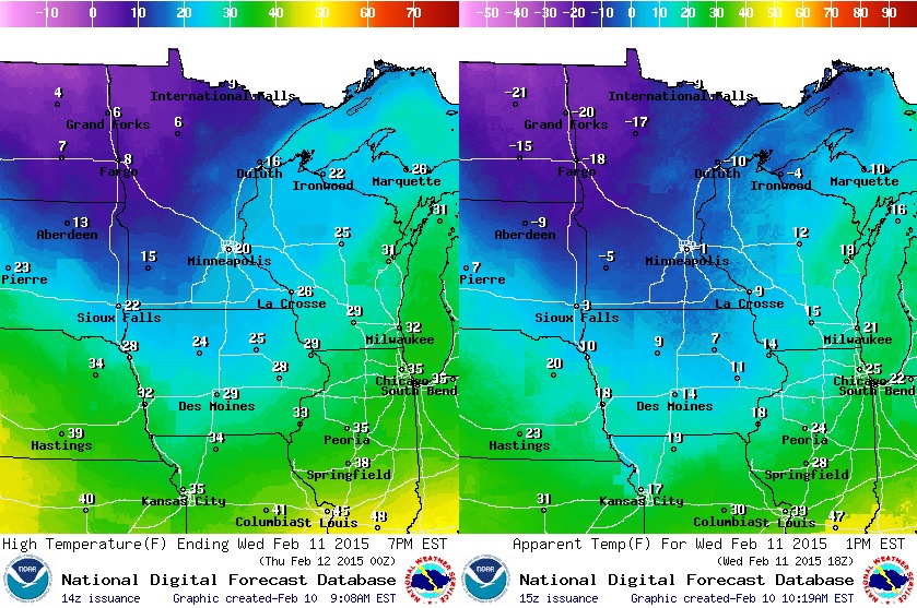
Wednesday Weather Outlook Continued
Strong northwesterly winds on the back side of our Tuesday clipper will be whipping pretty good. A 10mph to 20mph sustained wind could gust up to near 30mph at times blowing around any fresh snow that we picked up Tuesday.
Crazy Boston Snow
Thanks to Matthew Partee @partee875 for the picture below out of Boston, Mass. Take a look at the difference from 2 weeks ago to now!
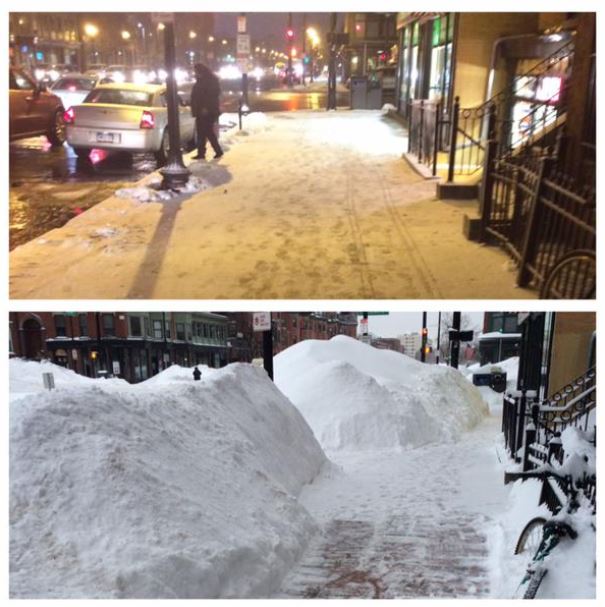
Crazy Boston Snow
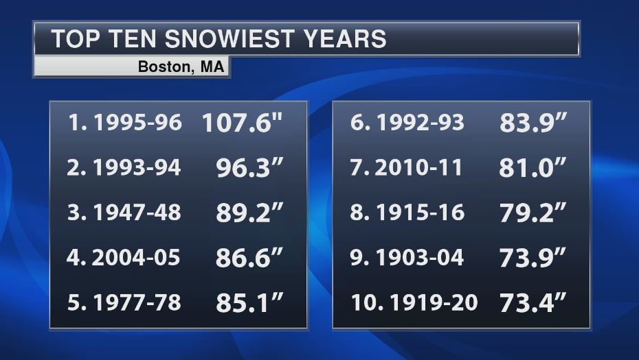
Here are a few the crazy snowfall stats from the National Weather Service out of Boston. Note that the 14, 20 and 30 day snowfall amounts are the snowiest on record in Boston and in Worcester! Interestingly, Boston has seen 77.3" so far this season, which is nearly 50" above normal to date and already the 9th snowiest season on record!
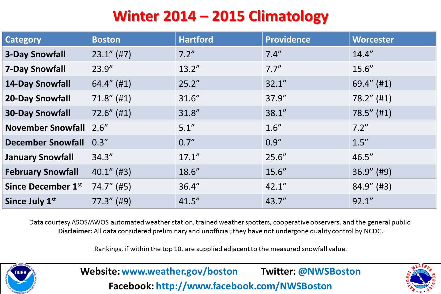
9th Snowiest Season on Record!
As of Monday, there had been 77.3" of snow in Boston this season, which is now the 9th snowiest season on record; beating the 73.9" set in 1903-04. Boston would need another 30.4" to get to the snowiest season on record (current record 107.6" set in 1995-96).
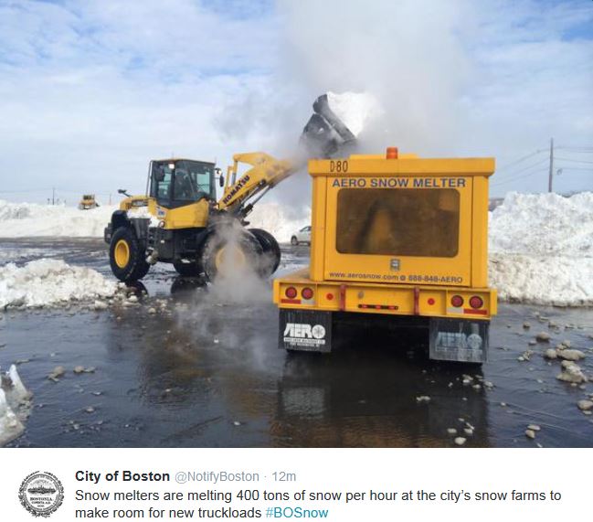
Getting Rid of Feet of Snow?
This picture come from the City of Boston @NotifyBoston Twitter page. Note how they're trying to get rid of all that snow! AERO SNOW MELTER!!
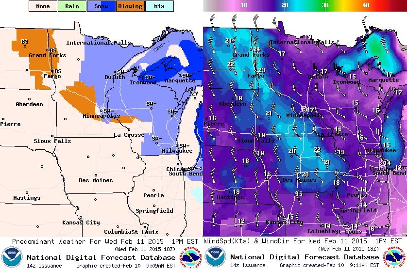
National Weather Outlook
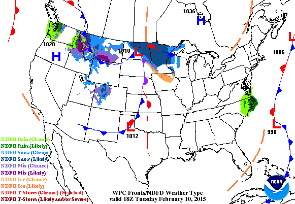
Nationally, weather conditions are fairly quiet. However, a fast moving clipper system is blasting through the Midwest/Great Lakes Region through midweek and land in the Northeast by the second half of the week.
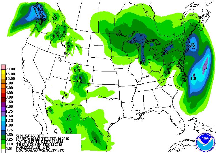
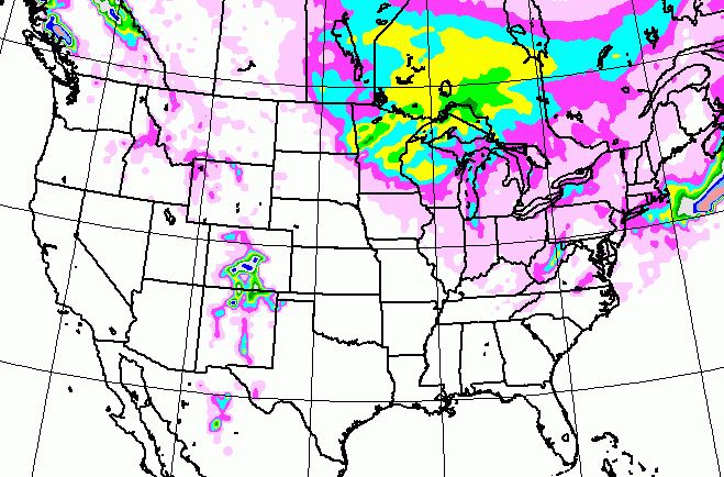
5 Day Precipitation Outlook
According to NOAA, the 5 day precipitation outlook still looks fairly wet and potentially snowy across parts of the Northeast. The clipper mentioned in the loop above will continue on it's southeast track toward the Northeast by the second half of the week. Precipitation amounts look a little lighter than they did earlier this week, but it appears that more snow is on the way for folks in the Northeast...
More Northeast Snow?
As the clipper pushes east, light snow will begin to make a return to parts of the Northeast by the second half of the week... Again, the good news is that the snowfall amounts look much lighter this go around!
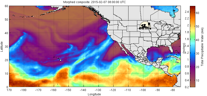
Eastern Pacific Water Vapor Loop
I love this animation below! Note the bright plume of moisture that fades near the western U.S. while another bright plume of moisture picks up just north of the Hawaiian Islands. These plumes are known as the "Pineapple Express" or "Atmospheric River", which can cause extensive flooding across the west coast during long duration events. The latest event from late last week through the week cause several flood concerns and even fanned a wildfire that cropped up near the Sierra Nevada Range.
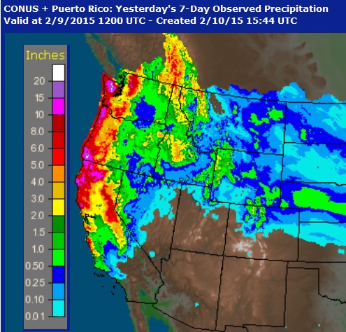
Precipitation Past 7 Days
According to the NWS, the radar estimated rainfall over the past 7 days is nearly 10" to 20" in some areas! A new version of the U.S. Drought Monitor gets released ever Thursday, so we'll see if there is any improvement from this latest deluge.
Thanks for checking in and have a great rest of your week! Don't forget to follow me on Twitter @TNelsonWX

No comments:
Post a Comment