Comfortably Numb
By Paul Douglas
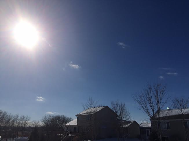
It's human nature to compare and contrast, and believe the grass is greener elsewhere. A few people have complained about the minor league cold wave shaping up for the next 10 days. I had to gently remind them that factoring snow, cold and wind chill this winter is a pale imitation of what we slogged through last year; a true pioneer winter - the worst in 30 years.
Welcome to the 16th subzero morning of winter, to date. A year ago we had already endured 41 nights of negative fun. The coldest air temperature so far this winter: -11F. Last winter: -23F. Based on heating degree days winter is 2 percent warmer than the running 30-year average - last winter was 10 percent colder. A year ago nearly 40 inches of snow had fallen; this winter 23.6 inches and holding. Not even close.
A southern storm may brush Minnesota with snow late Monday into Tuesday but dry weather prevails into next week as Canada burps a series of cold fronts south of the border. I would describe this as moderately cold air, not the shuddering, shriek-worthy, get-me-out-of-here scoop of Siberian suffering of last winter.
This too shall pass; long range models hinting at a Pacific thaw by the end of February.
============
WEDNESDAY NIGHT: A few flakes? Much colder, biting wind. Low: -3. Winds: NNW 15-25. Wind Chill: -10F to -25F
THURSDAY: -20F wind chill early! Blue sky, light winds and partially numb. High: 11. Wind: NNW turning SW 5-10.
THURSDAY NIGHT: Another clipper, snow likely overnight. Light coating of snow possible by daybreak Friday. Low: 9. Wind: S 5.
FRIDAY: Mostly cloudy, closer to average. High: 27
SATURDAY: Blue sky, bitter wind! Wind chill: -15. Wake-up: -2. High: 9
SUNDAY: More clouds than sun. Wake-up: -9. High: 8
MONDAY: Light snow possible late. Wake-up: 4. High: 20.
TUESDAY: Partial clearing, turning colder. Wake-up: 10. High: 12.
WEDNESDAY: Partly sunny, still a bit numb. Wake-up: -6. High: 11.
==============
This Day in Weather History
February 12th
1988: For warm weather...head west! Duluth had a temperature of 31 below zero, while Rapid City was sitting at 59.
1872: Severe Blizzard hits central Minnesota. The temperature at Litchfield was 34 degrees on the afternoon of the 12th, and fell to -20 by the morning of the 13th. At least 6 people died in Meeker County alone.
===============
Average High/Low for Minneapolis
February 12th
Average High: 28F (Record: 59F set in 1990)
Average Low: 12F (Record: -30F set in 1875)
===============
Sunrise/Sunset Times for Minneapolis
February 12th
Sunrise: 7:18am
Sunset: 5:37pm
===============
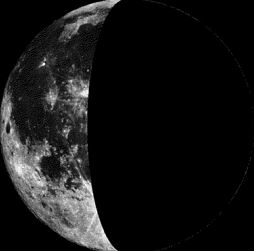
Moon Phase for February 12th at Midnight
1.1 Days After Last Quarter
====================
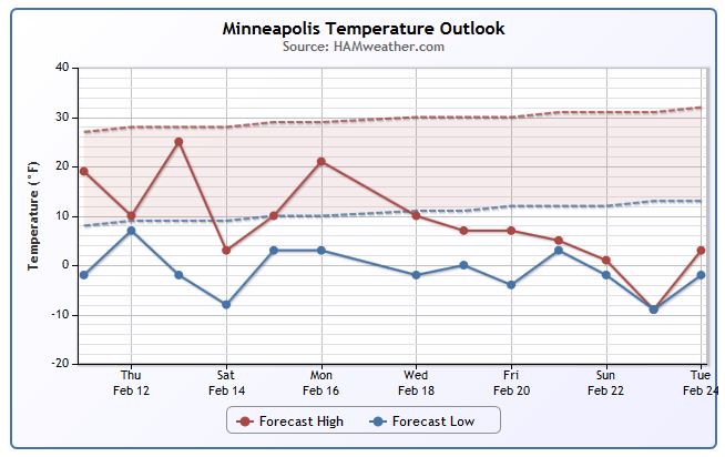
Minneapolis Temperature Trend
Ready for another round of cold weather? Take a look at the temperature trend below through the middle and end of February... we're getting some indications that it'll be chilly through much of next week too!! BRR!!
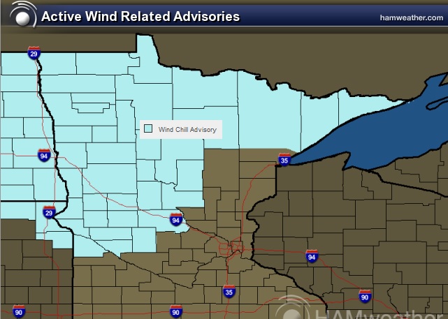
Wind Chill Advisory
...WIND CHILL ADVISORY IN EFFECT THRU 8 AM CST THURSDAY...
* WIND CHILL VALUES...25 TO 30 BELOW ZERO.
Thursday Weather Outlook
Wind chills will be a big deal early Thursday with feels like temperatures down to -20F to -30F across the state. The good news is that wind speeds are expected to diminish through the day, so wind chill values by midday may only be in the 0F to -15F range.
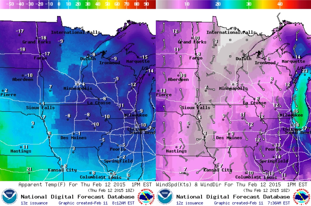
Thursday Weather Outlook
Actual air temperatures on Thursday will be nearly 15F to 20F below average with highs stuck in the teens and single digits across the state. We will be between clipper during the day Thursday, but another round of light snow will push in PM Thursday/AM Friday.
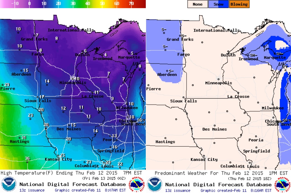
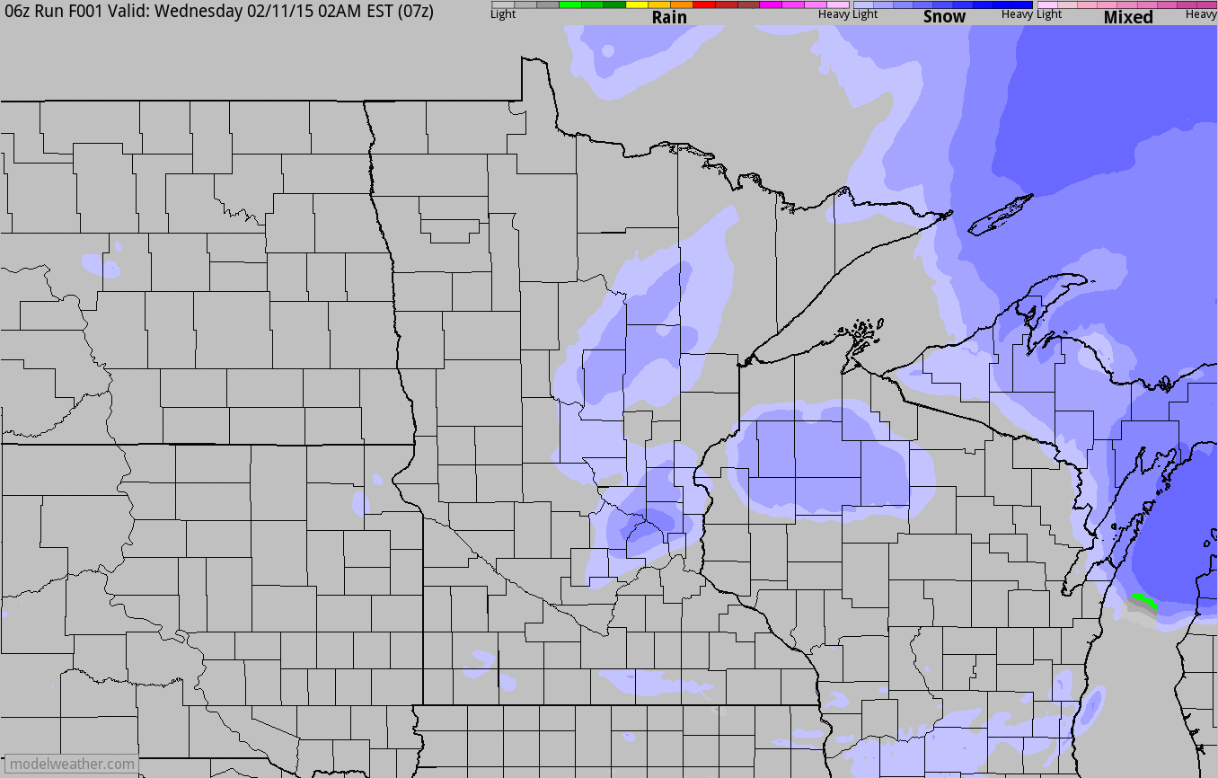
Thursday Night Clipper
Take a look at the simulated radar below from AM Wednesday thru AM Friday. Note the second round of light snow that slides through the region PM Thursday/AM Friday. This may be responsible for another light coating of snow, which could make a slightly slower and slippery AM Friday commute.
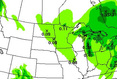
Precipitation Outlook
According to NOAA's HPC, the 2 day precipitation outlook for parts of Minnesota looks fairly light as our PM Thursday/AM Friday clipper slides through. However, with temperatures as cold as they are, light fluffy snow could add up to nearly 1" in spots!
=============================
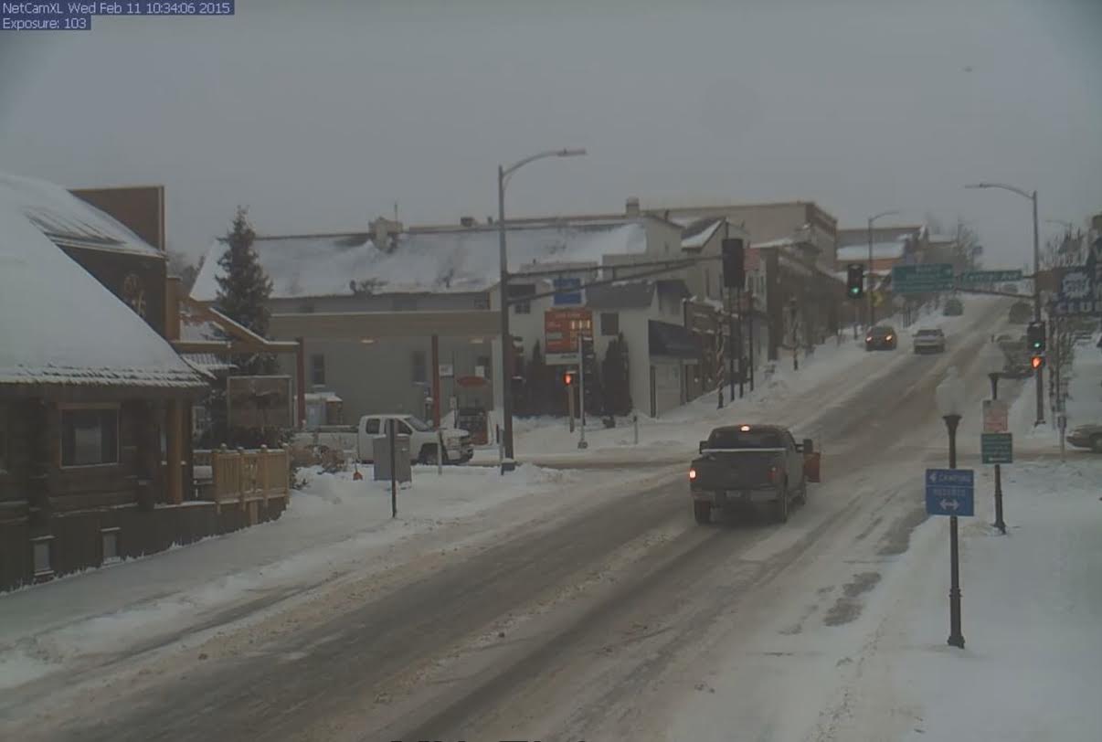
Ely, MN
This was the view from Ely, MN early Wednesday post clipper earlier this week. There was a little more snow that fell across the northern part of the state due to colder temperatures aloft. The Twin Cities and part of central Minnesota had some issues with freezing rain, sleet and snow due to a little wedge of warmer air aloft with sub-freezing temperatures at the surface.
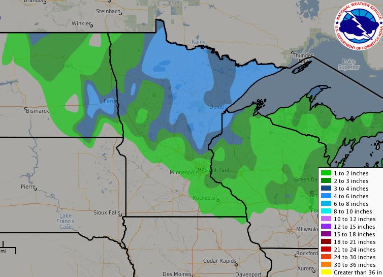
Midwest: 48hr Snowfall Analysis
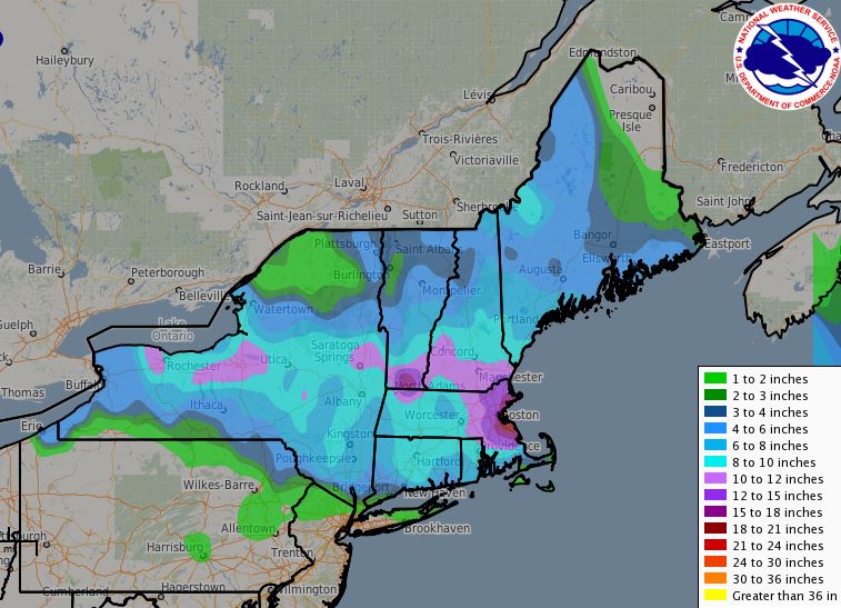
Northeast: 72hr Snowfall Analysis
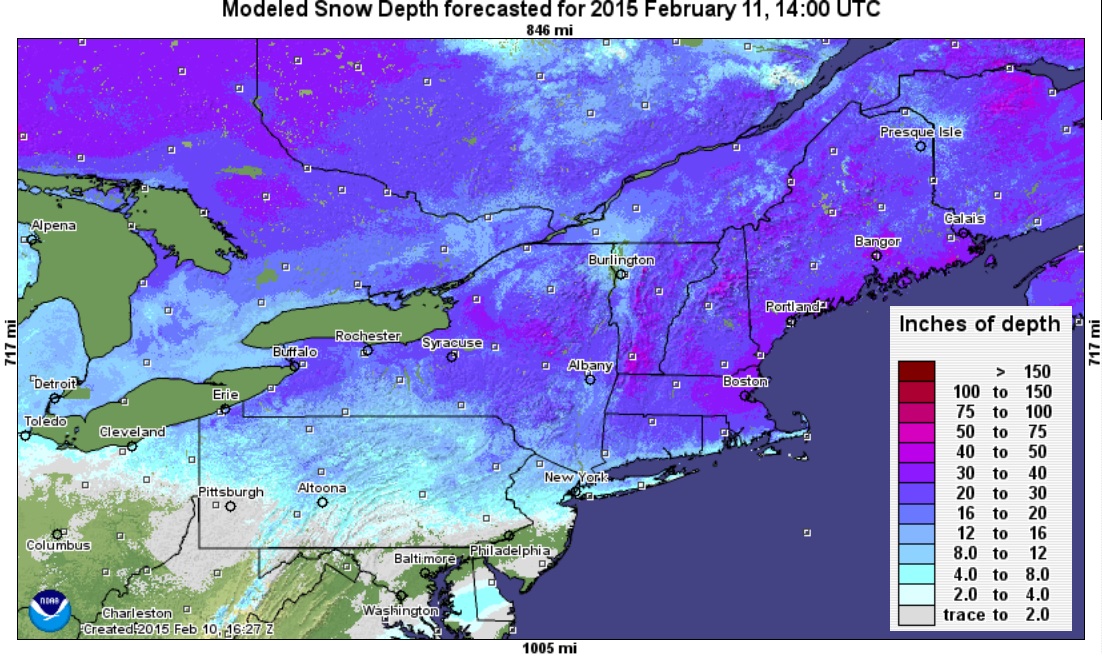
According to NOAA, the 72hr snowfall analysis shows a fairly large swath of 8" to 10" (light blue) from the Eastern Great Lakes to the Eastern Seaboard. Note that within that swath, there are several locations that saw nearly 12" to 18" + !! Boston Logan saw nearly 2ft. with isolated locations nearing 30" from the storm system earlier this week.
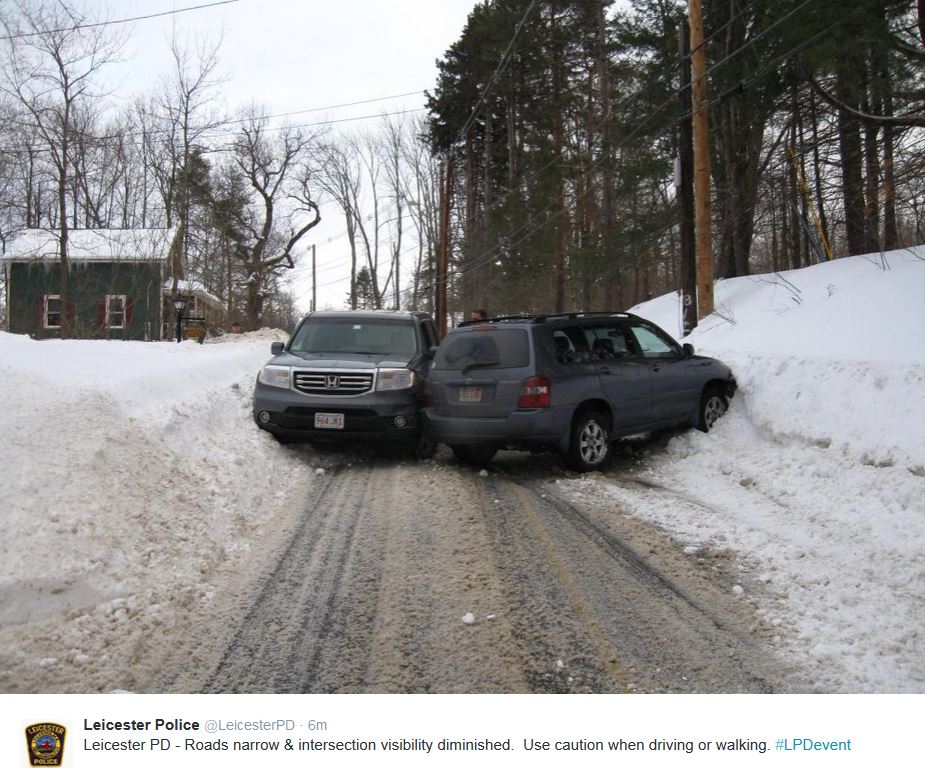
Too Close for Comfort...
Thanks to @LeicesterPD out of Leicester, Mass. for the picture below. Note that there is so much so in parts of the Northeast over the past couple/few weeks, that roads have become almost too narrow for 2 lanes of traffic!
Northeast Snow Analysis
Incredibly, there have been several bouts of heavy snow over the past 2 to 3 weeks and the end result has left nearly 2ft to 4ft of snow on the ground in some locations of the Northeast!
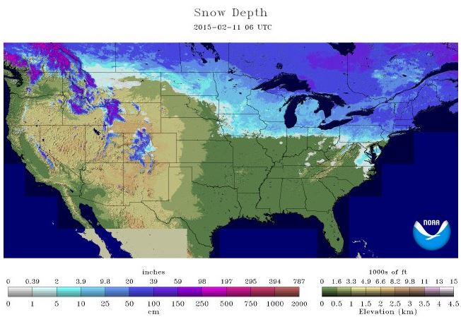
2015 National Snow Analysis
According to NOAA's NOHRC, nearly 25% of the nation was covered in snow as of February 11th with some of the deepest snow pack across parts of the Northeast and high elevations in the western U.S.
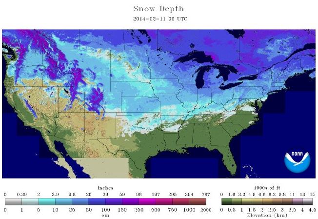
2014 National Snow Analysis
However, last year at this time, nearly 57% of the nation was covered in snow with the snow coverage as far south as northern Texas!!
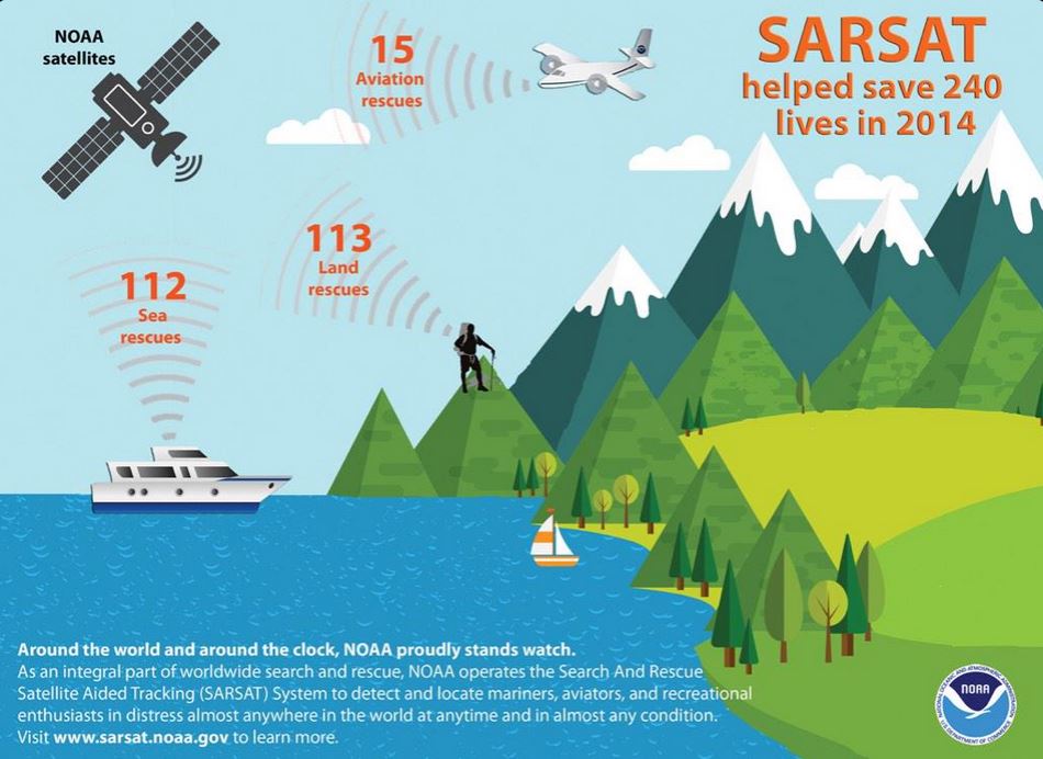
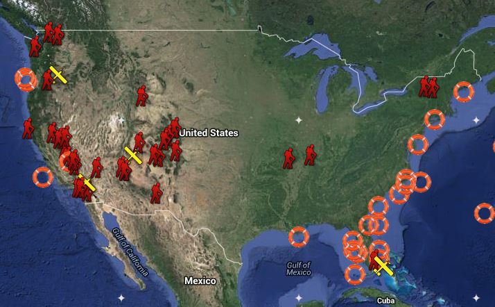
Do You Have a Beacon? Why Not?
Did you know that beacons save 240 lives last year? Neither did I! Interestingly, there have already been 5 saved in 2015 using NOAA satellites!
Search and Rescue Satellite Aided Tracking
Around the world...around the clock...NOAA proudly stands watch. As an integral part of worldwide search and rescue, NOAA operates the Search And Rescue Satellite Aided Tracking (SARSAT) System to detect and locate mariners, aviators, and recreational enthusiasts in distress almost anywhere in the world at anytime and in almost any condition.
The SARSAT system uses NOAA satellites in low-earth and geostationary orbits to detect and locate aviators, mariners, and land-based users in distress. The satellites relay distress signals from emergency beacons to a network of ground stations and ultimately to
the U.S. Mission Control Center (USMCC) in Suitland, Maryland. The USMCC processes the distress signal and alerts the appropriate search and rescue authorities to who is in distress and, more importantly, where they are located. Truly, SARSAT takes the "search" out of search and rescue!
NOAA-SARSAT is a part of the international Cospas-Sarsat Program to which 41 nations and two independent SAR organizations belong to. To find out more about SARSAT please feel free to explore our website. We hope you enjoy your visit!
SARSAT - A Lifeline To Survival!
Find out more from NOAA HERE:
You can read actual accounts from the SARSAT rescues HERE:
Thanks for checking in and have a great rest of your week! Don't forget to follow me on Twitter @TNelsonWX

No comments:
Post a Comment