Fair Game
By Paul Douglas
"Hey Paul! Oh, I'm sorry but you look better on TV" the nice, vaguely hyperactive woman wheezed. Don't we all. That poignant moment was from a few years ago at the State Fair, where people eat with abandon and speak their minds.
When you come into people's homes on their TV sets for 25 years the filter goes away. You're the crazy uncle who babbles on about the weather. You're family!
Another thing I've learned the hard way: never say "Nice to meet you!" It's always "Good to see you!" Why? "You came to my elementary school 25 years ago. I was in the back with my hand raised! What... you don't remember me?" Ugh.
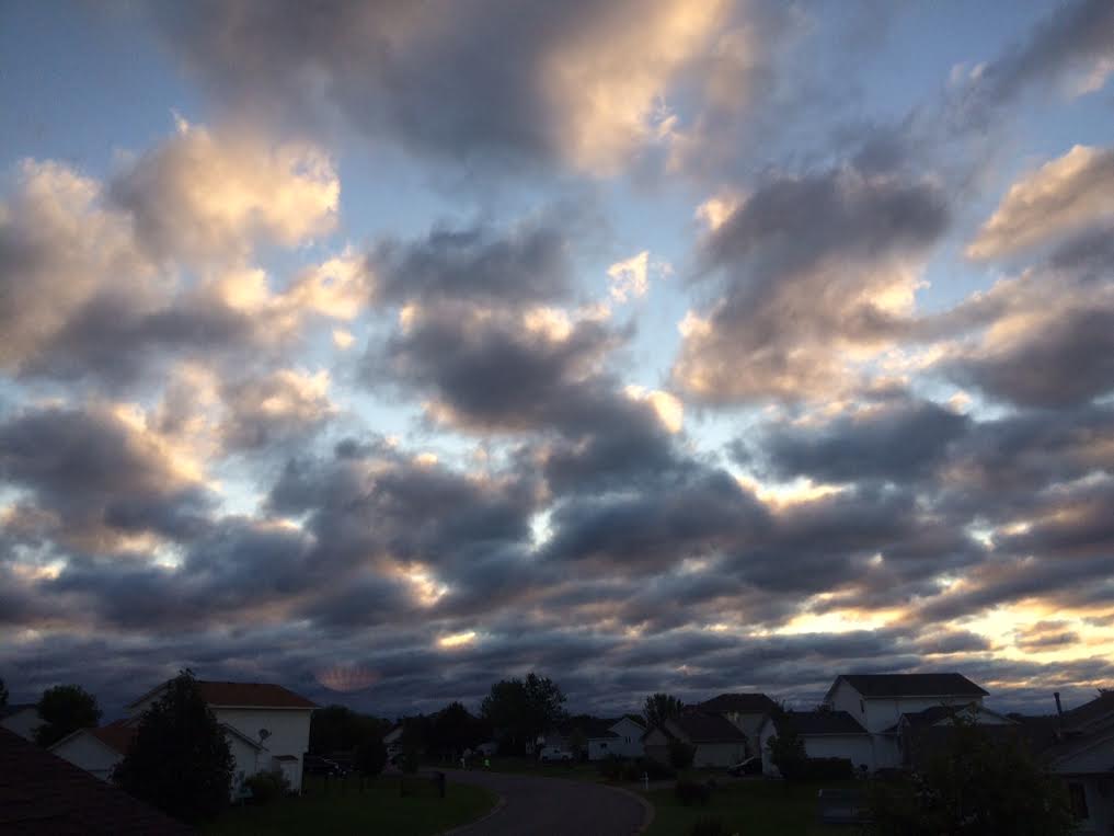
A fresh, Canadian breeze lingers into Thursday as the Minnesota State Fair kicks off; highs in the 70s. No sweat-on-a-stick. A stray thundershower may sprout on Friday, but the weekend looks warm and dry; very lake-worthy with highs topping 80F.
The GFS model still hints at a few 90-degree days the first week of September. With a "Super El Nino" underway I expect a super-sized summer, spilling well into September.
July was the warmest month on record and 2015 is on track to be the warmest year, breaking the old global record set in 2014. Another coincidence.
____________________________
MONDAY NIGHT: Breezy and cool. Partly cloudy. Low: 52. Winds: NW 10-25
TUESDAY: Chilly start. Brisk sun, less wind. High: 71. Winds: NW 10-15
TUESDAY NIGHT: Mostly clear and cool. Low: 52. Winds: NNW 5-10
WEDNESDAY: Sunny and brilliant, light winds. High: 75.
THURSDAY: MN State Fair Starts! Partly sunny, probably dry. Wake-up: 58. High: 80
FRIDAY:Few showers, possible thunder. Wake-up: 62. High: 72
SATURDAY: Warm sun, no complaints. Wake-up: 60. High: 81.
SUNDAY: Sunny, breezy and warmer. Wake-up: 64. High: 84.
MONDAY: Sticky sun, PM t-shower. Wake-up: 66. High: 83.
____________________________
This Day in Weather History
August 25th
1976: Roy Lake Fire. 2,600 acres burned during drought.
1875: Tornado strikes near Hutchinson.
______________________________
Average High/Low for Minneapolis
August 25th
Average High: 79F (Record: 96F set in 2013)
Average Low: 61F (Record: 41F set in 1887)
________________________________
Sunrise/Sunset Times for Minneapolis
August 25th
Sunrise: 6:26am
Sunset: 8:03pm
_________________________________
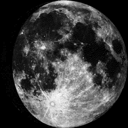
Moon Phase for August 25th at Midnight
3.5 Days Until Full (Sturgeon) Moon
____________________________________
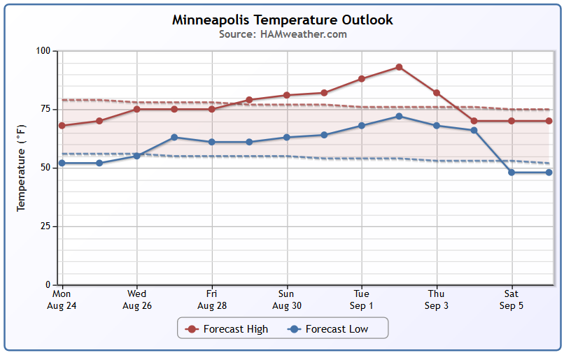
Minneapolis Temperature Trend
September-like temperatures continue through the next few days, but gradually we'll warm to near average levels by the weekend. Extended model runs are still suggesting temps near 90F by the start of September.
__________________________________
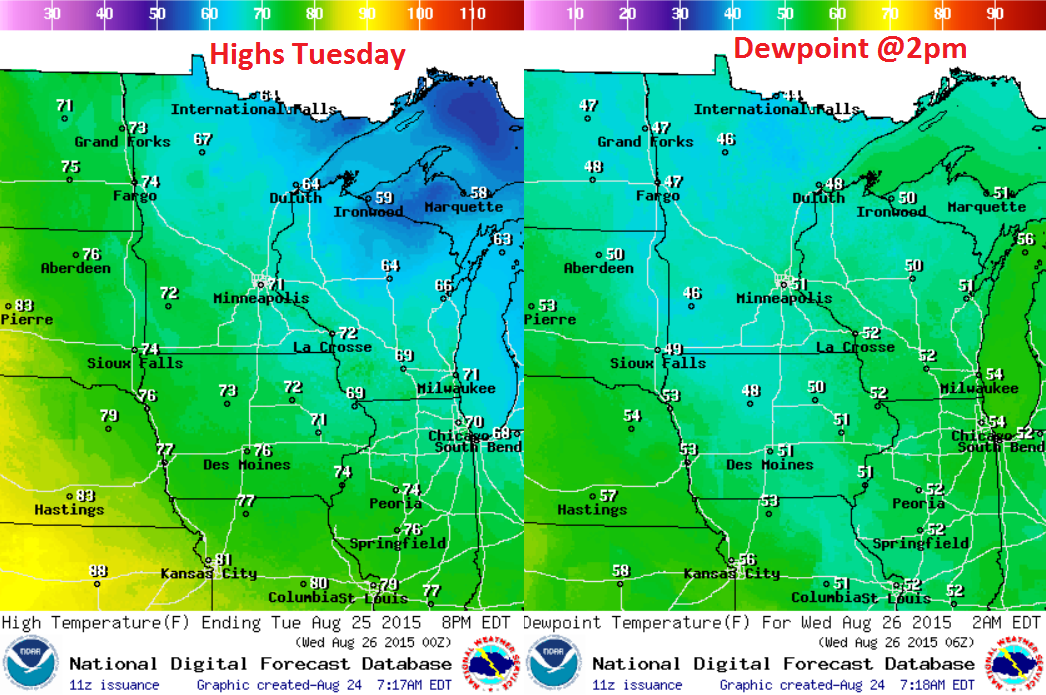
Tuesday Weather Outlook
Tuesday's temps will still be quite cool across the region with highs largely in the 60s and 70s. Dewpoints will still be quite cool, making overnight lows quite cool.
Tuesday Weather Outlook
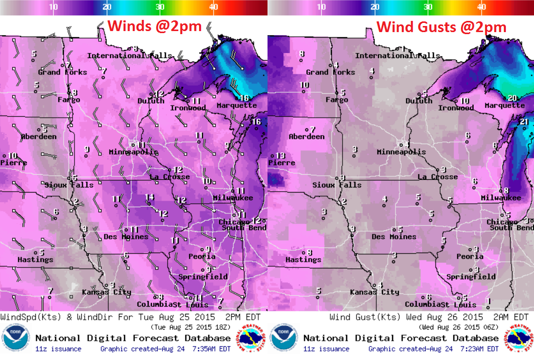
Tuesday Weather Outlook
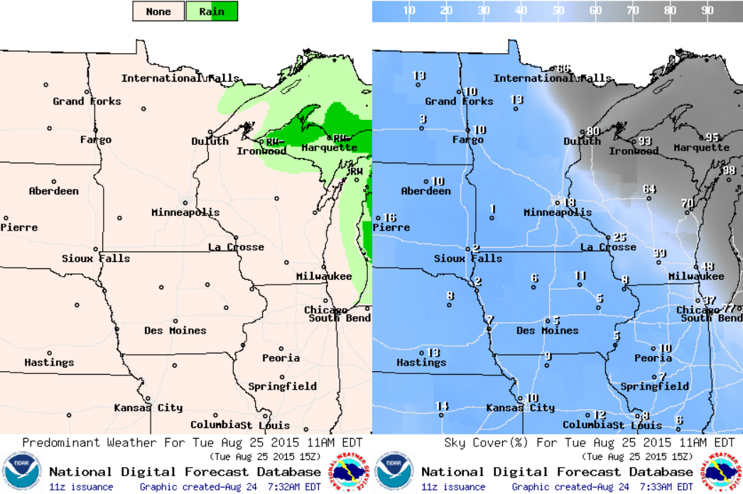
Wrap around moisture will continue to keep clouds and showers in place over the Great Lakes Region. The best chance of showers will be well to our east.
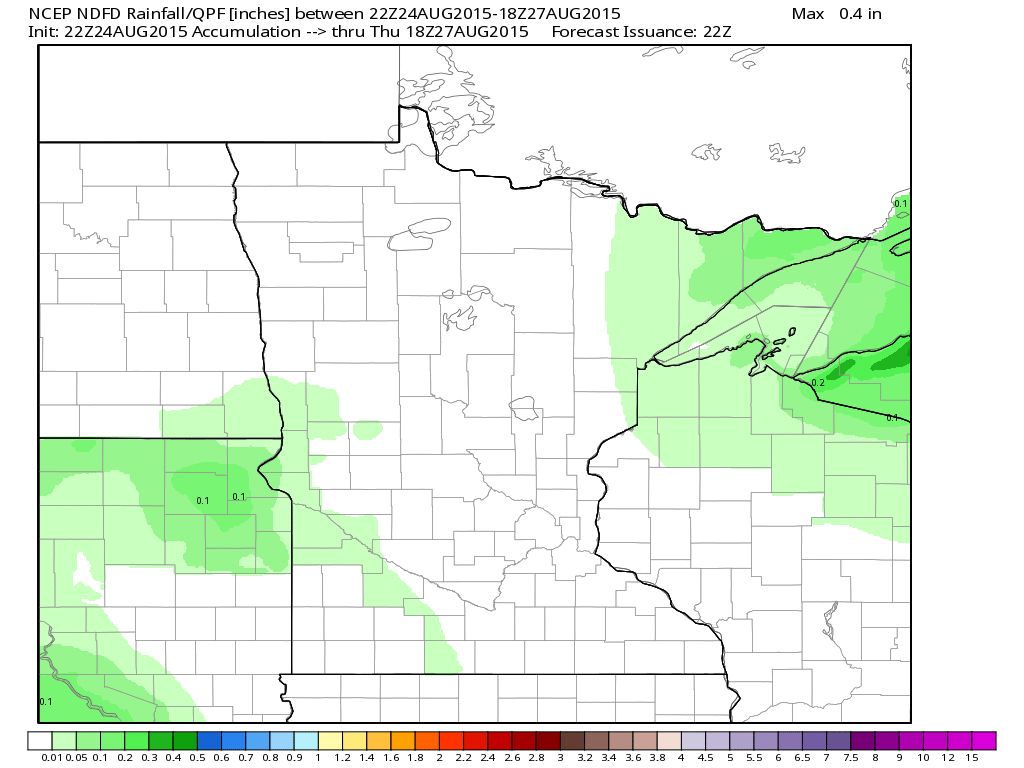
Rainfall Potential
A look at the rainfall potential through midday Thursday doesn't show much in the works. The next best chance of rain appears to be Friday.
______________________________________________
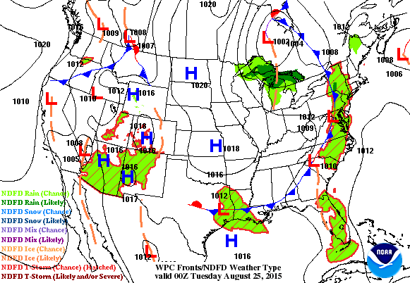
National Weather Outlook
A big bubble of high pressure in the wake of the fall cold front will continue to drift east over the coming days. Note the monsoonal moisture building in the Desert Southwest. Some of this will push into the Upper Midwest late this week
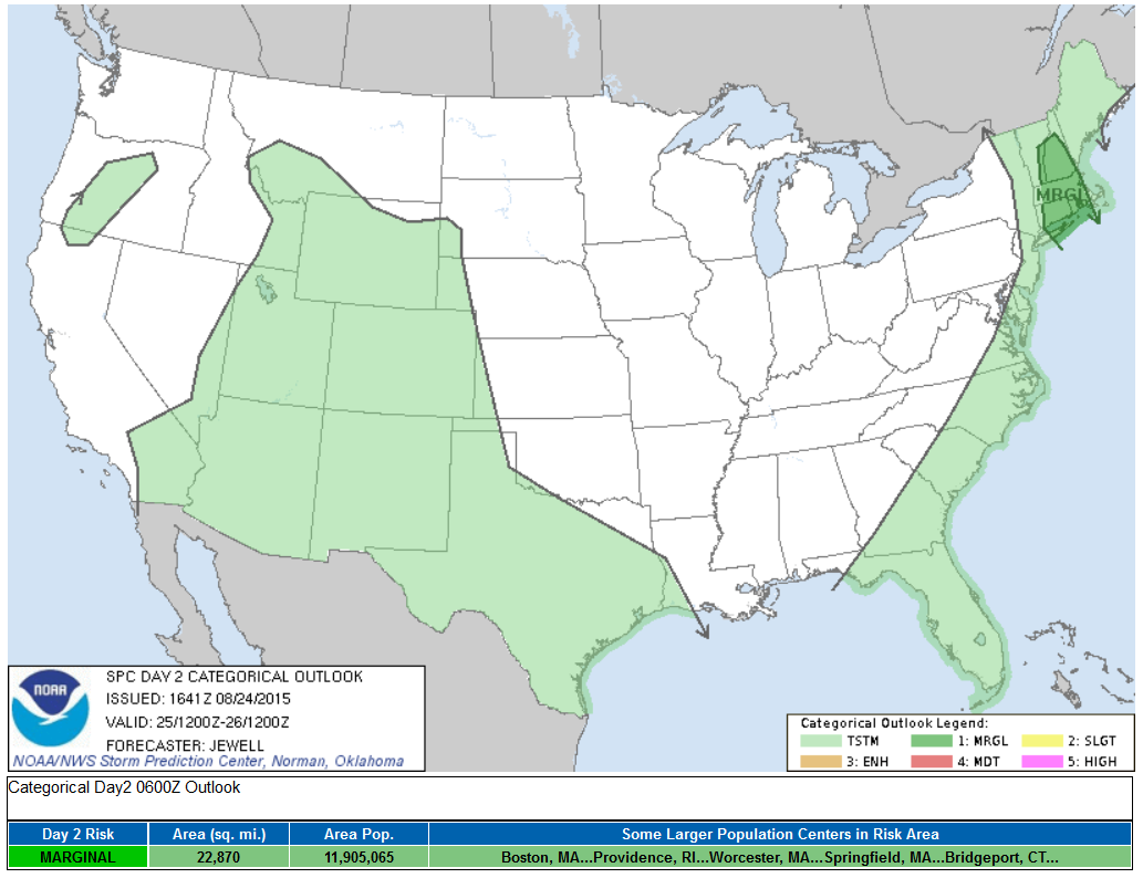
Severe Threat Tuesday
...SUMMARY... A FEW STRONG STORMS ARE POSSIBLE TUESDAY ACROSS SOUTHERN NEW ENGLAND. ...SYNOPSIS... AN UPPER RIDGE WILL REMAIN OVER THE ROCKIES WITH AN UPPER LOW FILLING ACROSS ERN CANADA. CYCLONIC FLOW ALOFT WILL EXTEND SWD INTO THE GREAT LAKES AND NEW ENGLAND STATES WITH A WEAK SFC TROUGH DEVELOPING INTO SRN NEW ENGLAND DURING THE DAY. A GENERALLY WARM/MOIST SLY FLOW REGIME IN THE LOW-LEVELS WILL AID IN DESTABILIZATION ACROSS NEW ENGLAND...AND RESULT IN SCATTERED THUNDERSTORMS.
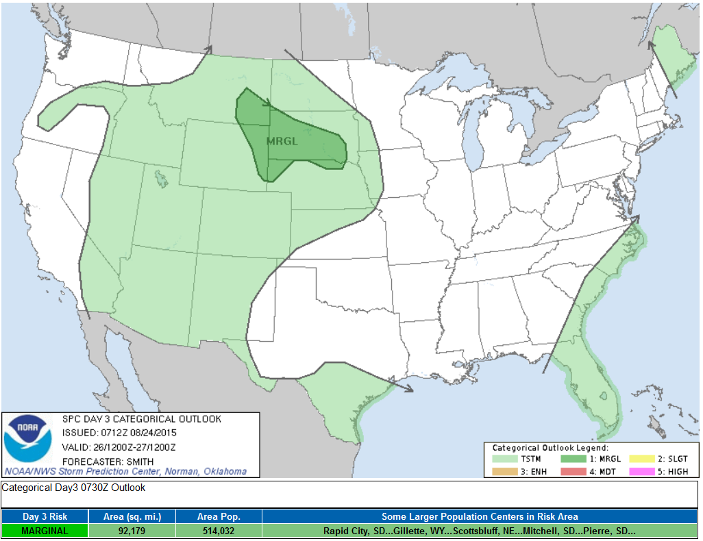
Severe Threat Wednesday
...SUMMARY... ISOLATED MARGINALLY SEVERE STORMS ARE POSSIBLE OVER THE NORTH-CENTRAL HIGH PLAINS WEDNESDAY AFTERNOON/EVENING AND FARTHER EAST OVER SOUTH DAKOTA WEDNESDAY NIGHT.
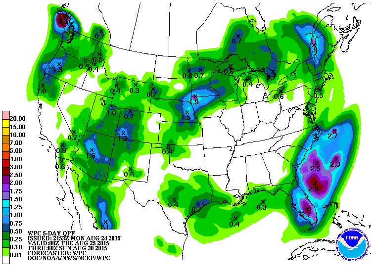
5 Day Precipitation Outlook
According to NOAA's HPC, the 5 day precipitation outlook keeps much of the Ohio/Tennessee Valleys dry through the first half of the weekend. pockets of heavy rain will be possible in the Desert Southwest due to monsoonal moisture, which will translate into the rain potential in the Midwest later this week.
_________________________________
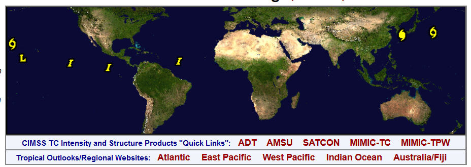
Tropical Update
Here's an interesting map, which shows all the current tropical interests across the globe. Note the two in the Western Pacific (GONI & ATSANI), while Danny in the Atlantic basin is gone. Also KILO continues in the Central Pacific south of the Hawaiian Islands.
See more from CIMSS HERE:
Update in the Atlantic
According to the National Hurricane Center, as of Monday, Danny was no longer a threat in the Atlantic. However, there are two other waves that the NHC will continue to monitor.
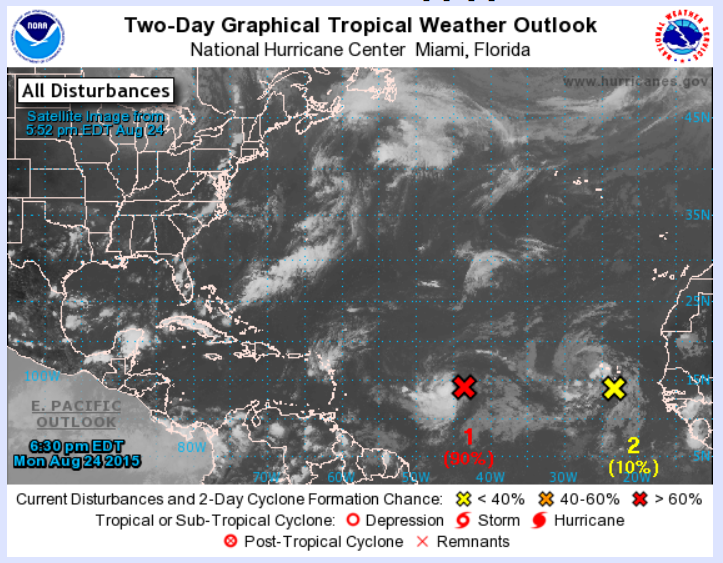
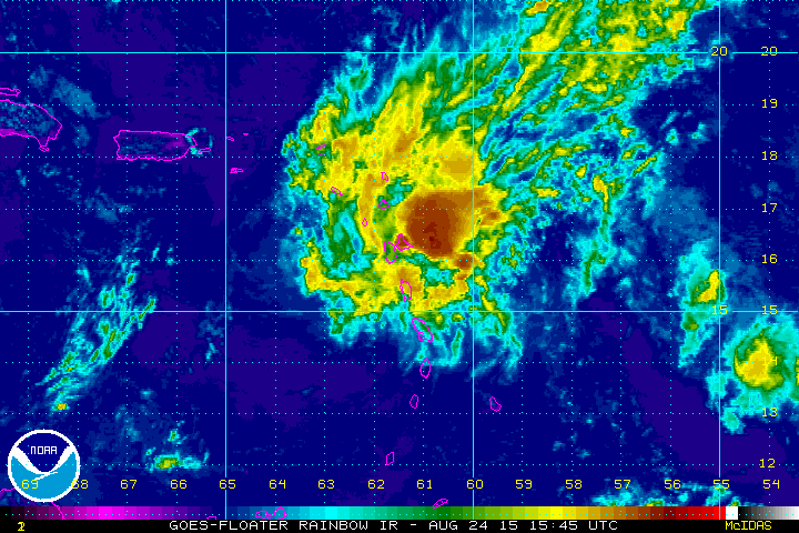
Danny in the Atlantic
The satellite loop below show the Remnants of Danny drifting west through the eastern part of the Caribbean. Ultimately, stronger upper level winds (shear) made it tough for Danny to survive.
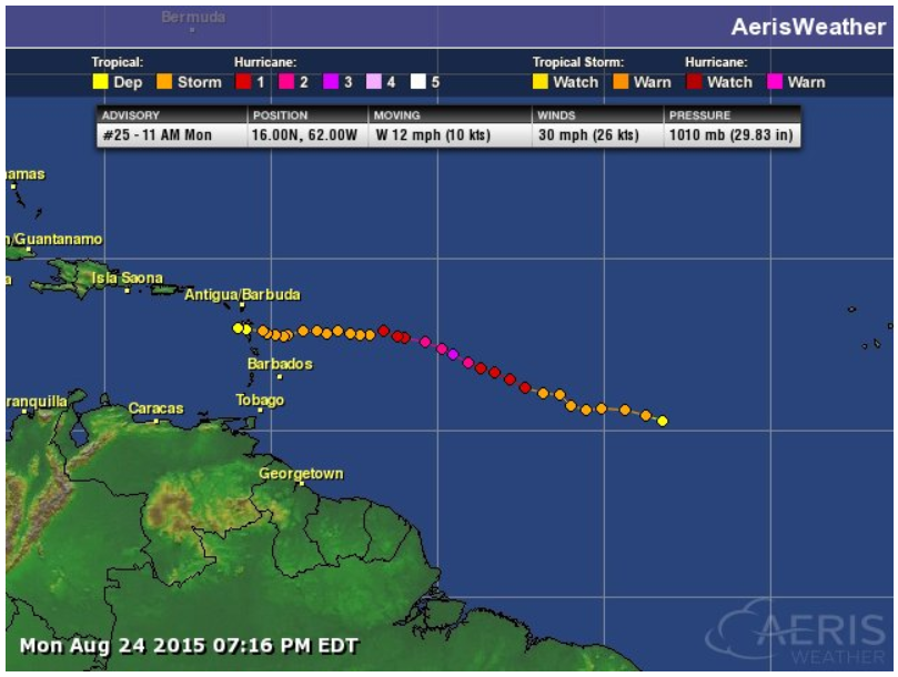
Danny's Track
Danny was the first hurricane in the 2015 Atlantic Hurricane Season. This was the path and strength as Danny moved west.
___________________________________________
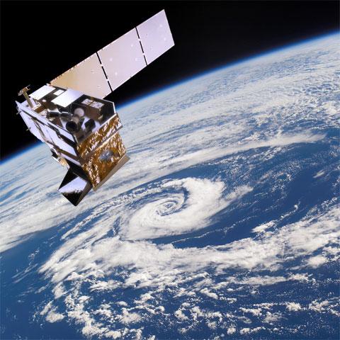
"10 Years After Katrina: Reflecting on Remarkable Advancements in Weather Satellites"
Here's a recent article from NOAA, which talks about a new NOAA Satellite that will help provide weather images faster and at a higher resolution than ever before.
Operating from two primary locations, GOES-East and Goes-West, Geostationary Operational Environmental Satellites (GOES) have been providing continuous imagery and data on atmospheric conditions, solar activity, and Earth’s weather systems for nearly 40 years. Now, with the next generation of weather observing satellites on the horizon, NOAA is poised to once again significantly improve weather forecasting and severe weather prediction with the launch of GOES-R. Positioned above North America, GOES-R will scan the Earth five times faster at four times image resolution, and triple the number of channels scientists can tap into to observe global weather and climate. This increase in data production means satellite imagery of severe weather, like hurricanes and tornados, will be available in near real-time, giving forecasters even more tools to make timely warnings during a severe weather event.
See more from NOAA HERE:
_______________________________________
Thanks for checking in and have a great week ahead! Don't forget to follow me on Twitter @TNelsonWX

No comments:
Post a Comment