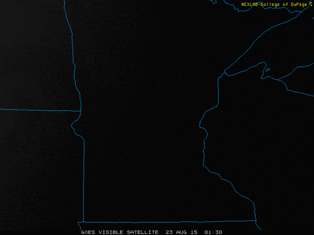
There was, no doubt, a touch of fall in the air on Sunday. The visible satellite loop below showed the swirl of low clouds and cool weather that kept much of the state in the 50s and 60s on Sunday. The good news is that this particular storm system will loosen it's grip on the region early this week. Slowly, more sun will build in and winds will ease. Temperatures will also start to warm gradually to near normal levels by the end of the week/weekend ahead.
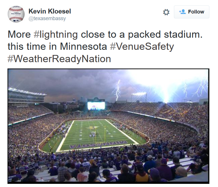
Too Close for Comfort...
I came across this frightening picture over the weekend. This was captured during the 2nd quarter of the Vikings vs. Raiders game at TCF Bank Stadium on Saturday evening as a line of intense thunderstorm rapidly developed. The good news is that everyone was evacuated safely as play was suspended.
Black Swallowtail Caterpillar
This was kind of a neat find... It took me a while to figure out what kind it was, but notice that this particular fellow had orange antennas that stuck out every so often. I am hoping that it'll find a nice place to nestle in for long pupa nap. I searched Black Swallowtail Butterfly and they look pretty neat!

Septemberish Sunshine
By Todd Nelson
It's hard to believe that fall is right around the corner, isn't it? Not sure there hasn't been a store that I've walked into recently with some sort of back to school sale. Seasons come and go here in Minnesota and we're on the cusp of another one, I can feel it in the air.
We're about one week away from the start of Meteorological Fall (Sept-Oct-Nov) and about one month away from Astronomical Fall (Sept. 23rd). High temps today will be more reminiscent of mid September, but with breezy winds again today, it'll feel more like early October. Grab your favorite sweatshirt.
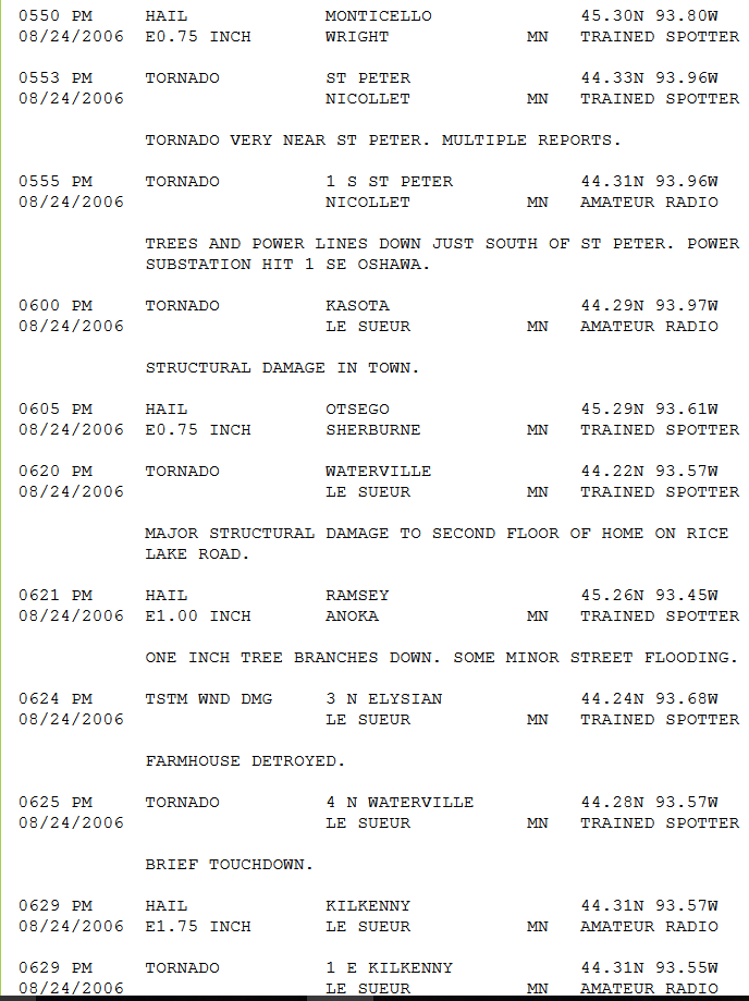
Weather conditions can still be volatile at this time of the year. In fact, 9 years ago today, a deadly F3 tornado tracked 33 miles through Nicollet and Le Sueur counties in southern Minnesota causing lots of damage. Softball sized hail fell in New Prague and windows were reportedly broken in downtown Anoka due to golf ball sized hail.
Septemberish sunshine continues through midweek with highs in the 60s and 70s. A gradual warming takes us back to near normal levels by the start of the MN State Fair. No problems for anything "on a stick".
Extended models suggest highs near 90 degrees by Sept. 1st.
________________________________
SUNDAY NIGHT: Breezy and cool. Turning partly cloudy. Low: 52. Winds: W 15-30.
MONDAY: Brisk sun, grab a sweatshirt. High: 70. Winds: WNW 10-25
MONDAY NIGHT: Mostly clear and cool. Low: 51. Winds: NW 5-15
TUESDAY: Chilly start. Brisk sun, less wind. High: 70. Winds: NW 10
WEDNESDAY: More sun, still Septemberish. Wake-up: 54. High: 76.
THURSDAY: MN State Fair Starts! Still dry, just about perfect. Wake-up: 57. High: 80
FRIDAY: Isolated PM thunder risk. Wake-up: 63. High: 79
SATURDAY: Am shower north, PM sun. Wake-up: 62. High: 80.
SUNDAY: Great for whatever "on a stick". Wake-up: 62. High: 81.
__________________________________
This Day in Weather History
August 24th
2006: Tornadoes and large hail strike southern Minnesota. One person died and 37 were injured when a strong tornado began 4 miles west-southwest of Nicollet in Nicollet County and move almost due east for 33 miles to near Waterville in Le Sueur County. Many storm chasers captured the tornado on video. The largest hail reported was grapefruit-sized at New Prague in Scott County.
1934: Early arctic blast across Minnesota. Rochester and Fairmont have lows of 34 degrees.
____________________________________
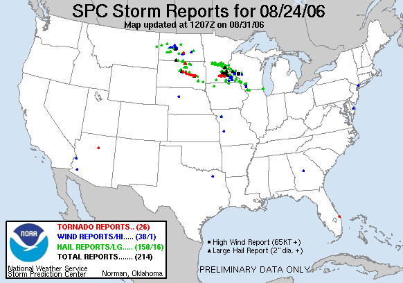
Tornadoes and Large Hail over Central and Southern Minnesota: August 24, 2006
August 24, 2006 was an interesting day across the Upper Midwest. There were several hail and high wind reports and even 26 tornado reports (several of which were in Minnesota). The MN DNR website has a good link in regards to what happened close to home.
"A rather deep low pressure area for August situated over southeast South Dakota set the stage for a tornado outbreak over southern Minnesota and eastern South Dakota. There were two tornadoes reported over south central Minnesota. One was a weak tornado near New Ulm. The other was much stronger and lasted nearly an hour. This tornado began 4 miles west-southwest of Nicollet and moved almost due east for 33 miles where it dissipated near Waterville in Le Sueur County. The tornado was intense, damaging farms and homes. There were 37 injuries and the tornado caused the death of an elderly man who lived at Lake Emily near Kasota. This was the first death due to a tornado in Minnesota in six years. The last death was at Granite Falls on July 25, 2000. See the storm reports for August 24. See the report for the August 24, 2006 severe weather event by the National Weather Service in Chanhassen. Large and destructive hail was a common characteristic of the storms over southern Minnesota. Hail the size of baseballs (2.75 inches) fell in some areas. The largest hail reported was grapefruit size at New Prage in Scott County."
See more from the MN DNR HERE:
Average High/Low for Minneapolis
August 24th
Average High: 79F (Record: 98F set in 1948)
Average Low: 61F (Record: 43F set in 1887)
____________________________________________
Sunrise/Sunset Times for Minneapolis
August 24th
Sunrise: 6:25am
Sunrise: 8:04pm
____________________________________________
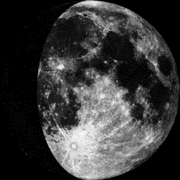
Moon Phase for August 24th at Midnight
2.5 Days Since First Quarter
______________________________________________
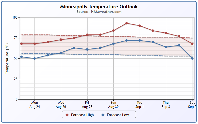
Minneapolis Temperature Trend
It'll be a chilly start to the week with highs in the 60s and 70s across the region. September-like temperatures will finally warm to August levels again by the end of the week/weekend ahead. Note that extended models suggest highs approaching 90F by the end of the month/early September. I mean, come on. What would the MN State Fair be without at least one warm spell?
_______________________________________________
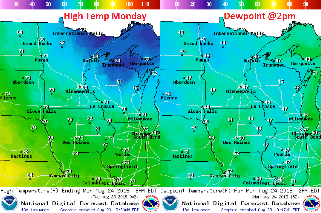
Monday Weather Outlook
Under the influence of a fall low pressure system. High temperatures in the 50s and 60s with dewpoint in the 40s will still feel like September.
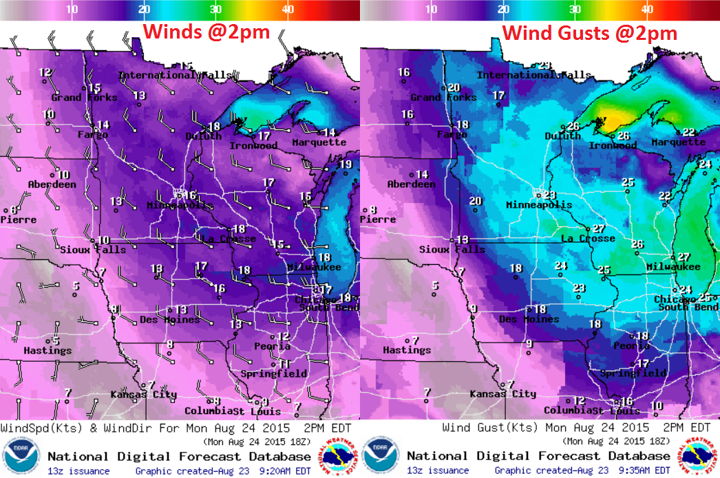
Monday Weather Outlook
Strong winds will still be in place on Monday. Feels like temperatures will be more Octoberish with gusty winds in the 15-30mph range.
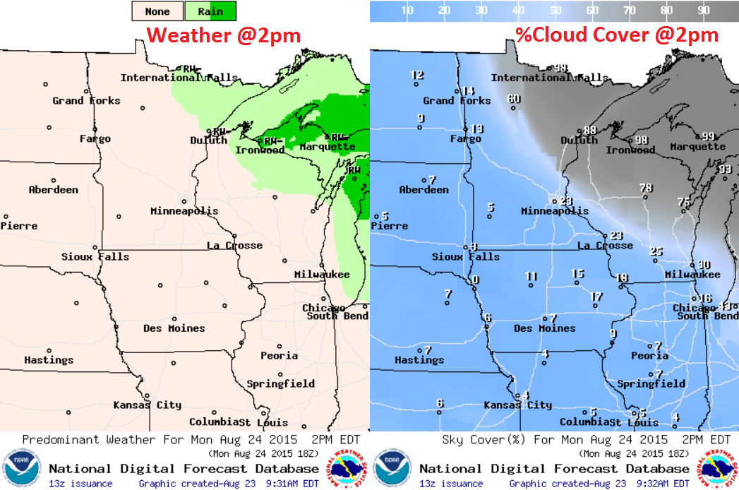
Monday Weather Outlook
A thick low cloud deck will still be in place across parts of the Western Great Lakes Region with a few spits of rain, but there will also be a little more sun across the region that what we had on Saturday & Sunday.
_______________________________________
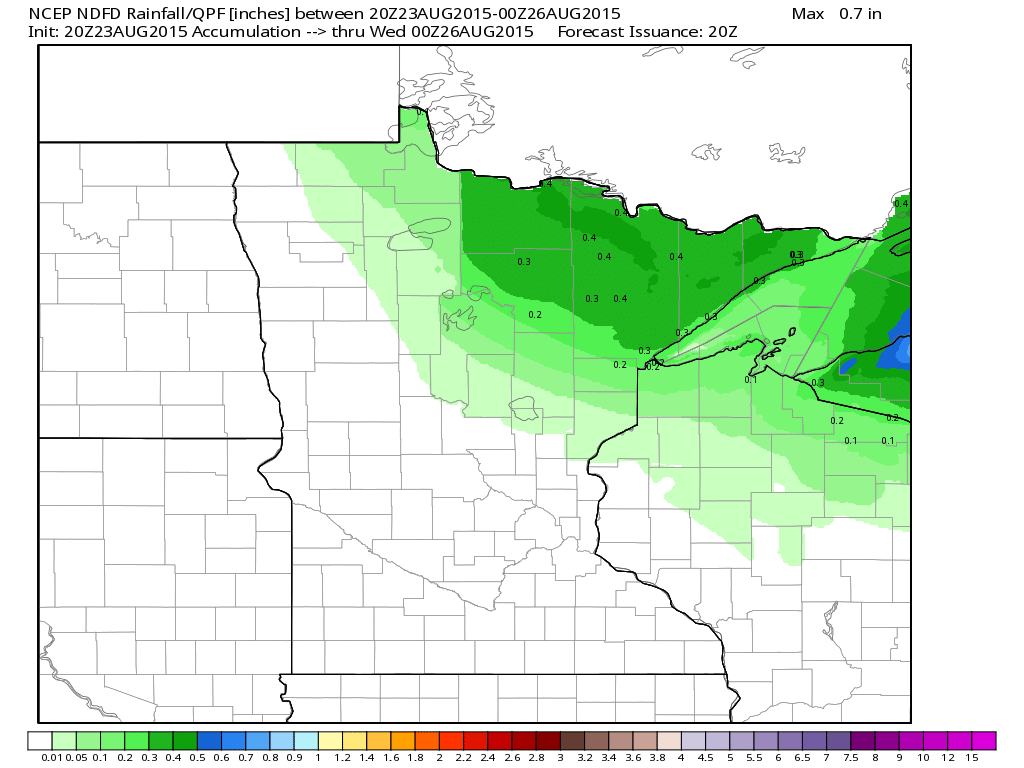
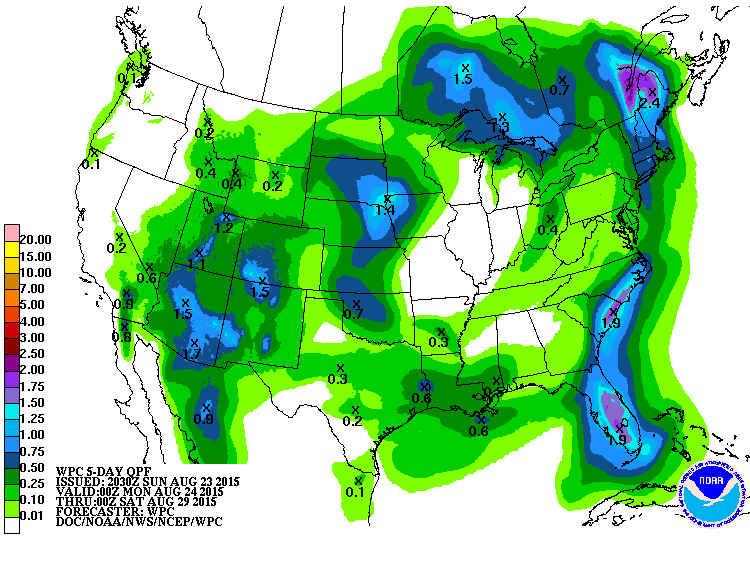
Rainfall Potential
Rainfall potential looks to be pretty minimal across the region. The image below suggests up to a few tenths of an inch across the Arrowhead with any wrap around moisture that may still be in place through the early week time frame.
______________________________
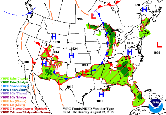
National Weather Outlook
A fairly large cold front will continue to sweet across the Eastern U.S. through early week with spotty showers and storms continuing along the eastern edge of the cooler push of air. In it's wake, a large area of cooler, drier weather will follow. The rest of the nation looks to be rather quiet, except for the potential monsoonal moisture in the Desert Southwest.
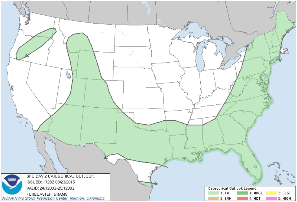
Severe Threat Monday
...SUMMARY... ISOLATED TO SCATTERED STORMS ARE EXPECTED FROM THE EASTERN STATES TO THE SOUTHWEST. LOCALLY STRONG WIND GUSTS MIGHT OCCUR FROM CENTRAL NEW YORK TO NORTHERN VIRGINIA...AND OVER PARTS OF THE CENTRAL GULF COAST STATES ON MONDAY AFTERNOON.
Severe Threat Tuesday
...SUMMARY... A CONDITIONAL THREAT FOR A FEW STRONG STORMS IS FORECAST ACROSS PORTIONS OF THE NORTHEAST ON TUESDAY. ...SYNOPSIS... AN UPPER-LEVEL LOW WILL MOVE ACROSS ONTARIO AND INTO THE LOWER GREAT LAKES. A SLOW-MOVING COLD FRONT WILL MOVE ACROSS MOST OF NEW ENGLAND DURING THE PERIOD AND SERVE AS A POTENTIAL FOCUS FOR SHOWERS/THUNDERSTORMS. FARTHER W UNDER A STATIONARY MID-LEVEL HIGH CENTERED OVER CO/NM...A LEE TROUGH IS FORECAST IN THE HIGH PLAINS.
5 Day Precipitation Outlook
____________________________________
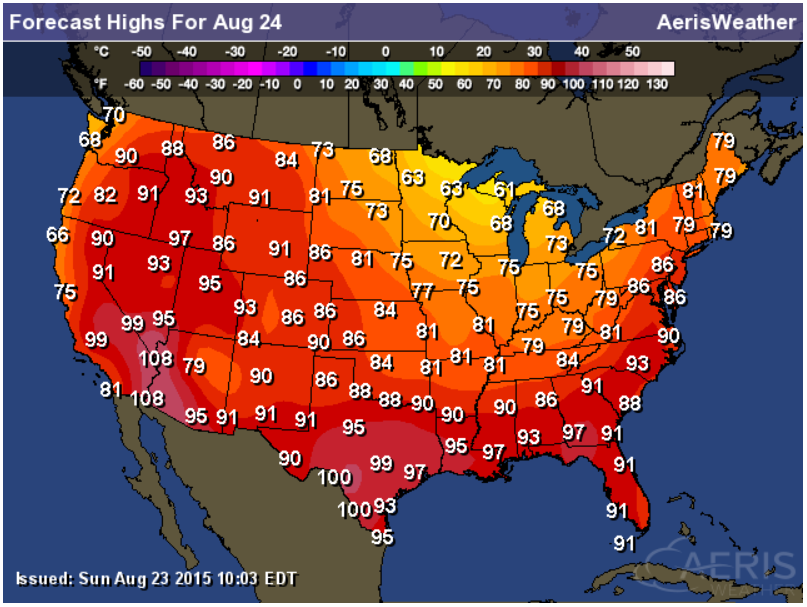
Highs Monday
Highs across the parts of the middle U.S. will still be quite chilly on Monday in the wake of the strong cold front. However, it'll still be quite warm across the western half of the country
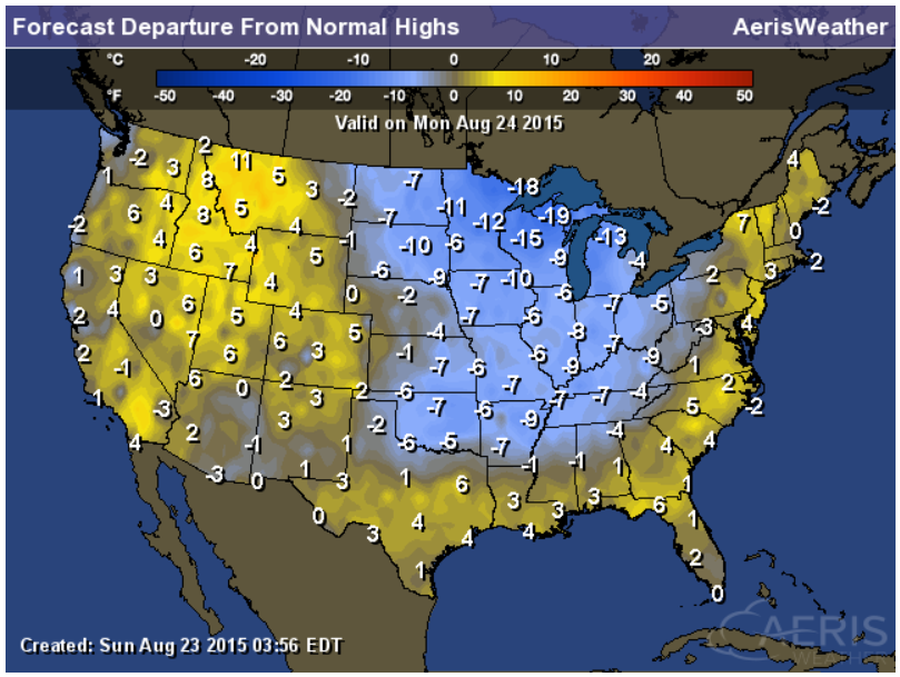
Highs From Average Monday
Note that temperatures in the wake of the cold front will still be running nearly 5F to 15F below average, but the western half of the country will still be nearly 5F to 10F above average.
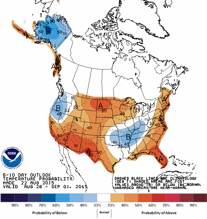
6 to 10 Day Temperature Outlook
According to NOAA's CPC, the Southwest, Midwest and Eastern Seaboard have decent chance of running above average in the temperature department at the end of the month.
___________________________________________
Lightning From the ISS
WOW! This is a neat picture taken from the International Space Station. Lightning from thunderstorms looks a little different above the cloud! These are called Sprites and Trolls and the ISS has a pretty good view!
"SPRITES AND TROLLS AT THE EDGE OF SPACE: We all know what comes out of the bottom of thunderclouds: lightning. But rarely do we see what comes out of the top. On August 10th, astronauts onboard the International Space Station were perfectly positioned to observe red sprites dancing atop a cluster of storms in Mexico. They snapped this incredible photo:"
See more from SpaceWeather.com HERE:
__________________________________________
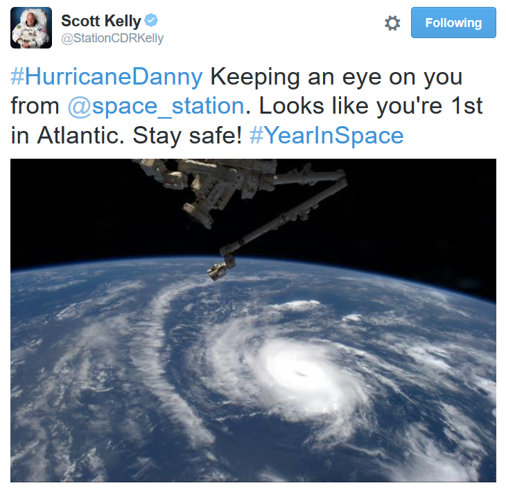
Danny from Space
I am amazed by some of the images that come from the International Space Station and here's another one. This time from Scott Kelly (Twitter: @StationCDRKelly) - an astronaut on the ISS. This was taken when Danny was a hurricane in the Central Atlantic.
____________________________________________
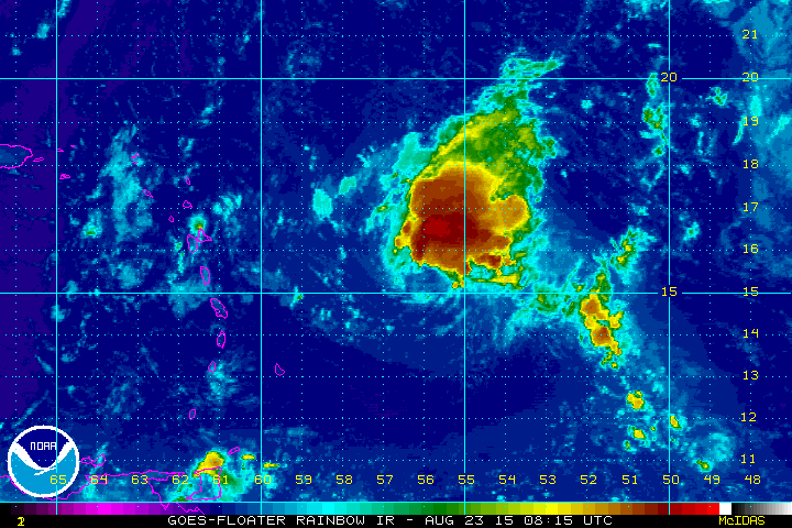
Update on Danny
As of PM Sunday, Danny was a tropical storm. The latest weakening was due to a hostile environment near the Caribbean. It appears that Danny will continue to weaken over the next several days as Danny drifts west.
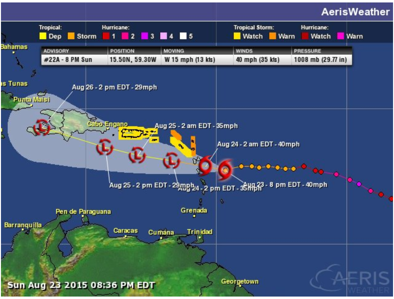
Tracking Danny
The forecast track for Danny isn't all that impressive. Continued weakening looks likely as Danny moves west.
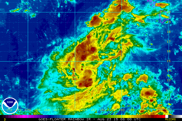
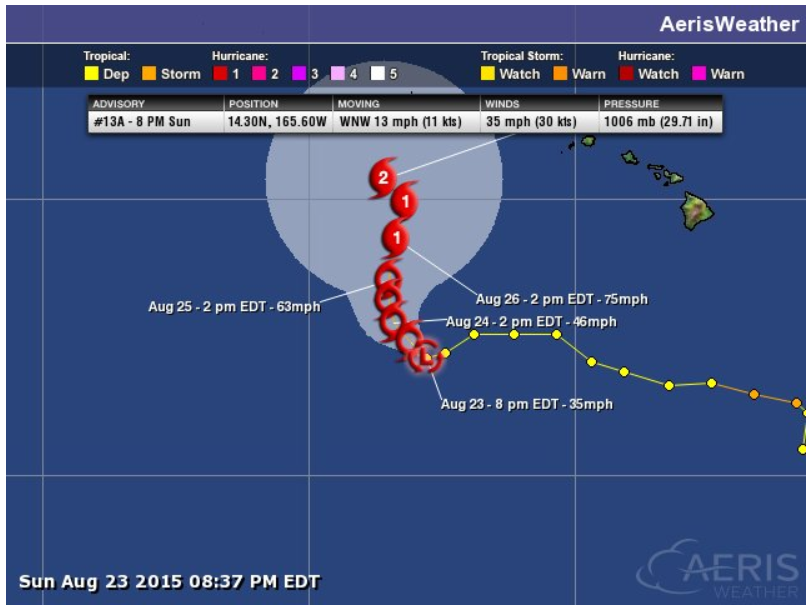
Update on Kilo
According to the Central Pacific Hurricane Center, Kilo was a tropical depression as of PM Saturday. The good news is that the latest forecast track keeps Kilo well away from the Hawaiian Islands.
 \
\Tracking Kilo
Although strengthening is expected with Kilo, it appears the track will drift west of the Hawaiian Islands through the week ahead.
____________________________________
Thanks for checking in and have a great week ahead. Don't forget to follow me on Twitter @TNelsonWX

No comments:
Post a Comment