What a treat it was to actually be able to see the northern lights early Wednesday morning. I actually had to pull over for a few minutes just to watch the dancing auroras. Unfortunately, I didn't have a good camera with me, but I was able to snap this with my Iphone! I am surprised it did this well!
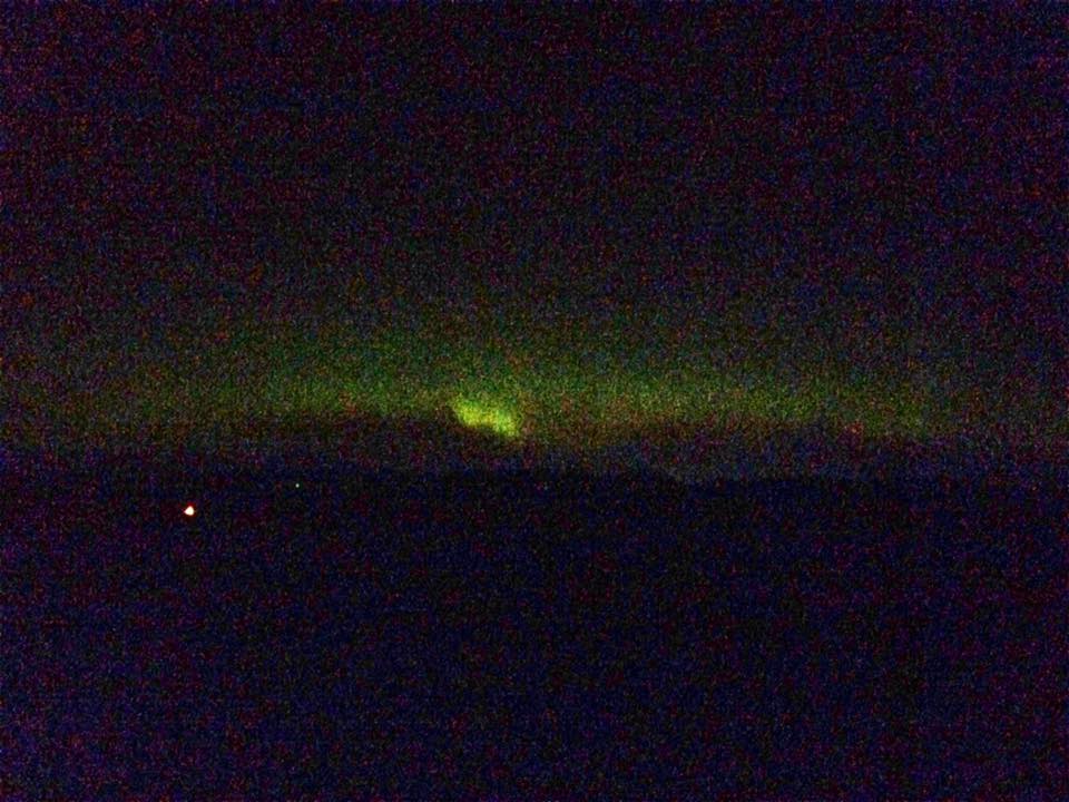
Northern Lights in the Twin Cities
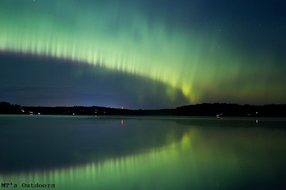
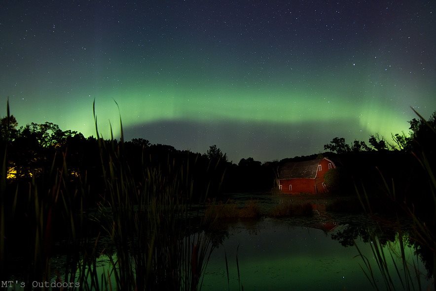
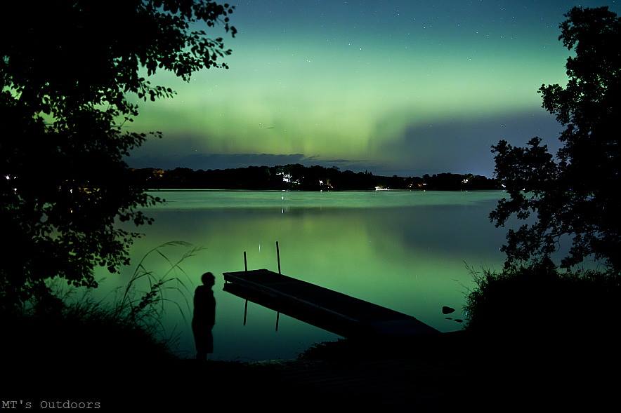
WOW! Michael Thompson does it again!! Look at these amazing images taken from the Twin Cities early Wednesday morning. The structure was quite impressive in this aurora display, wasn't it?
Check out Michael Thompson's other work HERE:
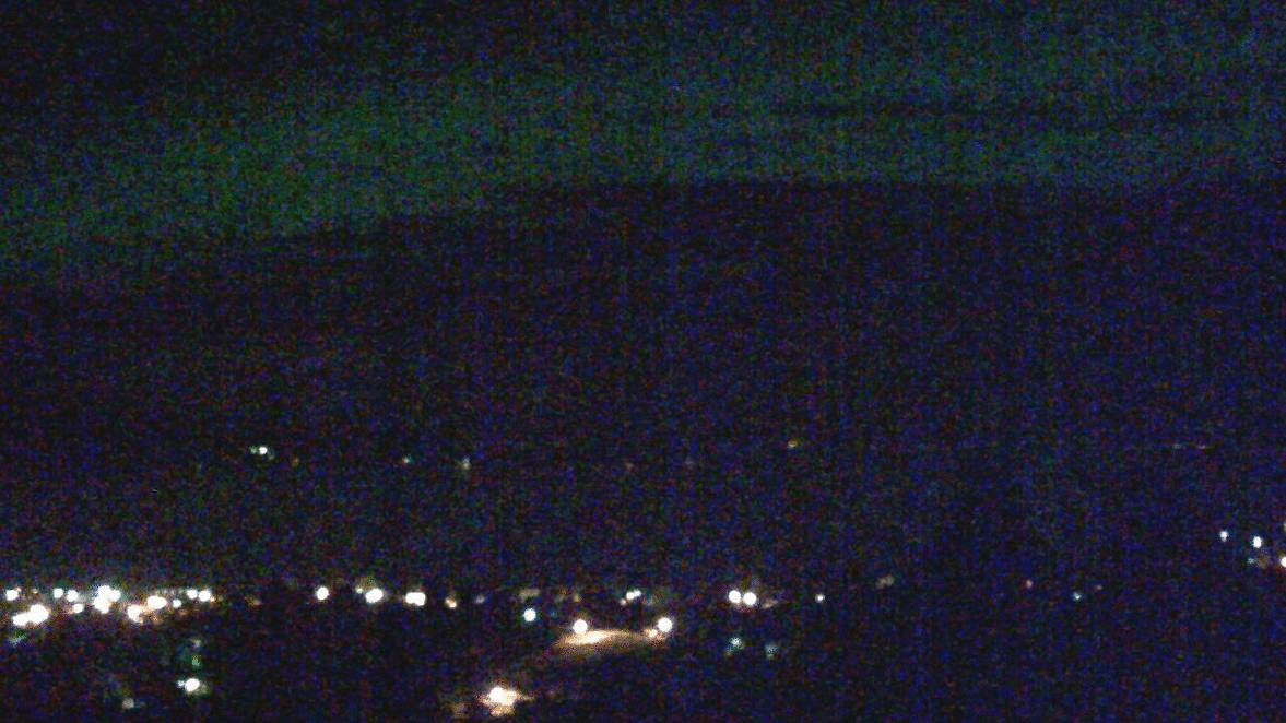
Northern Lights via Webcam
Here's a neat post from the National Weather Service out of Missoula Montana.
"What a treat tonight! The Northern Lights were on full display across the Northern Rockies. Check out this animated gif of what the Polson webcam looked like around 3 am MDT. Did anyone else happen to catch it?"
http://i.imgur.com/bArHAj7.gif
See the full post HERE:
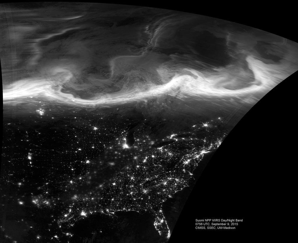
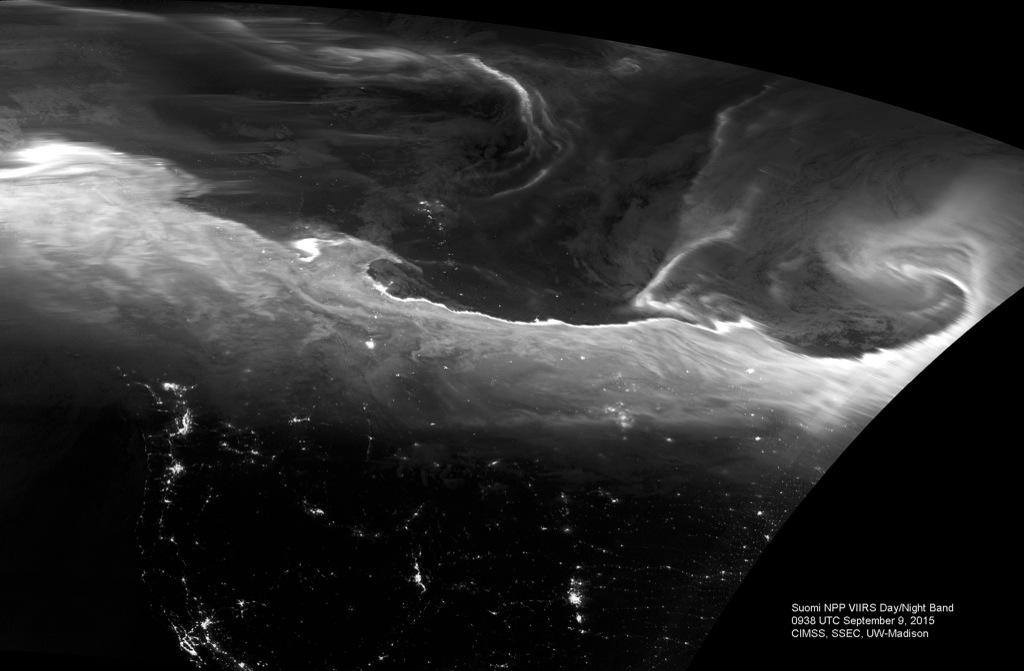
Northern Lights from Above
Now this is COOL! Thanks to UW-Madison CIMMS for this post, which shows the northern lights from above via the high resolution Suomi-NPP satellite!
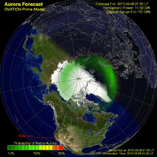
Aurora Forecast - OVATION
Here's a cool product from NOAA's Space Weather Prediction Center, which shows the formation of another round of northern lights PM Tuesday - AM Wednesday across North America.
See more from NOAA's SWPC HERE:
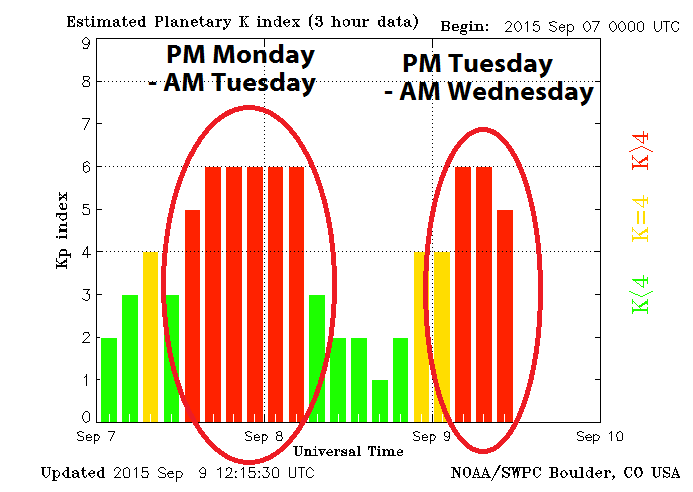
Kp-Index
The
Planetary K-Index shows the 2 different geomagnetic storms that took
place over the last couple of nights. Note that the one earlier this
week was a little longer lasting, while the one PM Tuesday - AM
Wednesday seemed to surge right at the time for a good show in North
America.
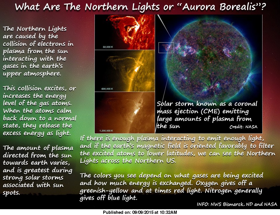
What are the Northern Lights Anyway?
Great post on Facebook Wednesday morning about the northern lights. Ever wondered what they are? Here's picture that may help:
_______________________________________
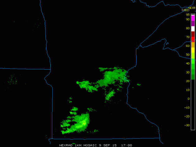
Wednesday's Rain
Here's
a look at the radar from Wednesday. Although rainfall tallies were all
that impressive, Wednesday turned into kind of a cloudy soggy day for
some.
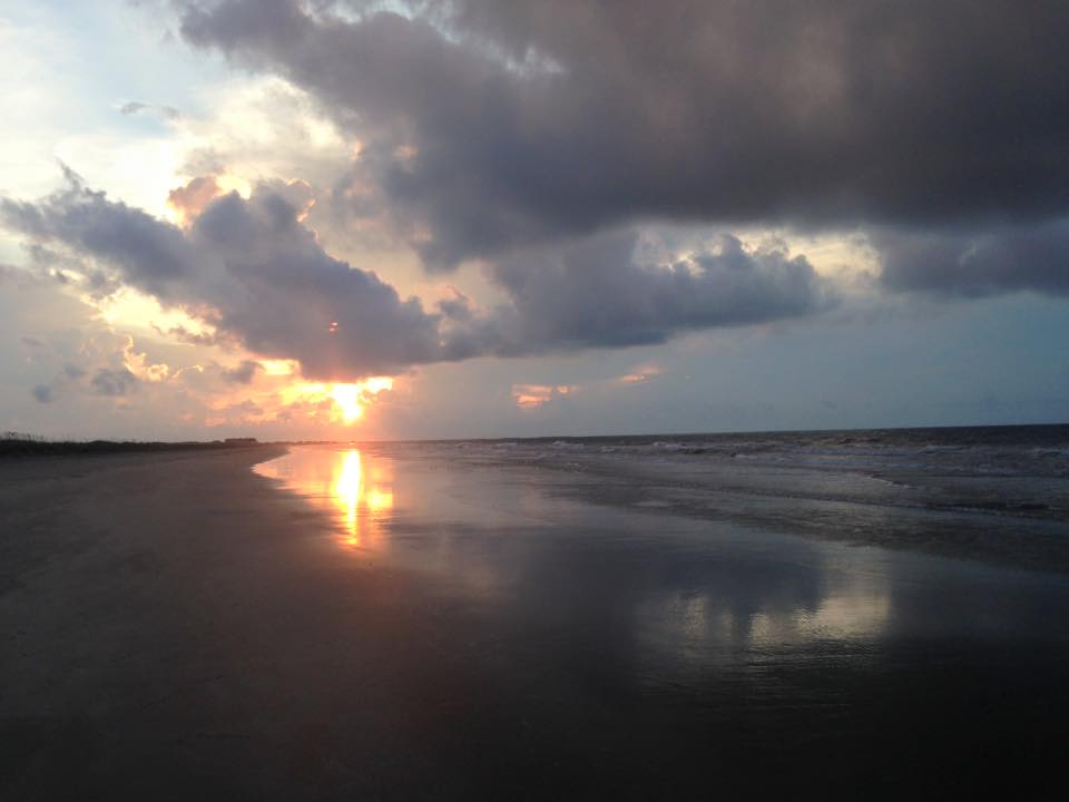
Kiawah Island
Thanks to my good friend, Robert Willey, for the picture below from Kiawah Island, SC. What a beautiful sunrise on Wednesday morning! Thanks and I hope you're enjoying your time!!
______________________________
Sweatshirt risk
By Todd Nelson
The second of two fronts pushed through yesterday with a few spotty showers and storms. It wasn't anything spectacular, but the clouds made for kind of a lazy Wednesday.
Not sure about you, but I definitely didn't have the hop in my stop like I normally do when it's sunny! It really is amazing to think how much the weather plays a role in how you feel day to day. One way to help combat moody weather is a little exercise. Take a little walk at lunch; find your Zen and creativity.
Weather maps have been a little more creative lately; kicking up cold fronts at a fairly frequent rate. We'll be post-front today with temperatures dipping in to the 60s and 70s across the state. I suspect sweatshirts will make a return to area prep football games tomorrow as temperatures fall through the 50s and 60s by the 2nd half.
No problems for the weekend, other than being a little chillier than average. Bright, brisk sun will be perfect for apple picking on Saturday. A milder south breeze picks up on Sunday with spotty showers and storms developing into early next week.
We're still about 1 month away from the average first frost in the Twin Cities metro, so garden on!
______________________________
WEDNESDAY NIGHT: Lingering shower or storm possible early. Low: 57. Winds: SW 5mph
THURSDAY:Lingering clouds and showers. High: 70. Winds: Turning NW 5-10mph
THURSDAY NIGHT: Partly cloudy and cooler. Low: 49. Winds: NW 5-10mph
FRIDAY:Dry. Risk of a sweatshirt. High: 64. Winds: NNW 5-15mph
SATURDAY: Beautiful Fall day! Cool sunshine. Wake-up: 45. High: 67.
SUNDAY: Sunny. Warmer breeze. Late PM storm. Wake-up: 51. High: 74.
MONDAY: AM shower, more PM sun. Wake-up: 57. High: 75
TUESDAY: Breezy. Spotty thunder. Wake-up: 57. High: 76.
WEDNESDAY: A few wind-whipped showers. Wake-up: 60. High: 71.
_________________________________
This Day in Weather History
September 10th
2002: A late-season tornado strikes Albertville just after midnight .According to a damage survey conducted by NWS personnel, it touched down on the eastern edge of Cedar Creek Golf Course, then it moved straight east and dissipated in a city park just west of the railroad tracks. It completely tore the roof off of one home. Roofs were partially off a number of other homes, many attached garages collapsed, and a couple of houses were rotated on their foundation. About 20 homes were damaged, nine of which sustained significant damage.
1986: 3 inch hail fell in Watonwan County.
1947: Downpour across the Iron Range. Hibbing got 8.6 inches in three hours.
1931: St Cloud's high was 106 degrees, while it reached 104 degrees in Minneapolis.
1910: Duluth had the shortest growing season ever with frost free days from June 14 to September 10 (87days). Normally the frost-free season is 143 days.
__________________________________
Average High/Low for Minneapolis
September 10th
Average High: 74° (Record: 104° set in 1931)
Average Low: 55° (Record: 37° set in 1917)
__________________________________
Sunrise/Sunset Times for Minneapolis
Sunrise: 6:45am
Sunset: 7:33pm
*Daylight lost since yesterday: ~3 minutes and 4 seconds
*Daylight lost since Summer Solstice (June 21st): ~2 hours and 48 minutes
___________________________________
Moon Phase for September 10th at Midnight
2.0 Days Before New Moon

______________________________________
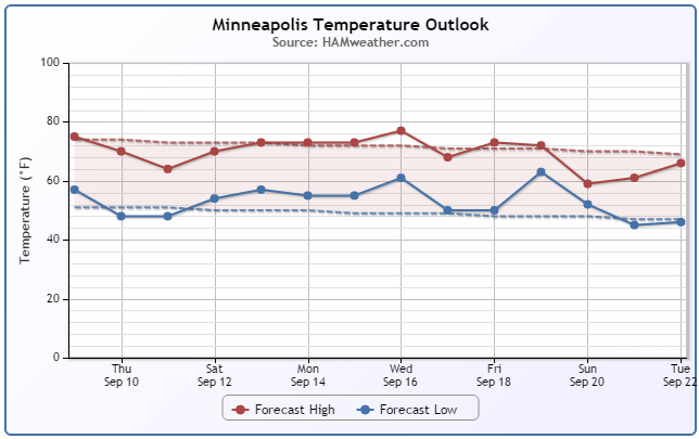
Minneapolis Temperature Trend
Cooler temperatures make a return through the end of the week with highs below average, especially Friday. Note that we look to warm up a bit over the weekend/next week prior to another potential cool down during the 3rd weekend of September.
______________________________________
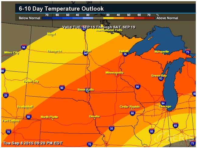
6 to 10 Day Temperature Outlook
We've had a lot of talk about cooler than average temperatures moving in over the next few days, but take a look at this bubble of warmth that could sneak in by mid week next week! Temperatures are forecast to be warmer than average, but it appears by the end of next week, we'll be dealing with fall-like temperatures again.
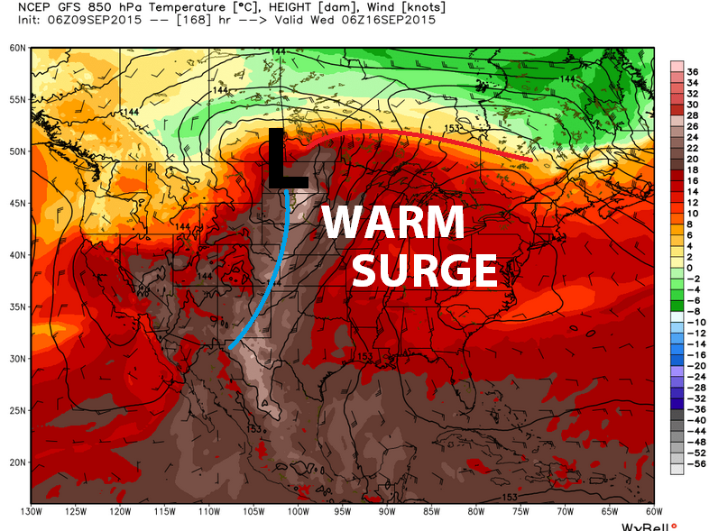
Warm Surge Next Week
Extended model runs are suggesting a fairly vigorous area of low pressure across the middle part of the country early/mid week next week. Note that ahead of the cool front, there appears to be a decent bubble of warm weather surging north across the eastern half of the country.
_________________________________________
Thursday Weather Outlook
Thursday will be a fairly cool day across the region with highs only in the 60s and 70s across the state. Dewpoints in the 40s and 50s will make it feel a little more crisp and autumn-like.
Thursday Weather Outlook
It appears that we'll have a bit of a cool northwesterly breeze on Thursday... I wouldn't be surprised to see a few more long sleeves as we head through the end of the week.
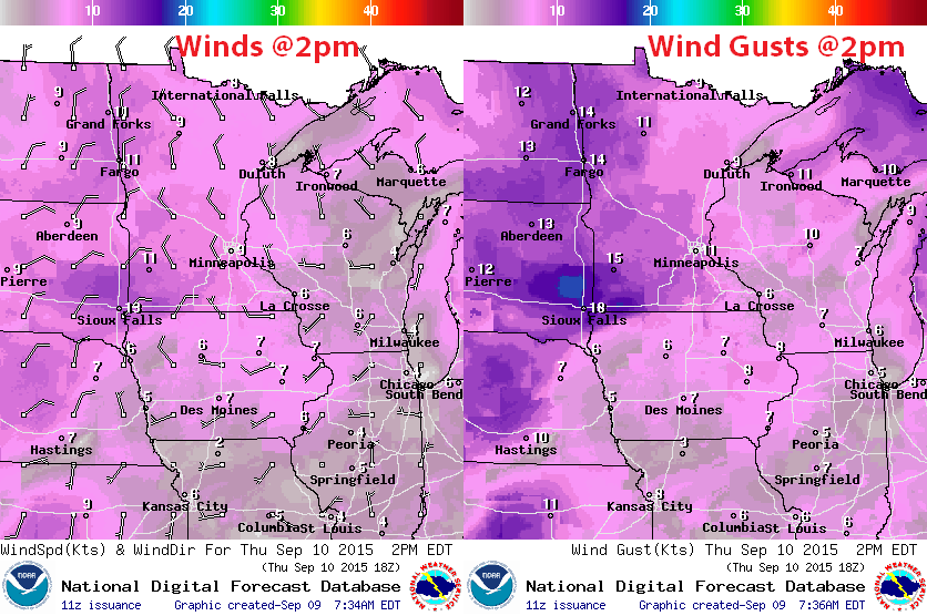
Thursday Weather Outlook
Most of the precipitation from PM Wednesday - AM Thursday will continue to push east, but there could be a few lingering showers/rumbles as this next impulse of energy slides southeast through the region. It also appears that we'll have a mix of clouds and sun with more sun moving in by Friday.
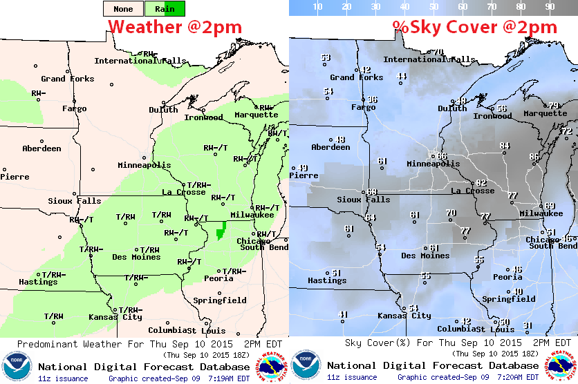
Rainfall Potential
Rainfall from PM Wednesday - Thursday will continue to slide east with quieter/drier conditions expected into the weekend. Temperatures will also be warming into the weekend, so it appears to be a pretty nice/dry weekend shaping up!

_______________________________________
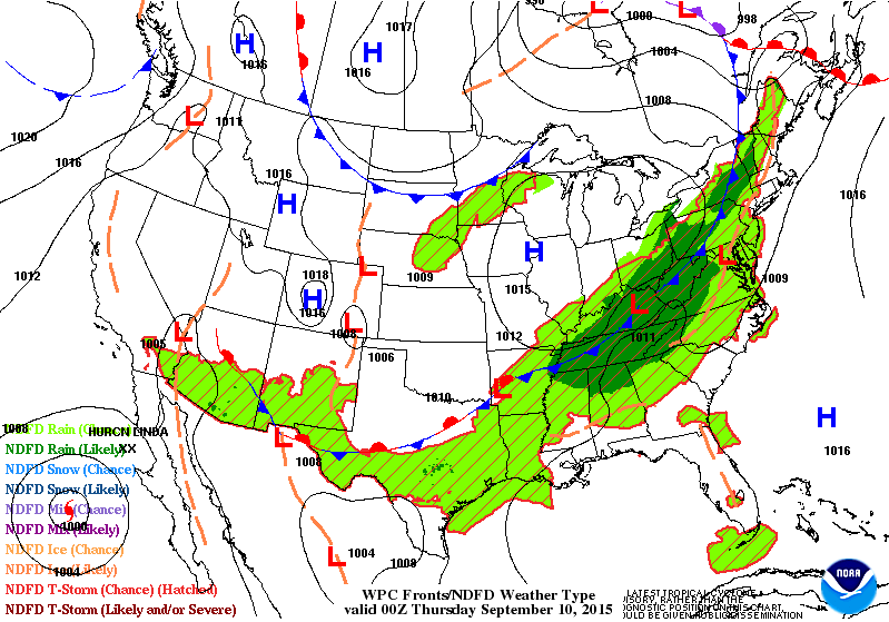
National Weather Outlook
The loop below shows 2 cold fronts working across the eastern half of the country. The first of which has brought heavier rainfall to many locations in the eastern half of the country since last weekend. It also dropped temperatures a bit, but the next front will not only bring a little more rainfall, but it will also help to reinforce the cold air through the end of the week/weekend ahead.
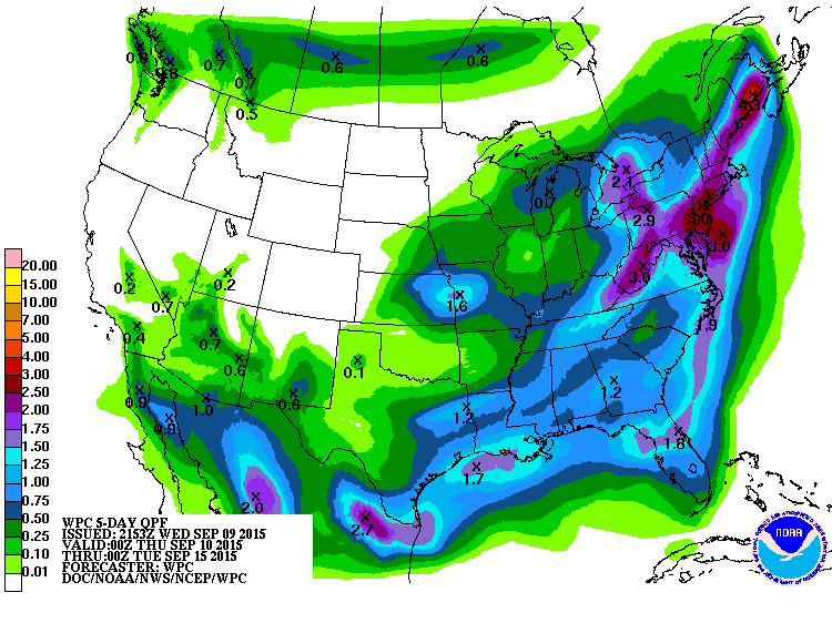
5 Day Rainfall
The heaviest rainfall over the next couple/few days looks to be confined mainly to either the eastern third of the country or along the southern tier of the nation. Some of the heaviest moisture will be found along in the Northeast, especially near Maine, while moisture will be trickling into the Desert Southwest from Hurricane Linda in the Eastern Pacific.
______________________________________
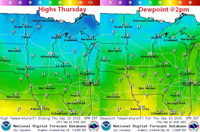
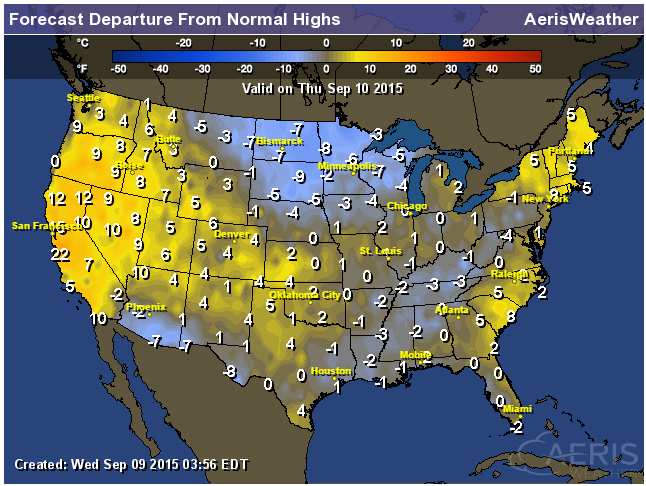
Highs From Average Thursday
The image below suggests how much above or below average high temperatures we'll be on Thursday. Note that we've cooled down considerably since last week. Now, much of the eastern half of the nation is eastern closer to or slightly below average. Meanwhile, temperatures in the western third of the nation look to be warming up to well above average levels once again.
________________________________________
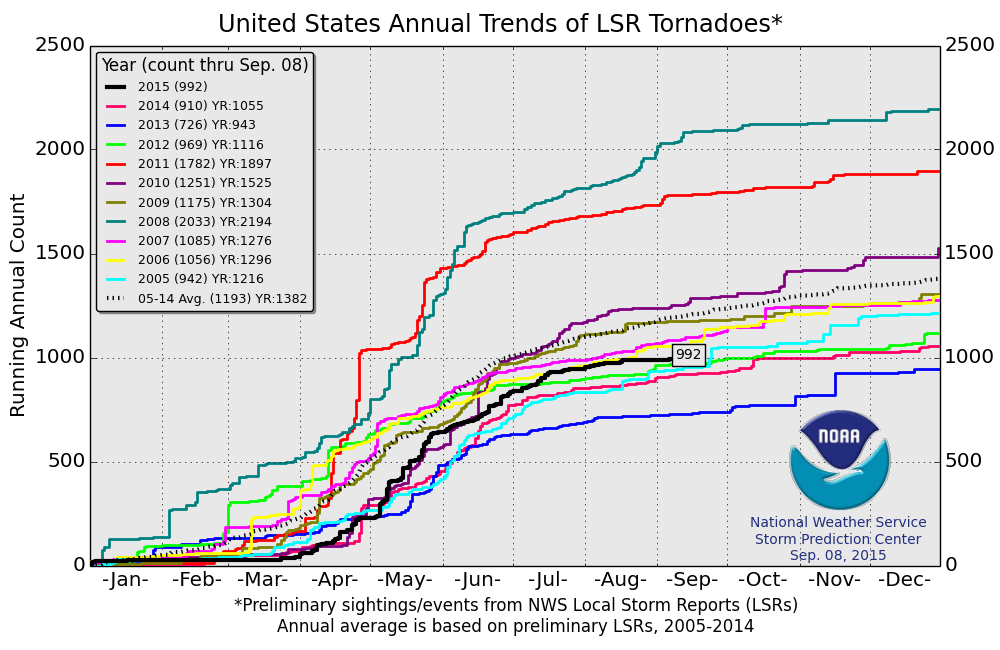
2015 Tornado Reports
According to NOAA's SPC, there have been nearly 1000 preliminary tornado so far this year. Keep in mind that the 2005-2014 average is nearly 1200 through September 8th, so we're a little behind the short-term average.
______________________________________
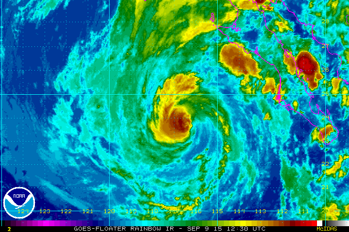
Tropical Update
This is what the tropical basin looked like PM Wednesday with 4 areas of interest in play. Jimena and Linda and in the Eastern Pacific and Tropical Depression EIGHT and the remnants of Grace in the Atlantic.
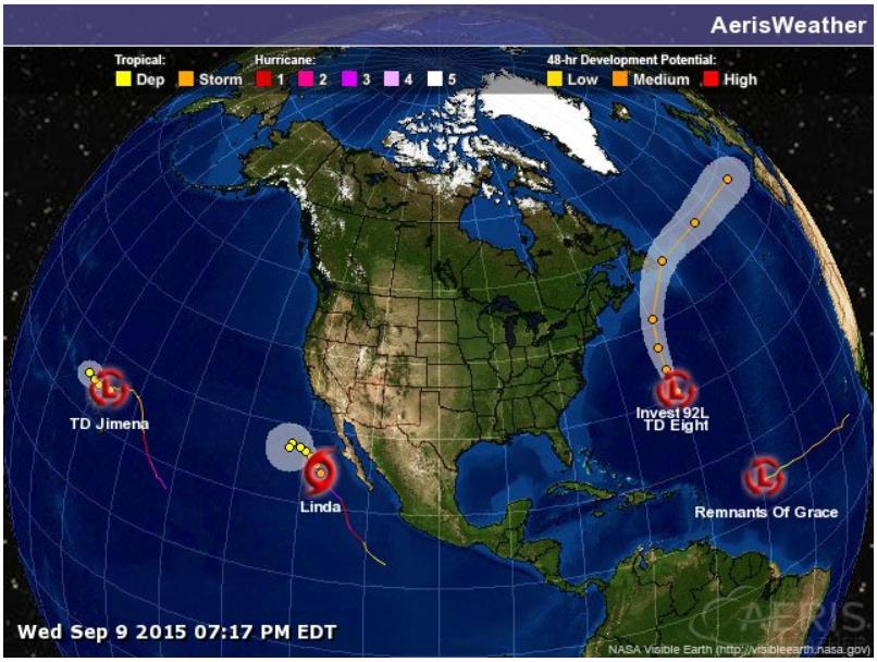
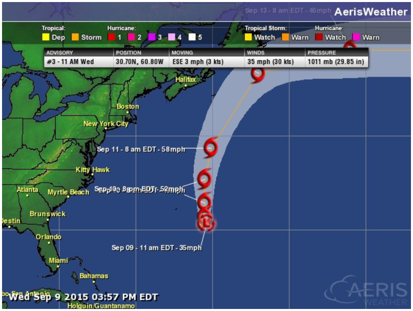
Tropical Depression EIGHT
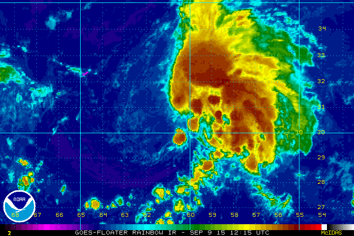
Newly formed Tropical Depression EIGHT formed in the Atlantic basin, but looked still fairly unorganized by PM Wednesday.
Tracking T.D. EIGHT
T.D. EIGHT is expected to strengthen into Tropical Storm Henri soon. However, the track takes it well away from the U.S..
____________________________________
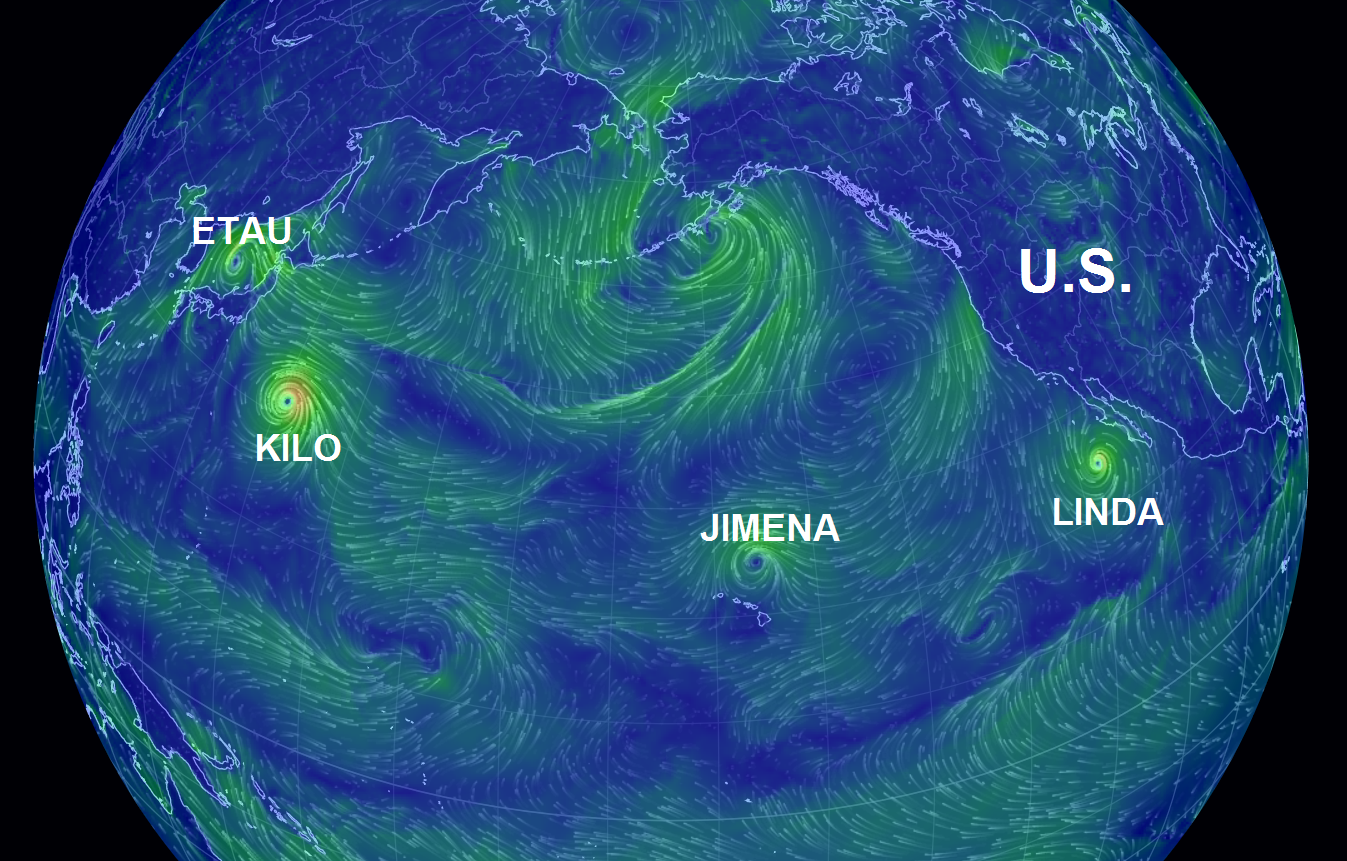
Pacific Update
Thanks to warm water temperatures in the Pacific, tropical systems remain quite active. From left to right, Etau, Kilo, Jimena and Linda were still ongoing as of PM Wednesday.
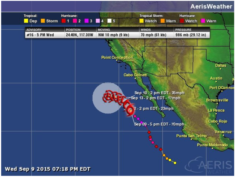
Linda
As of PM Wednesday, Linda was on a track to weakening. Down from it's category 3 strength earlier in the week, Linda was a tropical storm.
Tracking Linda
Linda will continue to track NW (away from Baja California) over the coming days with weakening expected through that time frame.
_________________________________________
Thanks for checking in and have a great rest of your week. Don't forget to follow me on Twitter @TNelsonWX

No comments:
Post a Comment