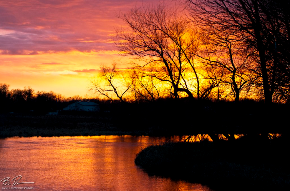
Thanks to @Bill_Doms for the gorgeous picture below from over the weekend. The picture was taken in rural Wright county. Thanks Bill!
Damp Wednesday and a little Turkey day snow
By Todd Nelson, filling in for Douglas
'Tis the season for extra layers, slippers, white-knuckle driving and over eating. Turkey day seems to be the kick off and I've been prepping; eating in short bursts, hoping to expand my belly in advance of the regretful caloric indulgence that is likely to occur on Thursday.
While many are planning on traveling over the next couple of days, a storm system will wrap up over the Central U.S., making for a few trouble spots. The good news is that significant snowfall tallies look unlikely close to home as the storm passes to our south, but rain changing to light snow Wednesday into Thursday may make for a slower commute as your mouth waters on the way to Grandma's house. Don't forget to try the pumpkin pie!
Temperatures dip a big to below average levels post storm system through the end of the week and just cold enough for the possibility of a light coating of snow Sunday/Monday as another system swings through.
Keep in mind that we are nearly 8 inches below average snowfall at MSP this season with no major dumps in sight.
______________________________
TUESDAY NIGHT: Becoming mostly cloudy, areas of drizzle possible late. Winds: SSE 10. Low: 32.
WEDNESDAY: Cloudy and damp. Light rain/drizzle changing to light snow later. Winds: SSE 10, turning W by the afternoon. High: 45.
WEDNESDAY NIGHT: Cloudy. Areas of drizzle and light rain changing to light snow. Winds: NNW 10. Low: 31
THURSDAY: Cool breeze, a few inches of wet snow in SE MN. Winds: N10-15. High 32.
FRIDAY: Chilly sunshine. Winds: SW 5. Wake-up: 22. High: 34.
SATURDAY: Dry. Clouds thicken late. Winds: S 5. Wake-up: 21. High: 37.
SUNDAY: More clouds. Light rain/snow mix late. Winds: ENE 10. Wake-up: 23. High: 38.
MONDAY: Rain changes to snow Winds: NNE 10-15. Wake-up: 26. High: 34.
TUESDAY: Lingering clouds and light snow. Winds: NW 10-15. Wake-up: 25. High: 32.
________________________________
This Day in Weather History
November 25th
1977: Record lows are set across central Minnesota with lows in the teens below zero. Montevideo had the coldest temperature of 18 degrees below zero along with Long Prairie at 16 degrees below zero.
1820: Ft. Snelling is in the middle of a three-day blizzard that would dump nine inches of snow.
_________________________________
Average High/Low for Minneapolis
November 25th
Average High: 36F (Record: 62F set in 1914)
Average Low: 21F (Record: -18F set in 1880)
__________________________________
Sunrise/Sunset Times for Minneapolis
November 25th
Sunrise: 7:23am
Sunset: 4:36pm
__________________________________
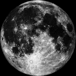
Moon Phase for November 25th at Midnight
0.3 Days After Full Beaver Moon
"Full Beaver Moon, Nov. 25, 5:44 p.m. EST— Time to set beaver traps before the swamps freeze to ensure a supply of warm winter furs. Another interpretation suggests that the name Beaver Full Moon comes from the fact that the beavers are now active in their preparation for winter. It is also called the Frosty Moon."
_____________________________________
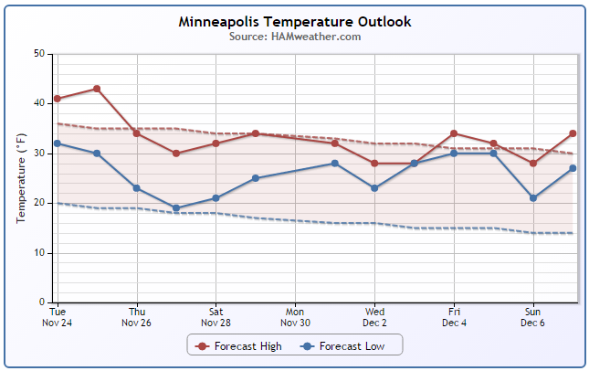
Minneapolis Temperature Trend
Temperatures will be fairly mild on Wednesday as moisture begins spreading through the region, but it won't take long for the cooler weather to move back in as the storm system sags south. Note that by the end of the week/weekend ahead, temperatures dip to slightly below average levels. Keep in mind that this may be cool enough for some light snow accumulations on Thanksgiving Day Thursday closer to home.
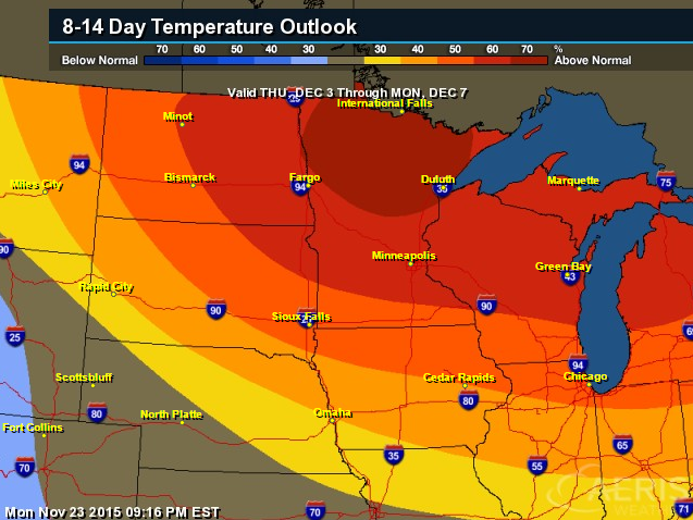
8 to 14 Day Temperature
According to NOAA's CPC, the 8 to 14 day temperature outlook, which takes us into early December, suggests warmer than average conditions once again possible across much of the Upper Midwest/Great Lakes Region.
_________________________________
Wednesday Weather Outlook
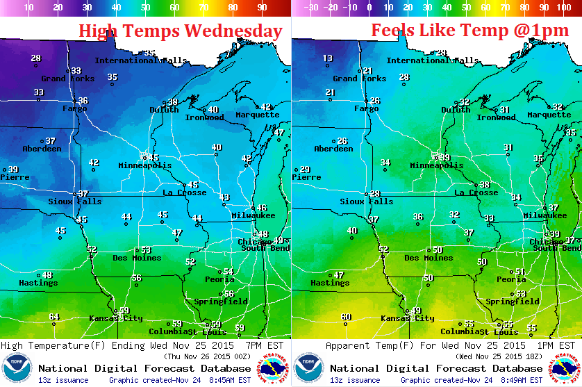
Highs on Wednesday will reach the 40s across the southern part of the state, but with the winds, temperatures around the state will fell more like the 20s and 30s. Enjoy this somewhat milder weather while you can because it looks much cooler by the end of the week.
Wednesday Weather Outlook
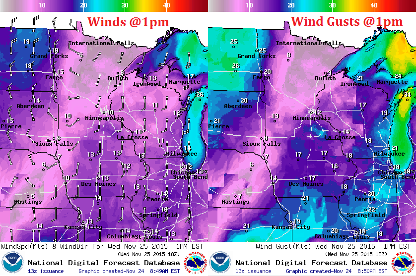
The wind field on Wednesday will be a bit odd as the storm system moves through the Midwest. Note that winds will be in a southerly direction along and east of the Mississippi Valley, while winds west of that mark switch to a more west/northwesterly direction! Precipitation type will depend on what direction the winds are from. Southerly winds would mean warmer air and a better chance of liquid, while winds switching northwesterly would be colder air and a better chance of snow.
Wednesday Weather Outlook
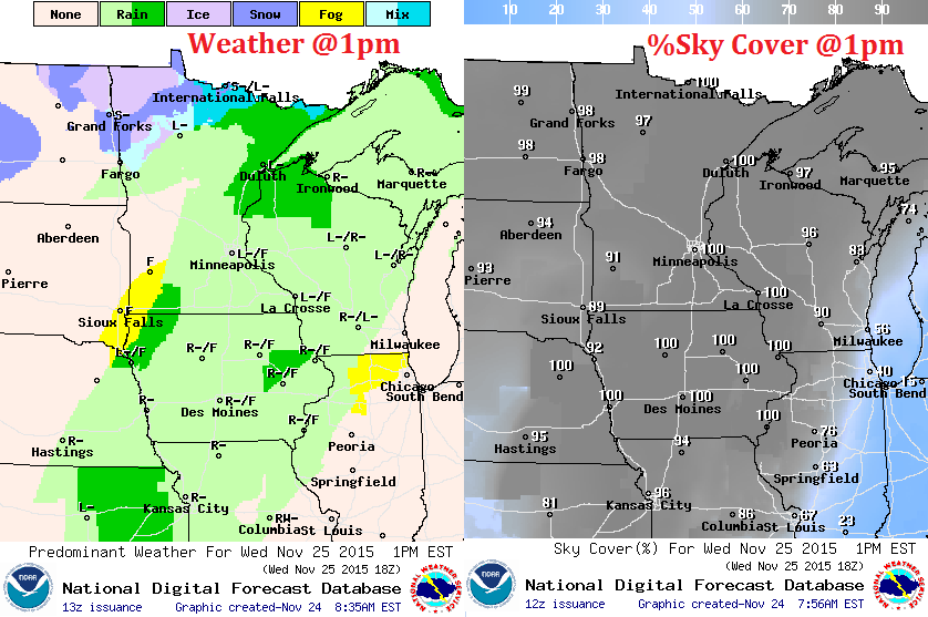
Here's the weather outlook at 1pm Wednesday. Note that much of the region will still be warm enough for liquid precipitation, but there may be a mix starting across the far northwestern part of the state as colder temperatures begin to move in. As the cold air begins to sink south, mixed precipitation and snow potential will increase late Wednesday through Thursday.
______________________________________
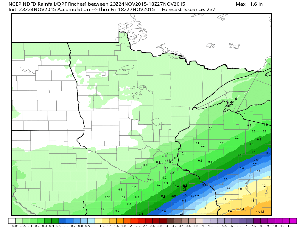
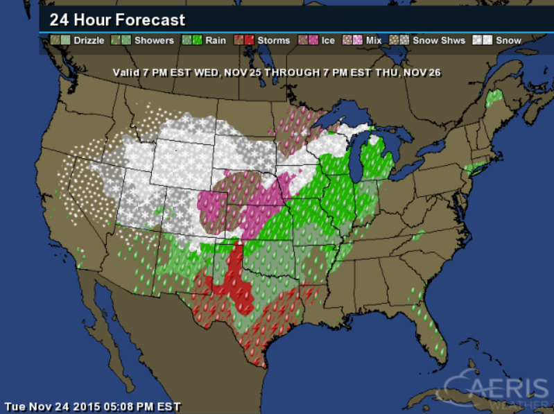
Minnesota Precipitation Outlook
Here's the precipitation outlook through midday Friday. Note that the heaviest appears to be developing southeast of the Twin Cities.
Minnesota Snow Potential
Snowfall potential will be possible across the southeastern part of the state with a couple/few inches of slush possible through midday Friday.
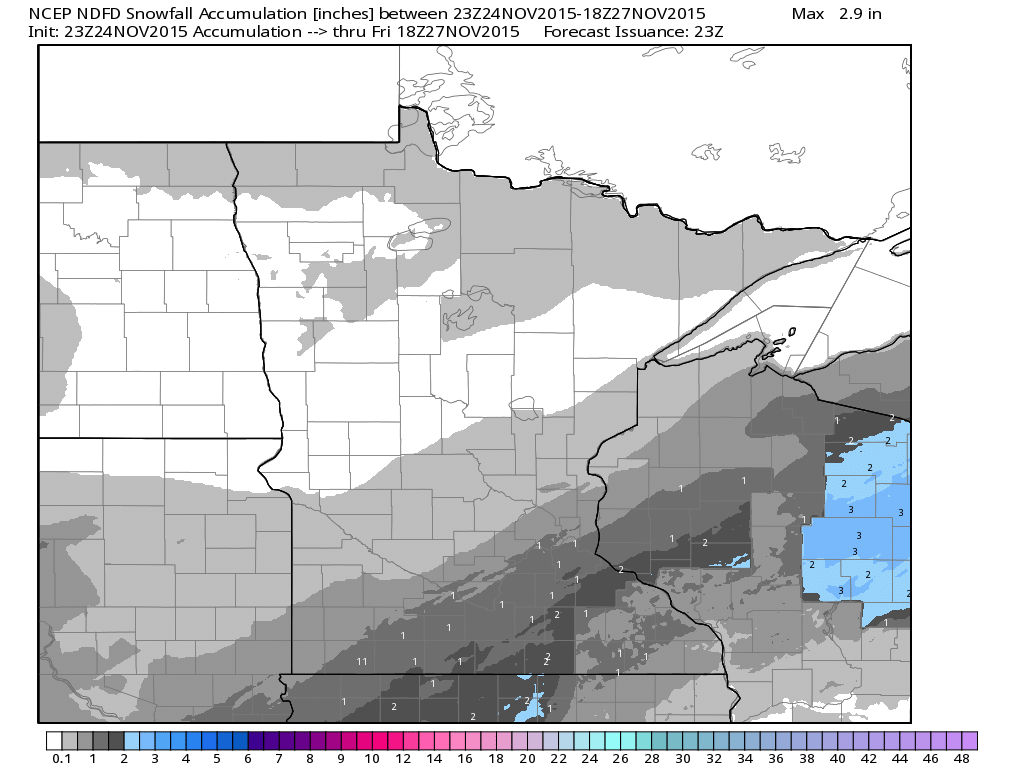
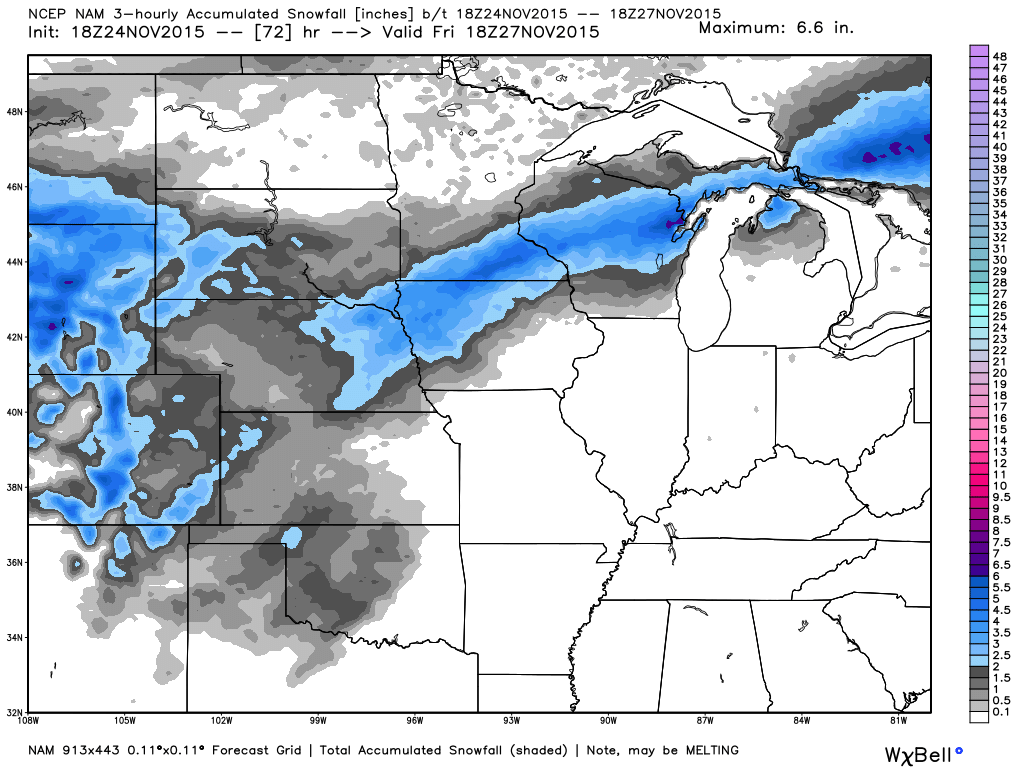
NAM: Snowfall Potential Through Midday Friday
The snowfall potential looks to be increasing through the end of the week across parts of the Midwest/Great Lakes. Note the light/dark blue colors, which indicates the potential of a few inches of slush possible by the end of the week.
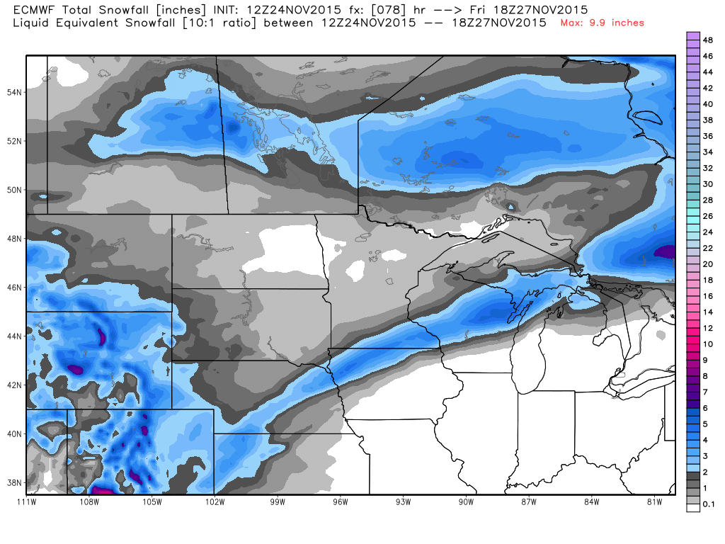
ECMWF: Snowfall Potential Through Midday Friday
Here's another model solution, which shows a similar outlook as above, the bulk of which looks to miss the Twin Cities.
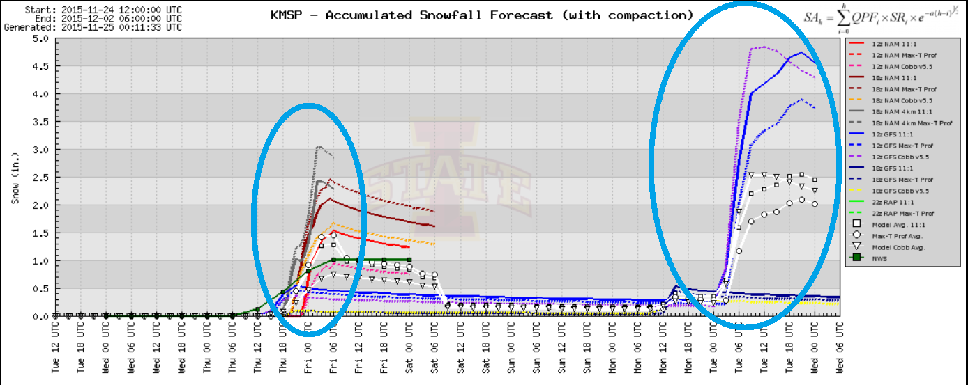
2 Upcoming Snow Chances for Minneapolis
Here are the 2 snowfall chances for Minneapolis over the next several days. The first snow chance comes in on Thanksgiving day, while the second comes in early next week. Both could bring a little slush close to home. Stay tuned!
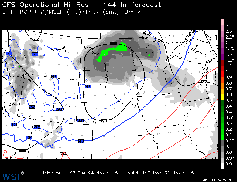
Monday Snow Chance
Here's
the system that looks to impact the Upper Midwest early next week. The
latest update doesn't look quite as impressive as earlier runs, but
it'll still be worth watching.
National Weather Outlook
The weather loop below shows the storm system developing and sliding into the Central U.S. through Thursday. Note that heavier rain looks to develop on the warmer side of the storm with snow developing on the colder northern/western side.
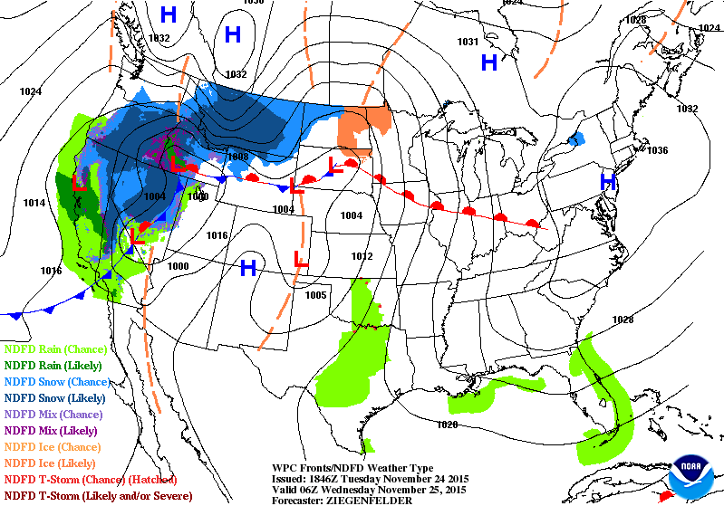
Thanksgiving Day Outlook
Here's the 7pm Wed. - 7pm Thursday weather outlook. This messy storm system will be capable of heavy rain, isolated flood concerns and snow potential. Travel issues will be possible as the storm system moves through.
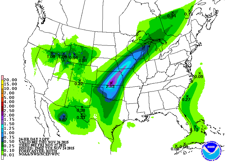
Thanksgiving Day Precipitation
According to NOAA's WPC, the precipitation potential from 6pm Wed. to 6pm Thurs. suggests heavy rain potential across parts of the Central Plains with as much as 1" to 2"+ possible.
______________________________________
Highs From Average Thursday
Temperatures will be dropping post storm system. Here are the departures from average highs across the nation. Note that highs will be running nearly 10F to 15F above average ahead of the system, but they will be nearly 10F to 20F+ below average in the Western U.S..

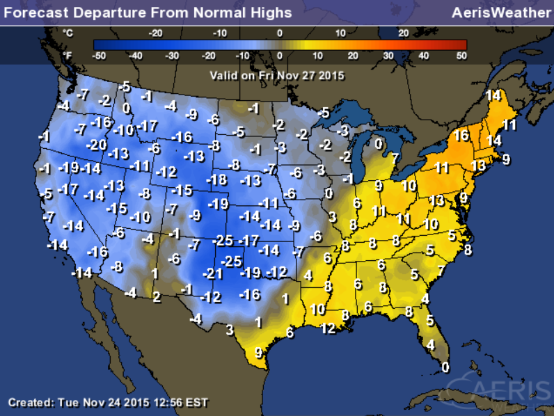
Highs From Average Friday
Cooler than average temperatures will continue to spread east with some of the significant departures showing up across the Central/Southern Plains.
Thanks for checking in and have a great rest of your week! Don't forget to follow me on Twitter @TNelsonWX

No comments:
Post a Comment