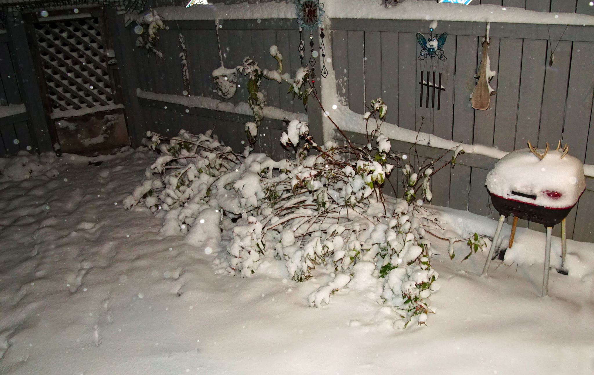
Thanks to my good friend Donna Maxie from northeastern Minnesota for the picture below who woke up on Friday morning to 4" of snow!
Snowy Ely, MN
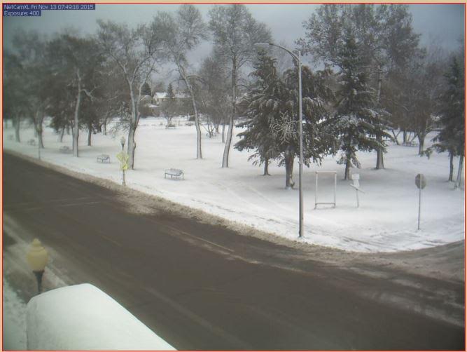
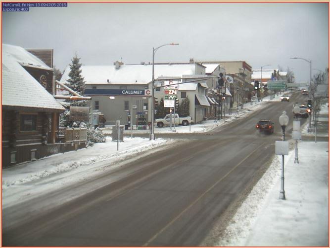
There was a fresh coating of snow in Ely, MN on Friday morning as well. This is what it looked like in downtown Ely.
Snow Reports
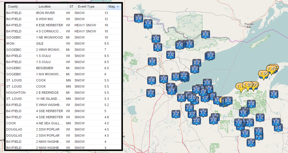
Some of the heaviest snowfall reports came in along the south shore of Lake Superior with a nearly a foot of snow reported in some locations!
__________________________
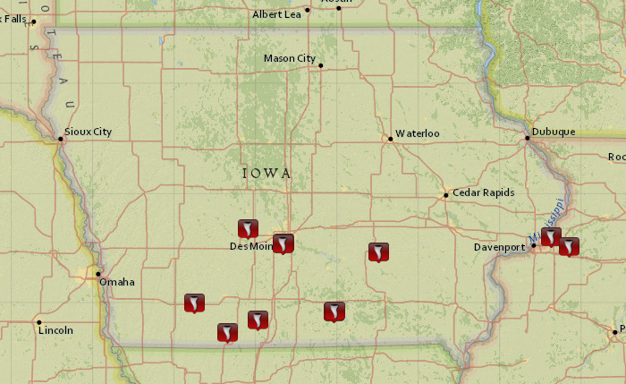
Des Moines, IA: Tornado, Then Snow??
On Wednesday, November 11th severe weather popped up across parts of the Midwest. According to NOAA's SPC, there were nearly 150 severe weather reports (Hail, high winds and tornadoes) 12 of which were tornadoes, including 1 that was observed from the Des Moines International Airport!
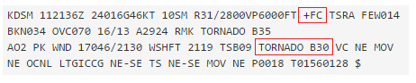
"The Des Moines Airport weather station reported a very unique combination of weather phenomena on Wednesday, 11 November 2015. At 3:36 PM, a tornado was sighted near the airport and an augmented METAR report was generated:"
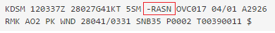
"And just 6 hours and 1 minute later, a rain snow mix was reported"
"Has such a close combination of such events been recorded before?For the Des Moines Airport, the answer appears to be "no". Based on IEM archives, just four other dates have had a tornado reported by the METAR report for the Airport:"
See more from @akherz at IEM HERE:
__________________________
An Extended October - Real Cold Front Brewing?
By Paul Douglas
We are hard-wired to react to weather; it's in our DNA. Weather is a specific Vikings football game. Climate is the Vikings win/loss record for the past 47 years. Weather is a snapshot, climate is the 2-hour movie.
If the climate scientists are right we should be experiencing more warmer than colder than average days. We are. If they're right the volume of arctic air every winter should be dropping over time. It is.
We're seeing fewer subzero nights and a longer growing season. The thumbprints of climate change are there, but it takes perspective and a willingness to drill down into the data. Not just looking out the window.
A year ago today the high in the Twin Cities was 22F, the low was 8F - with 3 inches of snow on the ground. Today will be 30 degrees warmer; we may hit 60F on Sunday.
Before we all get too smug a wintry slap is shaping up for the end of next week; highs in the 30s by next weekend. It will be cold enough to snow leading up to Thanksgiving; the question is whether moisture will be available to spin up an actual storm. It's too early to say. Stay tuned.
__________________________
FRIDAY NIGHT: Mostly clear and chilly. Low: 34
SATURDAY: Blue sky, turning milder. Winds: SW 10-15. High: 56
SATURDAY NIGHT: Mostly clear, not as chilly. Winds: SSW 5. Low: 42
SUNDAY: Sunny, October-like again. Winds: S 10-15. High: near 60
MONDAY: More clouds, chance of showers. Winds: S 10-20. Wake-up: 48. High: 54
TUESDAY: Damp & dreary, periods of rain. Winds: SE 15-25. Wake-up: 47. High: 51
WEDNESDAY: Showers linger, still damp. Winds: SE 10-20. Wake-up: 48. High: 54
THURSDAY: Windy, turning colder. Winds: NW 10-20. Wake-up: 35. High: 38
FRIDAY: Mostly cloudy, feels like November. Winds: NW 5-15. Wake-up: 29. High: 35.
_____________________________
This Day in Weather History
November 14th
2002: A magnitude 7.9 earthquake in Alaska turned some well water black in southeast Minnesota due to magnesium particles that were shaken loose.
1996: An ice storm moves through much of central and southern Minnesota and west central Wisconsin. Schools closed or began late over much of southern Minnesota the morning of the 15th due to a 1/2 inch thick layer of ice that covered much of the area. Flights were canceled at Minneapolis/St. Paul International Airport due to ice forming on airplanes and runways, although mainly sleet was reported in the Twin Cities.
1833: A spectacular meteor shower is witnessed at Ft. Snelling.
_____________________________
Average High/Low for Minneapolis
November 14th
Average High: 42F (Record: 71F set in 1990)
Average Low: 27F (Record: 0F set in 1919)
_______________________________
Sunrise/Sunset Times for Minneapolis
November 14th
Sunrise: 7:09am
Sunset: 4:46pm
_________________________________
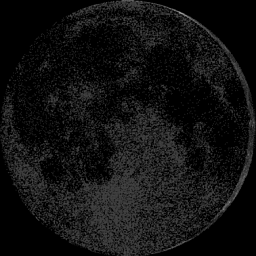
Moon Phase for November 14th at Midnight
3.6 Days Since New Moon
____________________________________
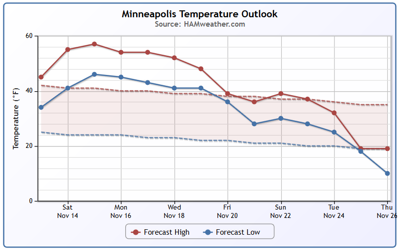
Minneapolis Temperature Trend
Extended forecast models suggest a fairly warm stretch of weather through the middle part of next week prior to a potential bigger cool down during the week of Thanksgiving. It appears that temperatures this weekend will be running nearly 15-20 degrees above average!
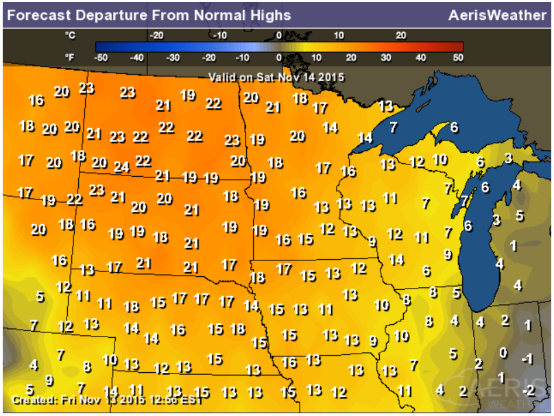
Highs From Average Saturday
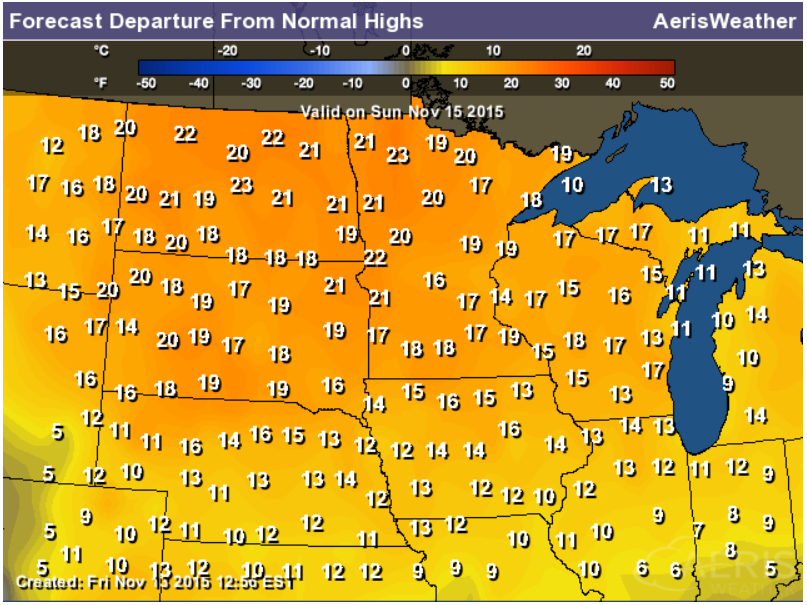
It will be a mild weekend as temperatures warm into the 50s across much of the state. Temperatures will be running nearly 10-20 degrees above average both Saturday and Sunday.
Highs From Average Sunday
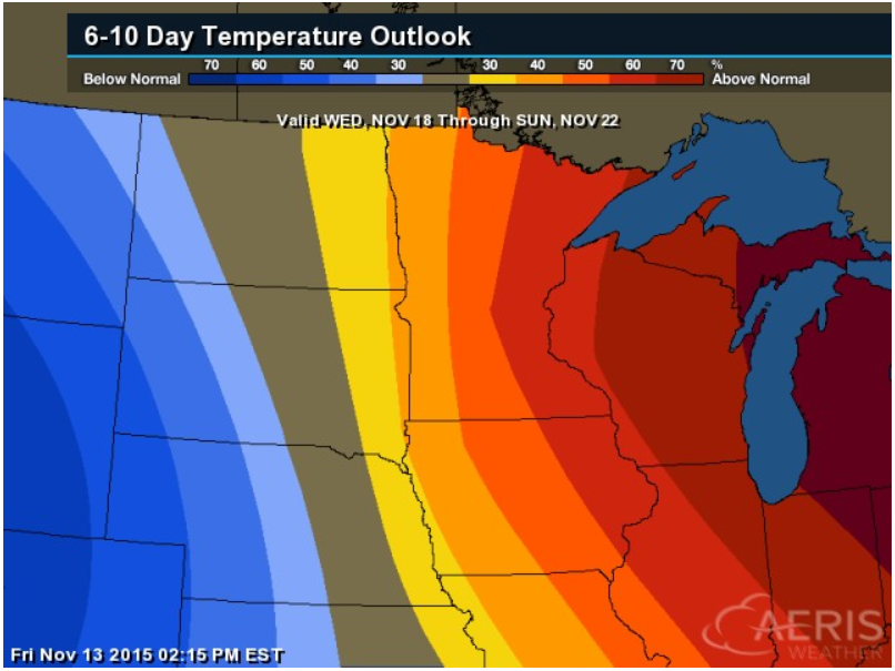
6 to 10 Day Temperature Outlook
According to NOAA's CPC, the 6 to 10 day temperature outlook suggests warmer than average temperatures into the middle part of the month across the Upper Mississippi Valley/Great Lakes Region.
__________________________________________
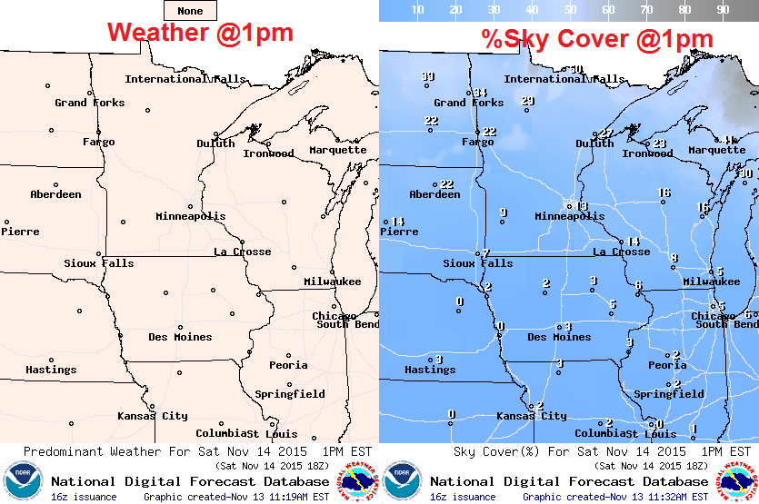
Saturday Weather Outlook
Highs on Saturday will be quite balmy for November. Actual air temperatures will warm into the 50s/low 60s across the state, but feels like temperatures will be in the 40s and 50s.
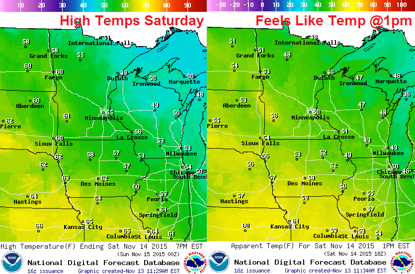
Saturday Weather Outlook
A mild southwesterly breeze at 10-15mph at times will help to boost temperatures on Saturday to well above average levels.
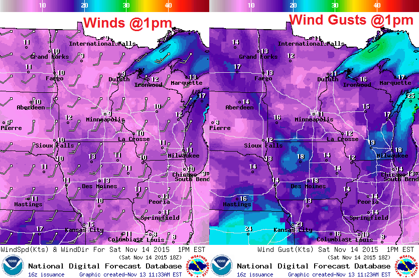
Saturday Weather Outlook
Enjoy the sunshine! Bright blue sky and mild temperatures will remind you of a mid October day!
__________________________________________
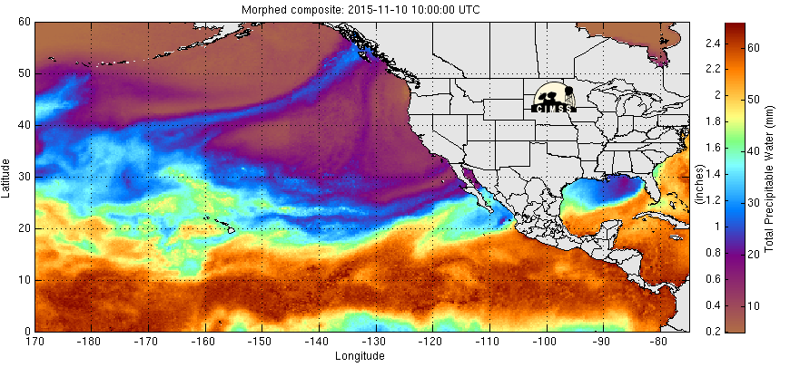
Eastern Pacific Precipitable Water Loop
Here's a neat loop of moisture in the Eastern Pacific. Note the deep tropical moisture in the tropics, but note the plume of moisture running across the Eastern Pacific into the Pacific Northwest. This band will help to produce some significant moisture tallies over the coming days with heavy rain, flooding and high elevation snow.
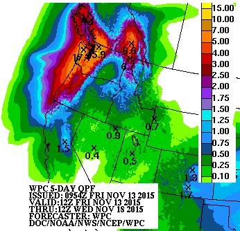
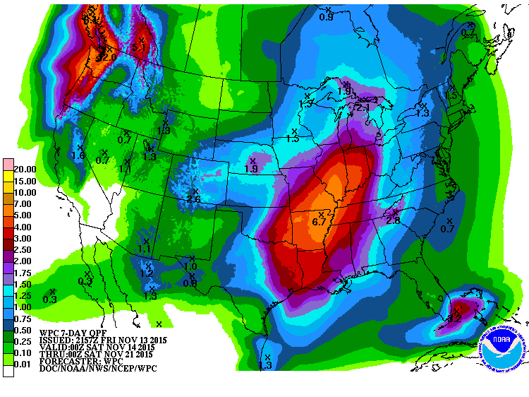
5 Day Precipitation Outlook
According to NOAA's WPC, the 5 day precipitation outlook suggests nearly 5" to 10"+, especially across the high elevations of the Northern Cascades and the Northern Rockies.
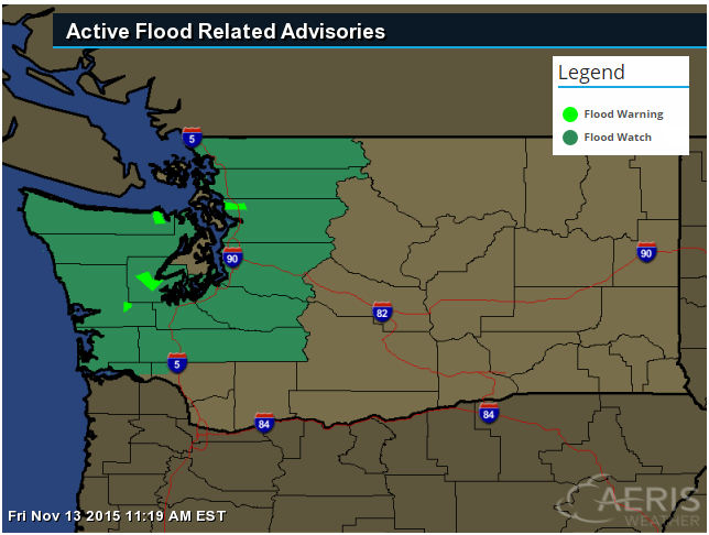
Flood Concerns
* THROUGH SUNDAY MORNING *
RAIN...HEAVY AT TIMES...WILL CONTINUE ON THE OLYMPICS AND CASCADES THROUGH EARLY SATURDAY MORNING. RAINFALL AMOUNTS AS HIGH AS 11 INCHES HAVE ALREADY BEEN REPORTED OVERNIGHT ALONG THE SOUTHWEST SLOPES OF THE OLYMPICS. RAINFALL AMOUNTS IN THE CASCADES OVERNIGHT RANGED FROM 1 TO 3 INCHES. ANOTHER 2 TO 5 INCHES OF RAIN IS POSSIBLE TODAY WITH THE RAINFALL RATES TAPERING OFF SIGNIFICANTLY SATURDAY MORNING. MORE FLOODING IS LIKELY LATER TODAY AND TONIGHT. IF SOME OF THE LONGEST RIVERS...SUCH AS THE CHEHALIS...FLOOD...THE LOWER REACHES MAY NOT FALL BELOW FLOOD STAGE UNTIL SUNDAY. * THIS AMOUNT OF RAIN COULD CAUSE FLOODING OF MOST OF THE RIVERS FLOWING OFF THE OLYMPICS AND WEST SLOPES OF THE CASCADES.
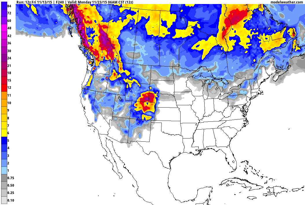
Western Snow Potential
As the moisture spreads inland and gets pushed into the higher elevations, snow will develop. It appears that some of the most significant will be found across the Northern Cascades and the Northern Rockies, but also notice the snowfall potential across the Sierra Nevada Range!

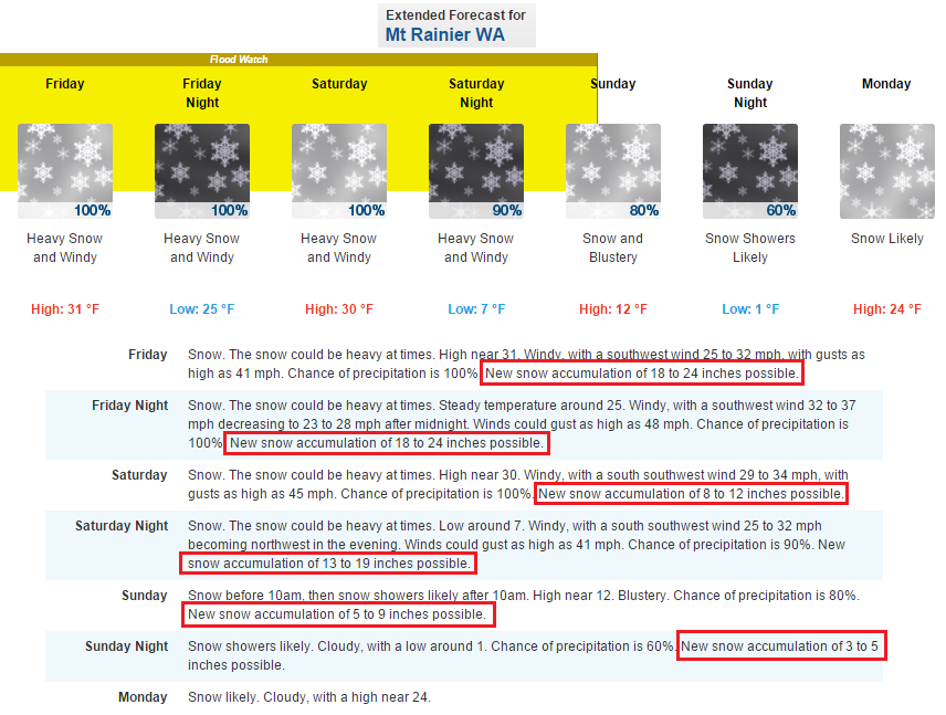
Incredible Snow at Mountain Rainier, Washington
Take a look at this snowfall forecast from the National Weather Service out of Seattle, Washington for Mount Rainier... If you tally up the snowfall amounts from Friday to Sunday, it calls for 65" to neraly 100"!! WOW!! Now that's a lot of snow!
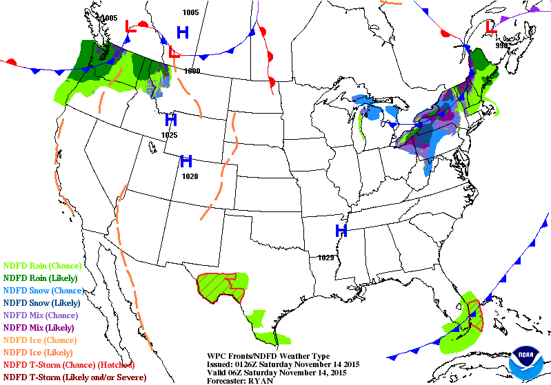
National Weather Outlook
As the storm system moves east, copious amounts of moisture will spread inland. Rain will be found at lower elevations and snow will be found in the higher elevations. This storm will continue to develop through early next week and bring heavy rain/severe storm chances to the Southern U.S. by early next week.
7 Day Precipitation Outlook
According to NOAA's WPC, the 7 day precipitation outlook suggests significant precipitation potential not only in the Pacific Northwest, but also across the Lower Mississippi Valley through much of next week. The storm system looks to slow down a bit next week across the Southern U.S., which will keep rain/thunder chances in place over a several day time period.
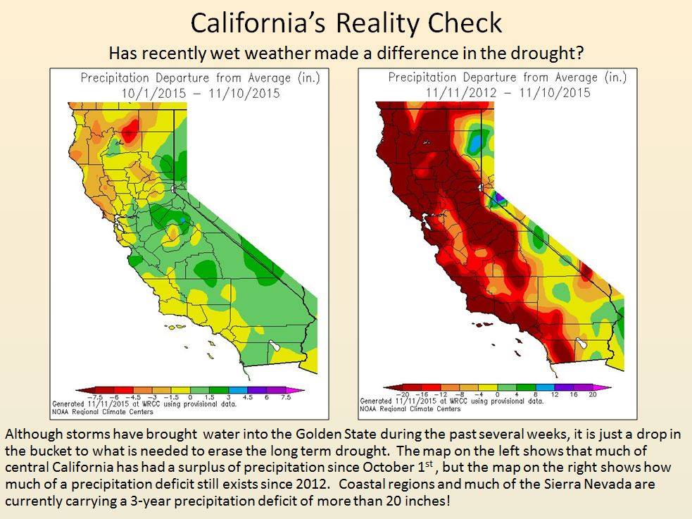
California Moisture: A Drop in the Bucket
Here's something to think about... While appreciative moisture has been falling in areas across the Western U.S. and California over the last several weeks, A LOT more still needs to fall to end the current drought, which has started in 2012. Interestingly, "Coastal regions and much of the Sierra Nevada are currently carrying a 3-year precipitation deficit of more than 20 inches!"
See more HERE:
Snow in the Plains
As our next storm system slides out into the Plains, more snow will be possible across the Front Range of the Rockies through early next week.
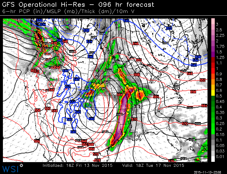
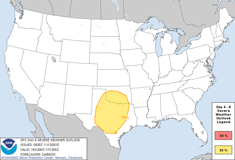
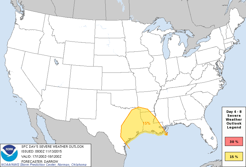
Severe Threat Early Next Week?
Extended model runs suggest a fairly potent low developing early next week across the Southern U.S. with scattered showers and storms ongoing Monday and Tuesday. The image below suggests Tuesday's weather outlook with heavy rain and possibly strong storms unfolding across the Lower Mississippi Valley.
Severe Threat Monday
According to NOAA's SPC, there is already chance of strong storms across across the Southern U.S. on Monday.
Severe Threat Tuesday
The threat for strong to severe storms will again be possible on Tuesday across the Deep South.
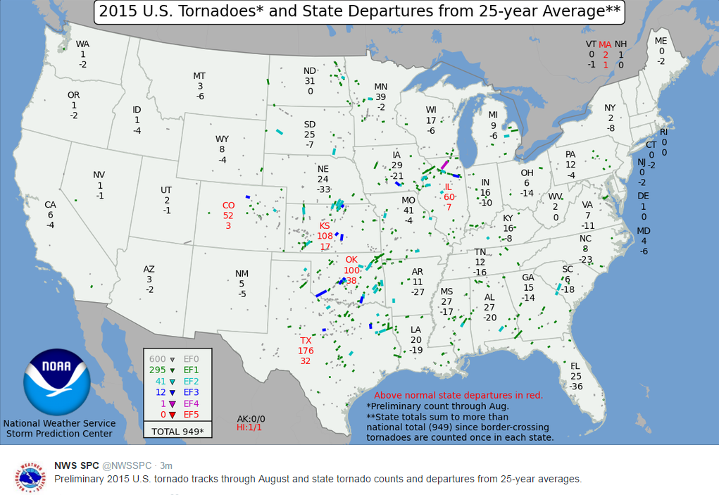
Preliminary Tornado Tracks
"Preliminary 2015 U.S. tornado tracks through August and state tornado counts and departures from 25-year averages. (This map will be updated in early 2016 to reflect year-end events.)."
Thanks for checking in and have a great weekend ahead! Don't forget to follow me on Twitter @TNelsonWX

No comments:
Post a Comment