By Paul Douglas
During a recent Q&A at St. John's University Gary Eichten asked me "Is it really so bad that Minnesota winters are a little warmer?" My personal opinion: I can live with that.
There is a silver lining to climate change: fewer hours below zero, longer autumns and growing seasons; earlier springs. Winter is losing some of its bite. Will it compensate for intense summer rains, more pests, more weather whiplash; from floods to droughts? I doubt it.
Meteorological Spring kicks off March 1. As far as the atmosphere is concerned the coldest 90-day period of the year ends in about 12 days. And gazing at the maps and models that isn't hard to believe.
The mercury approaches 50F Friday with rain showers; weather typical for late March. 40s linger into Sunday, and after a puff of cooler air, return late next week.
NOAA's CFS (Climate Forecast System) model shows March temperature anomalies 10F warmer than average across Minnesota. More warm whispers of a lingering El Nino, and a broader warming now underway.
Winter is winding down rapidly - the pattern favors a fast-forward spring.
_________________________
Extended Forecast
WEDNESDAY NIGHT: Mostly cloudy. Winds: SE 5-10. Low: 22, then warming.
THURSDAY: Windy and milder with a little drizzle. Winds: SE 15-25. High: 40
THURSDAY NIGHT: Cloudy and breezy with a slight chance of rain. Winds: SSE 15-25. Low: 37.
FRIDAY: Hello March. Few rain showers. Winds: S 20-35. High: 48.
SATURDAY: More clouds than sun, still mild. Winds: WSW 5-15. Wake-up: 36. High: 44
SUNDAY: Few sprinkles or flurries. Winds: NNW 5-15. Wake-up: 33. High: 38
MONDAY: Peeks of sun, a bit cooler. Winds: WSW 5-10. Wake-up: 25. High: 32.
TUESDAY: More clouds than sun, above average. Winds: NW 5-10. Wake-up: 22. High: 33.
WEDNESDAY: Intervals of sun, breezy and quiet. Winds: N 5. Wake-up: 21. High: 31.
___________________________
This Day in Weather History
February 18th
1979: This is one of the rare times that Lake Superior completely freezes over.
____________________________
Average High/Low for Minneapolis
February 18th
Average High: 30F (Record: 58F set in 1981)
Average Low: 14F (Record: -21F set in 1903)
_____________________________
Sunrise/Sunset Times for Minneapolis
February 18th
Sunrise: 7:10am
Sunset: 5:45pm
*Daylight gained since yesterday: ~2mins & 58secs
*Daylight gained since winter solstice: ~1hr & 50mins
_______________________________
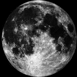
Moon Phase for February 18th at Midnight
4.0 Days Since First Quarter
_________________________________
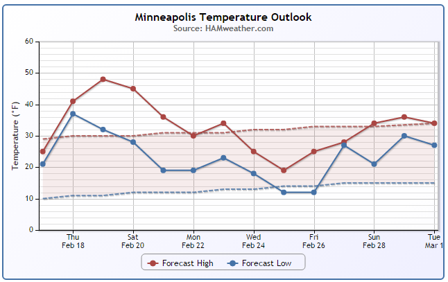
Minneapolis Temperature Trend
Much warmer than average temperatures are on the way through the end of the week/weekend. In fact, highs in the Twin Cities could warm into the 40s Thursday - Saturday! Heading into next week, it appears that we'll level off to more normal late February levels by late month. However, there could be another cold blip by the middle/end of next week.
_________________________________
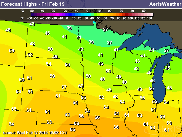
Friday Temperature Outlook
Friday still looks like the warmest day across the Midwest with high temperatures well into the 30s and 40s across the state. In fact, there may be even a few lows 50s showing up across the southern part of the state! Friday could also be host of record warmth across parts of the Central U.S..
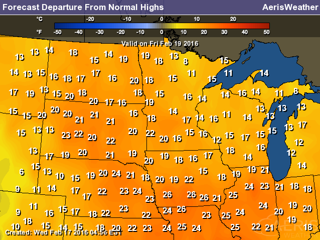
High Temperatures From Average Friday
High temperatures on Friday will be nearly 10F to 25F above average across much of the Midwest.
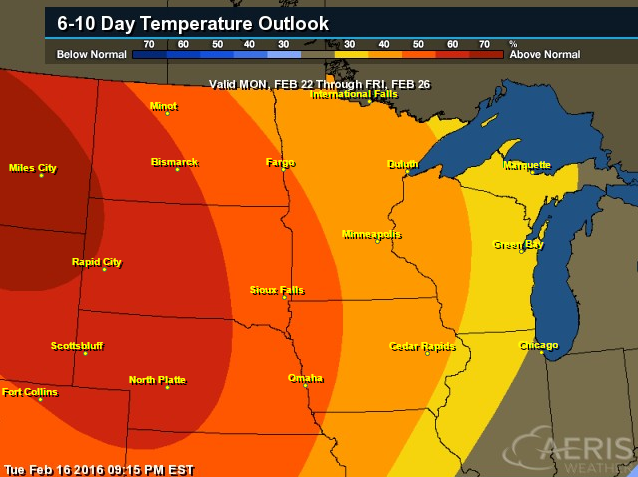
6 to 10 Day Temperature Outlook
According to NOAA's CPC, the 6 to 10 day temperature outlook still suggests a chance of warmer than average temperatures hanging on into the 4th week of February across parts of the Midwest.
_________________________________
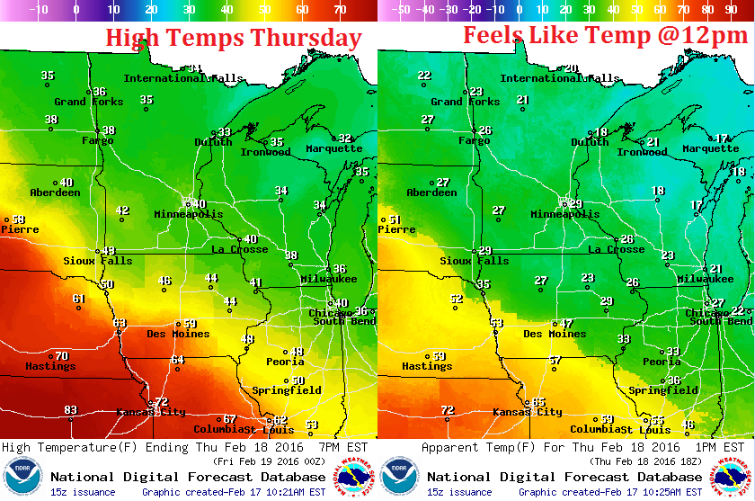
Thursday Weather Outlook
High temperature on Thursday will be quite mild across much of the region. Note that much of Minnesota will see highs in the 30s and 40s with some 70s and 80s showing up across the Central U.S.! However, winds will be fairly breezy on Thursday, which will make it feel a little cooler closer to home.
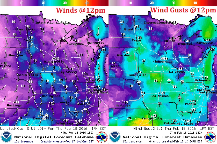
Thursday Weather Outlook
Here are the expected wind speeds and direct around midday Thursday. Note that the southeasterly breeze could be on the order of 15mph - 30mph across the region. This strong wind will actually help to push continued warmth into the region through Friday & Saturday.
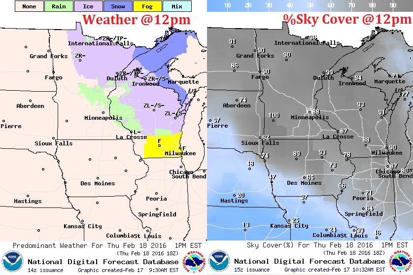
Thursday Weather Outlook
Clouds look to fill back into the Upper Midwest on Thursday. These clouds and areas of light precipitation will be on the leading edge of the warmer air as it lifts north. There will be areas of light wintry precipitation closer to the international border through the second half of the day Thursday.
_____________________________
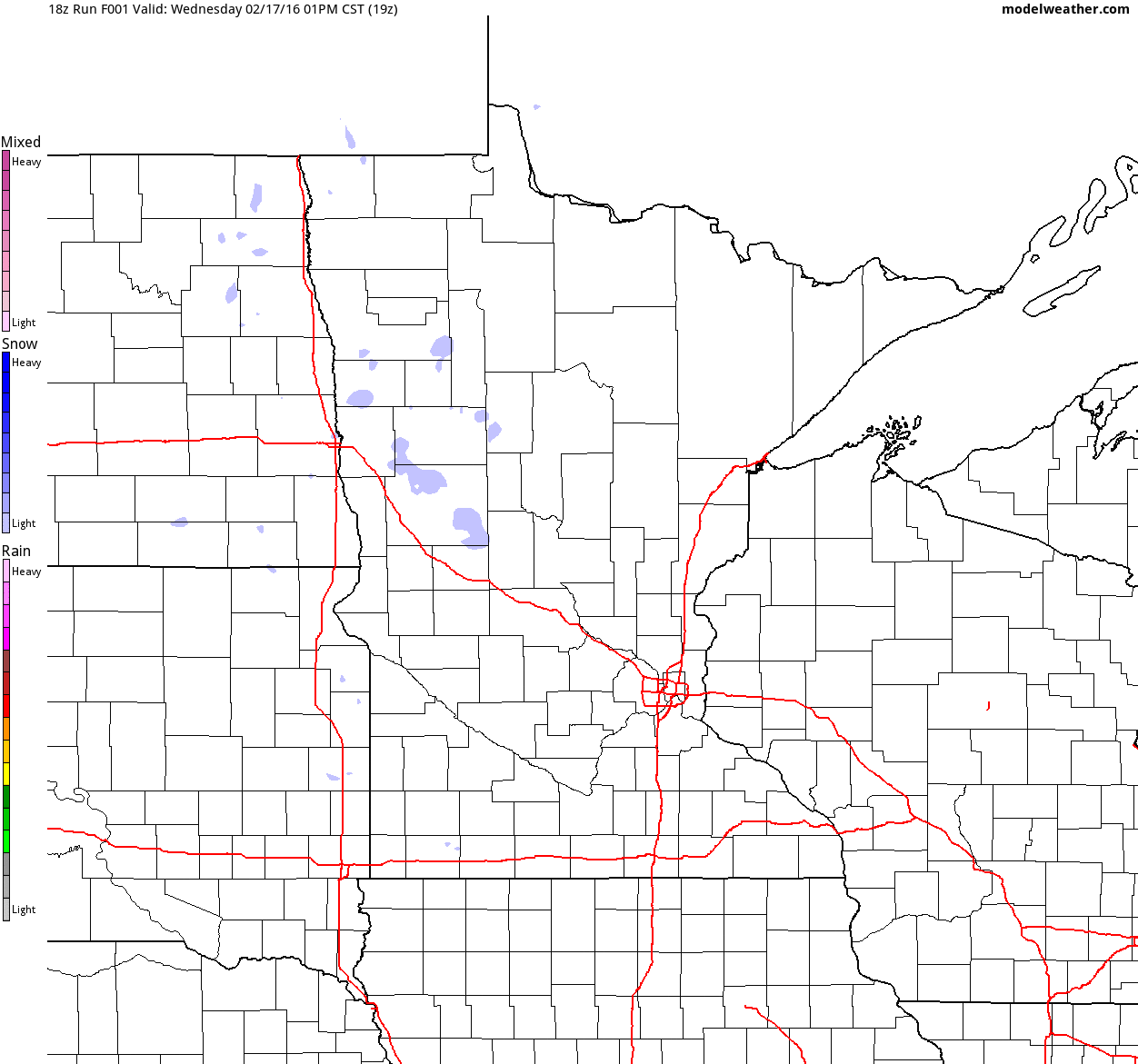
Simulated Radar
Light precipitation in a wintry fashion will push northeast through the region on Thursday as warmer weather pushes begins to slide in. The bulk of the precipitation with the wave of energy will arrive Friday - Saturday. Interestingly, it appears that temperatures will be warm enough for rain showers across parts of the region. Wintry mixed conditions and light snow potential looks to stay along/near the international border.
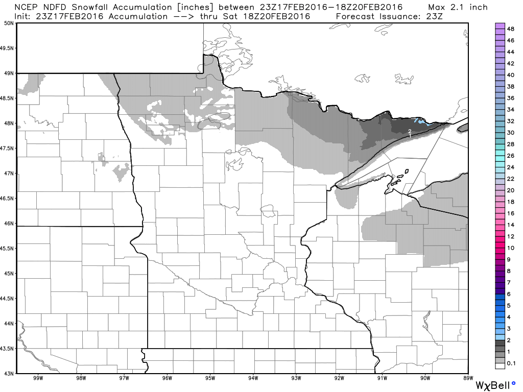
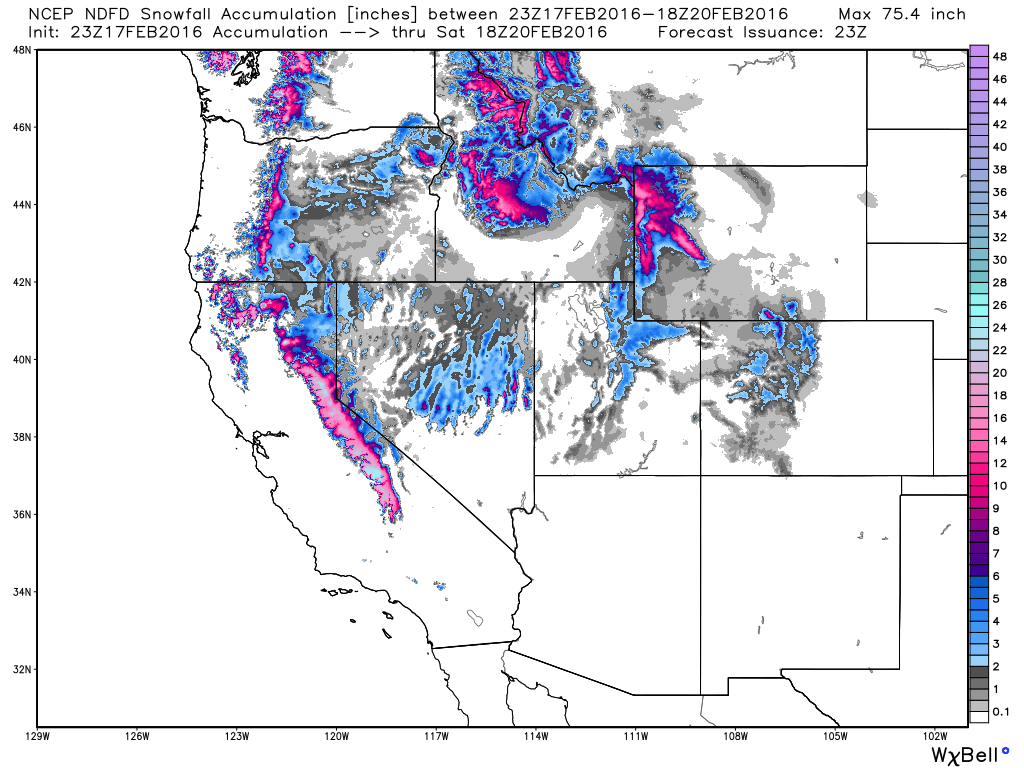
Snowfall Potential
As our next storm system moves into the region through late week, temperatures will warm enough to keep much of the precipitation in the form of liquid. However, there could be a wintry mix and light snow accumulations across the far north. The best chances of any light snow accumulations would be in the Arrowhead of Minnesota through midday Saturday.
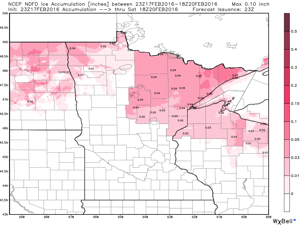
Icing Potential
The wintry precipitation along the international border may also be in the form of a little icing. Although it doesn't look like much, there certainly could be enough to cause some issues on area roads.
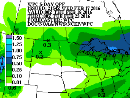
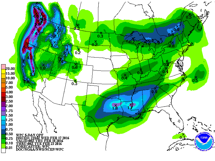
5 Day Precipitation Forecast
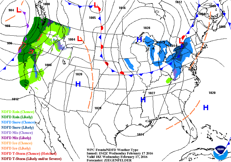
According to NOAA's WPC, the 5 day precipitation forecast across the Upper Midwest will feature heavier precipitation amounts along the international border and into the Great Lakes Region.
_____________________________________
National Weather Outlook
Heavy rain and snow in the Western U.S. will through the end of the week, will translate into ran and a light wintry mix across parts of the Midwest by late week/early weekend. This next system will also be responsible for bringing windy and warm conditions to much of the Upper Midwest.
5 Day Precipitation Outlook
The heaviest precipitation will be found in the Western U.S. with tallies nearing 3" to 6"+
Western Snowfall Potential
Snowfall potential in the Western U.S. will be heaviest in the high elevations of the Sierra Nevada Range to the Cascades to the Central/Northern Rockies. Some spots could see 12"+!
Ridge Pushes East
The storm system bringing heavy moisture to the West Coast will also help to push record warmth into the Central U.S. through late week. The image below shows how far north the bubble of warm air will get.
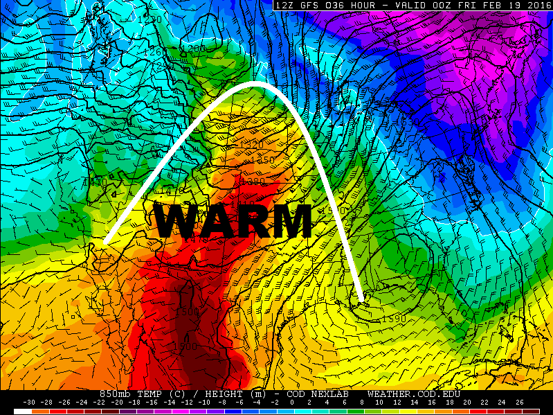
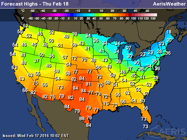
High Temperatures Thursday
High temperatures on Thursday will warm into the 70s and 80s across much of the Central/Southern Plains. Some locations will actually warm to record territory.
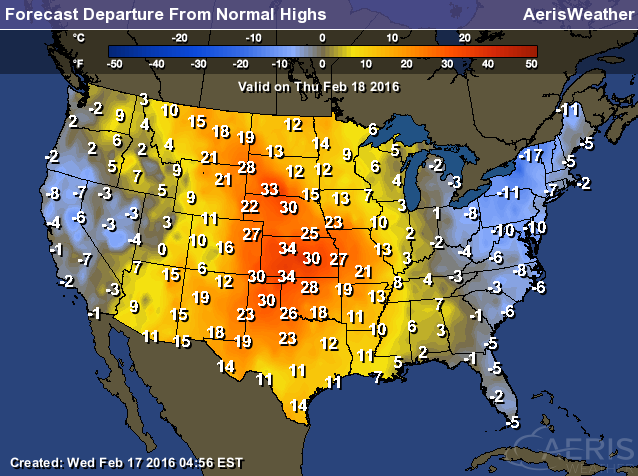
Highs From Average Thursday
High Temperatures from average on Thursday will be nearly 20F to 35F above average!
______________________________
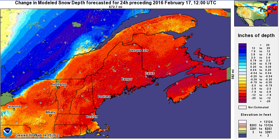
Bye Bye Snow in the Northeast
Thanks to the recent warm rainy weather in the Northeast, the snowpack took a major hit. Take a look a the recent post from the National Weather Service out of Caribou, ME
"...Bye Bye Snow... The New England snowpack was absolutely decimated by the rain/warm spell. Here is a 24hr snow depth change map and current snow depth map. Bangor's snow depth fell from 11" to none within 24 hours!" See more HERE:
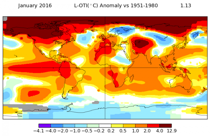
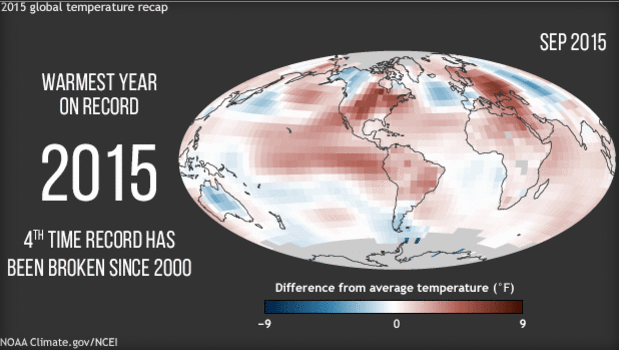
January Smashed Another Global Temperature Record
"The calendar may have turned to 2016, but temperatures are picking up where 2015 left off. January was record warm, according to data released this week by NASA. You may recall that last year was the hottest on record for the globe. And by NASA’s accounting, it ended with a bang. This past December was the warmest December on record and the most abnormally warm month on record, too That is until now."
See the full story from Climate Central HERE:
Climate change gets short shrift in U.S. classrooms
"Middle- and high-school students spend very little time learning about climate change in the classroom, and many students hear misinformation about the cause of rising global temperatures, new research finds. In the first nationally representative survey of public middle- and high-school teachers in the United States, only 30 percent of teachers said they emphasize that humans are causing climate change by burning fossil fuels. Another 12 percent said they don't mention human causes, and 31 percent said they "teach the controversy" by telling students that some scientists think climate change is human-caused, while others disagree."
______________________________
Thanks for checking and have a great rest of your week. Don't forget to follow me on Twitter @TNelsonWX

Really wonderful.Thank you sharing this information.Really useful information. I got several knowledge from your post.
ReplyDeletevisit best thesis writing service .
You have done a big job, where you find so much information? It's a huge research work! It's very nice. if you want to delegate your researches you can look at this web-site
ReplyDelete