Severe Weather Awareness Week in Minnesota and Wisconsin (April 11th - 15th)
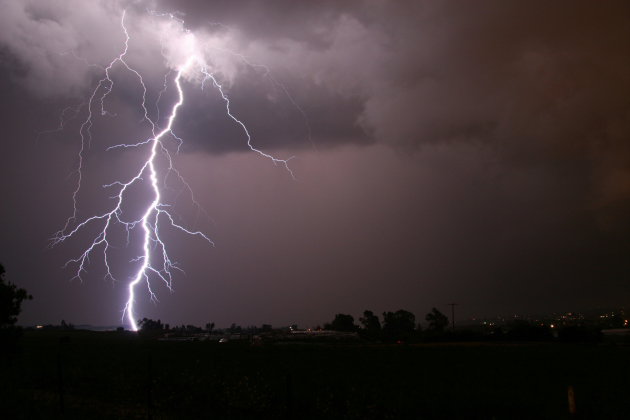
Tuesday's severe weather safety focus is on that of Severe Thunderstorms, Lightning, Wind and Hail.
"The
typical thunderstorm is 15 miles in diameter and lasts for 30 minutes.
Despite this size, all thunderstorms are dangerous. Severe thunderstorms
produce large hail or winds of at least 58 mph. Some wind gusts can
exceed 100 mph and produce tornado-like damage. Many communities will
sound their outdoor sirens for very damaging straight-line winds. When a
severe thunderstorm threatens, stay inside a strong structure. Mobile
home occupants should go to a more permanent structure."
Lightning...
"Every thunderstorm produces lightning, which on a national basis kills more people than tornadoes in a given year."
"Lightning kills around 100 Americans annually, with about 300 injuries. In Wisconsin and Minnesota, there have been many deaths and injuries over the years, most in areas such as camp grounds, although people have been injured indoors when talking on the phone."
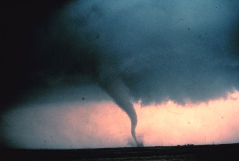
Statewide Tornado Drill - Thursday, April 14th
Here's an excerpt from Homeland Security and Emergency Management: "...The most important events during Severe Weather Awareness Week are the two annual statewide tornado drills. These drills are scheduled for Thursday, April 14, 2016 at 1:45 p.m. and 6:55 p.m. (Counties may chose to opt out of the drills if actual severe weather is possible in the area). Outdoor warning sirens and NOAA Weather Radios will sound in a simulated tornado warning. The first drill is intended for institutions and businesses. The evening drill is intended for second shift workers and families...
...According
to the National Weather Service, Minnesota experiences an average of 40
tornadoes per year. In 2012, 37 twisters touched down. A record was set
in 2010 with 104 tornadoes across the state.
Understanding this
threat and knowing what to do when a tornado is approaching can save
lives. Take advantage of Severe Weather Awareness Week to review your
own and your family's emergency procedures and
prepare for weather-related hazards.
Here are some simple tips from NOAA's Weather Ready Nation website:
Tornadoes,
lightning, floods, and early season heat - spring is three months of
danger that can imperil the unprepared. It roars in like a lion,
rampaging across the United States throughout March, April and May.
Spring hazards include:
-Severe Weather/Tornadoes
-Floods
-Lightning
-Tsunamis
-Heat
-Floods
-Lightning
-Tsunamis
-Heat
1. Know Your Risk
It is a simple action that will ensure that you’re ready for the day’s weather. Don’t leave home without knowing the forecast.
2. Take Action!
Assemble an emergency supplies kit with 72 hours worth of food and water. In an emergency (such as after a tornado or some other hazard event), you may be stuck at home without electricity for three days or more. Make sure that you’re prepared. Also, ensure that everyone in your life knows how to stay in touch with an emergency communication plan. This plan lists meeting places and alternate ways of communicating in case of emergency.
3. Be A Force of Nature
Inspire others by sharing your weather-ready story on social media with the hashtag #SpringSafety. It can be a simple as posting a photo of your emergency supplies kit or letting your friends know how to reach you during an emergency. Together, we can build a Weather-Ready Nation, one that is ready for any extreme weather, water, or climate event.
___________________________________________
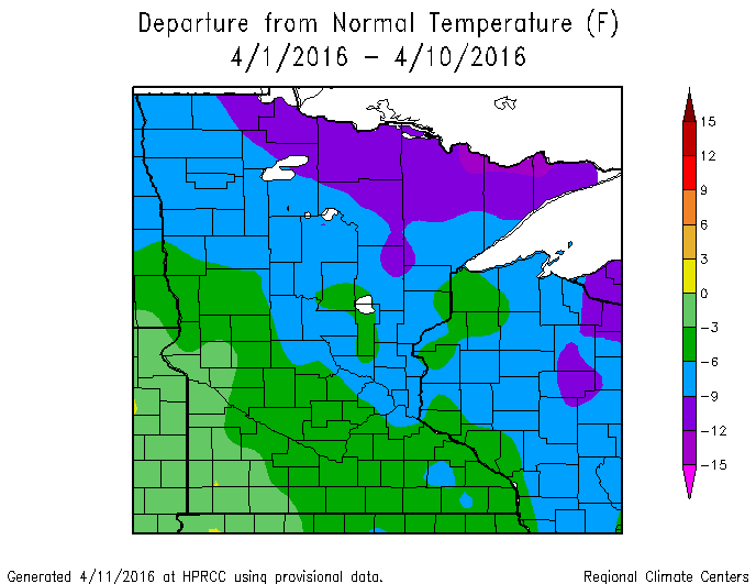
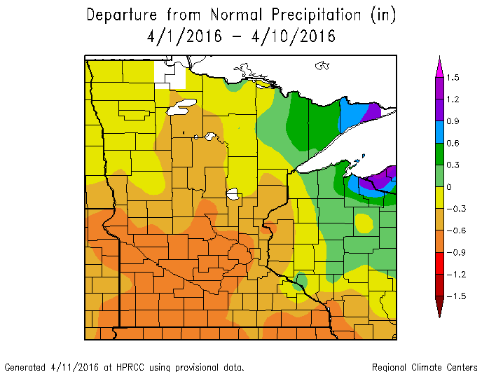
Cold and Dry Start to April 2016
April
has been a very chilly month thus far with the average temperature
through the first 10 days of the month running nearly -6F below average
in Minneapolis, nearly -8F below average in Duluth and nearly -10F below
average in International Falls. Low temperatures even dipped into the
sub-zero range on Saturday morning across the Arrowhead. Saturday
morning was also host to record low temperatures in Duluth (2F) and St.
Cloud (13F). It has also been a fairly dry start to the month with much
of Central/Southern MN seeing readings nearly -0.50" or more below
average. The Arrowhead is the only area with above average precipitation
values as several waves of accumulating snow have passed through the
area.
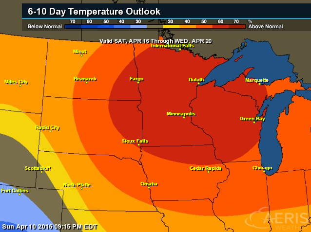
WARMING UP!!! 6 to 10 Day Temperature Outlook
Despite
cooler than average temperatures continuing on Monday, warmer than
average temperatures look to (finally) arrive later this week! According
to NOAA's CPC, the 6 to 10 day temperature outlook suggests a very good
chance of above normal temperatures Saturday, April 16th - Wednesday,
April 20th.
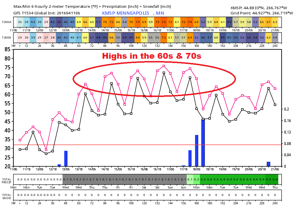
Minneapolis Temperature Trend
After
a cold start to the week (temperatures were nearly -15F below average
on Monday), it appears that a REAL warmup is in the works with a string
of 60s and 70s for the second half of the week and weekend ahead! I
predict several cases of spring fever returning by the end of the week!
________________________________
Windy Warm Up Ahead - Spring Fever Returns Friday
By Todd Nelson, filling in for Douglas.
Would it surprise you to know that April is, on average, the windiest month of the year for us in Twin Cities? This April is certainly living up to that hype with gusty winds pestering us nearly everyday. The strongest wind gust so far this month was 49mph on April 2nd!
April is also running colder than average with temps nearly 6 degrees below average in the Twin Cities, nearly 8 degrees below average in Duluth and nearly 10 degrees below average in International Falls. I am happy to report that the recent cold Canadian air is being evicted. I predict several cases of Spring Fever returning by Friday as the mercury tops out around 70 degrees across much of southern Minnesota. However, the warm up will also be accompanied by more wind. Ugh! Go fly a kite?
Severe weather awareness week continues today with lightning safety being one of the topics. Nearly 50 Americans die each year from lightning. The last lightning fatality in Minnesota occurred in 2013. Statewide tornado drills will be held on Thursday. Check your weather radio too!
________________________________
MONDAY NIGHT: Clear and frosty with decreasing winds. Winds: NW 5-10 Low: 25
TUESDAY: Bright sun, feeling better. A few PM sprinkles possible. Winds: SSE 8-13. High: 49
TUESDAY NIGHT: Chance of light rain early. Winds: SSE 10-15. Low: 41.
WEDNESDAY: Spring returns! Mild with a few clouds. Winds: SE 10-20. High: 65
THURSDAY: Breezy. 70s possible in southern MN! Winds: S 15-25. Wake-up: 47. High: 70
FRIDAY: Warmer winds. Spring fever sets in. Winds: S 15-25. Wake-up: 50. High: near 70
SATURDAY: Less wind. Still very warm for April. T-shower risk western MN. Winds: S 10-20. Wake-up: 53. High: 72
SUNDAY:More clouds, chance of PM thunder? Winds: SSW 8-13. Wake-up: 53. High: 70
MONDAY: Mostly cloudy. Risk of T-shower. Winds: NE 8-13. Wake-up: 49. High: 64.
____________________________
This Day in Weather History
April 12
1931: July-like temperatures are felt across the area with 90 degrees at Beardsley in west central Minnesota.
_____________________________
Average High/Low for Minneapolis
April 12
Average High: 56F (Record: 60F set in 1941)
Average Low: 36F (Record: 12F set in 1962)
______________________________
Sunrise/Sunset Times for Minneapolis
April 12
Sunrise: 6:33am
Sunset: 7:55pm
______________________________
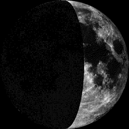
Moon Phase for April 12th at Midnight
0.9 Days Before First Quarter
__________________________________
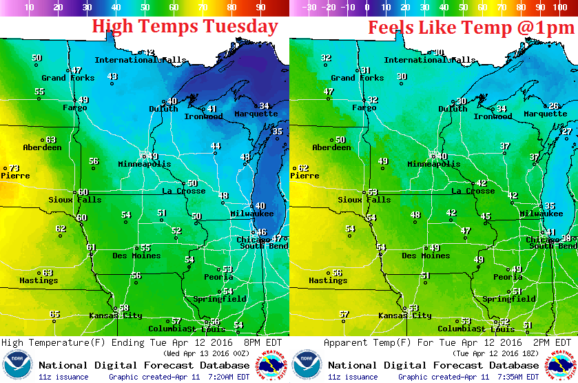
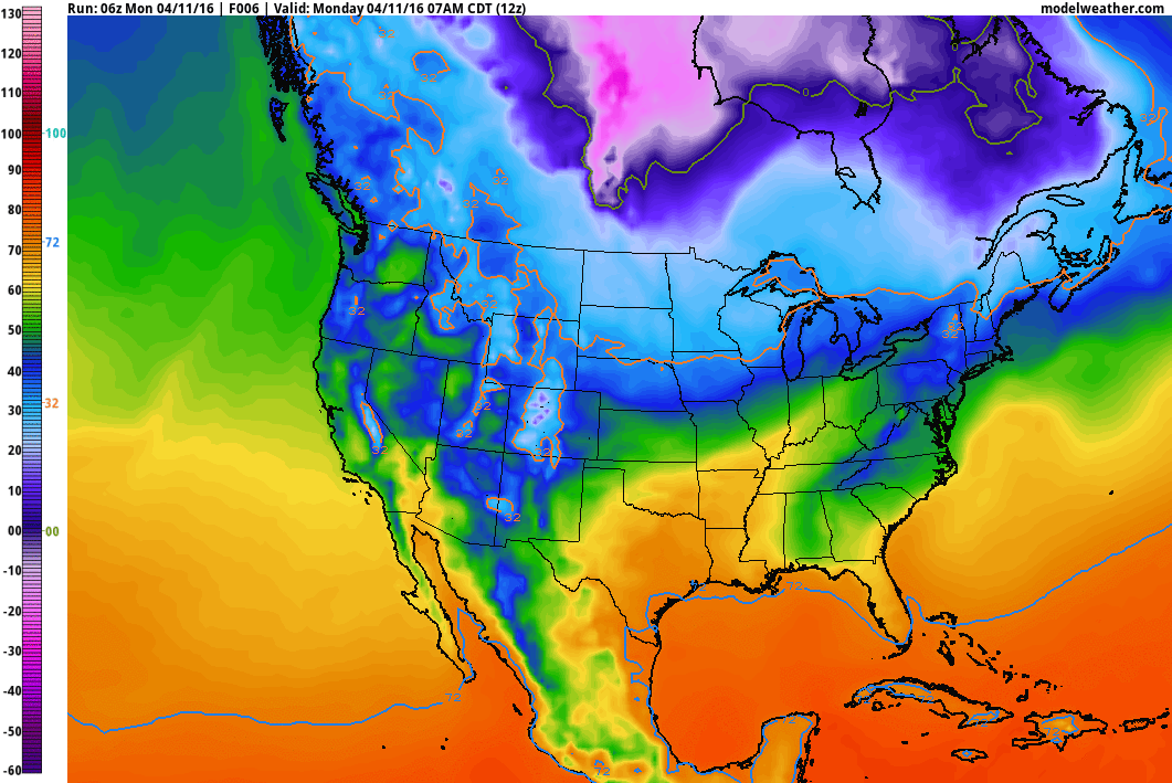
Tuesday Weather Outlook
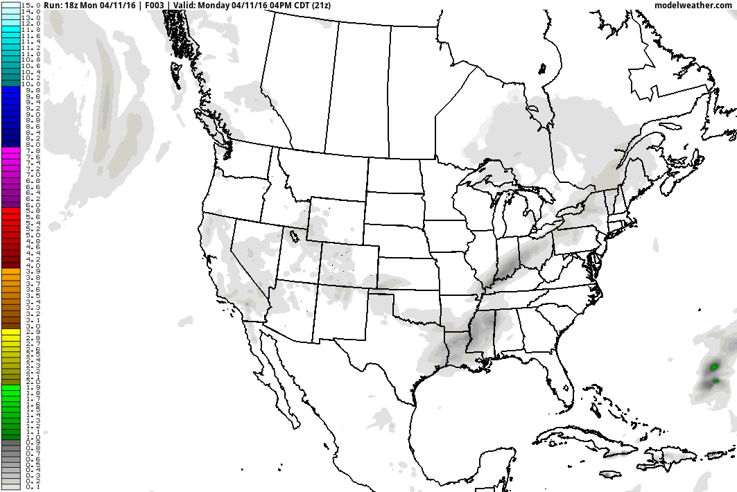
High temperatures on Tuesday will still be running a little cooler than average, but we'll be heading in the right direction. Note that from the Arrowhead of Minnesota to the southwestern parts of the state, temperatures will range from the 30s to near 60F. As warmer weather begins spreading into the region on Tuesday, an are of light precipitation will scoot through the northern half of the state.
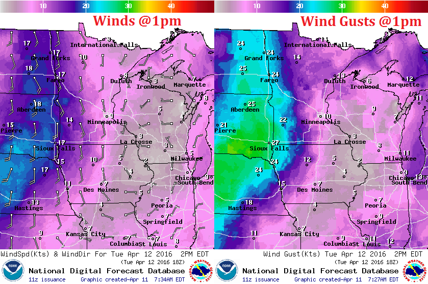
Tuesday Weather Outlook
Here's a depiction of winds midday Tuesday. Note that winds will be quite a bit stronger across the western part of the state. Gusty south winds could approach 20mph or more, ultimately helping to push temperatures up into the 60s & 70s across central South Dakota. This is the warmth that will continue moving northeast towards us by the middle/end of the week!
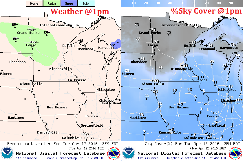
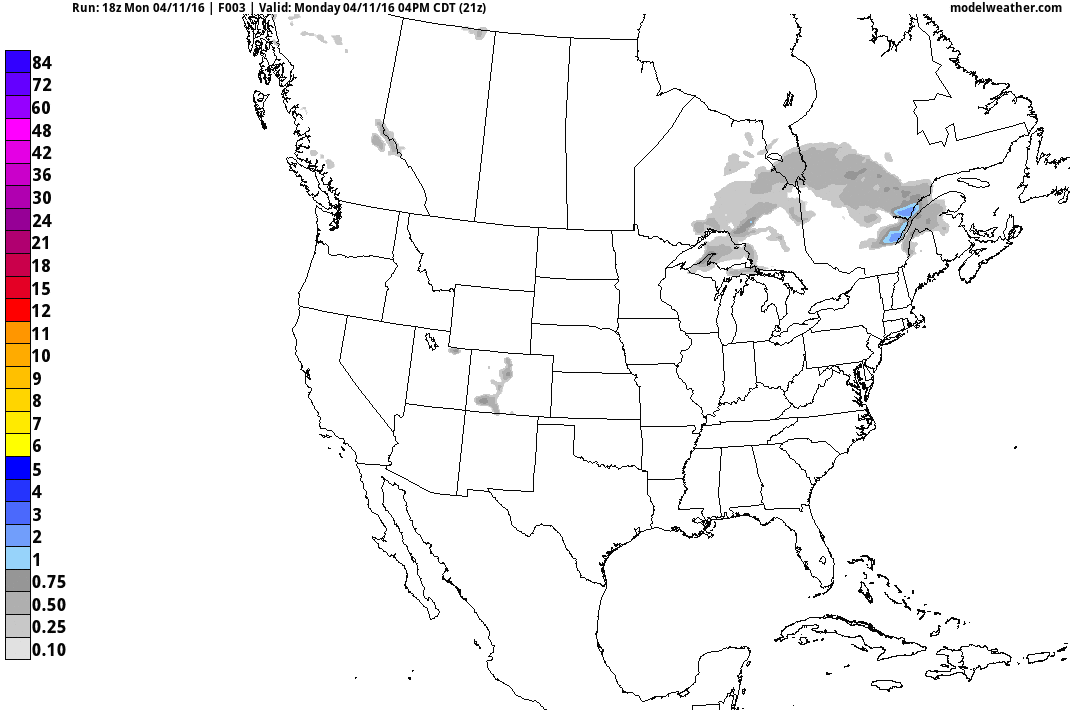
Tuesday Weather Outlook
Light precipitation will likely push through the northern half of the state during the second half of the day Tuesday. It will likely start as rain, but could transition into a light wintry mix across the Arrowhead Tuesday night/early Wednesday with minor/slushy accumulations near Grand Marais.
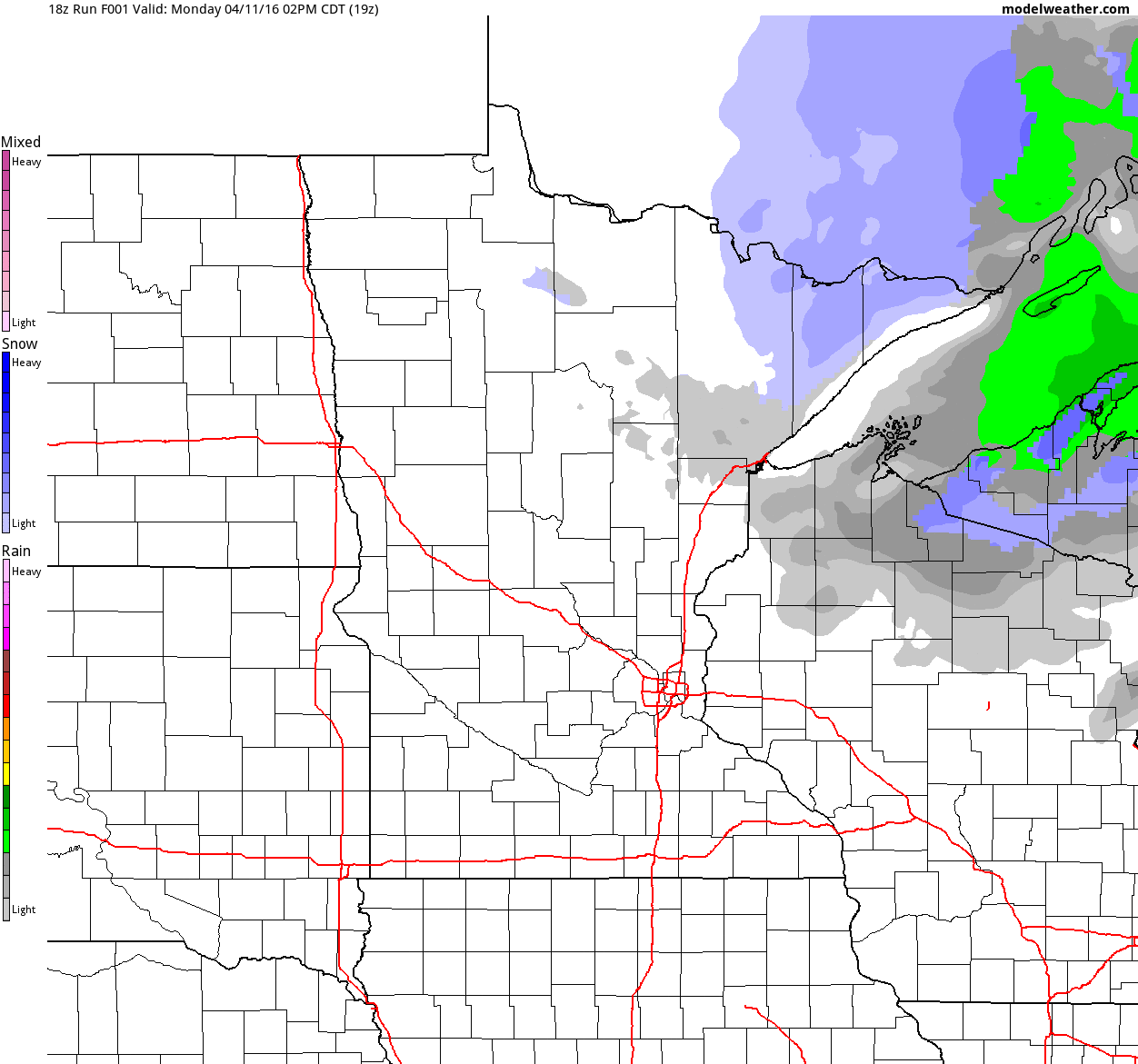
Simulated Radar
The simulated radar shows the light area of precipitation pushing through the region on Tuesday as warmer weather begins lifting northeast. Precipitation amounts look fairly light, but could transition into a wintry mix across northeastern Minnesota PM Tuesday/AM Wednesday.
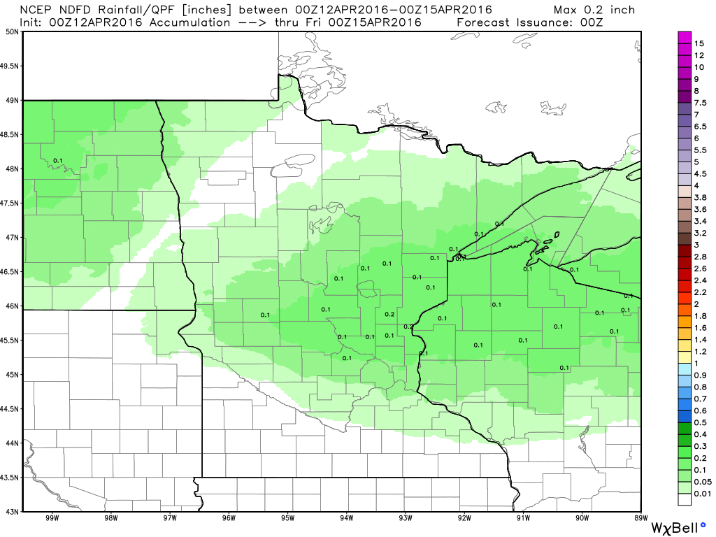
Precipitation Potential
Here's a look at precipitation values through midweek. Note that much of this moisture will push through Tuesday/AM Wednesday with the heaviest falling closer to Lake Superior.
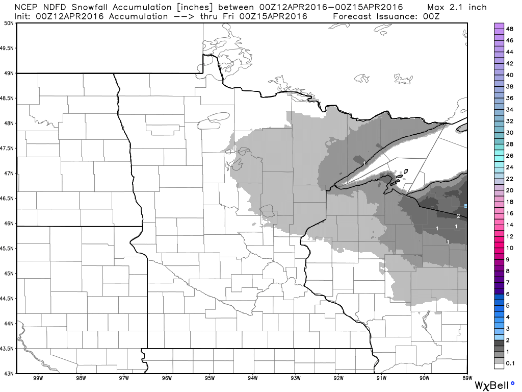
Snowfall Potential
Snowfall amounts look very light and should be mainly confined to the extreme northeastern part of the state. However, folks in the Arrowhead could wake up to another slushy coating Wednesday morning.
_____________________________________
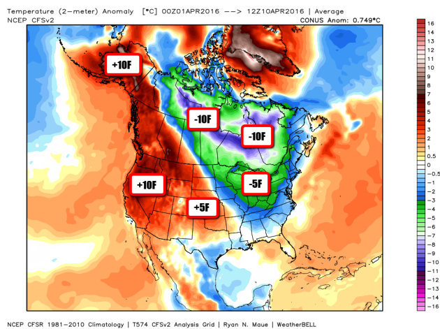
Temperature Anomaly So Far This April
Temperature anomalies for the month of April so far are running quite a bit below average from around the Hudson Bay to the Ohio Valley. Thanks to a fairly prominent trough of low pressure in the Great Lakes region, Minnesota has been included in that colder than average trend. Note that temperatures in the Western U.S. and Alaska have been quite a bit above normal!
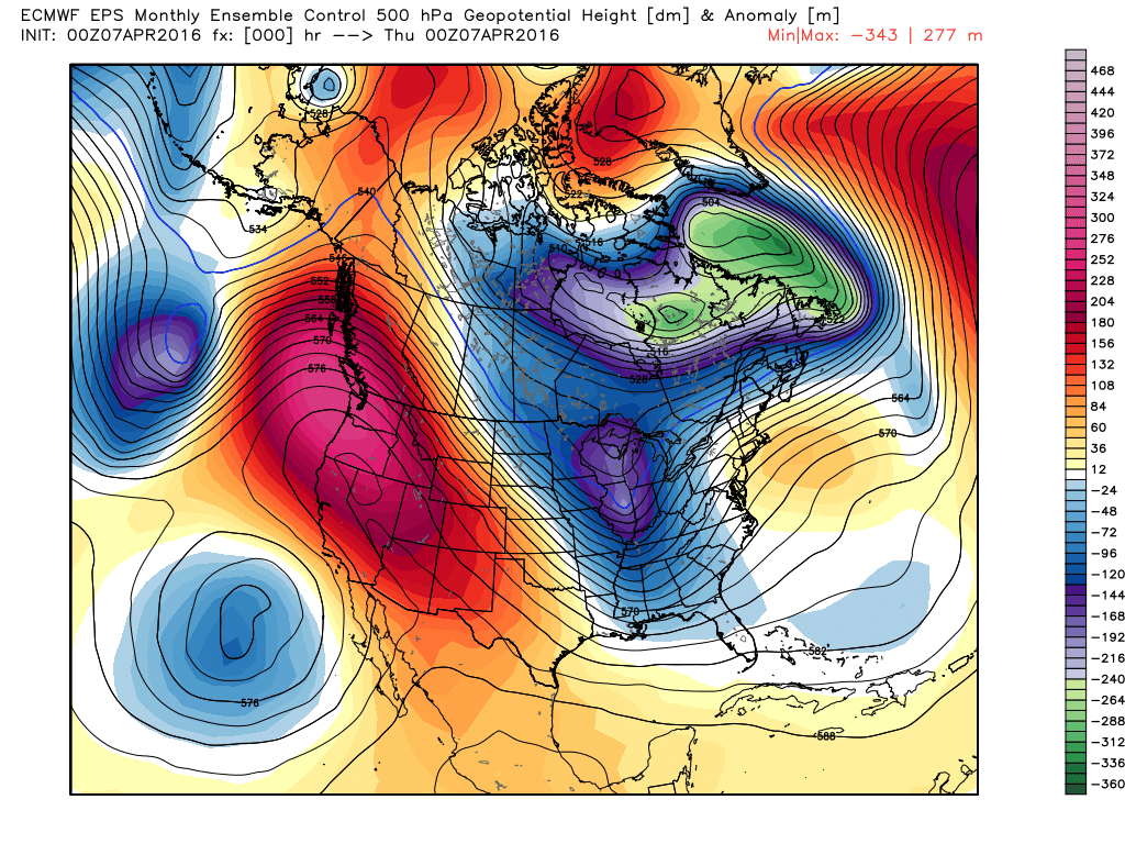
Temperature Anomalies Last Wednesday (April 7th)
This is a look at the weather map from last Wednesday. Note the trough of low pressure that was in the Eastern U.S. with wave after wave of cold than average temps dumping into the Lower 48. Meanwhile, the Western U.S. was dealing with a large ridge of high pressure with temperatures running well above average!
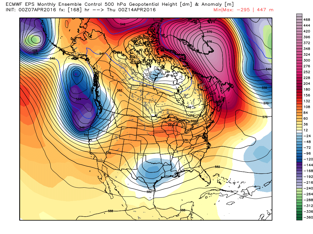
Temperature Anomalies This Wednesday (April 13th)
Here's a look at the projected weather map for this Wednesday. Note that the large trough of colder than average temperatures has since moved on and warmer than average temperatures look to return across much of the Midwest!
National Temperature Trend
As we head through the next several days, colder temperatures in the Eastern U.S. will continue to retreat north. In its wake, milder air from the Western U.S. will begin to move into the Central U.S.!
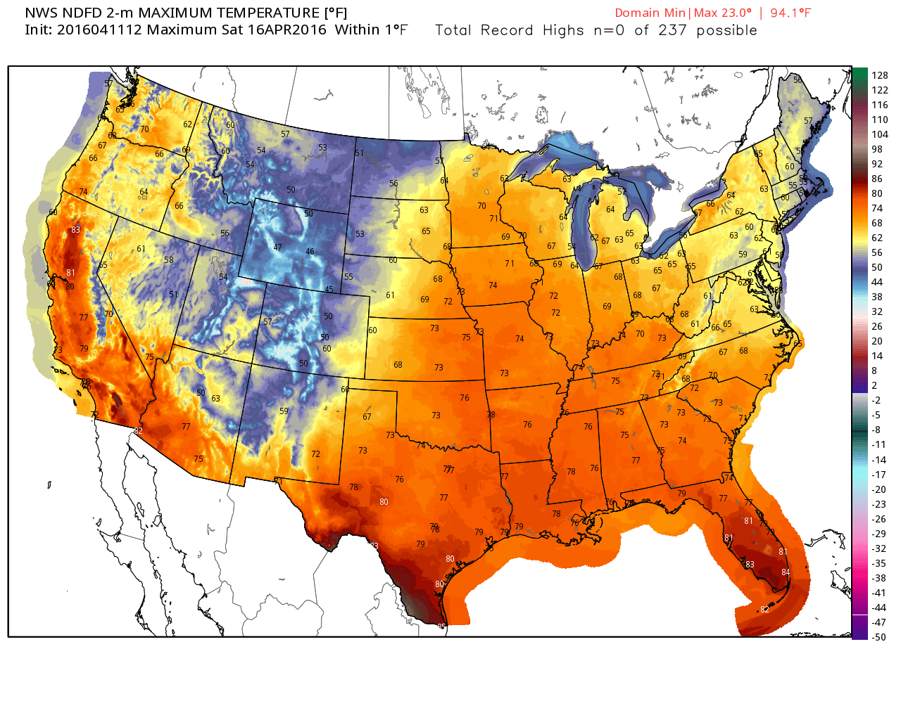
High Temps Expected Saturday (April 16th)
Here's a projected high temperature map for Saturday, April 16th, which shows 60s and 70s as far north and Minnesota and Wisconsin! Keep in mind that this warm air will likely come by way of gusty south winds.
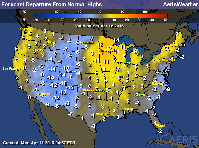
Highs From Average Saturday
High temperatures across the Midwest will likely be running nearly 10F to 15F above average on Saturday!
______________________________________________
National Weather Outlook
A cold front will continue to sweep through the eastern part of the country through midweek with heavier pockets of rain possible across the Gulf Coast States as that same front stalls. Meanwhile, waves of moisture will funnel into the Pacific Northwest over the next few days with some of that moisture turning to snow in the higher elevations.
Rainfall Potential
The rainfall forecast shows heavy rainfall potential across the Gulf Coast states, where areas of flooding may be possible through the end of the week. Also note the heavier rainfall moving into the Western U.S.. Some 1" to 2" liquid amounts can't be ruled out through the end of the week.
Snowfall Potential
As moisture continues moving into the Western U.S., some of it will be in the form of snow across the higher elevations. Most of the accumulations will be light, but there may be a few spots that see 6"+ through the end of the week.
__________________________________
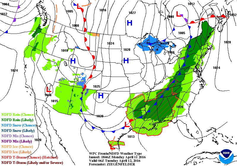
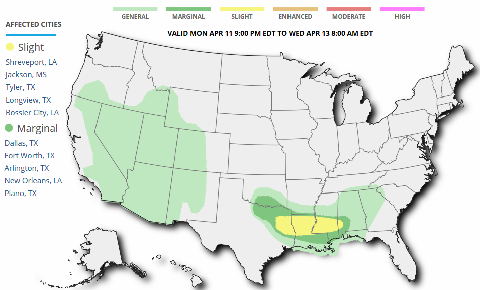
Severe Threat Tuesday
According to NOAA's SPC, the severe weather concerns will continue into Tuesday. A slight risk of severe weather has been issued across parts of the Lower Mississippi Valley with large hail, damaging winds and isolated tornado concerns.
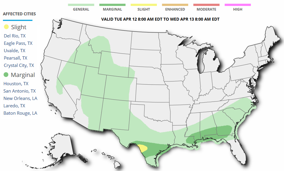
Severe Threat Wednesday
Areas of strong to severe storms will also be possible across the Deep South as the stalled frontal lingers into Wednesday.
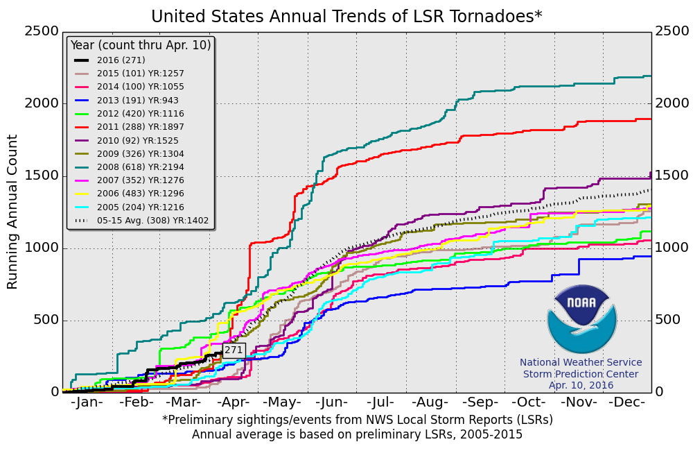
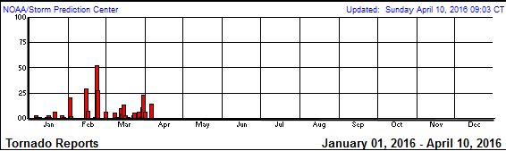
2016 Tornado Reports So Far...
According to NOAA's SPC, the PRELIMINARY tornado count (thru April 10th) suggests that there have been 271 tornado reports so far this year. Interestingly, this is the most since 2012 through this date.
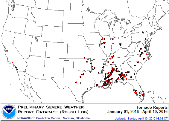
2016 Tornado Map
Here is the preliminary tornado report map, which shows the heaviest concentration of tornadoes so far this year across the Gulf Coast States. Interestingly, there have also been a few across the state of California.
_____________________________________________
NASA Study Finds Carbon Emissions Could Dramatically Increase Risk of U.S. Megadroughts
Here's an interesting article released by NOAA earlier this year regarding the increased risk of "Megadroughts".
"Natural droughts like the 1930s Dust Bowl and the current drought in the Southwest have historically lasted maybe a decade or a little less," said Ben Cook, climate scientist at NASA's Goddard Institute for Space Studies and the Lamont-Doherty Earth Observatory at Columbia University in New York City, and lead author of the study. "What these results are saying is we're going to get a drought similar to those events, but it is probably going to last at least 30 to 35 years."
See more from NASA.gov HERE:
_________________________________
Thanks for checking and have a great rest of your week!
Follow me on Twitter @TNelsonWX

No comments:
Post a Comment