68 F. average high on May 9.
69 F. high on May 9, 2015.
.19" rain fell at Twin Cities International Airport as of 7 pm yesterday.
May 10, 1934: 'The Classic Dust Bowl' hits Minnesota. Extensive damage occurs over the region, with near daytime blackout conditions in the Twin Cities and west central Minnesota. Dust drifts cause hazardous travel, especially at Fairmont where drifts up to 6 inches are reported. Damage occurs to personal property due to fine dust sifting inside homes and businesses.

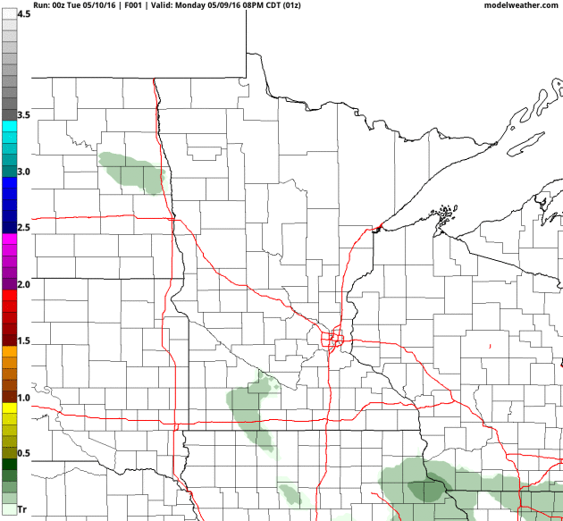
Welcome Puddles - Over 1 Inch of Rain by Wednesday
"The way I see it, if you want the rainbow, you gotta put up with the rain" said Dolly Parton. Smart woman.
It's hard keeping farmers, boaters & commuters happy, simultaneously. Maybe if we could time the rain after 8 pm on weeknights - reserve blue sky for weekends? Dream on.
I'm happy to see the rain, for a variety of good reasons. The Fort McMurray mega-blaze may be Canada's worst natural disaster on record. Much of northern Minnesota is too dry. The first 4 months of 2016 were the second warmest in 135 years of records, according to NOAA. And new data suggests we're sliding into a moderate La Nina cool phase in the Pacific, which correlates with a greater drought risk for Minnesota. Let it rain.
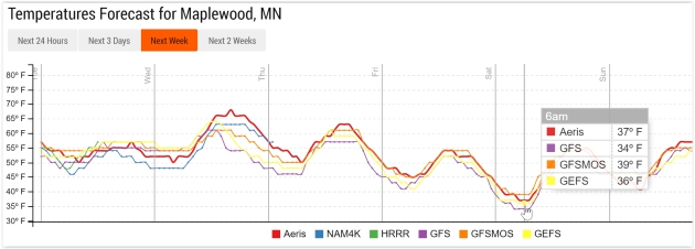
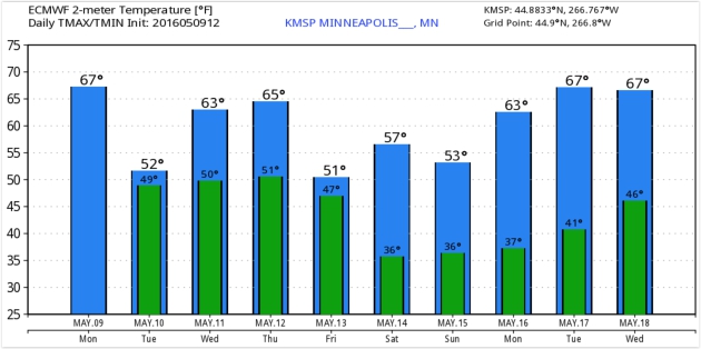
NAM guidance from NOAA prints out over 1 inch of rain between now and Wednesday. Embedded T-storms are possible, but conditions aren't favorable for anything severe, not yet. Cool exhaust behind the storm drops temperatures into the 30s by Saturday morning - a lingering breeze may prevent a widespread frost. Don't panic: 70s return within 2 weeks. Spring is fickle.
I know, shocking.


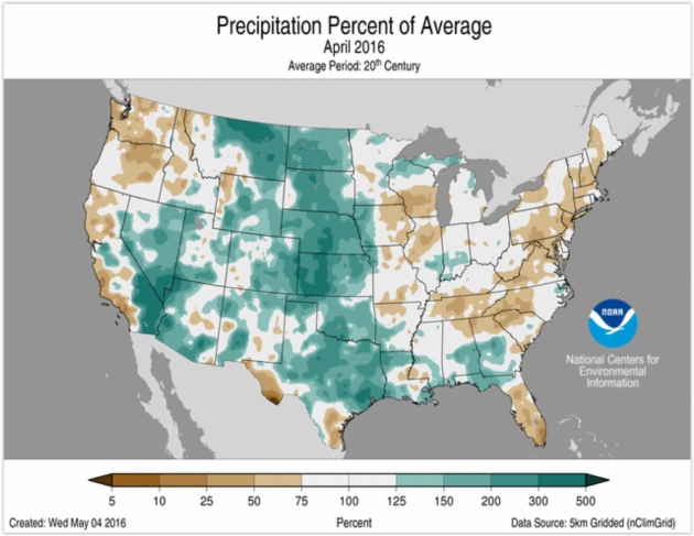
- Several rounds of heavy precipitation impacted parts of Texas during April causing widespread flooding. Houston was hit particularly hard on April 18 when 9.92 inches of rain was observed at the George Bush Intercontinental Airport; even higher amounts were observed to the northwest of the city. This was the second highest one-day precipitation total for the city, bested only by the 10.34 inches that was observed during Tropical Storm Alison in 1989. As a whole, Texas had its ninth wettest April with nearly 180 percent of average rainfall..."
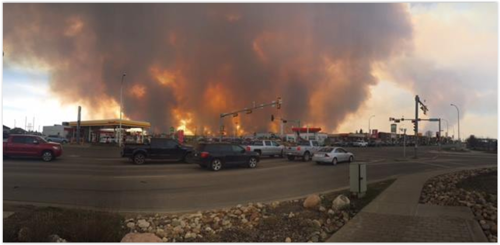
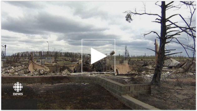
Scorched Remains: Haunting Images From a City Destroyed by Wildfire. Mashable has the story and photos; here's an excerpt: "...The wildfire, fueled by high temperatures, strong winds and dry conditions, has burned more than 385,476 acres (156,000 hectares) and could gobble up 741,300 acres (200,000 to 300,000 hectares) by the end of Saturday, Chad Morrison of Alberta Wildfire said. It has so far destroyed 1,600 buildings, but no deaths or injuries were reported Saturday. "In no way is this fire under control," Alberta Premier Rachel Notley told the Associated Press. Cooler temperatures and possible rain are expected Sunday, however it would take significant rainfall to tamp down the powerful fire. Authorities expect to be battling the blaze for months..." (Photo credit: CBC News Edmonton).
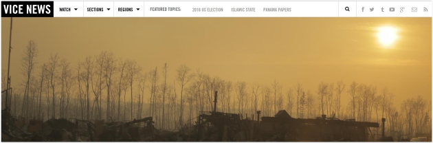
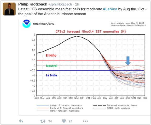
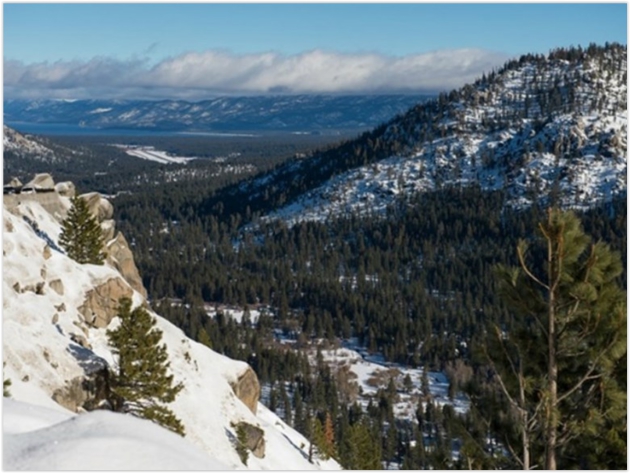
Photo credit above: "The
Natural Resources Conservation Service says the western U.S. snowpack
is melting at "record speed" as U.S. temperatures from January through
April 2016 were 4.0°F above average." California Department of Water Resources / Courtesy.
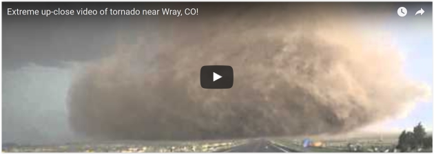
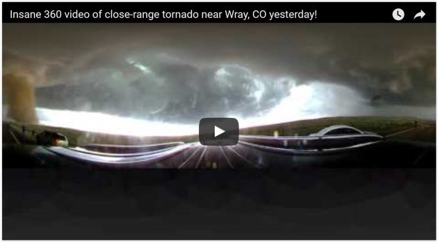
Try Not To Freak Out Inside This 360 Degree View of a Tornado. Esquire has a link to video from last weekend's outbreak near Wray, Colorado - here's a clip: "...The
beast was caught on camera in a 360-degree video that documented the
tornado as it gained strength, dust, and debris. The sky turned, the
wind whipped, and raindrops fell as the vehicle—and camera, and the
driver—approached the storm. Be sure to drag the cursor over the video
to experience the full effect, and take a moment to appreciate the
bravery (idiocy?) of those poor saps running straight towards the
twister..."
Yosemite National Park, Brought To You by Starbucks? Perish the thought. Here's an excerpt from The Washington Post: "A
Coca-Cola Visitor Center will still be off-limits, but an auditorium at
Yosemite National Park named after Coke will now be permitted. Naming
rights to roads are not up for grabs, but visitors could tour Bryce
Canyon in a bus wrapped in the Michelin Man. And park-goers could sit on
a bench named for Humana health insurance — and store their food in a
bear-proof locker emblazoned with the Nike swoosh..."
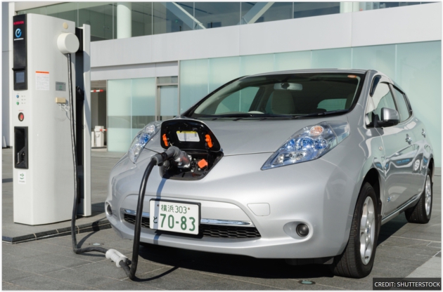
Why Used Electric Car Batteries Could Be Crucial to a Clean Energy Future. Here's an excerpt from ThinkProgress: "Battery costs are plummeting to levels that make EVs a truly disruptive technology, as we’ve explained. That’s why electric vehicle (EV) sales are exploding world-wide, and why Tesla broke every record
for pre-sales with its affordable ($35,000), 200+ mile range Model 3
last month. But what you may not realize is that major EV makers — BMW, GM, Nissan, Toyota
— are now exploring how much value their EV battery has for use in the
electricity storage market after that battery can no longer meet the
strict requirements for powering its car. This potential second life for
EV batteries is a clean energy game changer for two reasons..." (File image: Shutterstock).

Big Oil and Renewables Were Once Arch Enemies - That's Suddenly Changing. The smart fossil fuel companies will be hedging their bets, as described in this article at Quartz: "...Oil,
gas, and coal companies have insisted the world can’t work without the
high-intensity energy fossil fuels provide, even if the consequences are
carbon emissions higher than the world can sustain. Renewable energy,
meanwhile, was seen as niche, idealistic and, by some, unviable on a
large scale. But things have changed. Today, the news emerged that
Total, the French oil giant, had moved to buy Saft,
a battery company. Batteries aren’t themselves “renewable,” but they’re
a technology that could make renewables viable, because the problem
with wind, sun and other non-fossil energies is that they’re
intermittent..."
Just How Much Power Do Your Electronics Use When They are "Off"?
As long as they're plugged in they're in "vampire mode", sucking small
amounts of electricity, which in the aggregate really adds up. Here's a
clip from a New York Times article that had me unplugging all my gadgets: "...It adds up. About a quarter of all residential energy consumption is used on devices in idle power mode, according to a study of Northern California
by the Natural Resources Defense Council. That means that devices that
are “off” or in standby or sleep mode can use up to the equivalent of 50
large power plants’ worth of electricity and cost more than $19 billion
in electricity bills every year. And there’s an environmental cost:
Overall electricity production represents about 37 percent of all carbon dioxide emissions in the United States, one of the main contributors to climate change..." (File photo: AP).


Spanx For Your Face?
Proving American Exceptionalism one more time. A company called Second
Skin is promising just that - a lot cheaper (in theory) than a
face-lift. Here's an excerpt from New Scientist: "Had enough of
those bags under your eyes? An invisible wearable polymer called Second
Skin seems to act like a younger-looking layer of skin on top of your
face. It lasts for days, and, over time, may even reshape your face,
says the team that has developed the material. “This would be Spanx for
your face,” says Anne Lynn Chang,
a dermatologist at Stanford University in California who was not
involved in the research. But others say they are sceptical, and cannot
judge whether the material really does reduce sagging and swelling
without seeing more evidence. Young skin and old skin are physically different and people’s desire to turn back the clock has fuelled a multibillion-dollar make-up industry..." (Image credit: Olivo Labs).

Tornado Prom Selfies. It's the next big thing. Trust me. Here's an excerpt from ABC News: "When
Charlie Bator and Ali Marintzer saw a tornado in the distance on the
night of their high school prom, the two students turned it into a
one-of-a-kind photo opportunity. Bator, 18, and Marintzer, 15, were
taking photos before their prom Saturday night at Marintzer's home in
Wray, Colorado, when a tornado siren started going off outside. Once the
siren stopped, the couple went outside and saw a tornado in the far
distance. The couple decided to take advantage of the strange timing and
got Marintzer's mom, Heidi Marintzer, to snap a photo of them in their
prom gear in front of the tornado..."
Photo credit: Courtesy Charlie Bator/Ali Marintzer. "Charlie Bator and Ali Marintzer took their high school prom photos in front of a distant tornado in Wray, Colo."

TODAY: Rain likely - slower commutes (if that's possible). Winds: E 10-15. High: 61
TUESDAY NIGHT: More rain at times. Low: 54
WEDNESDAY: More rain, few T-storms possible. Winds: S 10-15. High: 67
THURSDAY: Mostly cloudy, drying out. Winds: NW 10-20. Wake-up: 51. High: 63
FRIDAY: Another cool front, passing shower? Winds: NW 15-25. Wake-up: 45. High: 56
SATURDAY: Slight frost risk for greater MN. Some sun, touch of October. Winds: NW 10-15. Wake-up: 38. High: 57
SUNDAY: Unsettled, risk of a PM shower. Winds: NW 10-15. Wake-up: 40. High: 55
MONDAY: Partial clearing, still brisk for May. Winds: N 8-13. Wake-up: 41. High: 58
Climate Stories...

Visualization credit: "Monthly global temperatures from 1850-2016." Credit: Ed Hawkins.
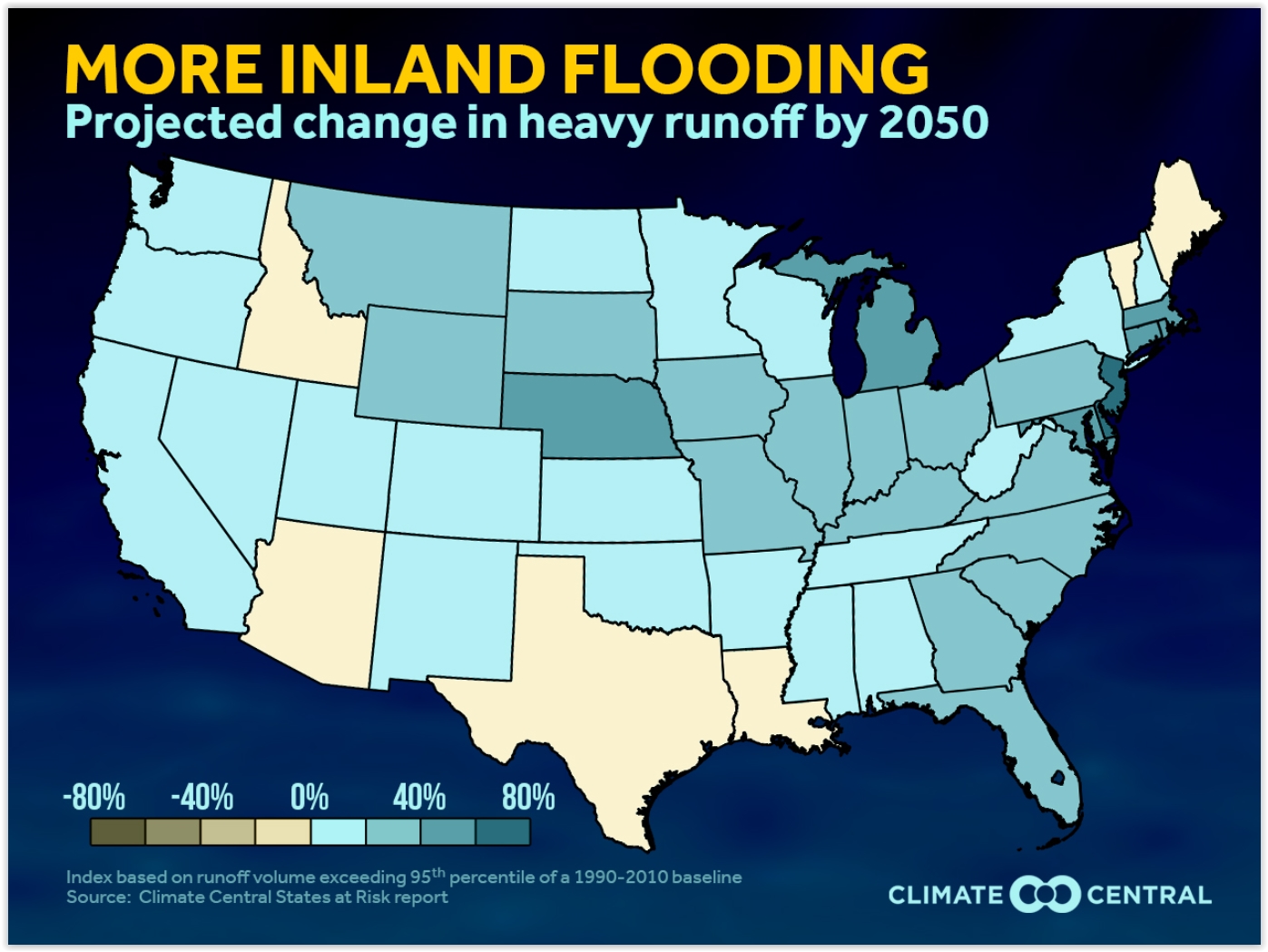
Inland Flooding Threat to Increase by 2050. WXShift has the analysis - here's an excerpt of a recent story: "...The recent flooding in the Gulf Coast states highlights the increasing threats from heavy precipitation with climate change. Our States at Risk report examined the intensity and duration of the heaviest runoff events for each state. To determine the future inland flood threat, the report examined the frequency of high water runoff that could lead to flooding threats both currently and in the future. In this week's analysis, we examine both the state and national projected trends for heavy runoff. Our Flooding Severity Index is used to quantify the runoff. This index is the average yearly sum of the daily total runoff which exceeds the 95th percentile of a 1990-2010 baseline. Using this index incorporates both intensity and duration of the runoff in each state (a full methodology can be found in the States at Risk report)..."

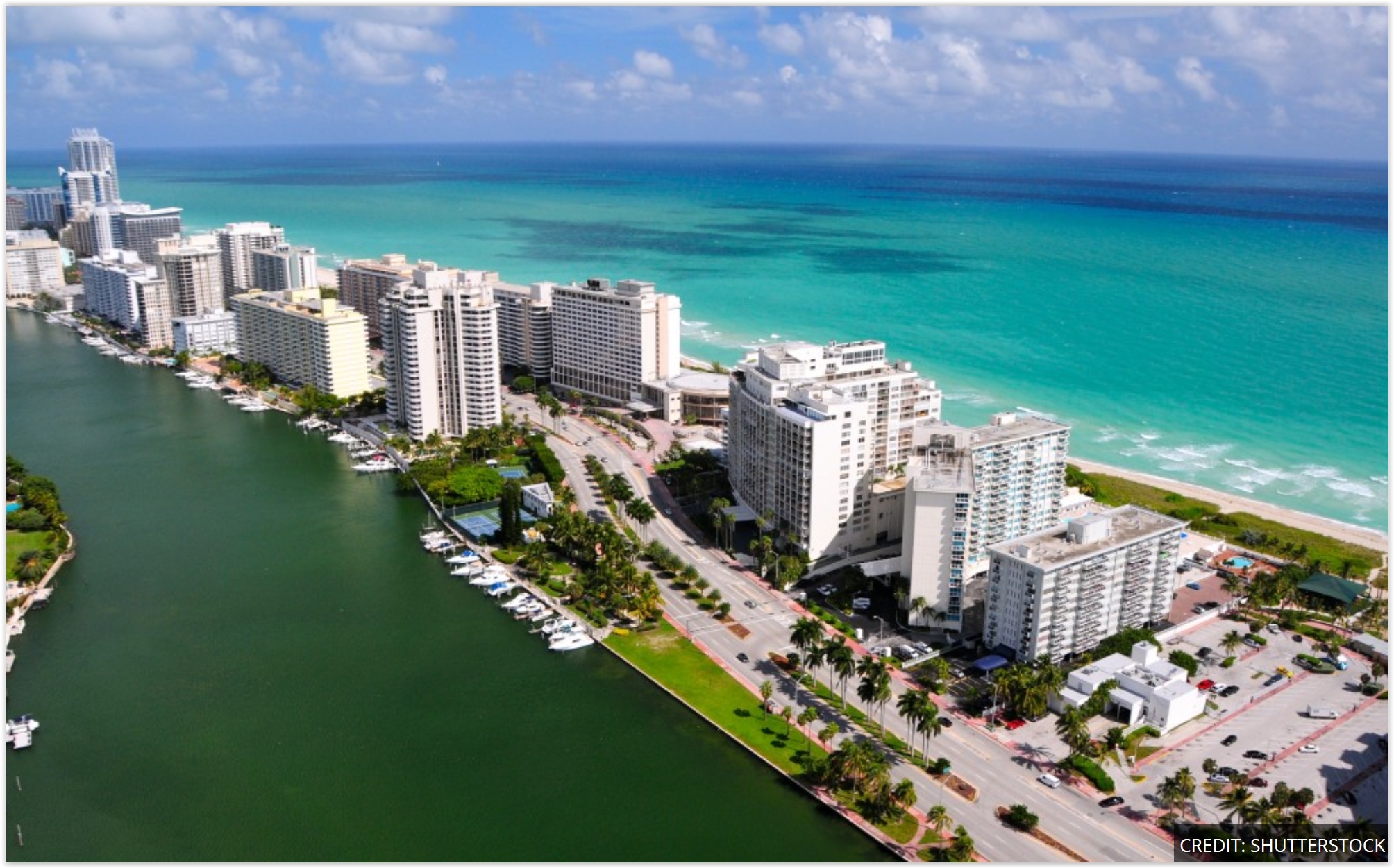
Photo credit above: "Miami Beach has put into action an aggressive and expensive plan to combat the effects of sea level rise. As some streets keep flooding from recent king tide events, the city continues rolling out its plan of attack and will spend between $400-$500 million over the next five years doing so." Emily Michot.
Florida Mayors Rush to Prepare for Rising Seas. Here's an excerpt from ThinkProgress: "Cindy Lerner and Carlos Gimenez are, in many ways, typical local politicians. Both are mayors, and both are intimately familiar with the trials and tribulations that their constituents face on a daily basis, from trash pickup to traffic. Both serve communities along the southeastern Florida coast — Gimenez is mayor of Miami-Dade County, the most populous county in Florida and the seventh-most populous county in the United States, while Lerner is mayor of the village of Pinecrest, a suburban village of about 18,000 residents located within Miami-Dade County. And yet both are in a unique position for a local leader: they both believe that climate change is occurring, and that the consequences will hit Florida residents hard. That puts them at odds with the state government, led by Governor Rick Scott, which fervently denies that climate change is occurring..." (File photo credit: Shutterstock).
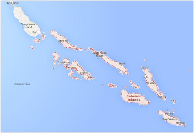
Five Soloman Islands Disappear Into The Pacific Ocean as a Result of Climate Change. ABC News has the story; here's the intro: "Five of the Solomon Islands
have submerged underwater and six more have experienced a dramatic
reduction in shoreline due to man-made climate change, according to a paper
published in the journal Environmental Research Letters. The Solomon
Islands, a sovereign country consisting of a network of picturesque,
tropical islands located in the Pacific Ocean, has a population of a
little more than 500,000 people, according to census data published in 2009, many of whom have been adversely affected by rising sea levels in recent years..."
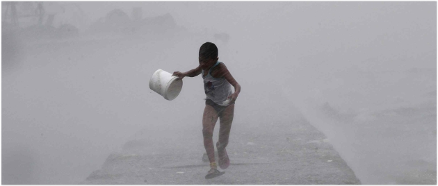
Photo credit above: "Heavy rains and high waves brought by Typhoon Linfa crash along a breakwater in Manila in 2015." Photograph: Romeo Ranoco/Reuters

Exxon Scrambles to Contain Climate Crusade. Politico reports; here's a snippet: "...The meeting marked a striking shift in Exxon’s handling of the controversy. The notion of holding oil companies responsible for global warming, in the same way tobacco companies had to pay billions of dollars in damages over the health effects of cigarettes, had long been seen as a quixotic quest led by scruffy, oil-hating extremists. But POLITICO’s interviews with dozens of activists, industry officials and lawmakers suggest that support for a legal crusade against Exxon is growing far beyond the political fringe — and now poses the biggest existential threat the company has faced in decades..." (File photo: Reuters).
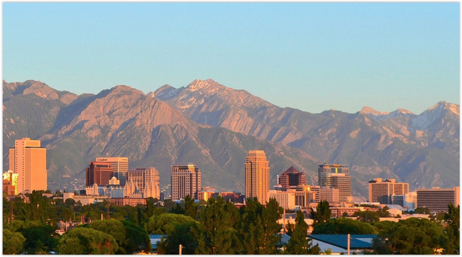
Meet the Utah Columnist Shining a Light on Fossil Fuel Front Groups. Here's an excerpt from Media Matters: "In recent decades, fossil fuel interests have been funding front groups to advance their ideological and political goals, and key to these groups’ success is concealing their industry backing. But Utah columnist Paul Rolly has been working to shine a light on the industry backing behind the most influential front groups in his state. In an interview with Media Matters, Rolly discussed the importance of following the money. Rolly has been a columnist at The Salt Lake Tribune for the last 20 years, and he has stood out because of his work exposing fossil fuel front groups operating in Utah. He has uncovered the oil industry fingerprints behind campaigns to seize public lands from the federal government, attack renewable energy, and promote an industry-friendly agenda in higher education..."
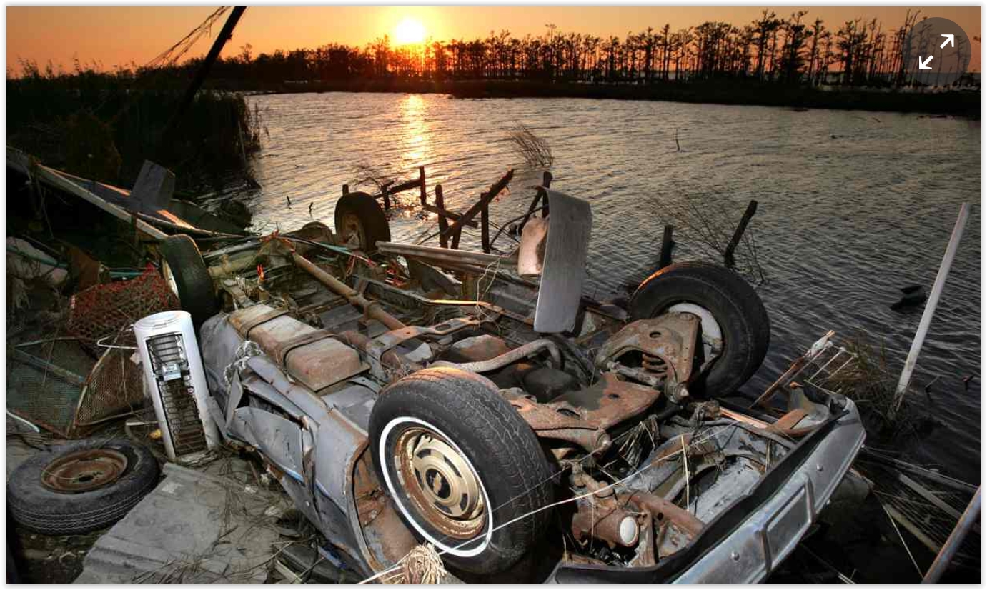
The Coming Refugee Crisis: When Home Leaves Us. Here's an excerpt of a poignant essay at The Guardian: "...The economic, political and psychological toll of the coming droughts, famines, wars, storms and rising seas is difficult to fathom. Yet remarkably, even in this active political season, the need to adapt to climate change has hardly been mentioned. For Louisiana, my home state, the stakes couldn’t be higher. We’ve lost the equivalent of Delaware’s entire landmass over the past century, and the familiar outline of the state is being eaten away. The wetlands that once provided bountiful resources while serving as a buffer against storms and floods are continuing to vanish at an alarming rate. Watching the Louisiana coast sink faster than any other shoreline on the planet while being buffeted by ever-rising seas and storms, one thing is clear. It’s not that we are leaving home, but that home is leaving us..."
Photo credit above: "A car lies upside down at the edge of a marsh amid other storm debris from Hurricane Katrina." Photograph: Robert F. Bukaty/AP.
Why does Florida get hit with so many hurricanes?
ReplyDeletehurricane insurance florida