90 F. high at KMSP yesterday.
74 F. peak dew point on Monday in the Twin Cities.
84 F. average high on July 11.
82 F. high on July 11, 2015.
July 12, 1863: Unseasonably cool temperatures are felt across the state. Frost is reported in the Twin Cities area.
 Peak Summer: Real Heat Wave Brewing Next Week?
“If
you saw a heat wave, would you wave back?” asked comedian Steven
Wright. We may get a chance to find out, first hand, next week.
My
TV screen is already cluttered with back to school commercials, but
please don't be fooled: we have plenty of summer left to enjoy. And
endure.
Historically this is the hottest week of the year, when
torrid heat from the desert southwest stands the best chance of reaching
Minnesota. A splash of Canadian air drops temperatures into the 70s
later this week, but models continue to hint at a full-frontal hot front
next week. NOAA's GFS model prints out 100 degrees in the MSP metro the
end of next week. I'm not buying it (yet) but you've been warned. 90s
should be commonplace next week, with gasp-worthy heat indices lingering
into late July, possibly longer.
The warmer the air, the more water vapor floating overhead - more moisture to spike storms. 4 to 6 inch rains fell
Monday from near St. Cloud to Alexandria into the Brainerd Lakes area, with up to 8" in a few spots. That's 1-2 month's worth of rain in one day.
On Sunday Sioux Falls set a gasp-worthy dew point record: 82F. More details below.
No, summer isn't even close to being over. The hottest days are yet to come.
Extreme Rainfall Amounts.
What is ironic about this image is that the scale only goes up to 5"
(darkest blue shade) so looking at derived Doppler-based rainfall
accumulation it's hard to tell exactly how much really fell. We're
getting
ground truth of numerous 4-6"+ amounts across central and northern Minnesota.
NOAA's Models Had The Right Idea.
I shared a looping version of this yesterday morning, before the
monsoon rains actually set up. Sunday PM's 4 KM NAM run was printing
out some extreme, 6-8"+ amounts for far northern Minnesota, which I
thought was much too high at the time. But with a dew point of 82F
reported in Sioux Falls, incredible levels of water vapor floating
overhead, the fuel was, in fact, available for record rains and serious
flash flooding. Source: AerisWeather.
Potentially Catastrophic Flooding For Parts of the Northland. I fear
Duluth News Tribune
has the right idea with the extreme rainfall amounts from Monday's
training T-storms. Much like the cars in a train pass over the same
section of track, repeated waves of heavy to severe storms tracked
across the same counties, resulting in some 5-8" rainfall amounts,
possibly more in some areas. Here's an excerpt: "...
At 9:40 p.m.,
the Weather Service issued a "flash flood emergency" for Pine County,
relaying reports from local authorities that "many state, county and
local roads are underwater, and some road washouts have been reported in
the Sturgeon Lake, Willow River, Denham, Bruno, Askov and Sandstone
areas." At about 9 p.m. the Weather Service issued an alert asking for
help notifying "campgrounds, resorts, anyone near rivers or streams ...
in and around the Brainerd Lakes area, Aitkin County, Pine County, and
much of Northwestern Wisconsin (that) we are expecting potentially
catastrophic flooding..."
Storm Damage to Homes in Litchfield. Here's a photo posted by
KARE-11 photographers of fairly extensive damage in the Litchfield area.
More Photos of Litchfield Tornado. Here's an excerpt of some of the photos posted at
Willmar Radio: "
This
photo was taken by Neal Thompson near Highway 12 and 5th Street in
Litchfield, near the Dairy Queen. Other photos by Deb Pearson and
Sabrina Mccorquodale."
Overshooting Tops.
Significant tornadoes usually don't form in squall lines, surrounded by
other T-storms. The rotating supercells that ultimately spin up
tornadoes are greedy. They want (need) a steady supply of warmth and
moisture, which becomes problematic with linear storms and outflow
boundaries of rain and hail-cooled air. Watch the isolated cells out
ahead of the main line of severe weather - this is where tornadoes are
most likely to form. If you look carefully on the late afternoon
satellite loop you can see a little knob on top of the thunderhead
sweeping across central Minnesota, the "overshooting top" marking the
most intense updraft within the tornado-generating mesocyclone. Source:
WeatherTap.
Trending Comfortable Later This Week - Not So Much Next Week.
As advertised in today's weather column models heat us up next week as
the ridge axis begins to finally shift east. After enjoying 70s later
this week 90s may return by Tuesday - with a run of 90s possible next
week. I want to see a few more model runs and see if the solutions
between ECMWF (above) and NOAA are consistent. Source: WeatherBell.
Late Month Heat Wave?
If this (GFS) solution for 500 mb winds 2 weeks from now verifies we'll
be sweating out the last half of July; although the worst of the
(100-degree?) heat may slide just to our south across Iowa toward
Chicago and Detroit. Too early to tell, but the maps look hot for much
of the USA.
Record Dew Point at Sioux Falls.
Anything above 70F is considered oppressive by most people (unless you
live in Florida, then it's just another day at the beach). But a dew
point of 82F? Impressively oppressive. Ghastly. More details from the
Aberdeen National Weather Service Office.
We Just Broke The Record for Hottest Year, 9 Straight Times.
The Guardian has details: "
2014 and 2015
each set the record for hottest calendar year since we began measuring
surface temperatures over 150 years ago, and 2016 is almost certain to
break the record once again. It will be without precedent: the first
time that we’ve seen three consecutive record-breaking hot years. But
it’s just happenstance that the calendar year begins in January, and so
it’s also informative to compare all yearlong periods. In doing so, it
becomes clear that we’re living in astonishingly hot times..."
Graphic credit: "
Running 12-month average global surface temperature using data compiled by Kevin Cowtan and Robert Way." Illustration: Dana Nuccitelli.
Heat: #1 Weather Killer in the USA.
30-year data from NOAA
confirms that heat consistently claims more lives than flooding,
lightning, or extreme storms. Since 1986 an average of 130 Americans
have succumbed, directly or indirectly, to excessive heat - more than 3
times the death toll from winter cold and storms.
Alberta Wildfires Costliest Disaster in Canadian History.
Climate Central has specifics: "
The Fort McMurray wildfire, driven by drought and climate change, was the costliest natural disaster
in Canadian history, ringing up $3.58 billion in losses, according to
the Insurance Bureau of Canada. The wildfire, which ignited May 1 in
eastern Alberta and was brought under control on July 5, forced Canada’s largest-ever evacuation. It scorched more than 1.4 million acres and destroyed 2,400 homes and other buildings in and around Fort McMurray, the hub of Canada’s oil sands industry..."
Photo credit: "
The Fort McMurray wildfire in Canada, shortly after the blaze ignited on May 1."
Credit: jasonwoodhead23/flickr
8 Billion-Dollar Weather Disasters So Far in 2016. Here are a couple of excerpts from
Cattle Network: "
The
weather can be cruel, and it can be costly. So far in 2016, eight
distinct events caused $13.1 billion in total damages and claimed 30
lives....According to NOAA,
there were 10 distinct billion-dollar weather events in all of 2015 and 8
in 2014. For more information, visit www.ncdc.noaa.gov/billions/events."
* NOAA NCDC has the list here.
Seattle Crowned "Least Severe" Weather Spot In The Nation. Not a good place to chase tornadoes. Here's an excerpt from KOMO News: "Fresh off last month's blog showing
Seattle was the only spot in the lower 48 with no severe thunderstorm
warnings this year comes more research that cements Western Washington
as among one of the most boring places in the nation when it comes to
severe weather. Ian Livingston with the Washington Post's Capital Weather Gang has been looking into the effectiveness of the National Weather Service's social media efforts
in getting severe weather warnings to the public, also learning more
about when you can be expected to get severe weather warnings..."
*
China's Worst Flooding Since 1998.
Bloomberg reports.
Stop Drinking Bottled Water. A bad habit I need to break as well. Here's a clip from
Gizmodo: "...
Clean,
safe drinking water that flows freely out of our faucets is a feat of
engineering that humans have been been perfecting for two millennia. It
is a cornerstone of civilization. It is what our cities are built upon.
And over the years the scientists and hydrologists and technicians who
help get water to our houses have also become our environmental
stewards, our infrastructural watchdogs, our urban visionaries. Drinking
the water these people supply to our homes is the best possible way to
protect future access to water worldwide. Even after public water crises like Flint—especially after public crises Flint. Companies that package water in a single-use bottle are not concerned with the future..." (Image:
change.org).
Pilot Captures Incredible Nighttime Thunderstorm Photo Over the Pacific Ocean. Tip of the hat to
Capital Weather Gang for sharing one of the more amazing CB photos I've ever seen: "
This
is one of the most striking thunderstorm photos we’ve seen. Taken from a
plane at the moment of a lightning flash, it illustrates both the
ferocity of a turbulent atmosphere and the beauty of Mother Nature. A
strong, roiling updraft; a smooth, flat anvil; and the overshooting top —
all features of intense developing thunderstorms. The photo was taken
over the Pacific Ocean from the cockpit of an airplane. The photographer
and pilot, Santiago Borja, says he was circling around it at 37,000
feet altitude en route to South America when he captured this
spectacular view..."
Photo credit: "
A developing thunderstorm climbs high into the atmosphere over the Pacific Ocean south of Panama." (Santiago Borja).
"Heaven's Water": The Launch of Amsterdam's First Rainwater Beer. Why not. Details via The Guardian: "It may have been the wettest June
since records began in some of the Netherlands, but that’s no reason
for the Dutch to be despondent. A small group of entrepreneurs has
demonstrated that it’s the perfect excuse to make beer, launching a brew
made from rainwater. The idea is that with climate change linked to
increased rainfall in the Netherlands – just as in the UK – they might as well use it as a business opportunity..."
Photo credit: "
Bottles of Hemelswater water: code blond beer." Photograph: Brouwerij de Prael.
 TODAY
TODAY: Sunny, a drier day. Winds: SW 10-15. High: 88
TUESDAY NIGHT: Partly cloudy and warm. Low: 68
WEDNESDAY: Unsettled, few T-storms likely. Winds: SW 10-15. High: 83
THURSDAY: Cooler, PM showers pop up. Winds: NW 10-15. Wake-up: 63. High: 78
FRIDAY: Comfortable, a few instability showers sprout. Winds: NW 7-12. Wake-up: 59. High: 77
SATURDAY: More sun, probably dry. Winds: S 3-8. Wake-up: 60. High: 82
SUNDAY: Hazy sun, a bit warmer. Winds: SE 7-12. Wake-up: 65. High: 85
MONDAY: Sticky sun, heating up. Winds: SE 7-12. Wake-up: 69. High: 89
Climate Stories...
 Food Shortages and Sea Level Rise U.S. Voters' Top Climate Change Concerns
.
The Guardian has the story: "...
Diminishing
food and water security and ruinous sea level rise are the leading
climate change concerns of a section of the American electorate that is
aghast at the lack of discussion of global warming during the
presidential debate. A Guardian US survey of its readers
found that pressure on food and water supplies is considered the most
important consequence of climate change. Sea level rise, which is set to
inundate coastal areas currently occupied by millions of Americans, is
second on the list of the most urgent issues..." (File photo: Nick Ut, AP).
Minnesota Advocates "Pleasantly Surprised" With New U.S. Bancorp Climate Policy. Here's the intro to a story at
Midwest Energy News: "
Minnesota climate activists say they are “pleasantly surprised” after Minneapolis-based U.S. Bancorp issued a new environmental policy
in June that will reduce lending for coal-fired power plants, coal
mines and other environmentally harmful projects. Two bank officials
have been meeting with MN350
members for the past several months on a new environmental policy that
would discourage lending to fossil fuel interests. Advocates say
the policy move — which they add could be stronger — is important
because U.S. Bancorp (the parent company of U.S. Bank) is one of the
largest financial services companies in the United States..."
Photo credit: "
Climate activists outside U.S. Bancorp’s headquarters in Minneapolis."
ExxonMobil: New Disclosures Show Oil Giant Still Funding Climate Science Denial. Here's a clip from
DeSmogBlog: "...
But the latest disclosures on donations by ExxonMobil,
reported publicly here for the first time, show it continues to support
organisations that claim greenhouse gases are not causing climate
change, or that cuts to emissions are a waste of time and money.
Organisations including the American Enterprise Institute, the American
Legislative Exchange Council and the National Black Chamber of Commerce
— all organisations with a record of misinformation on climate science
— all received grants in 2015 from ExxonMobil. The 2015 tally brings the
total amount of known Exxon funding to denial groups north of $33 million since 1998..."
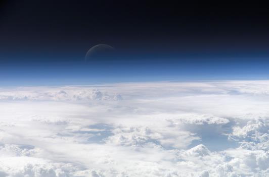
Changing Cloud Patterns Could Lead to More Global Warming. Here's a snippet of a story at
InsideClimate News: "...
Cloud
patterns have been shifting over the past 30 years in ways that a new
study says are possibly due to global warming––and may even lead to more
warming in the future. Climate scientists believe cloud changes are one of the biggest sources of uncertainty
in climate models and understanding how cloud patterns respond to
rising greenhouse gas levels is critical to determining how much and how
quickly global temperatures will rise.
This new study, published Monday in the journal Nature, provides for
the first time a reliable record of past cloud changes spanning nearly
three decades and a comparison of those changes with climate models..." (Image credit: NASA).
NPR has more perspective here.
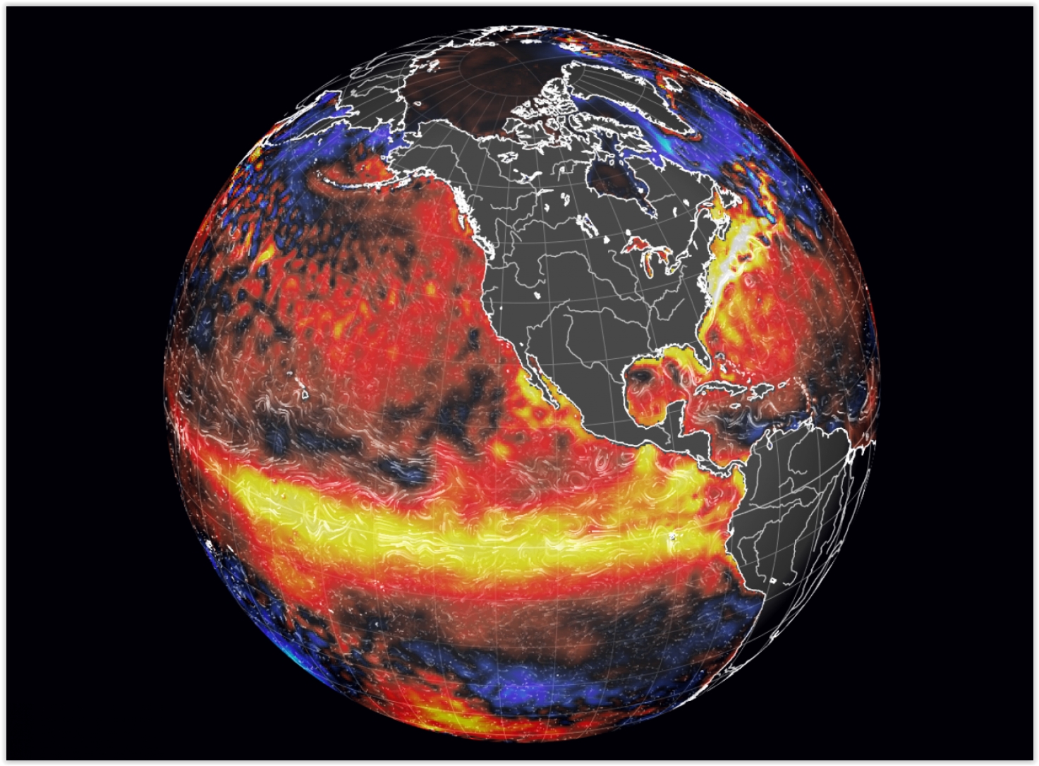 Another Inconvenient Truth: It's Hard To Agree How To Fight Climate Change. The New York Times
 reports; here's an excerpt: "...
But
the movement that started with a straightforward mission — to get more
people to appreciate the dangers of climate change as a precursor to
action — is feeling growing pains. What may seem like a unified front
has pronounced schisms, with conflicting opinions on many issues,
including nuclear power and natural gas,
that are complicating what it means to be an environmentalist in this
day and age. The factional boundaries are not hard and fast, with groups
shifting their positions as the science and waves of activism evolve..." (File image: earth.nullschool.net).
Have Conservatives Noticed Their Favorite Climate Talking Point Has Been Obliterated? The "pause"? Never mind. Here's an excerpt from
The Week: "...
Several
years ago, it seemed like that crowd had a perfect argument to justify
inaction on climate: the global warming "pause." Measurements of global
atmospheric temperatures were not quite increasing on the exact path
predicted by climate models. Climate science was "troubled," wrote Will Wilkinson. The "warming plateau is...effectively killing the rationale for green policies that limit growth," wrote Walter Russell Mead — hence seeming to justify a policy of "focusing first on areas where the problems in our common life are more immediate," as Ross Douthat put it two years ago. But lo and behold, two years later warming has surged back with a vengeance. First 2014 was measured as the hottest year on record by a slight margin, then 2015 broke that record by a bit more, and now 2016 is set to obliterate the record again, this time by a huge margin..."
Graphic credit:
Real Climate
Can New York Be Saved In The Era of Global Warming. Jeff Goodell reports at
Rolling Stone; here's an excerpt: "...
The
problem for New York is, climate science is getting better and better,
and storm intensity and sea-level-rise projections are getting more and
more alarming," says Chris Ward, the former executive director of the
Port Authority of New York and New Jersey, the agency in charge of
airports, tunnels and other transportation infrastructure. "It
fundamentally calls into question New York's existence. The water is
coming, and the long-term implications are gigantic..."
Image credit: "
As sea levels rise in the next century, even a $3 billion wall won't keep Lower Manhattan above water."
Arctic Cruise Raises Hopes and Environmental Concerns. Yes, let's cruise NORTH of Canada and admire a rapidly-melting arctic.
Alaska Dispatch News has the story; here's a clip: "...
There
are few opportunities for passengers to travel the sea route along the
northern coast of North America. Even with global warming opening up the
Northwest Passage, fewer than 50 passenger ships have completed the
full transit, and those were largely yachts and expedition boats with at
most a few hundred people. With 1,070 passengers and a crew of 655, the
Serenity is giant in comparison. Its foray into these waters will test
not only the ability of man and machine to avoid ice, but also the
readiness of a multinational search and rescue coalition..."
Photo credit: "The 1,077 passenger capacity Crystal Serenity is planning a 32-day voyage through the Northwest Passage in the summer of 2016." (Courtesy Crystal Cruises).


No comments:
Post a Comment