You probably couldn't help but notice the windy conditions around the region Friday. Winds gusted over 40 mph at times during the day, helping to strip some of the trees of their leaves.These were the windy conditions yesterday (Friday) at Frontenac State Park. #mnwx pic.twitter.com/bpXN5B0tWO— D.J. Kayser (@dkayserwx) October 15, 2016
_______________________________________________
Saturday's Warm Weather
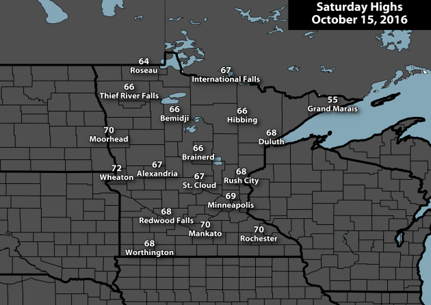
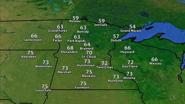
Did you enjoy the mid-October warmth across the region Saturday? Highs were a good 10-15 degrees above average across most of the state, reaching into the 60s and 70s. The high in the Twin Cities was 69 - 10 degrees above average. The last time the Twin Cities saw a high of 69 or higher on October 15th was back in 1996 (71). Highs and departure from average across the other climate locations in the state:
- St. Cloud: 67 (10 degrees above average)
- Duluth: 68 (16 degrees above average)
- International Falls: 67 (15 degrees above average)
- Rochester: 70 (11 degrees above average)
The coolest spot in the state Saturday? Grand Marais, which only saw a high of 55.
_______________________________________________
Today's Important Weather Note:
_______________________________________________
In Search of Average - Looking Ahead to Winter
By Paul Douglas
"What a severe yet master artist old Winter is.... No longer the canvas and the pigments, but the marble and the chisel" wrote John Burroughs. About this time every year it feels like we're all about to embark on a really bad 5-month vacation. From warmth. I'm not anti-snow. I LOVE snow. I'd be even more pro-snow if I could develop the technology to pile it up on trails and not the freeways.
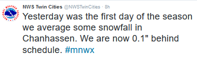
On Friday's edition of TPT "Almanac" Cathy Wurzer asked if heavy summer rains might translate into heavy winter snows. There's no evidence of a strong correlation but my semi-educated gut feeling: this will be a colder, snowier winter than last winter - yet still wind up milder than average, overall. Place your bets.
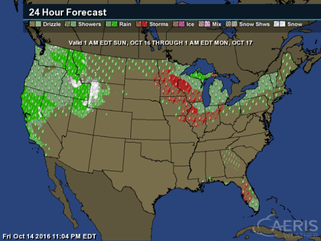
Nothing wintry brewing just yet, in fact don't be surprised if you hear a growl of thunder tonight, again Monday, along the leading edge of cooler air. Highs return to the 50s later this week; another shot at frost by Friday morning.
Some close-in suburbs may wind up with a growing season nearly one month longer than average. Uh, when has our weather ever been "average"?
_______________________________________________
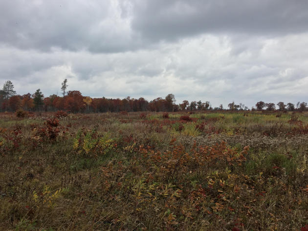 Photo: St. Croix State Park on Saturday, taken by D.J. Kayser.
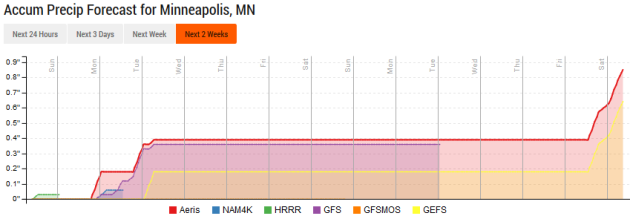
Extended Forecast for Minneapolis
_______________________________________________
This Day in Weather History
October 16th
1996: Early evening storms produce 3/4 to 1 3/4 inch hail in Nicollet, Dakota, Brown, Watonwan, and Martin Counties. In Scott County near St. Patrick, hail fell intermittently for an hour and the area received 3 1/2 inches of rainfall. In Watonwan County, wind gusts up to 63 mph moved several garages off their foundations, destroyed a cattle shed and a corn crib, and uprooted and toppled trees. Southwest of Lake Crystal in Blue Earth County, a garage was blown over onto a vehicle. A 250 gallon fuel tank was also blown over.
1937: A snowstorm dumps 10 inches at Bird Island.
1880: An early blizzard occurs in Minnesota. The blizzard struck western Minnesota and the eastern Dakotas especially hard. Over a foot of snow fell in western counties. Railroads were blocked, and damage was done to Great Lakes shipping.
_______________________________________________
Average Temperatures & Precipitation for Minneapolis
October 16th
Average High: 58F (Record: 86F set in 1938)
Average Low: 40F (Record: 23F set in 1952)
Average Precipitation: 0.08" (Record: 2.10" set in 1984)
Average Snow: 0.1" (Record: 0.5" in 1992)
________________________________________________
Sunrise/Sunset Times for Minneapolis
October 16th
Sunrise: 7:31 AM
Sunset: 6:26 PM
*Length Of Day: 10 hours, 54 minutes and 44 seconds
*Daylight Lost Since Yesterday: ~3 minutes and 1 second
*Next Sunrise That Is BEFORE 7 AM: November 6th (6:59 am) (Due to the fall back to standard time that occurs that morning)
*Next Sunset That Is At/Before 6 PM: November 1st (6:00 pm)
*Next Sunset That Is At/Before 5 PM: November 6th (4:54 pm) (Due to the fall back to standard time that occurs that morning)
________________________________________________
Minnesota Weather Outlook

________________________________________________
National Weather Stories
Across the nation Sunday, the Northwest will continue to see rain from systems impacting the region. The good news there is that wind won't be as much of a concern as it was on Saturday. Rain will be possible as far south as Los Angeles on the west coast. Elsewhere, some showers and storms will occur across the upper Midwest and Northeast. A few storms will also be possible across Florida.
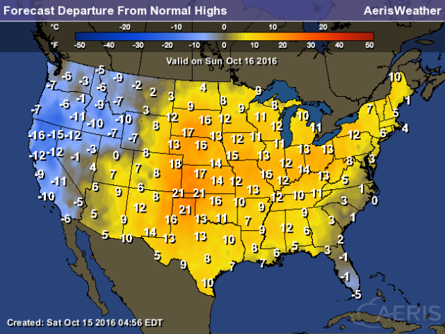
Temperatures will be warmer than average across a good section of the country Sunday - the only exceptions being out in the western United States and across Florida.
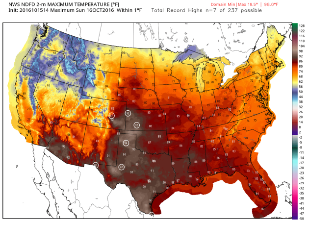
Highs could even reach record levels Sunday afternoon across portions of Kansas, Colorado and Texas.
________________________________________________
Thanks for checking in and have a great Sunday! Don't forget you can follow me on Twitter (@dkayserwx) or on Facebook (Meteorologist D.J. Kayser)!
- D.J. Kayser

No comments:
Post a Comment