Storm System Next Week
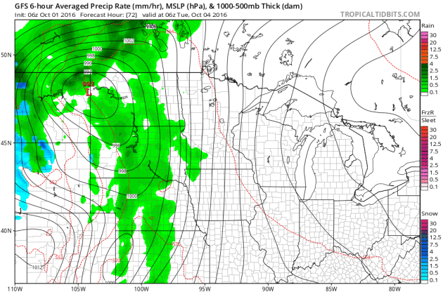
A storm system brewing in the Western U.S. will move into the Upper Midwest by the middle part of next week with scattered showers and storms along the cold front. Heavier rainfall potential may be possible along the cold front as it moves through the Mississippi River Valley. Note that temperatures may even be cold enough for snow potential across NW North Dakota.
Heavy Rainfall Potential Returns
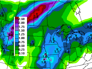
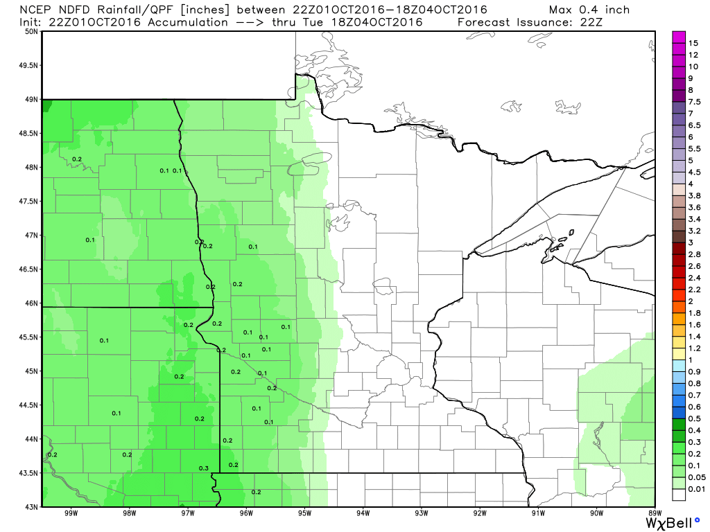
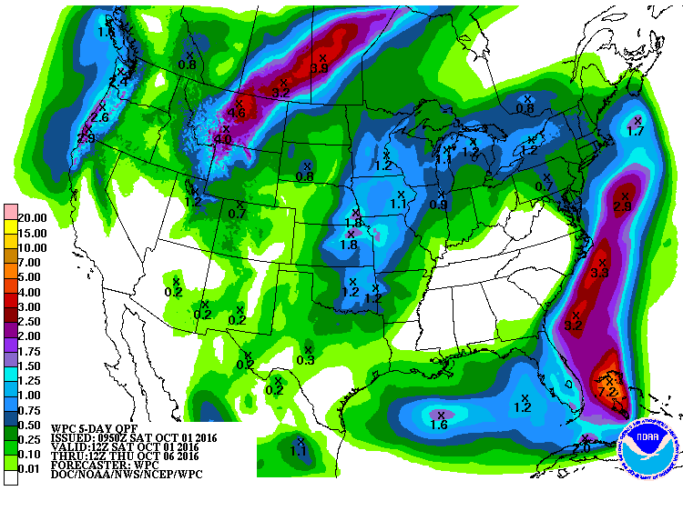
Here's the 5 day rainfall potential, which suggests heavier rain possibly moving back into the Upper Midwest by the middle part of next week. Some locations could see up to an addition 1" through Thursday.
Turning Colder Next Week
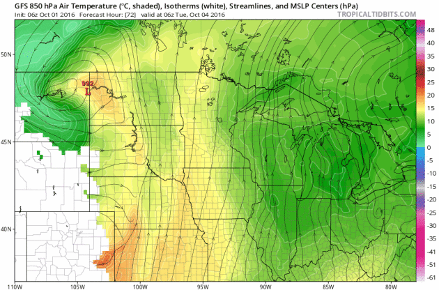
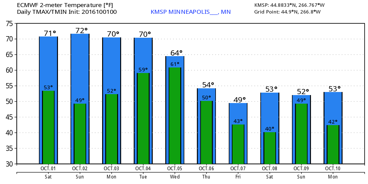
Temperatures ahead of the cold front will warm into the 70s through the early part of next week, but note how much cooler it gets post front by the middle/end of next week. I wouldn't be surprised to see more frost and freeze concerns develop by the end of next week.
_________________________________________
Hurricane Matthew
Hurricane Matthew became the 5th hurricane of the 2016 Atlantic hurricane season on Thursday and strengthened rapidly into a MAJOR category 3 hurricane Friday morning. Overnight Friday, Matthew strengthened even more into a category 5 storm with sustained winds up to 160mph. Interestingly, Matthew became the first category 5 hurricane in the Atlantic Basin since Hurricane Felix in 2007. Matthew is located in the Caribbean and is expected to lift straight north this weekend toward Cuba and the Bahamas by early next week.
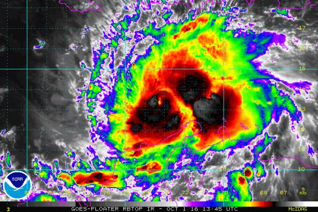
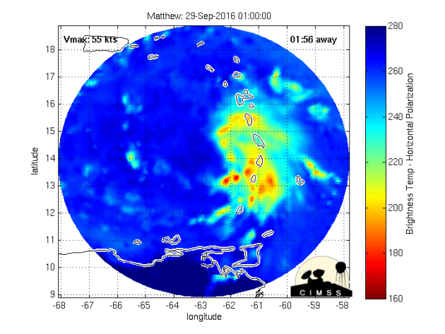
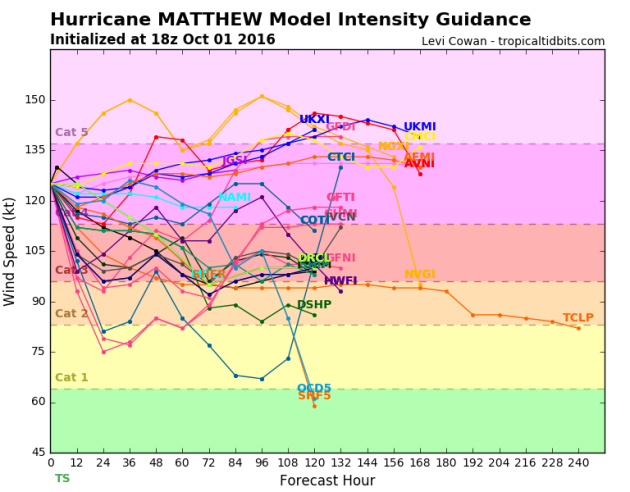
After strengthening into a category 5 hurricane (the first in 9 years; since Felix in 2007), models project that we may still see major hurricane strength (category 3 or higher) over the next few days.
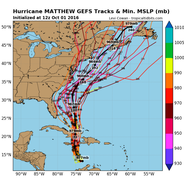
Tracking Matthew
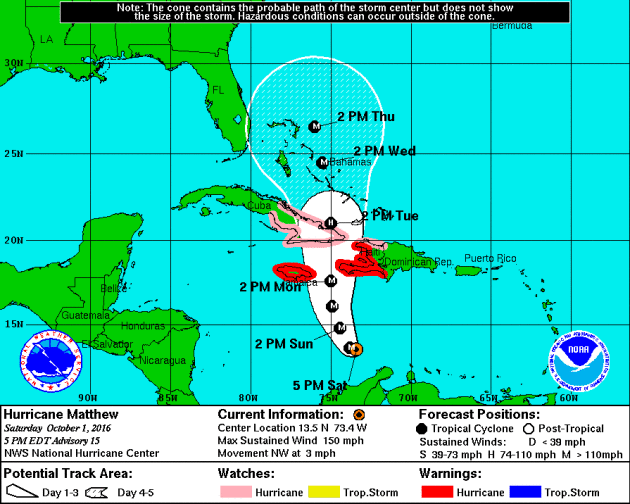
Hurricane watches and warnings have been issued for a number of locations in advance of Matthew. The official track from the National Hurricane Center suggests Matthew will continue at major hurricane strength through early and middle part of next week as it makes a close encounter with Jamaica, Haiti and slides over eastern Cuba. Note that the the northerly track takes it over the Bahamas by the middle/end of next week as a major hurricane.
Here are a few different model solutions for Matthew. Note that most are pretty consistent as it tracks over eastern Cuba and the Bahamas early next week. The extended forecast for mid/late week gets a little hairy as some track the system into the Eastern U.S., while others take it out into the Atlantic Ocean.
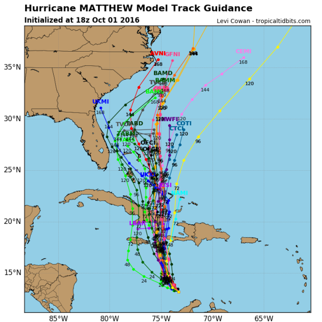
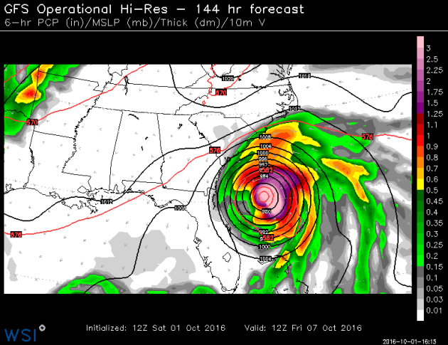
Here's the latest GFS track for Matthew by late week. Note that the storm looks to potentially take a very close track to the east coast of Florida and the Mid-Atlantic.
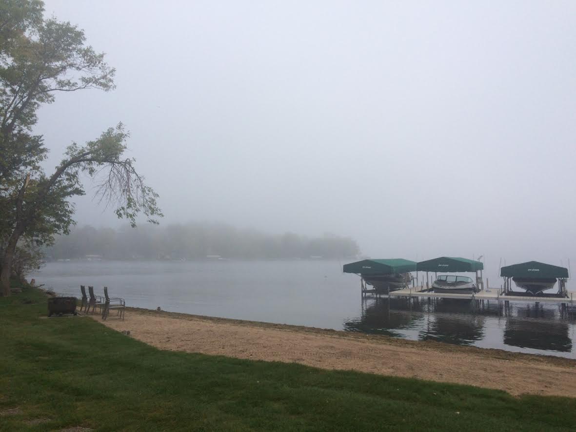
After a foggy start Friday, the sun popped out and became a beautiful sunny day. Some spots around the state woke up to more fog on Saturday morning.
Signs of Fall Closer to Home
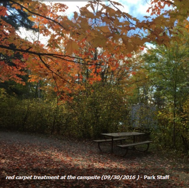
Bear Head Lake State Park - Park Staff
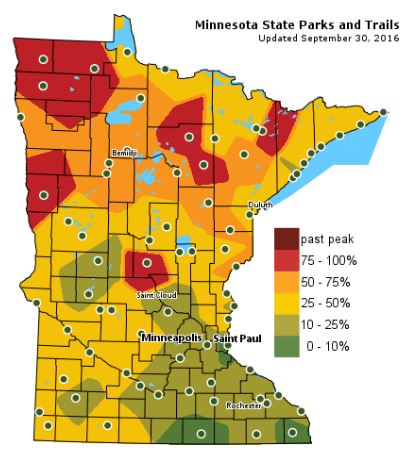
Fall Color Update
The latest update from the MN DNR shows that we are well on our way in the fall color department with some peak colors (75% - 100%) color being reported across parts of Central and Northwestern Minnesota. Note that only 10% to 25% color can be found across the Twin Cities; the average peak there is generally late September to mid October.
_______________________________________________
Northern Lights Potential Continues This Weekend...
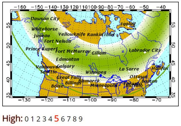
The geomagnetic storm that occurred on the sun earlier this week will continue to buffet Earth through the weekend. At this point, there is still a fairly decent chance at seeing northern lights as long as skies clear. Take a look at the weekend northern lights forecast from the Geophysical Institute at the University of Alaska Fairbanks.
"Forecast: Auroral activity will be high(+). Weather permitting, highly active auroral displays will be visible overhead from Inuvik, Yellowknife, Rankin and Igaluit to Vancouver, Helena, Minneapolis, Milwaukee, Bay City, Toronto, Montpelier, and Charlottetown, and visible low on the horizon from Salem, Boise, Cheyenne, Lincoln, Indianapolis and Annapolis."
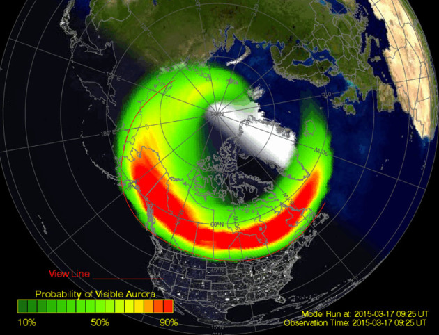
Northern Lights
Here are a couple of other bookmark worthy northern lights website that will help you stay current with what's happening. The first is SpaceWeatherLive.com that shows the current aurora and the probability of seeing northern lights (weather permitting). The next is SoftServeNews.com
______________________________________________
Hurricane "Matthew" in the Caribbean became a major category 5 storm with sustained winds up to 160mph late Friday night. Interestingly, this was the first category 5 hurricane in the Atlantic Basin since Felix back in 2007! This storm will impact Jamaica, Cuba and the Bahamas next week before making a close encounter with the East Coast. Stay tuned.
Closer to home, we'll enjoy a very nice, September-like Sunday as skies clear and temperatures warm to near 70 degrees. What a wonderful stretch of weather it has been for the Ryder Cup and there will be no worries today either.
A storm system working into the Western U.S. will bring snow to the Mountains and perhaps even a few flurries to northwestern North Dakota by Thursday morning. Ahead of the cold front, scattered showers and storms develop with locally heavy rainfall midweek. Post-front, temperatures dip significantly to more late October levels late week. Highs in the 50s and lows in the 30s will have you scrambling for extra layers as you head out the door. Fall is on its way!
___________________________________________________
Extended Weather Outlook
SATURDAY NIGHT: Mostly cloudy. Winds: E 5. Low: 52.
SUNDAY: Mostly sunny and mild. Winds: ESE 5-10. High: 71
SUNDAY NIGHT: Mostly clear and quiet. Winds: E 5. Low: 55
MONDAY: Increasing clouds, still dry. Winds: SE 10-20. High: 72
TUESDAY: Breezy with scattered storms later. Winds: SSE 15-25. Wake-up: 57. High: 72
WEDNESDAY: Lingering t-storm early. Cooler. Winds: SW 10-15. Wake-up: 56. High: 66
THURSDAY: Mostly cloudy with a chilly breeze. Winds: WNW 10-20. Wake-up: 47. High: 58.
FRIDAY: Feels like late October. Winds: NW 5-15. Wake-up: 38. High: 54.
SATURDAY: Skies clear. Nippy sunshine. Winds: E 5-15. Wake-up: 38. High: 59.
_______________________________
_______________________________
This Day in Weather History
October 2nd
1953: A record high of 90 for the St. Cloud area is recorded in 1953 (and later tied in 1992). Minneapolis also sets a record that same day in 1953 with a high of 89 degrees.October 2nd
1849: Persistent rain at Ft. Snelling accumulates to 4 inches in one and a half days.
________________________________
Average High/Low for Minneapolis
October 2nd
Average High: 65F (Record: 89F set in 1953)
Average Low: 45F (Record: 22F set in 1974)
_________________________________
Average Low: 45F (Record: 22F set in 1974)
_________________________________
Sunrise/Sunset Times for Minneapolis
October 1st
October 1st
Sunrise: 7:13am
Sunset: 6:50pm
Sunset: 6:50pm
*Daylight Lost Since Yesterday: ~3mins & 6sec
*Daylight Lost Since Summer Solstice: ~3hours and 59mins
______________________________________________________________________
*Daylight Lost Since Summer Solstice: ~3hours and 59mins
______________________________________________________________________
Moon Phase for October 2nd at Midnight
2.3 Days Since New Moon
2.3 Days Since New Moon

_______________________________________________________________________
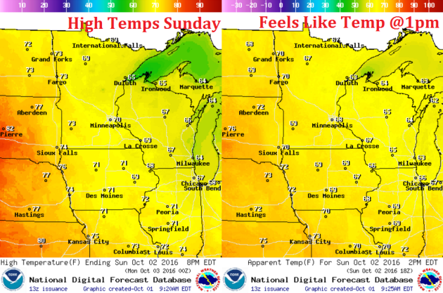
Weather Outlook Sunday
High temperatures on Sunday will be more September-like as we settle into the 70s with sunshine by the afternoon hours. Some spots across western Minnesota could warm into the mid 70s.
Weather Outlook Sunday
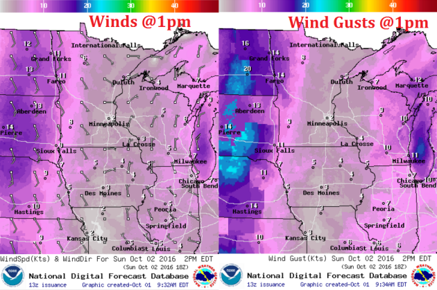
Winds on Sunday will be light again out of the east. Note that winds across the Dakotas will be picking up as a storm system starts moving into the Western U.S.. These winds will begin moving in our direction early/mid next week.
Weather Outlook Sunday
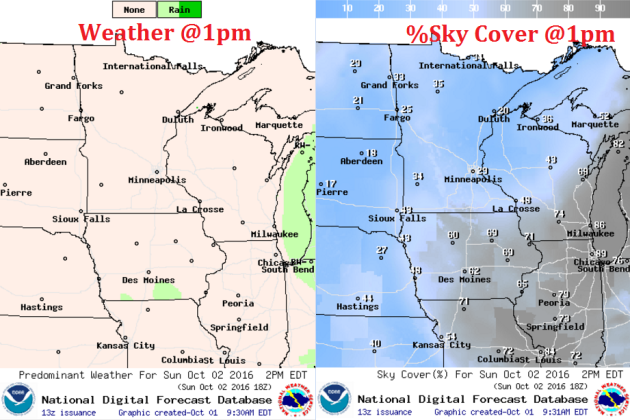
After a bit of morning fog in a few spots Sunday morning, skies should clear for a mostly sunny afternoon. Sunday really looks like a nice, dry day.
___________________________________________________________
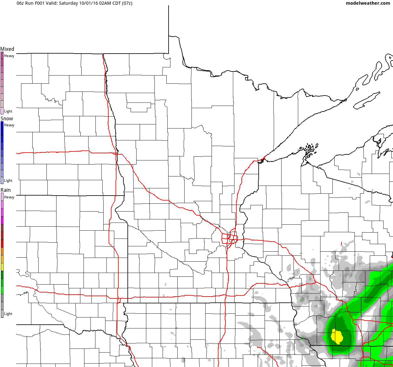
Simulated Radar
The simulated radar from Friday to Sunday shows mostly dry weather continuing across the region with only a few spotty showers possible closer to the Great Lakes.
Rainfall Potential
Rainfall potential through midday Tuesday suggests a few light showers moving into far western Minnesota by Tuesday. Until then, we will stay mostly dry.
_________________________________________
Extended Weather Outlook
The extended temperature outlook over the next 10 days suggests temperatures warming to near 70F over the next few days and into early next week. A fairly significant cold front sweeps through by the middle/end of next week. High temperatures by the second of October looks to be potentially very chilly.
6 to 10 Day Temp Outlook
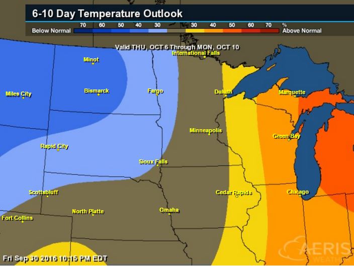
According to NOAA's Climate Prediction Center, warmer than average temperatures look to continue across the Great Lakes Region, but note the cooler than average temperatures lurking just to the west. This could potentially make for a chilly second weekend of October.
6 to 10 Day Temp Outlook
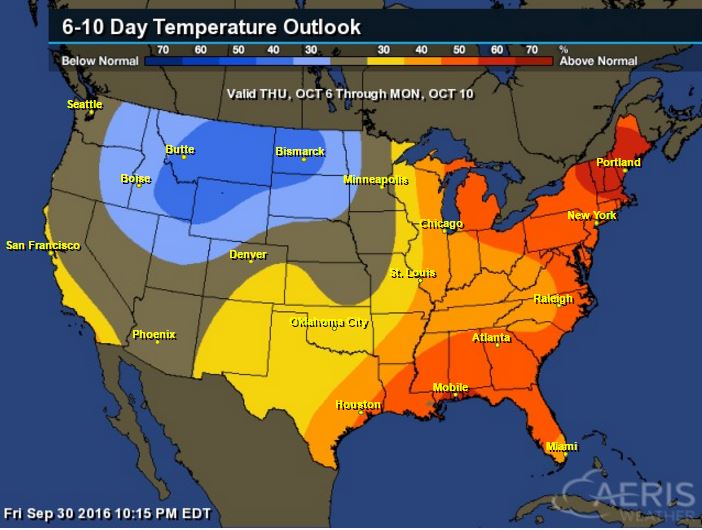
Here's the national temperature outlook from October 6th - 10th, which shows warmer than average conditions across the eastern half of the nation with cooler than average temperatures returning to places in the Intermountain-West
__________________________________________
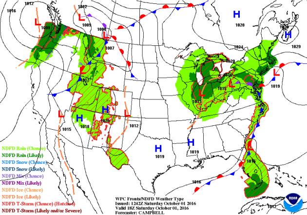
National Weather Outlook
A stalled and slow moving area of low pressure over the Ohio Valley/Great Lakes Region will slowly move north/northeast over the weekend. Heavy rains will still be possible across parts of the northeastern U.S., while mostly dry weather looks to continue in the Central U.S.. Heavier, steadier rain looks to move in along the West Coast as a large storm system moves in. This will bring mountain snow back into the Western U.S. over the next 5 days.
Precipitation Outlook
The heaviest rainfall over the next few days will once again develop across the Central U.S. as our next storm system moves in. There will also be heavier precipitation across the West Coast and the High Plains. Also note the heavy precipitation just east of the East Coast, this is associated with "Matthew".
___________________________________________
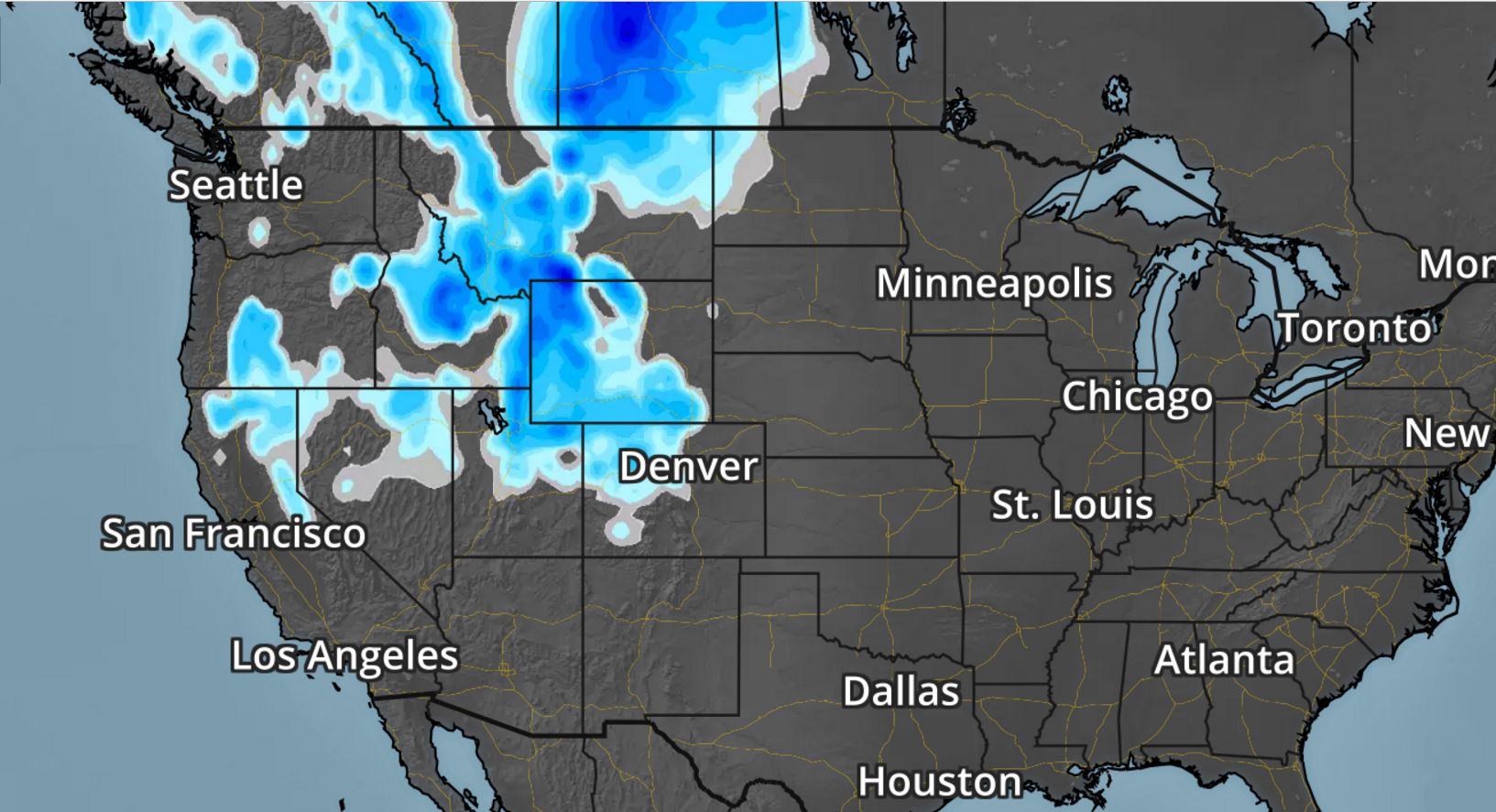
Western Storm System
The next storm system is forecast to move into the Western U.S. with some gusto by this weekend and early next week. Gusty winds, colder temps and high elevation snow will be possible. Interestingly, this storm will bring chances of widespread rain/thunder to the Upper Midwest by the middle part of next week.
.gif)
As the storm system works inland, moisture will turn to snow across the higher elevations from the Sierra Nevada Range to the Colorado Rockies. There may even be a little snow in the lower elevations along the Front Range.
_______________________________________________________
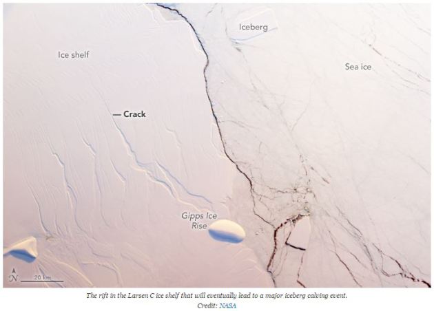
"Rift Speeds Up Across Antarctic Ice Shelf"
"As the sun reemerged over the Antarctic horizon in August after the long, dark austral winter, satellites could once again peer at a rift that has been wending its way across the white expanse of the Larsen C Ice Shelf on the eastern side of the Antarctic Peninsula. To the surprise of scientists, satellite images revealed that the fissure had grown by about 13 miles over just a few months — much faster than its previous pace."
See more from Climate Central HERE:
_________________________________________________________________________"Terns Flee Warming Temps in Epic Migration to Alaska"
"Eyebrows would be raised if American crocodiles, found on the southern tip of Florida, decided to relocate to New York’s Fifth Avenue or Moroccan camels suddenly joined the tourist throng outside Buckingham Palace in London. Yet this is the scale of species shift that appears to be under way in Alaska. In July, researchers in Cape Krusenstern national monument on the north-west coast of Alaska were startled to discover a nest containing Caspian terns on the gravely beach of a lagoon. The birds were an incredible 1,000 miles further north than the species had been previously recorded. “There was plenty of shock, it is a very unusual situation,” said Dr Martin Robards, Arctic program director at the Wildlife Conservation Society, which found the nest. “We checked with Caspian tern experts and they were all very surprised they were this far north. We get Arctic terns here but these terns are much bigger, they really stand out.”"
See more from Climate Central HERE:

__________________________________________________________________
Thanks for checking in and don't forget to follow me on Twitter @TNelsonWX
See more from Climate Central HERE:
__________________________________________________________________
Thanks for checking in and don't forget to follow me on Twitter @TNelsonWX

No comments:
Post a Comment