46 F. high yesterday at MSP International Airport.
27 F. average high on February 10.
13 F. maximum temperature in the Twin Cities on February 10, 2016.
February 11, 1932: Mizpah picks up 13 inches of snow in a storm.
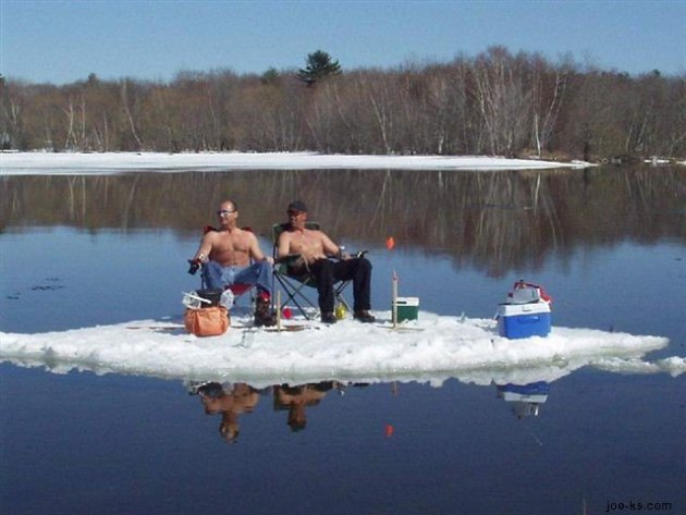
A Midwinter Night's Dream: 50s in February?
I'm dazed and delirious; standing over a hot grill with my shirt off. I think the neighbor-lady just called 911. I don't blame her.
You see, I'm disoriented. It was in the 60s yesterday in southwest Minnesota. 80F at Denver, the earliest 80 on record, broke the previous record for earliest 80-degree reading by nearly 5 weeks.
In Meteorology 1, the first course I took in college, they taught me which finger to point to the weather map with, how to chuckle on-cue, and the seasons. February is still "winter", with bitter cold and heavy snow at this lofty latitude.
Not this year. We'll see a few minor spasms of cold air - possibly a few sloppy snowfalls into March. But subzero cold, the days that make you want to RUN to the airport and fly ANYWHERE, so long as it's south, are probably behind us now.
The pattern is consistent with an El Nino warm phase in the Pacific, with a strong subtropical jet stream whisking the biggest storms south of Minnesota. Numbing air remains bottled up over Canada - a westerly "zonal" flow keeping temperatures here 10-30F above average. We cool off a little by midweek, but ECMWF guidance shows 50s next weekend.
Average for mid-April.
No snowstorms brewing, just a premature taste of spring. Winter is now on life-support.
Spring Break Comes Early.
If you didn't know any better you'd gaze at this (ECMWF) 15-day
temperature outlook and think late March or even early April. But
mid-February? The "Euro" is fairly consistent showing highs in the 50s
next weekend. By then there will be little or no snow cover, and the
sun's energy will be able to go into heating up the air, not melting
snow. Source: WeatherBell.
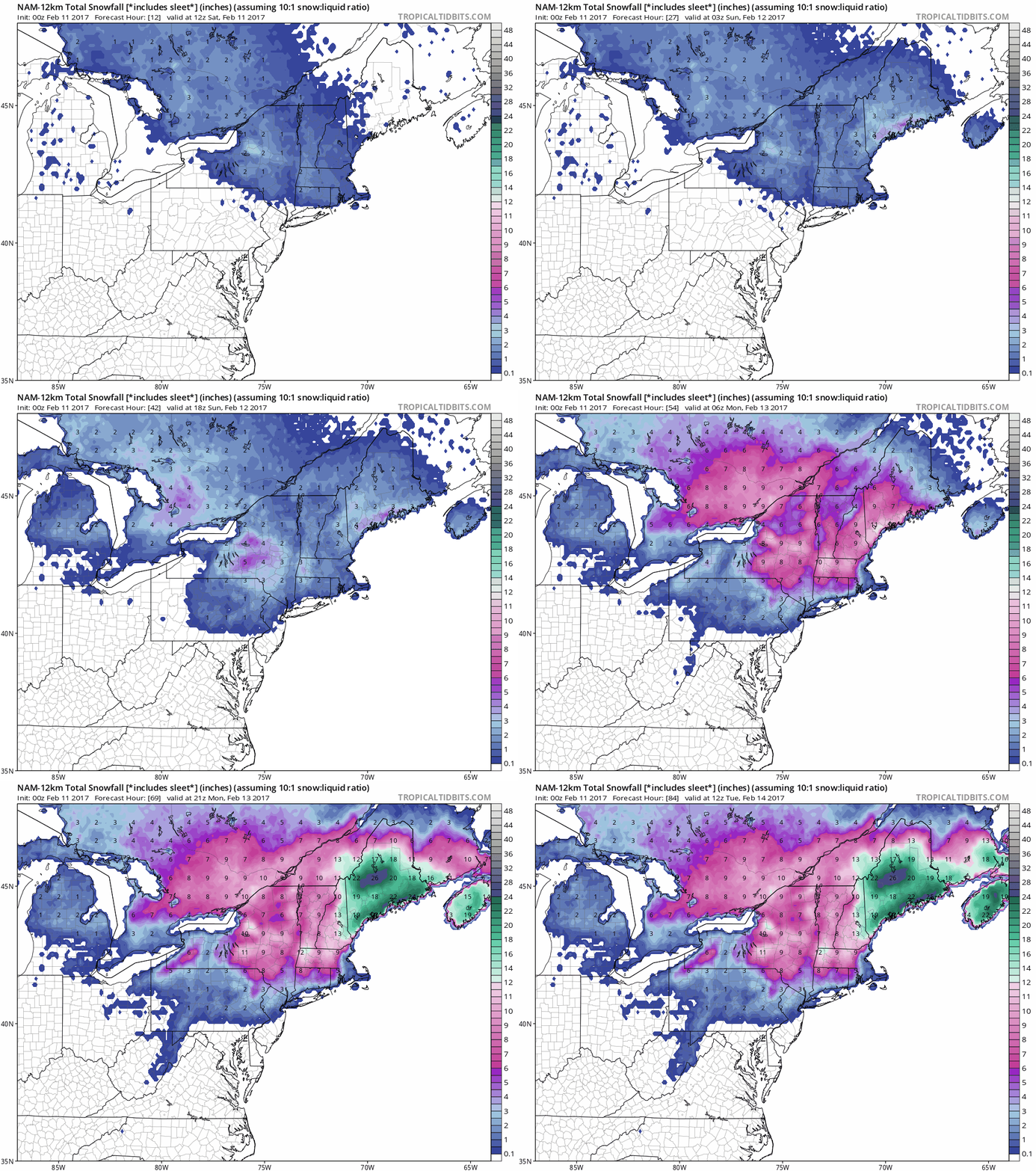
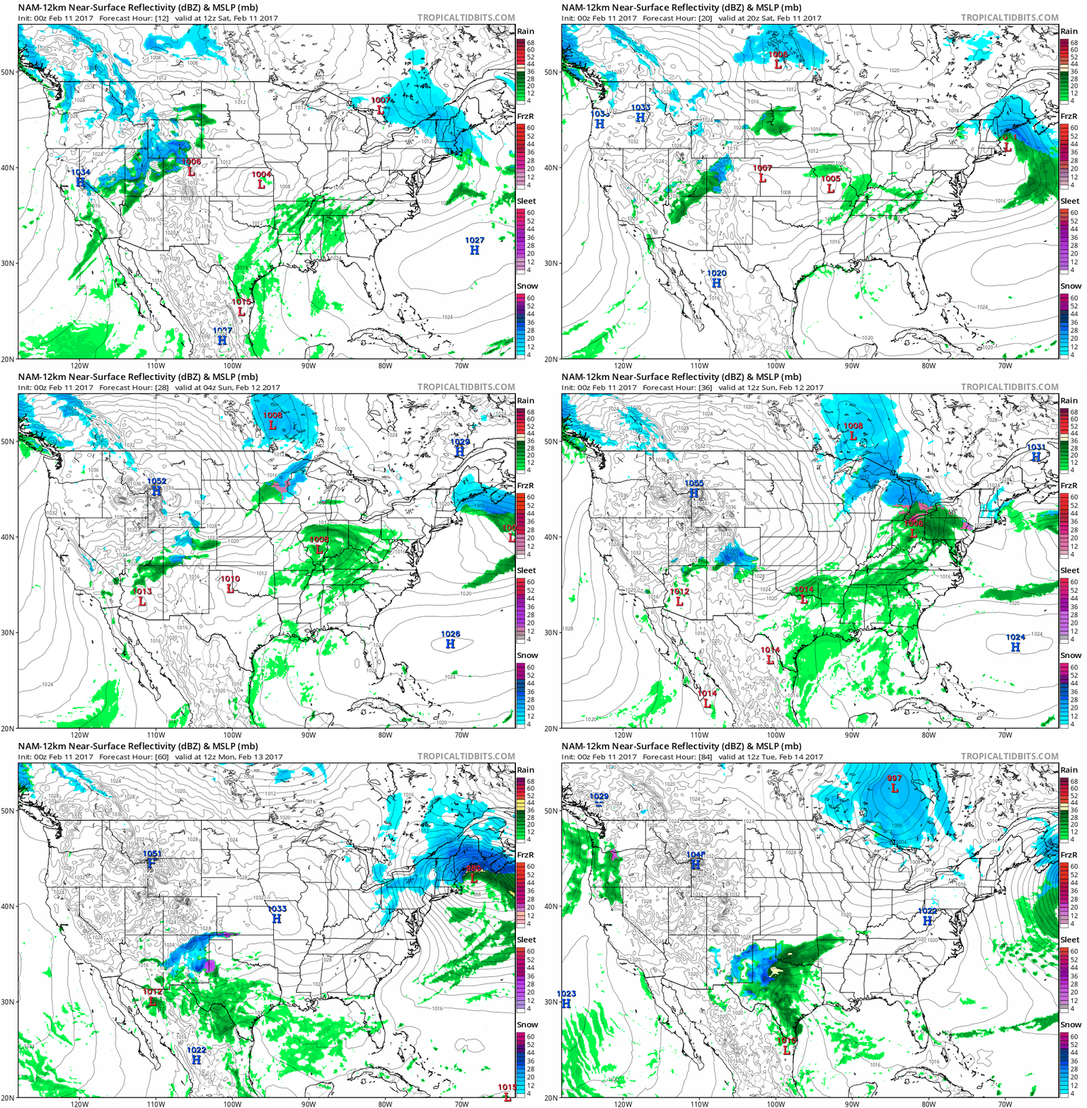 Drying Out West Coast - Another Major Snowstorm for New England.
Here is future radar (and isobars) showing another monster storm
spinning up east of New Hampshire by Monday morning; an extended
easterly fetch off the Atlantic may drop over 2 feet of snow on parts of
Maine. Boston may see a plowable accumulation. Meanwhile the western
USA dries out for a few days.
Drying Out West Coast - Another Major Snowstorm for New England.
Here is future radar (and isobars) showing another monster storm
spinning up east of New Hampshire by Monday morning; an extended
easterly fetch off the Atlantic may drop over 2 feet of snow on parts of
Maine. Boston may see a plowable accumulation. Meanwhile the western
USA dries out for a few days.Jaw-Dropping Heat. Temperatures may hit 90 degrees across much of Texas today. With a February like this who needs May?
Brief Return of Subzero Temperatures. Bitter cold will definitely be the exception, not the rule this month. Here's an excerpt from Mark Seeley's WeatherTalk: "This week saw the return of subzero temperature readings to many parts of the state with the dominance of a polar high pressure system. Most northern and central Minnesota climate stations reported some overnight lows that were subzero. It was -1°F as far south as Winona Dam and Redwood Falls. Many observers measured their coldest temperatures since the second week of January. No daily record low temperatures were reported, but Minnnesota did report the coldest temperature in the nation on some dates this week (see below):
Coldest in the nation reports this week came from:
Goodridge (Marshall County), MN with -13°F on the 5th
Hallock (Kittson County), MN with -29°F on the 8th
Crane Lake and Embarrass (St Louis County), MN with -22°F on the 9th..."
Winter Misery Index courtesy of the Minnesota DNR. Click here for details on how the index is calculated.
California Conservation Corp Tackles Snow Removal in Mammoth Lakes.
They prayed for snow - and it came. Now they can't make the snow in
Sierra Nevada mountains of California stop. Now there's a threat to 20
propane tanks buried under 20 feet of snow, and flat or low-pitch roofs
collapsing under the weight of snow. And potentially serious river
flooding. Details here.
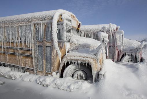
File photo: AP.
Serious Snows in Caribou, Maine. The town in far northern Maine has more snow on the ground than any time since 1998, according to The National Weather Service.
Graphic credit: "Forecast of future tropical Pacific SST conditions from 25 different models." (NOAA).
Photo credit: The New Orleans Advocate.
Coastal Cities Could Flood Three Times a Week by 2045. Climate Central explains that the Mid Atlantic region is most vulnerable to flooding from rising seas: "...Washington and Annapolis, Md. could see more than 120 high tide floods every year by 2045, or one flood every three days, according to the study, published last week in the journal PLOS ONE. That’s up from once-a-month flooding in mid-Atlantic regions now, which blocks roads and damages homes. “The flooding would generally cluster around the new and full moons,” said Erika Spanger-Siegfried, a Union of Concerned Scientists analysts who helped produce the new study. “Many tide cycles in a row would bring flooding, this would peter out, and would then be followed by a string of tides without flooding.” The analysis echoed findings from previous studies, though it stood out in part because of its focus on impacts that are expected within a generation — instead of, say, by the end of the century. It showed high tide floods along southeastern shorelines are expected to strike nearly as often as they will in the mid-Atlantic, portending a fast-looming crisis for more than 1,000 miles of coastal America...."
California Could Be Overdue for a 100-Year Mega-Flood. Details via SFist.com: "It may not be in the cards this year, but California has an extended history of mega-floods — the likes of which the state has not seen since 1862, when about 40 days of straight rain turned the Central Valley and much of Sacramento into a lake, killing countless people and thousands of livestock and leveling a number of barely decade-old west coast towns. Hydrology researcher Dave Reynolds argued in a 2012 paper that despite the lack of weather records for the state prior to the 1850s, the Great Flood of 1862 should be considered a 200-year event that could be expected to repeat itself with much more disastrous effects now that the west coast is so much more densely populated. But now KPIX/CBS 5 picked up on this historic flood narrative, noting that the "atmospheric river" effects we're seeing this season from the colloquially named Pineapple Express could lead to a mega-flood catastrophe sooner than we think..."
Image credit: "An illustration of K Street in Sacramento in January 1862."
- Bridgeport, CT: 36.9 (Warmest)
- Oak Ridge, TN: 46.8 (2nd warmest)
- Sault Ste Marie, MI: 24.8 (2nd warmest)
- Tupelo, MS: 50.8 (2nd warmest)
- Huntsville, AL: 50.9 (3rd warmest)
- Charleston, SC: 56.6 (4th warmest)
- Paducah, KY: 42.4 (4th warmest)
- Caribou, ME: 18 (5th warmest)
- Nashville, TN: 47 (5th warmest)
- Birmingham, AL: 52.5 (5th warmest)
- Atlanta, GA: 52 (6th warmest)..."

Animation credit: "The Meteo AR app uses augmented-reality techniquest to make atmospheric science data more accessible to the public." (©UCAR. This animation is freely available for media & nonprofit use.)
Photo credit: "Maintenance work is done on a Vestas wind turbine (R) at a wind energy park near Heide, Germany, September 9, 2010." REUTERS/Christian Charisius/File Photo.
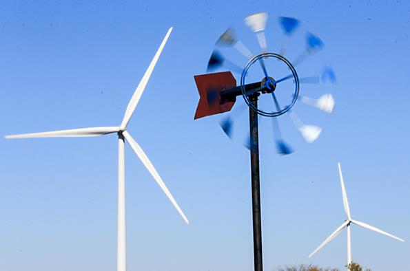
Wind Power Becomes the Top Renewable Energy Source. The New York Times reports: "The
wind industry crossed an important threshold last year, according to
its main trade group, the American Wind Energy Association, surpassing hydroelectric
power to become the largest source of renewable energy in the United
States. The nation’s fleet of dams has long stood as the top renewable
energy source, but there has been little market interest in building
more big hydroelectric generating stations. In the meantime, wind has
rapidly expanded — more than tripling in capacity since 2008 — with many
more installations on the way..."
File photo credit: Nati Harnik, Associated Press.
Navy Plans to Develop Major 200-Acre Solar Farm at Kauai Missle Range. Pacific Business News has the story: "The
Navy plans to develop a a major solar farm and battery energy storage
system on nearly 200 acres at the 2,134-acre Pacific Missile Range
Facility at Barking Sands on the west side of the island of Kauai. The
Navy plans to lease up to 181 acres of Department of Defense land to a
developer for 40 years for the construction, operation and
decommissioning of the project, according to its recently released
194-page draft environmental assessment..."
The "New Normal" in America: Renewables Boom, Emissions Plunge and Consumers Save More Than Ever. Here's the intro to a summary at Greentech Media: "After decades of technology development, business model innovation and policy progress, the U.S. economy is now decisively growing -- independent of energy consumption and carbon emissions. Since 2007, U.S. GDP has grown by 12 percent, while energy consumption has fallen by 3.6 percent, according to the new 2017 Sustainable Energy in America Factbook, compiled by Bloomberg New Energy Finance (BNEF) for the Business Council for Sustainable Energy (BCSE). This year’s fifth edition report builds on last year’s Factbook findings that show the U.S. economy grew by 10 percent since 2007, while energy consumption fell by 2.4 percent. “In other words, energy productivity continues to improve as less and less energy is needed to fuel growth,” the authors wrote..."
Minnesota Report Suggests Efficiency Push Could Generate 15,000 Jobs. Midwest Energy News has the story: "Minnesota could create 15,000 jobs and save more than $3.1 billion by reducing energy use in municipal buildings, universities, schools and hospitals, according to a new report. The report, “20 for MN: A Proposal To Reduce Minnesota’s Energy Use In The M.U.S.H. Sector By 20 Percent,” was released earlier this week by the BlueGreen Alliance, which coordinates labor unions with environmental groups. “We’re hoping the report brings more attention to the fact that this is one of the areas of the economy that can improve the environment and creates jobs,” said Minnesota regional program manager Bree Halverson. Energy efficiency initiatives naturally create local jobs, she said. The report suggests 50 percent of energy efficient equipment is locally sourced..." (Imagery: Department of Energy).

Of Thousands of Apps Tested, These Endured. Most of us use less than 5% of the apps on our smart phones. Here's a list of apps that The New York Times says pass the long-term smell test: "...The TED app (free on iOS and Android)
has also stayed on my phone for years, always ready to serve up a
fascinating and educational TED Talks video when I have a free
half-hour. Sleep Cycle (free on iOS)
has been a longtime companion, too, waking me at a more comfortable
moment in my sleep cycle and helping me avoid the horrid lurch one
sometimes gets with a timed alarm. Even though Apple has now built in
some sleep systems into iOS, I still use Sleep Cycle because it has more
features and has stored my sleep history. Last, because I have a
terrible memory for music, Shazam (free on iOS and Android) has been prominent on my phone's home page for years, always ready to identify a song..."
20 Metro Areas Are Home to 6 in10 Unauthorized Immigrants in U.S. Pew Research Center has the details: "Most
of the United States’ 11.1 million unauthorized immigrants live in just
20 major metropolitan areas, with the largest populations in New York,
Los Angeles and Houston, according to new Pew Research Center estimates
based on government data. The analysis shows that the nation’s
unauthorized immigrant population is highly concentrated, more so than
the U.S. population overall. In 2014, the 20 metro areas with most
unauthorized immigrants were home to 6.8 million of them, or 61% of the
estimated nationwide total. By contrast, only 36% of the total U.S.
population lived in those metro areas..."
Map credit: Pew Research Center.
When Land Surveys Were a Modern Marvel. How did the states get divided hundreds of years ago? It was a messy process, according to Atlas Obscura: "...Though
it’s taken for granted today, the systematic division of land in the
United States still defines the country’s geographical fate. In its
early stages, the survey pit Thomas Jefferson and Alexander Hamilton
against one another, with their competing visions of who should own and
profit from America’s land, and it enabled America’s great land grab
from the native people of the continent’s Western reaches. More than 230
years later, the same system still governs distributions of mineral
rights on public lands and underlies digital mapping systems. If you
know what to look for, you can still find its legacy in the physical
markers that dot the land today, in the neat divisions of the Western
states, and particularly in Ohio, where a not-yet-perfected survey
system created messy, irregular divisions that still hash the state..."
Map credit: "Ohio’s grid is not quite straight and square." C. Albert White/Public domain

TODAY: Clouds increase, mild. Few showers far southern Minnesota. Winds: S 3-8. High: 41
SATURDAY NIGHT: Decreasing clouds. Low: 29
SUNDAY: Partly sunny, windy, turning slightly cooler. Winds: NW 15-25. High: 38
MONDAY: Mild sunshine, less wind. Winds: SW 10-15. Wake-up: 25. High: 46
TUESDAY: Clouds and winds increase. Winds: NW 10-15. Wake-up: 29. High: 43
WEDNESDAY: Mix of clouds and sun, cooler. Winds: N 10-15. Wake-up: 20. High: 32
THURSDAY: More sun, warming up again. Winds: S 8-13. Wake-up: 18. High: 41
FRIDAY: Hello April! Spring Fever Epidemic. Winds: S 8-13. Wake-up: 28. High: 51
Climate Stories...
Photo credit: John Sonntag, NASA via AP.
NASA Earth Observatory has more perspective on what's happening in Antarctica here.
How the New Climate Denial is Like the Old Climate Denial. The Atlantic reports: "...This rhetorical stance—yes, climate change is real, and yes, human activity is implicated, but we don’t know how much human activity is to blame—is fast becoming the go-to position for conservatives. In confirmation hearings last week, Senator Ed Markey asked Scott Pruitt, Trump’s pick to head the Environmental Protection Agency, if he agrees with Trump that global warming is a “hoax.” Pruitt replied that he does not. But later, under questioning by Senator Bernie Sanders, Pruitt refused to say how much change is caused by human activity. He would say only that the “climate is changing, and human activity contributes to that in some manner.” When pressed by Sanders on whether he agreed with 97 percent of scientists who have published in peer-reviewed journals that human activity is “the fundamental reason we are seeing climate change,” Pruitt equivocated. “I believe the ability to measure with precision the degree of human activity’s impact on the climate is subject to more debate...”
Photo credit: "An Adelie penguin stands atop a block of melting ice." Reuters.
Photo credit: "Holley Kelly helps retrieve the CTD/Rosette ensemble, an instrument used to measure the ocean's conductivity, temperature and depth, from the Bering Strait, June 2011." Credit: NASA Goddard Space Flight Center.
More Tropical Nights in Alaska's Future? Ned Rozell has the post at AGU Blogosphere: "By
the end of this century, Alaskans may be enjoying tropical evening
breezes for about a week each year. That’s an increase from the almost
zero such nights we currently savor. But it could
happen, according to a graduate student who has tightened the grids of
computer models to perhaps offer a more detailed glimpse of Alaska’s
future. A tropical night is one with a
low temperature of 68 degrees F or warmer. Right now, even the warmest
places in Alaska hardly ever experience this. By the year 2100, the
average number of tropical nights at some location in Alaska goes to
6.8. That’s according to a computer climate model run by Rick Lader. He
is a graduate student at the International Arctic Research Center in
Fairbanks..."
Photo credit: "Summer nights may be getting warmer in Alaska." Photo by Ned Rozell.
Photo credit: Reuters. "James Baker III, the former secretary of state under George H.W. Bush, tours parts of Florida affected by Hurricane Ike in October 2008."
Photo credit: "
Something is Very, Very Wrong with the Arctic Climate. Are we at a tipping point at the top of the Earth? Andrew Freedman provides perspective at Mashable.
What David Rose fails to mention is that the new NOAA results have been validated by independent data from satellites, buoys and Argo floats and that many other independent groups, including Berkeley Earth and the UK’s Met Office Hadley Centre, get effectively the same results.
Rose’s claim that NOAA’s results “can never be verified” is patently incorrect, as we just published a paper independently verifying the most important part of NOAA’s results."
How a Culture Clash at NOAA Led to a Flap Over a High Profile Warming Pause Study. Science AAAS takes a look at the latest scuffle over data and trends: "...If there’s a dirty secret to the 2015 paper, it’s that “there wasn't a lot of new science in it,” says Karl, who retired in August 2016. It simply assembled the updated, already published NOAA ocean temperature record that their center had been assembling since 2011, and paired it with a published, nonoperational data set of land surface temperatures that included much more coverage around the world. “We said, let’s just put it together, and that’s what made it newsworthy and important.” At its heart, Bates’s concerns amount to a desire for Karl and his team to have more clearly stated that one data set used for their study was not defined by NOAA to have been in a final, “operational” form. One focus is the handling of a new approach to estimating temperatures on land around the globe. The agency’s monthly temperature estimates—which it uses to track climate trends—are drawn from 7000 stations scattered around the world..."
Photo credit: NOAA. "Data collected by satellites, land-based sensors, and NOAA ocean buoys like this are at the heart of the dispute."
No comments:
Post a Comment