First Month With Below Average Temperatures Since...
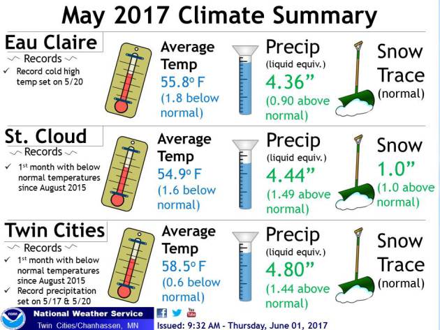
It's
been a while since we had a month where the average temperature ended
up below average in the Twin Cities... and in St. Cloud as well. The
last time we saw that was in August 2015. Last month ended up starting a
new streak: one month in a row with below average temperatures. Yes, it
was just 0.6° below average in the Twin Cities, but that still is good
enough. That was on the back of an above average month of precipitation
with 4.80" of liquid falling in the Twin Cities. St. Cloud even ended up
seeing an inch of snow!
______________________________
Spring Recap
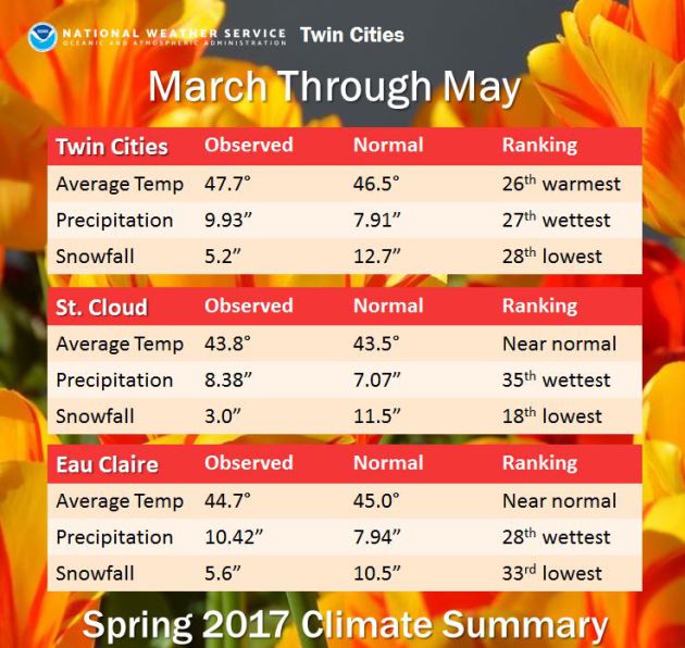
Meanwhille,
meteorological spring (March through May) ended up being the 26th
warmest and 27th wettest in the Twin Cities thanks to an average
temperture of 47.7° and 9.93" of precipitation. A lot of that was in the
form of rain, as only 5.2" of snow fell. You can check out more stats
for St. Cloud and Eau Claire above.
______________________________
First 90 Degree High Possible on Saturday!
By Todd Nelson, filling in for Douglas.
By Todd Nelson, filling in for Douglas.
Here it comes. Are you ready?
It's too hot!
Whew! There. I said it... I feel better now.
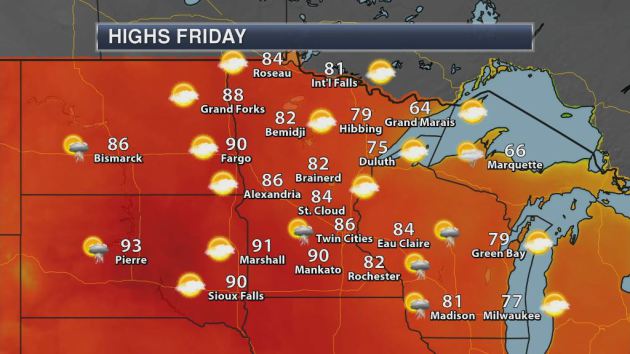
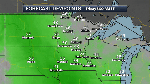
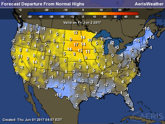
Minnesotans tend to be a little picky about their weather. Not too hot, not too cold, but just right. Goldilocks certainly wouldn't be a fan of the warm front blowing into town over the next couple of days. Highs approaching 90 degrees with dewpoints in the 60s may have many muttering similar objections.
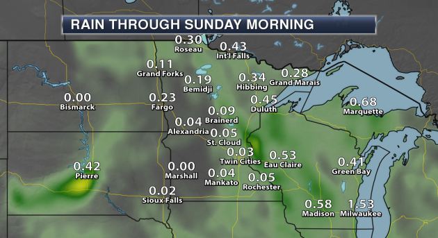
While we haven't had a 90 degree day since August 10th, 2016, climatologically speaking we're right on track as we typically average our first 90 on June 2nd. The storm system responsible for our sticky summer weather will also prompt a few late day showers and storms, some of which could be strong to severe.
By the way, May finished 0.6 degrees below average, which ends an impressive streak of 20 consecutive months with above average temperatures in the Twin Cities! Unreal.
June will most certainly start off on a warm note, but extended forecasts have us leveling off in the 70s early next week. More comfortable and perfectly average.
______________________________
Extended Forecast for Minneapolis
FRIDAY: Sticky sun. PM T-storm. High 85. Low 68. Chance of precipitation 30%. Wind SE 10-15 mph.
SATURDAY: Hot & sticky. Lingering strong storm. High 90. Low 62. Chance of precipitation 30%. Wind WSW 10-15 mph.
SUNDAY: Sun returns. Still mild, not as sticky. High 82. Low 58. Chance of precipitation 0%. Wind NW 5-10 mph.
MONDAY: Few clouds, fresh breeze. High 78. Low 57. Chance of precipitation 0%. Wind E 5-10 mph.
TUESDAY: Another beautiful day!. High 77. Low 58. Chance of precipitation 0%. Wind SE 5-10 mph.
WEDNESDAY: Dry start. Storms develop late. High 79. Low 60. Chance of precipitation 20%. Wind SW 10-15 mph.
THURSDAY: Chance of T-showers. High 78. Low 55. Chance of precipitation 20%. Wind NW 10-15 mph.
______________________________
This Day in Weather History
June 2nd
June 2nd
1945: Snow and sleet pile up to 4.5 inches at Tower.
1898: Heavy rain falls across Minnesota. Just over 7 inches is reported at Pine River Dam.
______________________________
Average Temperatures & Precipitation for Minneapolis
June 2nd
June 2nd
Average High: 74F (Record: 93F set in 1940)
Average Low: 54F (Record: 35F set in 1946)
Average Precipitation: 0.12" (Record: 2.00" set in 1897)
______________________________
Average Low: 54F (Record: 35F set in 1946)
Average Precipitation: 0.12" (Record: 2.00" set in 1897)
______________________________
Sunrise/Sunset Times for Minneapolis
June 2nd
June 2nd
Sunrise: 5:29 AM
Sunset: 8:52 PM
Sunset: 8:52 PM
*Length Of Day: 15 hours, 24 minutes and 31 seconds
*Daylight Added Since Yesterday: ~2 minutes and 19 seconds
*Earliest Twin Cities Sunrise During The Year: June 13th-17th (5:25 AM)
*Next Sunset At/After 9 PM: June 12th (9:00 PM)
*Daylight Added Since Yesterday: ~2 minutes and 19 seconds
*Earliest Twin Cities Sunrise During The Year: June 13th-17th (5:25 AM)
*Next Sunset At/After 9 PM: June 12th (9:00 PM)
______________________________
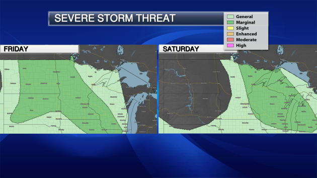
Minnesota Weather Outlook
A
warm front will be pushing north as we head through the last day of
your week, bringing warmer temperatures with it across the region. We'll
see highs on Friday ranging from the 90s across southern Minnesota to
the 70s and 80s across northern parts of the state. There is a chance of
some scattered showers and storms across the region as we head through
the afternoon and into Friday night.
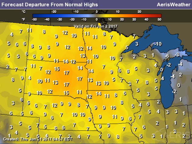
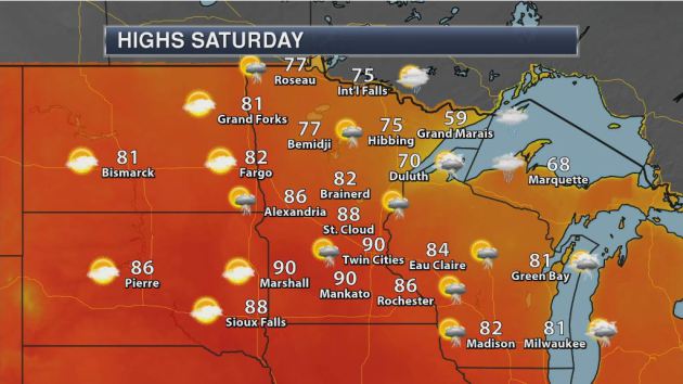
The
first 90 in the Twin Cities happens on average around June 10th
(looking at the entire Twin Cities climate record - it's June 2nd for
the 1981-2010 climatology), and it appears we could reach that Saturday
in the Twin Cities. That would actually be behind the date of the first
90 last year, which occurred on May 6th. The high Saturday could
approach records in the Twin Cities - the record for the day is 92 set
back in 1923. Temperatures across southern Minnesota are expected to be
into the 90s - a perfect day to find a local pool or beach! If you want
cool weather, head to the North Shore (of course)!
______________________________
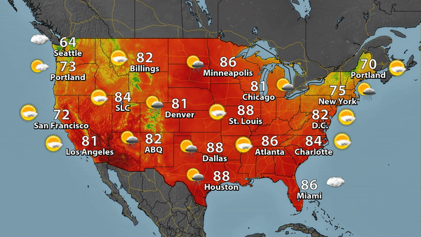
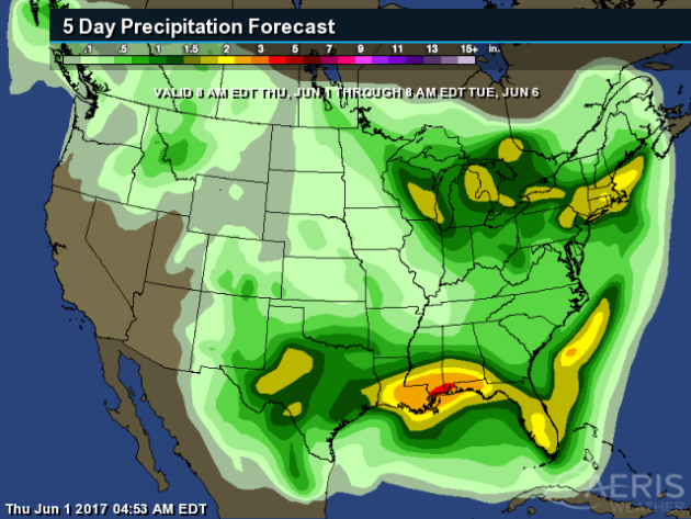
National Weather Outlook
Friday Forecast
______________________________
Up To Three Separate Derechos Last Saturday?
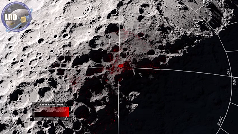
Frost On The Moon?
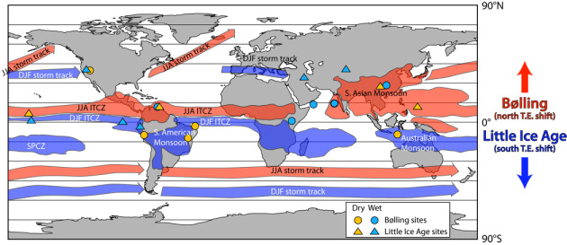
Earth's Rain Belts To Push North?
10.1% Of U.S. Electricity From Solar And Wind In March

What The U.S. Withdrawing From The Paris Climate Agreement May Do
Benjamin Sanderson, a climate scientist at NCAR, wrote an article for the Capital Weather Gang about what may happen with the U.S. withdrawing from the Paris climate agreement. Here is part of his assessment: "If the U.S. decision causes the Paris agreement to fail, any chance of keeping global temperatures below two degrees Celsius (3.6 degrees Fahrenheit) above pre-industrial temperature will effectively be nullified. This is a good time to remember that even two degrees of change will have significant global ramifications. Temperature records of the past will be yearly events, most years will likely have an ice-free Arctic, and extreme precipitation events are projected to markedly increase."
______________________________
Thanks for checking in and have a great Friday! Don't forget to follow me on Twitter (@dkayserwx) and like me on Facebook (Meteorologist D.J. Kayser)!
- D.J. Kayser

No comments:
Post a Comment