Minnesota July Rainfall So Far
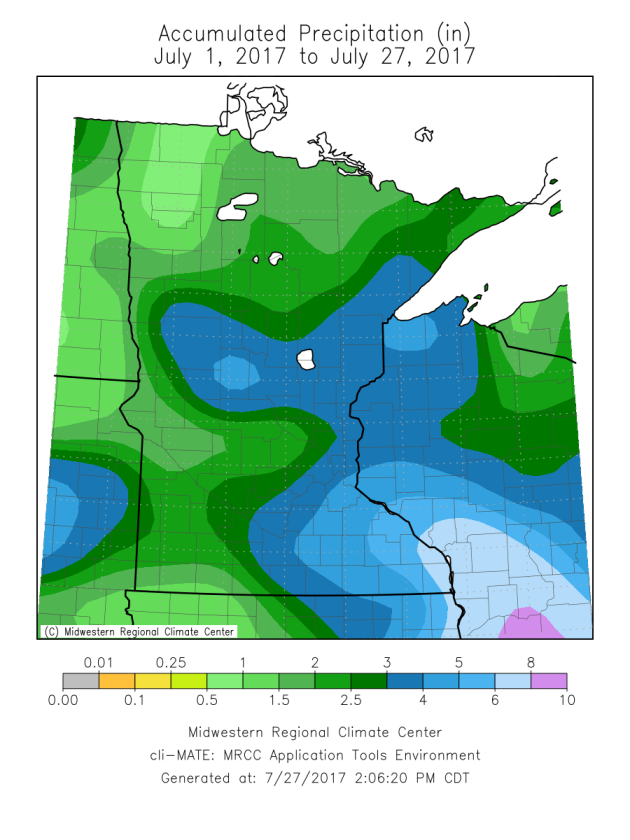
July has been a story of the haves and have-nots in the rainfall department. At times heavy rains have set up across parts of central and southeastern Minnesota, bringing them 3-4"+ of rain so far this month. Meanwhile, parts of northwestern and southwestern Minnesota haven't even received an inch of rain so far.
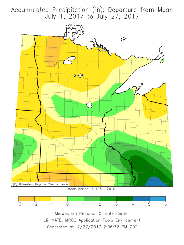
Only limited areas of the state have had above average rainfall so far this month. Many areas of northern Minnesota are running a deficit of at least an inch of rain, and with little rain in the forecast through the end of the month it is likely most of these numbers won't improve.
_______________________________________________
Fantastic Weather Ahead - Spotty Storms Sunday
By DJ Kayser, filling in for Douglas
Do you feel like you've been watering your plants and lawn a little more frequently?
Most of the state has received below average rainfall so far this month, with the exceptions being parts of central and southeastern Minnesota, where rounds of heavy rain have set up. Even in the Twin Cities, where July is typically the third wettest month of the year, rainfall amounts are slightly below average.
Our fairly dry July will continue as we end the month and head into early August across the state. There are only a couple possible rain blips on our map: one on Sunday, and another toward the middle of next week. Otherwise, we are in for a spectacular stretch of weather, with mainly sunny skies into early August. Highs will be within a few degrees of average, with the typical summertime heat and humidity remaining off to our south.
So there are no weather concerns if you are heading out to Billy Joel later this evening. Temperatures will be in the 70s with light winds and mainly clear skies. Enjoy the nice weather!
_______________________________________________
Extended Twin Cities Forecast
FRIDAY: A few clouds. Light winds. High 82. Low 63. Chance of precipitation 0%. Wind E 3-8 mph.
SATURDAY: Perfect Saturday weather! High 83. Low 64. Chance of precipitation 0%. Wind S 3-8 mph.
SUNDAY: Spotty afternoon storms. Partly cloudy. High 82. Low 65. Chance of precipitation 20%. Wind SW 3-8 mph.
MONDAY: A few passing clouds. High 85. Low 66. Chance of precipitation 10%. Wind SW 3-8 mph.
TUESDAY: Sunny. Storm potential Tuesday Night. High 85. Low 66. Chance of precipitation 20%. Wind SW 5-10 mph.
WEDNESDAY: A few lingering showers. Partly sunny. High 82. Low 65. Chance of precipitation 20%. Wind NW 5-10 mph.
THURSDAY: A mix of clouds and sun. High 83. Low 63. Chance of precipitation 10%. Wind NE 5-10 mph.
_______________________________________________SATURDAY: Perfect Saturday weather! High 83. Low 64. Chance of precipitation 0%. Wind S 3-8 mph.
SUNDAY: Spotty afternoon storms. Partly cloudy. High 82. Low 65. Chance of precipitation 20%. Wind SW 3-8 mph.
MONDAY: A few passing clouds. High 85. Low 66. Chance of precipitation 10%. Wind SW 3-8 mph.
TUESDAY: Sunny. Storm potential Tuesday Night. High 85. Low 66. Chance of precipitation 20%. Wind SW 5-10 mph.
WEDNESDAY: A few lingering showers. Partly sunny. High 82. Low 65. Chance of precipitation 20%. Wind NW 5-10 mph.
THURSDAY: A mix of clouds and sun. High 83. Low 63. Chance of precipitation 10%. Wind NE 5-10 mph.
This Day in Weather History
July 28th
1987: Heavy rain falls at La Crosse, WI, where 5 inches are recorded.
_______________________________________________
Average Temperatures & Precipitation for Minneapolis
July 28th
Average High: 83F (Record: 100F set in 1955)
Average Low: 64F (Record: 50F set in 1981)
Average Precipitation: 0.13" (Record: 1.48" set in 1942)
________________________________________________
Sunrise/Sunset Times for Minneapolis
July 28th
Sunrise: 5:54 AM
Sunset: 8:44 PM
*Length Of Day: 14 hours, 49 minutes and 39 seconds
*Daylight Lost Since Yesterday: ~2 minute and 15 seconds
*Next Sunrise At/After 6 PM: August 2nd (6:00 AM)
*Next Sunset At/Before 8:30 PM: August 8th (8:29 PM)
_______________________________________________
Minnesota Weather Outlook
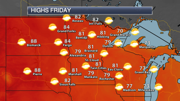 Friday will be an excellent day across the state, with highs in most areas climbing into the upper 70s to low 80s. No rain is expected across the state either, with just a mix of clouds and sun.
 As we look at the temperature trend over the next couple weeks, highs will remain mainly around average through the end of July and into August, with not much potential for highs to reach 90 in the Twin Cities.
 Rainfall chances continue to look light as well over the next couple weeks. There doesn't look to be a large chance of rain in the Twin Cities Sunday - the better chance of rain will be across parts of western Minnesota. A better chance of showers and storms for the Twin Cities will be possible Tuesday Night into Wednesday. That rain is not expected to add up to much, however. After that, we look to be dry through next weekend._______________________________________________
National Weather Outlook
Friday Forecast
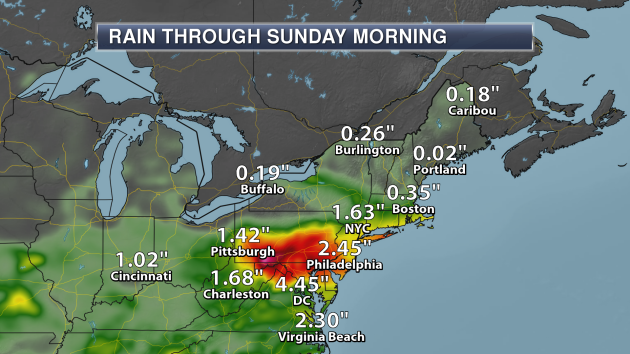
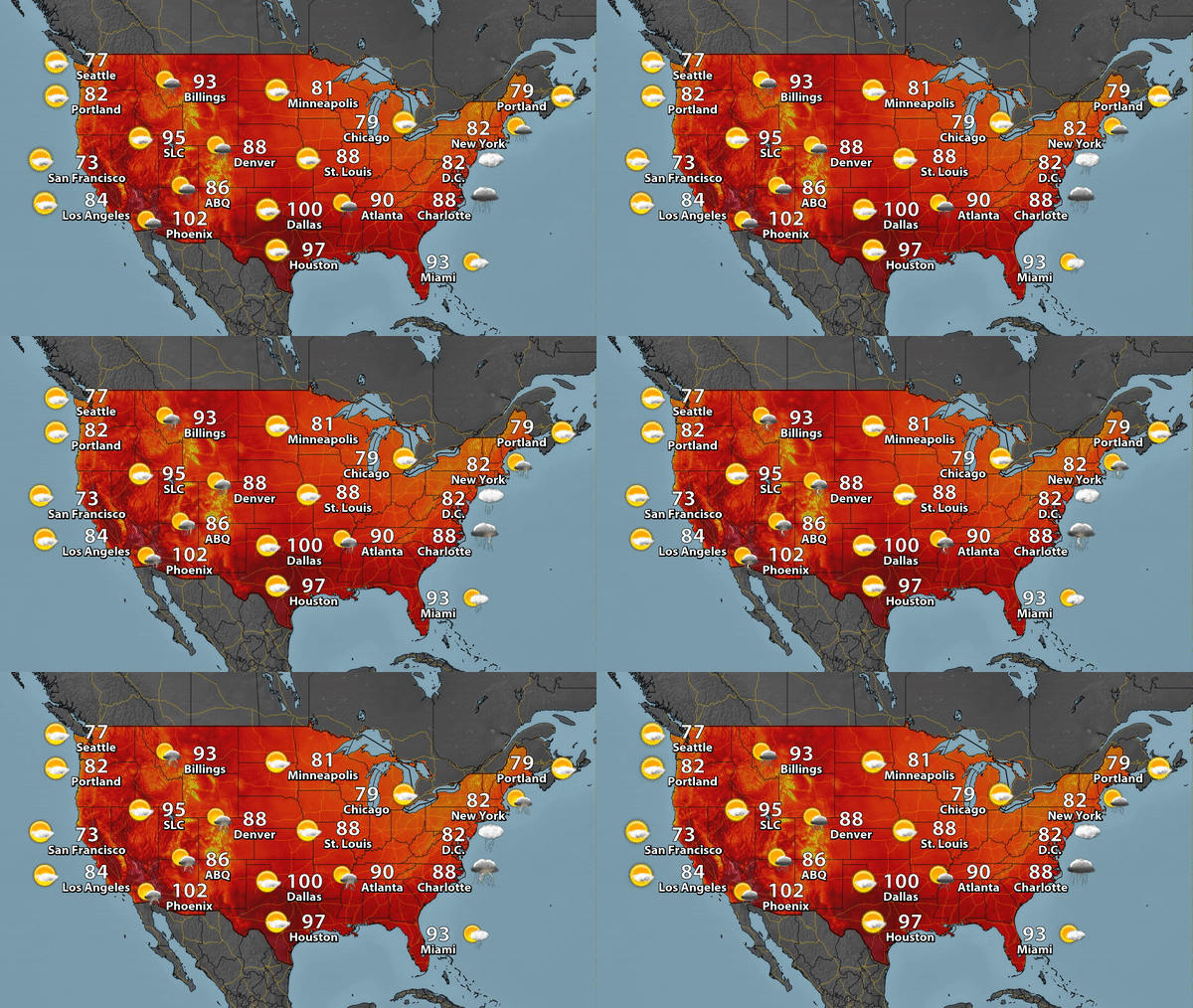 The heat continues to get squished south as we head into the end of the week, with Dallas still expected to reach 100 Friday. Storms will be possible from parts of the Northeast south into the Southeast as a cold front moves through the region. Meanwhile, monsoonal storms will continue across parts of the Desert Southwest.

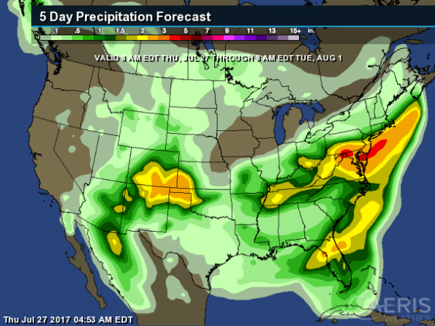
 Some of the heaviest rain through Tuesday morning is expected to be in the Mid-Atlantic and Northeast, where rainfall totals could top 4" in spots. 2"+ totals will be possible across parts of Colorado, Kansas, Texas, Oklahoma and New Mexico as well.
July 28th
1987: Heavy rain falls at La Crosse, WI, where 5 inches are recorded.
_______________________________________________
Average Temperatures & Precipitation for Minneapolis
July 28th
Average High: 83F (Record: 100F set in 1955)
Average Low: 64F (Record: 50F set in 1981)
Average Precipitation: 0.13" (Record: 1.48" set in 1942)
________________________________________________
Sunrise/Sunset Times for Minneapolis
July 28th
Sunrise: 5:54 AM
Sunset: 8:44 PM
*Length Of Day: 14 hours, 49 minutes and 39 seconds
*Daylight Lost Since Yesterday: ~2 minute and 15 seconds
*Next Sunrise At/After 6 PM: August 2nd (6:00 AM)
*Next Sunset At/Before 8:30 PM: August 8th (8:29 PM)
_______________________________________________
Minnesota Weather Outlook

National Weather Outlook
Friday Forecast


_______________________________________________
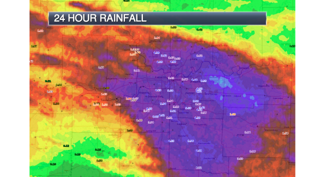
Heavy Kansas City Rain
Better Clouds... Better Forecast?

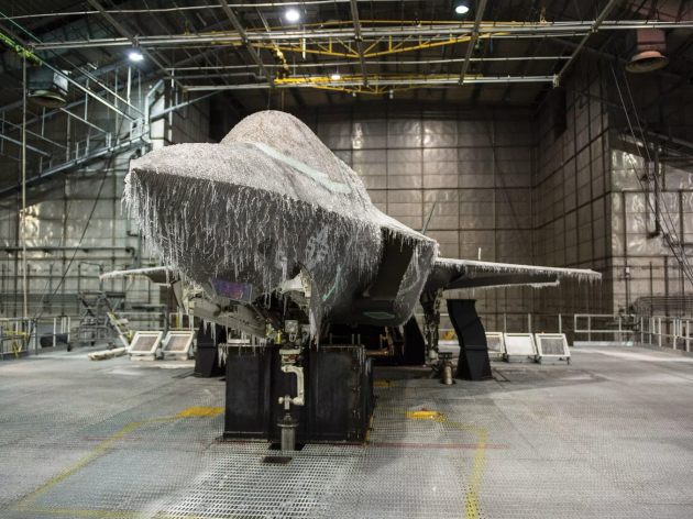
Fake Blizzards For Better Planes
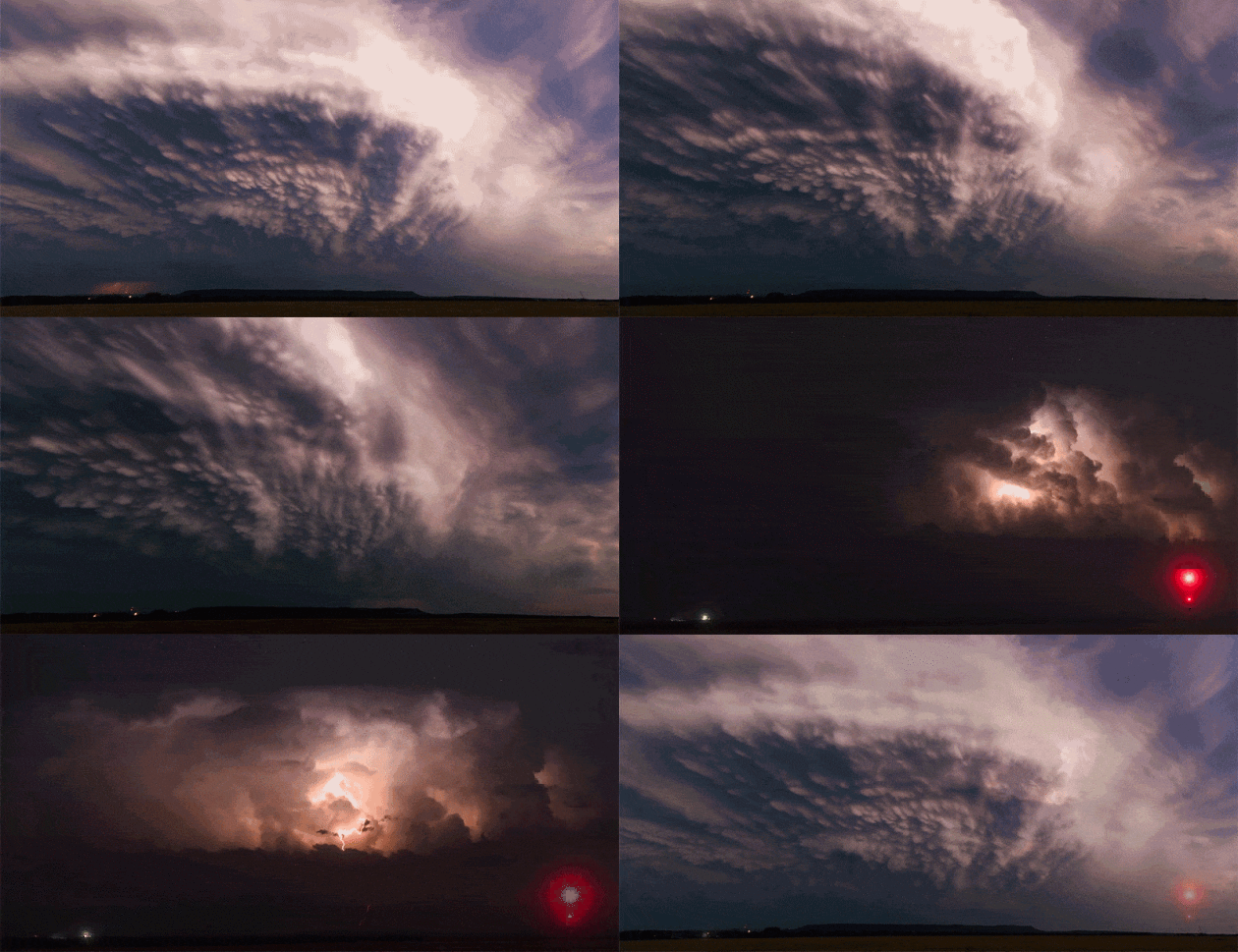
Amazing Weather Timelapses
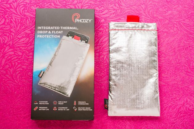
Phone Case Helps Prevent Overheating, Freezing
Nano-sized Satellites?
________________________________________________
Thanks for checking in and have a great Friday! Don't forget to follow me on Twitter (@dkayserwx) and like me on Facebook (Meteorologist D.J. Kayser)!
- D.J. Kayser

No comments:
Post a Comment