82 F. high in the Twin Cities Monday.
82 F. average high on August 7.
82 F. maximum temperature at KMSP on August 7, 2016.
Quick, go out and buy a Lotto ticket!
August 8, 1930: A record high of 102 is set at Redwood Falls.
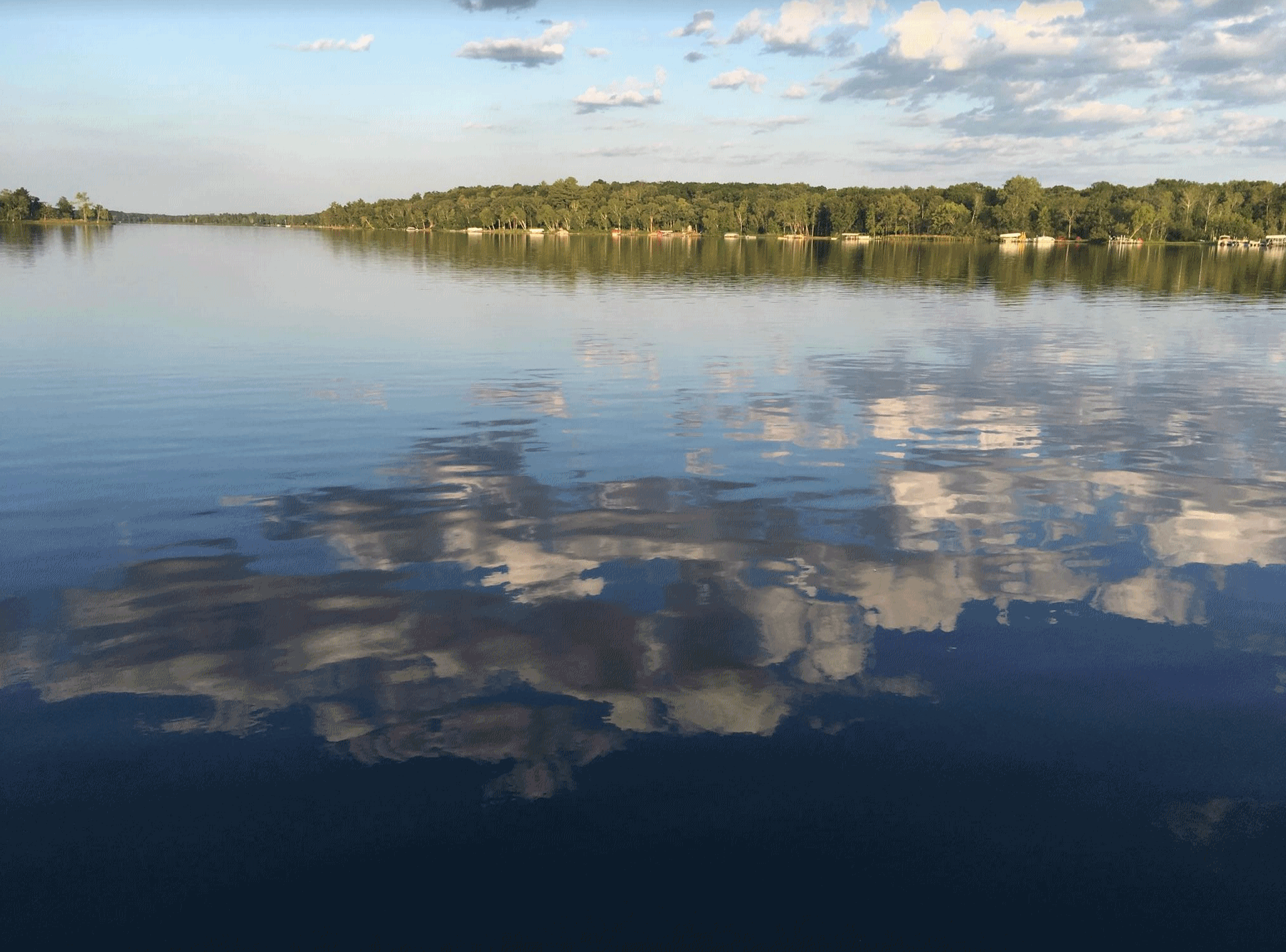 Look Up: Some of the Best Weather in the USA
We've
always had floods, heat waves and droughts, but a warmer (wetter)
climate is turning up the volume, making the extremes more extreme,
worldwide.
Oh, to have the Dairy Queen concession in Death Valley,
California. July brought an average temperature of 107.4F, making it
the hottest month ever recorded in the United States.
Details here.
A
heat wave in southern Europe, nicknamed "Lucifer", is igniting
wildfires, sparking water rationing and devastating crops. Sardinia,
Italy recorded a heat index of 122F last week.
New Orleans just
saw massive flooding from 10 inch rains (200-year flood) while Tropical
Storm Franklin tracks south of Cancun, promising severe flooding for
parts of Mexico.
We are counting our atmospheric blessings with
free Canadian A/C, highs in the 70s; little risk of severe weather
anytime soon. Showers and T-storms arrive late Wednesday and Thursday;
maybe a few more puddles on Saturday, but this is a pretty nice pattern
overall.
The summer stickies may return later in August. I'd bet a pickle-on-a-stick we'll see sticky 80s & 90s in time for the fair.
* Photo credit from Lake Ossy: Pete Schenck.
Above Average Hurricane Season On Track.
Here's an excerpt from NOAA NHC (National Hurricane Center) which will
have an update on their prediction for the core of hurricane season on
Wednesday: "
In just the first nine weeks of this season, there
already have been six named storms – that’s nearly half the number of
storms during an average six-month season and is double the number of
storms that would typically form by early August. NOAA’s initial outlook
in May predicted an above-normal season with 11 to 17 named storms, of
which five to nine could become hurricanes – including two to four major
hurricanes..."
* Tropical Storm Franklin is expected to take
a southerly track, impacting Mexico with tropical storm-force winds and
flooding rains. The latest from NOAA NHC is
here.
Tropical Storm Franklin Could Reach Hurricane Strength Before Hitting Near Cancun.
USA Today has more details on storm potential: "
Tropical
Storm Franklin could reach hurricane strength before it slams into
Mexico's Yucatan Peninsula late Monday or early Tuesday, dumping a
massive amount of rain and pushing a dangerous storm surge into the
coast. Up to a foot of drenching rainfall is possible, with the
potential for life-threatening flash floods, the National Hurricane
Center warned. A storm surge of up to four feet — accompanied by large,
destructive waves — is also possible as the storm slams into the
shoreline. Damaging wind gusts of 40-60 mph are also
possible. Tropical-storm-force winds extend outward up to 140 miles from
the storm's center..."
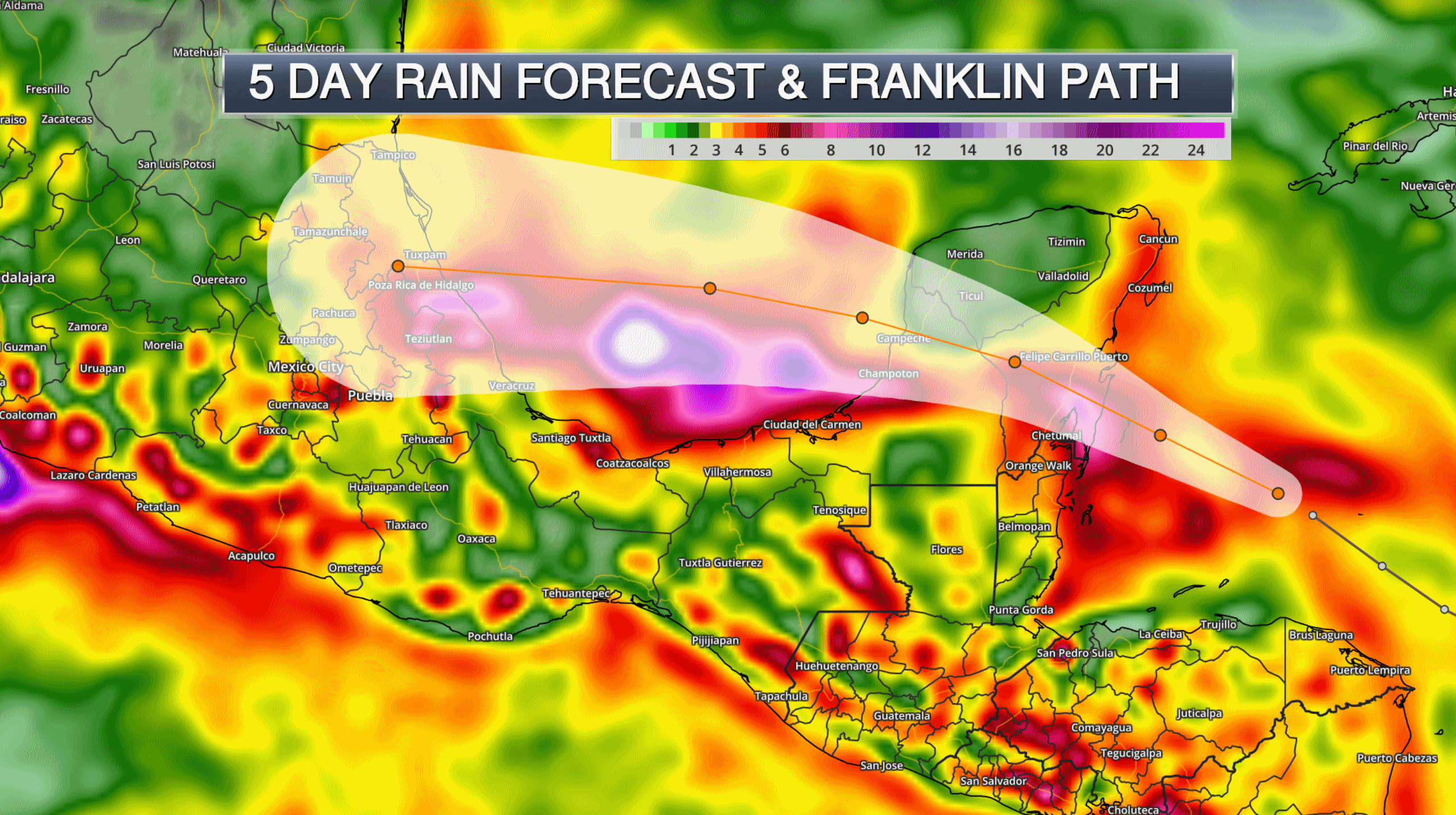 Excessive Rainfall Potential
.
10-15" rains are likely along and near the track of Franklin in the
coming days, with a potential for serious flash flooding and mudslides
across Mexico. Map: Aeris AMP.
Just Sitting Here on my Porch, Watching the Trash Float By.
Up to 10" of rain swamped New Orleans on Saturday, resulting in very
serious flash flooding. Here's an excerpt of a eye-witness account at
NOLA.com: "
We
knew without looking that a car was traveling too fast through our
flooded Mid-City neighborhood. It wasn't the whooshing sound of the wake
forced ahead of the car, or the slap back of the water behind it. It
was the angry screams of neighbors, rising like a chorus as the car
neared. For God's sake, would you slow down so the water STAYS OUT OF MY
HOUSE? The whole thing Saturday felt crazy. Up to nine inches of rainfall in
three hours over parts of New Orleans. Flash flooding that stranded and
soaked thousands across the metro area. The immediate impact in my
neighborhood, near Jesuit High School: Popeye's cups, trash cans and
miscellaneous floating garbage hitting me in the hips as I waded toward
Carrollton Avenue..."
A "Mini-Katrina" for New Orleans. Here is
Grist's take
on the extreme (freakish) flooding in New Orleans over the weekend. It
vaguely reminds me of the epic flooding last year near Baton Rouge,
where 20-30" of rain fell over a few days from a slow-moving cluster of
thunderstorms: "
Nearly 10 inches of rain fell in one neighborhood on Saturday during a rainstorm so severe that it would occur less than once in 100 years, assuming a stable climate. The city’s extensive network of canals and pumps operated as designed throughout the event, but officials said the system was overwhelmed by the magnitude of the deluge which fell at a rate five times faster
than the pumps could handle. Since much of New Orleans is below sea
level, every inch of rainwater that falls has to be pumped to higher
ground. A warming atmosphere can hold more water vapor, making deluges
like this more common. Throughout the city came stories of impromptu water rescues, traveling by canoe, and millions of dollars worth of damage..."
10 Hospitalized After American Airlines Flight Jolted Midair.
This is why you ALWAYS want to have your seatbelt fastened when you're
sitting in a chair in the sky (with all thanks to Louis C.K.). Here's a
clip from
The Washington Post: "...
But the
shaking got worse. Ehmke saw drinks spilling and sensed a faint panic
in the aisles. Still, he wasn’t worried. Then, suddenly, what he
calls “the lurch.” He would later tell NBC News that everything in his field of vision shot up four feet in the air, and he would tell WPVI that “it felt like the whole plane was in free fall.”
Other passengers would later report screaming and babies crying. Ehmke
didn’t recall that but can relive the surreal experience of beverages
suddenly being severed from gravity. “The liquid catches your eye,” he
told The Post. “I saw all the drinks fly up at once.” This seemed
amusing at first, when the plane settled down and Ehmke and his family
had a chance to collect their thoughts. “I was wearing half of my
coffee; my brother was wearing the other half,” he said. “My wife ended
up with a pastry in her cup that was not hers...”
Image credit: "
An
American Airlines flight bound for Philadelphia experienced severe
turbulence on July 5. Upon landing, three passengers and seven crew
members were hospitalized." (Reuters).
Downright Agreeable.
No sweaty fronts anytime soon, although I still believe it's going to
warm into the 80s the last third of August, give or take. More 90s?
Count on it - but no time soon. ECMWF guidance for the Twin Cities shows
highs mostly in the 70s to near 80F looking out the next 10 days.
Graphic: WeatherBell.
Tracking Franklin.
Welcome to the Dog Days of Summer, when steering winds aloft are as
light as they ever get, meaning storms can stall for extended periods of
time, squeezing out excessive rainfall amounts. Tell that to residents
of San Antonio, or New Orleans, or Miami for that matter. All 3 metro
areas have experienced serious flash flooding in recent days. The
leading edge of slightly cooler air sparks showers and T-storms across
the Deep South, while Tropical Storm Franklin pushes across the Bay of
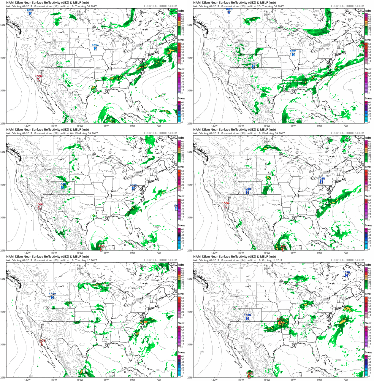
Campeche, pouring out some 10-15" rains. 84-hour Future Radar: NOAA and
Tropicaltidbits.com.
7-Day Rainfall.
Check out some of these predicted amounts, as much as 4-7" from near
Tulsa and Little Rock to Jackson, Atlanta, the Carolinas and Virginia
Tidewater. The risk of flash flooding will linger for much of the USA.
Warming Trend by Late August.
With the possible exception of New England and the Pacific Northwest
much of the nation will warm up again within 2 weeks as the main belt of
prevailing winds aloft lifts north, meaning another run of 80s and 90s
for much of the USA.
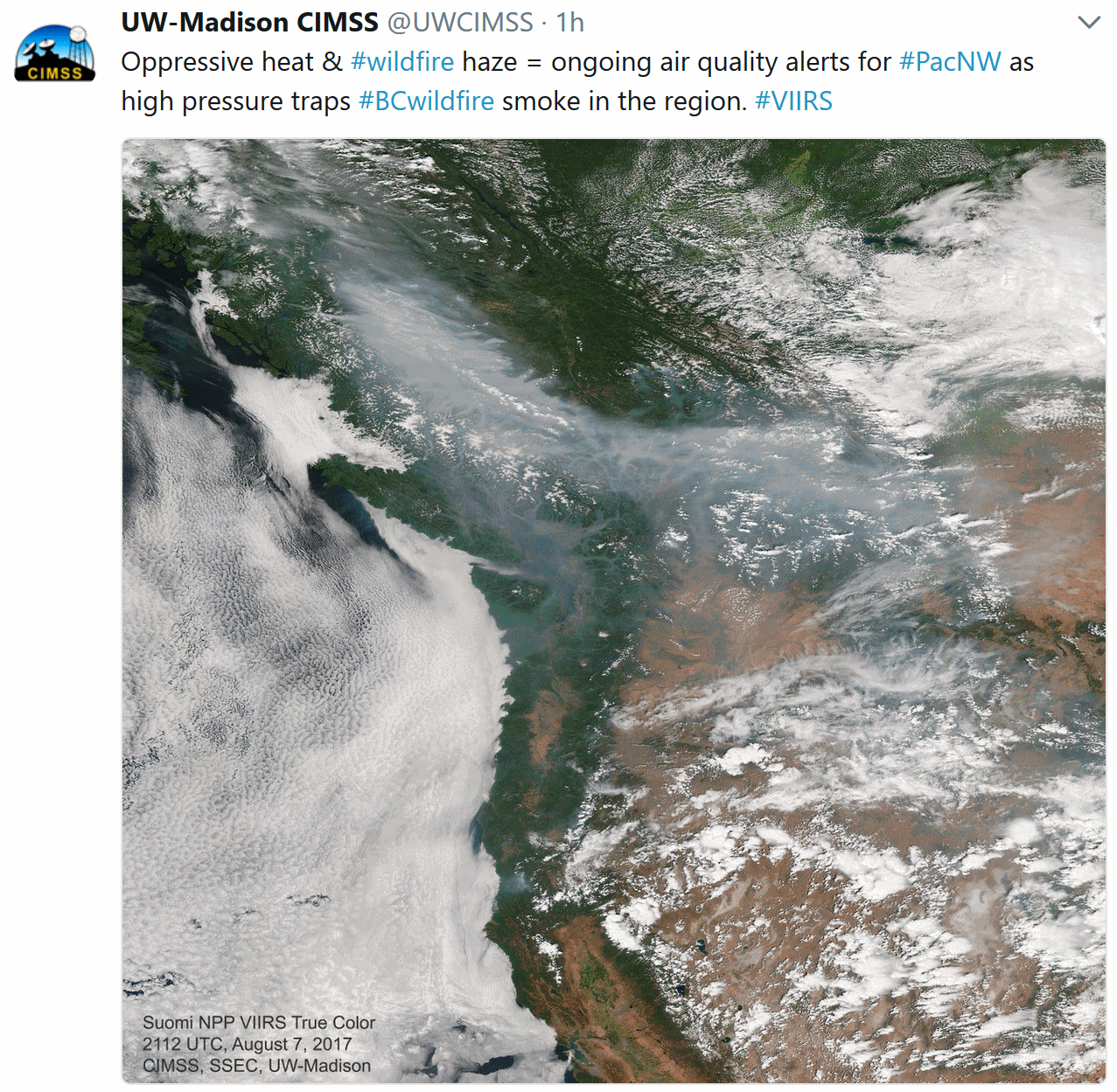
Around the Mediterranean, the Fire This Time. The New York Times reports on the epic heat wave and drought gripping southern Europe and the Balkans: "...
While
forest fires are a normal feature of summer in Mediterranean Europe,
the frequency and intensity of the blazes this summer are exceptional.
The unprecedented heat that has stoked them, and caused droughts like
the one that led to water rationing in Rome, is a harbinger of what
climate change will bring, scientists say. In the past week winds from
North Africa - which the Italians aptly call Lucifero - have caused
hellish temperatures across Italy. The heat index (what the temperature
feels like) reached a record 50 degrees celsius, or 122 degrees
Fahrenheit, in Sardinia last Tuesday..."
Italy: Widespread State of Emergency Imminent as Drought Continues. The heat wave nicknamed "Lucifer" continues to drag on.
AccuWeather has more details: "
Following
months of below-average rainfall—or in some locations no rainfall at
all—across Italy, many towns are considering extreme measures to aid
water conservation efforts. Rome received only 9 percent of its normal
precipitation during the month of June and has received no rainfall
since Jun. 30. This has resulted in a devastating drought overtaking
most of the peninsula. Across the country, drought has resulted in
agricultural losses exceeding 2 billion euros ($2.4 billion). Since July
26, there have been over 1,800 fire alerts, according to the Global
Forest Watch. While they are mainly concentrated in the south, dozens
have also been reported outside Rome, in central Italy, and Verona in
the north..."
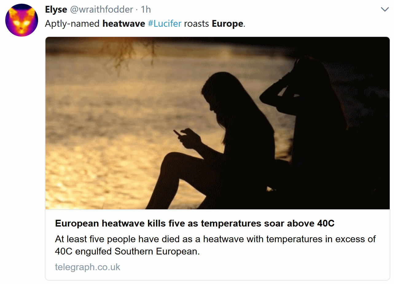 Europe Swelters Under a Heat Wave Called "Lucifer" The New York Times
 has more perspective on the relentless heat: "...
Sun-kissed
Italy has become sun-cursed. With temperatures in recent days regularly
rising north of 100 degrees, a nationwide drought leaving rivers and
mouths dry and countryside kindling and arsonists combining to ignite
the landscape, Italians are, well, boiling. Farmers are lamenting more
than $1 billion in revenue lost to drought and singed fields.
Firefighters are busy. Packs of gum are melting in their wrappers. In
Rome, the heat wave has coincided with a meltdown of public services,
including public transport..."
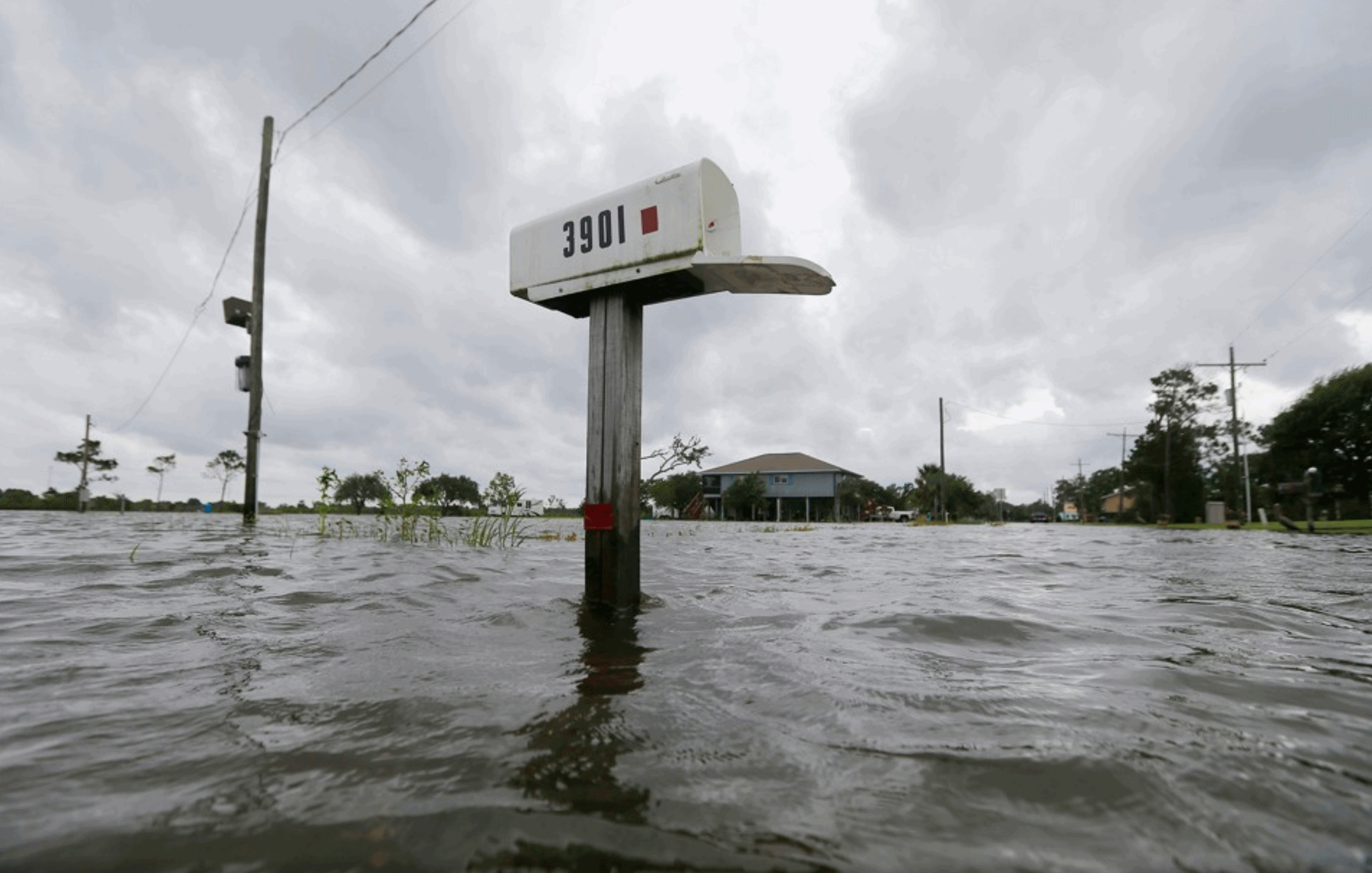
Can Congress Bring the National Flood Insurance Program Above Water?
As long as people are incentivized to keep rebuilding in increasingly
flood-prone regions the program is destined to fail. Here's an excerpt
at
The Atlantic: "...
As
problematic government programs go, the NFIP is a doozy. Established in
1968, it handles some 5 million policies nationwide. Unfortunately,
these days it collects less in premiums and surcharges than it shells
out in claims and other expenses, leaving the Treasury Department—read:
taxpayers—to plug the holes. Which means every time some neighborhood in
Galveston or Daytona winds up underwater (Texas, Florida, and Louisiana
account for more than half of all policies), the rest of the nation
effectively bails them out. Not that coastal areas bear all the
blame—rivers have a nasty habit of overflowing as well. Last August, an
ugly storm parked itself over Baton Rouge for several days, dropping
upwards of 20 inches of rain that caused $10 billion in damages. All
told, the FEMA-managed NFIP is neck-deep in debt to the tune of $24.6
billion..."
Photo credit: "Tropical Storm Cindy caused flooding in Big Lake, Louisiana, in June." Gerald Herbert, AP.
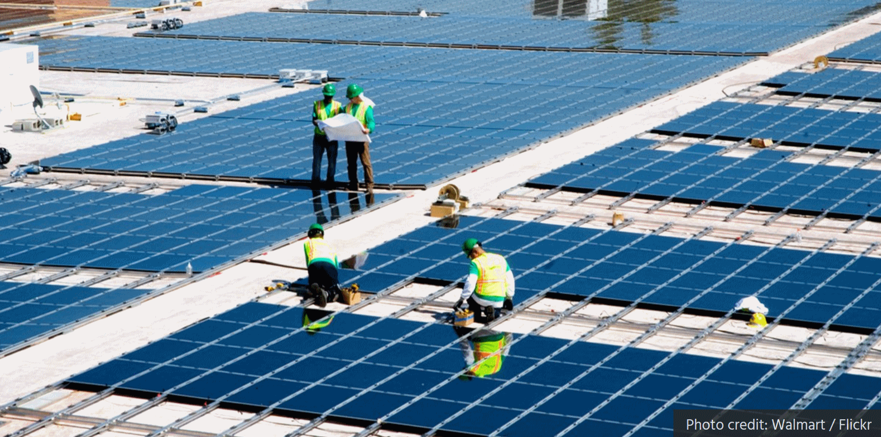 Dirty Energy's Quiet War on Solar Panels. Here's an excerpt of an Op-Ed at TheHill: "...In statehouses all over the country, there's a growing movement by industry front groups to undermine
net metering and other renewable energy incentives. These front groups
include the Edison Electric Institute, the utility industry’s trade
association, and outfits such as the American Legislative Exchange
Council (ALEC) and Americans for Prosperity, both of which are funded by
the Koch brothers. These groups scored recent victories against net metering in Indiana and Maine,
and have turned the renewable energy mandate for utilities in wind-rich
Kansas — known in the industry as a Renewable Portfolio Standard — into
a toothless voluntary goal.Industry
groups and the politicians they effectively buy claim that distributed
solar energy imposes costs on customers who don’t install solar panels,
because solar users don't pay their fair share of the costs of
maintaining the grid..." (File photo: Walmart).

Why Tesla is Worth More Than GM. Ask Apple; it's all about the ecosystem, not selling a specific product, but a platform. Here's an excerpt from
MIT Technology Review: "...
The
ability to gather enormous amounts of data and analyze it efficiently
is also at least part of the reason investors think Tesla is more
valuable than General Motors. After a traditional car company sells a
car to a customer, its relationship with that customer typically is
limited (except for maintenance and servicing). Tesla, by contrast,
collects terabytes of driving data—including, in some cases, video
data—from its customers. That data is then put to use in improving the
self-driving features of its cars. According to Adam Jonas, an analyst
at Morgan Stanley, Tesla cars are now logging five million miles a day.
Since making self-driving cars work depends on machine learning, which
in turn requires reams of the data that AI learns from, Tesla’s
advantage in data is likely to translate into a huge advantage in making
safe and effective self-driving cars. Indeed, Jonas has argued that
Tesla’s new mass-market Model 3 sedan could be up to 10 times safer than
the average car..."

Tesla's Asymmetric War Against the Auto Industry. If you want to have a better understanding of Elon Musk's overarching strategy check out this story at The Drive: "...Musk published Part Deux of his “plan” almost exactly one year ago. It says:
- Create stunning solar roofs with seamlessly integrated battery storage
- Expand the electric vehicle product line to address all major segments
- Develop a self-driving capability that is 10X safer than manual via massive fleet learning
- Enable your car to make money for you when you aren't using it
Now
that the sector has woken up to Musk, they are attempting to attack
elements of Part Deux before catching up with the tactics behind Part
One..."
 Toyota and Mazda Join Forces on Electric Vehicles
.
Is This the End of the Road for Gas Cars? Not so fast. As excited as I
am about saving money and cleaning up the air with electric vehicles I
suspect a slow fade of gasoline-powered vehicles in the years and
decades to come; it won't happen overnight. But the trends are
unmistakable, according to
The Washington Post: "...
Dudenhöffer
said Tesla, the largest American manufacturer of electric vehicles,
poses a formidable challenge. “To have invented the technology means
you’re Apple. Everyone else catching up is Samsung,” he said. Germany’s
response cannot be to “clean up a 20th-century technology,” said Greg
Archer, director of clean vehicles at the Brussels-based advocacy
organization, Transport & Environment. The aim instead, he said,
should be to shift to “zero-emission vehicles.” “France and the U.K. are
paving the way on that, and Germany along with its carmakers seem to be
lagging behind,” Archer said. “The danger for Germany is that it
continues producing cars that the rest of the world no longer wants.
Just 5 percent of the new cars sold outside Europe are diesels...”
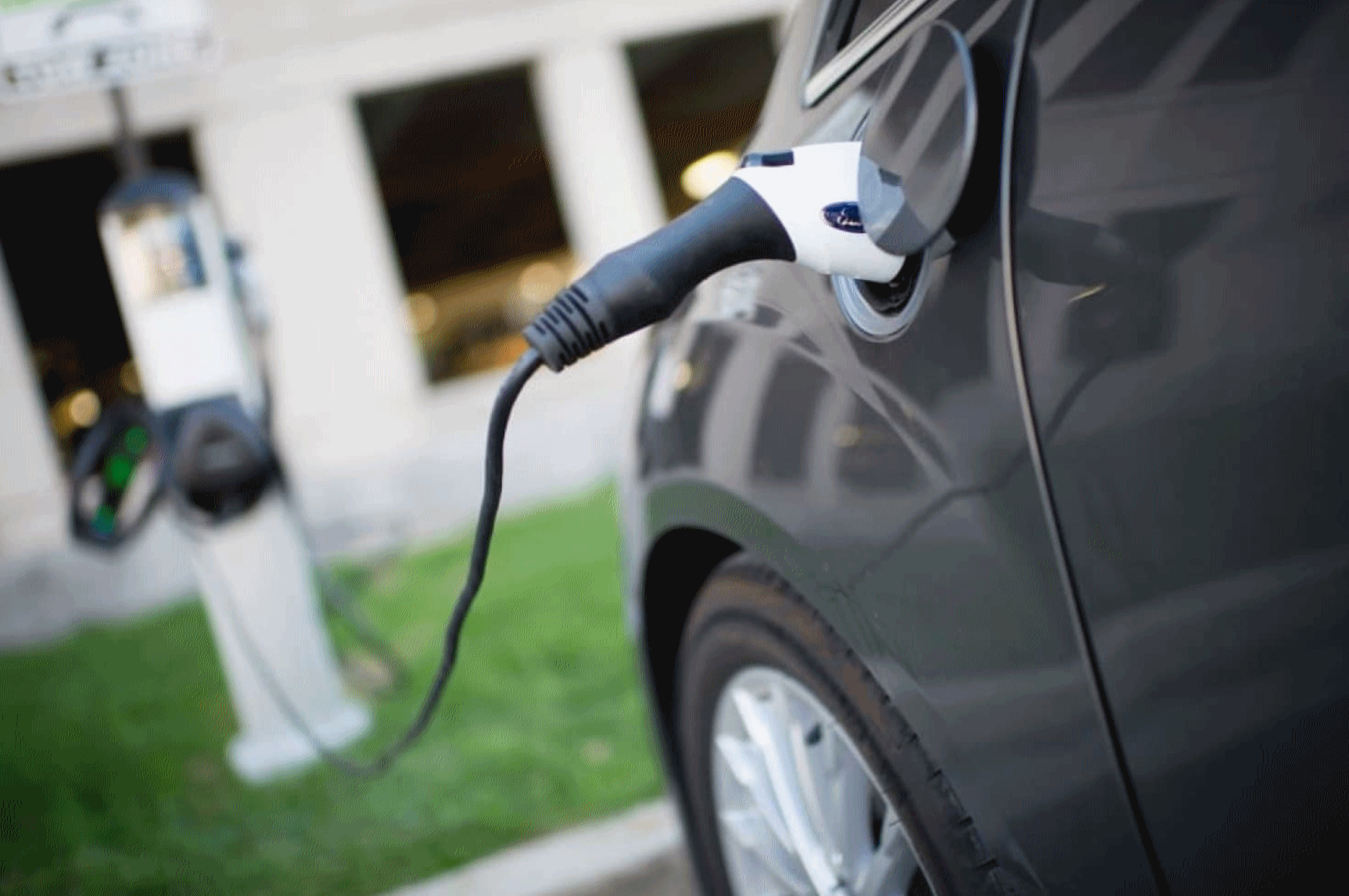
Photo credit: "
An electric car recharges at the University of Maryland at College Park." (Sarah L. Voisin/The Washington Post)
Our Minds Have Been Hijacked by our Phones. Tristan Harris Wants to Rescue Them. I didn't realize my brain was bing hijacked, but I suspect Mr. Harris is onto something. Here's an excerpt from
WIRED: "...
Yeah.
And I don’t mean to be so obtuse about it. YouTube has a hundred
engineers who are trying to get the perfect next video to play
automatically. And their techniques are only going to get more and more
perfect over time, and we will have to resist the perfect. There’s a
whole system that’s much more powerful than us, and it’s only going to
get stronger. The first step is just understanding that you don’t really
get to choose how you react to things..."
 Money Won't Make You Happy. Here's What Will, According to Science.
 A story at
Inc. was an eye-opener: "...
If you want to increase your happiness levels, then be altruistic. Help other people.
This is one of the interesting findings of research in positive
psychology. Most people actually think of pleasure, not happiness. They
think of the pleasure of eating an ice cream or of going to the movies.
But your happiness from these activities looks very much like a square
wave. You are happy during the event, but half an hour later it has very
little effect on your current state of happiness. However, humans are
wired for helping others. We get a nice long tail of happiness: Days
later, you can close your eyes and get a warm, happy feeling as you
remember helping your friend with something that mattered to him or her.
Either that or you've just peed yourself..." (File photo: someecards.com).

TUESDAY: Sunny, spectacular. Winds: SW 5-10. High: 81
TUESDAY NIGHT: Clear and mild. Low: 62
WEDNESDAY: Clouds increase, few T-storms by afternoon. Winds: SW 7-12. High: 79
THURSDAY: Wettest day: more showers and storms. Winds: NW 7-12. Wake-up: 63. High: 75
FRIDAY: Sun returns, potentially pleasant. Winds: N 5-10. Wake-up: 59. High: 77
SATURDAY: Mild sun, stray late PM T-storm. Winds: E 5-10. Wake-up: 60. High: 77
SUNDAY: Partly sunny, still comfortable. Winds: NE 5-10. Wake-up: 61. High: 79
MONDAY: Sunny. Too nice to work. Winds: NW 5-10. Wake-up: 60. High: 80
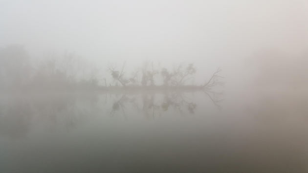
* Photo credit above: Steve "Lars" Larson from Apple Valley, who writes: "
Paul, this is a picture I took of the “Dense Fog” on a metro lake I was fishing at 6:30AM Monday
Morning. Probably should not have been fishing in those conditions, but
it was a “Kodak Moment”, and the fish were in a feeding frenzy!"
Climate Stories...
Flooding in Miami is No Longer News, But It's Certainly Newsworthy. The Washington Post explains the factors that resulted in widespread flooding in the Miami area last week: "...
The problem was twofold:
A heavy downpour, thanks to a dissipating tropical storm, combined with
the onset of high tide just after 4 p.m. But, really, the problem was
threefold. Those high tides are higher than they used to be because the
ocean itself is higher than it used to be. A National Oceanic and
Atmospheric Administration gauge at Virginia Key, just off the Miami
shoreline, had an average sea-level height from 2012 to 2016 that was
about 4 inches higher than the average from two decades earlier. At Lake
Worth, a bit further north on the coast, there has been a similar
increase since the mid-1980s. A gauge near Naples, Fla., saw a jump of
about six inches from the early 1980s to the most recent five-year
period..."
Extreme Weather "Could Kill Up To 152,000 a Year" in Europe by 2100. BBC News has a summary of new research and prediction as the hot gets hotter: "
Extreme
weather could kill up to 152,000 people yearly in Europe by 2100 if
nothing is done to curb the effects of climate change, scientists say.
The number is 50 times more deaths than reported now, the study in The
Lancet Planetary Health journal said. Heat waves would cause 99% of all
weather-related deaths, it added, with southern Europe being worst
affected. Experts said the findings were worrying but some warned the
projections could be overestimated. If nothing is done to cut greenhouse
gas emissions and to improve policies to reduce the impact against
extreme weather events, the study by the European Commission's Joint Research Centre says:
- Deaths caused by extreme weather could rise from 3,000 a year between 1981 and 2010 to 152,000 between 2071 and 2100..."
Photo credit: "Low levels of the Po River near Pavia in northern Italy." AFP.
We Know Vikings as Infamous Raiders - Was That Merely a Response to Climate Change? Yes, the climate has always been changing. Here's a clip from an interesting story at Ars Technica: "Beneath
their still surfaces, the lakes of some Arctic islands may hide the
story of the rise and fall of Viking chiefdom. Historians still aren’t
sure exactly what led to the centuries of Viking raiding and expansion, a
period politely known as the Scandinavian Diaspora that ran from the
late eighth century to the mid-11th. Population pressures and political
rivalries probably played a role, but changing climate around the North
Atlantic may also have given the Scandinavians a push. So far,
paleoclimate researchers have mostly focused on warmer climates in the
Vikings’ destinations, like Iceland, which might have drawn people to
settle there. But those who set sail may have been facing trouble with
the crops back home thanks to changing temperatures. A team of
researchers hope to find some answers in a new series of sediment cores
from ancient lakebeds in a remote Norwegian island chain..."
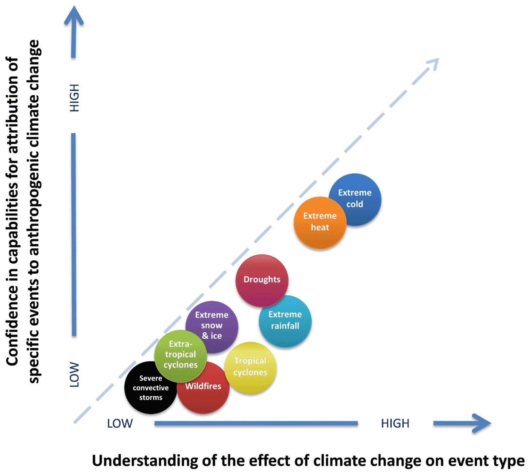 Attribution
.
According to climate scientists the link between a warming climate and
weather is strongest when it comes to temperature extremes, followed by
drought intensity and rainfall rates/amounts. There is less confidence
connecting the dots with severe local storms, hurricanes and wildfires.
Graphic: National Academy of Sciences.

No comments:
Post a Comment