Simulated Radar Ahead...
Here's the simulated radar from AM Tuesday to AM Thursday, which shows another round of showers and storms pushing through the region midweek. Note that the best chance of heavier rain moves through during the day Wednesday before tapering early Thursday.
.gif)
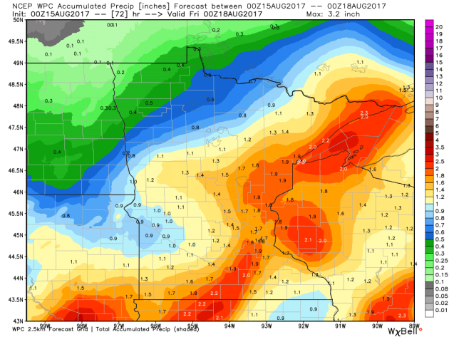
Rainfall Potential Ahead
The rainfall forecast through PM Thursday shows fairly decent rainfall potential moving back into the Upper Midwest as we head into midweek. Some of the heaviest rain looks to fall on Wednesday, where some 1" to near 2" tallies could be possible.
___________________________________________________________________________
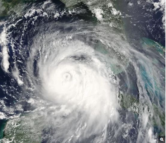
"El Nino's Absence May Fuel a Stormy Hurricane Season"
"The hurricane season is likely to be extra active this year, thanks to a likely no-show from El Niño. The National Oceanic and Atmospheric Administration's (NOAA) Climate Prediction Center released an updated hurricane season outlook today (Aug. 9). The new prediction ups the odds for a blustery, extremely active hurricane season – and possibly even the most active since 2010. "We're now entering the peak of the season, when the bulk of the storms usually form," Gerry Bell, the lead seasonal hurricane forecaster at NOAA's Climate Prediction Center, said in a statement. "The wind and air patterns in the area of the tropical Atlantic and Caribbean where many storms develop are very conducive to an above-normal season. This is, in part, because the chance of El Niño forming, which tends to prevent storms from strengthening, has dropped significantly from May." (El Niño is a climate phenomenon most distinguished by the shift of warm water from the western to the central and eastern tropical Pacific Ocean.)"
(The powerful Hurricane Katrina, a Category-5 storm, is seen here in a satellite image from Aug. 28, 2005. Credit: NASA/Jeff Schmaltz, MODIS Land Rapid Response Team)
_________________________________________________________
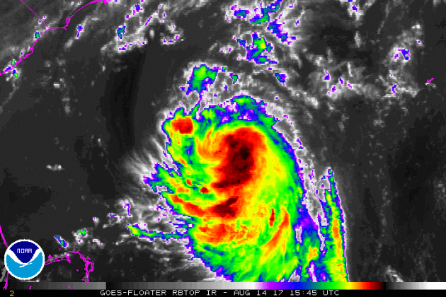
GERT in the Atlantic
The National Hurricane Center is tracking GERT in the Atlantic basin, which is 7th named storm of the 2017 season. The good news is that GERT is not expected to post any major threats to the U.S. as it moves northeast away from the East Coast over the next few days.
Here's the official track for GERT, which shows it becoming the 2nd hurricane of the 2017 Atlantic Hurricane Season.