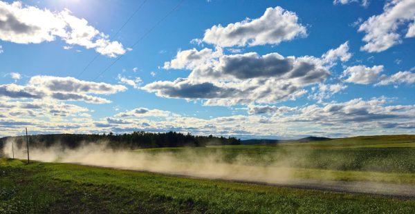
A Look Ahead Toward The Last Full Week Of August
Looking
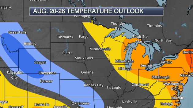
for some above average weather? Well, according to the 8-14 day
temperature outlook from the Climate Prediction Center, some warmer than
average weather might be coming to at least the northern parts of the
state as we head towards the beginning of the state fair, with
temperatures likely to be around average across other parts of
Minnesota. (Yellow/orange: Warmer than average expected, blue: colder
than average expected)
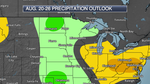
The
Climate Prediction Center is also expecting wetter than average weather
across a good portion of the state as we head through the last full
week of the month (August 20-26). Also, there is a note of good news in
this forecast as the potential of wetter than average weather would not
only would affect areas of Minnesota that currently are under drought
conditions, but areas of the Dakotas and even into Montana that are
under exceptional drought. (Yellow/orange: Drier than average expected,
green: wetter than average expected)
_______________________________________________
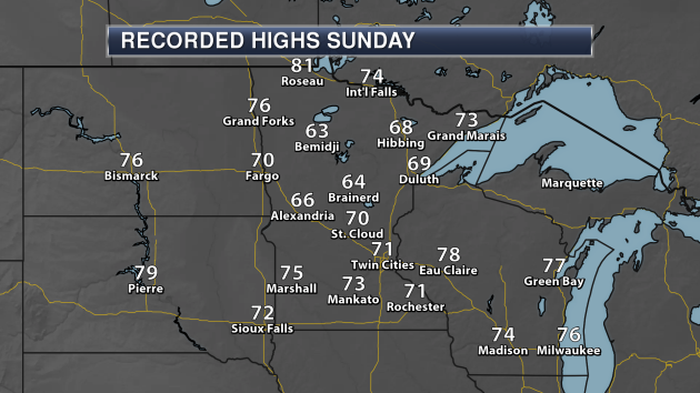
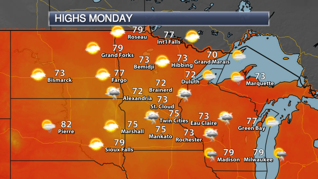
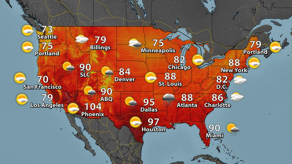
Sunday Highs (Through 5 PM)
_______________________________________________
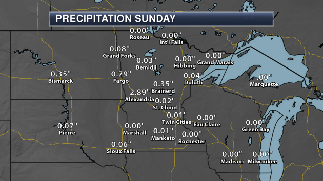
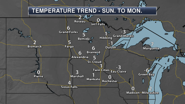
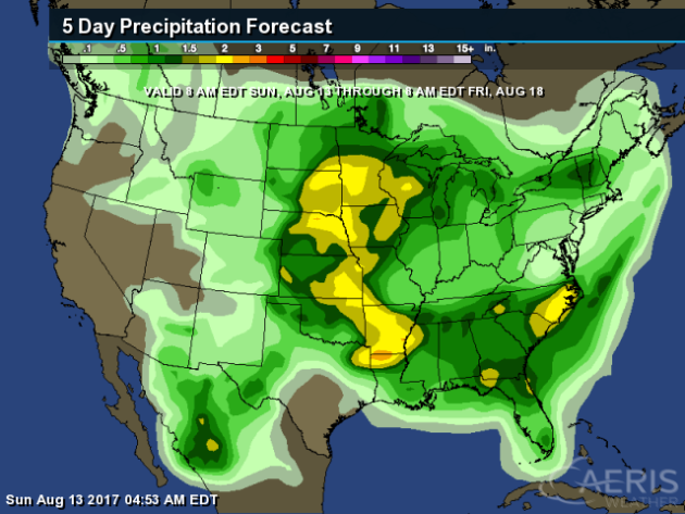
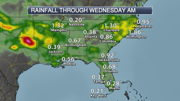
Sunday Rainfall (Through 5 PM)
_______________________________________________
The Fine Art of Naming Hurricanes
By Paul Douglas
Contrary to urban legend, Tropical Storm Don, an unremarkable tropical system that quickly fizzed in the Caribbean last month, was not named after our president.Every decade or so meteorologists at the WMO, the World Meteorological Agency, meet in Geneva to pick names for upcoming years. The names they use are Anglo, Hispanic and French, reflecting all cultures & languages in hurricane alley.
Especially deadly and devastating hurricanes have their names "retired". There will never be another Hurricane Camille, Hugo, Katrina or Sandy. Why name them at all? Easier to remember and track, especially when multiple storms flare up, simultaneously.
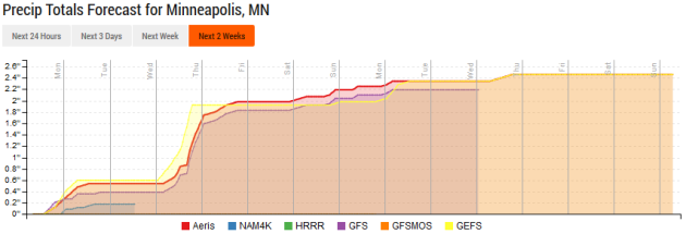
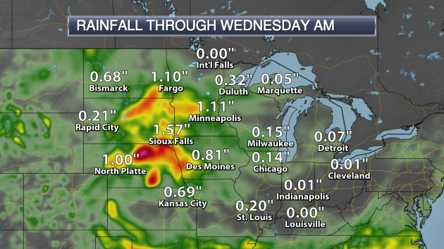
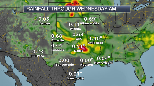
Showers taper off today with a ration of sunlight Tuesday - before the next round of T-storms drops another 1-2 inches by midweek. Models bring warmer, stickier air back into Minnesota by late week - the weekend should bring muggy 80s, with a few spotty T-storms, but no all-day washouts expected.
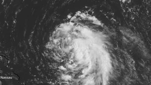
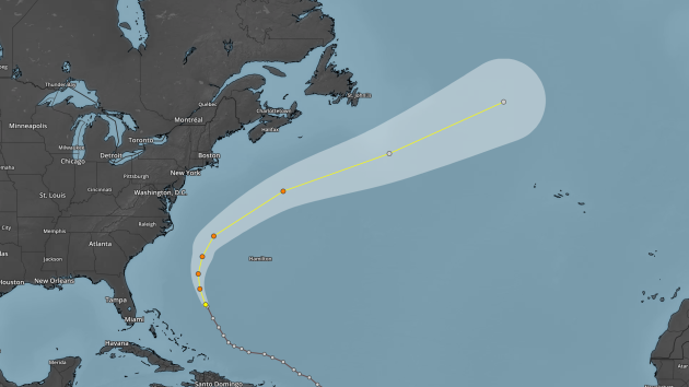
Tropical Storm Gert stays out to sea, but "Harvey" may threaten the Bahamas and Florida within a week. I expect a busy hurricane season.
By Paul Douglas
Contrary to urban legend, Tropical Storm Don, an unremarkable tropical system that quickly fizzed in the Caribbean last month, was not named after our president.Every decade or so meteorologists at the WMO, the World Meteorological Agency, meet in Geneva to pick names for upcoming years. The names they use are Anglo, Hispanic and French, reflecting all cultures & languages in hurricane alley.
Especially deadly and devastating hurricanes have their names "retired". There will never be another Hurricane Camille, Hugo, Katrina or Sandy. Why name them at all? Easier to remember and track, especially when multiple storms flare up, simultaneously.
Showers taper off today with a ration of sunlight Tuesday - before the next round of T-storms drops another 1-2 inches by midweek. Models bring warmer, stickier air back into Minnesota by late week - the weekend should bring muggy 80s, with a few spotty T-storms, but no all-day washouts expected.
Tropical Storm Gert stays out to sea, but "Harvey" may threaten the Bahamas and Florida within a week. I expect a busy hurricane season.
_______________________________________________
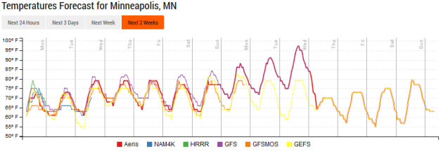
Extended Twin Cities Forecast
MONDAY: Showers taper, damp. High 72. Low 60. Chance of precipitation 30%. Wind N 3-8 mph.
TUESDAY: Partly sunny, T-storms arrive late. High 80. Low 66. Chance of precipitation 60%. Wind SE 7-12 mph.
WEDNESDAY: Heavy showers and T-storms. High 77. Low 63. Chance of precipitation 80%. Wind S 8-13 mph.
THURSDAY: More clouds than sun, drying out. High 74. Low 61. Chance of precipitation 20%. Wind N 5-10 mph.
FRIDAY: Plenty of warm sunshine on tap. High 80. Low 63. Chance of precipitation 10%. Wind NW 3-8 mph.
SATURDAY: Partly sunny, sticky. Lake-worthy. High 83. Low 66. Chance of precipitation 10%. Wind S 5-10 mph.
SUNDAY: Muggy with some sun. Storms north. High 86. Low 69. Chance of precipitation 30%. Wind S 8-13 mph.
_______________________________________________
This Day in Weather History
August 14th
Average Temperatures & Precipitation for Minneapolis
August 14th
Average High: 81F (Record: 96F set in 1978)
Average Low: 62F (Record: 43F set in 1964)
Average Precipitation: 0.15" (Record: 1.00" set in 1981)
________________________________________________August 14th
1978: The Boundary Waters area is hit by a strong tornado. Some of the damage could still be seen 10 years later.
_______________________________________________Average Temperatures & Precipitation for Minneapolis
August 14th
Average High: 81F (Record: 96F set in 1978)
Average Low: 62F (Record: 43F set in 1964)
Average Precipitation: 0.15" (Record: 1.00" set in 1981)
Sunrise/Sunset Times for Minneapolis
August 14th
Sunrise: 6:14 AM
Sunset: 8:20 PM
*Length Of Day: 14 hours, 6 minutes and 24 seconds
*Daylight Lost Since Yesterday: ~2 minute and 45 seconds
*Next Sunrise At/After 6 PM: August 2nd (6:00 AM)
*Next Sunset At/Before 8 PM: August 26th (8:00 PM)
_______________________________________________
Minnesota Weather Outlook
_______________________________________________
National Weather Outlook
Monday's Weather
_______________________________________________
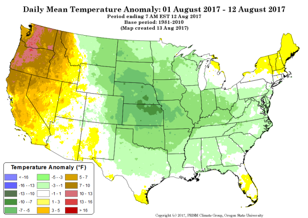
Cool Weather In The Central U.S. So Far This Month
Drought Is Harming The Potato Crop In Maine
Wildfires And Hobby Drones Don't Mix
This should be a no-brainer, but please don't fly your drones into wildfires. It's not a good thing for those fighting the fire. More from Popular Science: "Even as the Forest Service uses drones both to help prevent fires, by starting prescribed burns and on occasion to help battle flames, drones are emerging as a new fire threat. People fly them into fires to get pictures that they wouldn’t otherwise be able to capture. The problem is, however, that capturing those images puts firefighters at even greater risk. And, if a drone hinders the firefighting process, that can cost valuable time."
Watching The Eclipse From Space
Flooding Occurring More Often In Miami - But It Isn't Just Climate Change
Flooding is becoming more common in Miami, but it doesn't appear it is completely linked to climate change. It's appears that the El Nino/La Nina cycle and the North Atlantic Oscillation factor in as well. More from Gizmodo: "In Miami, it’s no secret that sunny day flooding is occurring more often, nor that rising sea levels and climate change are to blame. But, as is often the case when you drill down into the inner workings of our planet, the full story is a bit more complicated."
U.S. Won't Help Pay For The IPCC
The U.S. has helped paid for the Intergovernmental Panel on Climate Change in the past - considered some of the best climate science on the earth. Under the Trump administration, that won't happen. More from WIRED: "The most formal manifestation of the scientific consensus on climate change is an organization called the Intergovernmental Panel on Climate Change. Headquartered in Geneva, under the aegis of the United Nations, it coordinates the volunteer efforts of several thousand scientists, industry experts, nonprofit researchers, and government representatives into reports issued every five to seven years. These reports underpin virtually every climate-based decision on Earth, from the US military’s threat assessments to the Paris climate agreement itself. So it’s maybe surprising that the IPCC is a shoestring operation, running on just over $4.3 million a year. It gets that money from about 25 different countries, plus a few UN groups. Historically, the biggest chunk of that money comes from the US. Or rather, it used to."
_______________________________________________
Thanks for checking in and have a great Monday! Don't forget to follow me on Twitter (@dkayserwx) and like me on Facebook (Meteorologist D.J. Kayser)!
- D.J. Kayser

No comments:
Post a Comment