61 F. average high on October 11.
72 F. high on October 11, 2016.
October 12, 1969: Snow accumulates in several locations. Minneapolis receives 2 inches, while St. Cloud records 3.6 inches, Redwood Falls gets 1.7 inches, and Springfield records 1.5 inches.
October 12, 1918: Dry fall weather sets the stage for dangerous fires. Several fires roar through large areas of Carlton and St. Louis Counties. The towns of Cloquet, Moose Lake and Brookston are the hardest hit. The Carlton County Vidette calls it a 'Hurricane of burning leaves and smoke'. At least 453 fatalities are reported, and possibly as many as 1,000 occurred. Over 11,000 people would be left homeless.
Let Me Check: Still Nothing to Complain About
Considering we could be slipping & sliding to work I have no qualms about invigoratingly cool mornings and the colorful pile of leaves lurking on my yard.
Considering we could be slipping & sliding to work I have no qualms about invigoratingly cool mornings and the colorful pile of leaves lurking on my yard.
On
this date in 1969 two inches of snow delighted residents of the Twin
Cities. On October 12, 1918, raging wildfires swept across Cloquet and
Moose Lake. A "hurricane of burning leaves and smoke" left 453 people
dead and 11,000 homeless.
The
fires gripping California are apocalyptic; a tornado doesn't hold a
candle to a 100-foot tall wall of flames moving at 30 mph. To date
8,550,951 acres of U.S. land has been charred, closing in on the
all-time record of 10,125,149 acres scorched in 2015. And 13 of
California's 20 biggest blazes have burned since 2000.
Showers
stay mainly south of Minnesota until the PM hours Saturday, but next
week looks dry with a run of 60s. We may see a couple 70s before the
flakes start to fly. BTW, I don't see any accumulating snow close to
home looking out 2 weeks. Beyond that - all bets are off.
87F on this date in 1975, but 2.5 inches snow fell here on October 12, 2009. Where are we living?
Not Bad for Mid-October.
Highs mostly in the 60s; even a shot at 70F again late next week?
Considering we could be shoveling right now I don't expect too many
complaints. ECMWF guidance for the Twin Cities: WeatherBell.
84-Hour Rainfall Outlook.
NAM guidance (12km) shows a bulls-eye of heavy rain from near Des
Moines and Waterloo to the Quad Cities and Madison in the coming days.
Some half inch rainfall amounts are possible Saturday over the southern
third of Minnesota. Map: NOAA and Tropicaltidbits.com.
Late October: Cooling Down.
There's a shocker. Considering the sun angle Wednesday evening, October
25, will be equivalent to the sun angle on February 17, you would
expect a cooling trend. Nothing too harsh or arctic, but by the last
week of October just about all of us will have experienced our first
frost/freeze.
YTD acres burned across U.S.: 8,550,951. (https://www.nifc.gov/
The most acres burned in a year since 1960 was in 2015 with 10,125,149 acres (https://www.nifc.gov/
From CAL FIRE: "11 people alone died in the Tubbs Fire, making it the 6th deadliest fire in our state’s history." (http://calfire.ca.
7 Day Fire Outlook: http://psgeodata.fs.
Praedictix Briefing: Issued Wednesday, October 11th, 2017:
*At least 115,000 acres have burned over the past several days due to at least 15 separate wildfires across Northern California. A minimum of 25,000 people have been evacuated due to wildfires across the state, with at least 2,000 structures destroyed.
* California Governor Jerry Brown has declared a State of Emergency over the past several days for the following counties due to the ongoing wildfires: Butte, Lake, Mendocino, Napa, Nevada, Orange, Solano, Sonoma, and Yuba. President Donald Trump has approved a Major Disaster Declaration for the state of California, which allows federal aid and funding to be available to the state.
* New evacuations were issued overnight for portions of Sonoma and Napa Counties. The San Francisco Chronicle has a live feed with the latest developments on North Bay fires, including the latest numbers and evacuations.
* Fire weather conditions will worsen across northern California today as a frontal boundary moves through, with increasing northerly winds and lower humidity values. These conditions will allow any ongoing wildfires to once again spread quickly across the region.
* We’re also watching wildfires across southern California as well, particularly the Canyon 2 Fire located east of Anaheim. Winds will increase in these areas Thursday into the end of the week, allowing the potential of new fires and fire growth.


You can view an interactive map of these active wildfires from CAL FIRE with the latest updates.


It is important to put this upcoming wind event in perspective with the one we just had that has led to the devastating fires over the North Bay. For Sunday night we did see local gusts of 60 to 80 mph and even in North Bay Valley locations winds were gusting over 35 mph. In this case winds for higher elevation spots (especially over 1,500 feet) winds will locally gust in the 45 to 55 mph range while valley areas should see gusts peaking in the 20 to 30 mph range. However the values over the North Bay Mountains and East Bay Hill may be high enough to topple some additional trees and power lines.


- City of Anaheim: http://www.anaheim.net/
AlertCenter.aspx?AID=Canyon- Fire-2-3 - City of Orange: http://www.cityoforange.org/
CivicAlerts.aspx?AID=145 - Orange County: https://www.ocgov.com/
- CAL FIRE has the latest updated information on the California wildfires: http://www.calfire.
ca.gov/ - Tubbs Fire hi-res incident map: http://cdfdata.fire.ca.
gov/pub/cdf/images/ incidentfile1867_2689.pdf
California Increased Wildfire Risk. Some perspective from Climate Signals: "...Extreme
heat and years of ongoing drought are both linked to climate change
and are increasing wildfire risk throughout California by contributing
to the frequency and severity of wildfires in recent decades. Ten of
California's 20 largest wildfires on record have all burned in the last
10 years, while pine beetles, heat and California’s five-year drought
have caused 66 million trees to die in the state’s Sierra Nevada forests
since 2010. A formal modeling analysis has identified the fingerprint
of global warming in California's wildfires, reporting that "an
increase in fire risk in California is attributable to human-induced
climate change..."
The Meteorologist's Lament.
Weather forecasts are better than ever, but the public doesn't seem to
realize it, according to meteorologist Mike Smith reporting at Slate: "...For
meteorologists like me, this is frustrating. Our increasingly accurate
forecasts save untold numbers of lives. For instance, the death rate
from tornadoes has been cut by more than 95 percent since the 1930s, the
last decade when there was no tornado warning system of any kind. In
the 1970s and ’80s, thunderstorm-related downbursts—violent downrushing
air that spreads out when it reaches the ground, creating wind
shear—were the No. 1 cause of airliner crashes. Thanks to the work of
weather scientists, the last wind shear-related airline crash was in 1994.
It’s easy to overlook these major advances because when meteorology is
successful, nothing happens. Planes don’t crash. People don’t die, or at
least they die in far smaller numbers than before the storm warning
system existed. It’s a bit like national security—stopping a terrorist
attack before it happens doesn’t make for as good a news story..."
Why Choose a Career in Weather? It's Complicated
If it weren't for weather merit badge and a tropical storm named Agnes,
which flooded my home in 1972, I might have a real job. Most
meteorologists were traumatized by a major storm at a tender age: a
hurricane, flood, tornado or blizzard, something traumatizing and
life-changing. A career in meteorology is lifelong therapy, as we tee up
questions with no good answers. How could this happen? Why wasn't the
forecast better? Today I'm involved with two weather companies
attempting to make forecasts more accurate for consumers and businesses.
Because roughly a third of America's GDP is now "weather-sensitive".
This year variability in weather will impacted US GDP to the tune of
$879 billion. With better forecasts companies can optimize operations,
save money - and keep staff safer.
Hurricane Season Isn't Even Over, But It's Already Secured Its Place in History Books. Here's an excerpt of an insightful post at Capital Weather Gang: "This year’s hurricane season isn’t over. It still has 50 days left, but it’s already one of the most terrible on record, which will be talked about and remembered for generations. Like other famous seasons — 1995, 2004 and 2005 to name a few — 2017 has had many storms and many significant landfalls. Impressive records are falling this year. In an average season, we would typically have seen 10 named storms, five hurricanes and two major hurricanes by Oct. 11. This year — far from average — there have been 15 named storms from Arlene in April through Ophelia in early October. Nine of those storms became hurricanes, and it just happened to be nine consecutive storms from Franklin to Nate. That’s only happened three other times that we know of..."
Map credit: "The entire coastline from Texas to North Carolina has experienced tropical-storm-force winds this year." (Laris Karklis/The Washington Post).
First 10-Hurricane Streak in Atlantic Since 1886. The New York Times provides perspective on a crazy year in the Atlantic basin.
84% of Puerto Rico Is Without Power. The New York Times reports that 80% of the island's cellphone antennas are down, making communication difficult.
Help Puerto Rico Recover by Mapping Damaged Area. Crowd-sourcing mapping details can help residents of Puerto Rico can back up to speed faster, reports Atlas Obscura: "...When
you go someplace like Dominica, you simply don’t have that,” says Tyler
Radford, the executive director of Humanitarian OpenStreetMap Team, a
nonprofit that does emergency mapping in the wake of disasters. “If you
pull up a map, you won’t see the outline of each building. You’ll only
see the major roads.” These mapping disparities matter for governmental
and humanitarian organizations delivering aid after a hurricane,
earthquake, or other disaster. Radford’s organization mobilizes
volunteers from around the world to try to fill in those gaps, fast.
Currently, they have a call out for volunteers
to help improve digital maps of Puerto Rico and Dominica, in the wake
of Hurricanes Maria and Irma, areas of Mexico City affected by the
earthquake, and Bangladesh and Nepal, which experienced extreme flooding
in August. Anyone can sign up to help create maps that will aid workers
on the ground..."
Photo credit: "Northern Puerto Rico on September 26, 2017." Department of Defense
"Darwin Award": These Hurricane Chasers Are Being Ridiculed for Decisions During Nate. Public service or dangerous stunt? Here's an excerpt from Capital Weather Gang: "...The work that I do here is a public service,” Timmer told The Washington Post via email, “and like first responders who place themselves in harm’s way, we do go into dangerous situations but as top professionals do so in intelligent and cautious ways so that people understand the dangers and when told to evacuate they will do so.” Theiss takes a similar approach to chasing storms. “This is no different than a war photographer going to war or an astronaut going to space in the name of science.” Theiss told The Post. The only difference, he says, is that he’s “going to war with nature...”
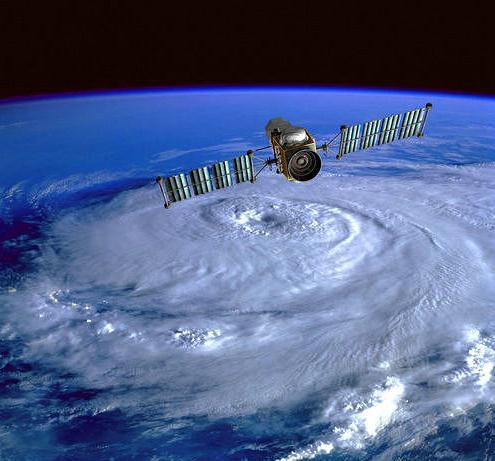
NOAA Is Running Out of Money for its Hurricane Hunting Planes and Drones. I had no idea. MSN.com has details: "In the aftermath of Hurricane Sandy, the U.S. National Oceanic and Atmospheric Administration (NOAA) began a unique program to more closely study these devastating tropical storms and their impacts using small, expendable drones called Coyotes. But despite the system proving its worth as recently as the monitoring of Hurricane Maria, the project is now effectively dead amid a funding crisis that has begun to threaten the agency’s aerial research efforts in general, including leaving one of its research planes, a modified Gulfstream IV-SP business jet, increasingly dangerous to fly..."
File photo credit: TIME Inc. "One of NOAA's Coyotes in 2015."
Photo credit: Space.com. "Photographer Dave Markel caught this view of a strange aurora-like feature that appears in the skies of northern Canada. Based on data from European Space Agency's Swarm satellites, it appears to be a 16-mile-wide (25 km) ribbon of flowing gas in an area whose temperature is 5,500 degrees Fahrenheit (3,000 degrees Celsius) higher than the surroundings; the gas flows at 3.5 miles per second (6 km/s) compared to a speed of 33 feet/second (10 m/s) on either side of the ribbon. They're calling the feature "Steve." Credit: Dave Markel Photography.
Don't Market EVs as "Green". Promote something a granola-munching hippy might drive? Not so much, according to the author of a story at Inside EVs: "...Faster, cooler, smarter, more fun to drive… and good for the environment. Electric vehicles (EVs) are all that and more. That’s why I’m calling for an immediate ban on “green” stereotypes from all EV marketing efforts. No more talking flowers, dancing animals or smiling trees—ever. Why? Because EVs don’t need to win the hearts of environmentalists. They had them at hello. The hearts they have to win are those who don’t believe EVs are the future. But alas, the writing is on the wall. More and more manufacturers are committed to producing all-electric vehicles, including big players like GM, Porsche, BMW and Jaguar. If great marketing helps build an emotional connection between your target consumer and your product/service, then these manufacturers must court self-proclaimed “car buffs”—like me. It’s actually quite simple. You go after what drives people to have a passion for cars and driving..."
Image credit: Madrona Venture Group.
China Charges Toward Electric-Car Supremacy. The Wall Street Journal explains: "Watch out Detroit: A Chinese electric car revolution is on the way. China is placing big bets on a plan
to reshape the global auto industry by replacing gas-guzzling cars on
its streets with new-energy vehicles. Ahead of Donald Trump’s trip to
China in November, the White House is focused on holding back Chinese
exports in traditional industries like steel and aluminum. But that’s a
sideshow. A titanic struggle is under way to control the industries of
the future from robotics to medical equipment and artificial
intelligence. In new-energy vehicles, China is firmly in the driving
seat..."
Image credit: WSJ. "China is the world's largest market for electric vehicles, thanks largely to a relentless program of subsidies and incentives." Photo/Video: Eva Tam/The Wall Street Journal
Photo credit: "An offshore wind farm stands in the water near the Danish island of Samso, May 19, 2008." REUTERS/Bob Strong.
Nobel Prizes Are Great, but College Football is Why American Universities Dominate the World. Quartz connects the dots: "...The
connection between brawny linemen and brainy physicists may seem
remote, but it’s really not. In order to support a large number of
high-powered professors, US universities need to attract a huge number
of tuition-paying students, and they need to turn those students into
loyal lifelong donors. In order to draw state appropriations, they also
need to extend their reach beyond their own alumni by attracting the
political support of citizens in the immediate community and in the
state at large. And they need to do so within an extremely competitive
higher education market consisting of nearly 5,000 degree-granting
institutions..."
Photo credit: Gophersports.com.
- Never try on a mask in a store without wearing a bathing cap over your hair..."
Photo credit:
TODAY: More clouds than sun. Winds: SE 10-15. High: 64
THURSDAY NIGHT: Partly cloudy. Low: 50
FRIDAY: Patchy clouds, close to avg. temperatures. Winds: N 5-10. High: 61
SATURDAY: Best chance of showers PM hours. Winds: E 8-13. Wake-up: 47. High: near 60
SUNDAY: Partly sunny, breezy and cooler. Winds: NW 8-13. Wake-up: 44. High: 54
MONDAY: Chilly start, mild finish. Bright sunshine. Winds: S 5-10. Wake-up: 38. High: 61
TUESDAY: Blue sky, another fine fall day. Winds: NW 5-10. Wake-up: 48. High: 65
WEDNESDAY: Plenty of sun, lukewarm breeze. Winds: SW 7-12. Wake-up: 47. High: 68
Climate Stories...
Amid Wreckage of Hurricane-Devasted Caribbean, Leaders See a Climate Change Opening. The Los Angeles Times reports: "...We did not choose this opportunity. We did not wish it," he added. "Having had it thrust upon us, we have chosen actively and decisively to be that example to the world." The plan, which began in 2015 after Tropical Storm Erika's floods and mudslides left the island with a $482 million reconstruction bill, calls for more renewable energy and less fossil fuels, hospitals and clinics that won't become paralyzed by power outages, infrastructure built around the environment and crops capable of withstanding today's climate swings. "The intensity of hurricanes are increasing and we need to ensure we can build better, resilient infrastructure," said Skerrit, who arrived in Washington Monday ahead of a World Bank and International Monetary Fund meeting this week to press his case for assistance. "We're going to need significant sums of resources..."
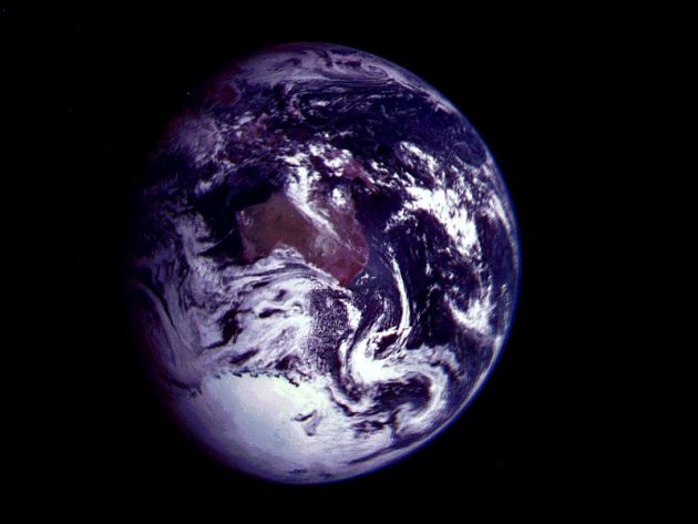
Carbon-Sucking Technology Needed by 2030s, Scientists Warn. Reuters has the details: "As
efforts to cut planet-warming emissions fall short, large-scale
projects to suck carbon dioxide out of the atmosphere will be needed by
the 2030s to hold the line against climate change, scientists said on
Tuesday. Many new technologies that aim to capture and store carbon
emissions, thereby delivering “negative emissions”, are costly,
controversial and in the early phase of testing. But “if you’re really
concerned about coral reefs, biodiversity (and) food production in very
poor regions, we’re going to have to deploy negative emission technology
at scale,” said Bill Hare of Climate Analytics, a science and policy
institute..." Image: NASA.
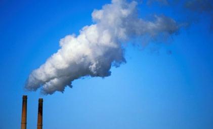
Scientists Say Cost of Capturing CO2 Declining. The Associated Press reports: "Technology now in limited use removes about 90 percent of carbon dioxide from the smokestacks of coal-fired power plants, but energy experts say cost remains the chief obstacle to bringing the “clean coal” touted by President Donald Trump into the mainstream. They cite recent advances in applying the longstanding technology, despite some earlier setbacks, but say the U.S. power sector needs bigger tax credits or other incentives to close the cost gap for using them....The U.S. has successfully cut other smokestack pollutants, including sulfur, nitrogen and mercury. But carbon dioxide is a bigger challenge because there is so much of it. Coal- and gas-fired electrical generators produce about 30 percent of CO2 from human activity. Other industries like cement, steel and fertilizer manufacturing add another 20 to 25 percent. Farming and vehicles are also major contributors..."
Photo credit: REUTERS/Muhammad Hamed. "The Syrian conflict can be viewed, in part, as a product of climate change."
The Most Powerful Evidence Climate Scientists Have of Global Warming. InsideClimate News has the details: "...More
than 90 percent of the excess heat trapped by greenhouse gas emissions
has been absorbed into the oceans that cover two-thirds of the planet's
surface. Their temperature is rising, too, and it tells a story of how
humans are changing the planet. This accrued heat is "really the memory
of past climate change," said Kevin Trenberth, the head of climate
analysis at the National Center for Atmospheric Research and co-author
of a new paper on ocean warming. It's not just the amount of warming that is significant—it's also the pace. The rate at which the oceans are heating up has nearly doubled since 1992, and that heat is reaching ever deeper waters, according to a recent study. At the same time, concentrations of carbon dioxide in the atmosphere have been rising..."
Graphic: Paul Horn, InsideClimate News.
No comments:
Post a Comment