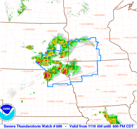
New Storm Watch. SPC has issued a severe storm watch for northern MN until 10 pm Thursday night for isolated hail and damaging straight-line winds, generally north of a line from Moorhead to Brainerd to Hinckley. An isolated tornado can't be ruled out - but dynamics aloft favor hail and straight-line winds, low-level moisture and wind-shear is marginal for tornadoes. Stay tuned for more updates.

Yes - I am, in fact, growing an umbrella. Moss is forming on my northern side (when I'm very still). My drip-dries are drooping. I realize June is the wettest month, but this is getting a bit ridiculous. Make it stop! People are glaring at me - muttering under their breath (and it's not "have a nice day, Paul!" Note to self: I'm just the messenger, and lately the message hasn't been very encouraging. It has rained very weekend in June, so far, and it would appear that our sloppy streak is going to continue, undaunted, into next weekend. More puddles in the weekend outlook - another sinister front to track, more outdoor plans in stark danger.
 Wednesday Almanac. A threatening, disturbed-looking sky lingered over Minnesota much of the day, frequent showers over central and northern MN. Rainfall amounts ranged from a paltry .02" up at Hibbing to .91" in St. Cloud, .32" at MSP International in the Twin Cities, and a hefty 1.73" in Rochester. The Golden Rain Gauge Award goes to Kimball, MN, where over 4.5" of rain fell, most of it during a 3-5 hour period during the wee hours of the morning.
Let me back up and bid good riddance to a sloppy, unsettled Wednesday, some bloated, sinister-looking clouds lurking overhead, leaking showers, but nothing severe, I'm happy to report. I am missing tufts of hair, from tugging at my scalp for the past 24 hours, trying to get a handle on the most fickle of weather patterns. Over 4.5" in Kimball, just southwest of St. Cloud, over 4.1" near Cambridge (that's over a MONTH'S worth of rain!) A band of nearly stationary T-storms blossomed over central MN Tuesday night, squeezing out torrential, tropical rains. This MCS system (mesoscale convective system - how could you forget?) turned severe as it raged across Chicago, dropping a few tornadoes near South Bend and Cleveland. Tornadoes in Cleveland? About as unlikely as twisters in Billings, Montana a few days ago. What an odd weather pattern. Tuesday Iowa endured 17 separate tornadoes, the same number Minnesota experienced last Thursday on a record-setting day for nature's wildest winds.
Have your camera ready, because the sun may stage a cameo appearance today, enough blue sky for low 80s by mid afternoon - just a slight chance of a late-day instability shower or T-shower (but nothing severe expected). The approach of yet another messy front sparks more T-storms Friday (best chance over far northern MN) and there's every indication that next frontal boundary will take it's sweet old time passing over Minnesota Saturday, treating most of us to at least 3-6 hours of rain (and thunder). It won't be as wet as that nasty Saturday nearly 2 weeks ago when it poured all day, but I'm not optimistic about sun returning until (possibly) the mid and late afternoon hours Sunday. Your best odds of salvaging part of the weekend? Saturday morning, again late afternoon/evening on Sunday.
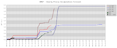
 Looks Like A Weekend. No, you're not hallucinating (much). The GFS prints out over an inch of rain for the upcoming weekend - best chance late Saturday into Sunday morning. Let's hope the models are wrong...
Hey, I'm just as bummed as you are. I look forward to sunny, lukewarm (spectacular) weekends as much as the next guy. My son is returning from the Naval Academy for a couple of weeks - we'll be out wakeboarding, kneeboarding, butt-boarding regardless, rain, hail, downbursts and downpours. I'll be the guy in the ski boat wearing a poncho, smiling through gritted teeth.
 Saturday? What Can Possibly Go Wrong? Here is the GFS model valid at 5 pm Saturday eveing, showing a warm frontal boundary draped from west to east across the state - in this kind of pattern showers and (heavy) thunderstorms tend to be heaviest and most widespread at night. Hopefully it won't be a steady rain, but as much as 3-6 hours of showers and storms are possible, the chance of bumping into something big, dark, wet (and potentially noisy) increases as the day goes on Saturday, with the heaviest rains coming Saturday night.
The good news - long-range (GFS) models are hinting at mostly-dry weather next week, possibly 3-5 relatively dry days in a row. An instability shower may drift on by Wednesday, but most of Monday, Tuesday and Thursday should be dry. It's come to this: highlighting weekdays that may be puddle-free. One thing I've noticed: traffic jams on the lakes when the sun does come out, restaurants overflowing with patrons during those few, fleeting (quiet) evenings when storms aren't prowling the state.
It's been a rough June. Maybe July will be better. Maybe Kevin Costner will save the Gulf of Mexico. Hey - miracles happen.
Windy & Wild. The Willis Tower (formerly the Sear Tower) in Chicago is routinely hit by lightning, as many as 10-20 times a year. The Windy City has been particularly hard hit by wave after wave of severe weather in recent weeks, the storm track stuck in a rut favoring extreme storms from near Des Moines to the Quad Cities to Chicago, Indianapolis and Detroit.

 Brazil Flooding. The flash floods that have battered northeastern Brazil continue to wreak havoc, at last report more than 350 local residents are still missing and feared dead, one of the biggest natural disasters in recent memory. More on what's happening in South America here. The BBC has a thorough recap on the mini tidal wave of muddy water and debris that swept through numerous communities, killing at least 33 people, here.
 Arizona Wildfires. Firefighters seem to be getting the upper hand tackling a massive blaze outside of Flagstaff, over 14,000 acres already blackened, nearly 800 local residents chased from their homes by the approaching flames. According to USA Today over 24,000 separate fires have blackened nearly 1.4 million acres of land so far in 2010. The story (and amazing time-lapse video) is here.
 Media Focus. You can't say that the historic well spewing untold millions of gallons of crude into the Gulf of Mexico isn't making plenty of news, in fact compared to news focused on the economy, various wars and politics, the catastrophic spill is generating a tidal wave of coverage. Last week 44% of the "news hole" was devoted to the growing stain in the Gulf. More on the media response here.
Paul's Conservation MN Outlook for the Twin Cities and all of Minnesota
Today: Plenty of sun....MUCH nicer. A passing shower or T-shower is possible by late afternoon, especially north of the cities. Winds: W 8-13. High: 82
Thursday night: Isolated evening shower, then clearing. Low: 65
Friday: Sun gives way to increasing clouds, good chance of T-storms late (best chance north). High: 83
Saturday: Mostly cloudy, more humid, a few hours of showers and T-storms likely. Winds: S 10-20. high: 84
Sunday: Lingering showers, drying out later in the day - some sun possible late PM hours. Winds: NW 10-20. High: 81
Monday: Partly sunny, drier statewide. High: near 80
Tuesday: Bright sun, another rare dry day in June. High: 81
Wednesday: Hanging on to sun - still pleasant. High: 82
No comments:
Post a Comment