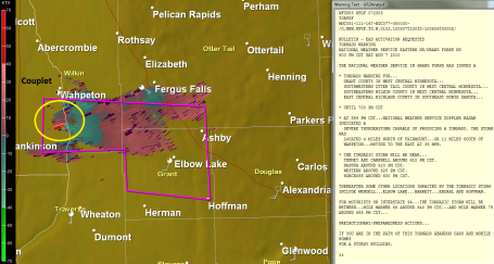
Update: 6:30 pm. Tornado Warning for parts of Grant, Otter Tail and Wilkin counties of west central MN until 7 pm. Doppler showing a developing "couplet" (meaning strong rotation) - a supercell capable of spinning up a tornado. the greatest risk is from Wahpeton and Wheaton to Elbow Lake and Fergus Falls. (This Doppler Radar image shows SRV or "storm relative velocity", showing air moving toward and away from the Doppler Radar site in Grand Forks, ND).
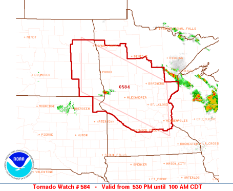
Tornado Watch until 1 am. SPC has a big chunk of Minnesota in a tornado watch until 1 am, meaning conditions are ripe for isolated tornadoes. We have all the ingredients - a warm frontal boundary, juicy low-level moisture (dew points in the 70s), sufficient wind shear and instability aloft for a few "supercell" thunderstorms capable of large hail and a few tornadoes.
No comments:
Post a Comment