St. Paul: 3"
Shakopee: 5"
Rush City: 5"
Plymouth: 6"
North Branch: 6"
Chanhassen: 6"
Burnsville: 7"
Lakeville: 7"
Mankato: 10"
Amboy: 10"
Biggest Pre-Thanksgiving Snowstorm Since 1991. If we pick up at least 6.5" (likely) from this storm at KMSP, this storm will go down into the record books as the biggest snowstorm (pre-Thanksgiving) in 19 years. Hey, we were due. I say that going into every winter, but today the law of averages finally caught up with us.
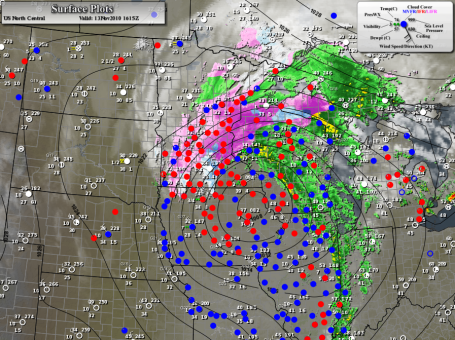

Dreaded Dry Tongue. Every major storm eventually pulls dry (desert) air into its circulation, what meteorologists lovingly refer to as the "dry tongue" - a surge of dry air that pushes in from the south/southwest - thinning out the clouds and lightening up snowfall rates. The 10 am visible satellite shows dry air getting tangled up in the storm's circulation, cutting off the heavy precipitation across southeastern MN and southwestern WI. The "deformation zone", the axis of heaviest snow - is setting up right over the Twin Cities - before the day is through many suburbs will pick up that 10-12" that was predicted. Snow lovers are grinning from ear to ear - anyone who has to drive in this stuff is probably dreading the next few hours.
Storm Headline Update (10:42 am)
1). All snow - the lowest mile of the atmosphere definitely cold enough for snow - no changeover to rain/sleet.
2). Deformation zone axis directly above MSP: heaviest snow bands will linger over the MSP metro area through the afternoon.
3). Snow will slowly decrease in intensity by late afternoon/evening, but by then many spots will have at least 8-10", a few suburbs may have closer to a foot.
4). Heavy, wet, cement-like snow will linger into mid afternoon. With temperatures close to freezing aloft: a). snowflakes are HUGE, and b). the risk of downed trees/powerlines is very high as snow continues to pile up. Consider cleaning the snow off smaller trees and shrubs.
5). Latest NAM/WRF prints out 1.2" liquid - which translates into a foot of snow. Factoring in some melting on contact and a snow:liquid ratio closer to 8:1 - you wind up with snow totals of 8-12" across most of the metro area, but less than 5" south/east of St. Paul.
No comments:
Post a Comment