* Rain today for the metro, try to get your travel out of the way by this evening, especially if you want to drive into northern or western MN. (by the way, this would have been 3-5" of snow had it been 3-4 degrees colder).
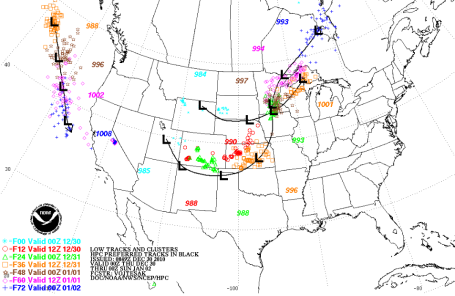
* Brief lull tonight as Storm # 1 tracks to the east of Minnesota.
* Second (stronger) storm arrives tomorrow, all snow for northern/central/western MN, but an icy mix for the Twin Cities, sleet, freezing rain, all ending as an inch or so of icy snow Friday night.
* Latest guidance hinting that the "dry tongue", a surge of dry, desert air from the southwest, will keep amounts down across much of eastern and southeastern MN - heaviest snow bands set up 75-200 miles north/west of the storm track, which may be very close to MSP late tomorrow.
* Travel conditions will get worse as the day goes on tomorrow (as temperatures fall) and as you drive north/west, away from the MSP metro area.
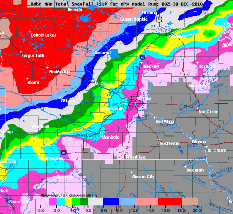
Expected (Friday) Snowfall Amounts:
MSP Metro: 1" of ice (sleet/freezing rain), then 1" of snow Friday night.
St. Cloud: about an inch of slush this evening, another 1-3" possible New Year's Eve.
Brainerd: 5-8" of snow possible.
Detroit Lakes, Fergus Falls and Fargo/Moorhead: 10-15" snowfall amounts are possible Friday and Friday night with treacherous travel due to gusty winds and low visibility. Near blizzard-conditions are possible late tomorrow up north.
Rochester: Coating of snow.
No comments:
Post a Comment