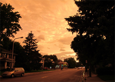
Paul's Conservation Minnesota Outlook for the Twin Cities and all of Minnesota:
TODAY: Partly sunny, chance of a late-day storm? Winds: S/SW 10-15. High: 73
SATURDAY NIGHT: A few showers, possible thunder. Low: 53
SUNDAY: Cooler with sunshine central and north. Clouds, showers and a few T-showers south (including PM). Winds: NE 7-12. High: 66
MEMORIAL DAY: Warm & sticky with intervals of sun. Few strong/severe storms possible. Winds: S 10-20. Low: 60. High: 83
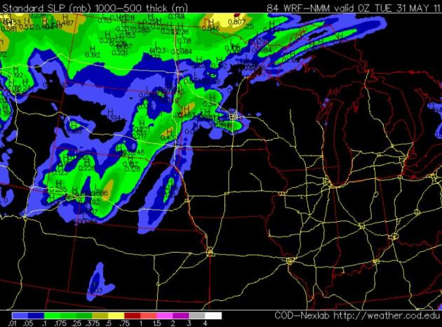
TUESDAY: Clearing, turning breezy and less humid. Showers far north. Low: 63. High: 75
WEDNESDAY: Plenty of sun, lukewarm - very pleasant. Low: 56. High: 76
THURSDAY: Unsettled, few T-storms (best chance south/west of the metro area). Low: 60. High: 79
FRIDAY: Intervals of sun, feels like summer again! Low: 62. High: 81
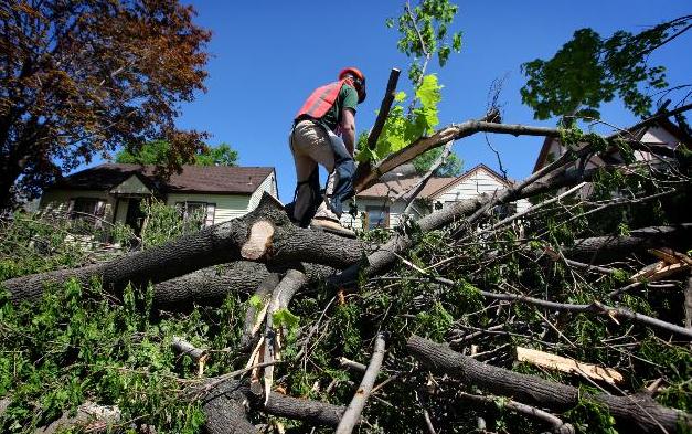
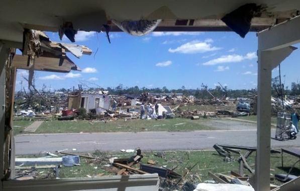
Official Tornado Clean-Up Day In Minneapolis Will Be June 4. The story from the
Star Tribune: "
The city of Minneapolis announced Friday that Saturday June 4 will be the official North Side Volunteer Clean-up Day to address damage from the tornado that struck that neighborhood. City officials said they hope to marshal a force of 2,000 volunteers that day to help clean up light debris. People who want to volunteer must call 311 to register. Only volunteers who register will be allowed to work, according to a news release. Since the tornado struck Sunday, about 3,000 volunteers have helped with clean-up efforts. Because of the huge response, additional volunteers aren't needed until June 4. Urban Homeworks, a housing organization that has helped coordinate the clean-up so far, estimated that volunteers have helped remove debris from more than 3,500 homes."
Late-Season Planting. Professor Mark Seeley has an update on our cool (wet) spring, and how it's impacting Minnesota agriculture in his Minnesota
WeatherTalk blog: "
Late planting season a challenge. Though farmers made very good progress last week on corn planting (now over 80 percent planted), weekend rainfall brought a halt to field work earlier this week. Minnesota farmers may be using crop insurance for delayed plantings, choosing earlier relative maturity corn seed for their remaining acreage, or perhaps even considering a switch to soybeans as they try to cope with this late planting season. A good deal of information relative to crop insurance and decisions about late planted crops can be found on the University of Minnesota Extension web site for those interested...."
http://www.extension.umn.edu/agriculture/crops/late-planting/
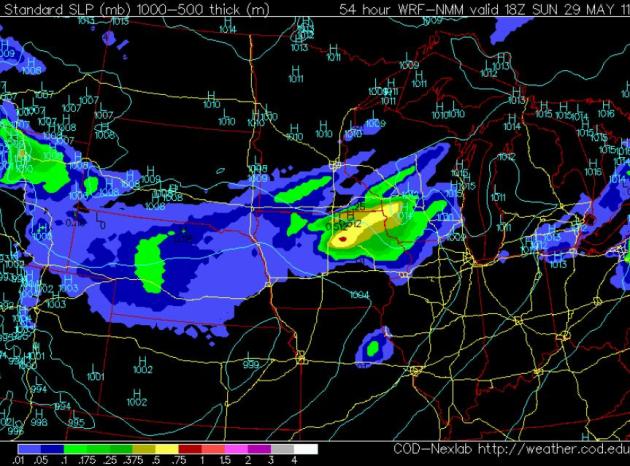
Half-Decent Saturday? After nearly half an inch of rain overnight and a very damp start, the sun should try to come out for a few hours (best chance of a little blue sky around midday into mid afternoon). The atmosphere will be unstable enough for a few late afternoon/evening showers and T-showers to fire off around the dinner hour - best chance western and central Minnesota. Not an all-day wash-out.
Saturday Winds: S: 10-15 Temperatures range from low 60s (north) to near 70 (metro) to mid 70s near the Iowa border.
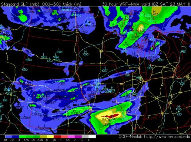
Sunday: Big North-South Variation. The 18z (1 pm) NAM model is hinting at a mostly-dry day over the northern half of Minnesota; the farther north you're loitering on your favorite lake Sunday the better the odds of a sunburn. Proximity to a warm frontal boundary will spark a few scattered showers and heavier T-storms, best chance of a few hours of rain Sunday afternoon/evening, especially south of the Minnesota River. Sunday Winds: E/NE 7-12, temperatures holding in the 60s most of the day.
Slight Severe Threat Monday? SPC isn't terribly impressed (yet) - no slight risk to speak of for the Upper Midwest on Memorial Day. But with a CAPE (indicator of instability) close to 3,000 by midday, helicity (wind shear) values > 200 and a lifted index (another stability index) dipping to -6 and a vigorous warm frontal boundary nearby I could definitely see a few isolated severe thunderstorms popping Monday afternoon/evening. I wouldn't change my plans, but know (in the back of your mind) that the sky could turn nasty Monday - have a Plan B and potential shelter within a 2 minute dash, just in case.
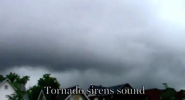
Time-Lapse Of North Minneapolis Tornado. Thanks to omgthisiscrazy1 for posting this
YouTube clip of the (crazy) sky over North Minneapolis last Sunday: "
Time lapse of the storm responsible for the north Minneapolis tornado that heavy damaged the area, killed one person and injured many others. At 0:38 the funnel is just beginning to form and moves fast towards the north. The likely location underneath this meso would be just south of the first touch down in St. Louis Park. I also enhanced this area to give the funnel a better appearance. Included also is the second storm with circulation that prompted another tornado warning no more than 10 minutes later after the first warning expired."
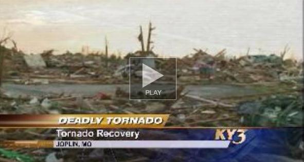
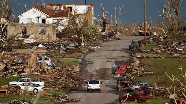
Winds In Joplin EF-5 May Have Approached 250 MPH. The ultimate EF-rating is determined (to a large degree) by how far heavy objects are blown through the air, heavy appliances, cars, etc. Here's an update from
ky3.com in Branson, MO:
"JOPLIN, Mo. -- The National Weather Service provided additional insight into the decision to rate the tornado last Sunday at the top of the Enhanced Fujita Scale. The tornado was given an initial rating of an EF-4 before it was upgraded the next day. Bill Davis with the National Weather Service said investigators look at structural damage and how far heavy objects were thrown. This tornado, for example, tossed concrete parking lot "bumpers" that sit low to the ground and can weigh up to 300 pounds. The NWS investigators also noted that tractor-trailers parked near the Wal-Mart store were thrown farther than 1/8th mile. Manhole covers were also lifted and tossed. The tornado's path is an estimated six miles long. It's from three-quarters of a mile to a mile wide at some points. The winds are estimated to have briefly hit between 225 and 250mph."
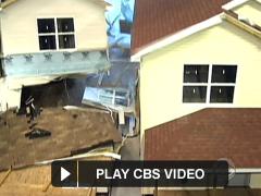
Tornado Tough: How To Keep Your Home Standing. Although there is no way to design an (above-ground, cost-effective) tornado-PROOF home, there are steps you can take to make your home more tornado-resistant. A "safe room" is a very good idea if you don't have a basement.
CBS News has more: "
NEW YORK - When you see a tornado bearing down, the first thing you're told to do is find shelter. But some shelters are built better than others. Less than 3 percent of American homes have storm shelters. CBS News senior business correspondent Anthony Mason reports such home improvements can save lives. When her Tuscaloosa, Ala., home was about to explode around her this past April, Elaine Davis took shelter. "My husband could felt the pressure. There was a big gust of wind and dust. It was just terrifying to me." A Cold War era atomic bomb shelter, with concrete walls several feet thick, saved them. The neighborhood above them was leveled - just as Joplin, Mo., was on Sunday. Engineers say it's almost impossible to build a house able to withstand a tornado's fury. "Tornadoes can come in speeds up to 200 mph and above," says Julie Rochman, President of the Insurance Institute for Business and Home Safety. "At some point Mother Nature's physical force will overwhelm even the best engineering." At a testing facility, two houses were bombarded with hurricane-force winds. Only the structurally reinforced house survived."
Redesigned Roofs Withstand Hurricanes And Tornadoes.
Tech News Daily has more information on how the structural integrity of your roof can often make the difference of whether your home remains intact after a direct tornado hit: "
The tornado that stormed through Joplin, Mo., on May 22 shredded an estimated 8,000 buildings and stranded desperate families that now must decide whether to rebuild or find a new home. For those choosing to rebuild, Rima Taher, an expert on wind-resistant structures, has a bit of advice: don't do it the old way. "You wonder why we keep doing the same things, making the same buildings," Taher told InnovationNewsDaily. By analyzing debris from hurricanes, Taher has come up with a set of guidelines for building new homes in areas prone to extreme weather. [Read More: Why Aren't There Tornado Safety Building Codes?] "There are similar problems. So, what usually works for tornadoes would work for hurricanes," Taher said. When wind hits, the roof provides the most critical defense. But during a hurricane or a tornado, the roof is often the first to go. Taher found that increasing the number of slopes on a roof improves the aerodynamics of the structure and greatly reduces the amount of pressure exerted on it. She recommended building a roof with at least four slopes, rather than a traditional gable roof that has only two. As wind swirls around a house, it can push on the roof from both the inside and outside. Taher suggested installing a moveable flap close to the seam of the roof. During hurricanes and tornadoes, the flap would open, stabilizing the air pressure. In hot weather, the flap would provide ventilation. [Read More: What's the Deadliest Natural Phenomenon?]"
Why Aren't There Tornado Safety Building Codes. An interesting post from
Life's Little Mysteries that caught my eye. None of us want to live in a concrete bunker (about the only thing that could survive a direct hit from an EF-4 or EF-5 tornado): "Tornadoes kill an average of 80 people annually in the Midwest and South, and in some years, many more. The tornado that touched down in Joplin, Mo. yesterday has exceeded that annual average on its own, having killed at least 89 people. So far in 2011, the twister death toll has already topped 400. By contrast, no one has died in an earthquake in the United States since 2003. While earthquake-proof building codes are becoming ever more stringent for structures built in
the country's earthquake zones, why are there no tornado building codes in Tornado Alley? According to Tim Reinhold, senior vice president for research and chief engineer at the Institute for Business and Home Safety (IBHS) in Tampa, Fla., it comes down to something called the "return period" -- the interval between two disaster events in a given location. Although major tornadoes happen every year, the likelihood they'll happen twice in the same place is very low. "In some areas of
California, earthquakes happen tens or hundreds of years apart, and they affect a tremendous area with a lot of properties," Reinhold told
Life's Little Mysteries."But for a tornado hitting a particular location in Tornado Alley, you're dealing with return periods of thousands of years." Earthquake building codes, Reinhold explained, vary between regions, but at their most stringent, they only apply to areas with disaster return periods of 500 to 1,000 years. "Building codes are required for a building that, in any given year, has a 1 in 500 to 1 in 1,000 chance of getting destroyed by an earthquake," he said. "With tornadoes, because they're relatively small and don't cover very much ground,
the chances that a particular building in Tornado Alley would be hit is 1 in 5,000 per year. And within that, the chance that the tornado will be F4 or F5 [the highest levels on the Fujita scale] is even lower. So to make everyone build houses to stand up to that level would be a huge cost increase and we'd all be living in concrete bunkers," Reinhold said.
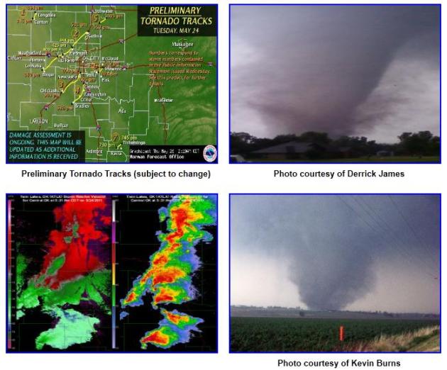
PAR (Phased Array Radar) Captures Long-Lived Tornado In May 24 Outbreak. The new (revolutionary) radar that provides more of a real-time 3-D volumetric scan of the surrounding atmosphere was up and running earlier this week when a series of EF-4 tornadoes roared across Oklahoma. More details from the
Phased Array Radar Innovative Sensing Experiment: "
The tornado outbreak forecasted by the NOAA Storm Prediction Center and the National Weather Service Forecast Office in Norman, Oklahoma became a reality as six damage-producing tornadoes struck central Oklahoma between 3 pm and 7 pm CDT May 24, 2011. The longest-track tornado, rated EF3 by the Norman Forecast office, damaged homes and businesses along its 75-mile path that originated just northwest of Binger and moved through the towns of El Reno, Peidmont, and Guthrie (Fig. 1). The rapid-scan, S-band phased-array radar (PAR), located within the National Weather Radar Testbed in Norman, Oklahoma, sampled this tornadic supercell every 1 minute. Based on PAR data, by 3:30 pm supercell storm formed its first well-defined hook echo and associated tornado vortex signature about 6 miles west of Binger (TVS; Fig. 2). At this time, PAR data show that the TVS had a maximum gate-to-gate velocity difference of 89 mph. A comparison of PAR velocity data with the damage path shows that the tornado formed about 12 minutes later, at 3:40 pm. The 1-minute updates of the PAR exhibit many important details about the evolution of this supercell and its long-lived tornado. One example is the hard-right turn of the TVS and hook at 4:15 pm that placed El Reno in the tornado's destructive path (Fig. 3: ppt 10 MB; ~62 km northeast of PAR). About 10 min later (4:25 pm, west-side of El Reno), as cells approaching from the southeast began to merge with the hook and a new circulation developed, the hook's motion was redirected to the northeast, toward Piedmont. Fig. 3 also shows the likely development of two “debris” signatures in the radar reflectivity, which are compact regions of high reflectivity values due to debris from the tornado."
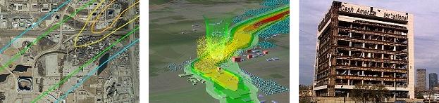
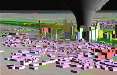
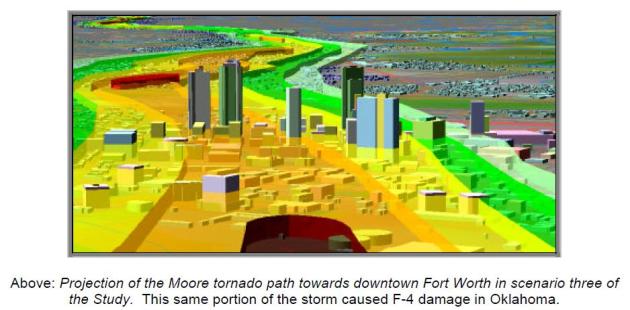
Thinking The Unthinkable. NCTCOG, the North Central Texas Council of Governments ran a series of computer simulations in 2000. They attempted to answer a question that was hard to contemplate: what would happen if a large, violent, long-lasting tornado (similar to the EF-5 that hit Moore, a suburb of Oklahoma City on May 3, 1999) struck downtown Dallas or Ft. Worth? A few highlights from the summary: "The series of tornadoes which struck the
Oklahoma City area on May 3, 1999 were some of the most expensive tornadoes in U.S. history, causing over 1 billion dollars in damage and destroying over 2500 structures. With such a large impact, other urban areas in tornado alley were forced to wonder about their own susceptibility and preparation. The
Dallas-Fort Worth Metroplex is one such area. With over five million people, 1 million houses, and 60 thousand commercial structures, understanding the potential risks is valuable, indeed. As part of the Spring 2000 severe weather planning season, The North Central Texas Council of Governments in cooperation with the
National Weather Service in Fort Worth put together a Tornado Damage Risk Assessment. The project estimates the potential impact of a major tornado outbreak to the Dallas-Fort Worth Metroplex. Specifically, tornado damage paths from the May 3, 1999 Great Plains Tornado outbreak in Oklahoma are transposed across the Metroplex and a statistical profile of each impacted area is generated. Five main scenarios are tested in which 53 of the damage paths are placed atop Metroplex geographical data, and centered as a group in five different locations. Additionally, 50 paths of the Moore tornado -- the costliest tornado in U.S. history to date -- are tested. Modern computer technology (GIS) is used to estimate
structures, property, residents, employees, and traffic that would be in the path -- better defining the magnitude that the tasks of warning, rescue, and recovery would entail. By identifying such demographics and development, a general assessment of this region's susceptibility to a big tornado outbreak can be made.
"Scenario 3". If a Moore-like, EF-5 swept directly over downtown Fort Worth the damage would be unimaginable, possibly in excess of $3 billion. Thousands, possibly tens of thousands of motorists might be stuck on freeways, unable to reach adquate shelter in time. The death toll could go into the thousands. This is the true nightmare scenario - one that keeps meteorologists (and city planners) up at night. What happens when a stadium filled with 35,000 people suffers a direct hit, or a concert or other outdoor event where (underground) shelter is unavailable or unrealistic?
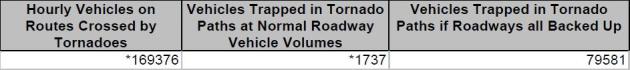
Sitting Ducks. The study found that (best case) the tornado might impact 1,737 people in their vehicles. But in a gridlock scenario close to 80,000 motorists might be in the path of the tornado.
* For a little light reading click
here to see the PDF summary. Let's hope this never happens, but statistically, I fear it's just a matter of time before a major metropolitan area is hit by an EF-4 or EF-5 super-tornado. We've been relatively lucky, but as this year is proving out, if the tornado count goes up (for whatever reason: La Nina, Arctic blocking patterns, even climate change) the odds of large, damaging tornadoes hitting populated areas goes up proportionately.
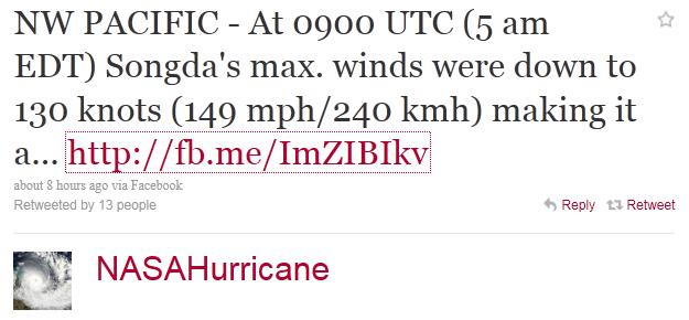
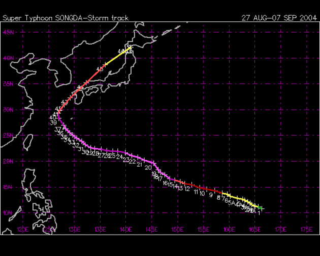
Typhoon Strengthens: May Hit Fukushima Nuclear Plant. Hawaii's
Star Advertiser has the details: "
Typhoon Songda strengthened to a supertyphoon after battering the Philippines and headed for Japan on a track that may pass over the crippled Fukushima nuclear plant by May 30, a U.S. monitoring center said. Songda’s winds increased to 150 miles per hour, the U.S. Navy Joint Typhoon Warning Center said on its website. The storm’s eye was east of Aparri in the Philippines at 8 a.m. today, the center said. Songda was moving northwest at 19 kph and is forecast to turn to the northeast and cross the island of Okinawa by 9 p.m. local time tomorrow before heading for Honshu. The center’s forecast graphic includes a possible path over Fukushima Dai-Ichi plant, which has been spewing radiation since March 11 when an earthquake and tsunami knocked out cooling systems. Three of six reactor buildings have no roof after explosions blew them off, exposing spent fuel pools and containment chambers that are leaking. “We are still considering typhoon measures and can’t announce detailed plans yet,” Takeo Iwamoto, a spokesman at Tokyo Electric Power Co., said by phone when asked about the storm. The utility known as Tepco plans to complete the installation of covers for the buildings by October, he said."
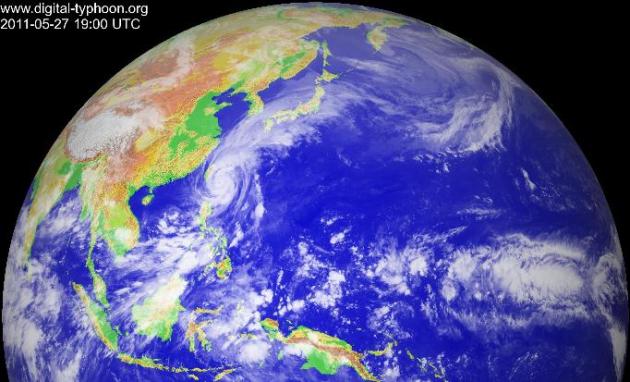
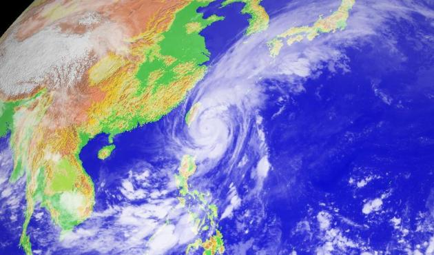
Songda's Projected Track. Here is the latest forecast for Super Typhoon Songda, forecast to come ashore over southern Japan, weakening gradually as it passes over slightly cooler ocean water.
A Wild Sky. A
post from AccuWeather regarding Thursday's severe weather outbreak in Pennsylvania: "
Severe thunderstorms ripped through Pennsylvania last night, and I got a few photos here in State College, Pennsylvania, home of AccuWeather HQ [Google Map]. I'll expand this entry later today to include radar loops and more photos. Henry had told me to look out for a developing storm just before 6 PM, so I put the video camera on the porch and got this screen grab of a close lightning strike that hit way outside of the main rain area: So he and I went out to view the next storm as it came in, because it was looking pretty good on radar, but the southern end of it, which was approaching, suddenly disappeared before our very eyes. This was what was left of it as it headed towards the State College (University Park) Airport. Note the scud lowering."
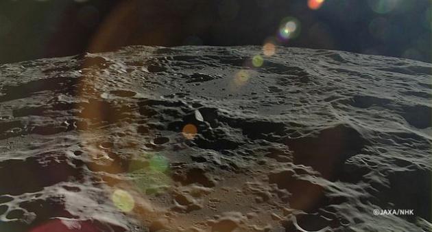
The Moon May Have As Much Water As Earth Does. IO9.com has a
fascinating story. Sadly, it looks like we won't be getting back up to the moon anytime soon: "
Today, a group of scientists announced that beneath the surface of the Moon there may be as much water as we have on Earth. This revelation could change everything we know about the Moon — and pave the way for lunar colonies in the next twenty years. The researchers used a special ion probe to analyze samples of volcanic glass dug up from the Moon's surface by the crew of Apollo 17. Water and other volatiles from deep beneath the Moon's surface remain preserved in this glass, and allowed the team of scientists to determine likely water levels in the Moon's mantle. Those levels were 100 times higher than what previous studies found. The Moon would only have as much water as Earth does in a relative sense - not as much total water, but as much water as the Earth would have in its mantle if it were the same size as the Moon."
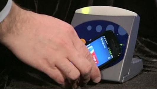
Google Unveils App For Paying By Phone. Soon (if Google has their way) the idea of whipping out your wallet or purse and digging around for a credit card may be a quaint artifact of the first decade of the 21st century, as reported by the
New York Times: "
Google is among the first out of the gate in the attempt to make leather wallets go the way of the typewriter. On Thursday, the technology giant introduced Google Wallet, a mobile application that will allow consumers to wave their cellphones at a retailer’s terminal to make a payment instead of using a credit card. The app, for the Android operating system, will also enable users to redeem special coupons and earn loyalty points. Starting this summer, the wallet will be available on the Nexus S 4G phone on Sprint and able to hold certain MasterCards issued by Citibank. It will also hold a virtual Google Prepaid MasterCard. The mobile wallet will work at any of the 124,000 merchants that accept MasterCard’s PayPass terminals, which take contactless payments, and more than 300,000 merchants outside the United States. The wallet is powered by a technology called near-field communications, which is incorporated into a chip in mobile phones and sends a message to the merchants’ terminals. “Eventually, you will be able to put everything in your wallet,” Stephanie Tilenius, vice president for commerce at Google, said at a news conference."
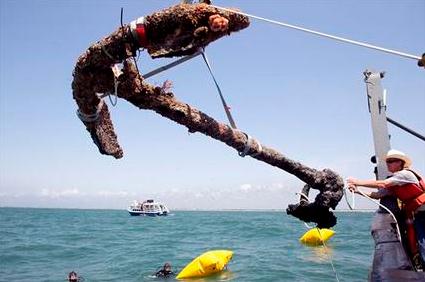
Blackbeard's Anchor Recovered Off North Carolina Coast. Really? The
AP has the story: "
MOREHEAD CITY, N.C. (AP) -- Archaeologists recovered the first anchor from what's believed to be the wreck of the pirate Blackbeard's flagship off the North Carolina coast Friday, a move that might change plans about how to save the rest of the almost 300-year-old artifacts from the central part of the ship. Divers had planned to recover the second-largest artifact on what's believed to be the Queen Anne's Revenge but discovered it was too well-attached to other items in the ballast pile, said project Mark Wilde-Ramsing. Instead they pulled up another anchor that is the third-largest artifact and likely was the typical anchor for the ship. Apparently, pirates had everyday anchors and special anchors just as the rest of us have everyday dishes and good china."
Photo credit: "
A 3,000 pound anchor from what is believed to be the wreck of the pirate Blackbeard's flagship, the Queen Anne's Revenge, is recovered from the ocean where it has been since 1718, on Friday, May 27, 2011 in Beaufort Inlet, in Carteret County N.C. Crew member Mitchel Gilliland, right, helps guide the anchor aboard the Dan K. Moore. (AP Photo/The News & Observer, Robert Willett)"
Living The Weather
Minnesota meteorologists don't just predict the weather. We live it. Look at the data, check the models (do they agree?) and place your bet. Then run to the window every 15 minutes to see if your forecast is "busting". I said partly SUNNY, why are the clouds lingering? The storms are stalling; how did THAT happen? To be a meteorologist is to live in a state of perpetual paranoia. People don't remember when you're right, but when the forecast is wrong, especially on a (holiday) weekend - run for cover! People have long memories.
With that preamble/disclaimer welcome to the unofficial kick-off of summer. We've had pretty rotten luck with Memorial Day, and this weekend will be no exception. A damp start gives way to midday sun, a few late-day showers and T-storms sprout, best chance over western/central Minnesota after 4 pm. The farther north you go the sunnier and nicer Sunday should be. A warm front lurking to our south may spark a few spotty showers Sunday PM, especially south of the metro. Good news: 80s on tap for Monday! Bad news: 80s on tap for Monday, along with juicy dew points, instability, and enough potential wind shear for a few isolated severe storms. Stay tuned.
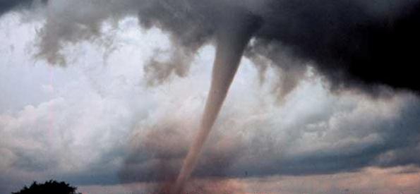
Twister's Tale. (photo courtesy of the AP). The New York Times has an
Op-Ed about the recent tornado tragedies in the larger context of politics, science and climate change: "
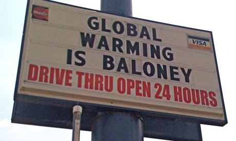
It is human to want to see these storms as part of a larger pattern, to anthropomorphize them with words like “nature’s wrath,” to ascribe a motive to the mayhem. But also something else: to see a warning of the oldest kind, dating to Greek mythology, a warning about hubris. Earlier this year, Republicans in a congressional panel declared, by a majority vote, that climate change caused by humans does not exist. The majority of the House then voted to get rid of federal funding for the world’s finest scientists in the field to study the changing earth, through the Intergovernmental Panel on Climate Change. Blink, blink, just like that — our representatives wished away the future. The twisters, floods and fires of this year have another say, and remind us that some political gestures are no more relevant than a lone pair of lips flapping in the wind. Of course, among atmospheric scientists there is ambiguity, at best, about whether global warming has anything to do with the worst tornado season in modern times. But the consensus of fair-minded research — ignored by those who assume to know better in the Republican Congress — is that an earth warmed by an excess of man-caused carbon emissions will cause more weather extremes. Warm air holds more water vapor than cold air — that’s an axiom that a congressman with a set of talking points paid for by Exxon cannot wish away. Torrential flooding in all parts of the world could easily be part of a new phase brought on by just a few upticks in ocean temperatures. The forecast is simple: You ain’t seen nothing yet.....
But there is a loud and intellectually corrupt segment of public life dedicated to fact-denial. They will not allow even a slim chance that humans are making a mess of this place. They will not do what a homeowner facing unlikely odds of a fire has to do just to hold a mortgage — take out insurance. Listen to people who have lived long lives in the American midsection, a place of peril, and a place that is deeply loved. They tell us to be prepared, to be humble in the face of nature, to think about the worst thing that could come from the sky. If this is radical advice, then common sense has surely met an early death."
 Yesterday's Emissions, Today's Denial, Tomorrow's Climate
. Doug Craig interviews Bill McKibben at
redding.com:
"We've got to engage these big forces, and we've got to do it very dynamically, because the time, as this chain of freak weather events makes clear, is running out."
"Ever reasonable, usually concise and often well-informed, Bruce Ross, editorial page editor of the Record Searchlight, offered us "a helpful counterpoint to my last blog." I had referred to Bill McKibben's piece in the Washington Post in which he made a connection between extreme weather events and climate change. In response, Mr. Ross invites us to visit Reason, "the monthly print magazine of 'free minds and free markets.'" While McKibben focused on climate-related disasters all over the planet, Reason ignored this and zeroed in on tornadoes alone. They found evidence to suggest that this is not all that unusual and certainly not related to anthropogenic climate change. "We see no correlation between global or US national temperature and tornado occurrence." Also, "The tornado record does not show a steadily increasing trend toward bigger deadlier storms." And then there is this: "Since modern records on tornadoes began, the deadliest outbreak was (over 37 years ago) on April 3, 1974. The 'Super Outbreak' claimed 310 lives when 148 tornadoes over a 24-hour period swept across 13 states." I remember April 3, 1974. I was a senior in high school when the Xenia Tornado hit nearby, killing 33. One of my best friends lost his sister and niece that day as they sought cover in a restaurant bathroom. But all of this is beside the point. Tornadoes are but one aspect of our unsettled climate. Imagine a man who smokes cigarettes, drinks excessive amounts of alcohol and overeats to the point of obesity. As the years go by his physician could warn him that he should quit smoking and reduce his food and alcohol intake as blood tests reveal worrying signs of his steadily deteriorating health."
An
interesting story from climate scientist Rebecca Anderson at the Huffington Post: "
It seems like there's been a lot of crazy weather lately. Powerful tornadoes wreaking havoc across the Southeast, Texas in the worst drought in decades and now flooding along the Mississippi. Global warming, right? Um, actually, maybe so. It's a standard first response whenever any climate scientist is asked if a particular weather event was caused by climate change: "You can't say any one storm happened because of climate change." And then they go on to talk about how climate change may have played a role, but that it's hard to tell without a long-term context. But by that point, most listeners (including highly-distractible high school students) have moved on. You wasted your 10-second window of opportunity on the caveat as opposed to the main point:
Climate change was involved.
There's no way it wasn't. The world we live in is a world warmed-up and altered by greenhouse gases that we put in our atmosphere and that's just the way it is. There is no control group. Every weather event we get is happening within the context of a climate-changed world. As one scientist, Dr. Peter Gleick at the Pacific Institute, puts it, "We are loading the dice." This has become one of my favorite ways to think and talk about the tricky relationship between weather and climate change. It might be tempting to take this approach to the extreme and blame climate change for everything from not paying your taxes to the Red Sox's poor start to the season, but there is actually a physical explanation for how climate change loads the dice. Greenhouse gases trap heat. Heat is one form of energy. That energy has to be used for something: warming the atmosphere is one thing but it can also go toward evaporating more moisture (warmer air holds more moisture) and raining it out again, intensifying storms." (photo above courtesy of weatheradvance.com).
Will Steger Foundation Talks Climate Change. From the Edina edition of
patch.com: "
Earth's climate is changing. There are many factors contributing to global warming, but few scientists would dispute that human behaviors like burning fossil fuels and deforestation contribute to the problem. You can witness some of the changes in your own back yard. Here in Minnesota, we may spend more time sneezing and rubbing our eyes as weeds thrive and pollen counts skyrocket. Up North, moose are dying, possibly because deadly parasites are surviving milder winters. Soon, we may see birds that have always lived to our south creep across our borders. Some climatologists think the record number of tornados we saw last year had to do with global warming. As glaciers shrink and sea levels rise, people who live in our planet’s polar regions are some of the most dramatically affected. Their way of life, which has always depended on traditional knowledge, familiarity with the land and the delicate cycles of the seasons, is threatened at its core."
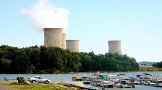
Thorium: A Safer Alternative To Nuclear Energy? Gizmag.com has a
good primer on thorium-powered nuclear power plants and how they may be a safer, more cost-effective alternative to BWR (boiling water) reactors: "
The worlds growing need for energy, the limits of our supply of fossil fuels and concern about the effects of carbon emissions on the environment have all prompted interest in the increased use of nuclear power. Yet the very word "nuclear" carries with it an association of fear. People are concerned about the waste produced by reactors, the possibility of catastrophic accidents as highlighted by recent events in Japan and the link between nuclear power and nuclear weapons. Yet what if there existed a means of nuclear power generation with which these risks were drastically reduced? The answer could be thorium - an element occurring as a silvery metal that's more abundant, cleaner and can produce more bang-per-buck in energy terms than uranium. So how does thorium differ from uranium and plutonium, and why isn't it being used? First, a quick run-down on how nuclear energy works."


No comments:
Post a Comment